The Garmin Edge 810 is a cycling GPS with built in mapping navigation that aims to build upon the previous edition of the unit, the Edge 800. I’ve been testing the unit for a while now, and have a pretty good grasp on how well it works and how the new features and functionality pan out.
Is this $499 unit worth the cash though? And are the new features enough to make you want to upgrade? The answer might surprise you.
Because I want to be transparent about my reviews – Garmin sent me a final production Edge 810 unit to test out, though, it’s been running beta and release candidate firmware. In the new few weeks I send them back to Garmin and then go out and get my own (to be able to support y’all in the comments section down the road). Simple as that. Sorta like hiking in wilderness trails – leave only footprints. If you find my review useful, you can use any of the Amazon or Clever Training links from this page to help support future reviews.
Lastly, at the end of the day keep in mind I’m just like any other regular athlete out there. I write these reviews because I’m inherently a curious person with a technology background, and thus I try and be as complete as I can. But, if I’ve missed something or if you spot something that doesn’t quite jive – just let me know and I’ll be happy to get it all sorted out. Also, because the technology world constantly changes, I try and go back and update these reviews as new features and functionality are added – or if bugs are fixed.
So – with that intro, let’s get into things.
Unboxing/Components:
While I received a final production unit, the unit sent to me for testing did not have the final box with it. So I’ll circle back for a proper unboxing once I’ve got a full retail kit.
Of course, I still have all the components and what’s included – so let’s dive into that.
The Edge 810 looks identical to that of its older sibling, the Edge 800.
In fact, the only visual difference between the two units is the outer case styling has “Edge 810” on it.
Like the 800, this unit features three buttons. On the left side, you’ve got the power button, which also controls the light/display options, as well as allows you to access sensor state information such as ANT+ connectivity and smartphone connectivity (as well as weather).
On the front of the unit, there are two additional buttons. The bottom-left button is for setting a lap, while the bottom-right button is for starting and stopping an activity (as well as pausing/resuming).
If you turn it over, you’ll find the USB port (mini-USB), as well as the MicroSD card for loading maps (or to use as additional storage):
The touch screen itself hasn’t changed any from the Edge 800. It’s still a full color, resistive touch screen, which means that it works just fine with gloves and the like (unlike your smart phone).
Looking at the backside, you’ll find the familiar Garmin Edge quarter-turn mount that’s on all Garmin Edge units these days.
This mount is secured via industrial strength rubber bands. These mounts and bands have proven themselves as being the industry standard over the last two years, primarily due to how easy they are to move between bikes – and because they just don’t break.
Within the box you’ll find a small flotilla of quarter-turn mounts and bands. Enough to start a small rubber band fight.
In addition, there are third party mounts available for the Garmin Edge series, which I’ll dive into at the end of the review.
Also in the box will be a USB charging cable. The Edge 810 uses a standard mini-USB cable. This isn’t micro-USB like your cell phone, but instead more commonly seen a few years ago in devices:
You’ll use the USB cable to both charge the unit, as well as download workouts (if you don’t wirelessly upload via cell phone). You can plug the USB cable into a computer, or the included USB charging block:
Also, depending on which bundle you buy, you’ll also get a soft-strap HR strap with the unit.
With the introduction out of the way, let’s dive into the size of these units.
Size Comparisons:
Garmin will often re-use their device casings for multiple iterations or variants of a device. For example, the Edge 200 is in the same case as the Edge 500. The Forerunner 110 and 210, and golfing devices share the same unit. The FR405, FR405CX, FR410 , again, all share the same case.
And the same is true here of the Edge 810. The 810 shares the same exact case as its older sibling, the Edge 800. In fact, from more than about two feet away, you probably can’t tell the difference:
The only visible difference is the 810 includes the text ‘810’ along the edges, whereas the 800 does not.
Looking at a comparison of GPS cycling units on the market today, you can see the 810 is at the bigger range of things – though not quite the biggest:
Here’s an above shot showing the depth (excluding the Mio unit, since it was being temperamental standing up):
If we narrow it down to the most popular GPS units around these parts, you can get a better understanding of where it stands:
From the side, the 810 is of course identical to the 800, and nearly identical in height to the new Edge 510. Though, it’s still a fair bit higher than the original 500. If we put the four Garmin units side by side, the differences are more easily spotted (left to right: Edge 800, 810, 510, 500):
The Quarter Turn Quick Mount System:
The quick mount system found on the Edge 810 is identical to that found on the earlier Edge 800. This mount system was introduced with the Edge 500, and has been kept the same since then – for all Garmin Edge units (as well as being utilized in the triathlon line-up too).
The Edge comes with a bag of two mounts and a bunch of rubber bands of varied sizes. You can also buy a box of mounts and bands for $9, which is pretty cheap compared to most cycling accessories.
You’ll go ahead and grab two rubber ands and a mount, and then snap them to your handlebars:
Once that’s done, you’ll take your Edge unit and put it into the mount at a 90* angle. After which, simply turn either left or right to lock it in place.
Quick and easy!
Here’s a quick video I put together showing how it works:
A few years ago when this system was first introduced folks (including myself) wondered how it’d stand up to long term use. Now, three years later it’s clear this system works exceptionally well. I’ve taken these mounts on and off bikes and other objects more times than I could ever count, and never in that time have I had a mount snap. Nor have I ever heard of anyone’s mount breaking. Not too shabby.
Touch screen:
The Edge 810 includes touch screen technology, which is used within the unit anytime you plan to change display information. The unit does still include tactile buttons though for Lap, Start/Stop, and Power. The touch screen is resistive, which means that even with wet fingers, or with gloves, it’ll still respond (cell phones are typically capacitive).
The screen found on the Edge 810 is indistinguishable from that found on the older Edge 800. Same size, same resolution, same colors, same screen.
While the touchscreen response isn’t quite as fast or precise as that found on smartphones, it does generally do the trick. When navigating through menus, you can swipe up/down, though I generally find it quicker to just use the arrows at the bottom of the screen:
Additionally, while in regular cycling data display mode, you can always hold down on a given data field to go straight into the menu to change that data field:
Because the easiest way to demonstrate how the touch screen works is via video, here’s a short clip I put together walking you through some of the basic functions using the touchscreen:
Next up, let’s look at how glove use works out. I’ve grabbed a stash of gloves from the winter glove box and will walk through a few seconds with all of them. These range from common cycling gloves I have around, to big fluffy mittens.
Last but not least, use in the rain. For better or worse, it seems to always be raining where I am here. So this has been easy to test. I’ve had no issues, just like the Edge 800 before it. I’ll look to get a nice rain video uploaded in the near future.
Note that you can lock the touch screen by tapping the power button (left side), and then pressing the lock icon. To unlock the screen from touch, you’ll just do the reverse. This does not lock the two top physical buttons however.
While I’m generally mixed on touch-screen devices in sport use as many often perform poorly, the Edge 810 generally responds well enough that it doesn’t annoy me. The fact that they kept the start/stop & lap buttons as physical buttons is key in my mind, since those are the most commonly used buttons – and ones where you don’t want to be fiddling around with a touch screen.
Cell-Phone Integration:
Without question the biggest new feature in the Edge 810 is the cell phone connectivity and integration. While Garmin first introduced cell phone connectivity to the fitness lineup in the Garmin Fenix, this is the first cycling unit (along with the Edge 510) to support it.
The Fenix though focused primarily on getting courses and activities to/from the phone. Whereas the Edge 810 does all that, but then adds in new features like weather and live tracking with sensor information. I can only hope we see those back-ported to the Fenix (no reason why it can’t be done).
I’ve split up this section into a bunch of smaller chunks, focusing on the different app components. Note that this is current as of January 7th, 2013. I’d expect (well, I’d hope anyway) that we’ll see further features and enhancements to the app over time. So I’ll come back and update this section with those new features as they’re added. With that, let’s get cookin’.
The Garmin Connect App and Basic Pairing:
In order to connect to the Edge 810 you’ll need to download a new Garmin app called ‘Garmin Connect’. This is different from their previous apps including Basecamp and the Garmin Fit app. Though, you will see some similarities.
Note that in my opinion Garmin made a critical revelation in calling it ‘Garmin Connect’ instead of ‘Garmin Edge Connect’. I think this is just the start of similar connectivity for other devices down the line – such as the running watches. Though I don’t foresee that happening anytime before summer.
The app is free, and can be grabbed from the iTunes store (it should be available in a couple days, a week or so at most). There’s also an Android version, but I just had access to the iPhone version for my testing.
Once you get the app installed you’ll need to either create a Garmin Connect account, or use one that you already have. This allows the unit to then upload workouts, pull course/workout/activity information, and publish Live Tracking results. No Garmin Connect account, no go. Fear not, it’s free.
After you’ve got yourself logged in, you’ll need to pair your Edge 810 to your phone. Just like a Bluetooth headset, you’ll do this via the Settings control panel and then into the Bluetooth portion.
While on the Edge 810, you’ll navigate to Settings > Bluetooth and enable pairing from the device. Note that you can pair the device to only one phone. However, you can pair multiple devices to a single phone.
The approval passkey process only takes a second, and you’ll just confirm that everything is good.
Following which, you’ll get a notification that the Edge unit can connect to the phone. It’ll prompt this notification each time you start the Edge 810 up in the vicinity of your phone.
With that set, we’re ready to use it.
LiveTracking:
Live tracking is probably the new feature with the biggest draw. It enables you to transmit your location and sensor data to others out on the web. It’ll show your current location, your past track (where you’ve been), and your past and current ANT+ data (Cadence/Power/Heart Rate/Speed). Additionally, it’ll show activity time and average speed (as well as average pace for runners…woot!).
To enable LiveTrack, you’ll select the ‘LiveTrack’ option from within the app.
Once you do that, you’ll go to the LiveTrack configuration options. From here you can edit the name of the activity broadcasted, as well as the recipient information:
Within recipients you can add in either direct e-mail addresses, or pull people from your contacts. It’ll keep this list saved, so it’ll send to the same group each time unless you edit it. This is nice because I’ve just been sending them to the same people each time (my wife, my coach, and myself).
Unlike the Garmin GTU tracking, people do NOT need a Garmin Connect account. They just click a link and see your live stats.
You can also post a notification with tracking information to Twitter and Facebook. By default it’ll leverage your default account configured on the phone. If you have multiple Twitter accounts, it’ll prompt you.
Once you’ve selected those options – you’re ready to start!
What’s cool here is that you can send out invites ahead of time. I’ve been doing it about 10-15 minutes prior to actually starting my ride. Usually when I’m getting ready. This allows me to validate they sent out. The activity tracking won’t start recording until you press the start button on your Edge unit to start recording the ride. The two of them are tied together.
Of course, you’ll need to ensure you press the ‘Start LiveTrack’ button. A second or two later, the Livetrack icon will illuminate (photo taken a second before it illuminated, see the icon next to the Bluetooth one on the Edge 810):
This will also post a notification to the Edge 810 too.
Now, once you begin your ride, simply start as normal by pressing the start button. The data will automatically stream to the site. In my testing it seems the first minute or two may be delayed, but then it catches up. The refresh interval is hard-set for every 30 seconds. But it backfills in data from that 30-seconds, so it looks ‘correct’. i.e. there’s no missing corners or anything between data points.
Here’s what it looks like from a normal web browser:
You can zoom in on the map as you’d expect, as well as swap back and forth between the satellite view and plain map view:
Every five miles you’ll get a 5-mile marker, which you can click on to get information about the previous 5-miles. Mostly summary information.
Personally, I’d like to see this be a bit more customizable. For example, I’d prefer the option to show every mile (or kilometer), as well as to show the laps as defined by me (the athlete) on the unit itself. Often times those laps are more useful in that they define the chunks of my workout.
If you’re from the metric persuasion, you can easily change the units at the bottom of the site as well, along with the language:
As we look at the bottom you’ll find the lower half includes an expandable graph section – which shows your current ANT+ sensor data. It records the full ride in real-time and the whole thing is displayed throughout the ride (meaning, it doesn’t slowly slide out of view):
You can click at any point on the graph to get more information about that point:
I’m super-appreciative of the fact that they allow you to switch between speed (MPH/KPH) and pace (minutes/mile – minutes/kilometer), which makes it function for running:
Lastly, at the top you’ll find total ride time and some high level average stats. What’s cool here is that these stats do NOT include stoppage time, in either the ride time or average. Meaning that if I stop along the side of the road to eat a Cinnabon, as long as I press pause, it won’t count against me. Essentially, my coach wouldn’t know. That’s key. The way I like it.
From my testing, the battery life impact here is quite minimal. I found repeatedly that it only impacted my iPhone 4s about 7-9% per 1 hour.
Automatic Workout Uploading:
Automatic uploading of workouts allows you to have the unit automatically upload your completed workouts to Garmin Connect, as soon as you press the ‘Save’ button on the screen.
This is configured within the app on your phone, and then it will save the setting for all future rides.
It will be using your phones data connection for transmission of the files – but the activity files are very small (typically about 100KB in size), so not much more than loading a web page or two. So I wouldn’t worry about it putting a dent in your cell phone data plan.
When the unit starts the upload, it’ll display a notification on the Edge 810 (it’ll also display a completion message):
Additionally, you can also see the status of the upload within the Garmin Connect app:
While this is definitely a cool feature, I really wish that Garmin had a connector to other services (such as Training Peaks/Strava/etc…) – allowing the data to be pushed to them as well. Ideally you’d configure this on Garmin Connect, and just select which data providers to push to.
Weather Information:
The display of any weather information is new to the Edge units. It too depends on cell connectivity. To enable weather transmission, you’ll go on the phone app and simply toggle the ‘Weather’ icon to the ‘On’ position. You can also get basic weather information via the Garmin Connect app:
After enabling weather (default is on), you’ll in turn see the weather icon illuminated on the Edge 810 (you can access this icon by pressing the power button). It’s the middle one along the bottom.
If you then tap the weather icon, it’ll show you the weather page with the current weather up top:
You can then scroll down to see upcoming weather over the next few hours. Unfortunately though, only three hours worth. It tells you the temperature, wind speed and direction, and the precipitation state:
Additionally, if you click the little information icon (looks like an ‘I’), you’ll get any weather alert information:
In my time using the 810, I’ve yet to find a case where a weather alert has been generated, though, it’s possible that’s a beta bug. In talking with the engineering team, there’s some 84 different cases where a weather alert might be generated and displayed to the end user. These are typically weather events that would impact a cyclist.
With that introduction, I’ll note that weather information can be pretty handy for a cyclist. However in my opinion the current way it’s displayed isn’t terribly useful. Let me explain.
Currently, this weather information is pulled from a nearby weather station. In many cases, these weather stations may be upwards of 30 miles or more away. In that case, it means that you as a cyclist have probably already accounted for the weather (i.e it’s really hot, or might rain). It also means that the weather event might not impact me at all being so far away.
For most cyclist doing long rides (i.e. 50 to 120+ miles), the weather can and often does change significantly over the course of a ride. When I lived in DC I’d often ride the full length of Skyline Drive along the top of the Appalachian mountains. This could take 6-7 hours to complete the 110 miles of mountain fun.
In that time the weather would often change quite dramatically. I’d usually see dark storm clouds off to my side or ahead of me. But the key was knowing when – if ever – they might actually impact me. I could well stay in the sun the entire time.
In my mind it would have been FAR more useful if the device had displayed some form of weather radar/image overlaid onto my route. Given the unit knows my route, it knows where I’m going and thus it would be easy to then visually see if the weather was going to impact me.
To illustrate my point, I’ve mocked this up (the green is a rain cloud layer from radar imagery, the red line shows my course/route):
That would have been cool. Otherwise, I just feel like the information is ‘blah’ useful at best.
The biggest drive of that blah-usefulness is that I have to have my cell phone anyway for this to work. As such, this feature should show me something truly useful since it ‘requires’ the use of my phone. Showing me something that may or may not be valid for me isn’t super useful, especially given the lack of detail.
Search and download courses/routes:
Behind LiveTrack, this is probably the second coolest phone integration feature – at least, in potential. This enables you to grab saved courses and routes from your Garmin Connect account and push them to your Edge 810.
Courses are essentially routes that you’ll follow. They can be roads, trails, or anything else you want.
I say ‘in potential’, because it does require you to have pre-created the courses online. But it does at least mean you can create the course quickly online without connecting your unit physically to your computer, and then just push it wirelessly to your edge.
So after you’ve created the course in Garmin Connect, then open the Garmin Connect app and select ‘Courses’ from the left side. It’ll then enumerate a list of all Garmin Connect courses you’ve ever created:
You can also toggle into map view to view them. Though, this isn’t terribly useful since it doesn’t show you the course/route. Just a starting point.
Once you’ve selected a course you can browse it and explore it on the phone.
Then, simply select to ‘Send to device’.
Typically it only takes about 5-10 seconds to send the course over to the unit, it’s pretty quick.
Once the course is there, it can then be found along with your other courses in the ‘Courses’ section under the folder icon on the main screen:
You can then select to ride a course, which I’ll get into later. Note that the course is NOT displayed during LiveTracking, which seems like a strange omission to me.
Search and download workouts:
The ability to download workouts works pretty much the same way as courses. Workouts are preconfigured training sessions with identified steps in them (such as zones, power, cadence, etc…) – just like that you’d get from a coach. You can set these up in advance on Garmin Connect. For example, here’s an indoor trainer ride workout:
Once I’ve created the workout I’ll go into the Garmin Connect app and then enumerate the workouts in my collection:
Just like with a course, I can then send it to my device:
It only takes a few seconds and it’s successfully transferred, ready on my 810.
One interesting note is that you can only send cycling workouts to either the Edge 510 or 810. Logical, but worth pointing out. If you try and send a running workout, it’ll give you an error.
From there, you’ll be able to find all workouts (regardless of whether they were downloaded or created manually on the device) within the folder icon, and then under workouts.
While I appreciate the ability to download pre-created workouts, I wish there was a workout creator as part of the app. Creating workouts on the device is hellish, and the same goes for trying to create workouts from my phone using the Garmin site.
Creating them via a normal desktop web browser is easy however.
Ability to search activity history:
Lastly, there’s one final item available today within the app – the ability to view your past Garmin Connect activities. This pulls from Garmin Connect and includes all workouts, including other sports such as swimming and cycling.
From within the app you can then look at the details of the activity, including maps and graphs, and lap and summary information.
And if you’re feeling social, you can go ahead and Tweet/Facebook/Text/E-Mail it out from there to anyone of your liking.
With that, I’ve covered all the cell phone functionality available today. As you can kinda guess, I think it’s a good start, but I feel like it’s 80% there on each of the features. Like they aren’t really fully baked yet. Perhaps in time that’ll rectify itself.
Activity and Bike Profiles:
In the past, the Edge units have always supported multiple bikes. But the Edge 810 also introduces the ability to create multiple activity profiles (in addition to the separate bike profiles).
Activity profiles are different in that they control your display field settings. For example, when I’m on the trainer, I don’t much care about elevation or grade. But when I’m out training, I do care about elevation and grade. Similarly, if I’m on my commuter bike, I don’t at all care about power meter display fields. Activity profiles also control settings such as which map layer to display as well as whether or not auto lap is enabled.
So activity profiles allow you to quickly swipe left or right and change all the display fields to a given preset configuration.
You can create up to five activity profiles, each having a separate colored background. This allows you to match the colors to the activity – a critical aspect of any cyclist:
Next up is bike profiles. They’ve expanded the number of bikes up to 10 bikes, with each one having not only their own ANT+ sensor sets, but also their own bike details:
Bike details include wheel circumference as well as bike weight:
And a new feature allowing you to specify a small icon as well. There’s about 20 to choose from.
For me, I’ve setup a couple different bike profiles. Some are for different physical bikes (triathlon vs commuter), and some are actually for different sensor sets that I use during testing. For example, one bike profile links up to the PowerTap power meter, while another to the Power2Max power meter. For most people though, you’ll just use them for separate physical bikes:
Interestingly, bike profiles also contain crank length – a required component for the upcoming Garmin Vector:
And for the activity profiles, I’ve personally set one up for trainer, and one for training (outdoors), and then one for race. The race one is a bit more focused on the core data fields I’d want to see.
Mapping and Routing Functionality:
There’s only one major reason to buy the Edge 810 over the Edge 510 or Edge 500, and that’s maps. Or more specifically, routable maps. Almost every other athletic GPS unit on the market contains some form of GPS track/course functionality, but those utilize breadcrumb trails, and aren’t routable. Breadcrumb means that it’s simply following hundreds or thousands of little markers, without any real understanding that you’re on ‘Main Street’ and turning right on ‘Maple street’. It’s just following little dots.
Whereas the Edge 810 supports routable maps, which means it knows that if you missed that turn on Maple street you can instead turn right on Nutcracker street and loop back.
With that overview, let’s talk about the five types of maps that the Edge 810 supports.
Base Maps
By default when you purchase the Edge 810 it’ll come with a ‘base map’, which is a default map set that Garmin loads on all mapping units. The challenge here is that the base map is about as useful for mapping as a airline napkin.
The basemap unfortunately provides absolutely no value, because there’s virtually nothing on it. Only a couple of streets in major cities. For example, in Paris proper, it only identifies a handful of roads – usually roads that you wouldn’t want to take your bike on no less.
Here’s what the basemap looks like when I stopped during a recent ride. Despite being on a road, with four other fairly major roads all intersecting right behind me – there was nothing shown (the blue circle you see isn’t the road, rather, my route):
The problem here (and this hasn’t changed since the first Edge cycling units), is that in order to make the Edge useful as a mapping device, you’re going to need to grab some maps.
The good news is there’s lots of options – including some free options. So let’s walk through them.
Garmin City Navigator Maps
Garmin City Navigator maps are Garmin’s paid mapping options. Typically these run about $100 for a region. What defines a region varies quite a bit. For example, some cover the entire US, yet other only cover chunks of Canada. There’s also non-City Navigator maps that cover other purposes, such as Topos and the like. Those are more useful for hiking and longer mountain biking trips.
Now to put things into context as to how big a difference these maps make over the basemaps, let’s look at Paris. Below, is the default (included) Global Basemap for the city of Paris and surrounding areas.
And here’s the exact same view with the City Navigator map set:
To zoom in a bit more, two more examples. First, the default map:
Now, the City Navigator set:
As you can see, exact same view – pretty massive difference.
If you zoom in further, you can get various shops and points of interest:
So, how does all this look on the Edge 810?
Well, here’s an example with the City Navigator maps turned on during the ride I was talking about in the section before:
Now the key benefit you get with any of the City Navigator benefits is what’s known as ‘routable mapping’. Routable means that it’s not just an image, but rather, has underlying road information that the Garmin can take advantage of to route you to your destination – just like a car GPS.
I’ll talk more about routable maps in the courses and navigation section – but it’s an important distinction, especially as we look at Birdseye maps, which are not routable. Think of them just as a photo on the wall, rather than than something with logic in them.
Birdseye Maps:
In addition to traditional maps, the Edge 810 also supports Birdseye Imagery, which is essentially just satellite maps. Now, in most cases I don’t actually find the satellite maps terribly useful – the reason being that for road cycling you’re generally more interested in knowing about the roads than a specific visual on a satellite. However, for some offroad cycling, or just other non-cycling uses, the Birdseye imagery can be useful.
The imagery costs $30 a year from Garmin to use, so it’s not free. You’ll use a piece of software called Garmin Basecamp to get the imagery onto the Edge 810. This is a desktop app that you’ll install. Though first you’ll have to authorize your Garmin Connect. Once that’s complete, back to Basecamp you go.
Within Basecamp, you’ll be starting with the Basemap, which as we established is useless. That’s what you see above. It has major highways in some countries, but not much more detail than that. I think in New York city it shows a total of about 6 roads.
To start the Birdseye process, we’ll need to zoom in on the area we want to pull the satellite imagery for. To do so, just use the zoom button. I’ve gone ahead and zoomed in to Paris below:
As you can see, not many roads are shown.
Next, in the upper left where it says ‘My Collection’, you’ll go ahead and right click to create a new Birdseye collection, which will then open up a starting wizard, as well as highlight a chunk of your map. You can resize the chunk as you see fit:
After selecting the required area, we’ll then be able to name it:
It’ll ask you for your credentials as well:
Following which, the download will begin. Depending on how much you requested, this might take a short bit of time:
Garmin does limit you a bit in terms of how much imagery you’re allowed to download in one shot (about 100MB). It’s kinda silly, as the limit hasn’t changed in years. Especially for cyclists or hikers going a long way. And even more silly when you figure that a simple 16GB MicroSD card costs all of $12.
Now, once you have it transferred to your unit (you can just check the box to transfer automatically when it finishes downloading), it’s added as a map layer.
Your Edge unit supports map layers. Think of them as pages in a book. If you have page three opened up, you can’t see what’s on the next page (another map layer). So you’ll need to toggle map layers on/off so that you can see which information you want. For the City Navigator maps, you’ll pretty much just leave it on all the time. But for the Birdseye maps, you’ll likely want to disable it unless you’re really using it – as it’ll otherwise obscure the stuff you want.
Note that the menu for toggling the map layers is in a new place compared to previous units. It’s under the Activity Profiles, and then under Navigation and Maps.
At first I was annoyed by this, but the more I use it, it actually makes sense. This way I can create a ‘Hiking’ activity profile with a different map layer (such as Topos), and then still have my default road riding one be City Navigator. Nice touch.
Finally, here’s what the Birdseye imagery looks like on the Edge 810:
Now, one interesting thing that I actually learned as part of this is that when you purchase a Birdseye Subscription, there’s a few options. For most people you’ll want to select the $30 (per year) standard subscription – which covers everything I did above. But in addition, there’s a few other options. Some of them are Topo based, and others have names like ‘France Select’. The other night while downloading them to the unit, I didn’t think and selected ‘France Select’. Figured that’s what I wanted.
Turns out, that was a bad 1AM assumption.
See, France Select is actually this wonky tourist map looking thing. As you can see below:
If you zoom in more, you can see what I mean. All the major tourist/point of interests on there, but not satellite imagery.
In case you’re curious, here’s what it looks like on the Edge 810:
The moral of this story being just download the regular Birdseye Imagery one, not one of the other funky ones – no matter where you are.
Openstreet Maps (Free Maps):
In addition to the paid Garmin options, there also exists the ability to use free maps that are readily accessible online. In past years, loading these maps have been somewhat difficult. But now, they’re pretty straightforward. To start, you’re going to head over to this site, which is where you can choose which regions you’d like to download:
You’ll then choose the map type you’d like (I choose Routable Bicycle), and then the predefined country. You can override that and deselect certain maps, or if perhaps you’re crossing over areas, you can do that too. This works for just about anywhere on the planet.
Next, you’ll click on “Download map now”, which will take you to the download page. You’ll want to download the Basecamp Map installer. Be sure that you’ve first installed Garmin Basecamp. Note that if you’re on a Mac, you’ll want to use the installer two items below the one I’ve highlighted.
With that done, it’s time to run the installer. It only takes a couple minutes to finish. Essentially during this time it’s unpacking all of the map tiles (the .img files you see below). Each tile represents a given area.
Once the install is complete, go ahead and open up Garmin Basecamp. Within Basecamp, you’ll now notice there’s a new map listed within the maps dropdown – that’s the Openstreet map:
In doing so, you’ll now notice you’ve got yourself a crazy amount of detail – all for free.
Now, go ahead and right click on your Edge 810 and the memory card within it, then select ‘Install Maps on Memory Card’. Note that you will need a memory card, as there’s just not much storage space otherwise. Fear not, memory cards literally only cost $10-20. Like I said above, here’s a quick and easy 16GB one I use($12) – TONS of space for a gazillion maps. These are MicroSD cards you’re looking for, not standard SD cards like for your camera.
Next you’ll get the screen to choose which maps to configure for the Edge 810, you can see I’ve selected the ‘Openfiestmap Lite’. Then click Continue.
It’ll ask you to confirm it. No problem, click okey-doke (Install):
And then wait a short bit:
Ok, make that a long bit:
As I said, might take some time. Note though that you can select just individual chunks – and it goes MUCH faster.
Once it’s on your unit, you can go into the maps menu to enable/disable the layer, my default though it’s enabled so you don’t have to do anything.
Using the free maps, the detail is just as high:
Note though that in some ways, the detail is a bit too high, as it makes it really difficult to see the route outline in this picture (it’s the dark blue one):
But hey, I can’t complain about free!
Custom Maps:
Finally, there are custom maps. Custom maps allow you to overlay a custom-made map on top of one of the other map sets. An example of this could be a unique map for say a large amusement or national park, where the default city map information isn’t really as relevant as that by the given entity. In most sport applications, these will likely be rarely used. Perhaps on occasions like 24 hour mountain bike races with a repeatable and set course. But in most cases, it’s just not as useful.
I don’t really have any good examples at the moment to show you. But this page explains it a bit more.
Courses, Navigation, Virtual Partner and Virtual Racer:
The Edge 810 has the ability to follow a set course. Courses allow you to create a predefined route. You’ll create courses online with Garmin Connect, and then push them to your Edge 810 either via phone or USB cable.
Once you’ve created a course, you can load it via the Edge by going into the folder icon. Alternatively, you can also access courses at any time via the little map icon while mid-ride.
Courses will give you navigational direction based on the predefined route. For example, below, it’ll tell me which streets to turn on:
As I approach each street it’ll count-down the distance and/or time until I make the turn:
If the course is off-road, then it acts more as a breadcrumb trail to follow.
But you don’t need courses to navigate. The Edge 810 supports freeform navigation – unlike the Edge 510 (which requires a known waypoint). The Edge 810 is also unique in that unlike the 510 it supports on-road navigation, so it knows that there’s a river between me and the point I want to go to, and routes appropriately based on roads/trails.
Within the Edge 810 I can go into the navigation menu to bring up a host of things I can navigate to:
For example, eateries or points of interest:
Once I’ve selected them, it’ll then pull up directions on how to get there. If I get off course, it’ll simply recalculate my route.
The database is pretty extensive – but does require that you have the City Navigator maps installed (or, have the Openstreet maps installed).
You can navigate to set addresses as well as known (predefined) waypoints. For example, I added in my house as a waypoint, so I could quickly navigate back.
And, you can trigger the navigation on the fly as your riding. Just this morning I pulled up a new point of interest across town as I was riding home, and navigated towards that – all at a stoplight.
In addition to courses and normal navigation, you can also race against a Virtual Partner. The Virtual Partner is simply a set-speed computerized person. As you ride it’ll tell you how far ahead or behind you are of him, based on your known speed and position.
In addition to Virtual Partner, there’s also Virtual Racer. This is similar, except it has knowledge of the course, and you race against a known past effort on the course. For example, you can race against a friends activity (or even a Pro’s file from Garmin Connect). Or just against yourself. Virtual Racer is different in that it’s aware of the speeds at different points on the route, so it knows that you aren’t going to go up a hill at 30MPH.
Creating and riding workouts:
Workouts allow you to create predefined parameters to follow while outside (or inside). Typically these are scripted against values like heart rate, power, speed, cadence and others. Think of it as guidance from coach.
It’s easiest to create the workouts online through Garmin Connect. To do so, you’ll just drag and drop the different segments of the workout, specifying which goals you’d like for each segment:
Then, you’ll take these and sync them to the Edge 810. You can do this via the phone app, or via the USB cable.
Once they’re on the Edge 810, the unit will alert you if you go over/under your set goal for that particular segment of the workout.
I often use these during races as a reminder to keep within given zones, which works fairly well. I usually take my race plan and then translate it into the workout. This helps to ensure that I don’t forget the different components of it.
Training Indoors:
The Edge 810 can work inside just as well as outside. Given that’s where I do much of my training, it’s also an area I’ve spent a lot of time with the 810 on lately.
In order for you to get usable data indoors you’re going to need some sort of ANT+ sensor. Otherwise it’s just going to be a really expensive stopwatch.
The good news is that ANT+ sensors work outside too, so it’s not wasted money. Typically most folks use an ANT+ speed/cadence sensor to get speed and cadence information. You can usually find these sensors for about $30-$40.
Do note however that speed indoors on a trainer is somewhat of a useless metric. The reason being it doesn’t prove anything. I can easily go 30MPH on a trainer with the same effort as going 9MPH, just by adjusting gearing on my bike. So keep that in mind when comparing trainer rides.
The cadence sensor will give you that same cadence information both inside and out, so that’s of more value. Plus, the sensor comes with most speed sensors.
Of course, you could always go the route of a power meter, which will give you wattage information, and that’s a much better indicator of progress when used correctly. The 810 supports all ANT+ power meters on the market today. But I’ll talk more about that in the power meter section.
The trainer is an ideal place to use the new ‘Activity Profile’ feature, as you can create a separate activity profile for the trainer that excludes data fields such as elevation or grade, as well as remove the maps.
Note that if riding indoors you’ll want to manually turn the GPS off. Some legacy software applications don’t correct interpret the ANT+ speed channel, which means even if your speed sensor is showing 20MPH, it’ll see the GPS showing 0MPH and use that instead.
It only takes a second to turn off via the Settings menu, and next time it’ll automatically turn back on so you don’t have to worry about forgetting it.
Finally, you’ll notice that you’ll still get elevation data indoors. This comes from the barometric altimeter. The data while indoors might look funky, since it’s slowly adjusting based on changes in pressure. Just something to be aware of.
Otherwise, all other non-GPS functions will work as normal.
On-Device History and Personal Records Feature:
There are two history options within the Edge 810. The first is your general activity history, which includes details about every ride you’ve done on the unit. This shows data such as the route, your heart rate, and power/cadence data. By default the Edge 810 has about 75 MB of free space on it for workouts. With a typical 1hr workout taking up about 100KB space (with GPS and all ANT+ sensors enabled), this means you’re looking at close to 750 hours of workouts before you need to upload. Of course, you could just stick that $12 16GB MicroSD card in there and have…well…a lot of hours.
The history menu is located within the little folder icon on the home page. Note that this icon is NOT accessible anymore once you’ve started a ride. Only before/after. I’ve not got a clear answer on why this change was made, but it’s kinda lame.
Once you’re in there, you can look at your past rides, by click ‘Rides’.
You can select either the Last Ride, or All Rides. All rides will give you a date-organized list of rides, and you can choose a given ride to dive into it a bit more.
Within that you’ll get summary information, as well as a map, elevation graphs, lap splits and more.
You can also create a course based on that activities route, which you can then follow for next time. Note that this doesn’t get uploaded to Garmin Connect, so it’s just for this device.
It’s sorta better to instead wait for the activity to upload to Garmin Connect, then create the route based on it there, so it’s in both places.
In addition to ride history, there’s a new area – Personal Records (PR’s aka Personal Bests). These PR’s are as recorded by the device through, and not the data stored in Garmin Connect. Which kinda sucks.
PR’s include ‘Longest Ride’, ‘Highest Power’, ‘Most Ascending’, and more. At the completion of a ride, a PR notification is displayed immediately upon saving the ride.
You can also access history of the PR’s you’ve set this far. Again, remember these are just on the device (hence why mine are kinda wimpy).
It’s too bad that this feature doesn’t pull from the Garmin Connect PR’s feature, which is slightly more accurate in that it contains years worth of data from me. Hopefully that’s something they can remedy, especially given the Garmin Connect tie-in via the phone app.
Uploading data to Garmin Connect via PC:
Most folks will likely just upload via their phone. But if you’re phone isn’t handy (or compatible), you can upload via USB cable. To start that process, grab the included mini-USB cable (or any one of the probably 30 of them you have around your house), and plug it into the computer and your Edge 810:
Then, navigate to Garmin Connect. If you haven’t created an account, you’ll need to do so. Otherwise, just go ahead and login. Then click the ‘Upload’ button in the upper right corner:
Once that’s done it may ask you to install the Garmin Communicator plug-in. This plug-in isn’t required, but it makes uploading new activities quicker and cleaner.
After that, you’ll go ahead and ensure that the screen says ‘Edge 810’ as the selected device. Normally this happens by default. You’re able to select whether to upload all new activities, or just selected activities. You can also upload just health data (from a weight scale). Personally, I just select ‘All New Activities’, and let it do its thing. It’ll automatically select only ones not already uploaded (including from the phone):
After pressing the button, give it a few seconds to figure itself out:
Once that’s done, it’ll show you a list of new activities (if there are any). You’ll simply click “View Details” to then view details about the activity.
From there it’ll take you to this page – the activity details page:
The map at the top can be switched between Bing and Google, as well as between map and satellite view:
The left side of the page shows you primarily summary information about the ride, while the bottom shows you graphs and sensor information from the ride. This includes heart rate, speed, cadence, and power.
Additionally, along the left side you’ll find your TrainingPeaks TSS/NP/IF metrics, if you set your FTP ahead of time and had a power meter attached.
Within the graphs you can select any given point to see more information about that data point:
Additionally, you can then expand the graph and zoom into specific sections or chunks of the workout:
Lastly, up at the top you’ll find the ‘Splits’ tab, which allows you to see details about each of your splits. Splits are the ones that you created by pressing the lap button, or, were created for you if you had auto-lap enabled.
There’s a fair bit more to Garmin Connect than just the activity information. For example, you’ve got access to both a reports summary and list view of past activities:
And, if you track weight/health information, that’s automatically in there as well (see the weight scale section).
For me, the most useful aspect of Garmin Connect though is planning rides. It’s like a massive MapMyRide.com – but with every activity ever uploaded from other Garmin users. Literally millions of activities (I heard once it was 50,000 per day uploaded).
You can then find an activity in an unknown land and save it as a course, and then send it to your Edge 810 via the phone. Pretty cool.
Finally, if you use 3rd party applications you can always export out the activity files as both GPX and TCX formats, which are widely supported by just about every training log site out there.
In general, Garmin Connect is a good basic platform for simple analytics and creating courses/routes. But for more comprehensive analytics I’d recommend other sites or applications. Personally I use Training Peaks while online, and use a combination of Sport Tracks and Golden Cheetah for desktop usage.
Power Meter Support and Details:
Power meters are used to measure a cyclist’s power output, usually displayed in wattages (watts). This value helps to remove environmental variables such as hills or wind, which speed would otherwise be impacted from. While cyclists will often proclaim how many watts they put out (i.e. 300w!), in reality, numbers are best compared based on watts/kilogram – which simply takes the wattage obtained and divides it by your weight in kilograms. This helps to even out the playing field between a heavier cyclist and a lighter one.
The Edge 810 supports ANT+ enabled power meters, which is essentially every power meter on the market today except the Polar power meters. ANT+ power meters follow the Power Meter Device Profile, which dictates how information is communicated to the Edge 810. The Edge 810 does not support Bluetooth Smart power meters, as the Edge 810 doesn’t contain a Bluetooth Smart capable chip (4.0 is required, and the Edge 810 only has 2.1)
There are a few types of power meters on the market today, based primarily on where the measurement data is taken. They range from the rear wheel hub (PowerTap), to the crank spider (Quarq, Power2Max, SRM) to the crank arm itself (StageOne power meter). Additionally, there are those coming down the line that are pedal or cleat based, such as the Garmin Vector or Brim Brothers Zone.
With that background out of the way, let’s get your power meter paired.
To do so, you’ll navigate into your bike profile settings, where you’ll see your ANT+ sensors displayed:
At that point, click the dumbbell icon, which is for power meters. That’ll take you to a screen allowing you to enable the power meter search:
When pairing your power meter for the first time, it’s best to be nowhere near other cyclists (I’d suggest your living room/garage). Once you’ve paired, you can be friends with others again, but otherwise it’ll find other people’s power meters. Note that if you know your ANT+ ID (of the power meter), you can manually enter it in. The latest Quarq power meter for example actually have it written on the outside of the device (four digit number).
With that paired, then go ahead and check out the calibration menu. You’ll want to calibrate at least before you’re ride, as well as about 10-15 minutes into it. In general, temperature affects most power meters (drift), so calibration never hurts. Some power meters have introduced methods to minimize drift through auto-zeroing, but others haven’t.
With everything paired, you’ve got a few options for display of power data. Here’s a snippet of some of what you’ve got. I’ve pulled out the full table of options later on in the ‘data fields’ section down below.
Now personally, I prefer using a 3s and 30s smoothed power arrangement. That’s because I use 3s (3-second) power instead of instant-power, as it’s a bit more stable. And then I use 30s power to give me an idea of what I’m trending at.
Below is a bit of a massive look at the mother of all power meter screens (not what I use though day to day).
While we’re talking about display, you should ensure that you’ve included zeros within your power data. By default, it’s enabled – which is what you want (yes, that penalizes you while you’re coasting). Additionally, I also prefer to set zero-recording enabled on cadence as well.
Additionally, one super-critical item to validate configuration of is 1-second recording, you definitely want that, not smart recording.
Lastly, if you have a power meter that displays left-right power (either calculated or measured), the Edge 810 does support that. You’ll see a few extra power fields above with the word ‘balance’ in them, these are for left-right power.
On the unit itself, when displaying left/right power it’ll show it as a percentage value (i.e. 52%-48%) with the left number showing left, and the right number showing right:
Later on, while online, you’ll also see the left/right power displayed a special graph on Garmin Connect:
Speaking of graphs, normal power is also displayed right above that as well (for those with or without left/right power capable PM’s):
And your Training Peaks TSS/NP/IF information is displayed along the left side, as well as your summary and average information:
Of course, remember that while power meters can make for an incredible training tool – they are just that – a tool. Ultimately, you have to put in the work and follow a plan of some sort to make them truly valuable.
Display and Device Customization (i.e. Metric/Statue/etc…):
The display of the Edge 810 is pretty customizable. Starting with the brightness and backlight, you can configure the backlight to turn off after a set time period (such as 15 seconds), or leave it on unless turned off.
At the same time, you can adjust the brightness via tapping the power button:
You can display GPS coordinates in more ways that I’d prefer to type. I wrote up all of the different display options in the Garmin Fenix review here. Literally about a hundred ways.
One pretty cool option in the Edge 810 is that you can configure different metrics with different display preferences. For example, you can configure distance to display in metric (kilometers), while temperature remains in fahrenheit.
In addition to configuring the display preferences as you see fit, you’ll also want to configure your heart rate and power zones. These zones can be set both on the device itself, as well as online at Garmin Connect.
Personally, I prefer doing it online as it’s way quicker to type it in there than on the device itself using the touch screen.
To access this, you’ll go into your settings on Garmin Connect and then choose Training Zones. From there, you can set the zones as you see fit. Once you’re done, you’ll click ‘Send to Device’ on the left side, which will then prompt you for the device to send to – in this case, the Edge 810. After that click Continue, and you’re good to go.
For power meter users, and in particular, TrainingPeaks users, it’s important that your FTP be set exactly the same on both the device and TrainingPeaks. Otherwise, your TSS/IF numbers won’t align when you go to upload your workout afterwards (or on the device itself).
Data Fields and Data Page Options:
I’ve already outlined how to customize your data fields, within the ‘Activity Profiles’ section. This section instead serves as a table of all of the data fields available on the Edge 810.
Note that you can have 5 data pages, with up to 10 fields per page (or as few as one field). Additionally, there are semi-configurable pages such as the map and lap summary page. In general, it’s almost identical to the Edge 800. Just slightly re-arranged from a category view.
Here’s the full listing of data fields you can configure as of January 7th, 2013:
Updating Firmware:
The Edge 810 is firmware updatable, which means that as new firmware releases occur from Garmin, you can easily update your unit. Garmin has often in the past added new features and fixed bugs for past Edge units, and that’ll likely be the same for this Edge unit.
During the beta cycle I’ve updated my firmware a few times, and each time it did save almost all of my settings (all the ones that matter). Of course, there’s no guarantee that it’ll do that in the future.
To update the firmware you’ll use the Garmin WebUpdater client, which is an application you download. You then connect your device via USB and the utility will copy over a roughly 10MB firmware file. After that you’ll turn back on the unit and wait about 3-5 minutes for it to finish installing.
Once that’s done, you’re good to go.
Running with the Edge 810:
While the Edge 810 is a bit clunkier than the Edge 510, you can still actually run with it. Sorta.
The Edge 810 includes the same quarter-turn mount as the Forerunner 310XT does, and the FR310XT has available for it a quick release kit ($18) that includes the below wrist strap:
With that strap, you can then connect the Edge 810 into it:
It’s not pretty, but it works just fine.
Now, the biggest challenge here is that there’s no ‘Pace’ option on the Edge 810. Instead, you’ll have to display everything in ‘Speed’ instead (i.e. MPH/KPH). But, it does work from a recording your information standpoint. Note, it will connect to your ANT+ heart rate strap just fine, but not to an ANT+ foot pod.
Lately I’ve been running with it to track my runs (via the LiveTrack option with my cell phone). While you can wear the unit on your wrist, you can also just stuff it into a pocket. I’ve been using the Spibelt to hold either the unit, or the unit and my phone.
Sometimes the phone ends up on an armband itself.
Just remember to lock the screen if you stuff it into the Spibelt or a pocket, otherwise you’ll find that it’s on some weird menu half-way through.
Here’s some tracking information from a few runs done this way:
The cool part here is that on the tracking site your followers can change it from ‘Speed’ to ‘Pace’ so they will see it more like a run than a ride.
Of course, taking both your phone and the Edge might be a bit silly, since there are free apps out there that do this just fine with just the phone. But, it is an option for those that want it.
Weight Scale Integration Functionality:
Like the Edge 800, the Edge 810 supports ANT+ weight scale integration. This means that if you have an ANT+ enabled weight scale, you can transmit that information wirelessly from the scale to the Edge 810.
To start, you’ll go ahead and navigate to the Weight Scale function within the menus:
Then, just tap it – and it’ll start searching for a scale:
Depending on how your ANT+ scale works, you’ll either need to step on it/kick it/or wait. If you need to step/kick, then go ahead and do that to get it turned on. Then weigh yourself as normal. If you’ve got to wait for the Edge 810 to initiate the connection, then do that and wait for the blinking light:
Once you’ve weighed yourself, the Edge 810 will update with the results (depending on the scale model, you’ll get both weight, or weight & body fat, or other metrics):
Those results are then stored on the device and will automatically upload to Garmin Connect the next time you sync the device (however, only via USB – and you’ll need to remember to use the ‘Upload Health Data’ button if you don’t have any new activities that aren’t already there).
They are then displayed on Garmin Connect within the Health section:
Now there’s a few different scales on the market that are ANT+ compatible, from about $80 to many times that. Check out the accessories section below for details on some models.
Accessories (Garmin Branded & 3rd Party):
I’ve talked about most of these accessories already throughout the review, but here’s the roundup of what’s compatible with the Edge 810:
Garmin Branded Accessories:
1) Box of Edge quarter-turn mounts:
In the event you need more mounts for your Edge, you can pickup a box for $9 of them. It comes with two full mounts and enough rubber bands for 10 mounts:
Really, I don’t know what people do with the extra 16 rubber bands.
2) Garmin Forward Mount
The Garmin forward cycling mount supports both the Edge and Forerunner units. Note that in order to switch between the two you’ll need to use the little included hex wrench.
The mount is nice and sturdy, but it’s hardly my favorite. Check out the 3rd party ones below for what I’ve been using. I prefer the 3rd party options because they don’t require a tool to change orientation for those that have both Garmin Edge and Garmin Forerunner units (triathletes).
3) Garmin ANT+ heart rate strap
The ANT+ heart rate strap will measure your heart rate during activities and report it back to the Edge 810. The Edge will display that information both in beats per minute (BPM) as well as a myriad of other metrics (see the data fields section).
The Garmin GSC-10 is probably the most popular speed/cadence sensor in the world. It measures your speed while indoors (or outside, such as in a tunnel), as well as measures your cycling cadence. It does this via magnets that attach to your crank and wheel, the sensor then sits in the middle. Cadence is the number of times your foot rotates around the crank, measured/displayed in revolutions per minute (one-side).
This information is then displayed both on the unit, and recorded for later analysis:
In the event you feel like your Edge 810 could be put in harms way (throwing it at passing motorists), you may want to grab the soft shell case, which might protect it.
I’ll have some hands-on time with them tomorrow and will be taking them home, so I’ll update this section with my awesome pics then, replacing the stock stuff:
3rd Party:
In addition to Garmin branded accessories, the vast majority of the ANT+ accessory ecosystem is not Garmin branded, but rather, made by other companies. Lots of other companies.
1) Power meters
ANT+ power meters are probably the most expensive ANT+ accessory you can buy. Some units stretch into the thousands of dollars. Power meters measure your power output, typically displayed in wattage (watts).
There are tons of players out there on the market today, the cheapest being the Stages Cycling power meter (coming up later this month) at $700, and the most expensive being the SRM starting at about $2,100. The most popular these days is the CycleOps PowerTap (about $1K depending on model).
Note that there are also power meters that aren’t direct force (DFPM). This means that they don’t directly measure your power output, but rather guesstimate it. These tend to be cheaper but more inaccurate.
Over the past year the 3rd party market for Edge compatible mounts has exploded. There are now tons of options, from super-cheap to super-expensive. For example, in parts of Asia you can find cheap $5 Edge mounts.
Lately I’ve been using the Barfly mount, as it’s compatible with both the Edge and Forerunner series – ideal for triathletes.
But there’s tons of options out there for them. Check out this monster Slowtwitch thread for all the options, both those on the market, and custom-made.
3) Weight Scales
I detailed these out above, but the Edge 810 is compatible with ANT+ enabled weight scales. This includes both those that transmit just weight, as well as weight and body fat.
The Tanita BC-1000 transmits body fat and weight, but lately I prefer the $80 Lifesource scale, which only does weight (but at 1/3rd the price).
4) Speed/Cadence sensors
The world is full of cool and innovative ANT+ speed and cadence sensors. Personally, I use Bontrager Quick Release ANT+ speed/cadence combo sensor, since it allows me to move it anywhere I’d like – no zipties required!
The Girl on the other hand uses the Bontrager Duotrap, which is built into a hole in the side of the bike:
There’s a LOT of other ANT+ heart rate straps out there. And that’s good for you. If you already have an ANT+ heart rate strap from another product, it’ll work just fine with the Edge 810. Simply ensure it has an ANT+ logo on it somewhere.
Note, the Polar straps are not compatible with ANT+ devices, and thus not compatible with the Edge 810. Same goes for Suunto heart rate straps, which are private-ANT, and not ANT+.
USAT (USA Triathlon) Official Ruling on using LiveTracking during events:
I reached out to USAT Commissioner of Officials Charlie Crawford late last night to get some clarification on the allowances of a device such as the Edge 510/810 with LiveTracking enabled with a cell phone. I outlined four scenarios. Some of them cover the Edge 510/810, and others cover future scenarios that the Garmin team could enable down the road.
Here’s what I asked:
“1) Using a cell phone to provide one-way live tracking of a rider (i.e. location/speed/distance/HR/cadence/etc…). Scenario: Cell phone sits in jersey or saddle bag and passively provides location info to family and friends.
2) Using a cell phone to provide two-way communications between an athlete and someone outside the race (i.e. text messaging/phone calls). Scenario: Rider pulls out cell phone and texts/calls others.
3) Using a cell phone in conjunction with a bike computer on handlebar (i.e. a Garmin unit) to provide one-way live tracking of a rider. Scenario: Rider has cell phone in jersey or saddle bag, which communicates wirelessly to their bike computer on handlebar. Communication is one way, transmitting position/athlete data from bike computer to phone to friends/family. No inbound communications.
4) Using a cell phone in conjunction with a bike computer on handlebar to provide two-way communications (i.e. Coach could send message to rider to ‘rider harder’, without athlete having to touch cell phone, via bike computer on handlebar). Scenario: Rider has cell phone in jersey or saddle bag, which communicates wirelessly to their bike computer on handlebar. Rider is streaming ride data in real-time, and friends/family/coaches can communicate back to rider, which appear on screen in front of them (not on cell phone in saddle bag).”
Here was his response:
“The answer to questions 1-4 are all “Not Legal.” We have made exceptions to the “carry” rule only to allow someone to make an emergency call while off the bike or not making forward progress on the run. Modern smart-phones are also personal audio devices and are forbidden by Articles 3.4i, 5.8, and 6.3.” – Charlie Crawford, January 6th, 2013.
A bit of a bummer for those hoping to use this in long-distance events. Though, technically, the Ironman branded (WTC) events don’t necessarily follow the full set USAT rules.
My thoughts on the Edge 810:
In general, my thoughts on the Edge 810 are pretty much in line with the Edge 510. So parts of the below are the only section I’ve duplicated from both reviews. I will say that my disappointment is just a tinge less with the Edge 810 than the 510. The reason being it doesn’t cost more than the Edge 800 did, and because it’s not awkwardly larger than the previous unit without notable benefits.
Bluetooth: Garmin made the virtually unforgivable selection of going with Bluetooth 2.1. In doing so, the unit will never be compatible with the host of new Bluetooth Smart sensors flooding onto the market – all of which require Bluetooth 4.0 (it’s a chipset thing, not a software thing). This means that there can’t be connectivity to any new Bluetooth Smart heart rate straps, speed/cadence sensors, power meters, or other items. Further, they couldn’t expand into areas such as connectivity to Bluetooth Smart trainers – like the Wahoo KICKR. How cool would it have been if you could control resistance on your trainer from the Edge? Simply can’t happen now. They could and should have placed a full Bluetooth 4.0 chip in there (not just Bluetooth Smart like in the Garmin Fenix watch), which would have still been compatible with legacy smart phones as well as new Bluetooth Smart sensors.
(Small Technology Sidebar: Bluetooth 4.0 allows one to connect to both legacy Bluetooth devices as well as newer Bluetooth 4.0 only devices, like Bluetooth Smart. Cell phones released in the last year or so have a full Bluetooth 4.0 chip that’s backwards compatible with any older devices. These chips are usually more battery dependent, but share the same battery drain as Bluetooth 2.1. Meanwhile, Bluetooth Smart is a subset of Bluetooth 4.0. It requires a Bluetooth 4.0 capable phone. The Garmin Fenix uses a Bluetooth Smart component, which means it must have a phone that supports Bluetooth 4.0. Whereas the Edge 510/810 use a standard non-smart Bluetooth 2.1 chip. This neither saves battery, nor provides access to Bluetooth Smart accessories.)
Some will speculate that perhaps Garmin went with a non-Bluetooth Smart compatible chip in order to slow adoption of Bluetooth Smart devices, in favor of ANT+ (which they own). The problem is, I think it’ll actually only serve to reduce their market share (Garmin’s) in this market. Garmin is facing a huge battle against cell phones as head units (including cycling), and by limiting itself, it only serves to isolate it further from the reality that consumers want both. It had a golden opportunity to bridge the gap and be the only device on the market that could do both…instead fell off the bridge.
Weather: Yes, the unit displays weather. But the detail of the weather data is pretty much useless in my mind. It pulls from weather stations that can be upwards of dozens of miles away. Why couldn’t the unit have shown weather radar information overlaid onto my route? Or the weather map on my screen? I can’t tell you the number of times I’ve been out for 100 mile rides and seen dark clouds in the distance. The opportunity to have my known course with the precipitation information overlaid onto it would have been awesome. Instead, it just shows me the super basic temp/cloudy/sunny/rainy information in hour chunks for three hours. My phone already does that (and it has to be in my pocket anyway). I just don’t see the value add here. I see potential, but failed execution.
Live Tracking: Live tracking on the Edge 810 is a cool feature, no doubt. But ultimately, it’s hamstrung by the fact that it has to have a cell phone connected to it. They really should have leveraged the GTU10 technology to include that within the Edge 810 – allowing upload of data in real-time, without a cell phone. In talking with Garmin, the concern was that products like the GTU10 are just now getting into some countries (for example, Brazil) due to regulatory slowness. While I understand that concern, ultimately I feel that Garmin selected to stay behind the technology curve for the benefit of a few countries – instead of leaping ahead. This problem is faced by every technology company on earth, and while I understand it’s tough to leave some markets untapped – it’s even worse to lose the war. There are other companies that are coming out in the spring with this functionality (such as Bia). Garmin has two years of GTU10 experience to rock this functionality. And yet still completely missed the boat. If you’re catering to “high performance racers” – how many of those are going to take their cell phone with them during a race?
Cell Phone Integration: There’s just so many things in my mind that could have been done here. Why doesn’t it allow pushing to Strava, Training Peaks, etc…? Why not allow 3rd party connectivity via Bluetooth to the Edge – imagine the Strava app talking directly to the Edge unit? Why can’t two Garmin Connect mobile phones talk to each other, à la race radios? Why can’t I search other people’s Garmin Connect routes, only my own? Why can’t I create workouts on the app? Why don’t you show my incoming text messages from people allowed by the Do Not Disturb feature? I don’t want to answer them – I just want to see when my wife is urgently trying to get ahold of me. Again, so many possibilities.
Many of you with the Edge 800 may ask whether or not you should upgrade to the Edge 810. Here’s the advice I would give to my Dad, who has the Edge 800 today. Likely, he’ll call me later today and we’ll chat about it. I’ll explain to him that due to the limitation of the older Bluetooth version, I think it’s a poor choice to upgrade to the 810 today because it would limit him in his accessory purchases for the next 2-3 years. I’d continue that I think he would be much better off waiting and seeing if Garmin removes their head from their back tire and updates that chip to Bluetooth 4.0. If they did that, then I’d recommend it.
Until then, I’d tell him to keep on using his phone for doing all the things that the Edge 810 has added – be it tracking or weather. For downloaded courses on the fly, I’d explain that while that’s definitely cool – as long as you know your end point, you can do that on the Edge 800 today. Thus the only thing lost is downloading courses you’ve already created (you can’t search others) to the unit. And since you’ve already created them, you’ve probably already downloaded them to the unit anyway.
Again, just my two cents. Make sense?
Overall, I feel like the phone integration is highly limited. It feels rushed, last second, and half-baked. The best analogy in my mind is of a college student who the night before a big project realized it was due, started working on it. He ended up copying someone else’s work (in this case, previous units), and only changed a few things. There wasn’t any original thought. At the end of the day, we’re talking three years for someone to think up kickass ideas. And virtually none of the things that people have been asking for were truly executed upon.
Summary:
Comparison Chart:
Below is a comparison chart comparing the units in this category. I’ve selected the units that are most comparable, and most likely to be compared. However, if you want to compare other units, simply go to the full product comparison page here, and you can mix and match units till your hearts content!
At this point, you probably have a pretty clear idea of what I like and don’t like. But just in case it needs to be highly distilled from 12,000+ words to a couple lines, here we go:
Pros:
– Cell phone integration for quick access to online workouts/courses
– Living Tracking works well
– Clean and clear mapping
– Routable navigation
– Supports major ANT+ cycling accessories
– New cleaner interface
– Easy uploading of rides via cell or PC
Cons:
– Bluetooth 2.1, not Bluetooth 4.0 (no Bluetooth Smart support)
– Cell phone integration seems half-baked, rushed
– Default map set (basemap) completely useless
– [Update] At this point, if you’re a power meter user, I would further not recommend this unit. The Edge 510/810 currently have issues where they have power drops within the data set, making power meter collection useless on the device. With the current firmware (Aug 2013), I’m seeing this as fixed best I can tell in my testing, and watching forums.
General Beta FWIW FYI: While the unit I used for this review was a final production unit, it was running beta software. As such, it’s plausible (though highly unlikely in the case of the Edge 810) that there could be slight changes to features and functionality between now and when the unit lands in your hands. Again, pretty unlikely given it’s supposed to land in your hands in a week or two. Additionally, because the software was beta software, it’s possible that functionality that worked above, may not work in future builds. That’s the reality of beta software. The inverse is true as well. Certainly, with beta software, I saw some minor bugs (though, fewer than the Edge 510, which is a bit further away). As always, if those bugs are still present in the final release of the software and I find them, I’ll note them accordingly.
As always – thanks for reading. Feel free to drop comments or questions into the comments section below and I’ll try and run down the answers!
Found this review useful? Or just want a sweet deal?
Hopefully you found this review useful. At the end of the day, I’m an athlete just like you looking for the most detail possible on a new purchase – so my review is written from the standpoint of how I used the device. The reviews generally take a lot of hours to put together, so it’s a fair bit of work (and labor of love). As you probably noticed by looking below, I also take time to answer all the questions posted in the comments – and there’s quite a bit of detail in there as well.
I’ve partnered with Clever Training to offer all DC Rainmaker readers exclusive benefits on all products purchased. You can read more about the benefits of this partnership here. You can pickup the Edge 810 through Clever Training using the link below. By doing so, you not only support the site (and all the work I do here) – but you also get to enjoy the significant partnership benefits that are just for DC Rainmaker readers. And, since this item is more than $75, you get free US shipping as well.
Additionally, you can also use Amazon to purchase accessories (though, no discount on either from Amazon). Or, anything else you pickup on Amazon helps support the site as well (socks, laundry detergent, cowbells). If you’re outside the US, I’ve got links to all of the major individual country Amazon stores on the sidebar towards the top.
As you’ve seen throughout the review there are numerous compatible accessories for the unit. I’ve consolidated them all into the below chart, with additional information (full posts) available on some of the accessories to the far right. Also, everything here is verified by me – so if it’s on the list, you’ll know it’ll work. And as you can see, I mix and match accessories based on compatibility – so if a compatible accessory is available at a lower price below, you can grab that instead.
And as always, feel free to post comments or questions in the comments section below, I’ll be happy to try and answer them as quickly as possible. And lastly, if you felt this review was useful – I always appreciate feedback in the comments below. Thanks! Finally, I’ve written up a ton of helpful guides around using most of the major fitness devices, which you may find useful in getting started with the devices. These guides are all listed on this page here.
I did my first ride with my new 810 yesterday after first updating to 2.6. I had no problems at all and everything looked fine. The only concern I would have is that the screens’ don’t ‘swipe’ across that easily, I often had to have several try’s at it while cycling along.Does anyone know if it is recommended to put a screen protector on your garmin device, like you do with cell phones?
Andrew. I noticed the same thing. I cut myself a customer screen protector from an iPhone screen protector. That way, my screen does not get scratched. (because there are some definite scratches on the protector). I do find that sometimes, the swiping does not work. But let’s not forget that these screens are not like iPhone/Android phone screens, they use a different technology which is why it works with a glove…
Anyone know if Livetrack stays connected if I press the Stop button for example if we have a coffee stop during a ride and stop for 30 minutes. If I then press Star button once we get going again, will Livetrack just resume or will it start a new session?
Anyone know if Livetrack stays connected if I press the Stop button for example if we have a coffee stop during a ride and stop for 30 minutes. If I then press Start button once we get going again, will Livetrack just resume or will it start a new session?
LiveTrack stops when you hit the Stop timer. You can start LiveTrack before or after you hit the Start button, but once you hit stop, you will see “LiveTrack Ended” on the 810.
I haven’t used livetrack yet as I have to get a new phone to run the Garmin Connect Mobile app but I would expect that the livetrack connection is independent of the Edge 810’s timer. Once you have started a livetrack session using the Garmin Connect Mobile app it doesn’t matter if you start, stop or pause the timer, the livetrack connection is still operational. On the Garmin connected features video they say you still need to start your timer if you want to record data, so that indicates you can use livetrack only without the timer running. I stand to be corrected on this, just guessing.
I did a 110km ride yesterday with my 810 (the second time I have used it) and it did a couple of funny things. The percent grade started going crazy at about 70km and then disappeared altogether along with the total ascent. After I got home and saved the ride it appears to have come right. Also when I hit the lap button to record a particular section of the ride it didn’t record it at the right location even though it indicated it had on screen at the time.
I have found that I like to use the auto scroll feature. However the elevation screen takes a few seconds to come up, its very slow. After my ride I found that it was almost impossible to examine the elevation graph on the 810 as it kept lagging and freezing when I tried to drag it around on screen. I had to look at it on Garmin Connect. Its like the 810 isn’t powerful enough to handle the elevation graph. Maybe Garmin could re-design the graph so it runs faster, at the moment it is a filled in graph which takes time to draw and redraw on screen. Unless the user can change that ?, I haven’t checked.
Despite these things I am loving the 810. The mapping is fantastic, its great to be able to ride along and see the names of the roads and local features. I have also tried the navigation and it works great. The heart rate monitor is also brilliant.
Unfortunately even with the latest fw update stilo missing the support for the new power metrics…..something provided by the Rotor Power! Any news Ray?
Went on another 80km ride yesterday and the percent grade played up again, was nearing the top of a hill at 15% when it suddenly shot up to readings as high as 100% and kept doing that until I got to the top. For the remainder of the ride it was okay. The elevation and total ascent readings were not affected. Has anyone else noticed this sort of thing ?
I do like the LiveTrack feature, but because I live in an area with 3 different countries in which I ride even in 1 day our on the bike it is simply to expensive with all the roaming costs.
Aside from that, I love my new 810. Thanks for all the advice in your reviews DC.
If I set up a map using Garmin Connect and the Google map with the “bicycle” option (showing trails and bike lanes) enabled…and then download this map to a Garmin 810, will the off-street course (trails) be shown on the 810’s screen? In other words, does an 810 with City Navigator software show off-street trails, as depicted on Google Maps? My guess is no…
I think the answer is a little bit of ‘it depends’. I know that when I lived in DC, some bike trails did show up (paved). However, I suspect there are others that don’t as well. I’m not sure if there’s a 100% consistent answer there unfortunately.
My guess (I may be wrong) from having a play with my Edge 810 is that when you create a course in Garmin Connect and send it to your device, only the path of your course is added to your existing map on your 810, no other information from any of the map types or layers you used to create it is transferred. So if you have City Navigator which doesn’t have all the off road trails, they probably won’t suddenly pop up. You will need to get the relevant Garmin Topo map if you want the off road information. I have the Garmin Topo New Zealand and Australia map on mine and I have all the trail info I want.
As a Garmin device newbie I am just discovering how cool all the connected stuff is. I just downloaded some courses/activities to my 810 from local people and its great to compare their performance with mine and ride their courses. I also tried using the 810 for running yesterday (just held it in my hand) and it work great.
I am having a problem with my device, in that I upload a course and immediately after it begins, it takes me a different route, which I think is a more direct route.
Is there anyway to stop this?
I am specifically using the device for navigation to places I do not know, so I need to follow the course I have mapped.
Jason, if you are riding an uploaded course it should stay on that course. Check that you are actually riding that course and not just navigating to a particular location. If you created the uploaded course yourself in Garmin Connect check that it actually followed the route you wanted to take. I rode a course I created yesterday and it took me down some unexpected roads which was because I hadn’t carefully looked to see where the route went. In Garmin Connect, when you select a start and endpoint, it is easy to assume that it creates the route you want in between but it may do something different. It followed the route okay but I found if I did go off course it wasn’t very good at getting me back on it.
Ray,
Ordered an 810 yesterday and was wondering how large the internal battery was in terms of mAH. Googling gets me nothing. Am looking to get an external battery pack to charge the 810 plus phone etc while away from home. How much charge would a 12000mAH battery give me on the 810?
Cheers
Hi Scott
I found a blog which talks about a device called a Mophie Juicepack Powerstation Duo ‘that can charge an Edge 810 and an iphone twice over’. The blog says the 810 is rated at 1100mAh while the Mophie can hold 6000mAh of charge, so you could charge your 810 five times using it. If you used your 12000mAh battery you could charge the 810 ten times. Blog address is: link to rememberingjaron.com
Has anyone ever had a weather alert displayed on their 810? was out yesterday with the phone connected and got caught in a huge 5 min rain storm, zero warning on the 810! This is with the latest firmware.
Hi,
Just wanted to say thank you for the in depth review. I bought an 810 and your site was a godsend for detailed instructions on how to actually put usable maps on it! So thanks! :)
Hi,
maybe someone knows this one;
today I rode to work and wanted to test LiveTrack to see how it handles that. Trouble is, in het area where I live (Zuid-Limburg in the Netherlands) I am close to the Belgian and German border, while living in the Netherlands. When I ride I ussually pass through at least 1 other country then my own, in case of a ride to work I go through Germany for about 3 miles. I have a data-connection in the Netherlands, but I don’t in Belgium and Germany because of expensive roaming-costs.
I was hoping that LiveTrack would pick me back up after I entered the Netherlands again and then maybe fill-in the missing part. But my lovely girlfriend tracking my progress told me that the LiveTrack stopped at the German border and never came back again.
Obviously I can set my iPhone to use roaming to keep the data-connection on in Germany, but that’s probably going to cost me some. Is this the only way? Or should LiveTrack pick me up automaticly after the small part abroad?
If anyone can answer this, thanks! If not, thanks anyway, I know not many people will ride through 2 or 3 countries in 1 ride.
@ Robbert: Live track seems to continue as soon as the Iphone-data connection is restored. I live in the same area but I do use int’l roaming. I tend to loose my connection because of bad reception (Ardennes) but after that live track restores and sends updates the “lost” part of the track automatically.
Thanks Eric, will have a look at the phone when I pass through Germany later today to see what’s happening. Maybe the phone had an issue getting data-connection back up or something.
New firmware is out:
Changes made from version 2.60 to 2.70:
◦Added Vector power sensor support.
◦Improved power sensor setup and calibration.
◦Improved map and elevation profile drawing speed.
◦Improved course calculation and navigation.
◦Improved turn review prompts when routing without maps.
◦Fixed issue causing incorrect battery percentage to be displayed.
◦Added support for Torque Effectiveness and Pedal Smoothness power data metrics.
Takes about 30 seconds to get your metric/imperial settings corrected, and you have to do that once. That’s a bug I can live with. At least I now have an Edge that allows me to ride courses against VP without difficult workarounds.
Hi, thanks for your reviews. Great.
I’ve had an Edge 800 with 2 map bundles and haven’t noticed a difference in terms of how the Edge selects a route. My main need is to be able to plan and ride a route which is optimum for a bike. I’ve been so disappointed with the Edge and have been directed through the worst junctions in London and I can’t see what the difference is in routing between this and the car satnav (which costs about $200 less!). Have you found another satnav / route map combination that meets my needs (i only need basic information from a training perspective – and honestly have found a better system of route planning using my android phone, google maps (possibly also cycle streets and Map my ride but havne’t managed to make them work yet) and getting some spare super-strength betteries to make the phone last more than a couple of hours when the GPS is on. Trouble is, the phone uses a lot of data – although I wonder if I need a wireless or mobile connection when routing – i think just a GPS connection might be enough.
Grateful for any advice for someone with my interests.
I have an 810 and just noticed that after the 2.70 firmware update (might have been there before), the “Total Ascent” (in the Elevation category) field only shows up in Feet. All of my Units are set to Metric/Meters. But, I can’t seem to get this field in Metric. Anyone else see this ?
If anyone out there has the unit in Metric mode, could you see what the field shows up on your unit ?
I’d prefer to check before doing a System Reset… which is what I assume Garmin will tell me to do…
Yeah, it looks like a bug was introduced there on many of the settings for Metric, back to statue. To fix it, just go into the settings and change to statue, then exit, then go back in and change to Metric. Good to go.
I had the same problem when I updated to 2.70 but fixed it doing what Ray suggested. I significant bug which I haven’t been able to fix and which I see there is some talk of on the net is the fact that when you create a route in Garmin Connect the elevation profile doesn’t work, it just stays as a straight line. I had to do a system reset to clear it. Apparently it works okay if you use a program other than Garmin Connect to create a route. Anyone know about this bug ?
I updated the firmware in my 810 a little more than a week ago. Since then I have had the following issues when following a course:
1) The field “Distance to Next” shows the same as “Distance to Destination”
2) If I get off course – usually it won’t find the course again. If I’m on a long ride, it might find the course again in 20 or 30 miles, but then only for another 10 miles or so. Sometimes it will find the next turn on the map screen (distance to turn), register correctly, then suddenly, it will start counting up, and lose the course again
3) I used to be able to “Stop Course” and restart the course and it would find the course and work correctly. Now it does not.
4) If I stop course and try to restart it several times, the device will either hang or shut down. When I power it back on, I can continue my ride, but it still won’t find the course.
5) I tried using a tcx file and at the end of the ride, the Save button went black. The unit froze and I ended up having to do a hard reset.
The latest version is somewhat worse for me with following courses, even turned off in the middle of a ride and when it turned on it didn’t want to pick up any GPS satellites for awhile. If I scroll the map while on a ride and leave it in scrolling mode the breadcrumb doesn’t track the road I’ve been on correctly and the map doesn’t redraw correctly as it moves off screen. I have a feeling the firmware was rushed out the door to support the Vector pedals and their work on redoing the mapping wasn’t ready.
I’m guessing the new Garmin Edge device that is rumored to come out is a cut down version of the 810 like how the 605 was to the 705 and then they realized how many bugs were in the device if its main purpose is for following courses on the map so had to redo lots of that code. At least I’m hoping thats true as a new device with a completely new code base would make it much more likely the 810 will be left with lots of bugs while a stripped down 810 would encourage those bugs to get fixed and make me less annoyed that I didn’t wait for the new device to ship that replaces the 810.
Since upgrading the firmware on my 810 the Navigation has also been completely screwed up!
None of the key features work properly any more, in particular the “Time to Next” or “Distance to Next” features. When I cross a waypoint, it will tell me the Time/Distance to the next waypoint, but the fields do not update as I am cycling, so I don’t know when I am getting close to the next waypoint. As it was, the navigation was never particularly accurate or reliable, so I relied on these two features to know when I was getting close to the next waypoint. Without these features, the navigation is absolutely HOPELESS!
Various other features no longer work, such as the “Time at Destination” feature.
I am really disappointed and frustrated. Garmin have obviously rushed out this “upgrade” without doing proper testing. This is very amateurish.
I have tried doing a “Master Reset” but this didn’t help.
Any ideas or suggestions? Should I roll back to the 2.6 firmware?
Power data with my powertap seems fine for me and I think the issues there were mostly fixed. Look at the garmin forums to see the issues others are having
Question for you – I’m a newer cyclist (riding for about a year now), thinking about purchasing the 810. I do not currently have a power meter, although that’s on my wishlist as well and I am hoping to make that happen within the next 2 to 3 months. Do you think upgrading my bike computer (I have a very minimilastic specialized computer) to the 810 without a power meter will beneficial? Thanks for your input!
Very detailed review, all the photo’s and short movies really very good.
One thing I have not seen much detail about, and is a feature high on my ‘has to be included’ list, is hill grade info. With apologies if the many, many comments already also include the Q I’m going to ask.
Does the 810 have the option to have current hill grade (%) info on screen? On the mapping of a ride, when reviewing on a computer and when placing your cursor on a, any, point on the track does it also show hill grade (%) info.
Yes, it displays grade (in %). However, it doesn’t record that metric. Instead it records elevation. Some 3rd party apps (like TrainingPeaks) will then display grade, but Garmin Connect doesn’t.
Ray,
I live in Florida, and the heat really affects my performance. Does the 810 support the Garmin temp sensor? I don’t care if the temp is displayed, I just need the data in Training Peaks.
The Edge 810 doesn’t work with the Garmin Tempe sensor (external). However, instead, it has its own internal temperature sensor which measures outside temperature and records it. It’ll show up both in TrainingPeaks and Garmin Connect (and on the unit).
I had this issue from post #418 on the 800 as well. Just got the 810 and we’ll see how the first ride goes tomorrow….
“Andrew replied
August 15, 2013 at 1:35 am #418
I had the same problem when I updated to 2.70 but fixed it doing what Ray suggested. I significant bug which I haven’t been able to fix and which I see there is some talk of on the net is the fact that when you create a route in Garmin Connect the elevation profile doesn’t work, it just stays as a straight line. I had to do a system reset to clear it. Apparently it works okay if you use a program other than Garmin Connect to create a route. Anyone know about this bug ?”
Hey Ray, thanks for this writeup… I have an 810 with the City Navigator maps for the US, but just recently decided to ride in a charity event near London (Oxford to Cambridge) and needed to load maps for the UK… this made it an easy proposition. Hope to be in Paris soon for more cupcakes!
-Tom
I purchased the Garmin 810 along with my new Trek Madone 5.2 back in the spring. I’ve been using it for almost five months now and I’ve been delighted with it. My only real complaint is that whatever calorie consumption algorithm Garmin is using does not appear to be particularly accurate in comparison with other devices I use. It seems to under-count calories burned by around 25%-30%. Apart from that, it’s a great acquisition and I’ve now bought the necessary accessories to use it on all three of the bikes I own.
About live tracking: if a friend sends you an invite and you take of for a ride yourself, can you see where the other person is riding on the screen (of your 810) and thus chase and try to catch him?
Hi Ray
First time here I’m gobsmacked at the detail and thoroughness of the review, congratulations.
My problem is that I don’t have any of these devices and need a recommendation.
I’m a bit over 60 and ride by myself most of the time, since a recent heart attack my wife gets a bit stressed about where I am and when she can expect me home so if I understand your explanation the live tracking should be a real boon for her.
I do a bit of bicycle touring much of it on dirt tracks some of which appear on maps and some that don’t so it would be good for me to plot a tour at home and use a device to get me to my destination without getting lost
I always wear a heart rate monitor so heart rate is essential beyond that speed, average speed distance is probably all I need.
Synching with my iphone would be a bonus but not essential.
I’d appreciate a recommendation, if this isn’t the right place for me to ask I’m sorry, but this site is the most comprehensive source of this info that I’ve seen so far. Feel free to redirect me.
.
Indeed, given your requirements of being able to allow someone else to track where you are in realtime, this is pretty much one of your best options. The Edge 810 is better when you want to go touring in places you don’t know well, or on routes you don’t know well. Whereas the Edge 510 is better if you don’t need a map and just want to ride.
a quick question on UI speed. i bought a 510 an had to return because i found it to brutal in term UI response, especially when trying to swipe between screens, or when trying to follow a course. do you know if the 810 has similar issues (especially with map refresh)? also, do you know if the 810 has the same processing power as the 800? i don’t really care for the phone integration, should i just get the 800?
Hmm, I don’t see any issues on my 810 (or my 510 to be honest) with screen latency. I ride almost every weekend with the 810 riding a course (and the 800 riding a course).
Question for hiking with the Edge. So I went for a couple of hikes with the Edge. The only thing I wanted was statistics like distance, heart rate monitor, speed and the basics like that. Nothing advanced.That’s why I thought the Edge would be ok, as I already had it. Started it and put it in my pocket (locked).
To my surprise it seems it doesn’t record speed 30% of the time. The stats just says zero. I was moving continuously for six hours, and still the stats came back I only moved for 4hours. The distance is also off. The hike was around 14miles and the Edge said 10.5miles.
Is this normal? Is it that it can’t handle lower speeds? or is it’s GPS capabilities limited? Can’t handle trees and hills? I was hiking in a hilly terrain but none of the hills is bigger than 600ft high.
Incredibly detailed reiveiw (again!) – thanks a lot.
I’m thinking of diving in and getting one of the Edge 810’s, but when you talk about Garmin updating the prodcuts in ‘cycles’ when is it anticipated a new ‘new’ version would be released? Just don’t want to be stung by getting one then a new version comes out shortly after.
Thanks
hi Ray, i wonder how you managed to do a detailed review and didnt find any of the nasty bugs that almost every 810 users have (and if you did you dont mention them at all). like livetracking suddenly stopping for no reason or garmin ios app redownloading all activities every time its uséd (hundreds of them in my case using many megs of my dataplan allowance and taking long minutes to complete before being able to ride). and what about the course following sending you to start point because its closer to your current location instead of following the complete route… or unit just turning off randomly at some points… or hegiht profile just showing past profile on half of the screen and the worst one all. garmin not doing anything to fix them …. i recommend you to stop by forums.garmin.com and have a loop……
I assume you skipped the part of the review around the ‘Cons’ section?
In any case, the only reason people post in the Garmin Forums is because they have an issue. Nobody ever goes to the Garmin Forums to post “Hey, I love my unit, just stopping by!”. Which, is true of any forums on any companies site. I read the Garmin Forums probably 4-5 times a day.
If you count how many unique users there are in some of those threads, it’s actually relatively small. It’s mostly just the same people posting issues – some of which doesn’t even have units anymore but post comments simply to stir the pot.
I’m not saying that all those folks aren’t having valid issues. They no doubt are.
It’s just I’m not having them on my units – and I’ve repeatedly demonstrated that in a slew of posts over the past 8-10 months with photos and videos. You can see time and time again when I’ve used the unit for navigation and recording of data without issues that a small segment of the population is seeing.
And ultimately, like I discuss repeatedly, my reviews are about my experiences. There’s 454 other comments on this post where people have posted their experiences (the vast majority of them positive btw).
But they’re also a snapshot in time. Just like it appears some of the issues people are having have been on a specific firmware that wasn’t there previously, it’s not something I can capture. I simply can’t go back and check every function on every device with every new firmware update that comes out. That’s not realistic.
I am puzzled as to why my elevation data collected by my 810 changes so much when corrected. For example I went on a 209km ride and my total ascent was 3106m. Garmin Connect corrected it to 5012m and Strava corrected it to 4847m. That’s a huge difference, why ? Should I set/calibrate the elevation at the start of a ride and also at various points along the way ?, I haven’t been doing that. Should I not attempt to correct the data at all ?
Elevation correction is a tough nugget. The reason is there’s a lot of factors involved. Typically elevation correct data is gathered by shooting a laser from a satellite at terrain. That then determines the actual elevation.
That generally works well, but where it falls apart is situations that have bridges, or tunnels in your route. In that case it may think you’re higher or lower than you are. For a short ride that may be minimal (or not), for a 209KM ride that could add up to quite a bit of errors (for example, if you rode through a mountain).
It’s actually somewhat encouraging that GC and Strava are only off by about 100m. It means they’re likely pulling from the same database, and just processing the actual trackfile location differently (normal).
The Edge units will calibrate the altimeter from GPS to begin with. Generally if my route has an aspect that concerns elevation, I’ll quickly look and see what value it pulled as a gut check. From there, I just let it ride.
Thanks Ray, that’s shed a bit of light on it but I’m still in the dark somewhat since on my 209km ride I didn’t go though any tunnels and I only went over one or two tiny insignificant bridges. When I corrected the data I noticed that the amount of noise on the elevation profile increased somewhat and all this noise obviously adds up to about 1.9km of extra vertical ascent. The noise is obviously wrong since I know that the hills I rode had positive gradients all the way to the top. I am thinking of doing some testing on a large hill I know the exact height of. Maybe the elevation data for this part of the world (NZ) is not good for some reason. I am thinking that I should not correct my elevation from now on even though I would like to think I am climbing more.
Hi Ray, thanks for the great review. I currently do not own a bike-GPS (though enjoy the GPSMAP62s for hiking and driving). I have no smartphone (actually, no phone at all!), so the BT options do not mean much to me. I will be using it on a road bike and a MTB.
What is interesting is the battery life: did you confirm that the 810 indeed has 17 hours compared to 15 hours on the 800? That’s 13% more, which on longer, multiday tours (without option to recharge) can be very useful.
Currently I can get a 810 for about $60 more than the 800, not sure if it is worth it and if the firmware bugs mentioned here are fixed?
Thanks in advance for your time.
I just found this on the Strava customer support zendesk.
‘On the 800/500 Garmin, the device smooths/filters the data before writing it to the FIT file. With the 810/510 the device uses the same smoothing process to compute the ascent/descent statistics in the header data, but they don’t write the smoothed data to the FIT file, but instead they write something that is much closer to direct readings. Hence it has more ripples, that could impact the calculation by 3rd parties (like Strava).
It looks like we might have to install an additional smoothing algorithm just for the 510/810 series, but we have not yet started this project.’
Apparently my inflated elevations are due at least partly to a problem with the 810 itself. This was posted in June. I have yet to check whether Strava have come up with a fix yet.
I am actually from DC myself. In the city now but heading back to Philly tomorrow. I am heading off to Australia in a month and was looking for information on the 800 vs 810 to help me navigate while cycling abroad. Your review provided me everything I need an more! Thanks!
I will be launching my blog cyclinggal.com in a week. Do you mind if I add your link under “helpful tips” on my blog and off course call your site out?
I’m planning to buy the Garmin Edge 810 in the USA; I’m from France. Is the French language available on the device ? I’ve seen in this review that it’s possible to change language on the Web Interface, but not direclty on the device.
Thank you very much for your quick answer ! My ultimate question is : do the Garmin Edge 810 can load .trk files ? (I see .gpx is ok but I didn’t see any information about .trk).
Thanks for all the good reviews. I’m a salesman in a Tri Shop in Belgium and have been referring to your sites all the time to all of my customers.
Now I have a problem myself, I created a few courses on the web Garmin Connect, aren’t they supposed to synchronise automatically with my iPhone 4 Garmin Connect app? Now, it doesn’t. Everything seems to be ok, so I don’t really know what the problem is. Maybe you can help me out, Garmin is a little slow in their replies.
Great review! I am looking at models to buy and wonder, has the firmware for the 810 been updated to allow round trip route calculation as on the edge touring plus?
Thanks!
I was competing in a 90km cycle event last week when my the ANT+ sensors I have, ie HRM and Cadence/Speed Duotrap (Trek Modane) on my 810 suddenly stopped working. It was not very good as just when I needed them the most they didn’t work. Everything else worked okay. After saving that ride and starting a new ride they were up and running again. Looking on the internet I found that other people have had the same problem but no one knows what the cause is. Does anyone know any answers to this ? My HRM is also not that reliable sometimes, even taking into account the things Ray has said about them. I know my max HR, from a hospital test, is no more than 196bpm but often my HRM will tell me I’m doing 250bpm or more.
Thanks Ray, I hadn’t seen some of that information. I also didn’t know about the 3rd generation of Garmin strap (HRM3), might see if Garmin can send me one. I am also going to try using a smaller jersey, the one I am using at present is way too big as it’s one someone gave me.
I want to point out to everyone that I love my Garmin 810 and its fantastic despite these issues, nothing is perfect. I am aware that I tend to make a comment when something is wrong only (like everyone does) so I want to balance it up by saying overall the 810 is brilliant. It has really improved my cycling.
Great review. Thanks. I have just one ?. Did I read the article right that the 800 will recorrect you if you miss a turn like a car GPS and has most of the same mopping capability’s as the 810.
When do you think Garmin will update the 510/810 devices?
I have the FR910XT; what are the logistics btw ANT+ and Bluetooth?
Will I have to buy a separate Bluetooth cadence sensor for my trainer?
Thank you very much & happy new year!
-Frank
I love our reports , truly in depth and enjoyable to go through !
Does the 810 have an app for Iphone that sends new files to Training peaks ? I hav the GAmrin Connect app for my Iphone, but cannot upload to Training peaks unless i have my mac .
Hi
i have an Indoor trainer tacx fortius.i use it with its software.
when i am training i use it with my EDGE 810.
o my bike there is powemeter (built in ) SRM.
during the cycling the cadence seen on the EDGE 810 and the TACX SOFTWARE
are the same but the power is not the same (40 units difference)
i did calibration to the 810 but still it is not the same
Daniel, its possible the difference in the power measured by your SRM and your Tacx Fortius is due to the fact that the SRM measures power at the crank of your bike while the Tacx measures it at the wheel. There is a loss of power between the crank and the wheel due to the mechanism of the bike and rolling resistance. If your chain is old and not lubricated properly, or your tyres are flat, the difference is larger. Some people have actually done tests on it and generally the difference is around 10%. Have a look at this page I found. link to bicycles.stackexchange.com
If the feature I care about the most is virtual partner, is the edge 810 a god way to go? I am aiming to do a 340 mile ride in under 24 hours and want to set virtual partner to the pace I’d need to go to make it in time to keep me honest while pedaling, and to know how much time I have for breaks by telling me how far ahead of schedule I am, and if I have time to stop for a pizza or something. I keep reading that virtual racer doesn’t work at all, and that the 810 is prone to just deleting entire tracks when it feels like. Have any of these issues been resolved? Is the 810 a bad choice for what I am describing? I have a dynamo hub so if I can charge the internal batteries via dynamo then I can extend the battery life past the quoted 17 hours, I am really just wondering if I can count on the new units to be a reliable virtual partner and track/record my route?
Also, has anyone gotten virtual racer to work to have a real time display of how far ahead/behind you are of your best time on a given route? Or is that a lost cause?
If Virtual Partner is important, than the 800 is the right choice and not the 810. I Have the 810 and up until now (version 2.8) proper use of the virtual partner is only possible using several workarounds and manual settings change every time you start riding.
Will Garmin be updating their 510/810 devices this year?
I have the FR910XT; what are the logistics btw ANT+ and Bluetooth?
Will I have to buy a separate Bluetooth cadence sensor for my trainer?
Thank you very much & happy new year!
-Frank
Sorry if I’m being thick (probably!) but your review mentions the virtual racer functionality. I’ve got a 910xt too and the virtual racer mode is pretty descreet from virtual partner and warrant specific instructions in the manual. I’m yet to find mention of virtual racer either in the various screens on the 810 or in a manual. Does it actually exist or is it somehow embedded into the virtual partner mode?
Living in a lumpy area I find ‘dumb’ virtual partner of little use as I am rarely going at my average pace. It would be quite possible to be 3mins up with 10km to go, cover the last 10km faster than my pb and still ‘loose’! I’d love to do my sunday ride racing against a previous effort but so far have not found a way using the 810. I guess I could you the 910xt at the same time on my wrist…
Amazing review – one of the most detailed I’ve seen, thank you.
My situation: new road bike (first ever), currently with smartphone bar mount for my Galaxy S4 using Strava.
Pretty happy with this apart from:
– phone mount come off once, and my S4 landed in the road, another rider spotted it
– no cadence
– it’s a bit bulky and doesn’t look quite right
Considering the 810 but still not convinced after reading the reviews. So a few questions if you’d be kind enough to answer:
1) This was launched a year ago. Any news on a successor (820, 900)? Maybe with Bluetooth 4, taking advantage of other BT sensors, better use of smartphone connectivity, better resolution screen, all would be nice
2) I currently have a Trek Domane 4.5 which has spaced for a sensor(DuoTrap ANT+ I think) and also have a Polar ANT HR belt. I was planning therefore to buy a Garmin package without accessories but I read above that the Polar HR belt is not compatible? So I’m not sure what package to buy. I think the Trek/Duotrap solution would be neater than the Garmin one? But guess I’d still have to buy another heart rate belt to work with the Garmin (that would be 3 I own then – Polar ANT, Polar BT and Garmin compatible ANT+)
3) I’m still not convinced to splash out several hundred pounds when I’m getting quite a lot of stuff from my phone, BT Heartrate belt and Strava. Any resounding reasons why I should!?
Hi Dc
It is a year on since this review, is there any way now to have the data from the 810 duplicated on the smartphone screen via bluetooth and not using cellular data network, say in area of bad coverage a coach following in the car could have the data live?
Cheers Brett
No, nothing onto the phone. You could certainly use something like the Wahoo Fitness dongle though for a coach in follow-car, but they have to be right nearby for ANT+ signal to reach them.
Just letting you know I recently ordered the 800 bundle and accessories through your Amazon link, so hopefully you got credit. Thanks so much for your oustanding reviews! If the 810 had the Bluetooth 4.0 technology, I would’ve spent the extra cash for that for sure.
thanks for the amazing review!
just a question about the navigation:
can the edge 810 be used also for “free navigation”..?
i mean navigation on the map but without a specific destination point, .. just as simple map support.. to see where you are on a maps and see what’s around..! is this possible
i’d like to use a 1:25000 map for MTB purposes and most time wouldn’t have a specific destination point… but would need to see where exactly i am, move and explore the map to see which paths are around me in order to take decisions about where to go.
also would be very curious to know if there are any news on a possible successor (820, 900)… may be with better screen resolution and so on… (i have read it is not so good for detailed/zoomed 1/25000 raster/vector maps)
Yup, you can always have the map on. For example, this weekend I was using the Edge 810 but in free mode. I didn’t enter in any navigation, but still had a map up.
Thank you for a very comprehensive review and also for the details regarding the openstreetmap set up and download, it worked a treat for me.
I have had 2 problems with my edge 810 on recent rides that I have passed to the support mail address at Garmin. It concerned the unit freezing and also switching off in the middle of 2 different rides. Whilst they have suggested a factory reset and reload 2.80 firmware they have not responded to my query concerning what is the recommended action when I know the GPS signal will be lost either due to going through a tunnel/underpass or when stopping for a cuppa and going inside a café.
What has been your experience when you lose the gps signal? have you any recommendations?
Should the unit just wait until the gps signal is received again? Should I press the timer button to pause the ride? (when I did this the overall ride showed up as 2 separate rides.
The freeze/power down both happened within a mile of restarting my ride after going through a tunnel(under a mountain) and stopping for a cuppa in a café.
Hoping some knowledgable 810 user can help out!
Just got back from a ride, I noticed that the ride didn’t appear in Garmin connect, despite trying to resync a few times.
So I checked on the 810, list of rides and it was there.
I powered off the 810 and the ride has disappeared completely!
I can still see the livetrack here, is there anyway to “save” the livetrack file before it disappears after 24 hours??
Yup, LiveTrack is different from Garmin Connect uploads. Be sure that you’ve got the setting checked to automatically upload upon completion (within the phone app). And, be sure you’ve ended/saved the ride (which is what triggers that). If all that’s done, validate that the ride shows on the iPhone app (as completed). If not, it hasn’t transferred to the phone, which is required to get it to the web. Or, you could just plug it into your computer via USB to upload to Garmin Connect.
Sorry if these are stupid questions (or already answered in this thread) — is it correct that the 810 wirelessly uploads your ride data to GarminConnect app on your smartphone but that 800 must be plugged into computer via USB to upload? With the 810 can you upload data to the phone after the ride or must you have the phone with you and paired during the ride? I currently use iCardio to upload my gym (non-bike) HR data from my Mio alpha – is it correct that 810 is only uploadable to Garmin Connect? What about 800? Ultimately, what I want is a simple logging program that will handle info both from the Garmin and from my Mio Alpha (hopefully soon to be Mio Link) and, even better, both upload wirelessly. Thanks
“Is it correct that the 810 wirelessly uploads your ride data to GarminConnect app on your smartphone but that 800 must be plugged into computer via USB to upload?”
Correct.
“With the 810 can you upload data to the phone after the ride or must you have the phone with you and paired during the ride?”
Post-ride is fine, no problems if phone is in car/house/etc during ride.
“I currently use iCardio to upload my gym (non-bike) HR data from my Mio alpha – is it correct that 810 is only uploadable to Garmin Connect?”
Sorta. The 810 can only upload via the phone app to Garmin Connect, but using USB you can upload to just about any reputable site on the internet using the standard files. Same with 800 files.
Hi, I wonder if the 1/4 mount will be good when driving in the mountains. Often I take the old 605 in mountains or at the races, but when it fell – I will not cry, but if I lost new 810 – I’d for sure regret it.
If you bought the SD card with the maps pre-loaded, then yes.
If you bought a blank SD card, and then bought the maps and did it through the Garmin software to get the maps added to the card while attached to your Edge, then that will likely break.
If you bought a blank SD card, and then downloaded free maps and added them to the card, that should be good to go.
Thanks for that. But I forgot the lack of BT4 capability on the Edge 810 – $150 total saved is nice but still too much for what was launched as a discontinued technology from the start.
Hi DC,
congrats for all your reviews! I own an Edge 500 and stepping to a 810 right now. I have many bicycles and 2 living locations.
When I move, I only take the Garmin with me and select the new bike in the settings of my Garmin.
Speed/Cadence and Powermeter are linked with the bike type, so they will be found automatically by changing the bike. The HR strap not, because is not in the bike menu. I need to synchronize every time and this is very annoying, especially when you go ride and you are not alone (It will find multiple straps….)
It is now possible in the edge 810 to set a different HR strap for every activity or bike? (I actually have 3 HR straps, 1 in each location and 1 for running)?
Hi DC, thanks for such in depth reviews! My question / situation:
I mainly do mountain biking.
I have entered a 2 day stage event where you cannot ride without a unit such as 800 / 810 where mapping can be down loaded onto the unit as there will be no route markers.
I currently use Garmin FR 610 and am happy with what it does for me and all my training & races are on Garmin connect.
Here is the question / advice needed.
With all you have said i.e. 810 fell short of what it should have been, it has been available for about a year, is it worth buying one now or waiting for new model that resolves these problems?
If a new unit is on its way when do you expect release?
I need to get a unit by no later than May 2014 to get used to it before the event, if a new successor is still to far away, what unit would you buy from currently available units taking into account the different units abilities and pricing?
Thanks for your help.
In general, Garmin has release cycles of every 2 years for most fitness products. I think that for the most part many of the major ‘issues’ have been resolved in the Edge 810, and they’ve added a handful of new features (i.e. Garmin VIRB action camera support). It’s just that on the list of potential things they could have done, it all fell kinda short.
Why can’t I edit the the weight/health information unless the weight?
It should be too change the other parameters, even in manual.
I bought a Tanita BC-601 and I would like to insert them too in the garmin connect…
You know how to do that?
Great Post. I own Garmin 910XT but I am considering getting Edge as I would like more data fields to show on one screen. I can purchase either 800 or 810. 810 is significantly more expensive these but I am not sure if I need all these “connectivity”/”social” features. What would be your advice: should I get 800 or 810 ?
thanks.
I think the Edge 810 was just an interims model (because of the little new features and same case than the Edge 800). Do you think the same?
Have you heard anything about a new model?
I’m having the Edge800 and don’t wanna buy the Edge 810 because of the old bluetooth but, I like the features so I would be happy if a new Edge would come soon.
Sorry if this has been asked, but I’m having some real problems with the navigation on my 810. When I plot a course that happens to be a loop it tells me to do u-turns until I start the course again.
If the loop is a figure of 8, it will direct me back on myself at the cross over point or anytime the routes are close.
It also often decides to navigate on its own and abandon’s the course altogether.
Have you heard anything about this at all? Any advice? My friend has one too and is experiencing similar problems.
Hmm, that’s definitely odd. I assume you have a full mapset on there, and not just a default base map set. Might be worth a reset, sometimes that fixes it.
I often do lollipop type courses, and haven’t seen that issue myself. :-/
I followed your instructions and got the openstreetmaps.
I’ve solved that problem but have a new one! Basically if you have reroute on it doesn’t just redirect you if you stray of course, it tries to cut chunks of your loop out too. Helpful!
Now the problem is that the turn by turn navigation just stops after a while at a seemingly arbitrary point in my ride. No warning or error message and definitely nowhere near the edge of my maps.
Many thanks for your great reviews. With the current $100 rebate and 10% off on the 810 via Clever Training, is it worth an extra $65 to go with the 810 over the 800? I’m thinking about long-term Garmin support of the 800 vs. the 810.
Also, sorry about the previous post…can’t delete it unfortunately.
For $65, I probably would, since as you noted, there’s more likelihood of newer features being supported there than the Edge 800. Obviously, I’d never buy a product based on unannounced features, but, it’s pretty certain than the Edge 800 won’t see anything new. The Edge 810 may (or may not).
Hello, thanks for the great review. This made me buy the 810 in the first place early spring last year.
Since then I have used it weekly for riding routes around my area to explore routes and places I would otherwise never would have found. I make routes on Garmin Connect, using other peoples rides from Strava and other sources.
I have a problem with navigation though. Like Ray stated above, lollipop style routes are most frequently my rides. But I do have issues with navigation. I have 2 possible issues;
1) I close in on the starting point and the Garmin askes me “want to start your route?”. I press the button and the first navigationscreen comes up. On the straight road I ussually start it tells me “Go right on Kasteelweg”, where as I’m already riding on the Kasteelweg and there is no option to turn right. There is a river there…
After that, there are no further navigation screens coming up. Just the mapscreen with the route I created in Connect shown as a red line on the map which I have to follow by visual interpretation only.
Any idea how I can like skip a navigation screen and just go on to the next navigation point from which the 810 will pick up navigation again?
2) I put my starting point and finishing point (too) close together and the second I start my route the 810 tells me “Congratulations, you finished your ride!” While I’ve never even started…
I could put the finishing point somewhere behind me and start up the 810 only just before I near the starting point, but I still think it’s odd.
I’m having the same problem except mine starts out alright and then just stops giving me turn by turn after a while. And I have to start navigating a half mile in.
Make sure in settings you have recalculation/reroute turned off too or it often ignores your route altogether. Will be sending mine back if the factory reset doesn’t work.
Unfortunately untill now the 810 (even with the latest fw 2.9) is useless for navigation, it get lost even going toward a starting point of a preload route (with Citymap Navigator)…..is Garmin planning to fix this issue?
I’m looking at getting a GPS unit. All I want from it is mapping, navigation, speed and cadence.
I use Strava and am happy with it and so am not interested in Garmins version of Strava.
I plan my routes before I go out and very rarely have to detour when out and about.
I’ve been offered a used 705 for £75 GBP, mint condition.
I either purchase this (if it will give me what I want) or pay £290 GBP for a new 810, unit only.
What would you recommend?
I have a 705, and mostly it’s been great. Seldom use the mapping/nav features as I down load the Garmin files to Training Peaks. I’m waiting until Garmin releases the next gen. Be advised that you will probably need a new battery for the 705. Garmin charges alot. You can get one and self install and void the warranty, of which is no longer anyway.
Hi! Since you’re a great expert regarding power meters I wonder if you can help me. I have a question regarding the analyses of data from power meters. Is it possible to get the raw data from power meters (particularly from the garmin vector and powertap)? For example, if power was set to be recorded every 30s, is it possible to have access to a file providing every single data point recorded? If so, which softwares provide such data? This is for scientific research purposes.All the best and congratulations on the excellent work!
Hi, great review and very helpfull. I have one question about the edge 810. Is that possible of customize the display screens through computer instead of the device? I am trying to find it on the garmin connect and so far no luck.
Hi, firslty I’d like to say thank you, brilliant site and great reviews. I have an Edge 800 and am having difficulty downloading maps using the Openstreetmap guide you give above for the 810. They download fine into my Macbook but then do not appear anywhere on the Basecamp application. I have Garmin Mapinstall as well.
They do appear as OpenfietsmapLite (France).gmap. Do I copy them into the device SD card like that? they do not appear anywhere in Basecamp.
thanks and regards
Dominic
I am having real difficulties here. Got the UK map working fine from talky toaster but the others, however I load them, appear on the SD Card in the Garmin folder but when I switch on the device they are nowhere to be seen. Tried downloading both methods you describe, for 810 and 800 but no joy. Very frustrating. Even with MapInstall app this shows they are downloaded but again, they don’t show up on the device.
Any advice gratefully received.
Cheers
Dominic
Hmm, I’m not sure there, I tend to create them in major chunks instead of trying to piece them together. You may also want to try posting on that thread (link to dcrainmaker.com) – as some of the different developers of those map sets follow there and would be able to better troubleshoot.
Hi DC. I have a Garmin 705 and wonder if you would recommend an upgrade from it to the Garmin 810. Thanks to a 20% discount coupon and the potential use of the $100 rebate, I may grasp my hands on a Garmin 810 stand alone unit (re-use the cadence and HRM sensors from 705) for $315 shipped. Since I figured out can get about $150 for my perfect condition 705, the update would be around $165. Do you think the upgrade is a good idea or should I wait for a good deal on the new Edge 1000 instead?
Thanks for your input! The thing is some people say the 800 and 810 screen is worst than the one on the 705 and was wondering whether I would be moving in the right direction.
I have an Edge 810 and often use the LiveTracker function. On today’s ride, we stopped at a resto (Tim Horton’s) and I went Inside. Unbenounced to me, the iPhone lost contact with the 810 and never reacquired it. So the person watching my LiveTrack session stopped at that point and never saw the rest of my ride. It just looked stalled from that point.
Is there a way to restart the LiveTrack session in the middle of a ride (aka, AFTER you press START and possibly load a course) ??? I don’t want to hit STOP or have to reload the course. That will screw up the logged data for the ride…
It’s finicky in that situation. Sometimes you can toggle either the Bluetooth settings on/off on your phone or the device and it’ll re-pair, but honestly most of the time once you’ve lost that connection due to power-off you’re kinda hosed. :-/ For temporary loss it usually re-pairs pretty quickly (something random like getting a water bottle filled and walking out of range and back in seconds later).
Thanks, that’s what I thought… Bugger ! I wish Garmin would hire some real programmers who understand real-time systems. I don’t understand why I need to start LiveTrack every time from the iPhone. I should be able to start it from the 810 and leave my iPhone in my Pocket where it belongs… Maybe the 1000 will have better firmware
Nashbar has a 21% discount that ends tomorrow morning which includes de Garmin units! I ordered one for a $105 discount, plus the $100 rebate from Garmin equals a $300 price for the base unit! Geab a bargain!!!!
It is frustrating that when I plan a route (‘course’) the Garmin 810 will decide to take an alternative route depending on the settings on the gadget itself. It will choose based on whatever ‘Calculation Method’ is set – minimize time, distance or ascent. Even a route cycled and saved as a ‘course’ will vary the next day. These settings cannot be switched off, one must be chosen. Strava and Runtastic are free and if you plan a route, they let you follow it.
I have had my 810 since last year and am finally uploading my first custom course thru Garmin Connect. I created the course and saved it, which worked fine. When I try to send it to the device, it recognizes the device but then goes into “Processing Data to Write” and has been like that for over 30 minutes.
I have the most recent version of Connect and my device is getting recognized so I’m not sure what the problem is. Can anyone help?
Bought one for navigation and general riding. I also have a 500 and a 200. To be honest, I like the bike and activity profiles best – yes I train on my commuter, but the unit is too big for racing. I think the ideal all-in-one device would be a 510 with navigation. I’d be happy to go a _little_ bit larger than the 500 for the navigation by maps, whilst retaining the small form factor of a 500. The 1000 is just too big.
So it’s 800 fr general riding, 500 for racing and 200 for off-road.
Hi DC.
Am here asking for your support cause didn´t received it from Wahoo staff.
Can I connect a Garmin Edge 810 to my Tickr HR and Blue SC sensors via Bluetooth or ANT? If possible what about battery consumption in Garmin by using bluetooth?
Thanks!
You can connect your 810 to the TICKR HR (via ANT+), but not to the BlueSC sensors unfortunately, since that’s Bluetooth Smart and the Edge 810 only works with ANT+ sensors.
Thanks for your quick reply DC.
The other escenario: can I use Garmin 810 sensors (HR and Speed/cadence) to connect to Wahoo Kickr and iPhone for indoor training?
Cheers
Nothing new. When I chatted last a couple weeks ago they said that they planned to decide later this year whether to bring support to the 510/810. Thus, I suspect it’ll be a little while if they do.
Anyone use the Edge 810 for night riding? When I tap the screen to look at my speed and distance, then the navigation icons appear, and I have to tap the screen again to make them disappear. Is there any way I can look at my stats at night by tapping the screen only once instead of twice?
Honestly, I’d ask why specifically you’re upgrading. If for maps, then 810. If for just connectivity, then 510. If just for the heck of it, then I’d probably stick with the 500.
Would you go for the 800 bundle or the 810 bundle as a first garmin device? I don’t need the cell phone integration/livetracking, but I guess there won’t be firmware support for the 800 any longer, as it is a quite old device?
Correct, no further updates for the Edge 800 (or, I certainly wouldn’t expect any). Thus, I’d probably look at the Edge 810 at this point. Though, I’d actually get the Edge 810 base (add the free maps), and then get the newer speed/cadence sensors instead.
My friend has a Garmin Edge 800 which displays the next cross street on the map. My 810 only shows what street I am on. I would prefer it to display the next cross street. Is there a setting for this, or have they removed this feature from the A810?
I have tried both the Open Street map and the Garmin Navigator NT North America 2013 with the same result: Neither display the next cross street as the top label on the map. Rather they both display the current street I am riding on.
Hi Ray:
I currently have a Garmin Edge 800. I have an opportunity to return this device for a full refund. Would you recommend I upgrade to The Edge 810, 1000 or something entirely different. I realize you say a drawback to the Edge 810 is the blue tooth is not smart blue tooth.
I really like the idea of loading bike routes from organized ride groups onto the device via wifi Am i understanding correctly that this is possible?
Please let me know if i should stand pat with the 800 or dismantle and reurn it to upgrade…and to what device.
I’d go with the Edge 810. You can download rides wirelessly from Garmin Connect, though not from other services (same on all Garmin devices). From other services you’d have to connect to a PC. I think the Edge 1000 is largely overkill.
I have scrolled looking for comments by Mac users and don’t find any for the open source maps.
“Next, you’ll click on “Download map now”, which will take you to the download page. (easy)
You’ll want to download the Basecamp Map installer. Be sure that you’ve first installed Garmin Basecamp. Note that if you’re on a Mac, you’ll want to use the installer two items below the one I’ve highlighted.” (easy also)
I can download the map for Mac but after that there are instructions to use the installer and I do not find an installer. I dragged the entire file to the SD card. The instructions and illustrations just do not work for me on a Mac.
I will answer my own question after searching through too-complicated instructions like command line programming. I have a Mac running Mavericks and an Edge 800 with the most recent Software version 2.70. I bought a new micro SD card since the 4GB one that came with the device was not big enough to hold a map in addition to the 2.1 GB North America one the device came with. (I bought a 16GB class 10 card because it cost $8 and a 4GB class 4 card was $6.) And there was the issue of the device recognizing a second map on the same card without some programming to fuse the two maps (which may not be a problem with newer devices but I haven’t tried that experiment yet). So first I moved the Garmin folder with the NA map onto the new card, drag and drop. When I started the device it was not able to unlock the map; I think Garmin may have put some code in the card so the map can be read only with that device and from that card to prevent us from sharing their maps for free. I found a reference to changing that code, but more than I was ready to handle. According to some post the device will read from a 32 GB card so it is not that the card is too large. Next I removed the NA map from the Garmin folder and dragged a map of most of Western Europe into the folder. That map I custom made from the website referenced above; all of Europe was too big for them to create so I gradually eliminated tiles until I got to an acceptable size; I wanted one map rather than multiple individual county maps that are easy to download because I was still concerned about reports that the device will read only one map unless you do some programming to fuse them. I started the device and the map of Europe was there and working. I conclude that on a Mac you can just drag and drop the gmapsupp.img Openstreet map into a folder labeled Garmin. I do not know if the other folders there (Activities, Courses, etc) and a couple files (Gmapsupp.unl, grmn0.gma) are necessary.
Hello All,
I’m migrating from an Edge 800 to an Edge 810, (edge 800 headed towards my wife). Has anyone found how to set the “activity class” on the edge 810 device? In the 800 I can see it under USER PROFILE, on the 810 it’s not under that menu. I know I can set via garmin connect, but with the new GC, you can never quite be sure if things have worked, so I’d like to see it on the device :-)
Thanks in advance
Paul
When I flip to the map page while NOT navigating on my Garmin Edge 810, at the top of the map it reads, “Riding on (street name)”. My friend’s Garmin Edge 800 displays the next cross street. Does anyone know if there is a way to change the top-of-the-map display to show the next cross street? I get the same result with the public map and the Garmin GT Navigator North America 2013. My software is updated to version 3.0. Any help would be appreciated as I sometimes lead group rides and it would be very helpful to know the upcoming cross streets to facilitate following the paper cue sheet.
Ray – I just got an 810 and am loading a map using your instructions above. If I want to load another map of another state, wom’t it have that same generic file name and prevent the first map from working? Is there an easy way to just load the entire US? That should fit on a 16g card.
I have the same question! I’m also trying to figure out topo maps, and how to find the elevation of stuff before I ride.
I ride very slowly (I have mobility issues, ride a ‘bent tadpole trike) and I go up hills so slowly, it stops registering %gain…one of the benefits of a trike is that one can go up a hill at 1mph, to save the knees and keep spinning, without falling over (I got absurdly low gears installed, to facilitate this). Do you have any suggestions? One of the ways I deal with the climbing is by keeping track of the steepness!
Thank you for the great instructions, I would never have managed to load the maps without the help! Even so, it was tricky (the zip was behaving strangely, but thanks to your extensive instructions, I could tell it was bad and started over) Garmin’s manual is useless!
can not find the Weather button on my android app to enable Edge 810 to show weather data.
Additional question: Is it possible to copy chosen data fields in training mode to another activity screen?
Great review. I’m a bit torn between the 510 and 810, but I’m slowly siding with the 810 I think. Interesting to see in your update that you don’t expect an 810 replacement any time soon. Thanks.
Thanks as always for another excellent review. Is there any update on the addition of support for Di2 or the Garmin Remote? If not, any idea as to when they will make their decision? Finally, are there any remotes coming from other manufacturers that will support the 810?
I deciding between the 800 & the 810 at the moment
Price difference is about £70 ($130). Have all the bugs with the 810 been ironed out and if buying now would you pay the extra for the 810? The only extra feature I’m likely to use from the 810 is the live tracking but I could live without it
I believe virtually all the kinks I saw initially were worked out. I know there seems to be a handful of people with turn by turn issues, but I don’t see them for whatever reason (and I have numerous 810’s).
At this point, I’d generally recommend the Edge 810 over the 800. We’re continuing to see firmware updates with new features, and I think we’ll continue to see new features as well for at least a bit longer.
Great review!
I have just bought one and was wondering if this unit is suitable for triathlon use in your opinion?
My concern is that while it is connected to my bike it would power down/go to sleep and lose satellite fix during my swim and therefore by a bit of a nightmare during transition. Would I be better off with a cheaper far more simple device for racing or is there a way of setting it to stay ‘alive’. Reason I ask is that my forerunner 410 powers down if you don’t start the timer.
Since my Edge 500 died while on holiday in Spain (very convenient with even no breadcrumb trail in a place where I haven’t been before, lots of stops to take the phone out), I decided to get the edge 810.
I have used it now for a couple of rides, one of them being a navigated ride of 130km. No problem there, but on a 60km ride – also with navigation on – it turned off twice during the ride.
While searching on the internet I noticed that this was a common bug with other people as well. However most complaints were posted when the device was new on the market and nowadays I don’t see too many people with this problem. Does this mean there is a fix for it that I am not aware of? Would be great if that’s the case, otherwise I am seriously thinking about sending it back and get the 800 from somewhere or even another 500.
BTW, I am running software version 3.0 (up-to-date) and OSM for maps (thanks for you guide on this).
Hope you can help and thanks for you blog!
I tried to scan through the comments – hope this wasn’t already answered.
I am part of that small group of crazies – randonneurs, that will ride longer than the battery life of any of these devices (rode 600K this weekend).
1. will this devices support a single activity that is hundreds of miles, tens of hours long in terms of recording that much data?
2. Is it possible to charge it while it is recording (through either an external battery or dynamo hub)?
I used my 810 on the LOL 1000K this summer. No, you can’t really run a track that long. I found performance started lacking around the 400K point. I’ve since adopted the practice of resetting the track every ~200K at a convenient control point. If you plan ahead and note on your cue sheet where you plan to do this it’s easier to remember to do it as your brain goes foggy and you can still keep a pretty clear idea of where you are on the course.
Sorry I hit “submit” without answering your second question…
Yes it will accept an external charge while riding. Just be sure to use a usb cord with a good snug fit to the device. One mildly annoying “feature” is that if the device senses a loss of external power, it starts a 15 second count down to turn off. You can override this with a single finger tap but of course you have to hear the beep or look down and see it. Neither of which is likely on a long descent. My habbit is to let run down to about 30% then plug it in to recharge. It will charge back up in about 2 hours even while riding, then I stow the cords. Out of an abundance of caution I also stow the cords during any precipitation.
A loose usb connector will appear to the device to be a momentary loss of power and trigger the shutdown. I haven’t found a way to turn this “feature” off.
I carry a 14,000 mAh battery inside my bar bag and charge it from that. Fewer wires and complexity than the E-Werk for use with your dyno hub, but I’ve also tried that too.
I have the Edge 800, works fine, except I have one major complaint.
I have 2 bikes, road bike with power meter and mountain bike without power meter.
I have called Garmin technical support and they have not given me the answer which I am looking for.
I have created 2 profiles, the road bike with Power Meter and Mountain bike without Power Meter, but the home screens both show the same settings on Page 1 ,, Power, Speed , Cadence,, so when I ride the mountain bike the Power and Cadence are not available.
I would make sense for Garmin to have individual settings for each bike and they get transferred to the home page once I go for a ride.
Garmin told me the I should change the home page each time I change bikes,,
Correct, with the Edge 810 the introduction of Activity Profiles solves that problem because you can create different page settings per activity profile.
Thanks for the info,, If I emailed you first, I would of saved over an hour on the phone with Garmin. They never mentioned anything about Activity Profiles or upgrade to the 810.
I am currently looking at the 510 and 810. Is it worth spending the extra money on the 810? The only difference I can see is the ability to use it as a satnav
First read on this and what a read. Is there a video of all that you have put together. If I missed it I would appreciated being directed to it. Thanks for now.
To respond to Ray – If you primarily do triathlons, my sense is that you would be much better off with a true Triathlon watch. I have a 310XT that I’ve been using for about 4 years now – it even works during swims, has enough juice to last for a full 18 hours, and easily switches between swim, bike and run mode. (There’s a newer model, the 910XT, that is reviewed on this site).
In terms of videos – one of the things I really appreciate here is that I didn’t have to watch a video. Not only can I read several times faster than anyone can talk, it’s much easier to find and to jump to the parts I care about in a writeup. Please keep writing – your reviews are a gift to the community.
would you recommend this unit for a MTB? I would use it twice a week to follow (not guided) tracks in the forrest. I guess the edge 1000 might be a bit overload for my scenario.
Hi,
I need some help on how to set up a FTP test using the Edge 810.
I downloaded a tcx file but it doesn’t work.
Can somebody post how to setup it from scratch using garmin connect?
Two tips for those of you that want to use the Garmin as a running device (and have pace):
-Buy a Garmin forerunner watch strap adapter (it says you can’t use it for the 810, but you can)
-Set your Garmin to auto-lap every 1km and then show last lap time on the screen. This effectively gives you the pace for the last km as you run.
I put this next to the average speed for the last lap and it gives you a target speed to beat on the run (so to speak) to help you with mental arithmetic
Wondering if anyone else is having turn by turn navigation issues, and if any solutions could be offered? I recently upgraded from my faithful 800 (as I wanted the scale factor adj. for the vector). I would have gone for the newest 1000 but didn’t want to strap a TV set onto my bike.
I have found the same courses I mapped and used on the 800 completely hopeless. I have tried a number of routes over the past month but it’s hopeless (I’m on latest firmware). Reports of the Beta versions 3.24 and 3.23 don’t indicate anything better.
It gives me perhaps 5 TBT directions when I should be getting 50+ on a long ride for example. A read on the Garmin forum indicates lots of people having the same issue – the link below summarises just some (~20) of the threads. Apparently Garmin are not assisting anyone, and I have logged a support request online (14 days ago) and also called (being referred) but am hearing nothing back.
Turn by turn is hit our miss, usually miss, works for a bit then stops. But the people line always works so I just follow that. Btw the 1000 isn’t that big
I suspect most people expect a navigation device to provide navigation functionality. As I mentioned my 800 was flawless for 2 years – very strange that a newer unit does less than the old in this regard.
Focussing on the purple line the whole time while riding a bike is not a good idea.
Ray – any chance you could seek comment from Garmin regarding this device? Customers are being ignored on this is my experience so far – little voices!
since using Garmin Connect to prepare a workout is time consuming I was wondering if you know a way to write a workout in a file and then just copy it on the sd.
I think it would be faster
Ever since Sunday I’ve been unable to sync via bluetooth. The sync starts and gets to about 10% before freezing and then ultimately failing. I can’t sync workouts to the phone, or courses from the phone to the 810. I’ve seen others have this issue on the forum but Garmin doesn’t seem to respond. Does anyone have any idea how to fix it?
I know I’m not the only one, but is elevation profile functionality just universally broken for everyone on the 810 or am I in the minority?
If I make a course using Garmin Connect and upload to my 810, the elevation profile shows up as flat. If I make the course with BikeRouteToaster (or any other app) and export manually as a .tcx, the profile shows up fine. Having to use other sites negates bluetooth uploading of routes, which is a key feature of the Edge X10 devices…
It also means that to make all of my previous courses (which were fine on the Edge 500) work correctly, I have to put them on the device, pull them off it, convert to a .tcx, recalculate the elevation on BRT, export as a new .tcx, and transfer that back to the 810.
Garmin’s own website is so broken that it doesn’t support a key feature. Pretty pathetic really, but then I wouldn’t export much less from Garmin…
That’s odd. I’ve experienced the exact opposite on my 910XT. It formerly always gave me “flat” profiles when I created courses in GC and sent them to the 910XT. Not sure when it changed, but in the last month, two courses that I created and ran showed elevation profile. The profile within GC still doesn’t show elevation stats, however. Which is somewhat of a bummer.
Hi Ray,
the Edge 810 and 510 were launched in January 2013.
I know the Edge 1000 was launched earlier this year but do you happen to know if we should we expect any replacement for these “smaller” devices early 2015?
Just to start out, I have no inside knowledge so this is just based on my own logic. On the connect iq garmin forum garmin did say connect iq will add some api support for map devices which I’m guessing includes the edge series. So basically I’d expect any new edge device to support connect iq outside of a low end device (ie if the 200 gets replaced)
The 510 would be easy to replace but I think an 810 replacement would be hard as how would they improve the 810 without the device being in direct competition with the 1000 which has not been on the market that long
As always very helpful and informative. Much appreciated,
My one comment is that in many places you say that the main reason to specifically get the 810 over the other options is for the routing. But I would say that the routing is very poor on the unit. If you load a course then try and get it to read out TBT directions it just fails on most of them and you see some other purple line it thinks you should be on as far as TBT directions go. With auto routing on and you go off course the recalculation can be crazy asking you to do a big U turn and go back on yourself when in fact you can just take the next turning. Routes from A-B using the built in navigation are not that great (of course the maps used have a lot to answer for in many cases). So I feel the above needs more of a review given this is the area most people would buy the 810 over the other options.
I do not have the latest beta but will try it tonight but in that one you can turn off TBT directions which is good because what it allows you to do is plan a route with a cue sheet. Set those cues to be say 150m prior to a turn and not have the Garmin’s built in TBT instability confuse things. Instead solely relying on your own route and directions. Its a shame that this seems to be the best way right now.
I bought the 810 over the Mio this week on your advice mainly for the routing side of things but right now I am wondering if that was a bad decision given how poor the 810 is at routing. Having said that I can’t compare it to Mio’s routing having never used it so it may be equally poor!!
It’s odd, I haven’t quite figured out the pattern as to why some folks have TBT issues and others don’t. Not sure if it’s a local mapset thing, or something else like how the routes are loaded. For me, I have no issues with TBT on the Edge 810 (even after 2 years). Yet others see oddities there.
Yeh strange one! I have open street maps installed as per your instructions (thanks!) and have tried creating routes in Strava, Garmin connect and bike toaster and sending them to the 810. Some are better than others but in all cases I see that the routing calc when I go to ride a route takes quite a while to calculate (it’s an old memory card so I’m wondering if there are card read speed issues?) say 2 mins. That’s a 11 mile route across London. But when it’s done you see the planned (bread crumb) route but then the 810 tries to copy this route using the open street maps but just goes a bit crazy and fills large segments of the ride with a straight line. Clearly for those say 2 miles you get no TBT directions! Just your bread crumb and this straight line the 810 put in. As you can imagine the open street maps in London are excellent and I’ve designed the route using open street map so in theory the 810 should be able to match that identically. So I’m not 100% sure what’s going on or where to turn, literally!
You may be the only one Ray! Wanna swap? Pasted below the explanation from someone on the countless threads on the forum on what happens with the TBT. I reiterate, I have used exactly the same course files on my previous 800 without a problem – it’s an issue with the 810 not mapping software etc.
Normally:
– You arrive +/- 175m before a turn
– TBT comes into action and jumps to the map page (or zooms in if you are already there) + generates a beep.
– Arrow is shown on the map + distance and time counters counting down towards the turn replace those you have active on the map page (if any).
– Beeps another 2 times to warn you about the turn.
– The time counter reaches 00:00 and jumps to –:–. If you see –:– this turn has processed and TBT jumps to the next TBT in the list.
– +/- 10m after the turn, the Edge continues to what it was doing (showing) before TBT kicked in.
– TBT prepares itself for to the next upcoming turn.
On a freeze this happens:
– You arrive +/- 175m before a turn
– TBT comes into action and jumps to the map page (or zooms in if you are already there) + generates a beep.
– Arrow is shown on the map + distance and time counters counting down towards the turn replace those you have active on the map page (if any).
– Beeps another 2 times to warn you about the turn.
! The time counter reaches 00:00 and does not jump to –:–. If you don’t see –:– The TBT process on this turn has not finished.
! Instead of jumping out of the TBT routine, the TBT info stays on the map page with counters either at zero or starting to count up from that turn.
! Ride cursor goes of the map, Edge keeps displaying map + counters but will eventually jump to back to what it was showing before the turn. At this point, TBT stops working, it FREEZES to that last working turn.
! From then on there is no TBT anymore (sometimes just an arrow), no beep no counters, no jumping to the map page if the next turn comes up. It’s in sort of frozen state (distance counter on the TBTlist still counts upwarts to that last working turn).
– x kms after this, TBT skips the all the turns it did miss and start working again, it unfreezes itself. From then on, all is fine again.
What I mean by breadcrumb trail is the route I designed on my Mac is shown as a line. My understanding is that this is merely gps data points to the 810. When you hit ride that course the 810 then tries to create its own route from the installed maps that matches the gps trail. Even though the trail was created using open streets maps which is what is installed on the 810 it seems to struggle and creates some weird routing leaving you with the originally designed route (I referred as breadcrumb above) and the 810’s version of the route with TBT directions. The difference can be large. I can photo this if I figure out where to place the images to link to here.
While troubleshooting is definitely valuable, I do follow the 810 TBT threads on the Garmin Forums, and it’s honestly probably better there since post comments here are a bit messy for troubleshooting back and forth.
Is it possible the device can have a bad gps reception while using it for running? I’m wearing it on my lower arm, in a simple pouch.
I have one registration where the moving time differs a lot from the ‘stopwatch time’.
Autopause was off.
Too bad I didn’t have my 310 in use at this occasion. (I was on a cycling vacation but found a small trailrace in a picturesque 10 houses & a church french villlage)
Garmin told me it is not intended for this kind of use (off course they do) and incorrect data can well be a result of it.
But I wonder……
By the way: you say (1st paragraph under Live tracking) the device will send your pace. But I never managed to pair my (Garmin) pod.
Is it possible the device can have a bad gps reception while using it for running? I’m wearing it on my lower arm, in a simple pouch.
I have one registration where the moving time differs a lot from the ‘stopwatch time’.
Autopause was off.
Too bad I didn’t have my 310 in use at this occasion. (I was on a cycling vacation but found a small trailrace in a picturesque 10 houses & a church french village)
Garmin told me it is not intended for this kind of use (off course they do) and incorrect data can well be a result of it.
But I wonder……
By the way: you’re saying (1st paragraph under Live tracking) the device will send your pace. But I never managed to pair my (Garmin) pod.
1) The Edge series is optimized for cycling paces, and not so much running paces. Thus, why you’ll see slightly less accurate results while running. It works, but it’s not perfect. What they’re saying is very much true, though, usually it tends not to matter too much.
2) Within Live Tracking, yes, you can actually change it to pace (on the web page, not your device). But that doesn’t mean you can pair to a running footpod unfortunately with the Edge.
Thanks for taking the time to put together such thorough and in depth reviews. We all appreciate them.
I want to buy a dedicated bike computer. I currently use my Fenix2 but the small screen is a bit of a headache. My gut reaction is to get the Garmin Edge 810. I have read that the the Edge 500 doesn’t support all of the Vector power features and isn’t getting software updates. The Edge 1000 is more than I want to spend. I want to stay in the Garmin family to stay consistent with my other toys.
My primary hesitation is that the Edge 810 is almost 2 years old. I hate buying a product and seeing the new upgrade appear 2 months later. Especially when it doesn’t get life altering or “Buy it now” type of reviews. Is the Edge 810 at the end of its product lifespan? Should I wait for the next iteration or enjoy the toy while training in San Francisco’s mild winter?
Just wondering whether you can scroll around maps on the device. For example, say I was out on a bike ride and decided I needed to find a nearby town to get water or a part for my bike can I move the visible portion of the map around?
I currently use ViewRanger on my smartphone for bike packing trips and the ability to be able to do this is really key for me.
on a 810 while riding, can i switch display from showing statistical data, ie, time, mph, distance, etc., to map mode, then back again without losing any data ? If so, how ? thanks for your help.
If I understand your question fully, then depending on how you’ve setup your data fields and screens, you can achieve this by simply swiping left or right.
Thanks for the great review. I have an Edge 800 and was going to go for the 810, as I had assumed it had the latest bluetooth. Thanks to your article I now know it does not and have saved myself disappointment.
Thanks again for the in-depth and trustworthy review – it is appreciated.
Has anyone information about how long tracks 810 kan store for a ride? This summer me and some friends plans to ride through Sweden from the north to south, a ride of 2100km. If I use a MicroSD-card and charge the unit on the run, can I store the ride in one track?
Thank you for such a great article on this cycling computer. Had to quickly buy the 810 before Illinois starts to charge sales tax on Amazon and plus my old Forerunner 305 rarely syncs reliably on my PC. I really like that you showed how to use open street maps and cycling. I found an old 1GB card to test and wow the maps just showed up on the 810. Good by base maps and no more paying Garmin their fees. I’ll be getting a 32 gb card this weekend due to the speed of the 1GB card is below Garmin’s recommendations.
Since I am only using it indoors right now due to weather I really can’t wait to get this thing on my road bike and see how it works with some of the new routes that our club is publishing. On to training.
Hello my name is Greg.
I have a question for you.
you wrote:
“At first I was annoyed by this, but the more I use it, it actually makes sense. This way I can create a ‘Hiking’ activity profile with a different map layer (such as Topos), and then still have my default road riding one be City Navigator. Nice touch.”
I have got a Garmin Edge 810. I’m trying to set up two profiles with different maps, but I can not. Always sets the last map. I have no way to change maps for the mediation of profiles.
I tried to 3.40 and 3.41 beta firmware.
Can you write me how you set this up?
Thank you very much for this incredible review. I can’t thank you enough for the thorough attention to detail! I decided to get the 810, my first full-feature gps cycling computer. best of luck to you!
I have an EDGE 705 with a USB port connectivity problem. I got it as a bundle. If I buy the 810, will my old HRM and Cadence sensors from the 705 work with the 810?
Oh, and I have both the original Garmin City Navigator, and Europe/Italy maps for my705. I also downloaded free maps from your “How-To” for the western US. I loaded the free maps onto separate microSD card. Are they compatible with the 810.
I have never read such an in-depth review on any product I ever bought! This should be the standard for reviews!
In your summary you wrote:
Many of you with the Edge 800 may ask whether or not you should upgrade to the Edge 810. Here’s the advice I would give to my Dad, who has the Edge 800 today. Likely, he’ll call me later today and we’ll chat about it. I’ll explain to him that due to the limitation of the older Bluetooth version, I think it’s a poor choice to upgrade to the 810 today because it would limit him in his accessory purchases for the next 2-3 years. I’d continue that I think he would be much better off waiting and seeing if Garmin removes their head from their back tire and updates that chip to Bluetooth 4.0. If they did that, then I’d recommend it.
Until then, I’d tell him to keep on using his phone for doing all the things that the Edge 810 has added – be it tracking or weather. For downloaded courses on the fly, I’d explain that while that’s definitely cool – as long as you know your end point, you can do that on the Edge 800 today.
I know this review must have been written a while ago, and I also know that they have fixed many things on the 810 by now. Do you still feel the same way or is it worth the upgrade from 800?
I currently own the 800 bundle. If I purchase the 810 do I need the bundle or can I just purchase the 810 and use the rest of the “stuff” that came along with the 800 bundle?
Also, with the passage of time, did they upgrade the Bluetooth 2 to 4? I have read that people were complaining about the tracker not working well between their phone and the gps system, is this still a factor?
One more – sorry. How does the battery life look next to the 800? I can use the 800 for a loooong time before needing a charge. Is the 810 similar?
Thanks so much for your feedback! Can you please send me a link to where I can purchase the 810 that I need (whether bundle or not), so I can repay you for your kindness?
Do you know if you can manipulate the official Garmin maps the same way you can the open maps? As in choose specific components.
I have an 810 with the official Europe maps and I would like to either move the maps to a faster microSD card or remove the irrelevant areas of Europe as I only use the England and France maps on a yearly basis. So far all I’ve tried is a straight copy to a new microSD but that gave a map read error (this will be anti-piracy presumably), I haven’t tried cloning or imaging the origional across with software.
I’m hoping to shave a few seconds off boot time because I’m fussy like that.
It’s honestly unlikely to save much time. For example, I only have France on one unit I have, and the loading time is no different than another unit I have with the entire US.
You could technically delete the maps off, and then load up the Open Street maps on the SD card. But again, I doubt you’ll see much savings.
Hi Ray, thanks for your outstanding work on all of your reviews! I’m thinking of purchasing a 810 and am wondering a couple of things. Will I be forced to download either city navigation or other third party maps to use this device to navigate? I ride through the middle of Augusta and the surrounding towns and am wondering if the installed maps will show me all the street names. I suspect not. Also,
Will the 810 now communicate with Strava, Map My Ride, etc via Blue Tooth?
Thanks again!
You might be interested in this. Garmin 810 ($140 off) and 1000 ($210 off) are discounted on Garmin website. Guessing a new model will be coming out, or maybe a Bluetooth Smart compatible update.
Hmm, I’m not seeing that (any discounts). However, those discounts sound pretty close to the Friends/Family/Corporate/Employee Discount prices. Any chance you’re logged in there?
any rumors about new devices? I’m about to pull the trigger on a 810 :-)
I normally buy gadgets hours before a new device is presented so I thought this time I’d ask around before :-)
Given the number of new features Garmin has added to the Edge 810 over the past 5-6 moths, I wouldn’t expect an Edge 810 replacement near-term. They typically don’t add that many new features when they’re looking to roll out a new unit and want you to buy something new.
Don’t know how your relationship with Garmin works, but do want to mention that I bought an 810 with this extraordinary review being the deciding factor. Found a great price from a place in Italy – even free shipping. Only downside was the fact that the AC adapter doesn’t have a US plug.
Used it for a 600K this weekend. It reset when I plugged in the external battery late in the first day of riding – worked fine otherwise. It’s clear that there’s a huge amount to learn to be able to take advantage of all the things it’s capable of – downloaded the full user manual to my tablet for light reading. :-)
I am late to the party on the 810, having been away from the bike for a couple of years, but thanks for your brilliant review. I am on my 4th generation of Garmin GPS devices having started with an Etrex Vista and have been through the trauma’s of Colorado and Oregon so I am used to Garmin manuals being next to useless and resisting the temptation to bin the new device after a couple of hours.
Without users like you I really don’t know how Garmin would ever survive in the GPS market.
Sure, though realistically I find the Edge unit a far better cycling-specific device than the Ambit3. If you were doing triathlons or running, then my recommendation would be different.
In my country there is only like a 300 rand price difference between the 2 devices seems like suunto you get allot more bang for your buck and the other sport option is always there if you need it. But maybe I wrong
Yeah, it just depends on what you’re looking for. The Edge 810 is all about mapping and navigation while cycling (i.e. ‘Turn left on Maple street’). Whereas the Ambit series is really more about being a triathlon and hiking watch.
Is there a way to use the 810 as a powered on unit as you could via Garmin Spanner with previous battery operated devices or has this been dropped due to the long life of the internal battery in the Edge units?
I recently purchased and downloaded a Birdseye mapping file for some off road cycling size 227mb. This will not fit on the Edge obviously so the file downloaded to urge SD card. However now when the unit starts up to goes to loading maps for about 1 minute and then shuts down.
OK, for info to answer my own question. Although BE will now allow downloads over 100mb it appears the EDGE cannot cope with this and crashes. If i limit file sizes to less than 100mb each then the unit will start up successfully with several files on the SD card.
From the main screen select the tools icon, then select activity profiles, select an activity, once in the activity settings press the down arrow this will give you additional options: Auto Pause, Auto Lap, Auto Scroll and Start Notice.
From here select Auto Pause and turn on.
Hi Ray – since your reviews are so detailed, I wanted to ask a question about the minutia of transferring files. Currently, I have devices like the 310XT and Edge touring that work with Garmin Express. What I’ve noticed is that Garmin Express fails if there is not an internet connection. My procedure with the ANT agent was to transfer the track from my device to my computer, and then upload files later on when I had an internet connection. The reason for this is that during adventures, certain times you have “down time” when it is appropriate to download – but you may not have internet until the next day when you’re hiking on the mountain (and that would not be a good time to mess around with getting the activity off your device). So, my question applies to all these devices that include bluetooth sync with Garmin Connect: Does it absolutely require an internet connection to transfer the track from the device to the app? OR, can you transfer from the device to the app, and then later (when you have an internet connection) upload to Garmin Connect? Thanks much in advance for answering this question; maybe you can even add it to your review.
out of interest, what f/ware are you running Ray? My 810 went downhill after v3.2, in fact I went back to that version as it was the most stable for me.
still fumbling my way into the 810. Just discovered – to my horror – that a ride recorded on the 810 doesn’t appear to automatically generate a split per mile, the way my 310XT does. Is there a way to enable that functionality on the 810, so that I can see the per/mile data?
I’m looking to buy a bike computer for navigation in the next few months but I might be tempted to wait until later in the year if there’s a chance a new device (820/ 900) with Connect IQ, Bluetooth Smart, better screen etc. Has there been / is there likely to be an announcement on this soon? I see from your other reviews that the product life cycle historically has been around two years and the 810 came out in early 2013.
Also, assuming no new devices in the near to medium term – is there much benefit of going for an 810 over a touring plus given that I don’t have a power meter and generally just ride for fun rather than specific training? What other features would I be missing out on?
Only thing I don’t see adressed is this problem I’m been having with it.
The unit decides to block and shut down quite a lot of times. (I’d even say more often than not)
I also got the maps just like you explain above, and someone told me that could be the problem.
Any idea if there’s any truth to that? Because I’m not keen on buying a Benelux-map if it won’t solve the problem.
Just bought the EDGE 810J version after reading your review. Just wondering if the 810(J) will fit the Quick Release kit 1121503 for the ForeAthlete 910XTJ.
I’m a randonneur, and have access to lots of courses folks have created with ridewithgps. Whenever I try to use one of the courses my Garmin switches to a profile with just Time / Distance / Laps, rather than one of the profiles that I laboriously created with all the data I’m interested in.
Is there a way to specify a particular profile to be used when following a course?
Hello, thx for the review. I now have the garmin 810 and am very happy with it:-)
One question left: Is it possible, to ride on a course in the opposit direction (e.b. for the way back start at the end-point and heading to the start-point? Or do I have to create a separate course for my way back?
thx michael
I was having a lot of trouble installing the maps that I downloaded from the Openstreet maps link on a mac. It turns out that the “install to device” option isn’t available on the macintosh version of Basecamp. There is another application that installs called Garmin MapInstall and that is the program that you use on a map to put the openstreetmaps on the device itself. The instructions in the body of the blog work perfectly on a PC running windows, but I was having a heck of a time on a mac.
First of all, thanks for dedicating so much of your time to inform our community, I really appreciate the work you do.
My question is, I have the 800 and I just got the 810 for my wife, on the 800 I was able to start a ride and after hitting the start button I am able to return to the menue and start a Workout. On the 810 it appears that once I start a ride I cannot activate a Workout.
For example I ride out to a group training ride once I get there I start a Workout and it records as one ride.
Maybe I an missing something, please, any help would be greatly appreciated.
My Edge 810 is freezing/shutting down during rides.
I contacted Garmin support but they seem loath to replace my unit, even though it is still under warranty.
Definitely think twice before getting a Garmin product. Problem is there is not much of an alternative and Garmin knows that.
As a general rule of thumb on Garmin devices, when the units shut down/freeze/reboot, it’s 99% of the time an issue with a corrupt activity file already on the device.
To solve it, cut/paste (i.e. move to your desktop) all of the activity files and all of the course files (seriously, this almost always fixes things). Doing a hard reset at that point is usually a good move, though not required. Also, if when you attach the unit to your computer you get some sort of corruption message, definitely a hard reset of the unit.
I’ve already done the hard reset procedure before and it did not help.
But you might be onto something: when I attach Garmin to my laptop, Windows flashes a warning about possible problems with the drive. This warning dissapears quickly and I can access my Garmin without problems, so I did not pay much of an attention to it till now.
I’ll do the hard reset again and also will scan the Garmin drive for errors. Will see.
Thanks for your suggestion!
Do you still have any of your activities on it after the reset? In theory, a hard reset will completely wipe the device. So do ensure all activities/courses are off.
But yes, if you’re getting that error message, that tells you already corruption is present – so that’s 100% going to be the cause of your crashes.
There is definitely an issue with the current firmware causing the unit to crash. If you follow a course, it will usually crash. Personally I’ve never had a crash when not following a course using recent firmware. Garmin Beta team have sent me a new beta version to test this week, and that also crashes so they recognise the issue and are trying to solve it. No telling on whether they will try to solve the TBT uselessness but we live in hope a couple years in. After my selling my 800 I bought one off eBay to use alongside and just like the old one it is flawless.
Yeah, no doubt there can be other issues…but…as a general rule of thumb when you get the corruption warning while plugging in, it’s kinda like seeing those traffic signs on the roadway ahead that said “Severe Traffic Delays” – in other words, you know you’re hosed.
I think, Garmin should make the unit to self check for these kind of errors.
They software is really poor. OTOH, competition might not be better.
I saw a test in the consumer dTest magazin. They tested many GPS devices, not only cycling related.
None of them received “very good” score. The best was Garmin Edge 1000 with “good” score 61%.
Garmin Edge 810 received score of 40%, Mio Cyclo 48% …
Whenever I have had crashing issues I agree with Ray that it’s down to corruption.
My 3 step process has always fixed this for me.
1. Remove all user files – hardly ever works IMHO
2. Hard reset – has worked a number of times
3. Full format of the device – worked well with 810 and 1000 that was crashing regularly – Note this wipes *EVERYTHING* you’ll need to backup/redownload maps etc
Hi DC, love the site it has been invaluable to me in my bike purchases. Just wondering if you have heard if there will be any updates to the garmin edge 810 for FE-C control similar to the new 520? or will that be reserved for the inevitable 820, 1020, etc..?
The fact that FE-C protocol will no be implemented in the Edge 510 / 810 is expalined by the fact that the bluetooth chipest of theses devices is unable to use this protocol. Absolutly not possible even whith a firmware update.
Another information supplied by an online shop is that a garmin 820 would be ready for the end of september ? This could explain the 810 price drop that we can observe (319€ or less frequently). Wait and see…..
No, ANT+ is a competitor to Bluetooth. So Bluetooth has nothing to do with it. It’s really as simple as them deciding that the Edge 520/1000 are the models they want folks to focus on.
The Edge 510/810 is fully capable of doing FE-C, should Garmin decide to invest that into the line. As for internet rumors by shops?…I wouldn’t believe them.
Interresting ! Even if i was agree with Ray concerning the eventuality of a new model in september, it look strange that the Garmin GPS sporline doen’t mention the 810 ?
The shop who inform me is primarly a real cycling boutic (one of the most appreciated in France), with a selling online shop. They are really very serious.
Another clue could be the price drop of the 810 that we can observe : 319€ or less than 300 frequently. For sure, the edge 810 will be replaced before 2017, but in my opinion, it would be strange that it occurs before january 2016….
Now, the presence of some serious competitors like the new Twonav Velo officially presented next week, can change this plan.
At this point, like my edge 705 crashed recently during cycling, i wait for the Twonav Velo (interresting characteristics like IGN mapping, big screen size in a little package, Ant+, BLE, Wifi, Strava, size, etc), or a possibly edge 820 to make my choice.
The poor quality of the 810 display comparing to the 705 is a criteria for me to not choose this one. The edge 1000 is really to big for me and my use (Road races, MTB raid long distance), and the battery is a real weakness on this model.
Hi
With my fomer Edge 800 and used to follow courses without using TBT. I loaded a course and followed it over the map screen. If I missed the path, a pop up message appeared for five seconds. Then, it disappeared and I was able to follow my route, even if I decided to use a different direction that the one in the orignial loaded course. No more pop-up out of track messages any further till I came back again to the original course.
With Edge 810, the situation is similar, but the message appears at the bottom of the screen and the system seems to stop. Just when I touch the screen again, the system recovers and the map screen shows again the arrow following my route. In this case, the out of track message appears several times, forcing me to touch the screen in order to make the system react.
Is that normal? If you initially want to follow a course and then abandon it and go by other directions using the map screen, the situation is quite annoying since the system constanly pops up the out of track message and you have to touch the screen every time to make the system run again.
Thanks.
Have you got an idea how you revert the 810 to previous versions of the firmware? Garmin continue to do their usual trick of releasing updates to the firmware which isn’t fit for purpose and causes more problems than it solves. I’ve deleted Garmin Express to stop the auto updates but need to get the device back to version 3.2 or 3.4 from version 4.2. Come November, I can get rid of it and move to the Wahoo Elemnt.
Nice review! I found it very helpful! You might have guessed it, there is a “but” :)
I already have a Strava profile, and (when I buy this piece of kit) I have a Garmin Connect profile, how do I setup my gear? Does Garmin Connect sync that information to Strava if both bike names are the same?
To clarify, I take a ride on my roadbike, aptly named “roadbike” in both Garmin and Strava, will the ride show up in Strava as taken on my roadbike?
I know, first world problems and all.. :D
Bom dia dcrainmaker, gostava de saber qual o melhor método de gravação dos traks se no modo inteligente, ou no modo 1 segundo ? Parabéns pelo excelente trabalho na descrição de todos os produtos.
Cumprimentos
Vitor Mateus
In general, unless you do a LOT of navigation where you’re deciding on the fly, I’d go with the Edge 520. With the 520 you can still do basic mapping and pre-create courses on the computer, whereas with the Edge 810 you can do that sort of last-minute decision making on the Edge itself.
Thanks on the reply– Additional question :when using strava segments and then they have loaded on with set goals of meeting or surpassing the QOM/KOM, I do not get notification of when to start or even if there is a segment. I have them “enabled”
1) Is there any issues with using segments with Openstreet maps?
2)Do you need Virtual racer on?
3)Is there any issues with using a drawn garmin map of the desired area using this as the map instead of the openstreet map? and then using the strava segments?
————-Perhaps a step by step usage listed is in order 1,2,3,4 etc.. Perhaps I am missing something in the intial setup–please advise–thank you in advance
Would like to see general thought about this computer. I am finding myself always coming back to this one. I only use a 610 running watch for my rides at the moment. really interested is almost every feature in this computer minus the power meter…I won’t be getting one of those due to being married.
Would this be a great first computer? thoughts? about i’m to buy i think!!!
Are there any outstanding firmware issues with the 810 that I should be aware of before buying one? I’ve heard reports of recent firmware being buggy.
My 800 recently conked out, and I’m wondering whether it’s worth upgrading to an 810! The 810 seems a bit more usable, but I don’t want to compromise on stability/reliability.
I swim, bike and run. Then, I come here and write about my adventures. It’s as simple as that. Most of the time. If you’re new around these parts, here’s the long version of my story.
You'll support the site, and get ad-free DCR! Plus, you'll be more awesome. Click above for all the details. Oh, and you can sign-up for the newsletter here!
Here’s how to save!
Wanna save some cash and support the site? These companies help support the site! With Backcountry.com or Competitive Cyclist with either the coupon code DCRAINMAKER for first time users saving 15% on applicable products.
You can also pick-up tons of gear at REI via these links, which is a long-time supporter as well:
With TPC (The Pro's Closet), you'll save $40 on purchases over $200 with coupon code DCRAIN40 for tech and non-tech purchases!
Alternatively, for everything else on the planet, simply buy your goods from Amazon via the link below and I get a tiny bit back as an Amazon Associate. No cost to you, easy as pie!
You can use the above link for any Amazon country and it (should) automatically redirect to your local Amazon site.
Want to compare the features of each product, down to the nitty-gritty? No problem, the product comparison data is constantly updated with new products and new features added to old products!
Wanna create comparison chart graphs just like I do for GPS, heart rate, power meters and more? No problem, here's the platform I use - you can too!
Think my written reviews are deep? You should check out my videos. I take things to a whole new level of interactive depth!
Smart Trainers Buyers Guide: Looking at a smart trainer this winter? I cover all the units to buy (and avoid) for indoor training. The good, the bad, and the ugly.
Check out
my weekly podcast - with DesFit, which is packed with both gadget and non-gadget goodness!
Get all your awesome DC Rainmaker gear here!
FAQ’s
I have built an extensive list of my most frequently asked questions. Below are the most popular.
You probably stumbled upon here looking for a review of a sports gadget. If you’re trying to decide which unit to buy – check out my in-depth reviews section. Some reviews are over 60 pages long when printed out, with hundreds of photos! I aim to leave no stone unturned.
I travel a fair bit, both for work and for fun. Here’s a bunch of random trip reports and daily trip-logs that I’ve put together and posted. I’ve sorted it all by world geography, in an attempt to make it easy to figure out where I’ve been.
The most common question I receive outside of the “what’s the best GPS watch for me” variant, are photography-esq based. So in efforts to combat the amount of emails I need to sort through on a daily basis, I’ve complied this “My Photography Gear” post for your curious minds! It’s a nice break from the day to day sports-tech talk, and I hope you get something out of it!
Many readers stumble into my website in search of information on the latest and greatest sports tech products. But at the end of the day, you might just be wondering “What does Ray use when not testing new products?”. So here is the most up to date list of products I like and fit the bill for me and my training needs best! DC Rainmaker 2023 swim, bike, run, and general gear list. But wait, are you a female and feel like these things might not apply to you? If that’s the case (but certainly not saying my choices aren’t good for women), and you just want to see a different gear junkies “picks”, check out The Girl’s Gear Guide too.


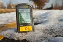
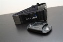

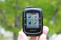

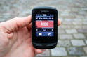
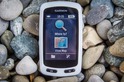


Greg – can you give me the details on how to do a master reset?
It was a little sketchy with the instructions to update to 2.6 (use the webupdater twice to fully update to 2.6)
Which updater did you use? Any information would be greatly appreciated.
NOTE – THE MASTER RESET DELETES EVERYTHING, your rides, your settings etc etc
This link tells you how to back it up link to support.garmin.com
Master reset – link to support.garmin.com
I used the webupdater, it had an option to re-load current version which is what I did.
Found the master reset instructions and did the reset, will reinstall 2.6 hopefully this works.
I did my first ride with my new 810 yesterday after first updating to 2.6. I had no problems at all and everything looked fine. The only concern I would have is that the screens’ don’t ‘swipe’ across that easily, I often had to have several try’s at it while cycling along.Does anyone know if it is recommended to put a screen protector on your garmin device, like you do with cell phones?
Andrew. I noticed the same thing. I cut myself a customer screen protector from an iPhone screen protector. That way, my screen does not get scratched. (because there are some definite scratches on the protector). I do find that sometimes, the swiping does not work. But let’s not forget that these screens are not like iPhone/Android phone screens, they use a different technology which is why it works with a glove…
Anyone know if Livetrack stays connected if I press the Stop button for example if we have a coffee stop during a ride and stop for 30 minutes. If I then press Star button once we get going again, will Livetrack just resume or will it start a new session?
Any guidance on how best to do this?
Thanks
Dex
Anyone know if Livetrack stays connected if I press the Stop button for example if we have a coffee stop during a ride and stop for 30 minutes. If I then press Start button once we get going again, will Livetrack just resume or will it start a new session?
Any guidance on how best to do this?
Thanks
Dex
Dex,
LiveTrack stops when you hit the Stop timer. You can start LiveTrack before or after you hit the Start button, but once you hit stop, you will see “LiveTrack Ended” on the 810.
Pierre
Hi Dex
I haven’t used livetrack yet as I have to get a new phone to run the Garmin Connect Mobile app but I would expect that the livetrack connection is independent of the Edge 810’s timer. Once you have started a livetrack session using the Garmin Connect Mobile app it doesn’t matter if you start, stop or pause the timer, the livetrack connection is still operational. On the Garmin connected features video they say you still need to start your timer if you want to record data, so that indicates you can use livetrack only without the timer running. I stand to be corrected on this, just guessing.
I did a 110km ride yesterday with my 810 (the second time I have used it) and it did a couple of funny things. The percent grade started going crazy at about 70km and then disappeared altogether along with the total ascent. After I got home and saved the ride it appears to have come right. Also when I hit the lap button to record a particular section of the ride it didn’t record it at the right location even though it indicated it had on screen at the time.
I have found that I like to use the auto scroll feature. However the elevation screen takes a few seconds to come up, its very slow. After my ride I found that it was almost impossible to examine the elevation graph on the 810 as it kept lagging and freezing when I tried to drag it around on screen. I had to look at it on Garmin Connect. Its like the 810 isn’t powerful enough to handle the elevation graph. Maybe Garmin could re-design the graph so it runs faster, at the moment it is a filled in graph which takes time to draw and redraw on screen. Unless the user can change that ?, I haven’t checked.
Despite these things I am loving the 810. The mapping is fantastic, its great to be able to ride along and see the names of the roads and local features. I have also tried the navigation and it works great. The heart rate monitor is also brilliant.
Unfortunately even with the latest fw update stilo missing the support for the new power metrics…..something provided by the Rotor Power! Any news Ray?
I suspect we’ll see Garmin add it in around the time Vector is released. They’ll likely need it (or at least want it), then.
Went on another 80km ride yesterday and the percent grade played up again, was nearing the top of a hill at 15% when it suddenly shot up to readings as high as 100% and kept doing that until I got to the top. For the remainder of the ride it was okay. The elevation and total ascent readings were not affected. Has anyone else noticed this sort of thing ?
Looks like the master reset fixed it leading me to believe that the problems I experienced were do to some corrupt files that needed to be cleaned.
2.6 firmware update so far so good. Just make sure that you do a master reset after you update. Inconvienent but it worked for me.
I do like the LiveTrack feature, but because I live in an area with 3 different countries in which I ride even in 1 day our on the bike it is simply to expensive with all the roaming costs.
Aside from that, I love my new 810. Thanks for all the advice in your reviews DC.
If I set up a map using Garmin Connect and the Google map with the “bicycle” option (showing trails and bike lanes) enabled…and then download this map to a Garmin 810, will the off-street course (trails) be shown on the 810’s screen? In other words, does an 810 with City Navigator software show off-street trails, as depicted on Google Maps? My guess is no…
I think the answer is a little bit of ‘it depends’. I know that when I lived in DC, some bike trails did show up (paved). However, I suspect there are others that don’t as well. I’m not sure if there’s a 100% consistent answer there unfortunately.
Hi Ed and Ray
My guess (I may be wrong) from having a play with my Edge 810 is that when you create a course in Garmin Connect and send it to your device, only the path of your course is added to your existing map on your 810, no other information from any of the map types or layers you used to create it is transferred. So if you have City Navigator which doesn’t have all the off road trails, they probably won’t suddenly pop up. You will need to get the relevant Garmin Topo map if you want the off road information. I have the Garmin Topo New Zealand and Australia map on mine and I have all the trail info I want.
As a Garmin device newbie I am just discovering how cool all the connected stuff is. I just downloaded some courses/activities to my 810 from local people and its great to compare their performance with mine and ride their courses. I also tried using the 810 for running yesterday (just held it in my hand) and it work great.
Thanks for the review.
I am having a problem with my device, in that I upload a course and immediately after it begins, it takes me a different route, which I think is a more direct route.
Is there anyway to stop this?
I am specifically using the device for navigation to places I do not know, so I need to follow the course I have mapped.
Any ideas?
Thanks
Jason, if you are riding an uploaded course it should stay on that course. Check that you are actually riding that course and not just navigating to a particular location. If you created the uploaded course yourself in Garmin Connect check that it actually followed the route you wanted to take. I rode a course I created yesterday and it took me down some unexpected roads which was because I hadn’t carefully looked to see where the route went. In Garmin Connect, when you select a start and endpoint, it is easy to assume that it creates the route you want in between but it may do something different. It followed the route okay but I found if I did go off course it wasn’t very good at getting me back on it.
Ray,
Ordered an 810 yesterday and was wondering how large the internal battery was in terms of mAH. Googling gets me nothing. Am looking to get an external battery pack to charge the 810 plus phone etc while away from home. How much charge would a 12000mAH battery give me on the 810?
Cheers
Hi Scott
I found a blog which talks about a device called a Mophie Juicepack Powerstation Duo ‘that can charge an Edge 810 and an iphone twice over’. The blog says the 810 is rated at 1100mAh while the Mophie can hold 6000mAh of charge, so you could charge your 810 five times using it. If you used your 12000mAh battery you could charge the 810 ten times. Blog address is:
link to rememberingjaron.com
Has anyone ever had a weather alert displayed on their 810? was out yesterday with the phone connected and got caught in a huge 5 min rain storm, zero warning on the 810! This is with the latest firmware.
cheers,
Greg
Hi,
Just wanted to say thank you for the in depth review. I bought an 810 and your site was a godsend for detailed instructions on how to actually put usable maps on it! So thanks! :)
Jessica
Any news from Garmin on a planned fix for the power meter issue? I was about to go ahead and buy this device but that is a deal breaker for me.
+1
Hi,
maybe someone knows this one;
today I rode to work and wanted to test LiveTrack to see how it handles that. Trouble is, in het area where I live (Zuid-Limburg in the Netherlands) I am close to the Belgian and German border, while living in the Netherlands. When I ride I ussually pass through at least 1 other country then my own, in case of a ride to work I go through Germany for about 3 miles. I have a data-connection in the Netherlands, but I don’t in Belgium and Germany because of expensive roaming-costs.
I was hoping that LiveTrack would pick me back up after I entered the Netherlands again and then maybe fill-in the missing part. But my lovely girlfriend tracking my progress told me that the LiveTrack stopped at the German border and never came back again.
Obviously I can set my iPhone to use roaming to keep the data-connection on in Germany, but that’s probably going to cost me some. Is this the only way? Or should LiveTrack pick me up automaticly after the small part abroad?
If anyone can answer this, thanks! If not, thanks anyway, I know not many people will ride through 2 or 3 countries in 1 ride.
Yes it does, see my other post. Ps. data usage of live track is very small.
@ Robbert: Live track seems to continue as soon as the Iphone-data connection is restored. I live in the same area but I do use int’l roaming. I tend to loose my connection because of bad reception (Ardennes) but after that live track restores and sends updates the “lost” part of the track automatically.
Thanks Eric, will have a look at the phone when I pass through Germany later today to see what’s happening. Maybe the phone had an issue getting data-connection back up or something.
Thanks again!
New firmware is out:
Changes made from version 2.60 to 2.70:
◦Added Vector power sensor support.
◦Improved power sensor setup and calibration.
◦Improved map and elevation profile drawing speed.
◦Improved course calculation and navigation.
◦Improved turn review prompts when routing without maps.
◦Fixed issue causing incorrect battery percentage to be displayed.
◦Added support for Torque Effectiveness and Pedal Smoothness power data metrics.
Right…and they had introduced a new bug related to mixed metric/imperial data
Takes about 30 seconds to get your metric/imperial settings corrected, and you have to do that once. That’s a bug I can live with. At least I now have an Edge that allows me to ride courses against VP without difficult workarounds.
Hi, thanks for your reviews. Great.
I’ve had an Edge 800 with 2 map bundles and haven’t noticed a difference in terms of how the Edge selects a route. My main need is to be able to plan and ride a route which is optimum for a bike. I’ve been so disappointed with the Edge and have been directed through the worst junctions in London and I can’t see what the difference is in routing between this and the car satnav (which costs about $200 less!). Have you found another satnav / route map combination that meets my needs (i only need basic information from a training perspective – and honestly have found a better system of route planning using my android phone, google maps (possibly also cycle streets and Map my ride but havne’t managed to make them work yet) and getting some spare super-strength betteries to make the phone last more than a couple of hours when the GPS is on. Trouble is, the phone uses a lot of data – although I wonder if I need a wireless or mobile connection when routing – i think just a GPS connection might be enough.
Grateful for any advice for someone with my interests.
I have an 810 and just noticed that after the 2.70 firmware update (might have been there before), the “Total Ascent” (in the Elevation category) field only shows up in Feet. All of my Units are set to Metric/Meters. But, I can’t seem to get this field in Metric. Anyone else see this ?
If anyone out there has the unit in Metric mode, could you see what the field shows up on your unit ?
I’d prefer to check before doing a System Reset… which is what I assume Garmin will tell me to do…
Yeah, it looks like a bug was introduced there on many of the settings for Metric, back to statue. To fix it, just go into the settings and change to statue, then exit, then go back in and change to Metric. Good to go.
Details: link to forums.garmin.com
I had the same problem when I updated to 2.70 but fixed it doing what Ray suggested. I significant bug which I haven’t been able to fix and which I see there is some talk of on the net is the fact that when you create a route in Garmin Connect the elevation profile doesn’t work, it just stays as a straight line. I had to do a system reset to clear it. Apparently it works okay if you use a program other than Garmin Connect to create a route. Anyone know about this bug ?
Thanks, that did the trick. Back to full Metric !
I updated the firmware in my 810 a little more than a week ago. Since then I have had the following issues when following a course:
1) The field “Distance to Next” shows the same as “Distance to Destination”
2) If I get off course – usually it won’t find the course again. If I’m on a long ride, it might find the course again in 20 or 30 miles, but then only for another 10 miles or so. Sometimes it will find the next turn on the map screen (distance to turn), register correctly, then suddenly, it will start counting up, and lose the course again
3) I used to be able to “Stop Course” and restart the course and it would find the course and work correctly. Now it does not.
4) If I stop course and try to restart it several times, the device will either hang or shut down. When I power it back on, I can continue my ride, but it still won’t find the course.
5) I tried using a tcx file and at the end of the ride, the Save button went black. The unit froze and I ended up having to do a hard reset.
Funny, I noticed #1 above on Sunday during my long ride with the new firmware (riding a course). Thought it was just me at first.
The latest version is somewhat worse for me with following courses, even turned off in the middle of a ride and when it turned on it didn’t want to pick up any GPS satellites for awhile. If I scroll the map while on a ride and leave it in scrolling mode the breadcrumb doesn’t track the road I’ve been on correctly and the map doesn’t redraw correctly as it moves off screen. I have a feeling the firmware was rushed out the door to support the Vector pedals and their work on redoing the mapping wasn’t ready.
I’m guessing the new Garmin Edge device that is rumored to come out is a cut down version of the 810 like how the 605 was to the 705 and then they realized how many bugs were in the device if its main purpose is for following courses on the map so had to redo lots of that code. At least I’m hoping thats true as a new device with a completely new code base would make it much more likely the 810 will be left with lots of bugs while a stripped down 810 would encourage those bugs to get fixed and make me less annoyed that I didn’t wait for the new device to ship that replaces the 810.
Since upgrading the firmware on my 810 the Navigation has also been completely screwed up!
None of the key features work properly any more, in particular the “Time to Next” or “Distance to Next” features. When I cross a waypoint, it will tell me the Time/Distance to the next waypoint, but the fields do not update as I am cycling, so I don’t know when I am getting close to the next waypoint. As it was, the navigation was never particularly accurate or reliable, so I relied on these two features to know when I was getting close to the next waypoint. Without these features, the navigation is absolutely HOPELESS!
Various other features no longer work, such as the “Time at Destination” feature.
I am really disappointed and frustrated. Garmin have obviously rushed out this “upgrade” without doing proper testing. This is very amateurish.
I have tried doing a “Master Reset” but this didn’t help.
Any ideas or suggestions? Should I roll back to the 2.6 firmware?
Hey Ray,
Is the 810 still very problematic with Power Meters?? Would the 800 still be a better choice to go with?
Power data with my powertap seems fine for me and I think the issues there were mostly fixed. Look at the garmin forums to see the issues others are having
for those having issues since the 2.7 update (which has been fine on my unit) I’d recommend doing a master reset then re-loading the firmware.
NOTE – THE MASTER RESET DELETES EVERYTHING, your rides, your settings etc etc
This link tells you how to back it up link to support.garmin.com
Master reset – link to support.garmin.com
I used the webupdater, it had an option to re-load current version which is what I did.
Question for you – I’m a newer cyclist (riding for about a year now), thinking about purchasing the 810. I do not currently have a power meter, although that’s on my wishlist as well and I am hoping to make that happen within the next 2 to 3 months. Do you think upgrading my bike computer (I have a very minimilastic specialized computer) to the 810 without a power meter will beneficial? Thanks for your input!
Very detailed review, all the photo’s and short movies really very good.
One thing I have not seen much detail about, and is a feature high on my ‘has to be included’ list, is hill grade info. With apologies if the many, many comments already also include the Q I’m going to ask.
Does the 810 have the option to have current hill grade (%) info on screen? On the mapping of a ride, when reviewing on a computer and when placing your cursor on a, any, point on the track does it also show hill grade (%) info.
Thank you for your advise on this.
Yes, it displays grade (in %). However, it doesn’t record that metric. Instead it records elevation. Some 3rd party apps (like TrainingPeaks) will then display grade, but Garmin Connect doesn’t.
Ray,
I live in Florida, and the heat really affects my performance. Does the 810 support the Garmin temp sensor? I don’t care if the temp is displayed, I just need the data in Training Peaks.
The Edge 810 doesn’t work with the Garmin Tempe sensor (external). However, instead, it has its own internal temperature sensor which measures outside temperature and records it. It’ll show up both in TrainingPeaks and Garmin Connect (and on the unit).
I had this issue from post #418 on the 800 as well. Just got the 810 and we’ll see how the first ride goes tomorrow….
“Andrew replied
August 15, 2013 at 1:35 am #418
I had the same problem when I updated to 2.70 but fixed it doing what Ray suggested. I significant bug which I haven’t been able to fix and which I see there is some talk of on the net is the fact that when you create a route in Garmin Connect the elevation profile doesn’t work, it just stays as a straight line. I had to do a system reset to clear it. Apparently it works okay if you use a program other than Garmin Connect to create a route. Anyone know about this bug ?”
Hey Ray, thanks for this writeup… I have an 810 with the City Navigator maps for the US, but just recently decided to ride in a charity event near London (Oxford to Cambridge) and needed to load maps for the UK… this made it an easy proposition. Hope to be in Paris soon for more cupcakes!
-Tom
I purchased the Garmin 810 along with my new Trek Madone 5.2 back in the spring. I’ve been using it for almost five months now and I’ve been delighted with it. My only real complaint is that whatever calorie consumption algorithm Garmin is using does not appear to be particularly accurate in comparison with other devices I use. It seems to under-count calories burned by around 25%-30%. Apart from that, it’s a great acquisition and I’ve now bought the necessary accessories to use it on all three of the bikes I own.
Hi,
great review!
About live tracking: if a friend sends you an invite and you take of for a ride yourself, can you see where the other person is riding on the screen (of your 810) and thus chase and try to catch him?
Thanks
No, only on the phone – not the device. Too bad, would be pretty cool that way.
Hi Ray
First time here I’m gobsmacked at the detail and thoroughness of the review, congratulations.
My problem is that I don’t have any of these devices and need a recommendation.
I’m a bit over 60 and ride by myself most of the time, since a recent heart attack my wife gets a bit stressed about where I am and when she can expect me home so if I understand your explanation the live tracking should be a real boon for her.
I do a bit of bicycle touring much of it on dirt tracks some of which appear on maps and some that don’t so it would be good for me to plot a tour at home and use a device to get me to my destination without getting lost
I always wear a heart rate monitor so heart rate is essential beyond that speed, average speed distance is probably all I need.
Synching with my iphone would be a bonus but not essential.
I’d appreciate a recommendation, if this isn’t the right place for me to ask I’m sorry, but this site is the most comprehensive source of this info that I’ve seen so far. Feel free to redirect me.
.
Hi Renovator-
Indeed, given your requirements of being able to allow someone else to track where you are in realtime, this is pretty much one of your best options. The Edge 810 is better when you want to go touring in places you don’t know well, or on routes you don’t know well. Whereas the Edge 510 is better if you don’t need a map and just want to ride.
So in this case, this would be the best bet.
Cheers!
thanks for your excellent reviews!
a quick question on UI speed. i bought a 510 an had to return because i found it to brutal in term UI response, especially when trying to swipe between screens, or when trying to follow a course. do you know if the 810 has similar issues (especially with map refresh)? also, do you know if the 810 has the same processing power as the 800? i don’t really care for the phone integration, should i just get the 800?
many thanks!!
Hmm, I don’t see any issues on my 810 (or my 510 to be honest) with screen latency. I ride almost every weekend with the 810 riding a course (and the 800 riding a course).
Question for hiking with the Edge. So I went for a couple of hikes with the Edge. The only thing I wanted was statistics like distance, heart rate monitor, speed and the basics like that. Nothing advanced.That’s why I thought the Edge would be ok, as I already had it. Started it and put it in my pocket (locked).
To my surprise it seems it doesn’t record speed 30% of the time. The stats just says zero. I was moving continuously for six hours, and still the stats came back I only moved for 4hours. The distance is also off. The hike was around 14miles and the Edge said 10.5miles.
Is this normal? Is it that it can’t handle lower speeds? or is it’s GPS capabilities limited? Can’t handle trees and hills? I was hiking in a hilly terrain but none of the hills is bigger than 600ft high.
Turn autopause off?
Auto pause is turned off :(
Incredibly detailed reiveiw (again!) – thanks a lot.
I’m thinking of diving in and getting one of the Edge 810’s, but when you talk about Garmin updating the prodcuts in ‘cycles’ when is it anticipated a new ‘new’ version would be released? Just don’t want to be stung by getting one then a new version comes out shortly after.
Thanks
Generally two years. In other words, don’t expect a new Edge 810-type unit replacement for at least another year.
hi Ray, i wonder how you managed to do a detailed review and didnt find any of the nasty bugs that almost every 810 users have (and if you did you dont mention them at all). like livetracking suddenly stopping for no reason or garmin ios app redownloading all activities every time its uséd (hundreds of them in my case using many megs of my dataplan allowance and taking long minutes to complete before being able to ride). and what about the course following sending you to start point because its closer to your current location instead of following the complete route… or unit just turning off randomly at some points… or hegiht profile just showing past profile on half of the screen and the worst one all. garmin not doing anything to fix them …. i recommend you to stop by forums.garmin.com and have a loop……
Hi Juan-
I assume you skipped the part of the review around the ‘Cons’ section?
In any case, the only reason people post in the Garmin Forums is because they have an issue. Nobody ever goes to the Garmin Forums to post “Hey, I love my unit, just stopping by!”. Which, is true of any forums on any companies site. I read the Garmin Forums probably 4-5 times a day.
If you count how many unique users there are in some of those threads, it’s actually relatively small. It’s mostly just the same people posting issues – some of which doesn’t even have units anymore but post comments simply to stir the pot.
I’m not saying that all those folks aren’t having valid issues. They no doubt are.
It’s just I’m not having them on my units – and I’ve repeatedly demonstrated that in a slew of posts over the past 8-10 months with photos and videos. You can see time and time again when I’ve used the unit for navigation and recording of data without issues that a small segment of the population is seeing.
And ultimately, like I discuss repeatedly, my reviews are about my experiences. There’s 454 other comments on this post where people have posted their experiences (the vast majority of them positive btw).
But they’re also a snapshot in time. Just like it appears some of the issues people are having have been on a specific firmware that wasn’t there previously, it’s not something I can capture. I simply can’t go back and check every function on every device with every new firmware update that comes out. That’s not realistic.
Just my two cents…
I am puzzled as to why my elevation data collected by my 810 changes so much when corrected. For example I went on a 209km ride and my total ascent was 3106m. Garmin Connect corrected it to 5012m and Strava corrected it to 4847m. That’s a huge difference, why ? Should I set/calibrate the elevation at the start of a ride and also at various points along the way ?, I haven’t been doing that. Should I not attempt to correct the data at all ?
Elevation correction is a tough nugget. The reason is there’s a lot of factors involved. Typically elevation correct data is gathered by shooting a laser from a satellite at terrain. That then determines the actual elevation.
That generally works well, but where it falls apart is situations that have bridges, or tunnels in your route. In that case it may think you’re higher or lower than you are. For a short ride that may be minimal (or not), for a 209KM ride that could add up to quite a bit of errors (for example, if you rode through a mountain).
It’s actually somewhat encouraging that GC and Strava are only off by about 100m. It means they’re likely pulling from the same database, and just processing the actual trackfile location differently (normal).
The Edge units will calibrate the altimeter from GPS to begin with. Generally if my route has an aspect that concerns elevation, I’ll quickly look and see what value it pulled as a gut check. From there, I just let it ride.
Thanks Ray, that’s shed a bit of light on it but I’m still in the dark somewhat since on my 209km ride I didn’t go though any tunnels and I only went over one or two tiny insignificant bridges. When I corrected the data I noticed that the amount of noise on the elevation profile increased somewhat and all this noise obviously adds up to about 1.9km of extra vertical ascent. The noise is obviously wrong since I know that the hills I rode had positive gradients all the way to the top. I am thinking of doing some testing on a large hill I know the exact height of. Maybe the elevation data for this part of the world (NZ) is not good for some reason. I am thinking that I should not correct my elevation from now on even though I would like to think I am climbing more.
Hi Ray, thanks for the great review. I currently do not own a bike-GPS (though enjoy the GPSMAP62s for hiking and driving). I have no smartphone (actually, no phone at all!), so the BT options do not mean much to me. I will be using it on a road bike and a MTB.
What is interesting is the battery life: did you confirm that the 810 indeed has 17 hours compared to 15 hours on the 800? That’s 13% more, which on longer, multiday tours (without option to recharge) can be very useful.
Currently I can get a 810 for about $60 more than the 800, not sure if it is worth it and if the firmware bugs mentioned here are fixed?
Thanks in advance for your time.
Hi Ray
I just found this on the Strava customer support zendesk.
‘On the 800/500 Garmin, the device smooths/filters the data before writing it to the FIT file. With the 810/510 the device uses the same smoothing process to compute the ascent/descent statistics in the header data, but they don’t write the smoothed data to the FIT file, but instead they write something that is much closer to direct readings. Hence it has more ripples, that could impact the calculation by 3rd parties (like Strava).
It looks like we might have to install an additional smoothing algorithm just for the 510/810 series, but we have not yet started this project.’
Apparently my inflated elevations are due at least partly to a problem with the 810 itself. This was posted in June. I have yet to check whether Strava have come up with a fix yet.
Hi DC Rainmaker-
I am actually from DC myself. In the city now but heading back to Philly tomorrow. I am heading off to Australia in a month and was looking for information on the 800 vs 810 to help me navigate while cycling abroad. Your review provided me everything I need an more! Thanks!
I will be launching my blog cyclinggal.com in a week. Do you mind if I add your link under “helpful tips” on my blog and off course call your site out?
Thanks!
Cycling Gal
Yup, feel free to link to the site – I’m always a fan of that! Hope you enjoyed DC, and the States at large!
Hi guys,
I’m planning to buy the Garmin Edge 810 in the USA; I’m from France. Is the French language available on the device ? I’ve seen in this review that it’s possible to change language on the Web Interface, but not direclty on the device.
Thanks in advance,
Cheers
Yes, it’s available on the device.
(DCR, living in France).
Thank you very much for your quick answer ! My ultimate question is : do the Garmin Edge 810 can load .trk files ? (I see .gpx is ok but I didn’t see any information about .trk).
Thanks !
No, no .TKR files. You can do GPX however, and KML.
Hi DC,
Thanks for all the good reviews. I’m a salesman in a Tri Shop in Belgium and have been referring to your sites all the time to all of my customers.
Now I have a problem myself, I created a few courses on the web Garmin Connect, aren’t they supposed to synchronise automatically with my iPhone 4 Garmin Connect app? Now, it doesn’t. Everything seems to be ok, so I don’t really know what the problem is. Maybe you can help me out, Garmin is a little slow in their replies.
They synchronize, but you need to manually pull them to the unit from the phone app.
Incredible detailed review…thank you! I mtnbike solo in Maine and need the best detailed off-road maps for my 810. Any suggestions?
Great review! I am looking at models to buy and wonder, has the firmware for the 810 been updated to allow round trip route calculation as on the edge touring plus?
Thanks!
It has not. I asked about it recently, and while it’s something they’ve heard requests for, it’s not in the queue to add at the moment.
I was competing in a 90km cycle event last week when my the ANT+ sensors I have, ie HRM and Cadence/Speed Duotrap (Trek Modane) on my 810 suddenly stopped working. It was not very good as just when I needed them the most they didn’t work. Everything else worked okay. After saving that ride and starting a new ride they were up and running again. Looking on the internet I found that other people have had the same problem but no one knows what the cause is. Does anyone know any answers to this ? My HRM is also not that reliable sometimes, even taking into account the things Ray has said about them. I know my max HR, from a hospital test, is no more than 196bpm but often my HRM will tell me I’m doing 250bpm or more.
For the HR strap side, start here: link to dcrainmaker.com
It’s tougher in cycling because often it’s the flapping of the jersey that causes it.
Thanks Ray, I hadn’t seen some of that information. I also didn’t know about the 3rd generation of Garmin strap (HRM3), might see if Garmin can send me one. I am also going to try using a smaller jersey, the one I am using at present is way too big as it’s one someone gave me.
I want to point out to everyone that I love my Garmin 810 and its fantastic despite these issues, nothing is perfect. I am aware that I tend to make a comment when something is wrong only (like everyone does) so I want to balance it up by saying overall the 810 is brilliant. It has really improved my cycling.
Great review. Thanks. I have just one ?. Did I read the article right that the 800 will recorrect you if you miss a turn like a car GPS and has most of the same mopping capability’s as the 810.
Kind regards, John
Yes, that’s correct on re-routing (assuming you have maps installed). Virtually identical from a mapping capability standpoint.
I mean “mapping”. Sorry for the typo.
When do you think Garmin will update the 510/810 devices?
I have the FR910XT; what are the logistics btw ANT+ and Bluetooth?
Will I have to buy a separate Bluetooth cadence sensor for my trainer?
Thank you very much & happy new year!
-Frank
Does this Edge 810 compatible with the new HRM (the one with running man picture on it) that comes with Forerunner 620?
Thank you and happy new year.
Yup, no problems at all. Obviously, you won’t get any Running Dynamics data with the Edge 810, but otherwise, it works just fine.
Thanks for speedy reply Ray. I really enjoy your Blog.
Enjoy the New Year Celebration wherever you are.
Cheers,
Chris
Hey Mate !
I love our reports , truly in depth and enjoyable to go through !
Does the 810 have an app for Iphone that sends new files to Training peaks ? I hav the GAmrin Connect app for my Iphone, but cannot upload to Training peaks unless i have my mac .
Thanks , hope you have some advice ?
Rich
Hi Richard. Check out this post from Tuesday, I think it solves your issue: link to dcrainmaker.com
Hi
i have an Indoor trainer tacx fortius.i use it with its software.
when i am training i use it with my EDGE 810.
o my bike there is powemeter (built in ) SRM.
during the cycling the cadence seen on the EDGE 810 and the TACX SOFTWARE
are the same but the power is not the same (40 units difference)
i did calibration to the 810 but still it is not the same
can you help me with that problem ?
daniel
It definitely sounds like a calibration issue, either on the Edge 810 or on the SRM PC. I’d suggest hitting up SRM support to see why it’s different.
Daniel, its possible the difference in the power measured by your SRM and your Tacx Fortius is due to the fact that the SRM measures power at the crank of your bike while the Tacx measures it at the wheel. There is a loss of power between the crank and the wheel due to the mechanism of the bike and rolling resistance. If your chain is old and not lubricated properly, or your tyres are flat, the difference is larger. Some people have actually done tests on it and generally the difference is around 10%. Have a look at this page I found.
link to bicycles.stackexchange.com
If the feature I care about the most is virtual partner, is the edge 810 a god way to go? I am aiming to do a 340 mile ride in under 24 hours and want to set virtual partner to the pace I’d need to go to make it in time to keep me honest while pedaling, and to know how much time I have for breaks by telling me how far ahead of schedule I am, and if I have time to stop for a pizza or something. I keep reading that virtual racer doesn’t work at all, and that the 810 is prone to just deleting entire tracks when it feels like. Have any of these issues been resolved? Is the 810 a bad choice for what I am describing? I have a dynamo hub so if I can charge the internal batteries via dynamo then I can extend the battery life past the quoted 17 hours, I am really just wondering if I can count on the new units to be a reliable virtual partner and track/record my route?
Also, has anyone gotten virtual racer to work to have a real time display of how far ahead/behind you are of your best time on a given route? Or is that a lost cause?
Thanks for all your helpful reviews!
If Virtual Partner is important, than the 800 is the right choice and not the 810. I Have the 810 and up until now (version 2.8) proper use of the virtual partner is only possible using several workarounds and manual settings change every time you start riding.
Will Garmin be updating their 510/810 devices this year?
I have the FR910XT; what are the logistics btw ANT+ and Bluetooth?
Will I have to buy a separate Bluetooth cadence sensor for my trainer?
Thank you very much & happy new year!
-Frank
No, they only came out exactly 1 year ago today. I wouldn’t expect to see either the 510 or 810 replaced. I would expect to see the FR910XT replaced.
Thanks! I wasn’t sure if they were like *Apple products or not regarding these nav bike devices.
Nah, Garmin typically operates on a 2-2.5 year release cycle.
What does Apple do differently from everyone else..they all have yearly or even shorter releases.
Hi Ray
Sorry if I’m being thick (probably!) but your review mentions the virtual racer functionality. I’ve got a 910xt too and the virtual racer mode is pretty descreet from virtual partner and warrant specific instructions in the manual. I’m yet to find mention of virtual racer either in the various screens on the 810 or in a manual. Does it actually exist or is it somehow embedded into the virtual partner mode?
Living in a lumpy area I find ‘dumb’ virtual partner of little use as I am rarely going at my average pace. It would be quite possible to be 3mins up with 10km to go, cover the last 10km faster than my pb and still ‘loose’! I’d love to do my sunday ride racing against a previous effort but so far have not found a way using the 810. I guess I could you the 910xt at the same time on my wrist…
Thanks.
Great Review and attached comments:
Are the Free maps that can be downloaded to the 810, from “Ride with GPS”, as detailed and good as the purchased maps from Garmin?
I haven’t played with the Ride with GPS maps. Though, I’ve done the free Openstreet ones, as detailed here: link to dcrainmaker.com
In most areas, they’re just as good.
Amazing review – one of the most detailed I’ve seen, thank you.
My situation: new road bike (first ever), currently with smartphone bar mount for my Galaxy S4 using Strava.
Pretty happy with this apart from:
– phone mount come off once, and my S4 landed in the road, another rider spotted it
– no cadence
– it’s a bit bulky and doesn’t look quite right
Considering the 810 but still not convinced after reading the reviews. So a few questions if you’d be kind enough to answer:
1) This was launched a year ago. Any news on a successor (820, 900)? Maybe with Bluetooth 4, taking advantage of other BT sensors, better use of smartphone connectivity, better resolution screen, all would be nice
2) I currently have a Trek Domane 4.5 which has spaced for a sensor(DuoTrap ANT+ I think) and also have a Polar ANT HR belt. I was planning therefore to buy a Garmin package without accessories but I read above that the Polar HR belt is not compatible? So I’m not sure what package to buy. I think the Trek/Duotrap solution would be neater than the Garmin one? But guess I’d still have to buy another heart rate belt to work with the Garmin (that would be 3 I own then – Polar ANT, Polar BT and Garmin compatible ANT+)
3) I’m still not convinced to splash out several hundred pounds when I’m getting quite a lot of stuff from my phone, BT Heartrate belt and Strava. Any resounding reasons why I should!?
i would also be very interested in knowing if there are any news on a successor (820, 900)…
I would not expect a direct replacement for either the 510 or 810 this year – they were only announced a year ago.
Hi Dc
It is a year on since this review, is there any way now to have the data from the 810 duplicated on the smartphone screen via bluetooth and not using cellular data network, say in area of bad coverage a coach following in the car could have the data live?
Cheers Brett
No, nothing onto the phone. You could certainly use something like the Wahoo Fitness dongle though for a coach in follow-car, but they have to be right nearby for ANT+ signal to reach them.
Just letting you know I recently ordered the 800 bundle and accessories through your Amazon link, so hopefully you got credit. Thanks so much for your oustanding reviews! If the 810 had the Bluetooth 4.0 technology, I would’ve spent the extra cash for that for sure.
Thanks for the support!
thanks for the amazing review!
just a question about the navigation:
can the edge 810 be used also for “free navigation”..?
i mean navigation on the map but without a specific destination point, .. just as simple map support.. to see where you are on a maps and see what’s around..! is this possible
i’d like to use a 1:25000 map for MTB purposes and most time wouldn’t have a specific destination point… but would need to see where exactly i am, move and explore the map to see which paths are around me in order to take decisions about where to go.
also would be very curious to know if there are any news on a possible successor (820, 900)… may be with better screen resolution and so on… (i have read it is not so good for detailed/zoomed 1/25000 raster/vector maps)
thanks again for the super review
Yup, you can always have the map on. For example, this weekend I was using the Edge 810 but in free mode. I didn’t enter in any navigation, but still had a map up.
any rumors on new models?
You won’t find any rumors of models coming from me, here. Sorry!
Thank you for a very comprehensive review and also for the details regarding the openstreetmap set up and download, it worked a treat for me.
I have had 2 problems with my edge 810 on recent rides that I have passed to the support mail address at Garmin. It concerned the unit freezing and also switching off in the middle of 2 different rides. Whilst they have suggested a factory reset and reload 2.80 firmware they have not responded to my query concerning what is the recommended action when I know the GPS signal will be lost either due to going through a tunnel/underpass or when stopping for a cuppa and going inside a café.
What has been your experience when you lose the gps signal? have you any recommendations?
Should the unit just wait until the gps signal is received again? Should I press the timer button to pause the ride? (when I did this the overall ride showed up as 2 separate rides.
The freeze/power down both happened within a mile of restarting my ride after going through a tunnel(under a mountain) and stopping for a cuppa in a café.
many thanks
Hoping some knowledgable 810 user can help out!
Just got back from a ride, I noticed that the ride didn’t appear in Garmin connect, despite trying to resync a few times.
So I checked on the 810, list of rides and it was there.
I powered off the 810 and the ride has disappeared completely!
I can still see the livetrack here, is there anyway to “save” the livetrack file before it disappears after 24 hours??
link to livetrack.garmin.com
Yup, LiveTrack is different from Garmin Connect uploads. Be sure that you’ve got the setting checked to automatically upload upon completion (within the phone app). And, be sure you’ve ended/saved the ride (which is what triggers that). If all that’s done, validate that the ride shows on the iPhone app (as completed). If not, it hasn’t transferred to the phone, which is required to get it to the web. Or, you could just plug it into your computer via USB to upload to Garmin Connect.
Sorry if these are stupid questions (or already answered in this thread) — is it correct that the 810 wirelessly uploads your ride data to GarminConnect app on your smartphone but that 800 must be plugged into computer via USB to upload? With the 810 can you upload data to the phone after the ride or must you have the phone with you and paired during the ride? I currently use iCardio to upload my gym (non-bike) HR data from my Mio alpha – is it correct that 810 is only uploadable to Garmin Connect? What about 800? Ultimately, what I want is a simple logging program that will handle info both from the Garmin and from my Mio Alpha (hopefully soon to be Mio Link) and, even better, both upload wirelessly. Thanks
“Is it correct that the 810 wirelessly uploads your ride data to GarminConnect app on your smartphone but that 800 must be plugged into computer via USB to upload?”
Correct.
“With the 810 can you upload data to the phone after the ride or must you have the phone with you and paired during the ride?”
Post-ride is fine, no problems if phone is in car/house/etc during ride.
“I currently use iCardio to upload my gym (non-bike) HR data from my Mio alpha – is it correct that 810 is only uploadable to Garmin Connect?”
Sorta. The 810 can only upload via the phone app to Garmin Connect, but using USB you can upload to just about any reputable site on the internet using the standard files. Same with 800 files.
Very helpful. One more. If i workout in the gym with mio link and an android phone but not my garmin can I get the mio hr data into garminconnect?
Hi, I wonder if the 1/4 mount will be good when driving in the mountains. Often I take the old 605 in mountains or at the races, but when it fell – I will not cry, but if I lost new 810 – I’d for sure regret it.
Can I take my maps micro-SD from my Edge 800 and put it in a new Edge 810?
I would think so, but sometimes they engineer in incompatibilities to force upgrades.
It depends a little bit on how they got there.
If you bought the SD card with the maps pre-loaded, then yes.
If you bought a blank SD card, and then bought the maps and did it through the Garmin software to get the maps added to the card while attached to your Edge, then that will likely break.
If you bought a blank SD card, and then downloaded free maps and added them to the card, that should be good to go.
Thanks for that. But I forgot the lack of BT4 capability on the Edge 810 – $150 total saved is nice but still too much for what was launched as a discontinued technology from the start.
Hi DC,
congrats for all your reviews! I own an Edge 500 and stepping to a 810 right now. I have many bicycles and 2 living locations.
When I move, I only take the Garmin with me and select the new bike in the settings of my Garmin.
Speed/Cadence and Powermeter are linked with the bike type, so they will be found automatically by changing the bike. The HR strap not, because is not in the bike menu. I need to synchronize every time and this is very annoying, especially when you go ride and you are not alone (It will find multiple straps….)
It is now possible in the edge 810 to set a different HR strap for every activity or bike? (I actually have 3 HR straps, 1 in each location and 1 for running)?
Thanks again,
Stefano
No, only one HR strap. Why not just keep the same HR strap? That’s what I end up doing – makes it simple. :)
Hi DC, thanks for such in depth reviews! My question / situation:
I mainly do mountain biking.
I have entered a 2 day stage event where you cannot ride without a unit such as 800 / 810 where mapping can be down loaded onto the unit as there will be no route markers.
I currently use Garmin FR 610 and am happy with what it does for me and all my training & races are on Garmin connect.
Here is the question / advice needed.
With all you have said i.e. 810 fell short of what it should have been, it has been available for about a year, is it worth buying one now or waiting for new model that resolves these problems?
If a new unit is on its way when do you expect release?
I need to get a unit by no later than May 2014 to get used to it before the event, if a new successor is still to far away, what unit would you buy from currently available units taking into account the different units abilities and pricing?
Thanks for your help.
Hilton Ralph
In general, Garmin has release cycles of every 2 years for most fitness products. I think that for the most part many of the major ‘issues’ have been resolved in the Edge 810, and they’ve added a handful of new features (i.e. Garmin VIRB action camera support). It’s just that on the list of potential things they could have done, it all fell kinda short.
Garmin is currently offering $100 mail-in rebate on the 810. So either their sales are pretty bad or they are planning a replacement this summer.
Thank you for your comments, 810 or 800 given the fairly big price difference?
Unless you need/want Bluetooth Smart functionality, I’d go with the Edge 800.
Why can’t I edit the the weight/health information unless the weight?
It should be too change the other parameters, even in manual.
I bought a Tanita BC-601 and I would like to insert them too in the garmin connect…
You know how to do that?
Best regards
Great Post. I own Garmin 910XT but I am considering getting Edge as I would like more data fields to show on one screen. I can purchase either 800 or 810. 810 is significantly more expensive these but I am not sure if I need all these “connectivity”/”social” features. What would be your advice: should I get 800 or 810 ?
thanks.
Hi DC!
I think the Edge 810 was just an interims model (because of the little new features and same case than the Edge 800). Do you think the same?
Have you heard anything about a new model?
I’m having the Edge800 and don’t wanna buy the Edge 810 because of the old bluetooth but, I like the features so I would be happy if a new Edge would come soon.
Hi Ray,
Sorry if this has been asked, but I’m having some real problems with the navigation on my 810. When I plot a course that happens to be a loop it tells me to do u-turns until I start the course again.
If the loop is a figure of 8, it will direct me back on myself at the cross over point or anytime the routes are close.
It also often decides to navigate on its own and abandon’s the course altogether.
Have you heard anything about this at all? Any advice? My friend has one too and is experiencing similar problems.
Thanks!
Hmm, that’s definitely odd. I assume you have a full mapset on there, and not just a default base map set. Might be worth a reset, sometimes that fixes it.
I often do lollipop type courses, and haven’t seen that issue myself. :-/
Hi Ray,
Thanks for replying, I really appreciate it.
I followed your instructions and got the openstreetmaps.
I’ve solved that problem but have a new one! Basically if you have reroute on it doesn’t just redirect you if you stray of course, it tries to cut chunks of your loop out too. Helpful!
Now the problem is that the turn by turn navigation just stops after a while at a seemingly arbitrary point in my ride. No warning or error message and definitely nowhere near the edge of my maps.
Pretty annoying!
Hi Ray,
Many thanks for your great reviews. With the current $100 rebate and 10% off on the 810 via Clever Training, is it worth an extra $65 to go with the 810 over the 800? I’m thinking about long-term Garmin support of the 800 vs. the 810.
Also, sorry about the previous post…can’t delete it unfortunately.
Justin
For $65, I probably would, since as you noted, there’s more likelihood of newer features being supported there than the Edge 800. Obviously, I’d never buy a product based on unannounced features, but, it’s pretty certain than the Edge 800 won’t see anything new. The Edge 810 may (or may not).
Thanks for your reply, Ray!
Hello, thanks for the great review. This made me buy the 810 in the first place early spring last year.
Since then I have used it weekly for riding routes around my area to explore routes and places I would otherwise never would have found. I make routes on Garmin Connect, using other peoples rides from Strava and other sources.
I have a problem with navigation though. Like Ray stated above, lollipop style routes are most frequently my rides. But I do have issues with navigation. I have 2 possible issues;
1) I close in on the starting point and the Garmin askes me “want to start your route?”. I press the button and the first navigationscreen comes up. On the straight road I ussually start it tells me “Go right on Kasteelweg”, where as I’m already riding on the Kasteelweg and there is no option to turn right. There is a river there…
After that, there are no further navigation screens coming up. Just the mapscreen with the route I created in Connect shown as a red line on the map which I have to follow by visual interpretation only.
Any idea how I can like skip a navigation screen and just go on to the next navigation point from which the 810 will pick up navigation again?
2) I put my starting point and finishing point (too) close together and the second I start my route the 810 tells me “Congratulations, you finished your ride!” While I’ve never even started…
I could put the finishing point somewhere behind me and start up the 810 only just before I near the starting point, but I still think it’s odd.
Any ideas?
Hi Robbert,
I’m having the same problem except mine starts out alright and then just stops giving me turn by turn after a while. And I have to start navigating a half mile in.
Make sure in settings you have recalculation/reroute turned off too or it often ignores your route altogether. Will be sending mine back if the factory reset doesn’t work.
Let me know if you solve it and I’ll do the same!
Unfortunately untill now the 810 (even with the latest fw 2.9) is useless for navigation, it get lost even going toward a starting point of a preload route (with Citymap Navigator)…..is Garmin planning to fix this issue?
I’m looking at getting a GPS unit. All I want from it is mapping, navigation, speed and cadence.
I use Strava and am happy with it and so am not interested in Garmins version of Strava.
I plan my routes before I go out and very rarely have to detour when out and about.
I’ve been offered a used 705 for £75 GBP, mint condition.
I either purchase this (if it will give me what I want) or pay £290 GBP for a new 810, unit only.
What would you recommend?
Thanks.
I have a 705, and mostly it’s been great. Seldom use the mapping/nav features as I down load the Garmin files to Training Peaks. I’m waiting until Garmin releases the next gen. Be advised that you will probably need a new battery for the 705. Garmin charges alot. You can get one and self install and void the warranty, of which is no longer anyway.
Only works with andriod and Iphones? not blackberry Z10’s??
Why would Garmin bother?
Hi! Since you’re a great expert regarding power meters I wonder if you can help me. I have a question regarding the analyses of data from power meters. Is it possible to get the raw data from power meters (particularly from the garmin vector and powertap)? For example, if power was set to be recorded every 30s, is it possible to have access to a file providing every single data point recorded? If so, which softwares provide such data? This is for scientific research purposes.All the best and congratulations on the excellent work!
Anytime you connect a Garmin device to a power meter it forces 1-second recording mode. Which, is the standard power meter recording rate.
SRM does some slightly higher stuff for track use, and there are further apps like what Stages has done for their PM.
Hi, great review and very helpfull. I have one question about the edge 810. Is that possible of customize the display screens through computer instead of the device? I am trying to find it on the garmin connect and so far no luck.
Thanks, Ugo
No, unfortunately not. It’s something I’ve long hoped for, but hasn’t happened yet.
Hi, firslty I’d like to say thank you, brilliant site and great reviews. I have an Edge 800 and am having difficulty downloading maps using the Openstreetmap guide you give above for the 810. They download fine into my Macbook but then do not appear anywhere on the Basecamp application. I have Garmin Mapinstall as well.
They do appear as OpenfietsmapLite (France).gmap. Do I copy them into the device SD card like that? they do not appear anywhere in Basecamp.
thanks and regards
Dominic
It depends a bit on how you do it. If you follow these steps – it’s actually a bit more straight forward and easier: link to dcrainmaker.com
Basically, you’d just be copying the file you downloaded from the site straight to the Garmin folder, nothing else to do.
Thank you. One final question – do i need to change the filename from its root ending .gmap to ending .img?
I am having real difficulties here. Got the UK map working fine from talky toaster but the others, however I load them, appear on the SD Card in the Garmin folder but when I switch on the device they are nowhere to be seen. Tried downloading both methods you describe, for 810 and 800 but no joy. Very frustrating. Even with MapInstall app this shows they are downloaded but again, they don’t show up on the device.
Any advice gratefully received.
Cheers
Dominic
Hmm, I’m not sure there, I tend to create them in major chunks instead of trying to piece them together. You may also want to try posting on that thread (link to dcrainmaker.com) – as some of the different developers of those map sets follow there and would be able to better troubleshoot.
Hi DC. I have a Garmin 705 and wonder if you would recommend an upgrade from it to the Garmin 810. Thanks to a 20% discount coupon and the potential use of the $100 rebate, I may grasp my hands on a Garmin 810 stand alone unit (re-use the cadence and HRM sensors from 705) for $315 shipped. Since I figured out can get about $150 for my perfect condition 705, the update would be around $165. Do you think the upgrade is a good idea or should I wait for a good deal on the new Edge 1000 instead?
Thanks,
Francisco
Given those deals and what you can get for resale, I’d go with the Edge 810 if I was in your shoes.
Thanks for your input! The thing is some people say the 800 and 810 screen is worst than the one on the 705 and was wondering whether I would be moving in the right direction.
Francisco
Hmm, I don’t think I’ve heard that often, most would say the 800/810 is better than the 705 (of course, there is always someone that disagrees).
I have an Edge 810 and often use the LiveTracker function. On today’s ride, we stopped at a resto (Tim Horton’s) and I went Inside. Unbenounced to me, the iPhone lost contact with the 810 and never reacquired it. So the person watching my LiveTrack session stopped at that point and never saw the rest of my ride. It just looked stalled from that point.
Is there a way to restart the LiveTrack session in the middle of a ride (aka, AFTER you press START and possibly load a course) ??? I don’t want to hit STOP or have to reload the course. That will screw up the logged data for the ride…
Thanks,
It’s finicky in that situation. Sometimes you can toggle either the Bluetooth settings on/off on your phone or the device and it’ll re-pair, but honestly most of the time once you’ve lost that connection due to power-off you’re kinda hosed. :-/ For temporary loss it usually re-pairs pretty quickly (something random like getting a water bottle filled and walking out of range and back in seconds later).
Thanks, that’s what I thought… Bugger ! I wish Garmin would hire some real programmers who understand real-time systems. I don’t understand why I need to start LiveTrack every time from the iPhone. I should be able to start it from the 810 and leave my iPhone in my Pocket where it belongs… Maybe the 1000 will have better firmware
Nashbar has a 21% discount that ends tomorrow morning which includes de Garmin units! I ordered one for a $105 discount, plus the $100 rebate from Garmin equals a $300 price for the base unit! Geab a bargain!!!!
It is frustrating that when I plan a route (‘course’) the Garmin 810 will decide to take an alternative route depending on the settings on the gadget itself. It will choose based on whatever ‘Calculation Method’ is set – minimize time, distance or ascent. Even a route cycled and saved as a ‘course’ will vary the next day. These settings cannot be switched off, one must be chosen. Strava and Runtastic are free and if you plan a route, they let you follow it.
Johnny, I have no such problems with my 810, if I tell it to follow a route it does so.
Use these settings
Activity => Cycling
Calculation Method => Minimize Distance
Lock on Road => No
Avoidance Setup => Disable all (to minimize crazy re-routing)
Recalculate => Off
Thanks Greg, I shall try that, though I won’t be out on the bike now for about a month I shall look forward to trying your recommendation.
Is there a product that combines the car-like navigation features of this unit, with running stats tracking capabilities like the TomTom cardio?
I am looking for a unit that can be used to track data on runs and riding, and also provides navigation / gps capabilities,
thank you,
I have had my 810 since last year and am finally uploading my first custom course thru Garmin Connect. I created the course and saved it, which worked fine. When I try to send it to the device, it recognizes the device but then goes into “Processing Data to Write” and has been like that for over 30 minutes.
I have the most recent version of Connect and my device is getting recognized so I’m not sure what the problem is. Can anyone help?
Bought one for navigation and general riding. I also have a 500 and a 200. To be honest, I like the bike and activity profiles best – yes I train on my commuter, but the unit is too big for racing. I think the ideal all-in-one device would be a 510 with navigation. I’d be happy to go a _little_ bit larger than the 500 for the navigation by maps, whilst retaining the small form factor of a 500. The 1000 is just too big.
So it’s 800 fr general riding, 500 for racing and 200 for off-road.
Hi DC.
Am here asking for your support cause didn´t received it from Wahoo staff.
Can I connect a Garmin Edge 810 to my Tickr HR and Blue SC sensors via Bluetooth or ANT? If possible what about battery consumption in Garmin by using bluetooth?
Thanks!
You can connect your 810 to the TICKR HR (via ANT+), but not to the BlueSC sensors unfortunately, since that’s Bluetooth Smart and the Edge 810 only works with ANT+ sensors.
Thanks for your quick reply DC.
The other escenario: can I use Garmin 810 sensors (HR and Speed/cadence) to connect to Wahoo Kickr and iPhone for indoor training?
Cheers
Not really, no. Not without a separate adapter.
Any news about segment creation on the 810?
Nothing new. When I chatted last a couple weeks ago they said that they planned to decide later this year whether to bring support to the 510/810. Thus, I suspect it’ll be a little while if they do.
Anyone use the Edge 810 for night riding? When I tap the screen to look at my speed and distance, then the navigation icons appear, and I have to tap the screen again to make them disappear. Is there any way I can look at my stats at night by tapping the screen only once instead of twice?
Nice review! thanks a lot!!!
And for someone who has an edge 500 and is considering an upgrade… would you recommend the 510 or the 810.
Thanks in advance
Honestly, I’d ask why specifically you’re upgrading. If for maps, then 810. If for just connectivity, then 510. If just for the heck of it, then I’d probably stick with the 500.
Thanks for the great review!
Would you go for the 800 bundle or the 810 bundle as a first garmin device? I don’t need the cell phone integration/livetracking, but I guess there won’t be firmware support for the 800 any longer, as it is a quite old device?
Price difference is about 100$.
Correct, no further updates for the Edge 800 (or, I certainly wouldn’t expect any). Thus, I’d probably look at the Edge 810 at this point. Though, I’d actually get the Edge 810 base (add the free maps), and then get the newer speed/cadence sensors instead.
My friend has a Garmin Edge 800 which displays the next cross street on the map. My 810 only shows what street I am on. I would prefer it to display the next cross street. Is there a setting for this, or have they removed this feature from the A810?
Which map set do you have?
I have tried both the Open Street map and the Garmin Navigator NT North America 2013 with the same result: Neither display the next cross street as the top label on the map. Rather they both display the current street I am riding on.
Mine does show the next street if I have enabled a course. Otherwise it shows the street I am on.
When I go to the Openstreetmaps site I get the message below from my virus protection. Have you seen this before and is this site really legitimate?
Malicious Web Site Blocked
You attempted to access:
link to garmin.openstreetmap.nl
This is a known malicious web site. It is recommended that you do NOT visit this site. The detailed report explains the security risks on this site.
For your protection, this web site has been blocked. Visit Symantec to learn more about phishing and internet security.
I haven’t seen any issues there. I think you’re just getting a false-positive from Symantec.
Hi Ray:
I currently have a Garmin Edge 800. I have an opportunity to return this device for a full refund. Would you recommend I upgrade to The Edge 810, 1000 or something entirely different. I realize you say a drawback to the Edge 810 is the blue tooth is not smart blue tooth.
I really like the idea of loading bike routes from organized ride groups onto the device via wifi Am i understanding correctly that this is possible?
Please let me know if i should stand pat with the 800 or dismantle and reurn it to upgrade…and to what device.
Best regards, and thank you
Michael
I’d go with the Edge 810. You can download rides wirelessly from Garmin Connect, though not from other services (same on all Garmin devices). From other services you’d have to connect to a PC. I think the Edge 1000 is largely overkill.
I have scrolled looking for comments by Mac users and don’t find any for the open source maps.
“Next, you’ll click on “Download map now”, which will take you to the download page. (easy)
You’ll want to download the Basecamp Map installer. Be sure that you’ve first installed Garmin Basecamp. Note that if you’re on a Mac, you’ll want to use the installer two items below the one I’ve highlighted.” (easy also)
I can download the map for Mac but after that there are instructions to use the installer and I do not find an installer. I dragged the entire file to the SD card. The instructions and illustrations just do not work for me on a Mac.
I will answer my own question after searching through too-complicated instructions like command line programming. I have a Mac running Mavericks and an Edge 800 with the most recent Software version 2.70. I bought a new micro SD card since the 4GB one that came with the device was not big enough to hold a map in addition to the 2.1 GB North America one the device came with. (I bought a 16GB class 10 card because it cost $8 and a 4GB class 4 card was $6.) And there was the issue of the device recognizing a second map on the same card without some programming to fuse the two maps (which may not be a problem with newer devices but I haven’t tried that experiment yet). So first I moved the Garmin folder with the NA map onto the new card, drag and drop. When I started the device it was not able to unlock the map; I think Garmin may have put some code in the card so the map can be read only with that device and from that card to prevent us from sharing their maps for free. I found a reference to changing that code, but more than I was ready to handle. According to some post the device will read from a 32 GB card so it is not that the card is too large. Next I removed the NA map from the Garmin folder and dragged a map of most of Western Europe into the folder. That map I custom made from the website referenced above; all of Europe was too big for them to create so I gradually eliminated tiles until I got to an acceptable size; I wanted one map rather than multiple individual county maps that are easy to download because I was still concerned about reports that the device will read only one map unless you do some programming to fuse them. I started the device and the map of Europe was there and working. I conclude that on a Mac you can just drag and drop the gmapsupp.img Openstreet map into a folder labeled Garmin. I do not know if the other folders there (Activities, Courses, etc) and a couple files (Gmapsupp.unl, grmn0.gma) are necessary.
Hello All,
I’m migrating from an Edge 800 to an Edge 810, (edge 800 headed towards my wife). Has anyone found how to set the “activity class” on the edge 810 device? In the 800 I can see it under USER PROFILE, on the 810 it’s not under that menu. I know I can set via garmin connect, but with the new GC, you can never quite be sure if things have worked, so I’d like to see it on the device :-)
Thanks in advance
Paul
When I flip to the map page while NOT navigating on my Garmin Edge 810, at the top of the map it reads, “Riding on (street name)”. My friend’s Garmin Edge 800 displays the next cross street. Does anyone know if there is a way to change the top-of-the-map display to show the next cross street? I get the same result with the public map and the Garmin GT Navigator North America 2013. My software is updated to version 3.0. Any help would be appreciated as I sometimes lead group rides and it would be very helpful to know the upcoming cross streets to facilitate following the paper cue sheet.
Ray – I just got an 810 and am loading a map using your instructions above. If I want to load another map of another state, wom’t it have that same generic file name and prevent the first map from working? Is there an easy way to just load the entire US? That should fit on a 16g card.
I have the same question! I’m also trying to figure out topo maps, and how to find the elevation of stuff before I ride.
I ride very slowly (I have mobility issues, ride a ‘bent tadpole trike) and I go up hills so slowly, it stops registering %gain…one of the benefits of a trike is that one can go up a hill at 1mph, to save the knees and keep spinning, without falling over (I got absurdly low gears installed, to facilitate this). Do you have any suggestions? One of the ways I deal with the climbing is by keeping track of the steepness!
Thank you for the great instructions, I would never have managed to load the maps without the help! Even so, it was tricky (the zip was behaving strangely, but thanks to your extensive instructions, I could tell it was bad and started over) Garmin’s manual is useless!
Hi Ray,
can not find the Weather button on my android app to enable Edge 810 to show weather data.
Additional question: Is it possible to copy chosen data fields in training mode to another activity screen?
Thanks,
Andreas
Great review. I’m a bit torn between the 510 and 810, but I’m slowly siding with the 810 I think. Interesting to see in your update that you don’t expect an 810 replacement any time soon. Thanks.
Thanks as always for another excellent review. Is there any update on the addition of support for Di2 or the Garmin Remote? If not, any idea as to when they will make their decision? Finally, are there any remotes coming from other manufacturers that will support the 810?
Garmin has stated they’ll decide “later this year”.
As for other companies, the problem there is would still require Garmin to add firmware support into the Edge 810 (or 510) to support the remote.
I deciding between the 800 & the 810 at the moment
Price difference is about £70 ($130). Have all the bugs with the 810 been ironed out and if buying now would you pay the extra for the 810? The only extra feature I’m likely to use from the 810 is the live tracking but I could live without it
I believe virtually all the kinks I saw initially were worked out. I know there seems to be a handful of people with turn by turn issues, but I don’t see them for whatever reason (and I have numerous 810’s).
At this point, I’d generally recommend the Edge 810 over the 800. We’re continuing to see firmware updates with new features, and I think we’ll continue to see new features as well for at least a bit longer.
Hi Ray,
Great review!
I have just bought one and was wondering if this unit is suitable for triathlon use in your opinion?
My concern is that while it is connected to my bike it would power down/go to sleep and lose satellite fix during my swim and therefore by a bit of a nightmare during transition. Would I be better off with a cheaper far more simple device for racing or is there a way of setting it to stay ‘alive’. Reason I ask is that my forerunner 410 powers down if you don’t start the timer.
Thanks!
As long as you turn it on and find satellites before hand, you’ll be fine, even if it falls asleep (since it has hotfix).
Or, you can just tell it to stay on, and since the battery is more than enough for an Ironman bike + an Ironman swim, you’re good.
Hi Ray,
Since my Edge 500 died while on holiday in Spain (very convenient with even no breadcrumb trail in a place where I haven’t been before, lots of stops to take the phone out), I decided to get the edge 810.
I have used it now for a couple of rides, one of them being a navigated ride of 130km. No problem there, but on a 60km ride – also with navigation on – it turned off twice during the ride.
While searching on the internet I noticed that this was a common bug with other people as well. However most complaints were posted when the device was new on the market and nowadays I don’t see too many people with this problem. Does this mean there is a fix for it that I am not aware of? Would be great if that’s the case, otherwise I am seriously thinking about sending it back and get the 800 from somewhere or even another 500.
BTW, I am running software version 3.0 (up-to-date) and OSM for maps (thanks for you guide on this).
Hope you can help and thanks for you blog!
Hello,
Do you know if it is possible to have annual kilometers on the Edge 810 screen and not only via a computer or smartphone ?
Thanks.
You can use the odometer function, and then reset the odometer each year.
I tried to scan through the comments – hope this wasn’t already answered.
I am part of that small group of crazies – randonneurs, that will ride longer than the battery life of any of these devices (rode 600K this weekend).
1. will this devices support a single activity that is hundreds of miles, tens of hours long in terms of recording that much data?
2. Is it possible to charge it while it is recording (through either an external battery or dynamo hub)?
I’m replying to Ronald re. randonneuring…
Ron –
I used my 810 on the LOL 1000K this summer. No, you can’t really run a track that long. I found performance started lacking around the 400K point. I’ve since adopted the practice of resetting the track every ~200K at a convenient control point. If you plan ahead and note on your cue sheet where you plan to do this it’s easier to remember to do it as your brain goes foggy and you can still keep a pretty clear idea of where you are on the course.
Mike
Sorry I hit “submit” without answering your second question…
Yes it will accept an external charge while riding. Just be sure to use a usb cord with a good snug fit to the device. One mildly annoying “feature” is that if the device senses a loss of external power, it starts a 15 second count down to turn off. You can override this with a single finger tap but of course you have to hear the beep or look down and see it. Neither of which is likely on a long descent. My habbit is to let run down to about 30% then plug it in to recharge. It will charge back up in about 2 hours even while riding, then I stow the cords. Out of an abundance of caution I also stow the cords during any precipitation.
A loose usb connector will appear to the device to be a momentary loss of power and trigger the shutdown. I haven’t found a way to turn this “feature” off.
I carry a 14,000 mAh battery inside my bar bag and charge it from that. Fewer wires and complexity than the E-Werk for use with your dyno hub, but I’ve also tried that too.
Just wanted to say thanks for the great review!
I’ve been looking into a few different bicycle computers, and this helped out a lot!
Just wanted to say thanks for the great review! I’ve been looking into a few different bicycle computers, and this helped out a lot!
I have the Edge 800, works fine, except I have one major complaint.
I have 2 bikes, road bike with power meter and mountain bike without power meter.
I have called Garmin technical support and they have not given me the answer which I am looking for.
I have created 2 profiles, the road bike with Power Meter and Mountain bike without Power Meter, but the home screens both show the same settings on Page 1 ,, Power, Speed , Cadence,, so when I ride the mountain bike the Power and Cadence are not available.
I would make sense for Garmin to have individual settings for each bike and they get transferred to the home page once I go for a ride.
Garmin told me the I should change the home page each time I change bikes,,
Correct, with the Edge 810 the introduction of Activity Profiles solves that problem because you can create different page settings per activity profile.
Thanks for the info,, If I emailed you first, I would of saved over an hour on the phone with Garmin. They never mentioned anything about Activity Profiles or upgrade to the 810.
I am currently looking at the 510 and 810. Is it worth spending the extra money on the 810? The only difference I can see is the ability to use it as a satnav
That’s it.
First read on this and what a read. Is there a video of all that you have put together. If I missed it I would appreciated being directed to it. Thanks for now.
No, nothing at this point. I’ve started trying to do more videos of new products, since I know folks like those a fair bit.
To respond to Ray – If you primarily do triathlons, my sense is that you would be much better off with a true Triathlon watch. I have a 310XT that I’ve been using for about 4 years now – it even works during swims, has enough juice to last for a full 18 hours, and easily switches between swim, bike and run mode. (There’s a newer model, the 910XT, that is reviewed on this site).
In terms of videos – one of the things I really appreciate here is that I didn’t have to watch a video. Not only can I read several times faster than anyone can talk, it’s much easier to find and to jump to the parts I care about in a writeup. Please keep writing – your reviews are a gift to the community.
Fear not, no plans to reduce text reviews. Purely spending 5-7 minutes to put together a qiuck intro video and calling it done like the M400 video. :)
I’m having horrible issues with both 3.2 and the beta 3.24 software, crashes, hangs and power offs. Tried full reset and still the same issues.
Does anyone know where I can get 2.9 or 3.0 firmware and downgrade please? That version was rock solid for me over many, many months.
Hi Ray,
would you recommend this unit for a MTB? I would use it twice a week to follow (not guided) tracks in the forrest. I guess the edge 1000 might be a bit overload for my scenario.
Hi,
I need some help on how to set up a FTP test using the Edge 810.
I downloaded a tcx file but it doesn’t work.
Can somebody post how to setup it from scratch using garmin connect?
Two tips for those of you that want to use the Garmin as a running device (and have pace):
-Buy a Garmin forerunner watch strap adapter (it says you can’t use it for the 810, but you can)
-Set your Garmin to auto-lap every 1km and then show last lap time on the screen. This effectively gives you the pace for the last km as you run.
I put this next to the average speed for the last lap and it gives you a target speed to beat on the run (so to speak) to help you with mental arithmetic
Wondering if anyone else is having turn by turn navigation issues, and if any solutions could be offered? I recently upgraded from my faithful 800 (as I wanted the scale factor adj. for the vector). I would have gone for the newest 1000 but didn’t want to strap a TV set onto my bike.
I have found the same courses I mapped and used on the 800 completely hopeless. I have tried a number of routes over the past month but it’s hopeless (I’m on latest firmware). Reports of the Beta versions 3.24 and 3.23 don’t indicate anything better.
It gives me perhaps 5 TBT directions when I should be getting 50+ on a long ride for example. A read on the Garmin forum indicates lots of people having the same issue – the link below summarises just some (~20) of the threads. Apparently Garmin are not assisting anyone, and I have logged a support request online (14 days ago) and also called (being referred) but am hearing nothing back.
link to forums.garmin.com
Interested in your opinion or views on the 810 TBT issue. Many thanks
Turn by turn is hit our miss, usually miss, works for a bit then stops. But the people line always works so I just follow that. Btw the 1000 isn’t that big
I suspect most people expect a navigation device to provide navigation functionality. As I mentioned my 800 was flawless for 2 years – very strange that a newer unit does less than the old in this regard.
Focussing on the purple line the whole time while riding a bike is not a good idea.
Ray – any chance you could seek comment from Garmin regarding this device? Customers are being ignored on this is my experience so far – little voices!
Hi
since using Garmin Connect to prepare a workout is time consuming I was wondering if you know a way to write a workout in a file and then just copy it on the sd.
I think it would be faster
ciao
Ever since Sunday I’ve been unable to sync via bluetooth. The sync starts and gets to about 10% before freezing and then ultimately failing. I can’t sync workouts to the phone, or courses from the phone to the 810. I’ve seen others have this issue on the forum but Garmin doesn’t seem to respond. Does anyone have any idea how to fix it?
I know I’m not the only one, but is elevation profile functionality just universally broken for everyone on the 810 or am I in the minority?
If I make a course using Garmin Connect and upload to my 810, the elevation profile shows up as flat. If I make the course with BikeRouteToaster (or any other app) and export manually as a .tcx, the profile shows up fine. Having to use other sites negates bluetooth uploading of routes, which is a key feature of the Edge X10 devices…
It also means that to make all of my previous courses (which were fine on the Edge 500) work correctly, I have to put them on the device, pull them off it, convert to a .tcx, recalculate the elevation on BRT, export as a new .tcx, and transfer that back to the 810.
Garmin’s own website is so broken that it doesn’t support a key feature. Pretty pathetic really, but then I wouldn’t export much less from Garmin…
That’s odd. I’ve experienced the exact opposite on my 910XT. It formerly always gave me “flat” profiles when I created courses in GC and sent them to the 910XT. Not sure when it changed, but in the last month, two courses that I created and ran showed elevation profile. The profile within GC still doesn’t show elevation stats, however. Which is somewhat of a bummer.
Hi Ray,
the Edge 810 and 510 were launched in January 2013.
I know the Edge 1000 was launched earlier this year but do you happen to know if we should we expect any replacement for these “smaller” devices early 2015?
Hi Ray,
Sorry to insist, just wondering if you had anything on this
Cheers
Hi Ray,
just wondering if you got any news on this?
Thanks,
Chris
Sorry Chris, but I generally only post about announced products.
Just to start out, I have no inside knowledge so this is just based on my own logic. On the connect iq garmin forum garmin did say connect iq will add some api support for map devices which I’m guessing includes the edge series. So basically I’d expect any new edge device to support connect iq outside of a low end device (ie if the 200 gets replaced)
The 510 would be easy to replace but I think an 810 replacement would be hard as how would they improve the 810 without the device being in direct competition with the 1000 which has not been on the market that long
Thanks Eli,
I appreciate your views as an outsider.
Seems to make sense, let’s see what strategy Garmin follows
@Ray, I understand. Thanks
Good afternoon.
Have not seen any comment about the autonomy of the 810!
Does anyone know the autonomy and under what conditions is it lasted?
Thank you.
As always very helpful and informative. Much appreciated,
My one comment is that in many places you say that the main reason to specifically get the 810 over the other options is for the routing. But I would say that the routing is very poor on the unit. If you load a course then try and get it to read out TBT directions it just fails on most of them and you see some other purple line it thinks you should be on as far as TBT directions go. With auto routing on and you go off course the recalculation can be crazy asking you to do a big U turn and go back on yourself when in fact you can just take the next turning. Routes from A-B using the built in navigation are not that great (of course the maps used have a lot to answer for in many cases). So I feel the above needs more of a review given this is the area most people would buy the 810 over the other options.
I do not have the latest beta but will try it tonight but in that one you can turn off TBT directions which is good because what it allows you to do is plan a route with a cue sheet. Set those cues to be say 150m prior to a turn and not have the Garmin’s built in TBT instability confuse things. Instead solely relying on your own route and directions. Its a shame that this seems to be the best way right now.
I bought the 810 over the Mio this week on your advice mainly for the routing side of things but right now I am wondering if that was a bad decision given how poor the 810 is at routing. Having said that I can’t compare it to Mio’s routing having never used it so it may be equally poor!!
It’s odd, I haven’t quite figured out the pattern as to why some folks have TBT issues and others don’t. Not sure if it’s a local mapset thing, or something else like how the routes are loaded. For me, I have no issues with TBT on the Edge 810 (even after 2 years). Yet others see oddities there.
Yeh strange one! I have open street maps installed as per your instructions (thanks!) and have tried creating routes in Strava, Garmin connect and bike toaster and sending them to the 810. Some are better than others but in all cases I see that the routing calc when I go to ride a route takes quite a while to calculate (it’s an old memory card so I’m wondering if there are card read speed issues?) say 2 mins. That’s a 11 mile route across London. But when it’s done you see the planned (bread crumb) route but then the 810 tries to copy this route using the open street maps but just goes a bit crazy and fills large segments of the ride with a straight line. Clearly for those say 2 miles you get no TBT directions! Just your bread crumb and this straight line the 810 put in. As you can imagine the open street maps in London are excellent and I’ve designed the route using open street map so in theory the 810 should be able to match that identically. So I’m not 100% sure what’s going on or where to turn, literally!
You may be the only one Ray! Wanna swap? Pasted below the explanation from someone on the countless threads on the forum on what happens with the TBT. I reiterate, I have used exactly the same course files on my previous 800 without a problem – it’s an issue with the 810 not mapping software etc.
Normally:
– You arrive +/- 175m before a turn
– TBT comes into action and jumps to the map page (or zooms in if you are already there) + generates a beep.
– Arrow is shown on the map + distance and time counters counting down towards the turn replace those you have active on the map page (if any).
– Beeps another 2 times to warn you about the turn.
– The time counter reaches 00:00 and jumps to –:–. If you see –:– this turn has processed and TBT jumps to the next TBT in the list.
– +/- 10m after the turn, the Edge continues to what it was doing (showing) before TBT kicked in.
– TBT prepares itself for to the next upcoming turn.
On a freeze this happens:
– You arrive +/- 175m before a turn
– TBT comes into action and jumps to the map page (or zooms in if you are already there) + generates a beep.
– Arrow is shown on the map + distance and time counters counting down towards the turn replace those you have active on the map page (if any).
– Beeps another 2 times to warn you about the turn.
! The time counter reaches 00:00 and does not jump to –:–. If you don’t see –:– The TBT process on this turn has not finished.
! Instead of jumping out of the TBT routine, the TBT info stays on the map page with counters either at zero or starting to count up from that turn.
! Ride cursor goes of the map, Edge keeps displaying map + counters but will eventually jump to back to what it was showing before the turn. At this point, TBT stops working, it FREEZES to that last working turn.
! From then on there is no TBT anymore (sometimes just an arrow), no beep no counters, no jumping to the map page if the next turn comes up. It’s in sort of frozen state (distance counter on the TBTlist still counts upwarts to that last working turn).
– x kms after this, TBT skips the all the turns it did miss and start working again, it unfreezes itself. From then on, all is fine again.
I don’t have those problems Adam, and I don”t see breadcrumb routes so I wonder if you have some different settings??
TBT seems to work for me the majority of the time…
I’m travelling at the moment, when I get back I’ll try and let you know what my various settings are
What I mean by breadcrumb trail is the route I designed on my Mac is shown as a line. My understanding is that this is merely gps data points to the 810. When you hit ride that course the 810 then tries to create its own route from the installed maps that matches the gps trail. Even though the trail was created using open streets maps which is what is installed on the 810 it seems to struggle and creates some weird routing leaving you with the originally designed route (I referred as breadcrumb above) and the 810’s version of the route with TBT directions. The difference can be large. I can photo this if I figure out where to place the images to link to here.
While troubleshooting is definitely valuable, I do follow the 810 TBT threads on the Garmin Forums, and it’s honestly probably better there since post comments here are a bit messy for troubleshooting back and forth.
Is it possible the device can have a bad gps reception while using it for running? I’m wearing it on my lower arm, in a simple pouch.
I have one registration where the moving time differs a lot from the ‘stopwatch time’.
Autopause was off.
Too bad I didn’t have my 310 in use at this occasion. (I was on a cycling vacation but found a small trailrace in a picturesque 10 houses & a church french villlage)
Garmin told me it is not intended for this kind of use (off course they do) and incorrect data can well be a result of it.
But I wonder……
By the way: you say (1st paragraph under Live tracking) the device will send your pace. But I never managed to pair my (Garmin) pod.
Is it possible the device can have a bad gps reception while using it for running? I’m wearing it on my lower arm, in a simple pouch.
I have one registration where the moving time differs a lot from the ‘stopwatch time’.
Autopause was off.
Too bad I didn’t have my 310 in use at this occasion. (I was on a cycling vacation but found a small trailrace in a picturesque 10 houses & a church french village)
Garmin told me it is not intended for this kind of use (off course they do) and incorrect data can well be a result of it.
But I wonder……
By the way: you’re saying (1st paragraph under Live tracking) the device will send your pace. But I never managed to pair my (Garmin) pod.
1) The Edge series is optimized for cycling paces, and not so much running paces. Thus, why you’ll see slightly less accurate results while running. It works, but it’s not perfect. What they’re saying is very much true, though, usually it tends not to matter too much.
2) Within Live Tracking, yes, you can actually change it to pace (on the web page, not your device). But that doesn’t mean you can pair to a running footpod unfortunately with the Edge.
Hi Ray,
Thanks for taking the time to put together such thorough and in depth reviews. We all appreciate them.
I want to buy a dedicated bike computer. I currently use my Fenix2 but the small screen is a bit of a headache. My gut reaction is to get the Garmin Edge 810. I have read that the the Edge 500 doesn’t support all of the Vector power features and isn’t getting software updates. The Edge 1000 is more than I want to spend. I want to stay in the Garmin family to stay consistent with my other toys.
My primary hesitation is that the Edge 810 is almost 2 years old. I hate buying a product and seeing the new upgrade appear 2 months later. Especially when it doesn’t get life altering or “Buy it now” type of reviews. Is the Edge 810 at the end of its product lifespan? Should I wait for the next iteration or enjoy the toy while training in San Francisco’s mild winter?
Thanks in advance,
Colin
Garmin 810 with Blackberry OS 10
Hello folks, can you please confirm that 810 has working online functions through the Blackberry Q10 (OS 10.3)
thanks
Hi,
Just wondering whether you can scroll around maps on the device. For example, say I was out on a bike ride and decided I needed to find a nearby town to get water or a part for my bike can I move the visible portion of the map around?
I currently use ViewRanger on my smartphone for bike packing trips and the ability to be able to do this is really key for me.
Great review!
Thanks
Justin
Yup, you can tap on the map screen and basically there’s an option to then move around.
on a 810 while riding, can i switch display from showing statistical data, ie, time, mph, distance, etc., to map mode, then back again without losing any data ? If so, how ? thanks for your help.
If I understand your question fully, then depending on how you’ve setup your data fields and screens, you can achieve this by simply swiping left or right.
Thanks for the great review. I have an Edge 800 and was going to go for the 810, as I had assumed it had the latest bluetooth. Thanks to your article I now know it does not and have saved myself disappointment.
Thanks again for the in-depth and trustworthy review – it is appreciated.
HI!
Is there any option for trackback function during ride or hike, without previously created track?
Has anyone information about how long tracks 810 kan store for a ride? This summer me and some friends plans to ride through Sweden from the north to south, a ride of 2100km. If I use a MicroSD-card and charge the unit on the run, can I store the ride in one track?
Thank you for such a great article on this cycling computer. Had to quickly buy the 810 before Illinois starts to charge sales tax on Amazon and plus my old Forerunner 305 rarely syncs reliably on my PC. I really like that you showed how to use open street maps and cycling. I found an old 1GB card to test and wow the maps just showed up on the 810. Good by base maps and no more paying Garmin their fees. I’ll be getting a 32 gb card this weekend due to the speed of the 1GB card is below Garmin’s recommendations.
Since I am only using it indoors right now due to weather I really can’t wait to get this thing on my road bike and see how it works with some of the new routes that our club is publishing. On to training.
Hello my name is Greg.
I have a question for you.
you wrote:
“At first I was annoyed by this, but the more I use it, it actually makes sense. This way I can create a ‘Hiking’ activity profile with a different map layer (such as Topos), and then still have my default road riding one be City Navigator. Nice touch.”
I have got a Garmin Edge 810. I’m trying to set up two profiles with different maps, but I can not. Always sets the last map. I have no way to change maps for the mediation of profiles.
I tried to 3.40 and 3.41 beta firmware.
Can you write me how you set this up?
I would add that I have got two maps. OpenStreetMap and City Navigator.
3.43 beta firmware the same :(
Thank you very much for this incredible review. I can’t thank you enough for the thorough attention to detail! I decided to get the 810, my first full-feature gps cycling computer. best of luck to you!
Hey DCR, is there any way to turn off the tones and notifications on workouts?
I have an EDGE 705 with a USB port connectivity problem. I got it as a bundle. If I buy the 810, will my old HRM and Cadence sensors from the 705 work with the 810?
Yup.
Oh, and I have both the original Garmin City Navigator, and Europe/Italy maps for my705. I also downloaded free maps from your “How-To” for the western US. I loaded the free maps onto separate microSD card. Are they compatible with the 810.
Yes to those as well.
Hi Ray,
I have never read such an in-depth review on any product I ever bought! This should be the standard for reviews!
In your summary you wrote:
I know this review must have been written a while ago, and I also know that they have fixed many things on the 810 by now. Do you still feel the same way or is it worth the upgrade from 800?
I currently own the 800 bundle. If I purchase the 810 do I need the bundle or can I just purchase the 810 and use the rest of the “stuff” that came along with the 800 bundle?
Also, with the passage of time, did they upgrade the Bluetooth 2 to 4? I have read that people were complaining about the tracker not working well between their phone and the gps system, is this still a factor?
One more – sorry. How does the battery life look next to the 800? I can use the 800 for a loooong time before needing a charge. Is the 810 similar?
Thanks so much for your feedback! Can you please send me a link to where I can purchase the 810 that I need (whether bundle or not), so I can repay you for your kindness?
Thanks,
Mendy
Do you know if you can manipulate the official Garmin maps the same way you can the open maps? As in choose specific components.
I have an 810 with the official Europe maps and I would like to either move the maps to a faster microSD card or remove the irrelevant areas of Europe as I only use the England and France maps on a yearly basis. So far all I’ve tried is a straight copy to a new microSD but that gave a map read error (this will be anti-piracy presumably), I haven’t tried cloning or imaging the origional across with software.
I’m hoping to shave a few seconds off boot time because I’m fussy like that.
It’s honestly unlikely to save much time. For example, I only have France on one unit I have, and the loading time is no different than another unit I have with the entire US.
You could technically delete the maps off, and then load up the Open Street maps on the SD card. But again, I doubt you’ll see much savings.
Ok, thanks for the reply!
Hi Ray, thanks for your outstanding work on all of your reviews! I’m thinking of purchasing a 810 and am wondering a couple of things. Will I be forced to download either city navigation or other third party maps to use this device to navigate? I ride through the middle of Augusta and the surrounding towns and am wondering if the installed maps will show me all the street names. I suspect not. Also,
Will the 810 now communicate with Strava, Map My Ride, etc via Blue Tooth?
Thanks again!
You might be interested in this. Garmin 810 ($140 off) and 1000 ($210 off) are discounted on Garmin website. Guessing a new model will be coming out, or maybe a Bluetooth Smart compatible update.
Hmm, I’m not seeing that (any discounts). However, those discounts sound pretty close to the Friends/Family/Corporate/Employee Discount prices. Any chance you’re logged in there?
any rumors about new devices? I’m about to pull the trigger on a 810 :-)
I normally buy gadgets hours before a new device is presented so I thought this time I’d ask around before :-)
Thanks DC Rainmaker for all reviews!
Well there is the 1000 already out…
link to dcrainmaker.com
Given the number of new features Garmin has added to the Edge 810 over the past 5-6 moths, I wouldn’t expect an Edge 810 replacement near-term. They typically don’t add that many new features when they’re looking to roll out a new unit and want you to buy something new.
Don’t know how your relationship with Garmin works, but do want to mention that I bought an 810 with this extraordinary review being the deciding factor. Found a great price from a place in Italy – even free shipping. Only downside was the fact that the AC adapter doesn’t have a US plug.
Used it for a 600K this weekend. It reset when I plugged in the external battery late in the first day of riding – worked fine otherwise. It’s clear that there’s a huge amount to learn to be able to take advantage of all the things it’s capable of – downloaded the full user manual to my tablet for light reading. :-)
big thanks!
ronald
Does the Garmin 810 work with the Trek Duo Tap?
Yup, no problem.
Hi DC,
I am late to the party on the 810, having been away from the bike for a couple of years, but thanks for your brilliant review. I am on my 4th generation of Garmin GPS devices having started with an Etrex Vista and have been through the trauma’s of Colorado and Oregon so I am used to Garmin manuals being next to useless and resisting the temptation to bin the new device after a couple of hours.
Without users like you I really don’t know how Garmin would ever survive in the GPS market.
Well done and many thanks
Rich.
Wouldn’t a suunto 3 also work as a ride tracker for training and rising purposes
Sure, though realistically I find the Edge unit a far better cycling-specific device than the Ambit3. If you were doing triathlons or running, then my recommendation would be different.
In my country there is only like a 300 rand price difference between the 2 devices seems like suunto you get allot more bang for your buck and the other sport option is always there if you need it. But maybe I wrong
Yeah, it just depends on what you’re looking for. The Edge 810 is all about mapping and navigation while cycling (i.e. ‘Turn left on Maple street’). Whereas the Ambit series is really more about being a triathlon and hiking watch.
Just speed distance, time riden, heart rate , not really nav
Is there a way to use the 810 as a powered on unit as you could via Garmin Spanner with previous battery operated devices or has this been dropped due to the long life of the internal battery in the Edge units?
Sorry should have added to the above that I mean when connect via USB to a computer, Thanks
You can keep it plugged in for long-term recording.
ok of course, should have thought of that. Thanks
Garmin Birdseye download.
I recently purchased and downloaded a Birdseye mapping file for some off road cycling size 227mb. This will not fit on the Edge obviously so the file downloaded to urge SD card. However now when the unit starts up to goes to loading maps for about 1 minute and then shuts down.
Has anyone else come across this problem?
OK, for info to answer my own question. Although BE will now allow downloads over 100mb it appears the EDGE cannot cope with this and crashes. If i limit file sizes to less than 100mb each then the unit will start up successfully with several files on the SD card.
I am just starting to use my Garmin 810. I cannot find how to turn on the Auto Start/Stop.
Can you help?
Hi Brian,
From the main screen select the tools icon, then select activity profiles, select an activity, once in the activity settings press the down arrow this will give you additional options: Auto Pause, Auto Lap, Auto Scroll and Start Notice.
From here select Auto Pause and turn on.
All the Best
Rich
Hi
When using live track, do I need to bringa my Phone as well or does The edge 810 work on its own?
Hi Ray – since your reviews are so detailed, I wanted to ask a question about the minutia of transferring files. Currently, I have devices like the 310XT and Edge touring that work with Garmin Express. What I’ve noticed is that Garmin Express fails if there is not an internet connection. My procedure with the ANT agent was to transfer the track from my device to my computer, and then upload files later on when I had an internet connection. The reason for this is that during adventures, certain times you have “down time” when it is appropriate to download – but you may not have internet until the next day when you’re hiking on the mountain (and that would not be a good time to mess around with getting the activity off your device). So, my question applies to all these devices that include bluetooth sync with Garmin Connect: Does it absolutely require an internet connection to transfer the track from the device to the app? OR, can you transfer from the device to the app, and then later (when you have an internet connection) upload to Garmin Connect? Thanks much in advance for answering this question; maybe you can even add it to your review.
you should mention about the HUGE shutdown bug in these devices that garmin has not fixed
people are buying these and getting machine that shuts down during rides….
but garmin is happy since reviewers dont mention this and people keep on buying shit
I’ve been using two different Edge 810’s on almost all my rides concurrently, and have never seen such an issue.
If you’re seeing an issue, contact Garmin support to get your device swapped out.
out of interest, what f/ware are you running Ray? My 810 went downhill after v3.2, in fact I went back to that version as it was the most stable for me.
still fumbling my way into the 810. Just discovered – to my horror – that a ride recorded on the 810 doesn’t appear to automatically generate a split per mile, the way my 310XT does. Is there a way to enable that functionality on the 810, so that I can see the per/mile data?
thanks
Yes, just enable ‘Auto Lap’, and then specify the distance as ‘1 mile’.
found the answer to my question about auto laps – in the activity profile. Surprised that was off by default.
I’m looking to buy a bike computer for navigation in the next few months but I might be tempted to wait until later in the year if there’s a chance a new device (820/ 900) with Connect IQ, Bluetooth Smart, better screen etc. Has there been / is there likely to be an announcement on this soon? I see from your other reviews that the product life cycle historically has been around two years and the 810 came out in early 2013.
Also, assuming no new devices in the near to medium term – is there much benefit of going for an 810 over a touring plus given that I don’t have a power meter and generally just ride for fun rather than specific training? What other features would I be missing out on?
Thanks
Loved the review as well!
Only thing I don’t see adressed is this problem I’m been having with it.
The unit decides to block and shut down quite a lot of times. (I’d even say more often than not)
I also got the maps just like you explain above, and someone told me that could be the problem.
Any idea if there’s any truth to that? Because I’m not keen on buying a Benelux-map if it won’t solve the problem.
Just bought the EDGE 810J version after reading your review. Just wondering if the 810(J) will fit the Quick Release kit 1121503 for the ForeAthlete 910XTJ.
Yes, it will fit.
That’s great! Thanks a lot!
I’m a randonneur, and have access to lots of courses folks have created with ridewithgps. Whenever I try to use one of the courses my Garmin switches to a profile with just Time / Distance / Laps, rather than one of the profiles that I laboriously created with all the data I’m interested in.
Is there a way to specify a particular profile to be used when following a course?
thanks
Hello, thx for the review. I now have the garmin 810 and am very happy with it:-)
One question left: Is it possible, to ride on a course in the opposit direction (e.b. for the way back start at the end-point and heading to the start-point? Or do I have to create a separate course for my way back?
thx michael
I was having a lot of trouble installing the maps that I downloaded from the Openstreet maps link on a mac. It turns out that the “install to device” option isn’t available on the macintosh version of Basecamp. There is another application that installs called Garmin MapInstall and that is the program that you use on a map to put the openstreetmaps on the device itself. The instructions in the body of the blog work perfectly on a PC running windows, but I was having a heck of a time on a mac.
I had no problem using my MacBook to load the openstreet maps onto a mini-SD chip, which goes into my 810. Works great.
First of all, thanks for dedicating so much of your time to inform our community, I really appreciate the work you do.
My question is, I have the 800 and I just got the 810 for my wife, on the 800 I was able to start a ride and after hitting the start button I am able to return to the menue and start a Workout. On the 810 it appears that once I start a ride I cannot activate a Workout.
For example I ride out to a group training ride once I get there I start a Workout and it records as one ride.
Maybe I an missing something, please, any help would be greatly appreciated.
Euan
My Edge 810 is freezing/shutting down during rides.
I contacted Garmin support but they seem loath to replace my unit, even though it is still under warranty.
Definitely think twice before getting a Garmin product. Problem is there is not much of an alternative and Garmin knows that.
As a general rule of thumb on Garmin devices, when the units shut down/freeze/reboot, it’s 99% of the time an issue with a corrupt activity file already on the device.
To solve it, cut/paste (i.e. move to your desktop) all of the activity files and all of the course files (seriously, this almost always fixes things). Doing a hard reset at that point is usually a good move, though not required. Also, if when you attach the unit to your computer you get some sort of corruption message, definitely a hard reset of the unit.
I’ve already done the hard reset procedure before and it did not help.
But you might be onto something: when I attach Garmin to my laptop, Windows flashes a warning about possible problems with the drive. This warning dissapears quickly and I can access my Garmin without problems, so I did not pay much of an attention to it till now.
I’ll do the hard reset again and also will scan the Garmin drive for errors. Will see.
Thanks for your suggestion!
Do you still have any of your activities on it after the reset? In theory, a hard reset will completely wipe the device. So do ensure all activities/courses are off.
But yes, if you’re getting that error message, that tells you already corruption is present – so that’s 100% going to be the cause of your crashes.
Will see how it goes…
Definitely, you helped me more than the Garmin support. Thanks!
There is definitely an issue with the current firmware causing the unit to crash. If you follow a course, it will usually crash. Personally I’ve never had a crash when not following a course using recent firmware. Garmin Beta team have sent me a new beta version to test this week, and that also crashes so they recognise the issue and are trying to solve it. No telling on whether they will try to solve the TBT uselessness but we live in hope a couple years in. After my selling my 800 I bought one off eBay to use alongside and just like the old one it is flawless.
And I should add, this is my second unit. Was replaced and performs same as the previous – badly!
Yeah, no doubt there can be other issues…but…as a general rule of thumb when you get the corruption warning while plugging in, it’s kinda like seeing those traffic signs on the roadway ahead that said “Severe Traffic Delays” – in other words, you know you’re hosed.
This particular unit I have was crashing no matter what firmware I downloaded.
I tried the current one, beta, previous ones…
I think, Garmin should make the unit to self check for these kind of errors.
They software is really poor. OTOH, competition might not be better.
I saw a test in the consumer dTest magazin. They tested many GPS devices, not only cycling related.
None of them received “very good” score. The best was Garmin Edge 1000 with “good” score 61%.
Garmin Edge 810 received score of 40%, Mio Cyclo 48% …
Whenever I have had crashing issues I agree with Ray that it’s down to corruption.
My 3 step process has always fixed this for me.
1. Remove all user files – hardly ever works IMHO
2. Hard reset – has worked a number of times
3. Full format of the device – worked well with 810 and 1000 that was crashing regularly – Note this wipes *EVERYTHING* you’ll need to backup/redownload maps etc
Hi DC, love the site it has been invaluable to me in my bike purchases. Just wondering if you have heard if there will be any updates to the garmin edge 810 for FE-C control similar to the new 520? or will that be reserved for the inevitable 820, 1020, etc..?
They’ve confirmed there are no plans to bring it to the Edge 510/810, unfortunately. Only the Edge 520/1000 right now.
The fact that FE-C protocol will no be implemented in the Edge 510 / 810 is expalined by the fact that the bluetooth chipest of theses devices is unable to use this protocol. Absolutly not possible even whith a firmware update.
Another information supplied by an online shop is that a garmin 820 would be ready for the end of september ? This could explain the 810 price drop that we can observe (319€ or less frequently). Wait and see…..
No, ANT+ is a competitor to Bluetooth. So Bluetooth has nothing to do with it. It’s really as simple as them deciding that the Edge 520/1000 are the models they want folks to focus on.
The Edge 510/810 is fully capable of doing FE-C, should Garmin decide to invest that into the line. As for internet rumors by shops?…I wouldn’t believe them.
Anyone else find it interesting how Garmin dropped mention of the 810?
link to explore.garmin.com
Interresting ! Even if i was agree with Ray concerning the eventuality of a new model in september, it look strange that the Garmin GPS sporline doen’t mention the 810 ?
The shop who inform me is primarly a real cycling boutic (one of the most appreciated in France), with a selling online shop. They are really very serious.
Another clue could be the price drop of the 810 that we can observe : 319€ or less than 300 frequently. For sure, the edge 810 will be replaced before 2017, but in my opinion, it would be strange that it occurs before january 2016….
Now, the presence of some serious competitors like the new Twonav Velo officially presented next week, can change this plan.
At this point, like my edge 705 crashed recently during cycling, i wait for the Twonav Velo (interresting characteristics like IGN mapping, big screen size in a little package, Ant+, BLE, Wifi, Strava, size, etc), or a possibly edge 820 to make my choice.
The poor quality of the 810 display comparing to the 705 is a criteria for me to not choose this one. The edge 1000 is really to big for me and my use (Road races, MTB raid long distance), and the battery is a real weakness on this model.
Wait and see….
Hi
With my fomer Edge 800 and used to follow courses without using TBT. I loaded a course and followed it over the map screen. If I missed the path, a pop up message appeared for five seconds. Then, it disappeared and I was able to follow my route, even if I decided to use a different direction that the one in the orignial loaded course. No more pop-up out of track messages any further till I came back again to the original course.
With Edge 810, the situation is similar, but the message appears at the bottom of the screen and the system seems to stop. Just when I touch the screen again, the system recovers and the map screen shows again the arrow following my route. In this case, the out of track message appears several times, forcing me to touch the screen in order to make the system react.
Is that normal? If you initially want to follow a course and then abandon it and go by other directions using the map screen, the situation is quite annoying since the system constanly pops up the out of track message and you have to touch the screen every time to make the system run again.
Thanks.
Have you got an idea how you revert the 810 to previous versions of the firmware? Garmin continue to do their usual trick of releasing updates to the firmware which isn’t fit for purpose and causes more problems than it solves. I’ve deleted Garmin Express to stop the auto updates but need to get the device back to version 3.2 or 3.4 from version 4.2. Come November, I can get rid of it and move to the Wahoo Elemnt.
Cheers in advance.
You can grab the latest firmware versions via the link within the toolbox: link to dcrainmaker.com
Then from there you can just copy the .GCD file to your Garmin subfolder and reboot the unit.
Nice review! I found it very helpful! You might have guessed it, there is a “but” :)
I already have a Strava profile, and (when I buy this piece of kit) I have a Garmin Connect profile, how do I setup my gear? Does Garmin Connect sync that information to Strava if both bike names are the same?
To clarify, I take a ride on my roadbike, aptly named “roadbike” in both Garmin and Strava, will the ride show up in Strava as taken on my roadbike?
I know, first world problems and all.. :D
You’ll probably want to start here: link to dcrainmaker.com
Ah, that clears it up nicely! Thanks!
Bom dia dcrainmaker, gostava de saber qual o melhor método de gravação dos traks se no modo inteligente, ou no modo 1 segundo ? Parabéns pelo excelente trabalho na descrição de todos os produtos.
Cumprimentos
Vitor Mateus
Hello folks,
what to buy these days ??
Garmin Edge 810 price dropped so it’s cca the same price as new Garmin Edge 520
as a current owner of 510 I’d prefer 520 .. but with same price, isn’t 810 better pick ?
thanks for any thoughs and ideas ;-)
I second the question – new biker and deciding between 520 and 810.
In general, unless you do a LOT of navigation where you’re deciding on the fly, I’d go with the Edge 520. With the 520 you can still do basic mapping and pre-create courses on the computer, whereas with the Edge 810 you can do that sort of last-minute decision making on the Edge itself.
Can or Should we delete the garmin basemap on the 810 before we use openstreets map to install custom maps —to free up space
You can delete them if you need the space. No real harm there.
Thanks on the reply– Additional question :when using strava segments and then they have loaded on with set goals of meeting or surpassing the QOM/KOM, I do not get notification of when to start or even if there is a segment. I have them “enabled”
1) Is there any issues with using segments with Openstreet maps?
2)Do you need Virtual racer on?
3)Is there any issues with using a drawn garmin map of the desired area using this as the map instead of the openstreet map? and then using the strava segments?
————-Perhaps a step by step usage listed is in order 1,2,3,4 etc.. Perhaps I am missing something in the intial setup–please advise–thank you in advance
Good evening,
Would like to see general thought about this computer. I am finding myself always coming back to this one. I only use a 610 running watch for my rides at the moment. really interested is almost every feature in this computer minus the power meter…I won’t be getting one of those due to being married.
Would this be a great first computer? thoughts? about i’m to buy i think!!!
great review BTW.
Are there any outstanding firmware issues with the 810 that I should be aware of before buying one? I’ve heard reports of recent firmware being buggy.
My 800 recently conked out, and I’m wondering whether it’s worth upgrading to an 810! The 810 seems a bit more usable, but I don’t want to compromise on stability/reliability.
I think it’s fair to say at this point things are pretty stable (I still use mine every other day, even last night).
Please take note, firmware 5.0 for Edge 510/810 has been released, fixing some issues and adding rearvirw Varia radar to the Edge
Guess they weren’t selling enough radar units? Or does this mean an 810 replacement got pushed back so they needed to keep the 810 viable?
The 800 got VIRB updates even after the 810 was released, so I doubt that’s the reason.