What exactly is the Edge 800 you ask? Well, it’s a new bike computer that aims to provide all of the cycling features you’d expect from the Edge series (ANT+ support, power meter compatibility and configuration, GPS route recording and workout capabilities), and combine it with features from not only the higher end Edge 705, but also from many of Garmin’s outdoor line of products that allow you to include satellite imagery – known as Birdseye Satellite imagery and custom maps, which we’ll get into in a bit.
In effect, this is combing the best of both words – the smaller form factor closer to the Edge 500, but with a higher resolution screen and far more features than the last generation Edge 705 – all with the fill-in features like a touch-screen from the outdoor/hiking units…finally, in a price about half-way in between.
Like all my reviews, they tend to be pretty in depth (perhaps overly so) – but that’s just my trademark DC Rainmaker way of doing things. Think of them more like reference guides than quick and easy summaries. I try and cover every conceivable thing you might do with the device and then poke at it a bit more. My goal is to leave no stone unturned – both the good and the bad.
Because I want to be transparent about my reviews, as I mentioned when I first got the device – Garmin sent me this Edge 800 for a period of 45 days as a trial unit. Once that period has elapsed, I send the whole messed up box back to the folks in Kansas. Simple as that. Sorta like hiking in wilderness trails – leave only footprints. If you find my review useful, you can use any of the Amazon links from this page to help support future reviews.
Lastly, at the end of the day keep in mind I’m just like any other regular athlete out there. I write these reviews because I’m inherently a curious person with a technology background, and thus I try and be as complete as I can. But, if I’ve missed something or if you spot something that doesn’t quite jive – just let me know and I’ll be happy to get it all sorted out. Also, because the technology world constantly changes, I try and go back and update these reviews as new features and functionality are added – or if bugs are fixed.
So – with that intro, let’s get into things.
Unboxing:
When it first arrives in your hands, it’ll look a lot like this:
After opening it up, you’ll find a box packed with little plastic baggies:
Take those baggies out, and you’ve moved from a large pile of baggies, to a flat surface of baggies:
After removing enough plastic to make a small blimp, here’s the goods:
I’ve gone through and labeled all the different components that came in the box:
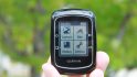
Of course, the real center piece is the Edge 800 itself:
Size Comparison and Weights:
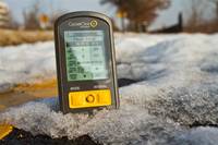
The first question cyclists always ask is: How much does it weigh? Followed closely by…how big is it? So, let’s start with size. I put it in a typical Altoids tin for comparison. If you can’t find an Altoids tin around your pad…I suggest a trip to 7-11. They have Slurpee’s anyway…
Next up, comparison against the popular Edge 500, and the Edge 705:
And last but not least, the weight test. I start with the Edge 500, then do the Edge 800 and then the oldest and heaviest of the bunch – the Edge 705. All figures are in ounces: The Edge 500 is 2.05, the Edge 800 is 3.45 and the Edge 705 is 3.85.
You can see weight-wise it slots in between the Edge 500 and Edge 705 – despite being smaller/lighter than the Edge 705, the screen is actually the same size.
You may be wondering exactly how much 3.45 ounces is. Well, it’s about the same as two medium sized eggs:
All in all, it’s pretty small and fairly light. And in my case, I generally reason that if the extra weight is a big deal – I’m pretty sure I could just forgo a few cookies and lose it off of my posterior instead.
Getting it on the bike:
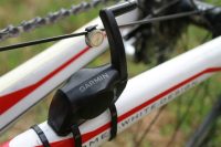
The Edge 800 uses the newer quarter turn mount system that was introduced with the Edge 500 (well, technically it started with the quick release kit on the Garmin 310XT). This mount system snaps in place using industrial strength rubber bands, and then the unit simply attaches in via a quick quarter turn mount.
This is a huge improvement over the older Edge 705’s mount system…which was a bit of a PITA to say the least. The older system was susceptible to breakage and especially for mountain bikers – popping off. I’ve been using the new quarter-turn mount system for about 9 months now and absolutely love it. It’s super easy to remove the device, yet, the device is highly unlikely to leave your bike. I’m relatively certain if you got hit by a semi-truck, the only thing left still in one piece would be the mount/device to your handlebar.
But…the real kicker is that these mounts are cheap – $9 for a box of two of them, a million rubber bands. Though, everything below is included inbox with the Edge 800 itself – two full sets.
This makes it easy to swap between bikes. I bought a few boxes of them and put them on all my bikes, and my two turtles.
Here’s a quick video on how it snaps in place:
Garmin Edge 800 mount and bike swapping
Note that I’ve tried it on both a triathlon bike and a standard road bike. On the tri bike I find it fits best up on the aerobars:
And on a road bike, your standard bar placement works pretty well:
(You’ll notice I have the 310XT quick release mount to the side zip tied, that’s also compatible with the Edge 800)
One question that’s often asked is: “Can I use it for running?”. The answer is: Sorta. The Edge 800 will record the GPS information just fine, along with heart rate. However, it’ll show your speed in MPH (or KPH) and not in the standard Minutes/Mile pace format. Also, it’s not quite designed for your wrist, but if you pickup the cheap 310XT quick release kit, it’ll snap into that just fine.
Base Cycling Features:
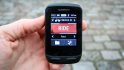
Once you get it all situated on the bike, you may want to pair it to any of your existing ANT+ sensors you have – such as a speed/cadence sensor or a 3rd party power meter. This only takes a second via the menu system:
Once those are set, it’s time to get rolling. By default the Edge 800 will utilize GPS to determine speed, distance and other location information. The Edge 800 uses the same GPS chip as the Edge 500 that came out just later year. In my experience with the Edge 500, the GPS has no issues tracking in virtually all conditions…from trails to airplane flights. In my testing with the Edge 800 – the resultant is the same – no issues in tracking.
Below is a page I setup with the information I typically use on a given ride:
And here’s another screen with less information displayed – only three fields (click to expand):
Once you’re riding, you’ll have a number of data fields that can be displayed at any one point in time. You can set up to 10 data fields per data screen (up from eight), and have up to 3 primary data screens, in addition to map and course based screens. You can customize all of these screens and data fields however you’d like with the following information:
(Note: These are transcribed directly from the menu’s, expand to actually be readable)
Customizing only takes a second via the menu system. If you’re interested in what data fields I use, here’s my post on how I setup my Edge for different scenarios from racing to training. You’ll notice the screen is super clear, whether in sun or shade:
And by switching to the larger display fields, you can see it from quite far away:
The Edge 800 supports Auto Pause, which is great for city riding. Auto Pause automatically starts and stops the timer once you bike speed has reached a given (customizable) threshold. This is useful if you have a lot of stop lights along the way and get tired of pressing stop/start each time you hit a light.
Note however that it’s generally recommend you turn Auto Pause off if you’re using a Power Meter and analyzing some power-specific workout information such as Normalized Power, where introducing unaccounted for gaps in time can twist your results and artificially inflate them. Just the way the calculations work.
Like the Edge 500, the Edge 800 also supports a movement warning system that lets you know you haven’t hit start yet, but are moving. This is especially useful if you don’t use Auto Pause and instead rely on the old noggin to remember to press start after that bio break.
The Edge 800 includes a barometric altimeter in it. This is standard issue for the Edge line, but isn’t found on the triathlon/running line (Forerunner’s). Barometric altimeters generally improve elevation accuracy over typical GPS altimeters as they use changes in air pressure versus GPS using a fairly complex triangulation method that’s prone to errors. The Edge 800 also lets you customize known elevation data points to allow you to calibrate off that data point. If you’d like a good look at barometric vs GPS altimeters in sport devices, check out this post I wrote up.
The Edge 800 includes a temperature sensor that will display and record temperature along the course of your ride. While I’m still trying to find a good training reason to have a thermometer, I do like the fact that they’ve continued to include it within the Edge series.
Virtual Partner:
Virtual Partner is a cool feature introduced back a few years ago that allows you to race against yourself. Basically you set a given speed you want to maintain, and then the Garmin device will show a little person representing that speed. It’ll also show your progress. If you’re faster than the ‘little man’, it’ll show that. And if you’re slower, it’ll show that. It also shows how far ahead/behind you are.
To setup Virtual Partner, you’ll choose a given speed you’d like to maintain – once done, the Virtual Partner screen will appear. Below is the configuration screen:
In the Edge 800 though – the user interface gets a significant upgrade which makes it look much much cleaner – complete with nifty animated graphics:
Workouts/Intervals:
Once you’ve got the basics of the Edge 800 down, you may start to look at planning downloadable workouts. I often use this feature actually for races more than training. It helps me to execute on a given race strategy.
You can create workouts using both Garmin Training Center or via the user interface on the device itself.
Once created, you’ll navigate through the Edge 800’s menu system into the workout area, to start the workout:
(Because the unit I have is pre-production, there are a few tiny bugs to be worked out still, like the above HR’s lacking the ‘1’ in front of them, as they should be in the hundreds.)
Once you’ve started the workout, the parameters you’ve specified will be shown on the screen. Should you stray from the programmed parameters, the unit will beep at you. The beeping is loud enough that others may believe you’re physically/emotionally harming the unit…so there’s no doubt that you’ll miss the alarms.
Training Indoors:
The Edge 800 supports the ability to train indoors on a trainer, assuming you use the Speed/Cadence sensor and/or Heart Rate Strap. Any ANT+ speed/cadence sensor will work, though for the purpose of this test, I’m using the standard issue GSC-10 from Garmin. I’ve manually set the wheel size, but you can also have the unit auto-configure it by doing a quick ride outdoors where it uses GPS to calibrate the size of the wheel.
When on the bike indoors it’s best to turn the GPS off. While most modern training applications (including all of Garmin’s) easily notice that it should read sensor data over GPS data, some apps don’t. This means when you go to load your workout, it shows you went a grand total of nowhere…instead of showing you actual mileage that the wheel recorded. Once you’ve done that – simply go to town and knock out your workout.
Once done, you’ll see the same speed/cadence/HR/power data that you would outdoors, all on Garmin Connect.
Touch Screen:
If you’ve read my reviews in the past, you’ll know that I’m generally not keen on touch screens in sports devices. The reasoning being that in most cases, a combination of sweat and fingers never results in ones desired menu options. Further more, adding in winter accessories like gloves often makes life even more difficult.
So I was a bit apprehensive when I found out that the unit uses a touch screen. However, one of the first things you’ll notice is it still retains two key buttons for Stop/Start and Lap/Reset – in addition to a power button. In my mind, this is a fair compromise. The two buttons I generally use are these two, and I rarely need to change menu’s very much while riding.
Nonetheless – how well does the touch screen handle? Well, let’s play around with the user interface a bit going through some of the menu’s:
Garmin Edge 800 Touch Screen Video Clip
As you can see from the short video, the unit is surprisingly responsive and seems to pickup my choices pretty quickly (and correctly). It’s also fairly easy to use while riding, especially just scrolling through the data screens with a single tap or swipe.
The unit features a screen lock, should you want to lock the touch screen itself. That’s activated via the top left side button:
Of course, a logical question is how does the screen perform if you put on a pair of winter gloves? Well, I set to find out. I started with the thinnest pair, and then moved up through the most common cycling gloves to some heavy duty sub-zero style gloves, I then finished it off with a pair of mittens. Here’s the ever-so-exciting video…try to hold back your excitement while you watch three riveting minutes of glove action – enough to make OJ nervous:
Edge 800 Touch Screen Glove Tests
As you can see, I was able to fairly easily manipulate the menu’s of the device, including both common tasks and those you might need to do quickly – like change display or bike settings. While there was an occasional ‘typo’, most of those were due to the fact I was trying to watch the lens as the same time.
In short…no problems with gloves.
Mapping via Birdseye Satellite Imagery:
Perhaps the coolest single feature of the Edge 800 is the ability to download Birdseye Satellite Imagery onto it. Birdseye Imagery is basically the same stuff as you’d get if you went to Google Maps or Bing Maps. Essentially, the ability to see your house.
The imagery is based on a subscription service, and the price is $29 a year. This isn’t too bad in my opinion, especially if you use it a lot. To load the imagery, you’ll utilize a piece of software called Base Camp. Users of Garmin’s outdoor line of handhelds will be familiar with this software, but for the rest of us runners/cyclists/triathletes – this will be a new piece of software to add to the lineup.
Base Camp allows you to do route planning – focused heavily on off-road routes like hiking trails or mountain bike trails. But it also has the capability to add in satellite imagery from Garmin’s Birdseye service.
To add imagery, you simply drill down into the area of interest and then choose to send it to the device. Note, you can’t send the ‘entire world’, as its rather big and won’t fit on a single micro-SD card, but you can select pretty big chunks that you’d ride.
From there you simply right click the imagery in the left pane and send it to the device. I would show you the final resultant, but unfortunately the pre-production device I have isn’t quite in the position to show it off for today’s post – look for a follow-up post on that.
As noted above, the imagery doesn’t come on the unit itself from the store, but you can add it to your unit for $29 a year. The only caveat I’ve found is that you can only download so much imagery at a time, and while in the past handheld devices designed for hiking limited how far you could realistically travel – with a bike – you go a lot further. I tried to capture a 30-mile section of Skyline Drive in Shenandoah National Park and the program had a set download limit of about 105MB, smaller than my area of selection. For this to be a truly useful feature for cyclists, I need to be able to select an area covering hundreds of miles – even if that means it takes a bit of time to download, and a bigger MicroSD card (or more than one).
Mapping via City and Topo Maps:
In addition to the cool Birdseye Satellite Imagery, you can still use standard issue maps and topographical maps that you can purchase from Garmin. The more expensive of the two Garmin Edge 800 bundles comes with North America City Navigator. This is important, because the base imagery that Garmin would otherwise provide isn’t terribly useful and doesn’t have many of the streets that you’d likely cycle on. For me, it pretty much only had Interstate 95, whereas the City Navigator maps had everything including the alley in my back yard.
You have two options when you by City Navigator – one is to buy the DVD and the other is to buy the SD card. I was sent the SD card, but I also have the DVD version from when I originally bought the Edge 705. Both work just fine, though the MicroSD card is certainly quicker.
In the case of the MicroSD card (far easier), you simply slide it in the back slot. It comes with a regular SD card adapter though if you want to update/add to it on your computer.
Once in the slot the Edge 800 will automatically recognize it and show off the more detailed maps. Check the below before (left) and after (right):
(Before)
(After)
You can purchase Garmin detailed maps for just about everywhere on the planet, and, with a bit of creativity you can also create your own maps.
Garmin Custom Maps:
In addition to utilizing downloadable/purchasable maps, you can also create your own maps and upload them to the Edge 800 via Garmin Custom Maps. This is particularly useful if you have maps that contain additional data not found via common providers. For example, you may have a map that lists all port-o-john’s in your area (any cyclist/runner knows this is important). However, for my example I simply grabbed the city’s local bike maps and went to town. Here’s the initial city provided map I started from:
While I won’t detail the process fully as it’s well described here, here’s what the half-way mark looks like:
As I get it all aligned, you can see my city bike map overlayed on the detailed city map. As you can imagine, this would be incredibly powerful if you have heavily customized maps with waypoints or unique features not normally found on traditional online maps. For example, water stops, bathrooms, etc.. are all common on race routes, and would be perfect for overlaying into the device.
And finally, once I’ve loaded it onto my actual device and navigating with it:
(At this juncture you may be wondering how I got that clear screenshot…well, the Edge 800 includes the ability to simply tap the power button and take .bmp screenshots)
Pretty cool stuff and really gives you (and even event planners) a ton of flexibility.
Navigation:
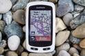
The Edge 800 has the same navigational features that you’d expect from a car GPS. For example, it’ll give you turn by turn directions and show you how far until the next turn:
And you can also go into the menu’s and select POI’s (Points of Interest) – such as food or if you’re feeling tired after that long ride…a hotel. Or you can simply enter in any street address. It’s astoundingly quick within the UI, and has auto-complete so that you don’t need to type in the full street addresses or states.
And if you get off course, it’ll re-calculate you’re route for you in seconds automatically:
I’ve put together a short clip showing what it looks like if you’re riding and it’s routing. You’ll have to excuse some of the focus/bumpiness issues. I was riding while holding a full DSLR camera in one hand and trying to navigate a time trial bike with the other…while dodging squirrels, cars and small kids. Sometimes sketchiness happens.
I start off the clip showing destination address entry, and then from there we’ll get into the actual riding:
Garmin Edge 800 On Street On Bike Routing
Yes…I survived the creation of that video – I was pretty happy about that.
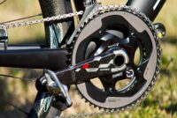
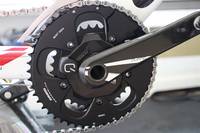
Power Meters:
The Edge 800 supports all ANT+ power meters, which includes ones such as the PowerTap Wireless, Quarq Cinqo and SRM power meters. There are a few more power meters coming in September as well with Interbike that support ANT+.
I use the Quarq Cinqo as my power meter (and love it), which is shown below:
The Edge 800 has a number of power configuration options on par with the Edge 500 and 705. This includes the ability to set zero averaging for both cadence and power.
In addition, you can display a number of power-related fields, including all of the following:
Power
Power
%FTP
Power
30s Avg.
Power
3s Avg.
Power
Avg.
Power
kJ
Power
Lap
Power
Max
Power
Watts/kG
Power Zone
The recording rate when a power meter is attached is every second, or 1s as it’s commonly written.
The above is an XML snippet showing the 1s recording while a power meter is attached. Without a power meter attached it defaults to ‘smart recording’, which on this device is averaging a data point between every 1-4 seconds, which appears to be a bit of an improvement from other devices.
ANT+ Scale Support:
The Edge 800 is the first Edge series device to support ANT+ scales. Past Edge devices haven’t, only the Forerunner 310XT and Forerunner 60 have supported the ANT+ scales that are out on the market. These scales wirelessly communicate your weight and body fat information to the Garmin device, which in turn gets uploaded to Garmin Connect. Today’s most common ANT+ scale is the Tanita BC-1000 – which I reviewed back in the winter.
To scan for scales, you simply go into the menu system and select Weight Scale. From there, it’ll initiate the ANT+ search.
Once it finds the scale, the green scale light will illuminate and you can go ahead and step on it. The scale will take your weight, and then communicate it back to the Edge 800.
The Edge 800 will then upload that data to Garmin Connect, where you can track your weight related information over time.
Software:
I typically get into the software a bit more in my In Depth Reviews of products, but I’ll cover the basics here on the first look review. The Edge 800 connects using a USB cable and shows up like any other mass storage device:
Once connected, you can go ahead and launch Garmin’s free online site – Garmin Connect – to analyze your ride data. The site will allow you to upload directly from the unit. The unit itself can record a crap-ton of data. On my Edge 500 (similar storage size) I have almost a year’s worth of rides on there and I’m only a few percent full. So no worries about running out of space.
After the upload has completed – and it only takes a few seconds – your activities are shown by date in both a calendar, list and dashboard view. You can select them to get more detailed information about that activity.
On the left side you’ll see summary information, while on the right you have graphs for each of the major sensor and data types:
Garmin Connect is a good option for beginner to intermediate users looking to analyze their data. However, for more advanced users I’d recommend a program like WKO+,Sport Tracks, or Training Peaks. The Edge 800 utilizes the newer Garmin .FIT file format, and all three of those applications (latest versions) support the .FIT file format. Personally, I use both Sport Tracks and Training Peaks daily. Training Peaks easily uploads the files using their free Device Agent (or just via the web uploader).
I prefer Training Peaks because of some of the power meter analysis you can do, as well as some of the longer range trending that’s easier/possible to do than on Garmin Connect. TP has both a free and premium version.
It should be noted that the Edge 800 is also supported via the old school Garmin Training Center (free) – should you want a basic desktop application. But, Garmin really isn’t updating this app much any more and is only used for some basic functions.
Also note that if you plan to utilize imagery from Birdseye, remember that you’ll need Basecamp – which is also free from Garmin.
Finally, all this stuff works great on a Mac as well, if you’re of that persuasion:
Accessories:
The Edge 800 supports all of the major ANT+ accessories out there. This means you can utilize any existing Speed/Cadence/HR/Power Meter sensors you have without having to by any new ones. Plus, any of the non-Garmin ANT+ sensors that are coming out on the market (or already there) are also supported.
This sensor allows you to use the Edge 800 indoors on a trainer, as well as records cadence information outdoors. Additionally, you can increase your accuracy a hair if you use the speed sensor outdoors (automatically occurs actually).
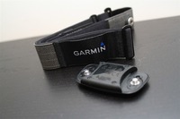
Depending on which version you pickup, the unit will either come with the Premium ANT+ Heart Rate Soft Strap, or it’ll require you to pick on up. You can utilize any existing ANT+ strap (such as one from an older Garmin unit), but it does have to be ANT+. Meaning, a strap from a Polar or similar unit won’t work.
Garmin today itself offers two straps – one is the classic strap, and the other is the newer ‘Premium Soft Strap’. However, an even newer premium strap has also been tossed into the mix. This one looks very much like the Polar Wearlink Strap and is oddly enough ‘licensed’ from an unnamed organization. Garmin had no comment on who it was licensed from.
Note that the Edge 800 bundle includes the newer premium soft strap HR monitor, which is different than the older soft strap one. This new strap may resolve some of the issues of the existing soft strap, but more testing is in order – it will be available as a standalone strap ‘later this year’. I just wrote up a good post earlier this week on a workaround for the older one, as well as a much longer post on other tricks to try.
Power Meters-
The Edge 800 will pair easily with any ANT+ power meter. I have the Quarq Cinqo and it recorded data from it without issue. PowerTap, SRM, and Quarq all make ANT+ compatible power meters. And there are a few others coming on the market here in the coming weeks leading up to Interbike. See the previous section on more details on power meter configuration options.
As noted earlier, you can pickup a box of extra mounts for about $9. This box includes two full sets of mounts, and a million extra rubber bands. By far, the cheapest cycling product you’ll probably ever buy.
Maps, maps and more maps:
Because the Edge 800 supports both topographical and city imagery, as well as satellite imagery, there’s a ton of different mapping products you can buy for it. You can also create your own maps using some 3rd party tools. In my limited time with the product I haven’t had a chance to dig into compatibility quite yet, but I’ll do so for my final in depth review. In the meantime, here’s the basic different maps offered:
In summary, this device rocks. It’s everything that most cyclist have been asking for – even if they didn’t know they were asking for it. I love the new mapping capabilities as it bridges the gap from hard to decipher street maps, to crystal clear satellite imagery. The ability to create custom maps is really really cool, and I’m looking forward to folks whipping up some relevant maps for cyclists and longer races. Plus – and perhaps most importantly – my fiancée has immediately decided she wants one…now.
However, I do question the ability for the Garmin Edge series to compete long term with cell phones. Over the last 12 months the number of cell phone based applications that effectively do large portions of what the Edge 800 does has grown. While the Edge 800 adds functionality around custom maps and offline caching of large satellite image tile sets that is difficult to find on phones today, it is an area that competitors will rapidly catch up on. I was hoping that the next generation Edge device would include some sort of connectivity to allow updates to Internet based infrastructure – such as Live position tracking – helping it to compete with phones that also have ANT+ integration.
That said – for a purely dedicated cycling computer, there’s nothing like it today. And that includes the phone world. There is no phone/app combo I’m aware of that does all of the features that the Edge 800 does from complex mapping and navigation to ANT+ data integration.
The Garmin Edge 800 will be available in mid-October with the following pricing:
– Black/White Edge 800 is $449.99 (with AC adapter, quarter-turn Mount, USB cable)
– Black/Blue Edge 800 Performance and Navigation bundle is $649.99 (Adds newer Premium Soft-strap Heart Rate Monitor, Speed/Cadence sensor and City Navigator Maps on MicroSD)
If you’re looking at some of the other Edge series line, I’ve put together this quick comparison chart. When comparing between the Edge 705 and the Edge 800 – I see no reason to purchase the Edge 705 at this point, and as such, I’ve updated my 2010 GPS recommendations to instead focus on the Edge 800 over the Edge 705. If you comparing between the Edge 500 and the Edge 800 – they serve two different markets with one focusing on slim and sleek and the other focusing on navigation.
No review would be complete without the Pro’s and Con’s list – so here I present the time honored tradition:
Pro’s:
– Easy to use and small form factor
– Compatible with all major online/offline training applications
– Supports ANT+ accessories
– Improved virtual partner feature
– Use of satellite maps
– Creation of custom maps
– Very quick touch screen UI
– You can take screenshots by holding the power key
– You can change the background to both custom and pre-set images
Con’s:
– Wireless data transfer to other units removed
– Unclear on touch screen long term use with gloves in winter
– Not ‘connected’ to the Internet, no options for live data updating (like cell phone)
– Unable to get large satellite map sets onto device due to download limiters set
So with that – start saving your pennies!
Found this review useful? Here’s how you can help support future reviews with just a single click! Read on…
Hopefully you found this review useful. At the end of the day, I’m an athlete just like you looking for the most detail possible on a new purchase – so my review is written from the standpoint of how I used the device. The reviews generally take a lot of hours to put together, so it’s a fair bit of work (and labor of love). As you probably noticed by looking below, I also take time to answer all the questions posted in the comments – and there’s quite a bit of detail in there as well.
I’ve partnered with Clever Training to offer all DC Rainmaker readers an exclusive 10% discount across the board on all products (except clearance items). You can pickup the Garmin Edge 800 in any of the available colors below. Then receive 10% off of everything in your cart by adding code DCR10BTF at checkout. By doing so, you not only support the site (and all the work I do here) – but you also get a sweet discount. And, since this item is more than $75, you get free US shipping as well.
Additionally, you can also use Amazon to purchase the unit or accessories (though, no discount on either from Amazon). Or, anything else you pickup on Amazon helps support the site as well (socks, laundry detergent, cowbells). If you’re outside the US, I’ve got links to all of the major individual country Amazon stores on the sidebar towards the top. Though, Clever Training also ships most places too and you get the 10% discount.
Thanks for reading! And as always, feel free to post comments or questions in the comments section below, I’ll be happy to try and answer them as quickly as possible. And lastly, if you felt this review was useful – I always appreciate feedback in the comments below. Thanks!
As you’ve seen throughout the review there are numerous compatible accessories for the unit. I’ve consolidated them all into the below chart, with additional information (full posts) available on some of the accessories to the far right. Also, everything here is verified by me – so if it’s on the list, you’ll know it’ll work. And as you can see, I mix and match accessories based on compatibility – so if a compatible accessory is available at a lower price below, you can grab that instead.
Finally, I’ve written up a ton of helpful guides around using most of the major fitness devices, which you may find useful in getting started with the devices. These guides are all listed on this page here.
Just found your site Ray! Great Work, Thanks. I ride a trike, do you know if the edge 800 can use separate speed and cadence sensors. On my trike the cranks don’t overlap the rear wheel. Can you do a long term review of the 800?
Thanks for the in depth review. I was wondering if you could tell me if the Edge 800 still works while charging? I want to get one for both motorcycle and bicycle use, and will likely fabricate a 14v charger for motorcycle use.
Hi DC, Great review. I bought my 800 edge last week after reading the review. Can you help, I previously used a Polar device. I tried the new Garmin over the weekend in a race and my calories reading is half of that on the polar? Did I do something wrong in the settings? (Used both devices at the same time)
Hello Rainmaker, thanks for your review, it helped me to buy one.:)
Do you maybe kwnow this one: when I follow a course (premade in Garmin Connect), and encounter a roadblock…how can the Edge 800 help me to get back on that same course let us say a mile further???
Once you encounter a road block, and you get around that road block, then the unit will re-route you back to the route.
The tricky part is really getting around the road block. If it’s obvious (i.e., follow road detour signs), then the unit will resume directions once back on track.
If non obvious, then you may want to add in a new waypoint to get you past the initial roadblock.
Just wondering if you have any indication as to whether a new model for the Edge 800 would be released this year? I have a 310XT, but keen to get the Edge 800 as I no longer run, just ride. I just got a powermeter on my MTB and will get the Vector pedals as soon as they’re eventually released. The Edge 800 would be great for me as I’m a big user of trainingpeaks. Being nearly two years since the 800 was released, do you think I should just buy the 800 now, or do you think a new model might get released around the time of the Vector pedals? If a successor to the 800 is a long way off, I might as well get the 800 now as it would be useful to have intensity factor displayed on my MTB as well as just being more awesome than the 310XT.
Has anyone experienced strange speed readings? I mean a situation in which the device is NOT in motion (lying still on a table)but it still shows readings ranging from 0,2 to 1,7 (km/h in my case).
Is it because of a fault in my device? Or is it normal for GPS based speedometers?
Don’t know if any of the other 200+ comments addressed, but my main frustration with the 800 was that the scaling for elevation didn’t work well in the Colorado mountains – but Garmin support had the answer. On the profile page, double tap the axis you want to change, and “+” and “-” buttons will appear and allow you to adjust the scale. Very necessary when doing 15+ mile long climbs of 3000+ feet
Thank you for the excellent review and your very helpful website. I just bought an 800 and I have four bikes, two of which I plan to use the 800 on. Are there any problems with switching the 800 back and forth between two or more DSC 10 cadence units mounted on two different bikes?
Yup, you can create profiles for each bike, and then simply change which bike profile you are using, each of which have different ANT+ sensors (like the GSC10) paired to it. So in my case, I have multiple bikes, each with their own sensor and each then with their own labeled listing in my Edge 800. Enjoy!
haven’t bought one yet, currently using the 500, but looking to upgrade for downloadable mtb maps.
biggest concern I see to hear outside of your review is the ability to read the screen in daylight…….is this a problem that I should be concerned about? on the 500, being a non touchscreen, there doesn’t seem to be any problem with this.
About calories computation, try to compare the Cal measurement from 910XT and Edge 800 both connected to a powermeter (also both wiht the same use data/setting)….curious what you’ll get…. Since you’re in contact with suppot Team, any news also about avg 3″, 10″, 30″ THR Power and better slope reading (the 705 was far better)?
Great review! I currently use the Timex GPS Global Trainer but was thinking of moving to the Edge 800. A few questions:
Will the 800 pick up cadence from my Quarq S975 Power Meter without the cadence sensor as my Timex does?
Can I use the Timex HR strap with it?
Is there a new Garmin coming out that replaces the 800 that I should wait on?
Lastly, weird question :) With my Timex if I leave it on my wrist and twist it so the screen sits on the inside of the wrist I cannot read the watch when in aerobars with polarized sunglasses, however without them I can. I know some would say get different glasses but I love polarized so that isn’t an option. At angles can the 800 still be read clearly and more importantly clearly with polarized glasses.
I read a review of yours from early last year mentioning that Garmin are “starting to discuss” getting their act together to allow Edge series computers to use ANT to transfer data between the Garmin Dongle (and the Wahoo Key). Have you heard any more on this? I have a FR610 and it sync’s beautifully with my Garmin dongle each morning. I am thinking of now ditching the laptop, getting a Wahoo Key and using the ipad for all my fitness syncing “I use strava mostly”. I believe this will be fine for the FR60, but my issue will be with the Edge 800, where it still requires the USB cable??
I keep hoping, but honestly, as this point I don’t suspect an update to the Edge 500 or Edge 800 anymore. I suspect we’ll see it in whatever the next version of those products is, but I don’t think they’ll back port it.
Bonjour from France,
firstly just to thankyou for a really good review.
I recently recieved a garmin 800 from my beautiful Irish wife and was really pleased with it, untill I decided to fit a plastic film screensaver,. and while I was trying to squeeze out an air bubble the screen cracked.
It was not covered for cracked screen even though it is only 2 weeks old.
Has anyone had this happen as the screen seems quite fragile.Overall everything is really great.
Many thanks David
Thanks for the great review. Do you know if it is possible to display roads in Garmin’s City Navigator when zoomed out more than the 0.2 mi scale? Most of my riding is on secondary roads and I would like to see the road options farther out than 0.2 miles. Also, do you know if this same limitation exists in other mapping files or just Garmin’s?
Not sure about city navigator .. but sign up for Garmin Connect and you can see your route in Google or Bing maps. You can do the same thing with Strava or Mapmyride.
Thanks Mark,
I’m specifically asking about seeing displaying more detail on the garmin 800 while I am riding. City Navigator is one of the map collections that can be loaded on the unit; others are also available. I do use Garmin Connect and other utilities after a ride.
Kevin
Okay, I think I have answered my own question. It helps to first learn how to use the device I guess :-)
The map detail can be customized by drilling down in the Settings…System…Map…Map Visibility…Detail…
The default is set to Normal which for Garmin’s City Navigator maps will begin to show secondary roads at a zoom level of 0.2 miles. Changing the detail to Most, the secondary roads become visible at a zoom of 0.8 miles.
To put this in perspective, a zoom level of 0.8 shows a little less than 4 miles total top to bottom of screen and a little more than 2-1/2 miles left and right. The current position marker is normally centered left and right and little below center top to bottom. So with a zoom level of 0.8 miles and maps oriented with north pointing up, secondary roads become visible at abt 1-1/4 miles away east/west and abt 2-1/2 miles away north/south.
It appears the default detail depends on the mapset used. I downloaded the mapset from http://www.osmmaps.com and secondary roads become visible at 0.5 miles using normal detail and at 2 miles for “most” detail. The Garmin mapset appears to have many more points of interest, e.g. food and drink…
Anyway, take it for what it’s worth. This may be common knowledge for the rest of you, I’m new to all this and still learning.
Your reviews are great, almost too great. Like going to a restaurant that has a menu with so many delectable choices it’s hard to pick and just when I’ve narrowed down what I think I want the chef brings out more choices that make my mouth water more….meanwhile I’m starving.
Still trying to pick the ideal computer (HR/cadence/maybe maps) for my new Spec Roubaix.
Garmin 500/800 or my iPhone 4 w/ Wahoo or ?
WHAT WOULD BE YOUR FIRST CHOICE?
Any advanced heads up on when the Garmin 900 (?) is coming out?
It’s hard to say on the RFLKT. I think it’s going to be pretty darn cool though. That said, if you wait a week or two I should have my hands on it and be able to give a better comparison.
Hello,
First of all thank you for all the great reviews.
I am strongly considering an Edge 800 or 810. After reading your review of both I still cant decide which one to get. Although the social media aspects of the 810 are pretty cool, it is far from necessary. Even though there is only a $50 difference, I could use that money to buy another speed/cadence sensor.
I plan to use whichever unit on both my mountain bike and road bike, so I will have two different bike profiles. I have read that it is a little bit of a pain to set up the different profiles on the 800. I will be using a speed cadence sensor and heart rate monitor on almost all my rides on both bikes. Can I set up each bike with those functions turned on and just leave it that way? That way which ever bike I select and get on will be ready to go, or will I need to select the sensors each time I switch bikes?
Also, have you used either unit in the woods? Does the speed/cadence accurately measure the distance in tighter switchbacks and trails when GPS signal may not be very strong. I have noticed with my fenix on trails with a lot of tight turns my distance from my watch and wired speedo can be miles off.
Yup, the unit supports bike profiles, so you can setup sensors for each bike profile and then just swap bikes and then the associated bike profiles (it’s what I do).
Tight turns do generally cause issues for GPS, by using the speed/cadence sensor you’ll get consistent speed data.
HR straps either work or don’t work for people given a certain situation – and for the most part, there’s very little variance in that from brand to brand. Polar tends to trend slightly better, but otherwise, same-same.
I wouldn’t much stock in the Amazon reviews of straps.
Hi there,
thank you for the in depth review.
Did you ever work with courses on the 800? I did now 3 courses & the GPS performance is horrible at best. During the last ride i did not get any turn directions, then i rebooted during the ride & the turn directions decided to show up, but the screen went blank after each turn & took about 30 sec to load the map. I get off course warnings when i am clearly on track. Every of the three courses so far has been a disaster. I have played with map details etc but nothing seem to make a difference. i thought maybe the chipset is overwhelmed, but i am only using a heart rate strap & the speed/cadence sensor, so i am a little lost what could cause the horrible guiding performance – any thoughts would be greatly appreciated. – thank you.
Have you updated your software to the latest release?
I have whole bunch of problems after I have done so. My activities’ files got corrupted (not all though, just the one from earlier than a ~ year ago).
Device discovery on my computers is weird.
Can’t create courses directly on the device itself, only via the browser.
Yes, I use it almost-daily. no issues with corruption.
Based on device discovery sounding weird, it sounds like the disk may have some corruption issues – which can be fixed pretty easily by following the prompts on your computer. Alternatively, a hard reset should fix it too.
I recently obtained the edge 800 but the cadence is not recording on the screen, the speed is working and the pick up is connected correctly, i get the red / green light from the censor, the devise has been paired with the gsc 10. cant fathom this out, can anyone help.
DC, been using the 800 with the new Quarq Riken and notice power drops on rides for 1 second or so then it comes back. It sounds common with the Quarq products. I know the Quarq is installed correctly. My 800 has the newest firmware.
Just bought an 800 and am puzzled by your statement: “By default the Edge 800 will utilize GPS to determine speed, distance and other location information.”
So far, that doesn’t seem to be my experience. And the manual says this: “If there is no GSC 10 paired, GPS data is used to calculate the speed and distance.” which implies that if there IS a GSC10 paired, then the speed and distance data comes from that, not GPS. Today I did a ride and the auto-calibration was way off* so my distance and average speed were only about 2/3s of their true values (when I got home I mapped the route on MapMyRide which showed 30 miles compared to only 21 miles on the 800. Any thoughts?
*the auto calibration reading was only about 1400 mm for a 700×23 wheel. The true figure is about 2096. The other weird thing is that the Auto-Pause and Auto-Resume kept on kicking in even when I was moving. The pauses would only be for a couple of seconds but this must have happened 50 or more times today.
Any chance you don’t have full maps (which, renders it kinda useless)? Obviously, the functionality works (as seen in the review and by many here, and by even myself using the Edge 800 a bit still now).
In any case, if you don’t have full maps (paid extra for them), follow the steps here: link to dcrainmaker.com
And, even if you do have the maps, still follow the later sections of that post to ensure your unit is configured correctly.
I followed your instructions (I do have the garmin maps installed, got the navigation package) and I can view the map perfectly. Just don’t have any functionality with regard to courses made on Strava/Garmin Connect/mapmyride/ridewithgps/bikeroutetoaster. For the life of me, I can’t get them to work.
I uploaded another course just then to see if it would work, i’m 144km away from the start point but it thought I was nearby. Hit start to navigate to the start point and the clock goes but that’s it.
Hi there,
Sorry if I missed the info, but I have not sean anything about battery life, how much juice you have left in the Edge 800 after you got message, low battery?
I had that twice, unfortunately first time I did not have any external battery with me and I did not know how much longer I can ride before I will loose it completely.
So my question is, once you got the “low battery” do you know how many precent or how long it will last?
Thank you,
Brano
Roughly an hour is my experience. It depends a bit more on backlight settings though (that’s the main driver to how quickly the unit depletes battery).
Thanks Rainmaker for your in-depth observation I own an Edge 605 currently. You have convinced me that an Edge 800 is certainly the way to go in the future. Thanks again.
Hello,
thanks for your in depth reviews on Garmin 800 and Garmin 810. At the moment, not being interested in using the social features of Garmin 810 and disappointed by the old fashioned blue tooth support on it, my options are reduced to
– Keep using my android smartphone waiting for a new Garmin with more interesting stuff
– Buy a Garmin 800 (waiting for a new Garmin with more interesting stuff)
Do you think buying a new (not second hand) Garmin 800 is still advisable or the fact that it is probably going to be discontinued by Garmin is something I should think about?
I haven’t tested it. The ANT+ directory says no, but I thought I’d seen somewhere else that it’s yes. It uses the ANT+ Fitness Equipment Device Profile.
Does virtual partner stop when you stop for breaks? Is there a way to keep virtual partner going all day even when you stop for breaks? It would be ideal if it would keep going even when stopped on longer rides when you want to finish in a certain time and want to know how long you have available to take for breaks.
When you use navigation with Garmin 800, can you switch screens forth and back from navigation map to screen with data you normally use for everyday training like power/cadence/HR? Can you during ride switch to map just to see where you are, if you decided to explore out of the usuall route?
Hey I am thinking about getting the garmin edge 800. I am going to ride the pacific coast with a few detours and was wondering how easy is this to preprogram your route in it? To me that would be my ideal use for the trip and when I go exploring at home. I only want one computer. I currently have one that sets batteries like they are going out of style ……,.
It’s very easy these days with Garmin Connect. I plan routes all the time on mine. I just go into Garmin Connect and choose to plot a course. If you’re doing a multi-day route, you’ll probably want to break it up into a few chunks on your unit (per day), but all straight forward. Much easier than it was when the Edge 800 first came out.
Hey DC!! Was going to say this is a bit like a blast from the past tagging on to the end of this wall given how old the product is. However, I see you are still replying to it! So here I go with a question:
I have begun working with a coach & so my road rides have taken on a bit of structure. I have been creating workouts in my Garmin 800 to follow when out on the road. However, what keeps happening to me is that I end up in my attempts to start the workout by pushing the start/stop button I end up pausing the timer (I am guessing). It’s really annoying that in the Garmin pushing on the screen “Do Workout” is not sufficient to begin it.
Is there a way to stop this happening? I have a large gap in my Training peaks & Garmin Connect data today (but not when I uploaded to Strava interestingly).
I can start the workout using the start/stop button but I keep pausing the main ride so to speak. I don’t know if I’m just double tapping or what but I have 2 rides now with large sections of in recorded data.
By the way is there any reason for me to upgrade to the. 810? I don’t need the live weather feature or to be able to upload routes on the go.
Yeah DC I checked in training peaks & for the times I used and followed the workouts from my garmin 800 I have no data recorded. So I just have a gap in my power and HR graph. Really annoying as my coach wants to see the data of my actually doing the workout.
Do you use the workout function when out on the road?
Hmm, that’s really odd. I wish I had an idea there. I do use the workout function from time to time out on the road. Not a lot, but once every few months. :-/
Hi Ray – thanks for all of the great info – I read your site at least twice a week.
I have an Ambit 2S. I love the data but am thinking of adding a unit for an easier to see display while riding. I’ve thought about using my Galaxy S3 but am concerned about the poor visibility in sunlight (not to mention mounting it–the more secure options with weatherproofing are pricey and make a dedicated unit more attractive). I really would like a unit that I could see basic stats- speed, distance, time, and navigation. I like the option on the Edge Touring that suggests routes but it’s price is so close to the 800. I am older and need reading glasses and the Ambit is hard to get a quick glance while riding. I would still use the Ambit 2S for the detailed data. In an ideal world, It would be nice to have a unit that would just better display the Ambit’s stats.
Does anyone have thoughts or advice? I just don’t see the advantage of the Edge Touring over the 800 price wise but I do like the route suggestion option.
I am the new owner of this bike computer … Is it possible that Garmin did not allow users the option to measure Odometer / Distance1 / Distance 2 .. in the sense that separately measure the total mileage from the mileage of the current season?
Does the Edge 800 have the ability to show current speed and cadence while viewing the map? Does it notify you of an upcoming turn if you’re not viewing the map provided you have set a route?
Thanks for the quick reply and for providing us with invaluable reviews. Your site is a well thought out and efficiently performing wealth of knowledge.
You, sir, are living the dream.
I re-visited this site to see whether I could lose the spoke mounted sensor as it seems to only do speed and the GPS does that.
I love my edge 800 but am not impressed with Garmin themselves.
My main bugbear with Garmin in general is “Waypoints”. I had waypoints on my old hiking Etrex and they are great. if I’m pottering around a city/region but want a point marked to go to at some time. Say to meet up with friends for a cuppa I cannot do it on connect. I can make a route but that’s no good unless I go there from the same place. I can record a place on the Edge if I’m there but that’s no good if I want to do it in advance. I can make a waypoint with Basecamp but now Garmin connect has gone “modern” I now need 5 bits of software if I want to upload my rides and create waypoints. connect, express, basecamp, communicator and web updater. I’ve e-mailed garmin asking why connect cant do this but they don’t seem to understand why i want a waypoint and not a route.
Do you or any of your readers/viewers know how to do this with less than 5 items of software?
Firstly, thanks to Ray for setting up such a great website, and taking the time to keep it great.
I have just become the owner of an 800 and whilst Ray is very helpful I would also like to point out that there is a very helpful website called ScarletFire.
It has tutorials on how to chase KOMs using Virtual Partner and, very cool, a way to change to the startup screen to show your own details, for example an ICE contact number.
Thanks for the mention. As someone who produces some similar content to Ray, I’m in awe of the level of detail he provides.
Having said that, there are many how-to articles and tutorials for edge 800 owners that I’m sure people would find interesting, so thanks again for the mention!
Alan http://www.scarletfire.co.uk
1. Can you create a custom page on the Edge 800 with Virtual Partner stats? I’d love to see elevation, time ahead/behind, BPM, cadence, and distance to course end. This doesn’t look possible? Seems at least the Edge 500 has a more usable Virtual Partner screen instead of some mostly useless graphics.
2. Is the Edge 800 still the best choice in cycling GPS if you want maps? Seems that the 500/800 are still the best deals at their current price points as the 510/810/1000 are either too short on new features or too buggy.
I just got a Garmin Edge 800 and was quite surprised that I cannot transfer trainingdata to my computer via ANT+. I really appreciate not having to mess with cables og plugs – and with my Forerunner 610 it’s a breeze… I just turn on my computer and voila it’s transfering.
Can it really be, that the Edge 800 is not capable of this? And if not, is it a hardware limitation (how can this be when it can pair with ANT+ units?) – or just Gamin not implementing it in their firmware?
Nope, it won’t work like that on 800. It will receive but not transmit Ant+
The 810 will transmit data without cables, so perhaps you should have checked option first?
I don’t know why the 800 can’t be upgraded to transmit, but I bet that Garmin need a reason or two to sell the 810, and they’d rather release 510/810/100 with new features that you have to buy to access, than keep perfecting the 800. I liked the idea of 810 but I kept hearing that it had issues so I would rather stick to 800 and cables, than 810 and problems.
True, I should have checked the specs more thoroughly. I just couldn’t imagine that ANT+ datatransferring could be a problem as it’s (obviously) an ANT+ unit. :-O
I’ll just live with the USB cable. Not really a problem – and the unit will be charged at the same time. The 810 is nowhere worth the higher price (IMHO). I don’t need any of the extra features – nice treats but not worth anything trainingwise.
I am sure that you will enjoy using the 800 ( I found some great advice at http://www.scarletfire.co.uk on all sorts of things with 800 and Strava)
I think in some ways, the 800 and 500 were great products and the 810 and 510 are not much improved. I like the idea of the 1000 letting me know if I get a text, but if I just make sure the volume is up on my phone then I’ll probably hear it anyway. A bit like some of the iPhone ‘improvements’, a basic 3 or 4 will do most people really well.
I have searched on the internet a few times, and saw an article briefly but can’t find it again. My Edge 800 seems to stop coping with all of my ANT+ monitors after 3 and a half hours of training. They wouldn’t pick up again until I switched off and on again.
Is this a known issue, has anyone seen a cure to the issue?
I’ve just deleted all my Edge 800 system files by accident. Stupid thing. Since then I can’t connect it using any USB ports both PC or Mac – no matter what. Any suggestion to fix it? Thanks a lot. Great reviews!
Just bought one on the strength of this thread, so many thanks for providing a forum of enlightenment! Plenty of layers to explore with this gadget, and the thread deals with many
I am so confused. I really want a gps. I looks like I actually want the 1000, but it is too buggy. My ideal gps would let me, on the fly, set up a route, choosing which streets to use, and then it would tell me the route’s gain. Then it would warn me of turns as I rode and recalculate when I went off route. It would also tell me the grade of hills as I approach them, or as I ride them.
Having a history of my cadence and heart rate for the last time I rode that route, shown as I ride it again, would be lovely.
What I *must have* for it to be useful is to be able to choose a destination and fine tune the route a little bit, give me turns, and have it recalculate on the fly. I can’t tell if I need the 800 or 810 for this. Although, if the parts I listed above were parts of the 1000 that weren’t buggy, I’d consider it…
Hi Ray
Your site is the best discovery I did in the last century. I check it daily. Congratulations for this great job.
A question:
I use Edge 800, load activities on Garmin Connect and make Training Peaks sync automatically workouts. As you cannot edit title on activities in Edge 800 as soon as you connect it to computer the workouts are in both GC and TP without title, so I must edit them in both applications.
As I also travel 40 weeks per year I am short of time.
Do you happen to have a bettre solution?
See you on the road :-)
Francesc
Hey Ray,
I’m really hoping you can answer a question for me. I’ve recently upgraded from a Garmin 500 to the 800, the 5 did everything I wanted, without a glitch except for the mapping.
I’ve upgraded and can say that I’m happy with the unit apart from one issue which I cannot seem to resolve.
I have set up both of my bikes (road and mtb) on the unit, when using the road bike (which also has a cadence sensor), I get the full raft of training pages cycling round as I want, training partner, elevation, mapping, + a couple of multi-line displays.
If I stick the unit onto my mtb and head out for a ride, I only get the map and elevation screens displaying, everything else is just blank.
I have tried going into settings and setting it up, but it won’t save it, just reverts back to unenabled.
It’s very frustrating, especially when I’ve done a couple of rides ‘against the clock’ in training.
Do you have any suggestions?
Thanks
Brilliant site by the way, I’ve used it for all my technology buys!
The SD card is used for maps, or secondary storage for activities. You can buy any MicroSD card you want, and then place free maps on it. Simply search here for free maps for my post on it.
I will shortly be going on a 6 day trip and would like to display my accumulated mileage as I go along, Is there a function on the 800 that displays this. I could of course reset my odometer at the start but do not want to do it that way.
Hi Ray,
Avid follower of your website!
I have a Garmin Forerunner 800. I purchased the late ant + cadence pod and attached it to my cank arm. I tried numerous ways to pair the device with the 800. No success. Any suggestions? I did the latest firmware update with Garmin connect.
Thanks,
george
Hi.
Just wondering if you can help? Just done a long ride and at the coffee stop half way round I accidentally reset the unit so now I have 2 separate lots of data. I normally upload via Garmin Express and from there to Strava. I wondered if there is any way I can merge the data into one so it appears as the one ride it really was? (I haven’t yet uploaded).
Thanks for your help.
The first thing to try if you are not too tech is to email Strava and see if they can do it for you (as a Premium member).
There are some tools like SNAP (strava needs a polish) which may be able to do it for you.
Thanks for your great site. Is there any way to organize COURSES on the 800. Now that I have been using the 800 for a year, I have accumulated over 40 courses so it is a bit difficult to sort through and choose the one I want. This is especially true since I find I need to do 2 courses per ride: 1 for the outbound part of the loop and 1 for the return, otherwise the 800 ends as soon as it starts :).
If there were a way to group courses into folders like on a PC in Windows Explorer, that would make things much easier. Any ideas?
I just got the vivoactive HR and I’d like to broadcast my heart rate from the watch to my Garmin 800. How do I pair the 2? When I try to add a new sensor, the vivoactive can’t seem to be the 800. Thoughts?
Thanks for this review but can you plan routes on the device it’s self? Can it run on normal batteries and how does it compare to a buttoned GPS like a Garmin GPSMAP 64s?
I have just found this review to assess a second hand Garmin 800 unit. I think this is one of the best reviews of any piece of technology I have read on the net. Kudos to DCR.
Hello,
thanks for nice review!
I know this is an old post but I’ll try my luck with the question about this oldie device.
When riding a course there is black line on the the map showing your track and there is additional red / purple line which shows different route and pissing me off.
Anybody knows why is it for and how can I turn off it?
I swim, bike and run. Then, I come here and write about my adventures. It’s as simple as that. Most of the time. If you’re new around these parts, here’s the long version of my story.
You'll support the site, and get ad-free DCR! Plus, you'll be more awesome. Click above for all the details. Oh, and you can sign-up for the newsletter here!
Here’s how to save!
Wanna save some cash and support the site? These companies help support the site! With Backcountry.com or Competitive Cyclist with either the coupon code DCRAINMAKER for first time users saving 15% on applicable products.
You can also pick-up tons of gear at REI via these links, which is a long-time supporter as well:
Alternatively, for everything else on the planet, simply buy your goods from Amazon via the link below and I get a tiny bit back as an Amazon Associate. No cost to you, easy as pie!
You can use the above link for any Amazon country and it (should) automatically redirect to your local Amazon site.
While I don't partner with many companies, there's a few that I love, and support the site. Full details!
Want to compare the features of each product, down to the nitty-gritty? No problem, the product comparison data is constantly updated with new products and new features added to old products!
Wanna create comparison chart graphs just like I do for GPS, heart rate, power meters and more? No problem, here's the platform I use - you can too!
Think my written reviews are deep? You should check out my videos. I take things to a whole new level of interactive depth!
Smart Trainers Buyers Guide: Looking at a smart trainer this winter? I cover all the units to buy (and avoid) for indoor training. The good, the bad, and the ugly.
Check out
my weekly podcast - with DesFit, which is packed with both gadget and non-gadget goodness!
Get all your awesome DC Rainmaker gear here!
FAQ’s
I have built an extensive list of my most frequently asked questions. Below are the most popular.
You probably stumbled upon here looking for a review of a sports gadget. If you’re trying to decide which unit to buy – check out my in-depth reviews section. Some reviews are over 60 pages long when printed out, with hundreds of photos! I aim to leave no stone unturned.
I travel a fair bit, both for work and for fun. Here’s a bunch of random trip reports and daily trip-logs that I’ve put together and posted. I’ve sorted it all by world geography, in an attempt to make it easy to figure out where I’ve been.
The most common question I receive outside of the “what’s the best GPS watch for me” variant, are photography-esq based. So in efforts to combat the amount of emails I need to sort through on a daily basis, I’ve complied this “My Photography Gear” post for your curious minds (including drones & action cams!)! It’s a nice break from the day-to-day sports-tech talk, and I hope you get something out of it!
Many readers stumble into my website in search of information on the latest and greatest sports tech products. But at the end of the day, you might just be wondering “What does Ray use when not testing new products?”. So here is the most up to date list of products I like and fit the bill for me and my training needs best! DC Rainmaker 2024 swim, bike, run, and general gear list. But wait, are you a female and feel like these things might not apply to you? If that’s the case (but certainly not saying my choices aren’t good for women), and you just want to see a different gear junkies “picks”, check out The Girl’s Gear Guide too.


![IMG_9887[4]](https://media.dcrainmaker.com/images/2010/08/garmin-edge-800-in-depth-first-look-review-36.jpg "IMG_9887[4]")


![IMG_9658[4]](https://media.dcrainmaker.com/images/2010/08/garmin-edge-800-in-depth-first-look-review-46.jpg "IMG_9658[4]")


![IMG_9599[4]](https://media.dcrainmaker.com/images/2010/08/garmin-edge-800-in-depth-first-look-review-76.jpg "IMG_9599[4]")


![CustomMapsOverlay[3]](https://media.dcrainmaker.com/images/2010/08/garmin-edge-800-in-depth-first-look-review-103.jpg "CustomMapsOverlay[3]")


![CadenceAvg[3]](https://media.dcrainmaker.com/images/2010/08/garmin-edge-800-in-depth-first-look-review-118.jpg "CadenceAvg[3]")
![Pwravg[3]](https://media.dcrainmaker.com/images/2010/08/garmin-edge-800-in-depth-first-look-review-120.jpg "Pwravg[3]")


Hi,
And thanks for spending time reviewing.
Could you please tell me what are differencies compared with the 310xt or 910xt for the running activity ?
I’m looking for a device for runnig (10 km, half marathon) and montain biking (for maps).
Thanks for assistance
Just found your site Ray! Great Work, Thanks.
I ride a trike, do you know if the edge 800 can use separate speed and cadence sensors. On my trike the cranks don’t overlap the rear wheel.
Can you do a long term review of the 800?
Thanks for the in depth review. I was wondering if you could tell me if the Edge 800 still works while charging? I want to get one for both motorcycle and bicycle use, and will likely fabricate a 14v charger for motorcycle use.
Hi – great review content that I found really useful. Thanks for taking the time and effort to put together such a useful website!
Hi DC, Great review. I bought my 800 edge last week after reading the review.
Can you help, I previously used a Polar device. I tried the new Garmin over the weekend in a race and my calories reading is half of that on the polar? Did I do something wrong in the settings? (Used both devices at the same time)
On my third edge 800 ,unit keeps turning off,garmin support no help,ready to give up
Hello Rainmaker, thanks for your review, it helped me to buy one.:)
Do you maybe kwnow this one: when I follow a course (premade in Garmin Connect), and encounter a roadblock…how can the Edge 800 help me to get back on that same course let us say a mile further???
thanks, Raf
Hi Raf-
Once you encounter a road block, and you get around that road block, then the unit will re-route you back to the route.
The tricky part is really getting around the road block. If it’s obvious (i.e., follow road detour signs), then the unit will resume directions once back on track.
If non obvious, then you may want to add in a new waypoint to get you past the initial roadblock.
Hey mate,
Just wondering if you have any indication as to whether a new model for the Edge 800 would be released this year? I have a 310XT, but keen to get the Edge 800 as I no longer run, just ride. I just got a powermeter on my MTB and will get the Vector pedals as soon as they’re eventually released. The Edge 800 would be great for me as I’m a big user of trainingpeaks. Being nearly two years since the 800 was released, do you think I should just buy the 800 now, or do you think a new model might get released around the time of the Vector pedals? If a successor to the 800 is a long way off, I might as well get the 800 now as it would be useful to have intensity factor displayed on my MTB as well as just being more awesome than the 310XT.
Cheers,
Tom
Hi there,
Has anyone experienced strange speed readings?
I mean a situation in which the device is NOT in motion (lying still on a table)but it still shows readings ranging from 0,2 to 1,7 (km/h in my case).
Is it because of a fault in my device?
Or is it normal for GPS based speedometers?
Cheers!
Don’t know if any of the other 200+ comments addressed, but my main frustration with the 800 was that the scaling for elevation didn’t work well in the Colorado mountains – but Garmin support had the answer. On the profile page, double tap the axis you want to change, and “+” and “-” buttons will appear and allow you to adjust the scale. Very necessary when doing 15+ mile long climbs of 3000+ feet
Hello DC,
I’m looking for some navigation device for my bike.
I also use the Garmin 910XT. I bought this after your report.
I prefer garmin device, but you say about the “Edge 800”: Save your pennys.
So, what device can you recommend?
Kind regards,
Predes
Is it planned an update to calories computation (like the FR 910XT) with the next fw update?
I don’t think we’ll see any updates there. The calorie calcs haven’t really changed too much to be honest from the Edge 800 to the FR910XT.
DCRainmaker,
Thank you for the excellent review and your very helpful website. I just bought an 800 and I have four bikes, two of which I plan to use the 800 on. Are there any problems with switching the 800 back and forth between two or more DSC 10 cadence units mounted on two different bikes?
Yup, you can create profiles for each bike, and then simply change which bike profile you are using, each of which have different ANT+ sensors (like the GSC10) paired to it. So in my case, I have multiple bikes, each with their own sensor and each then with their own labeled listing in my Edge 800. Enjoy!
haven’t bought one yet, currently using the 500, but looking to upgrade for downloadable mtb maps.
biggest concern I see to hear outside of your review is the ability to read the screen in daylight…….is this a problem that I should be concerned about? on the 500, being a non touchscreen, there doesn’t seem to be any problem with this.
just looking for some insight before upgrading.
Nah, no worries there. It’s easier in person to read than to photograph due to light reflections. Enjoy!
About calories computation, try to compare the Cal measurement from 910XT and Edge 800 both connected to a powermeter (also both wiht the same use data/setting)….curious what you’ll get….
Since you’re in contact with suppot Team, any news also about avg 3″, 10″, 30″ THR Power and better slope reading (the 705 was far better)?
Great review! I currently use the Timex GPS Global Trainer but was thinking of moving to the Edge 800. A few questions:
Will the 800 pick up cadence from my Quarq S975 Power Meter without the cadence sensor as my Timex does?
Can I use the Timex HR strap with it?
Is there a new Garmin coming out that replaces the 800 that I should wait on?
Lastly, weird question :) With my Timex if I leave it on my wrist and twist it so the screen sits on the inside of the wrist I cannot read the watch when in aerobars with polarized sunglasses, however without them I can. I know some would say get different glasses but I love polarized so that isn’t an option. At angles can the 800 still be read clearly and more importantly clearly with polarized glasses.
Cheers,
Hi,
I read a review of yours from early last year mentioning that Garmin are “starting to discuss” getting their act together to allow Edge series computers to use ANT to transfer data between the Garmin Dongle (and the Wahoo Key). Have you heard any more on this? I have a FR610 and it sync’s beautifully with my Garmin dongle each morning. I am thinking of now ditching the laptop, getting a Wahoo Key and using the ipad for all my fitness syncing “I use strava mostly”. I believe this will be fine for the FR60, but my issue will be with the Edge 800, where it still requires the USB cable??
Thanks in adcance
LM
I keep hoping, but honestly, as this point I don’t suspect an update to the Edge 500 or Edge 800 anymore. I suspect we’ll see it in whatever the next version of those products is, but I don’t think they’ll back port it.
I have an 800.
What is the length in ‘mm’ for a wheel size of 700 x 22C? Zipp 404 FC – Vittoria Diamante tyres.
It’s not in the manual.
Thx.
Bonjour from France,
firstly just to thankyou for a really good review.
I recently recieved a garmin 800 from my beautiful Irish wife and was really pleased with it, untill I decided to fit a plastic film screensaver,. and while I was trying to squeeze out an air bubble the screen cracked.
It was not covered for cracked screen even though it is only 2 weeks old.
Has anyone had this happen as the screen seems quite fragile.Overall everything is really great.
Many thanks David
Thanks for the great review. Do you know if it is possible to display roads in Garmin’s City Navigator when zoomed out more than the 0.2 mi scale? Most of my riding is on secondary roads and I would like to see the road options farther out than 0.2 miles. Also, do you know if this same limitation exists in other mapping files or just Garmin’s?
Not sure about city navigator .. but sign up for Garmin Connect and you can see your route in Google or Bing maps. You can do the same thing with Strava or Mapmyride.
Mark
Thanks Mark,
I’m specifically asking about seeing displaying more detail on the garmin 800 while I am riding. City Navigator is one of the map collections that can be loaded on the unit; others are also available. I do use Garmin Connect and other utilities after a ride.
Kevin
Okay, I think I have answered my own question. It helps to first learn how to use the device I guess :-)
The map detail can be customized by drilling down in the Settings…System…Map…Map Visibility…Detail…
The default is set to Normal which for Garmin’s City Navigator maps will begin to show secondary roads at a zoom level of 0.2 miles. Changing the detail to Most, the secondary roads become visible at a zoom of 0.8 miles.
To put this in perspective, a zoom level of 0.8 shows a little less than 4 miles total top to bottom of screen and a little more than 2-1/2 miles left and right. The current position marker is normally centered left and right and little below center top to bottom. So with a zoom level of 0.8 miles and maps oriented with north pointing up, secondary roads become visible at abt 1-1/4 miles away east/west and abt 2-1/2 miles away north/south.
It appears the default detail depends on the mapset used. I downloaded the mapset from http://www.osmmaps.com and secondary roads become visible at 0.5 miles using normal detail and at 2 miles for “most” detail. The Garmin mapset appears to have many more points of interest, e.g. food and drink…
Anyway, take it for what it’s worth. This may be common knowledge for the rest of you, I’m new to all this and still learning.
Your reviews are great, almost too great. Like going to a restaurant that has a menu with so many delectable choices it’s hard to pick and just when I’ve narrowed down what I think I want the chef brings out more choices that make my mouth water more….meanwhile I’m starving.
Still trying to pick the ideal computer (HR/cadence/maybe maps) for my new Spec Roubaix.
Garmin 500/800 or my iPhone 4 w/ Wahoo or ?
WHAT WOULD BE YOUR FIRST CHOICE?
Any advanced heads up on when the Garmin 900 (?) is coming out?
It’s hard to say on the RFLKT. I think it’s going to be pretty darn cool though. That said, if you wait a week or two I should have my hands on it and be able to give a better comparison.
Hi
Hey what about talking about a new Garmin Edge 900, have you heard anything?
Hello,
First of all thank you for all the great reviews.
I am strongly considering an Edge 800 or 810. After reading your review of both I still cant decide which one to get. Although the social media aspects of the 810 are pretty cool, it is far from necessary. Even though there is only a $50 difference, I could use that money to buy another speed/cadence sensor.
I plan to use whichever unit on both my mountain bike and road bike, so I will have two different bike profiles. I have read that it is a little bit of a pain to set up the different profiles on the 800. I will be using a speed cadence sensor and heart rate monitor on almost all my rides on both bikes. Can I set up each bike with those functions turned on and just leave it that way? That way which ever bike I select and get on will be ready to go, or will I need to select the sensors each time I switch bikes?
Also, have you used either unit in the woods? Does the speed/cadence accurately measure the distance in tighter switchbacks and trails when GPS signal may not be very strong. I have noticed with my fenix on trails with a lot of tight turns my distance from my watch and wired speedo can be miles off.
Thanks for your assistance.
-Dave
Yup, the unit supports bike profiles, so you can setup sensors for each bike profile and then just swap bikes and then the associated bike profiles (it’s what I do).
Tight turns do generally cause issues for GPS, by using the speed/cadence sensor you’ll get consistent speed data.
“Garmin had no comment on who it was licensed from.”
This is re the NEW Premium Heart Rate Strap. It’s not licensed for Polar. Check the patent number. It’s in fact a Suunto licensed product.
And if you read the reviews on Amazon of the Suunto straps, they are very poorly rated.
HR straps either work or don’t work for people given a certain situation – and for the most part, there’s very little variance in that from brand to brand. Polar tends to trend slightly better, but otherwise, same-same.
I wouldn’t much stock in the Amazon reviews of straps.
For those having HR strap issues, start here:
link to dcrainmaker.com
The Patent # is on the back of the strap. Voila:
link to google.com
What is the part # of the newer Garmin Heart Rate Strap? I just picked up a 800 unit.
Thanks!
Bob
Are the accessories from my Edge 305 compatible with the Edge 800 ?
As long as they have the ANT+ logo on them, they will be. However, accessories such as mounts/etc are not.
Hi there,
thank you for the in depth review.
Did you ever work with courses on the 800? I did now 3 courses & the GPS performance is horrible at best. During the last ride i did not get any turn directions, then i rebooted during the ride & the turn directions decided to show up, but the screen went blank after each turn & took about 30 sec to load the map. I get off course warnings when i am clearly on track. Every of the three courses so far has been a disaster. I have played with map details etc but nothing seem to make a difference. i thought maybe the chipset is overwhelmed, but i am only using a heart rate strap & the speed/cadence sensor, so i am a little lost what could cause the horrible guiding performance – any thoughts would be greatly appreciated. – thank you.
Yup, I’ve used courses quite a bit on my Edge 800. What you’re describing is definitely not normal (nor have I ever heard it happening).
I’d first look at doing a soft-reset of the device, and then failing that consider a hard reset or calling up Garmin support.
The reason I’d suspect a soft reset is that you said the GPS performance is having issues, which might be something in cache is stuck.
Have you updated your software to the latest release?
I have whole bunch of problems after I have done so. My activities’ files got corrupted (not all though, just the one from earlier than a ~ year ago).
Device discovery on my computers is weird.
Can’t create courses directly on the device itself, only via the browser.
Have you heard about something similar?
Yes, I use it almost-daily. no issues with corruption.
Based on device discovery sounding weird, it sounds like the disk may have some corruption issues – which can be fixed pretty easily by following the prompts on your computer. Alternatively, a hard reset should fix it too.
I recently obtained the edge 800 but the cadence is not recording on the screen, the speed is working and the pick up is connected correctly, i get the red / green light from the censor, the devise has been paired with the gsc 10. cant fathom this out, can anyone help.
DC, been using the 800 with the new Quarq Riken and notice power drops on rides for 1 second or so then it comes back. It sounds common with the Quarq products. I know the Quarq is installed correctly. My 800 has the newest firmware.
Just bought an 800 and am puzzled by your statement: “By default the Edge 800 will utilize GPS to determine speed, distance and other location information.”
So far, that doesn’t seem to be my experience. And the manual says this: “If there is no GSC 10 paired, GPS data is used to calculate the speed and distance.” which implies that if there IS a GSC10 paired, then the speed and distance data comes from that, not GPS. Today I did a ride and the auto-calibration was way off* so my distance and average speed were only about 2/3s of their true values (when I got home I mapped the route on MapMyRide which showed 30 miles compared to only 21 miles on the 800. Any thoughts?
*the auto calibration reading was only about 1400 mm for a 700×23 wheel. The true figure is about 2096. The other weird thing is that the Auto-Pause and Auto-Resume kept on kicking in even when I was moving. The pauses would only be for a couple of seconds but this must have happened 50 or more times today.
Recently purchased an 800 and compared to my 500 it is a massive let down.
Course function is non-existent. Only GarminConnect uploads them in a recognisable way and even then they don’t work when out on the bike.
Google shows its a big problem but none of the solutions that people have found have worked for me yet.
Any chance you don’t have full maps (which, renders it kinda useless)? Obviously, the functionality works (as seen in the review and by many here, and by even myself using the Edge 800 a bit still now).
In any case, if you don’t have full maps (paid extra for them), follow the steps here: link to dcrainmaker.com
And, even if you do have the maps, still follow the later sections of that post to ensure your unit is configured correctly.
Thanks for those links DC.
I followed your instructions (I do have the garmin maps installed, got the navigation package) and I can view the map perfectly. Just don’t have any functionality with regard to courses made on Strava/Garmin Connect/mapmyride/ridewithgps/bikeroutetoaster. For the life of me, I can’t get them to work.
I uploaded another course just then to see if it would work, i’m 144km away from the start point but it thought I was nearby. Hit start to navigate to the start point and the clock goes but that’s it.
Thanks for your help.
Hi there,
Sorry if I missed the info, but I have not sean anything about battery life, how much juice you have left in the Edge 800 after you got message, low battery?
I had that twice, unfortunately first time I did not have any external battery with me and I did not know how much longer I can ride before I will loose it completely.
So my question is, once you got the “low battery” do you know how many precent or how long it will last?
Thank you,
Brano
Roughly an hour is my experience. It depends a bit more on backlight settings though (that’s the main driver to how quickly the unit depletes battery).
No backlight, but using heart rate monitor and cadence sensor?
I’ve got a feeling that it lest much less then that.
Thanks
Thanks Rainmaker for your in-depth observation I own an Edge 605 currently. You have convinced me that an Edge 800 is certainly the way to go in the future. Thanks again.
Hello,
thanks for your in depth reviews on Garmin 800 and Garmin 810. At the moment, not being interested in using the social features of Garmin 810 and disappointed by the old fashioned blue tooth support on it, my options are reduced to
– Keep using my android smartphone waiting for a new Garmin with more interesting stuff
– Buy a Garmin 800 (waiting for a new Garmin with more interesting stuff)
Do you think buying a new (not second hand) Garmin 800 is still advisable or the fact that it is probably going to be discontinued by Garmin is something I should think about?
I’d definitely go with the Edge 800 these days, especially if you can find it onsale. It’s a steal there.
Does anyone know if it’s possible to pair a Garmin 800 with Concept2 rowing machine ? Would be an nice feature.
You are able to capture data with:
FR60
FR70
FR210
FR310XT
FR610
FR910
link to concept2.com
I haven’t tested it. The ANT+ directory says no, but I thought I’d seen somewhere else that it’s yes. It uses the ANT+ Fitness Equipment Device Profile.
Hi Rainmaker, what is ANT+ Fitness Equipment Device Profile and how do you use it on the 800 ?
Does virtual partner stop when you stop for breaks? Is there a way to keep virtual partner going all day even when you stop for breaks? It would be ideal if it would keep going even when stopped on longer rides when you want to finish in a certain time and want to know how long you have available to take for breaks.
As long as you press stop (pause) on the unit, or use auto pause, you’ll be good.
When you use navigation with Garmin 800, can you switch screens forth and back from navigation map to screen with data you normally use for everyday training like power/cadence/HR? Can you during ride switch to map just to see where you are, if you decided to explore out of the usuall route?
Thanks, Aleksander
Yup, simply swipe left/right on the screen to change data pages (from map to metrics, etc…).
Hey I am thinking about getting the garmin edge 800. I am going to ride the pacific coast with a few detours and was wondering how easy is this to preprogram your route in it? To me that would be my ideal use for the trip and when I go exploring at home. I only want one computer. I currently have one that sets batteries like they are going out of style ……,.
It’s very easy these days with Garmin Connect. I plan routes all the time on mine. I just go into Garmin Connect and choose to plot a course. If you’re doing a multi-day route, you’ll probably want to break it up into a few chunks on your unit (per day), but all straight forward. Much easier than it was when the Edge 800 first came out.
Hey DC!! Was going to say this is a bit like a blast from the past tagging on to the end of this wall given how old the product is. However, I see you are still replying to it! So here I go with a question:
I have begun working with a coach & so my road rides have taken on a bit of structure. I have been creating workouts in my Garmin 800 to follow when out on the road. However, what keeps happening to me is that I end up in my attempts to start the workout by pushing the start/stop button I end up pausing the timer (I am guessing). It’s really annoying that in the Garmin pushing on the screen “Do Workout” is not sufficient to begin it.
Is there a way to stop this happening? I have a large gap in my Training peaks & Garmin Connect data today (but not when I uploaded to Strava interestingly).
No, unfortunately ‘Do workout’ basically just loads it. And then from there you’ll go ahead and press ‘start’ when you start pedaling.
Is that what you’re doing, or?
I can start the workout using the start/stop button but I keep pausing the main ride so to speak. I don’t know if I’m just double tapping or what but I have 2 rides now with large sections of in recorded data.
By the way is there any reason for me to upgrade to the. 810? I don’t need the live weather feature or to be able to upload routes on the go.
Hmm, not sure why you’d end up with two files. The only reason that would happen would be if you held down the lap button to save it. Weird.
Based on not needing the phone connectivity features, I don’t see much of a reason to upgrade to the 810.
Yeah DC I checked in training peaks & for the times I used and followed the workouts from my garmin 800 I have no data recorded. So I just have a gap in my power and HR graph. Really annoying as my coach wants to see the data of my actually doing the workout.
Do you use the workout function when out on the road?
Hmm, that’s really odd. I wish I had an idea there. I do use the workout function from time to time out on the road. Not a lot, but once every few months. :-/
Hi Ray – thanks for all of the great info – I read your site at least twice a week.
I have an Ambit 2S. I love the data but am thinking of adding a unit for an easier to see display while riding. I’ve thought about using my Galaxy S3 but am concerned about the poor visibility in sunlight (not to mention mounting it–the more secure options with weatherproofing are pricey and make a dedicated unit more attractive). I really would like a unit that I could see basic stats- speed, distance, time, and navigation. I like the option on the Edge Touring that suggests routes but it’s price is so close to the 800. I am older and need reading glasses and the Ambit is hard to get a quick glance while riding. I would still use the Ambit 2S for the detailed data. In an ideal world, It would be nice to have a unit that would just better display the Ambit’s stats.
Does anyone have thoughts or advice? I just don’t see the advantage of the Edge Touring over the 800 price wise but I do like the route suggestion option.
Hi mate,
I am the new owner of this bike computer … Is it possible that Garmin did not allow users the option to measure Odometer / Distance1 / Distance 2 .. in the sense that separately measure the total mileage from the mileage of the current season?
This option have some cheaper models (eg, Cateye Strada Cadence – 40-50 $)
– Odometer
– Trip distance
– Trip distance 2
Thanks,
Milan
On the Edge 800 you can create an odometer per bike profile, so each bike has its own odometers.
Then, for each ride you’ve got a total per ride.
Thank for reply…
But unfortunately that is not what I need (I think other users also would be happy with this feature)…For example
Bike 1
Odometer 15500 km
Distance 1 (season 2014 – 4500)
Unfortunately there just isn’t that in the product. And, further, Garmin Connect doesn’t track equipment. Some sites like Sport Tracks do however.
Anyway thanks…And btw – great website with huge and detail info…Keep going :-)
Does the Edge 800 have the ability to show current speed and cadence while viewing the map? Does it notify you of an upcoming turn if you’re not viewing the map provided you have set a route?
Yes, you can change the two fields shown on the map display page to whatever you’d like, including cadence and speed.
And yes, if you’re on a different page than the map, it’ll automatically notify you of upcoming turns.
Thanks for the quick reply and for providing us with invaluable reviews. Your site is a well thought out and efficiently performing wealth of knowledge.
You, sir, are living the dream.
I re-visited this site to see whether I could lose the spoke mounted sensor as it seems to only do speed and the GPS does that.
I love my edge 800 but am not impressed with Garmin themselves.
My main bugbear with Garmin in general is “Waypoints”. I had waypoints on my old hiking Etrex and they are great. if I’m pottering around a city/region but want a point marked to go to at some time. Say to meet up with friends for a cuppa I cannot do it on connect. I can make a route but that’s no good unless I go there from the same place. I can record a place on the Edge if I’m there but that’s no good if I want to do it in advance. I can make a waypoint with Basecamp but now Garmin connect has gone “modern” I now need 5 bits of software if I want to upload my rides and create waypoints. connect, express, basecamp, communicator and web updater. I’ve e-mailed garmin asking why connect cant do this but they don’t seem to understand why i want a waypoint and not a route.
Do you or any of your readers/viewers know how to do this with less than 5 items of software?
Firstly, thanks to Ray for setting up such a great website, and taking the time to keep it great.
I have just become the owner of an 800 and whilst Ray is very helpful I would also like to point out that there is a very helpful website called ScarletFire.
It has tutorials on how to chase KOMs using Virtual Partner and, very cool, a way to change to the startup screen to show your own details, for example an ICE contact number.
Thanks again Ray
Thanks for the mention. As someone who produces some similar content to Ray, I’m in awe of the level of detail he provides.
Having said that, there are many how-to articles and tutorials for edge 800 owners that I’m sure people would find interesting, so thanks again for the mention!
Alan
http://www.scarletfire.co.uk
I have two questions.
1. Can you create a custom page on the Edge 800 with Virtual Partner stats? I’d love to see elevation, time ahead/behind, BPM, cadence, and distance to course end. This doesn’t look possible? Seems at least the Edge 500 has a more usable Virtual Partner screen instead of some mostly useless graphics.
2. Is the Edge 800 still the best choice in cycling GPS if you want maps? Seems that the 500/800 are still the best deals at their current price points as the 510/810/1000 are either too short on new features or too buggy.
Thanks!
jordans $95.65 & Buy It Safty!!! More From link to arcdox.com
I just got a Garmin Edge 800 and was quite surprised that I cannot transfer trainingdata to my computer via ANT+. I really appreciate not having to mess with cables og plugs – and with my Forerunner 610 it’s a breeze… I just turn on my computer and voila it’s transfering.
Can it really be, that the Edge 800 is not capable of this? And if not, is it a hardware limitation (how can this be when it can pair with ANT+ units?) – or just Gamin not implementing it in their firmware?
Nope, it won’t work like that on 800. It will receive but not transmit Ant+
The 810 will transmit data without cables, so perhaps you should have checked option first?
I don’t know why the 800 can’t be upgraded to transmit, but I bet that Garmin need a reason or two to sell the 810, and they’d rather release 510/810/100 with new features that you have to buy to access, than keep perfecting the 800. I liked the idea of 810 but I kept hearing that it had issues so I would rather stick to 800 and cables, than 810 and problems.
True, I should have checked the specs more thoroughly. I just couldn’t imagine that ANT+ datatransferring could be a problem as it’s (obviously) an ANT+ unit. :-O
I’ll just live with the USB cable. Not really a problem – and the unit will be charged at the same time. The 810 is nowhere worth the higher price (IMHO). I don’t need any of the extra features – nice treats but not worth anything trainingwise.
I am sure that you will enjoy using the 800 ( I found some great advice at http://www.scarletfire.co.uk on all sorts of things with 800 and Strava)
I think in some ways, the 800 and 500 were great products and the 810 and 510 are not much improved. I like the idea of the 1000 letting me know if I get a text, but if I just make sure the volume is up on my phone then I’ll probably hear it anyway. A bit like some of the iPhone ‘improvements’, a basic 3 or 4 will do most people really well.
Hello All,
I have searched on the internet a few times, and saw an article briefly but can’t find it again. My Edge 800 seems to stop coping with all of my ANT+ monitors after 3 and a half hours of training. They wouldn’t pick up again until I switched off and on again.
Is this a known issue, has anyone seen a cure to the issue?
Thanks
Paul
Hmm, that’s strange. I saw that in early firmware versions of the 810 (not the 800), but haven’t seen it since. :-/
Thanks DC, I may try some sort of reset, off out for five hours tomorrow, and will see if it re-occurs
Hi guys,
I’ve just deleted all my Edge 800 system files by accident. Stupid thing. Since then I can’t connect it using any USB ports both PC or Mac – no matter what. Any suggestion to fix it? Thanks a lot. Great reviews!
Alan
Eek. Your best bet is Garmin support, which might be able to do a factory reset.
Without wishing to profit from your error, I think that has just reminded me to figure out how to backup all of my ride data…
best of luck with your restoration!
Thanks for the very valuable information. I just bought to Edge 800 and am still learning about all the features. Your review was very helpful.
Just bought one on the strength of this thread, so many thanks for providing a forum of enlightenment! Plenty of layers to explore with this gadget, and the thread deals with many
I am so confused. I really want a gps. I looks like I actually want the 1000, but it is too buggy. My ideal gps would let me, on the fly, set up a route, choosing which streets to use, and then it would tell me the route’s gain. Then it would warn me of turns as I rode and recalculate when I went off route. It would also tell me the grade of hills as I approach them, or as I ride them.
Having a history of my cadence and heart rate for the last time I rode that route, shown as I ride it again, would be lovely.
What I *must have* for it to be useful is to be able to choose a destination and fine tune the route a little bit, give me turns, and have it recalculate on the fly. I can’t tell if I need the 800 or 810 for this. Although, if the parts I listed above were parts of the 1000 that weren’t buggy, I’d consider it…
Hi Ray
Your site is the best discovery I did in the last century. I check it daily. Congratulations for this great job.
A question:
I use Edge 800, load activities on Garmin Connect and make Training Peaks sync automatically workouts. As you cannot edit title on activities in Edge 800 as soon as you connect it to computer the workouts are in both GC and TP without title, so I must edit them in both applications.
As I also travel 40 weeks per year I am short of time.
Do you happen to have a bettre solution?
See you on the road :-)
Francesc
No, there’s no better way. But honestly, it only takes a second to edit the titles afterwards – so I can’t really see that being a big drain.
On the Edge 510/810/1000, with Bluetooth connectivity, you can edit them using the app upon connection.
Hey Ray,
I’m really hoping you can answer a question for me. I’ve recently upgraded from a Garmin 500 to the 800, the 5 did everything I wanted, without a glitch except for the mapping.
I’ve upgraded and can say that I’m happy with the unit apart from one issue which I cannot seem to resolve.
I have set up both of my bikes (road and mtb) on the unit, when using the road bike (which also has a cadence sensor), I get the full raft of training pages cycling round as I want, training partner, elevation, mapping, + a couple of multi-line displays.
If I stick the unit onto my mtb and head out for a ride, I only get the map and elevation screens displaying, everything else is just blank.
I have tried going into settings and setting it up, but it won’t save it, just reverts back to unenabled.
It’s very frustrating, especially when I’ve done a couple of rides ‘against the clock’ in training.
Do you have any suggestions?
Thanks
Brilliant site by the way, I’ve used it for all my technology buys!
Ian
How do I find the screen fro zero averaging? Also, what is the purpose of the SD card? Do I have to buy from garmin?
Thanks
The SD card is used for maps, or secondary storage for activities. You can buy any MicroSD card you want, and then place free maps on it. Simply search here for free maps for my post on it.
Enjoy!
I will shortly be going on a 6 day trip and would like to display my accumulated mileage as I go along, Is there a function on the 800 that displays this. I could of course reset my odometer at the start but do not want to do it that way.
Thanks.
There is no need to answer thank you as I have discovered the answer in a previous post. Not quite the same question but you answer covered mine
can the Garmin map card be updated?
Hi Ray,
Avid follower of your website!
I have a Garmin Forerunner 800. I purchased the late ant + cadence pod and attached it to my cank arm. I tried numerous ways to pair the device with the 800. No success. Any suggestions? I did the latest firmware update with Garmin connect.
Thanks,
george
For the cadence pod, when searching did you change the type to just ‘Cadence’ from speed&cadence?
Isit possible to show the heading in degrees rather than NESW?
When using turn-by-turn nav on the 800, is it possible to be notified as you approach a POI?
Hi.
Just wondering if you can help? Just done a long ride and at the coffee stop half way round I accidentally reset the unit so now I have 2 separate lots of data. I normally upload via Garmin Express and from there to Strava. I wondered if there is any way I can merge the data into one so it appears as the one ride it really was? (I haven’t yet uploaded).
Thanks for your help.
The first thing to try if you are not too tech is to email Strava and see if they can do it for you (as a Premium member).
There are some tools like SNAP (strava needs a polish) which may be able to do it for you.
Hello – any ideas on factors that might influence the battery life? I was doing a long ride and it died after 12 hours
12 hours sounds pretty good to me.
I can only think of reducing the backlight and certainly not getting it to do any calculations like route plotting,
Thanks for your great site. Is there any way to organize COURSES on the 800. Now that I have been using the 800 for a year, I have accumulated over 40 courses so it is a bit difficult to sort through and choose the one I want. This is especially true since I find I need to do 2 courses per ride: 1 for the outbound part of the loop and 1 for the return, otherwise the 800 ends as soon as it starts :).
If there were a way to group courses into folders like on a PC in Windows Explorer, that would make things much easier. Any ideas?
Thanks so much
Ray,
I just got the vivoactive HR and I’d like to broadcast my heart rate from the watch to my Garmin 800. How do I pair the 2? When I try to add a new sensor, the vivoactive can’t seem to be the 800. Thoughts?
Thanks!
Thanks for this review but can you plan routes on the device it’s self? Can it run on normal batteries and how does it compare to a buttoned GPS like a Garmin GPSMAP 64s?
Thanks
Karl.
NICE SITE
I have just found this review to assess a second hand Garmin 800 unit. I think this is one of the best reviews of any piece of technology I have read on the net. Kudos to DCR.
Hello,
thanks for nice review!
I know this is an old post but I’ll try my luck with the question about this oldie device.
When riding a course there is black line on the the map showing your track and there is additional red / purple line which shows different route and pissing me off.
Anybody knows why is it for and how can I turn off it?
Thanks!