
It’s time for another bike computer comparison, this time comparing the best bike computers at the sub-$500 level. The price range is somewhat arbitrary – as really my goal was to compare the three most popular options from the three most popular brands. In this case that matches up the Garmin Edge 840, the new Hammerhead Karoo 3, and the Wahoo ROAM V2.
Sure, there are more expensive units out there, and cheaper units out there. But I’d argue these are the sweet spot of the best available bike tech on the market.
I’ve been using all three of these side by side for quite some time. Roughly 1,000km over the last few months of rides with all three units on the handlebars, comparing them in all manner of conditions. Be it sunny hot days, mountain passes, dumping rains, and more.
I’ll be covering all of the following areas, trying to summarize the key differences for each model.
1. Pricing
2. Included Mounts
3. Display & Screen
4. Usability & Ease of use
5. Data Pages & Data Fields
6. Navigation & Mapping
7. Climbing
8. Structured workouts
9. Strava Live Segments
10. Battery Life
11. Sensor/Connectivity
12. Physiological Metrics (and crash detection), structured workouts, calendar, etc..
13. Web Platform & Phone Apps
14. 3rd Party Apps & Integrations
15. GPS & Elevation Accuracy
Of course, I’ve got in-depth reviews available for all these units as well, which you can find here:
– Garmin Edge 840
– Hammerhead Karoo 3
– Wahoo ROAM V2 In-Depth Review
Note, I’m going to try and keep each section to the most critical 1-3 paragraphs of info. Obviously, I’ll undoubtedly fail at that. But this is partially so things don’t get too out of hand (and I can actually finish this comparison), and partially so that it’ll make this thing consumable. Point is, there are going to be tons of itty-bitty differences I can’t cover without this post being 500 pages long. Feel free to drop questions in the comments and I’ll do my best!
Pricing:
This is arguably the easiest of the sections, the retail prices are as follows (for base, non-bundles):
– Garmin Edge 840: $449
– Hammerhead Karoo 3: $479
– Wahoo ROAM V2: $399
Obviously, there are other variants here. The Edge 840 Solar is $549, but unless you live in Florida or something, I don’t see the value of it. More on that in the battery section.
Further, sales can also impact this. Garmin has the Edge 840 on sale for $399 right now, and the Edge 1040 down to $499 right now. This is the first time either has been that low. Equally, Wahoo will occasionally put the ROAM down to $349, though it hasn’t been on sale this year yet. Note that Garmin’s current philosophy is that the Edge 840 and Edge 1040 are feature-wise identical, with the only difference being the screen size.
Included Mounts:
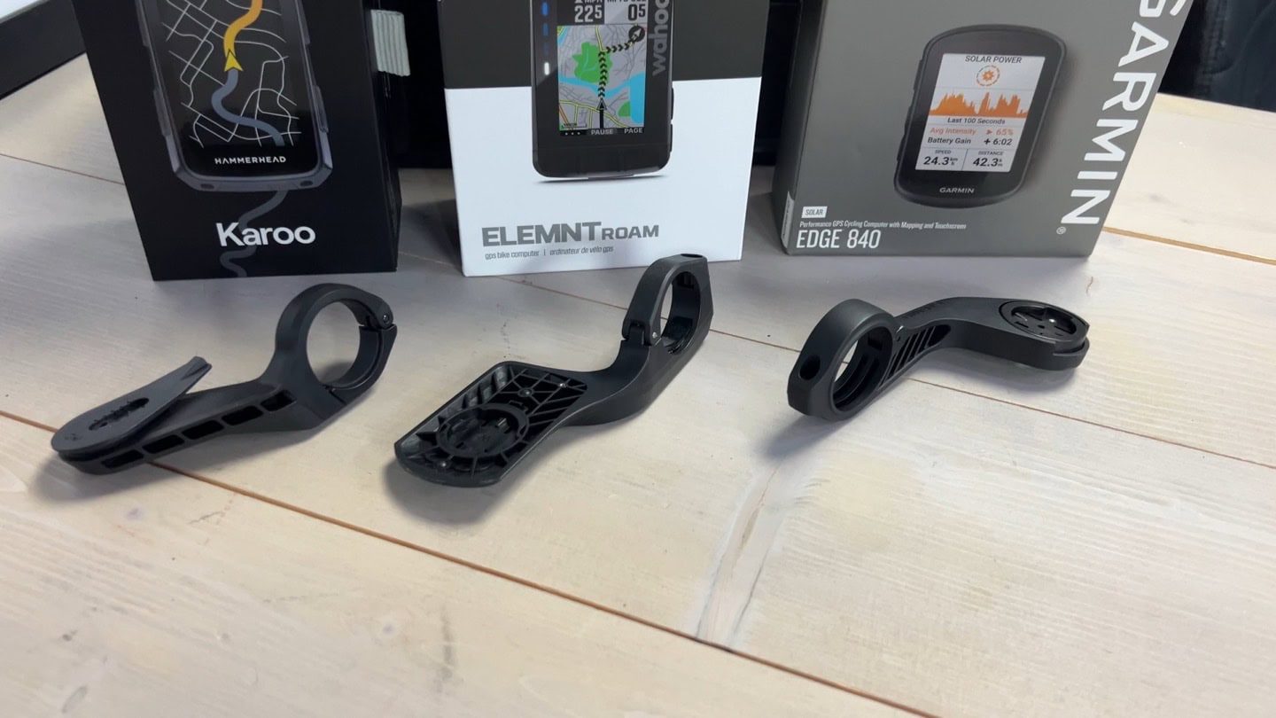
All three units come with included out-front mounts for your handlebars. In the case of Hammerhead and Garmin, these mounts can also support 3rd party lights/GoPros being hung below them, if you buy the extra adapter. Wahoo’s mount is an ‘aero mount’ that’s designed to be more aerodynamic, and doesn’t have any connectivity options. Both Garmin and Wahoo also include smaller rubber-band style mounts, handy for extra bikes/traveling.
When it comes to adapting these units to 3rd party mounts, all three have 3rd party mounts from various companies. Garmin obviously has a gazillion options (including bikes with built-in mounts), and Wahoo has plenty from the major players. Hammerhead has a few options, including from SRAM entities and K-Edge. However, both Wahoo and Hammerhead seem to acknowledge this outsized reality. Hammerhead includes a Garmin to Hammerhead adapter in the box, allowing you to use Garmin’s quarter-turn mounts. Whereas Wahoo sells the tiny adapter separately.
Display & Screen
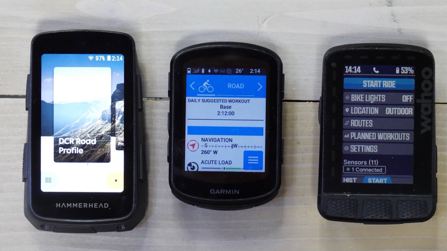
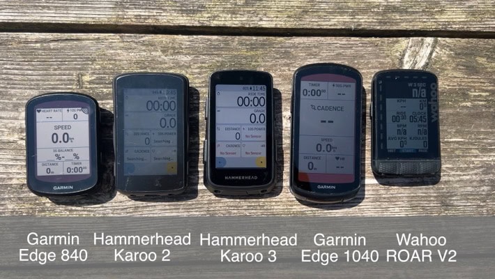
The three companies have relatively similar screen sizes for their units, but with differing resolutions, most notably from the Hammerhead side. Here’s those specs:
Garmin Edge 840: 2.6” display at 246×322 pixels
Hammerhead Karoo 3: 3.5” display at 480×800 pixels
Wahoo ROAM V2: 2.7” display at 240×400 pixels
Arguably, this is the single biggest difference for Hammerhead, and the one I get the most questions on. Thus, I may go over my 3-paragraph limit here. Apologies. First, the Karoo 3 is definitely more viewable than the Karoo 2, due to the increased brightness and new top-cover. Equally, and this is *super important*: All there units are totally viewable in all lighting conditions. I’ve done everything from night riding, to thunderstorm riding, to bright sunny Florida and island riding. I can view all three units without any real issue.
In darker conditions, the Hammerhead and Garmin units tend to do better, due to the brighter backlight. In fact, a few people have argued the Hammerhead is actually *too* bright at night, with the lowest brightness setting being overly bright. But I didn’t have any issues there with it being overly bright.
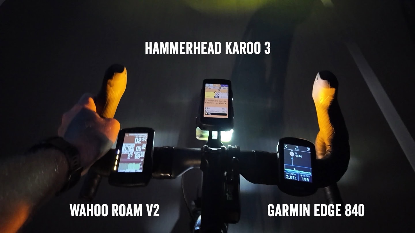
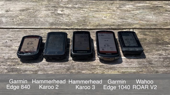
Inversely, in very bright conditions (direct summer sun), the Garmin and Wahoo units do better, especially slightly off-axis (where you normally ride). As a really simple example of this, check out these two photos side by side. One is directly looking down, and the other is at the same angle as a rider (both in bright direct sun). You’ll notice it’s harder to read the Karoo 3 in this scenario. Some of that challenge is simply camera optics, and some is real life. Again, all are perfectly viewable to my eyes. But the Garmin and Wahoo screens are more clear in direct sun, full stop. That said, I do find the Karoo mapping page more clear/readable than Garmin’s, but more on that down below in the navigation section. Note the slight differences both at an angle (how’d you’d be set back while riding), versus directly straight down (in the video I show this entire range in motion):
Lastly, what about touchscreens? Well, Wahoo has no touchscreen, so that removes that piece. All three units have buttons for controlling functions, and all three units support using SRAM extra/bonus buttons for controlling the data pages too (and all Wahoo/Garmin support Shimano extra buttons). In terms of rain usage, I’ve published videos of both the Hammerhead Karoo 3 and Garmin Edge 840 in direct/hard thunderstorm rain conditions, without any issues.
Note that both Garmin and Hammerhead made improvements here over previous models. Thus, if you’ve got a Karoo 2, then the Karoo 3 is very different here. And likewise, if you’ve got a Garmin Edge 830, the Edge 840 is different here too. That said, the Hammerhead Karoo 3 is still laggy in certain areas (namely dropping down from the menu), another area I show clearly in the video side-by-side with other units.
Finally, looking at glove usage – I’ve used gloves with both, though Garmin clearly has the edge here (get it, Edge?). This simple and quick video with gloves (and then simulated rain) shows it well:

TLDR: Most people are going to overthink this section (perhaps even me). Seriously, all three units are perfectly fine, with the differences being relatively minimal, and only really notable when you have all three units side-by-side.
Usability & Ease of Use:
Generally speaking, the easier something is to use, the fewer features it has. The more features something gets, the more complex it gets. Companies can mitigate or hide this to an extent, but eventually all companies that want to add more and more features battle with this.
Obviously, Garmin has the most features. Both Wahoo and Hammerhead will tell you that straight up. Inversely, they argue that by having fewer features, their own products are easier to use. In some ways, that’s true, and in other ways it’s just marketing speak. Anytime you switch from one brand to another, there’s a learning curve. I think all three companies’ products are easy to use at a basic level. At the same time, I think as you try and do more complex things on a Garmin device, it tends to be more complex to find some of those features. But the key is: Those options actually exist, whereas they don’t elsewhere.
From a simplicity standpoint, I’d agree Wahoo is probably “the easiest” overall to use, in that it has the fewest options/features. I think that was a big strategic benefit for them 5-7 years ago, but I’m not as convinced now. Hammerhead is also equally easy to use, and will feel much more like using your phone or apps on your phone.
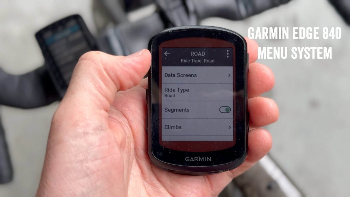
The key difference I’d say is that with Hammerhead, the majority of your not-riding interactions are going to be with your Karoo, rather than with your phone or web/desktop app. Whereas with Garmin/Wahoo, they’ve got deeper apps to configure your bike computer, look at rides, and more.
And I know that users who have switched ecosystems (perhaps years ago), will have varied feelings here. But the market seems pretty clear here that “ease of use” hasn’t really been a barrier to consumers choosing one unit over another.
Data Pages & Data Field Options:
All three units offer a boatload of data fields, and I’ve never had any issues creating my standard-issue data pages that I use on all my bike computers. All three units also include TrainingPeaks fields like TSS/NP/IF. While I can find a list of Garmin’s Edge 840 data fields here, I can’t seem to find an online linkable list of Wahoo or Hammerhead’s data fields.
But again, it’s got pretty much anything you’d want covered. Likewise, when it comes to data pages and customization of data pages, all three offer a bunch of different options that probably have you covered. Garmin and Hammerhead tend to have a bit more on the graphical data field side, whereas Wahoo has their ‘dynamic’ data page concept, that allows you to increase/decrease the number of data fields shown on a page (during a ride), which also increases the size. You can set the importance of the data fields, such that if you only had one data field, it’d be X (e.g. power), but if you had two data fields it’d be power + heart rate, and so on.
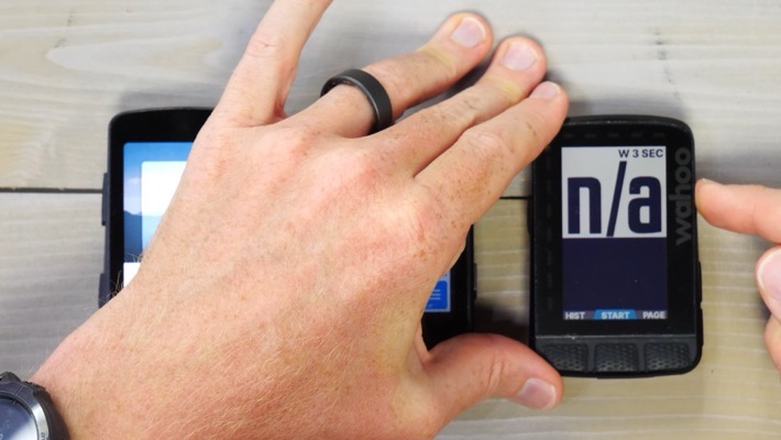
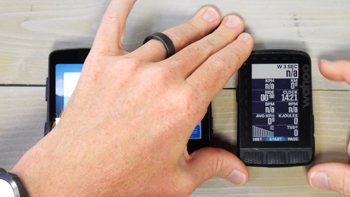
It’s a feature that some people really love, and others just shrug at. Inversely though, Wahoo lacks any sort of bike profile concept. Thus, you don’t have the ability to create different data pages/fields for mountain biking versus road cycling, etc… A gap many people find frustrating. Both Garmin and Hammerhead have ride profile concepts.
Lastly, as I’ll cover lower down in the 3rd party integrations, Garmin has a ton more data field/page options via Connect IQ, almost all of which are free.
Navigation & Mapping:
This is arguably the most complex of the categories. As there is no clear winner here. Instead, it’s variable depending on what exactly you value most. At a high level, all three have full and free mapping, with global free downloadable maps (via WiFi). All three can receive routes from Strava and Komoot, along with other sources that vary slightly between them. You can create routes on both Hammerhead and Garmin web platforms, but Wahoo doesn’t have the ability to create a route within its app, except a point-to-point route (e.g. navigate to a specific point). All three can consume GPX/etc route files though.
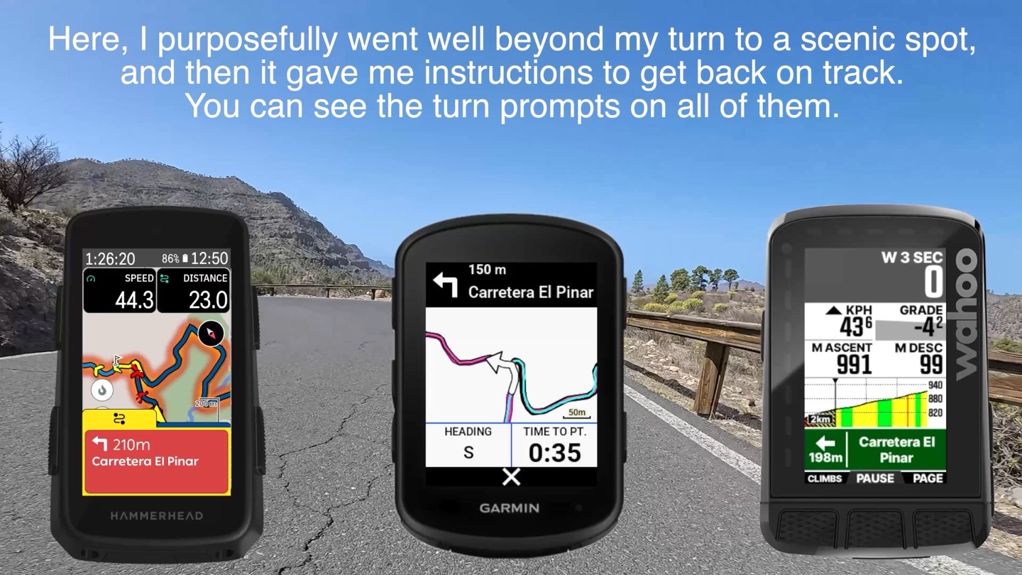
All three will re-route on the fly, using real road data. So if you miss a turn, all three will find some place up ahead to get you back on course, or if required, tell you to turn around. In my testing, this works well across all three now. It takes years to get this right, and at this point they all do a good job of this, and do so virtually instantly.
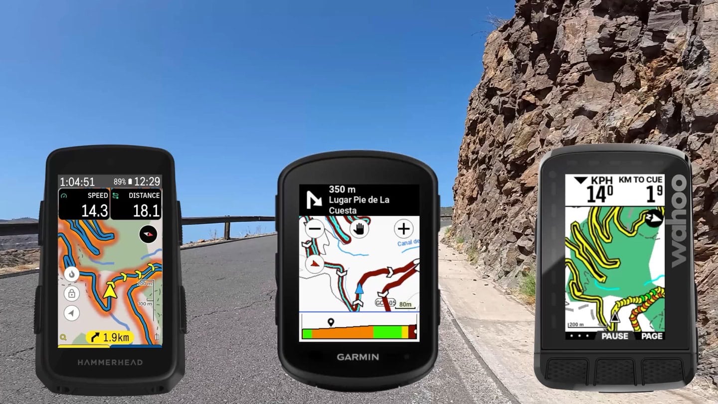
The biggest difference you’ll see visually is actually just in the maps themselves. Here’s me routing along a road in the Canary Islands. You can see the three maps are set to as similar a zoom level as I could get (note the scale lengths are different). For me, the Hammerhead is the most visually pleasing, with the heat maps turned on. I can clearly see my route, as well as where others ride. The Wahoo is the most minimalist. And the Garmin is good, but the other data on the screen isn’t super useful.
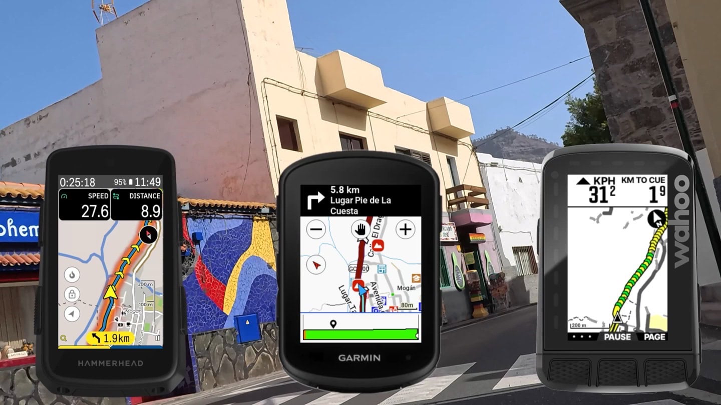
Again, I could write an entire post dissecting the differences here. I’ve navigated with all three just fine, but which style you prefer will probably be personal preference. Likewise, how each unit does turn alerts varies. Garmin does an initial full-screen pop-over, Hammerhead has a swipe-up drawer, and Wahoo compresses things to make room for it. All of these act slightly differently depending on which data page you’re on at the time of the turn alert:
Beyond the map styles, the units also have other map features. In Garmn’s case, they can generate on the fly round-trip routes from any location, using their own heat map data. So you can ask it for a 50KM route, and it’ll come back with a (generally quite good) ~50KM route. You can even specify which direction you want to ride (e.g. out to the west). Neither Wahoo nor Hammerhead have this. Likewise, Garmin is the only one that displays points of interest and things like cafes on the map – and the only one that can route to a specific address without internet connectivity.
Yet, inversely, both Hammerhead and Wahoo allow you to use your phone to send an address to the device. This means you can pick something from Google maps on your phone (usually far easier than trying to navigate a bike computer GPS address field), and then simply send directions directly to the Wahoo/Hammerhead devices. Quick and instant. Thus for navigating to a last-second new address, the Wahoo and Hammerhead tend to be easier.
In many ways, Garmin is the navigation and mapping behemoth here. It’s got as many features as an aircraft carrier, but isn’t quite as nimble as Hammerhead and Wahoo are for last-second changes. If you’re just riding on routes from Strava or Komoot though, you’ll never really notice the differences outside of map styles.
Climbing:
All three units have a climbing-specific mode. Garmin was the first in this realm with ClimbPro, followed by Hammerhead and then Wahoo. In the original mode, all three companies required a route to be loaded to get upcoming climb information. Then Hammerhead introduced their free-ride version, which will automatically detect climbs on the roads ahead of you. Garmin and Wahoo followed suit as well. Thus, all three now have roughly equal modes.
When it comes to the displayed data up ahead, all three are very similar. They detect upcoming climbs (with or without a route), and show the distance and climb data to the top. Here’s how all three look on a recent climb:
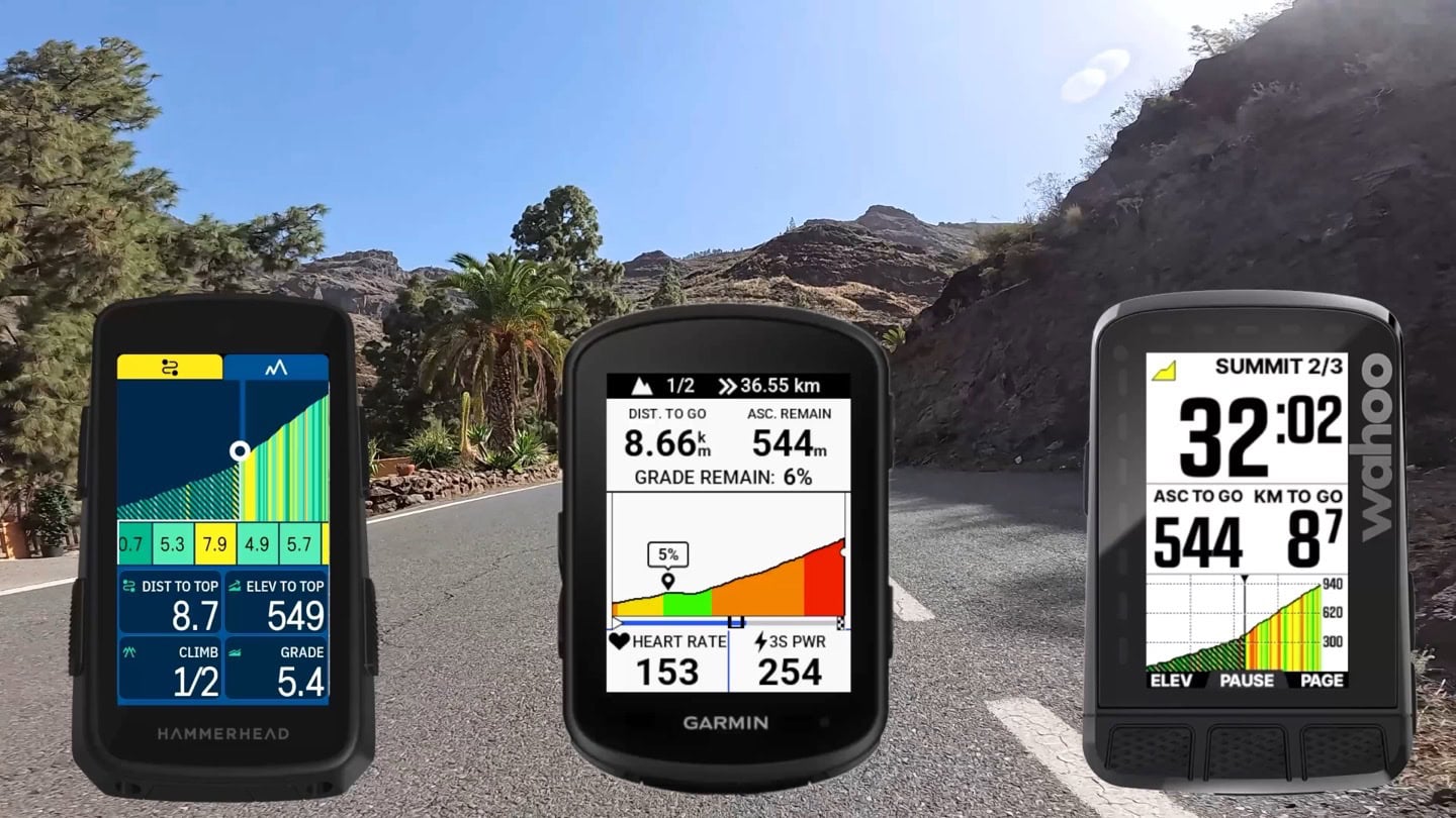
In testing all three across a variety of climbs (both recently, and long term), there are very minor little quirks based on detection of the climbs themselves. For example, each company has very slightly different definitions of climbs (length/grade), though despite that, almost all of the climbs I’ve ridden recently have been detected within a few seconds of each other.
In terms of the underlying climb data (gradient), Hammerhead made improvements for the European gradient data set this past spring, which has helped in my testing in terms of previous gradient accuracy issues they’ve had. That said, I do still get some wonky upcoming 15% gradients that don’t exist in real life. But it’s reduced enough now in my testing these past few months that I don’t consider it much of an impact anymore.
Structured Workouts:
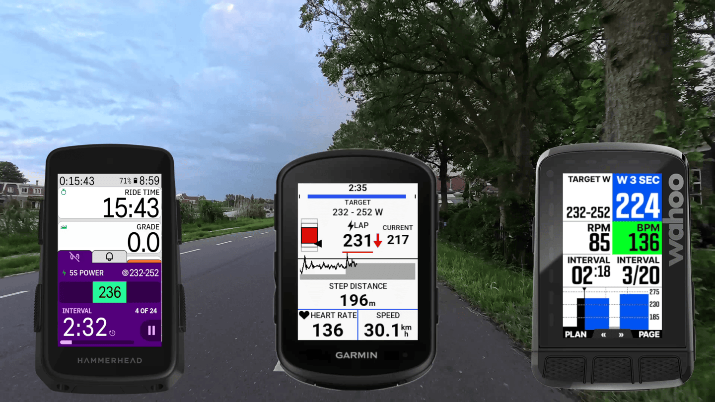
All three units support structured workouts, such as those coming from platforms like TrainingPeaks. To that end, there’s two core differences here:
A) Which platforms they support
B) What the in-ride experience is like using it
On the platform side, all three support TrainingPeaks and TrainerRoad. After that, Wahoo also supports their own SYSTM. And Hammerhead also supports Xert via the Xert app. Garmin supports basically every other platform (e.g., Final Surge, Athletics, etc..), as Garmin has a dedicated API that makes it easy for developers to quickly push workouts to all Garmin devices.
This allows you to have a structured workout both outdoors, as well as controlling an indoor smart trainer. All three units support ANT+ FE-C trainers.
Next, is how good the implementation is. Both Garmin and Wahoo’s implementations are solid. Minor style differences between them, but nothing of major consequence. Hammerhead’s however wasn’t great, but has actually been improving over the last month. There’s still some progress to be made (such as some form of visual indication as to what’s coming up on a single page), but they’re slowly getting there.
Lastly, for lack of anywhere else to put it – Garmin does also have their ‘Power Guides’ feature. This is really aimed more at racing than structured training. It allows you to put in a specific goal for an event, load the course up, and it’ll give you exact power guidance throughout the route to have you hit your goal time. It’s basically a race plan, but can also be adjusted on the fly if things are going better/worse. I outline how this works in the Garmin Edge 840 in-depth review.
Strava Live Segments:
All three units support Strava Live Segments, albeit to somewhat different degrees. In this case, the Hammerhead and Wahoo implementations surpass that of Garmin, because they can track multiple overlapping segments at once. That’s handy if you’re on a route that has perhaps a shorter segment and a longer segment. With the Garmin, you’ll only see the first segment, but with Hammerhead and Wahoo, you’ll see both segments and can easily toggle between them.
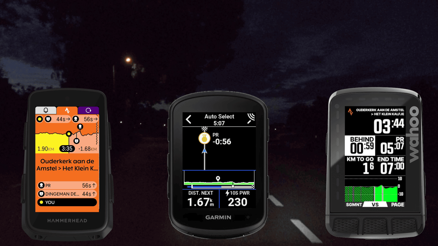
Outside of that, I’d argue that Hammerhead does a much better job at visualizing your ‘competitors’ on the screen. Meaning you can see exactly where the people are ahead of you on a little timeline, versus just knowing how many seconds they are.
Note that displaying Strava Live Segments requires a paid Strava subscription, per Strava requirements. That said, Garmin does have their own Segments (relics of days long past) that you can create for free and compete on. Most people aren’t really competing on these against other Garmin users, but rather, instead of paying for Strava they just build some of their favorite segments in Garmin Connect, and race on them for time purposes. Once uploaded to Strava (even with a free account), they’ll still end up on the leaderboard.
Also note that all three devices let you disable Strava Live Segments, if that’s not your jam.
Training Load & Physiological Metrics:
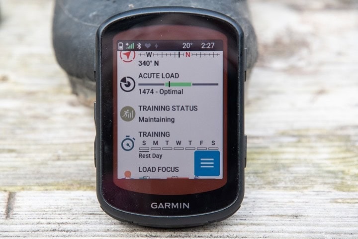
This is another easy category, as Wahoo and Hammerhead have none. Whereas Garmin does have training load and a slate of other training-load-focused metrics. This includes things like Acute Training load, Recovery Time, VO2Max, Training Focus, and more.
Further, only Garmin has suggested workouts, and included training plans for various events. You can give it an event (e.g. a Grand Fondo), and it’ll create a custom training plan for it, leveraging your power meter. Likewise, you can also tell it nothing, and it’ll just keep you busy with varied workouts based on your detected training level. In my experience, these workouts tend to be pretty solid (again, if you have a power meter).
But beyond that, it also includes crash detection (I suppose the opposite of training load), which will notify friends/family if you’ve crashed. If that happens, it’ll send them a notice as well as your current location using the GPS.
Battery Life:
Aside from display tech, battery life is easily the biggest difference between these units. And for some, it’s going to be the defining factor. Let’s look at the (claimed/official) specs first for GPS time, then reality:
Hammerhead Karoo 3: “At least 15 hours”
Garmin Edge 840: Up to 42 hours (28hrs in multi-band)
Garmin Edge 840 Solar: Up to 60 hours
Wahoo ROAM V2: Up to 17 hours
I noted the solar edition this time, because if you live in a very sunny place, then that can make a bit of difference. But it does take a fair bit of sun. Still, if you’re riding a long time, and have your settings turned down – it can really add up.
Additionally of note, is that Garmin is the only company that offers a detachable waterproof battery pack for on-the-go charging, as well as charging via another product, the ‘power mount’ for bikes that have built-in charging ports. All three companies can charge via USB-C cable (while riding), if you’re looking to charge in the rain, only Garmin has that capability.
That said, most of us aren’t. So more day-to-day battery life is what matters. Here’s a chart I did two weeks ago on a 3.5hr ride, showing the battery burn between the three units. In this case, the Edge 840 Solar on a sunny day. All three units were roughly in the same pages/settings, and none had screen recording turned on. All three were in multiband configurations, with all three connected to the same sensors (HR/shifting/power), the Edge also was connected to the NIX hydration and CORE body temp sensors.
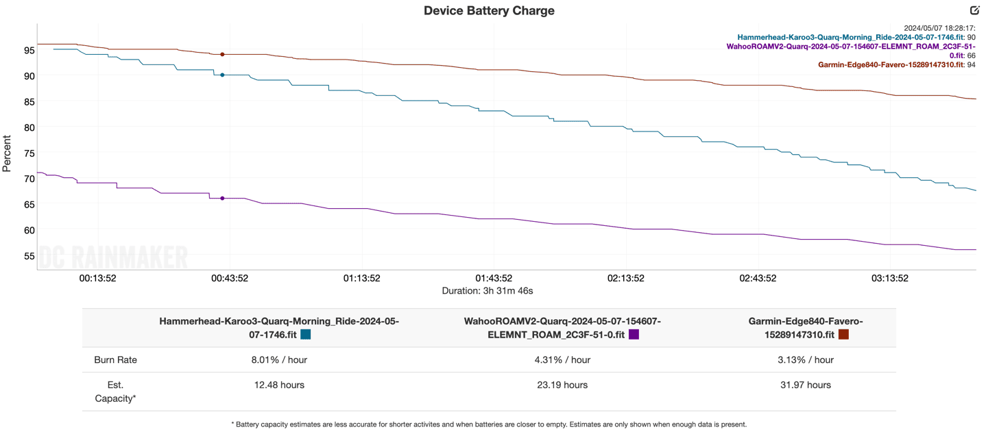
As you can see, real-life usage will vary based on the day and exact settings (especially the backlight). I’ve got some rides over the past month where the Edge reports less, and the Wahoo more. And vice versa. The Hammerhead Karoo 3 on most of my rides though has been trending pretty constantly towards about 12-13hrs in battery usage.
Sensor Connectivity:
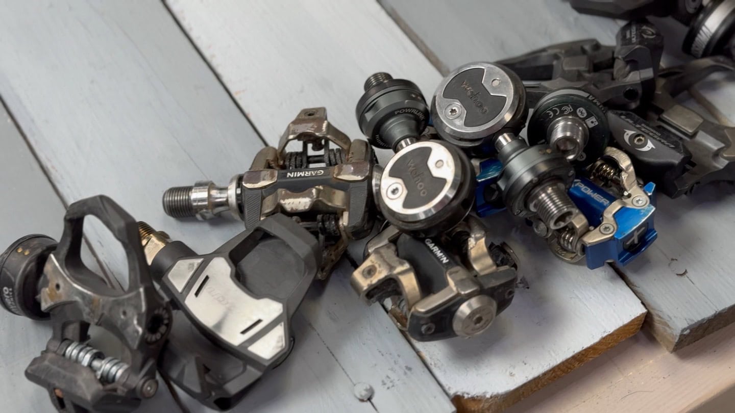
All three of these units support all of the major open-standard ANT+ and Bluetooth sensor types you’d expect from any bike computer, which includes:
– ANT+ & Bluetooth Smart power meters
– ANT+ & Bluetooth Smart heart rate sensors
– ANT+ & Bluetooth Smart speed & cadence sensors
– ANT+ Gear Shifting
– ANT+ Bike Lights
– ANT+ Bike Radar
– ANT+ LEV eBikes
– ANT+ FE-C Trainers
– CORE Body Temp Sensor
– Tire Pressure Sensors
Of course, the big ticket one for Shimano users is the lack of Shimano Di2 support from Hammerhead, after Shimano got upset and forced SRAM to remove it. I detail that here. You can though use a 3rd party plug-in, Ki2, to get around that. Albeit, it’s not yet available/updated for the Karoo 3 (but is coming shortly).
Now, once you get beyond the above sensor types, there’s an absolute boatload of specialty sensors that are really only supported on Garmin, via Connect IQ. We’re likely talking stuff like aero sensors, hydration sensors, muscle oxygenation sensors, etc…. In addition, there’s also just a lot of other sensors that are supported on Garmin natively/built-in, that aren’t supported on the other two, including Garmin VIRB action camera support. But Wahoo does have one unique sensor capability: They can control their own Headwind fans, and soon GoPro cameras too.
In other words, for most cyclists, you’ll be more than fine on any of the three for all major sensor types. But if you’ve got a fancy aero sensor or something else, you’ll probably only be able to connect to it on the Garmin Edge.
Web Platform & Phone Apps:
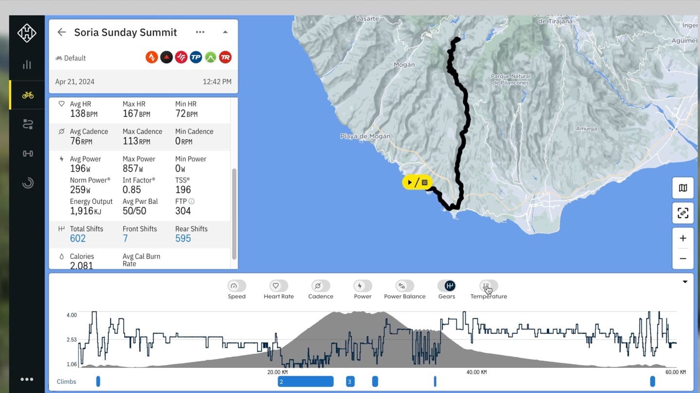
This category looks at both the smartphone apps and websites that each unit has. Garmin easily wins this category by a landslide. Still, both Hammerhead and Wahoo do offer some basic functionality that covers most people’s core needs. Here’s what each has:
Garmin: Deep web platform and mobile apps with analytics, connectivity, planning tools, device configuration, etc…
Hammerhead: Basic web platform with good route planning tools, and basic post-ride analytics. Mobile app to simply provide sync capabilities to Karoo 3
Wahoo: A reasonable smartphone app for basic analytics, but plenty of device configuration options from the smartphone app. No user-facing web platform.
I could dive into all three of these for an entire post, but alas, I do that in each of my reviews. The key thing here to understand is a bit of a different philosophy between each of them.
At one end, you’ve had Garmin, which is providing ‘everything’ you could possibly need to interact with the device, and tons of depth for analytics/reports etc… With the Garmin approach, there’s no need for a casual user to use 3rd party apps/platforms for anything (of course, you still can). At the opposite end of things was Wahoo initially, which aimed to really just focus on “the device” and then offload other elements (analytics/etc) to 3rd party apps. Over time though they’ve added more features to their app, so it covers the basics. Hammerhead has had basically no app till now, and even now, it’s just a conduit of internet to the Karoo 3 – you can’t do anything with the app. However, their web platform has been quite good for route creation/importing, allowing the majority of things people want to do. There’s also basic individual ride summary data there (but no long-term/multi-month ride analytics/etc).
3rd Party Integration & Apps:
This category is basically broken out into two core pieces: On-device 3rd party apps, and platform 3rd party integrations.
Let’s go with the easiest one first – platform 3rd party integrations. This is things like Strava or TrainingPeaks connectivity, or Komoot uploads/etc… All three platforms have all of the ‘majors’ in this regard. However, Wahoo has even more connectivity than Hammerhead (partners like Relive, Final Surge, 2Peak, and more), and Garmin has infinitely more 3rd party platforms it connects with. We’re talking many many hundreds, compared to Hammerhead’s sub-10, and Wahoo’s 20-30. Are you on those other platforms? Probably not…but then again, maybe.
The next piece is on-device integrations/apps. Both Wahoo and Hammerhead have a handful of ones each, such as Xert for Hammerhead and Best Bike Split for Wahoo. But that’s in comparison to the literally thousands of apps you can download for the Garmin Edge. Most of these apps are custom data fields displaying unique data (like a live wind app or a radar data recording app), or integrations with larger apps/devices/sensors.
While Hammerhead does have the ability to side-load 3rd party apps, it’s currently a complicated and technical process that most non-geeks would be intimidated by. As such, there’s virtually no apps that are designed for it, outside of the Shimano Di2 plug-in app. And that one isn’t yet working on the Karoo 3 (as Hammerhead hasn’t released the Karoo 3 SDK yet).
Again though – as always, figure out what you’re actually going to use, or perhaps likely to use. The vast majority of people don’t use most of these integrations and simply upload to Strava/TrainingPeaks.
GPS & Elevation Accuracy:
This is a super-easy category. All of these are accurate, for both GPS and elevation. You can see this in my in-depth reviews, where I have dedicated sections for all of them. All three of them have multiband/dual-frequency GPS/GNSS, and all three of them are throwing down some very solid tracks. Here’s one snippet, from my much larger accuracy test section, in the mountains:
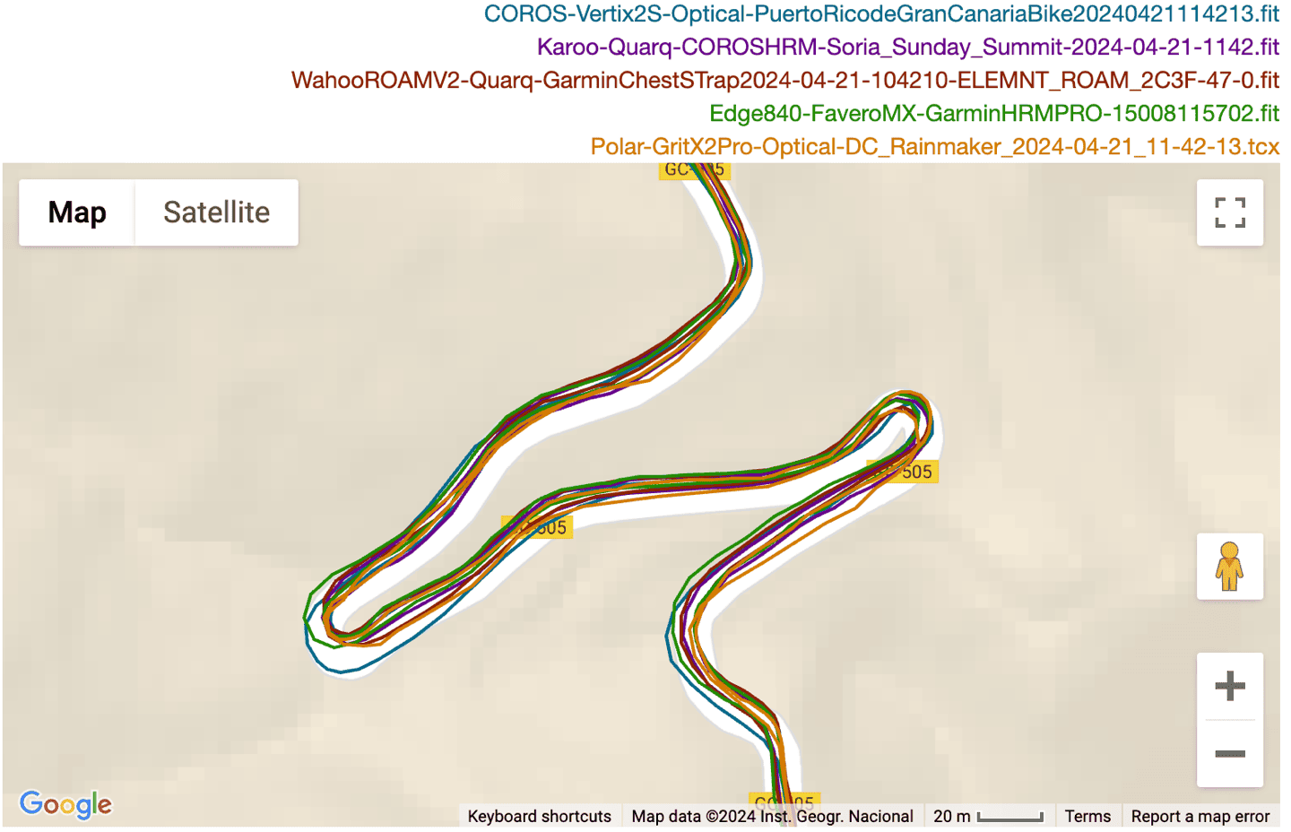
Again, this is the one category you can actually ignore here, and I almost didn’t bother to list it, but I figured I’d cover my bases nonetheless.
Wrap-Up:
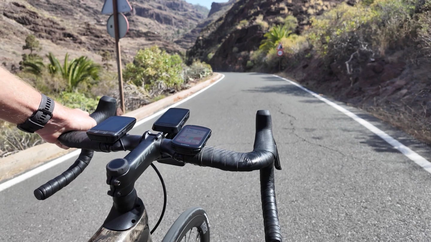
As I said at the beginning, all three units are great units. All three units will get you where you want to go, record all your cycling data, and display the most common cycling metrics. All three units have good enough battery for most people’s needs, and all three units will upload to the common cycling platforms that you know and love. And all three units will cost you roughly the same amount of cash.
The key differences here are more nuanced, and will vary quite a bit based on how you value certain features. Broadly speaking, nobody disagrees that Garmin has the most features/functions – be it on the device itself, the phone, or the website. Instead, the discussion is whether you’ll use those extra features, and the ease of use of said features. Most are easy to use, but finding them can be like finding buried treasure. Still, there are specific areas where the Wahoo and Hammerhead units outshine Garmin. For example, Hammerhead’s Strava Live Segments implementation is better, and I’d argue the map legibility/display (graphical choices) of the Hammerhead map is easier to understand too. Meanwhile, Wahoo’s ability to quickly download smaller per-country maps via WiFi is super useful if you’re already traveling (versus the much larger Garmin maps).
But again, it all depends on what you want, and how you want to use it. Hopefully, between the 28,000 words above and the 24-minute video, I’ve covered as many differences as possible to help you make that informed choice. If not, there’s always the comments section.
With that – thanks for reading!
Found This Post Useful? Support The Site!
Hopefully you found this review/post useful. At the end of the day, I’m an athlete just like you looking for the most detail possible on a new purchase – so my review is written from the standpoint of how I used the device. The reviews generally take a lot of hours to put together, so it’s a fair bit of work (and labor of love). As you probably noticed by looking below, I also take time to answer all the questions posted in the comments – and there’s quite a bit of detail in there as well.
If you're shopping for the Garmin Edge 840, Hammerhead Karoo 3 or Wahoo ELEMNT ROAM V2 or any other accessory items, please consider using the affiliate links below! As an Amazon Associate I earn from qualifying purchases. It doesn’t cost you anything extra, but your purchases help support this website a lot.
And finally, here’s a handy list of accessories that work well with this unit (and some that I showed in the review). Given the unit pairs with ANT+ & Bluetooth Smart sensors, you can use just about anything though.
And of course – you can always sign-up to be a DCR Supporter! That gets you an ad-free DCR, access to the DCR Shed Talkin' video series packed with behind the scenes tidbits...and it also makes you awesome. And being awesome is what it’s all about!
Thanks for reading! And as always, feel free to post comments or questions in the comments section below, I’ll be happy to try and answer them as quickly as possible. And lastly, if you felt this review was useful – I always appreciate feedback in the comments below. Thanks!



As a gadget geek I love my Edge 1040 Solar, EXCEPT for the reflectivity of the screen!! In bright conditions it’s fine, in dark conditions it’s fine. But anything with a combination of both (i.e. leafy tree cover etc) it’s totally unreadable. I tried putting an anti-reflective screen cover on it which cut out the reflection issue, but then made everything on the screen really fuzzy. I also got tonnes of micro sensor drops over Ant+, this is especially annoying with he Varia Radar as it beeps at you each time. It’s the first time I’ve head a head unit and actually tried to get as many connections as possible on to BTLE.
Reading this only strengthens my idea (as a person mostly riding in the Netherlands) to save money and not go for a solar-enabled bike computer. I have the same issue with solar-enabled watches and my current watch is definitely the last solar-enabled product I’d buy.
I’m not sure that the non solar screen is any different from what I’ve seen. It’s not the solar part in terms of transparency, it’s the glossy screens that Garmin tend to use to improve contrast/sharpness.
There is very slight difference between the two in visibility, but nothing that I’ve noticed meaningfully (my wife has the non-solar version). But I agree, for living in the Netherlands, non-solar makes sense. Frankly, in everywhere but a year-round sunny place, it makes sense.
If you’re seeing drops on things like Varia/etc, I’d be ringing up Garmin support – assuming it’s all your sensors, then something is wrong with that unit. I virtually never see outside drops on any of my units.
Lee, by any chance are you using ConnectIQ fields, in particular the Windfield.app? I had trouble during the 21.xx betas and with 21.16 where for about 20% of my rides within a half mile of the start of a ride all of my paired sensors dropped. From what I gather in the forums it’s possibly caused by a bug in ConnectIQ. In particular my best guess now as to what’s happening is the first time Windfield connects to its weather service (can take several minutes) the ANT/BLE radio gets shut off for some reason. A power cycle on the 1040 has always brought things back to normal, so I’m going to just live with it until it gets fixed, but you might try turning off ConnectIQ fields if you’re using any.
I am currently using that data field, it the drops were happening before I used that. It’s not a total sensor drop as it’s not that all sensors drop at the same time, and when it does happen it basically drops and immediately reconnects. I didn’t even notice things like the power meter dropping while on a ride due to smoothing.
I’ve seen quite a few comments in FB groups of people having the same issue, but Garmin basically deny it. But curiously, they seem to account for it in their own recordings as they interpolate the missing points. Unfortunately it’s a while ago since I dig into this so no idea where my files are now. But as a rough outline, I noticed that the average power on my rides was lower (as in more than a couple of watts) in Garmin Connect than the subsequent upload to TP and also on my dual record of the same power meter on my Roam 2.
When I looked at the file in the DC Analyzer, you could see all the drops to zero. But it appears Garmin fudge for that by filling in the points in between when calculating their final figures. I checked a few rides and seemed to be the same. Obviously, that’s hard to categorically prove as the GC graphs are all smoothed, so you’d never see the drops anyway. But as someone who’s used to doing data analysis, it seemed a bit of a coincidence.
After a few FW updates it did get a LOT better. But like I say, I ended up just switching to BTLE as zero issues there. Unfortunately my radar is the older version so Ant+ only.
The unit is outside of warranty now, I probably should have pushed harder with Garmin support at the time, but I find them a bit of a brick wall to deal with unless it’s a very clear failure. I just got the usual “could be a number of factors” response. Which totally ignored the fact when I dual recorded with either my Fenix 6X and/or Roam 2 neither of them did (or still do) suffer the same issue.
I was having the same issues for the past six month with other CIQ fields and resolved it by factory-resetting, updating the firmware (26 times) and removing this field.
I live in Arizona (a year round sunny place) and I have found the 1040 Solar useless from the solar point of view. On a typical 2 hour ride I end up with solar adding about 5 minutes of life. Not even worth mentioning since I still only need to charge every couple of weeks.
The dropouts are something I’m getting too. Sometimes all sensors drop-out and reestablish connection immediately (Radar, DI2, Speed, Powermeter and HR)
I have it on my 530, had it on my 820 too. There’s one spot on a bridge that always causes the dropout but other times it’s just random.
David, I’d say there’s an issue there then as I get way more than that in cloudy UK weather! On a cloudy day I get 5-10 minutes per hour and on a really sunny day I can easily get 15+ minutes which I’ve been really impressed with. Granted, given the battery capacity, the “usefulness” of that is questionable as it has such a great run time without the solar.
Dirk, that’s not a bad shout. I think I did factory reset at one point quite early on, but there’s been a lot up FW updates since then so I’ve just done a full reset/restore. Fingers crossed it helps :-)
RE: Solar Time
Agree, something is wrong there. For context, on the Edge 840 Solar, a few weeks ago, I did a 3.5 hour ride, and it shows 49 mins of gained solar time. It was sunny for most of that, in Florida. (attached).
I don’t think it’s worth it for most people unless you need to eek it out, but you should definitely be getting more than you’re getting.
RE: Dropouts
Always hard to troubleshoot, but my first go-to is removing Connect IQ apps. I feel like when it doubt, it’s something there that’s causing the issue.
With the factory reset I’m going to forgo installing any Connect IQ stuff before I get three or four rides in to see what happens 🤞🤞
Well…. First ride post factory reset and in just over an hour I had zero Varia drops! Didn’t notice any other sensors dropping but the totals looked right so 🤞🤞🤞🤞
Normally in that time I’d have at least half a dozen Varia disconnected beeps…
Lee, I’m with you 100% there. I’ve had the 1040 solar since its release, and there are times when it is just unreadable. I’ve used an 840 non-solar (my son’s computer) and don’t have the issue. I just received a “free” Karoo 3 with a new bike with the new Sram Red, and it also does not have the issue. I’ve been using Garmin since around 2000 for all things fitness (watch and bike computer), but I’m messing around with the Karoo 3 now because of this display issue. I’m holding out on the 1040 until they release its replacement, and I will definitely not be getting the solar version. I can’t believe I don’t hear more people complain over the display issues.
@Damon, glad it’s not just me :-) I’ve tried leaving it in dark mode the last couple of rides. It was possibly “marginally” better, but still totally unreadable at times.
After a good first ride sensor connection wise after the factory reset, today’s was back to it being pretty poor. I think I may switch to using my Fenix just to keep my Garmin metrics up and stick to my Roam 2 as my main computer.
I’m an Arizonan as well, and due to the heat and intense sun I usually only go on rides first thing in the morning. At these times, the sun angle is so low that a solar device laying flat just isn’t going to get enough light on it to make any real juice. I recently went with the non-solar 1040 and have no regrets.
49 min is something from an ecological point of view. Using solar as a powers source gives us free and clean energy. Technology will only get better which means higher efficiency. It’s good to support this trend. And 49 min can really make a difference. It’s not good for the longevity of a battery to continuously charge it and only drain it by max 20%. Means you can easily forget to recharge it sufficiently. 49 min extra is really something. The longer the tour the more relevant the benefit. If you always ride for 1h then of course the benefit is not relevant – except the ecological idea. And if you are doing bike packing trips and you only have a power bank to charge your gadgets then solar is a very welcome feature I guess. Solar just does not show it’s strength in a one hour training ride.
I happen to live in the PNW, and like living in the Netherlands, I regret getting the Solar flavor of the 1040. You’d think I’d have learned that from my 7x solar. Oh well!
Sean
This is a great guide. Very handy to refer friends to when they ask about getting a bike computer.
The only bummer is that Wahoo hasn’t come out with their new computer yet. Would really like to see how it stacks up instead of the (relatively) old Roam. Wahoo has done a good job keeping it competitive with software upgrades. But a screen and hardware refresh would be really nice.
Will you update the comparison when 1050 is released?
Hi Ray,
thanks for the write-up!
Regarding the bike profiles on Garmin/Hammerhead – is there a way to link those profiles to bikes on their respective platforms (i.e. if I do a TT ride – I want to see that Garmin auto-matched it with my TT bike instead of using the “default” gear and requiring me to change it manually every time)? I know that you can sorta get this functionality on Strava via ActivityFix (if you can distinguish the bikes via sensors) but is there anything similar for device-native platforms?
I don’t believe Garmin does bike inventory linking today. Strava does, via the bike profile, but not natively via the sensors (you’d have to do ActivityFix).
Hammerhead does it though via AXS Web, SRAM’s AXS focused site, which ties in SRAM gear and give stats there.
With the Karoo you can tie a specific bike to a profile. So, if you make a TT profile and tie your TT bike to it then it will track miles, etc. on the TT bike as long as you chose the TT profile. For road vs gravel a created one profile tied to my road bike, then duplicated it and ties the duplicate to my gravel bike. It all works like I’d want. You do still need to choose the profile which you already need to do at the start of each ride.
Hint of the upcoming naming change for Wahoo? Roar! ;-)
(captions in the side-by-side comparison pictures)
Doh, nice catch!
Does anyone know if the bugs in last year’s tests have been fixed yet in 540?
Delayed remaining altitude display in climb pro, difficulty of the control buttons?
What changed in updates in the last 1 year?
It’s better, but I still find it not-awesome. I don’t use it a ton, every once in a while if I need an extra unit for something to be all common for some reason (was doing some screen recording recently for radar testing).
That said, lots of new software updates/features since then, such as the just released features around sending map points via phone/etc…
One big thing that changed in the 21.xx beta series now out as 21.16 production is they changed the way you designate climb difficulty in free ride ClimbPro. When I first put on 21.xx (don’t remember exactly which) a ride that usually has zero ClimbPro climbs had six. They now let you choose climb difficulty based on their categories, and the beta simply set it on everything rather than what I had before. But it still doesn’t start until you’re already climbing, still ends just before the actual summit, some profiles are still just wrong, etc. I haven’t noticed any big improvements in that regard.
Out of curiosity, which routing provider do you make your courses in?
I had pretty good luck with all my climbs in Gran Canaria, as well as the Italian Alps. All of these were created on Strava. However, I noticed (somewhat more frequently) that when I’m creating routes on Komoot, the elevation profiles aren’t usually super awesome/exact. I don’t know why, but in chatting with another sports tech reviewer, he also noted the same thing in his area.
In this case I’m talking about free ride, but in general I use Strava. I don’t remember seeing any problems when navigating in quite a while, although I’ve seen some in the past (mostly non-existent cliffs and such). Last year when navigating I did see the “climbs shifted by 1/4-1/2 mile” thing that Shane Miller did a video on. That was fun. Since I rarely navigate, most of the quirks I see are free ride quirks.
Just my thougths about routing providers, since it seems it can fit here, I’m usually use komoot for hiking then sync those to my fenix7 and they are far from even good. Turn notifactions are non existent (for a 10k route I got 3 tturn notifications in avg for komoot routes, working well with garmin planned routes), and if I check the imported route in garmin explore it’s not even continous, so strange….
I believe Strava uses a data model for their route planning where elevation data along the road (in meters from node, not in lat/lon!) is held alongside the 2D projection of the roads, and they continuously refine that elevation data from measurements in uploads. Very much unlike the elevation data of segments, which are whatever faulty measurements the segment creator uploaded.
Komoot on the other hand just does what (almost) everybody else does, using a 2D height field DEM (SRTM or something more recent), looking up points along route locations in that grid. This is laughably wrong whenever the road goes alongside a steep slope (and a few meters left/right lead to dozens of meters of elevation change in the grid surface lookup), through a tunnel, over a bridge. Just like everybody else using that method, they simply put the results of the lookup through a smoothing filter (simple box filter presumably) to hide most of that error. Picking that window size is a compromise, too big and routes in flattish terrain get underestimated, too small and routes in rough terrain get overestimated. A possible improvement, not sure if komoot does that, might be varying the filter length based on general terrain roughness.
As for remaining altitude: it’s tempting to just take the climb prognosis number from route planning and subtract accumulated observed climb, but that will give really bad results whenever the prognosis is less than perfect, and worse when the observation is faulty, e.g. from rain in the sensor. Remaining climb has to be a total prognosis minus the accumulated prognosed climbs until current point in course, and current point in course has to be some clever sensor fusion between current lat/lon and observed travel (this part is already there, on all devices that do acceptable turn notifications).
Thanks for the comparison and the 28+k words!
I own the K3 and Edge 1030. As you have noted, beyond some more pro features, both are capable, and either would meet the needs of most users. Like you, I prefer the mapping and data visualization experience on the K3 over the Edge, but I prefer Garmin’s approach to live tracking. It works on the K3, but my wife likes Garmin’s better.
In your world, I don’t know that a go-to exists, but if it did, which would be your go-to computer on most days?
If you’re a Garmin watch user, then having that watch/Edge tie-in is pretty powerful on the Garmin Edge unit side. Everything just sorta all works together, especially from a training load perspective (and even more so since it consolidates Zwift/TrainerRoad workouts too).
Hammerhead does have that to a degree with Suunto, but it’s really kinda just one-way from HH to Suunto.
I used the Karoo 2 a lot but I was a bit surprised that SIM cards have been removed… Now, with the new Karoo, if you use side loaded applications and want to access web, you need to connect over Wifi, which means create a hotspot on your smartphone (drains the battery and annoying to do it every time). Otherwise I am plenty satisfied with the new Karoo which is a great improvement.
“and all three units support using Shimano & SRAM extra/bonus buttons for controlling the data pages too”
Are you sure the Hammerhead Karoo supports Di2 buttons? 😉
Even the Ki2 app does not work yet because the SDK has not yet been enabled on the new Karoo.
Doh, good catch. All three support SRAM buttons. :)
Waiting on official/further details from HH still on SDK…
I know everyone has a killer feature, and for me, it’s the way structured workouts function on Wahoo. The ability to pause an interval without pausing the activity, being able to rewind or fast forward within the workout, all those things I deeply value and basically have me locked into Wahoo.
Ray, I’m a bit surprised you glossed over that bit. I know it’s niche, but from my point of view, the difference between the devices is pretty big.
You can actually do that on the Garmin too. Just swipe-up mid-workout. :)
Thus, I saved most of that section talking about how not-good the HH was in this area.
Ultimately, I was mostly focusing on differences. Else, I’d still be working on this post/video since there’s just so many nuances to cover.
I recently started doing TrainerRoad workouts outdoors and wanted this on my Hammerhead.
Their support team kindly sent me a few links.
Their workout control center allows:
– Start / Pause / Resume of workout independent of ride recording
– Increasing or decreasing target intensity as a % of intervals
– Skipping or returning to intervals
link to support.hammerhead.io
The workout player has a few additional settings for what is visualized
link to support.hammerhead.io
It also has graphic and numeric workout datafieds which makes where you want to display the data more modular
link to support.hammerhead.io
link to support.hammerhead.io
I would agree that the out-of-box Wahoo and Garmin implementation seems a little more polished or intuitive based on what riders are used to but Hammerhead is not short of capability in this regard.
Love the article!
I moved from Wahoo Bolt (1st gen) to Garmin 1040 6 months ago and love it.
Wahoo navigation was way better than the *30 series (imo) but the *40 series clawed all that back (and more).
The Body Battery link is great (shows how much longer it thinks you can go – it’s about right too!)
What grinds my gear is how routes get synced with STRAVA. As they don’t get synced because when deleted from STRAVA they are still on the Garmin ‘eco-system’. Anyone with ideas on how to tackle that would make my day.
Are you sure about the VIRB and the 840? Early on with my 1040 after an update the VIRB page disappeared and my VIRB 360 no longer starts when I start a ride on the 1040. I know this matters to essentially no one these days, but I thought I’d check. I can still control my VIRB from my Epix 2, so I do that on the rare occasions I use the 360.
It shows in the sensor pairing menu (just checked). I’d assume it still works, though I haven’t charged one up to see.
Yeah, it shows there but you can’t control it anymore, at least from my 1040.
“The three companies have relatively similar screen sizes for their units”
That is a curious statement, seeing that the HH display is 70%/80% larger than the Wahoo/Garmin one.
What’s more, screen size alone doesn’t tell the full picture. I went from an old Wahoo ELEMNT (basically same size as ROAM) to an Edge 840 – and figured since the screen sizes are nearly identical that wasn’t an issue. But the Garmin screen just feels smaller. The layout of data fields, font sizes etc. makes it feel more cramped and harder to read. Cannot speak to HH.
Garmin’s strava segment support is really limited. It seems to only pull a ridiculously small subset of your starred segments, so if you have a lot of starred segments, the support might as well not exist.
The Strava route support is also oddly limited. It will not pull updates to routes if they are changed after first downloading it, for example.
Thanks for the comparison – really usefull – and obviously will devaluate with software updates.
A few points related to Wahoo and Garmin i’d like to add:
1. Structured workouts with FE-C integration – with Wahoo there is a challenge that it treats FE-C enabled trainer and power meter as a single unit – this is problematic since the power readings from the trainer will be greatly dependant on gear and can significantly differ from what you see on your pedal or crank power meter. Would be good if they’d finally allow to point out other unit as a source of power (especially matters for ERG mode). Otherwise the interface for trainer control is great.
2. The maps – i’d say Garmin has some edge here – you can upload other maps e.g. from 3rd parties or directly from OSM. Wahoo updates maps once a year – and TBH it’s far from what you can pull from the open sources where users are putting updates quickly. This was most visible for MTB/offroad rides in new/unknown places for me.
If you are in the market for a new bike computer at this price point you’d be hard pressed to argue against going with the Garmin Edge 1040 at its promotional price (in the US) of $499, correct?
It’s clearly a superior unit from a tier above at essentiallly the same price?
I always wear full finger gloves (road and MTB) and would go for the 1040, but with the 1040 touchscreen interface and no button backup, this won’t work … that’s the argument from my side.
Hi – that was my view with the 30 series but I have used my 1040 with gloves on a very rainy (and muddy !) day and it worked a treat.
Hmmm … I will have to get my hands on a friend’s 1040 and see how my gloves work. Some gloves totally don’t work on my phone and some are just able to launch the camera (iPhone – no button able to be used for launching the phone and internet connection is required to use Siri for ‘camera’ command).
Maybe there’s been significant improvement with the companion app for the Karoo 3, but there are a few places where connectivity to other systems seems really behind:
1. Notifications. Connection between K2 and phone was hit or miss. Had to pair again every couple of months because it wouldn’t work. On top of that, can’t swipe notifications away. Usually not a big deal, but I’ve had occasions of full that of notifications that I can’t Even tell which are new
2. Course sync – why did hammerhead require extra step to sync third party courses? Especially annoying on the go – get a course firm a friend in Strava or RWGPS and like it. Go to the movie browser to log into hammerhead site and refresh. Then open courses on the device and it shows up
3. Ride type sync – garmin gravel / mountain / road/ ebike / indoor types carry over into Strava. Hammerhead ride type and equipment doesn’t.
I didn’t know if the k3 is better, but overall my impression of hammerhead was that they keep improving a lot faster than Garmin, but at the cost of having not fully baked solutions. Great for tech geeks, not the best for people who “just want it to work”
> I’ve never had any issues creating my standard-issue data pages that I use on all my bike computers
Probably a bit geeky for most, but I’d love a run through of what your standard data pages are!
Do you by any chance know whether Karoo now supports “Auto light” in combination with the Garmin Varia radar, that Wahoo introduced recently? (The feature that allows the radar to be on, light to be off, and light to flash when a vehicle is approaching.) I find this to be quite a game changer, especially on lonely backcountry and riding with other people.
When I first rode with my 840 I was getting so many pop-ups and notifications it was basically useless. I had to sit down and work through how to find and turn everything off. Just a couple of days ago, I got a new mtb so copied over an existing mtb profile to create a new one. I went for a ride and found many of the settings and features had come over wrong (e.g. it was changed to road from mtb, map had the elevation profile added back in, avoidances were changed, etc.) So I had to go back in find everything and turn off/correct all those “features” again.
One of my biggest gripes after switching from Wahoo to Garmin a few years ago is how Strava Live Segments are handled while a route is loaded.
Live Segments simply won’t display while a route is loaded unless that route was created with Strava and the desired segments were starred/favorited prior to the route being uploaded to Garmin Connect.
I’ve tested this pretty extensively so if anyone knows of an easier workaround or how I can load a route from RWGPS and still have Strava Live Segments pop up, please let me know!
I don’t use live segments (despite premium), but I agree, these days this should be considered one of the biggest weaknesses of Garmin, even if it is completely irrelevant for many.
I suspect that if Strava had not helped Garmin with that interim solution of adding helpful segment data to the route import, Garmin would have full, independent segment support by now: priority for the changes in the codebase required for proper segments-while-routing would have been so much higher. There’s a popular saying in programming, temporary solutions live forever. Garmin really needs to find a way (process) to dig themselves out of those constraints from the past.
Really interesting how much parity there is now among these major bike computer makers. I’m still running a 1030 and see no real reason to upgrade at the moment. This apparent parity or maturity in bike computers is seemingly at complete odds with the vast difference in the gps watch market where Garmin reigns undeniably supreme and there is little if any parity among major brands. For instance, HH doesn’t have a watch and Wahoo, for the most part, no longer has a watch. Garmin, in my opinion, is light years ahead of Polar, Suunto, and maybe even Coros in almost all areas of the gps watch. That may explain the near price match and the reason we have Garmin pumping out $1,500 and up watches but sell their 1040 bike computer on sale now for $499. Garmin is forced to keep prices low to compete in the bike computer market but not so with watches, or at least it appears that way.
I’m currently tracking the delivery of my new 1040. But I’m still curious, for Navigation, do Wahoo and Karoo offer a similar concept as Garmin’s Course Points? I first started using this on my Forerunner 255, and really like the ability to highlight (and see the distance to) upcoming water stops, stores where I know I can hit the bathroom, etc., all pre-marked on my Garmin Course.
Thank you for the comparisons! Maybe a typo in the Display section – “there” s/b “three”?
“All there units are totally viewable in all lighting conditions.”
A question for me is how well the Apple Watch plays with these computers, if there’s any variation there. For a variety of reasons I use the Apple Watch — the big ones being automated afib detection which I really need, a better fitting back and strap than anything else, smartphone integration which has recently gotten way less buggy (for example I can now operate the gate buzzer/intercom for my condo building with my AWU, whereas it previously was hanging up on it), and the ability to use it independently as a backup voice and text phone — but it’s annoying how many gaps there are between Apple Health/Apple Fitness and Garmin Connect. Notably, Apple Health still isn’t integrating bicycle power meter data into its VO2 max calculation as far as I can tell, and the Apple Fitness app remains a joke, requiring me to resort to piecing together Garmin Connect, Athlytic and Gentler Streak info to plan workouts. Curious if there’s any difference in this regard among these units.
Hello! I am wondering how these units are behaving in tunnels. Are there differences at all?
My Edge 530 behavior pattern is as follows: (1) loosing GPS connection which is expecting (2) telling me that I am off course and trying to re-route which is bullshit. No car GPS is behaving like this. The unit should know that I am in a tunnel, it should also know where and when it ends based on map and unit speed data (i have speed sensor) (3) after the tunnel GPS connection is re-established, but often with GPS some errors like elevation spikes.
I hope this has been solved in the current units, but I am looking for confirmation. Thank you!
With the Garmin x30 and older units it is generally better to just turn route recalculation off. If you do go off route get yourself back on route. Route recalculation on these units doesn’t work how you think it should.
Elevation data comes from the pressure sensor, not the GPS data.
Garmin maps don’t have a tunnel type code so you can’t mark a road as in a tunnel.
Hi and thanks for the response. Yes, the elevation should come from the pressure sensor, but what happens is, that when the GPS signal is poor in the tunnel, or the unit reconnects after the tunnel, the GPS points seem to inaccurate enough to “place me” to the top of the mountain instead of the road. In such cases there is also a spike in elevation is the GPS point is on the hill. I have real life examples of this behaviour.
Which maps after, Garmin, Strava, or something else?
I’ve never seen any tunnel spikes for altimeter data, including ones during this trip.
Something missing from the maps section is that (should you want to) you can create your own maps for Garmin units from OSM mapping data. Then you have full control of how the map looks on your Garmin unit.
You can also get Garmin compatible maps from 3rd party sources with different map styles.
Quick update!
A few folks asked about gloves, and I simply forgot to include it within my main video. So, I made a short one-shot-wonder video last night after my trainer ride before rushing home to kids. No do-overs, no second chances, just here’s how it works with gloves, and then water on the screen and gloves:
link to youtube.com
It somewhat inadvertently also became a bit of a lag test…
Amazing how quickly you updated your blog with a cool video. You should do this for a living ;-).
great representation of my experience with my 1040
All these nifty features, and the one reason i prefer my HH over my Edge, is because i don’t have to disable erroneous weather popups every single ride. If that hasnt been fixed on the 1040, then the bike computer will remain the one thing inuse outside thw garmin ecosystem.
Can’t wait to see how the new COROS unit will measure up.
Context for background: link to dcrainmaker.com
I used garmin since 705 up to 1030.
I’m totally done with them, never had equipement with so many crappy software, bugs and hardware failures. Don’t mention the halo after 1 week.
Don’t get me started about their car satnav….
Waited long, 1,5 years, for the karoo 3 to arrive. Never going back to garmin again, a men can only have a certain amount of irritations in his life. And irritation has no place around your favorite hobby.
Maybe Garmin can stop placing the intern of the flight department as head of the cycle software department. 😉
I ditched the Edge 830 for the Bolt2 because the Edge 830 wouldn’t sync new routes while an activity was in progress. That’s shockingly bad integration, and typical of Garmin to have all these headline features that are poorly implemented. Is that fixed now for the 840?
Yup, has been in the x40 series devices for about a year: link to dcrainmaker.com
Awesome, thanks for the link. Of course it’s a joke that it needed an update to do it, and that it’s still not possible on the 530/830 so need to spend £300+ on a new device to get that “feature”. Honestly, since the Bolt2 got “Summit segments”, it does everything I want it to, and generally does it really well (would still love activity profiles, and to be able to fix the map “north up” when following a route – it’s bizarre it doesn’t do that).
How do you send an address to the Karoo? I had a quick search and can’t see any hints as to how you do this. Sounds like a really useful feature but I never knew it could do it.
The appearance of the wahoo and karoo3 page layout is ok. They look consistent and nice to the eye. However, the Garmin looks terrible. Each data page is inconsistent. Small letters, strange icons, hardly visible. It’s a nightmare to look at, as if the appearance was made by a programmer :).
NEXT issue: the map page you didn’t write that on Garmin there are only two data fields, on Karoo3 4 data fields and on Wahoo 6 data fields plus an elevation chart and side LEDs. For me the wahoo wins here.
It’s true on the map being limited by default to two fields, but it’s also true that it’s easy to grab the CIQ app that let’s you reconfigure that to a bunch of data fields.
Thus, it was one of those things where I think it’s covered either way (and there are tons more minor nuances pros and cons on every little feature), but the more I wrote, the further this piece got from publishing.
Yes, I know this Garmin application. However, this is a poor alternative. Even though the 1040 has a huge screen, these data fields are microscopic, because the program still has a limitation that it can only be the size of one data field. I don’t understand why Garmin can’t create data fields on the map like Wahoo or Karoo. For me, the gaming department responsible for screen layout should be fired. Every side of the screen is just ugly. See the segments screen, see the climb, see the data screen look like a beginner programmer.
Wahoo:
I would not buy a Wahoo unit because it requires a smartphone, application, camera (QR-Code), internet (and probably an account) to turn setup the device for usage. You cannot bypass the setup via smartphone, so you need also to own a recent smartphone from either Google or Apple. Keep in mind, this company was already near bankrupt last year. This means, no app, no setup, device bricked.
Garmin:
Skip the setup of the smartphone connection during. Ready to use. No internet, no app, no cloud, no account. You can connect it to your computer with BSD, Linux, MacOS or Windows. I’ve connect it to the app – because it the convinced me that is is usable. Not forced.
Tipp. I recommend the 530 or 580 over the 840:
* Affordable.
* Better Screen-To-Body ratio.
* Sharing of GPX-Routes via Bluetooth “GarminDrop”.
* WiFi is always on – as users expect (faster sync + no smartphone needed).
Nice comprehensive review, few questions, Cant find how LEDs work on Wahoo Roam any where on the internet, the manual on Wahoo is Vague, a guide on LEDs will be super helpful. Second, how does page navigation work on Wahoo, for example in my garmin 1040 i have 5 page configured, i can swipe back between 1-2, 1-5, how does this work on Wahoo, is it 1-2-3-4-5 and do a circle to reach page 1?Is it possible to connect garmin account with Wahoo, meaning, after each ride does wahoo support uploading rides to Garmin, Strava?
You can send addresses directly to a Garmin Edge from Google maps on the phone if you install the connect IQ app Sendpoints. The place then gets added to your saved locations on the watch/computer. I have used it to navigate to places with my Fenix instead of using the phone.
Riding with a friend who uses a garmin computer, his crash-detection went off every couple of minutes, apparently whenever he – ever so slightly – used the brakes. Had to call his wife three times to tell her he was alright, then switched off the function (probably could have done that anyway as we were riding together).
Having said that, for single rides I really like the idea of a crash detection, which my old Wahoo elemnt Bolt V1 does not have. So MY wife has to follow the live-track function to see whether I am immobile in some ditch.
Otherwise I am quite happy with my wahoo, as I do not need much data.
My brother complains about the Bolt 2’s navigation being troublesome in cities and when you are going past 30 km/h.
If his crash detection is going off on road-riding at all, then something is wrong with his unit. I have it enabled, and it’s been years since it went off (and was a case where I stopped hard, while concurrently dropping off a sidewalk/edge of sorts at a stoplight).
One thing that I missed was the external lights on the Wahoo. When using a VIRB, these lights make the alert notification much more visible, or at least it would seem so, vs the bars on the Garmin screen. No?
I have the Jaroo 2, which I live, but there js one thing about the navigation that really annoys me – the pop up banner with the turn information pretty much totally obscures your location marker on the map, so if your coming to a complex junction or roundabout you can’t see which is the correct turn (ypu need to see the map detail for this, especially if 2 turns fork off each other for example). Has the Karoo 3 improved this? It didn’t look like it from the images.
Sorry for my fat fingered spelling!
DC, have you ever had issues, or tested these devices in the rain? I have had major issues with Garmins when they are used in anything from a steady drizzle to a downpour. The elevation and gradient data goes totally berserk, e.g., Garmin says I’m climbing at 15% when I’m actually going downhill, or vice versa, and sometimes just not registering altitude changes at all! I’ve always gotten a free Garmin from them but the exchange process is a hassle. Any insights or thoughts?
It’s a common issue. Altitude on these devices is measured by using a barometric altimeter. This requires access to the air outside the device to properly measure ambient air pressure at a given location, so somewhere on the device there’s a hole that lets outside air reach the pressure sensor inside. (On older devices, it used to be an obvious D-shaped hole in the case. I couldn’t tell you where it is on my Edge 1040.) Anyway, if that hole gets blocked by rain, then external pressure can no longer accurately be measured, so altitude can no longer be accurately determined, and you get weird results Since they measure grade by looking at the changes in altitude, if you can no longer measure altitude you can no longer measure grade. I hate riding in the rain so it doesn’t happen to me often, but I have had it happen. Keeping that hole (wherever it is) clear is about the only thing you can do. Maybe a different mount or a different mounting angle might help.
Paul – thanks – that is what the Garmin folks said as well. I’ve been trying to figure out a “trick” but wrapping in plastic cling wrap or putting in a ziplock would probably interfere with the sensor’s ability to accurately assess barometric pressure. I usually have it on the stem mount. Maybe the “out front” would actually work better because moisture might actually fall down, rather than get trapped between stem and device. I’ll have to experiment.
I use out front mounts now, and I haven’t had this problem in years. But as I said, I don’t ride in the rain voluntarily. Sometimes I get caught, but if I know it’s going to rain, I’ll be riding Zwift.
Unfortunately, I ride in a lot of rain.
I haven’t had issues with these three units in the rain, using normal handlebar mounts in most cases (on the bars). This has included some crazy storm rains, as well as up in the mountain rains.
Companies have definitely improved in this area though, compared to older units. Another thing is to ensure that you don’t have debris in there. One tip is to put your unit in a bowl of warm water, or warm soapy water for about 15 mins, and then rinse it off afterwards. That helps get out any gunk/sport gels/mud, etc….
Oh my. Soaking my Garmin in warm soapy water to make it work better in water! I’n not sure I’m that brave. :-)
They’re IPX7 certified, including with the bottom charging port fully open. I’ve done it many times before, even did a post years ago on it: link to dcrainmaker.com
That was a fun read! Thanks!
Thought I had subscribed before, but don’t seem to be getting your reviews. Great work, enjoy reading.
Albert
I like my Wahoo Bolt 2 and it does all I need except for one crucial thing. When you have a Garmin watch it will log sports recorded on the watch or otherwise imported like ZWIFT or even Wahoo Systm and then use V02max, and training intensity etc to keep your overall schedule. It does not integrate with Wahoo bike computers, and simply registers the ride, and while you might have over 2 hours of intense work, it simply registers it as no training load. Importing the ride does not help, nor importing it via Strava. Hugely annoying. For this reason I will likely switch to the Garmin.
Have you tried the rungap (iOS-App)? It will sync all workouts to garmin from other services and will fake a garmin-trainer (TACX), so the training-load,… is available in Garmin Connect.
The answer here is Hammerhead Karoo 3 for me. Garmin is just embarrassing at this point to me what their bike computers cost compared to what they really are. They feel like a calculator with a calculator screen, just silly to pay a few hundred euro for this. Never tried Wahoo because for me gives even more of those vibes.
If you’re riding MTB off road and choose come back home by the fastest way, is the Wahoo proposing you an off road route as on the Garmin or just the fastest road (ie tarmac road) ? Can you choose a routing profile as on the Garmin ? I’m riding MTB and it can be useful! Thanks !
Not sure if this happened after this review. But I noticed Garmin now offers users the ability to pick a point on apple maps and send it to their garmin device now just like wahoo does in their app.
Does Garmin allow uploading another route while it is in the ride recording mode?
My buddies tell me you need to terminate the current ride recording, upload another route, then start a new recording. While Wahoo allows uploading a new route without disrupting the current recording.
Yes, for the Edge x40 series it does (540/840/1040/1050/Edge Explore 2). All previous units required ending the ride.
Thank you!
I’ve have all 3 eco systems and the Hammerhead is best. Hands down. It’s not app dependent, which is great, it uploads to Strava seamlessly, which Garmin can be a problem, and the screen set up is changeable mid ride, and totally custom and easily set up. The Wahoo is good and less money but the buttons wear out. Especially the bottom R which is needed for any usefulness. Two units wore out after 2 years each. Admitly, I ride every day. But still.
The Garmin, which I am using now on a holiday where I rented equipment, is unintuitive and it changes screens on its own if you stop of whatever. It’s map is crap and has fewer options to change.
which Garmin are you using ?
One thing I wonder if it has been ever looked at for navigation is the fact that you can get audible turn by turn directions from Garmin directly to an earpiece which is in my opinion super cool so you don’t have to look at the map at all. I wonder if that is something either of the other devices can do?
Is there more flexibility in the screen layout? especially a 5 field layout with 3 super large
(like when you have 4 fields) and 2 small. That’s not possible in the 1040.
I’ve been a wahoo user pretty much from the start. I just prefer slightly alternative products. But more recently, Wahoo’s quality control has been driving me nuts. I ditched their HR products some time ago, in favor of Polar. But now, with constant issues plaguing my Wahoo Roam’s ability to connect to satellites in a reasonable time, I’m finally tossing this as well. I’ve had three in a row that have not worked well, the last one was replaced after I complained, but the next one was similarly poor. So not complaining to them, just buying either the Karoo or the Edge. Just for reference, the issue I keep having is really long wait times for the unit to connect to the satellite. Like sometimes more than 10mins, and the last straw was waiting close to 30mins.
I have had Wahoo bike computers for years. First the Bolt and now the Roam V1. I have several MTB bikes (Hardtail / Fully) where I use the Roam V1. Yesterday I went on a gravel tour with two colleagues who both own the Hammerhaed Karoo 2.
After the tour that we planned with Komoot and then transferred to the respective devices via Sync, the big aha moment came! All three riders uploaded their recordings to their Strava profiles.
My (Wahoo V1) showed 111 kilometers and 677 vertical meters. HH Karoo 2 from colleague A showed 112 kilometers and 941 vertical meters. HH Karoo 2 from colleague B showed 112 kilometers and 1133 vertical meters!
My data in Strava is 99% consistent with the original route in terms of distance and elevation.However, the two Karoo 2 devices failed completely when it came to altitude! What’s more, the two devices are not even consistent with each other. In the Hammerhead support forum, there are various users who document exactly such incorrect altitude meter data. How can this happen if the kilometers (distances) actually match? Both colleagues have identical HW and firmware…
Measuring altitude is different from measuring distance. Distance is determined by using GPS or a speed sensor. Altitude is a different story. The most accurate way is to use a barometric altimeter. (Using GPS in the vertical is a poor idea, since you can’t be surrounded by “visible” GPS satellites in the vertical, and the ones near the horizon are almost useless.) But even a barometric altimeter will depend on an atmospheric model and the current temperature as measured by the device. The relationship between altitude and pressure is not fixed, both weather and seasonal changes can affect it, even over the course of a single ride.
Ordinarily if you just gave me those three numbers, yours is the outlier, so I’d worry about the accuracy of your Roam. But since you say you’re closer to Strava data, the Karoo’s are probably the ones that are having problems. There are checks you can make. For example, on a loop course (beginning and ending at the same spot), the elevation gained should be the same as the elevation lost. (For me on my ride today, 1604 ft ascent, 1598 ft descent on my Edge 1040.) The elevation gain/loss should be repeatable. If you follow the same route you should ideally get the same gain/loss (for me, looks like the ride I did today gives numbers within +/- 100 ft or so over the last 20 times, although today I did a slight variant, and I’ve only been using the 1040 for a little over a year. Prior to that it was an 830.) If it’s not a loop course, gain and loss should differ by the difference in altitude between the start and end. Vertical variation between devices is more likely than horizontal variation, but they should probably be closer than the numbers you give.
I hated the 840 after four rides.
Crazy complex to set up.
Terrible UI
Screen reflective in sunlight. Yes, on a bike computer!
New functionality would come on out of nowhere while riding that I didn’t want and didn’t ask for.
Would stop collecting data while riding or disconnect from Di2.
Constantly bugging me to login to social media. Does Garmin collect and sell your data?
I finally got some peace by disconnecting it and putting in my jersey back pocket while riding.
I can’t wait to return this thing. I will probably try the Wahoo although my Apple Watch Ultra is enough for now.
The Garmin 840 screen is reflective which is just bizarre for a bike computer.
ClimbPro in an unplanned route also shows a map and there is no way to get rid of it. It doesn’t tell you the finish time for the climb either.
I have had the Garmin lose connection to Di2 and other sensors.
The Garmin UI and interface is terrible.
Loading any apps can cause battery drain and instability on a Garmin. So I avoid them making it not a plus for Garmin.
I’m really surprised you mention none of this especially in the climb section. Every one of these are common complaints about Garmin.
I’m in the return window for the 840 and will probably try the Roam.
A bit out of context but how do you compare GPS accuracy? Do you get the same distance and altitude at the end of your test rides? I ride with a Garmin Fénix 7 Pro (set to the highest GPS settings) and a Wahoo Bolt 2. I always get different reading, with Garmin shorter and higher (1 km difference over 40 km).
Never mind I enrolled on the DCR Analyzer. pretty impressive! 👏👏
Are there any updates on the Karoo 3 SDK? I still can’t upgrade from the Karoo 2 because I rely on the Xert app and Ki2. It’s disappointing that they’re keeping everyone in the dark on this.
Good reminder. Just poked (somewhat hard) via e-mail.
Thanks! I look forward to hearing some good news or a snarky callout from you or whatever else comes next. :)
Ok, got an answer back, after I told them it seemed pretty dead now.
“At the moment, we don’t have an update to share on the SDK – I know this isn’t the answer you’re after, but I can tell you it’s not dead. When there’s information we can share, we’ll get it to you ASAP.”
Obviously, not much to say on that I guess. Other than they’re saying it’s not dead at least. :-/
That’s more of an update than what they’ve otherwise shared so far. Thanks!
I miss something about the maps and in particular about the roam2. I use it several months now after 5 years using the roam 1. The color scheme of the new colorful map is really bad. I navigate a lot offroad and i find it very important to see all different kinds of roads very well. Often you can doubt which road to take and this helps a lot. Because a lot of roads are now in light grey they are very hard to see and especially when riding in forests. You just don’t see there are other roads on an intersection and often you the wrong one. For me this is a reason to get a garmin back on the bike despite its disavantages
Will the element roam 2 connect to Shimano step e5000 ebike and bring up an e ime screen like Garmin does?
Dave, sorry for a late answer. I am positive Wahoo Roam 2 works perfectly with Specialized e-bikes but had no chance to test it with a Shimano e-bike system. For your information, Wahoo had an issue to extract the LEV Battery % from a Giant (Yamaha) e-bike while all other e-bike data were read correctly. I know Garmin has a special submenu for Shimano e-bikes so if you cannot test a Wahoo with a store or a friend, stay with Garmin!
Is there any notable differences between charging rates? I’d be interested to know how long each would take from, say, 20% -> 50% and 20% -> 100%. I try not to leave things plugged in all the time to minimize long term battery degradation, but also often forget or leave early morning and only have 15-20 min to top up my computer.
Hey Ray. Im interested for the edge 840 to upgrade from my edge 130.
Should i wait this year for an upcoming 850?
Thanks, keep up the great work 👍🏻