
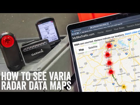
As part of my Garmin Varia RTL515 & RVR315 radar review last week, a few eagle-eyed readers spotted a unique data field within my Garmin Edge device: The ‘Vehicle Count’ field. Except, more meets the eye here than just a simple vehicle count. In fact, that data field is quietly logging not just the count of vehicles, but the exact spots. Atop that, it’s even logging estimated speeds and range/distance of the vehicles.
But all that functionality isn’t some hidden Garmin field you simply couldn’t find. Nope, it’s a Garmin Connect IQ field, and it works with *any* Varia radar and most newer Garmin units. By newer, I mean anything made in the last ~3 years. That limitation is because only those devices support the newer Connect IQ version that in turn supports 3rd party apps accessing Varia Radar data.
Now, I show how it all works in the below super-efficient weekend-sized video:
Or, you can just keep on scrolling for the step by step instructions. Trust me, it’s silly simple.
Oh – and finally, it’s worth noting that this whole app/site is done by just a single guy. He was hit by a car (at high speed, from behind) a few years back and after the incident he was curious how frequent the traffic really was on his presumed low-traffic road. It’s a great example of 3rd party developers being able to do cool $h!t on platforms when companies give them the tools to do it.
Quick Setup & Use:
This part is easy, simply head over to the Connect IQ app store and search for ‘My Bike Radar’ (or, just search for radar, there’s only a few apps, you’ll find it). Or, just click this darn link.

Some devices, like the Fenix 6, aren’t listed for some reason [Update: Now they’re listed as compatible]. Fear not, the developer was kind enough to publish the .PRG file on their site, so you should be able to manually install it there.
Once installed on your device, you’ll need to add it to a data page. Any data page will do, but it has to be loaded somewhere. I just stuck it down on one of the main pages. This is no different than configuring any other metrics/data fields, so go to the same settings field where you would have added cadence fields, heart rate, and so on:

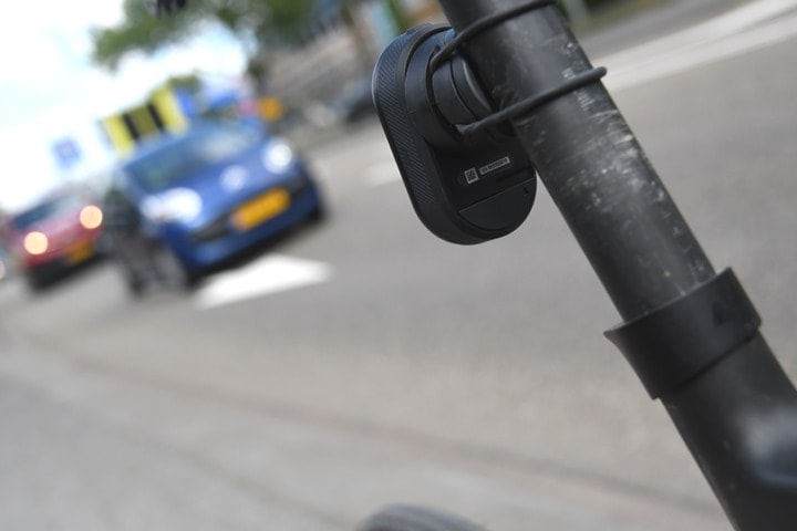
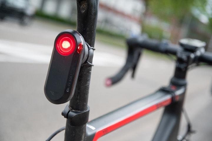
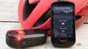
Obviously, I just want to be clear, you need a Garmin Varia radar here. Any radar will do, it doesn’t matter. So as long as you have one of these units, you’re good to go:
RVR315: Smaller Varia radar pod with ANT+ & Bluetooth, no taillight
RTL515: New 3rd gen Varia radar taillight with ANT+ & Bluetooth
RTL516: New 3rd gen Varia radar taillight with ANT+ & Bluetooth [STVZO compliant for German market]
RTL510: 2nd gen Varia radar taillight with ANT+
RTL511: 2nd gen Varia radar taillight with ANT+ [STVZO compliant for German market]
RTL500: 1st gen Varia radar with ANT+ (looks rectangular)
RTL501: 1st gen Varia radar with ANT+ (looks rectangular) [STVZO compliant for German market]
(TDLR: Any Garmin radar)
And of course, probably also obvious, you need that radar turned on and paired up to your Garmin. With that, Now, go out and ride. Really, it’s that simple.
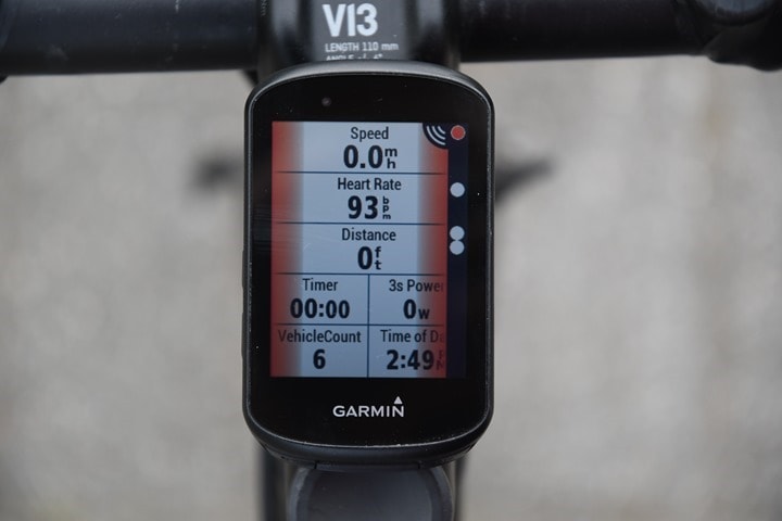
While riding it’ll show you a simple vehicle count. This is how you know the field is working. There is a specific threshold of 30 meters for a vehicle to count, meaning, it as to come within 30 meters of you, or it won’t register the count. That makes sense, and reduces false-positives for vehicles that may have turned off before it got to you. It also reduces overcounting cars that by, slow down out of range, and come back again. It’s not perfect, but it’s pretty darn close.
Inversely, in denser traffic areas with multiple lanes, it likely slightly undercounts cars because a car 2-3 lanes over could potentially hide behind another car. But that’s more of a core Varia radar thing than this app’s issue.
Ok, so good – ride is done. Save the ride and then let’s head inside.
Looking at the data:
What’s cool here is that there’s two levels of data, depending on how much effort you want to put into it. If you just do nothing, the file will sync to Garmin Connect, and within that file is all this extra radar data goodness. On Garmin Connect, you’ll see the exact vehicle count as a chart within your activity:

And, there’s a simple counter as well:

And yes, even in Garmin Connect Mobile on your smartphone too:


But I hear ya, you want the map goodness you see up above. For that, you’ll need to either connect your device to your computer to get the file, or, download the file from Garmin Connect on the web (after opening the activity, select the gear icon at the right, and then choose ‘Export Original’ to get the .FIT file, which is inside a .Zip file).
Once that’s done – head over to MyBikeTraffic.com – which is the site the developer of the Connect IQ app made to plot the data. It’s there you can upload the file and check out the data inside. The site can store multiple data sets. In an ideal world, the developer would connect their CIQ app up to the site and it’d all happen in the background, but for now, this is good enough. Here’s what a file looks like once loaded:

At first you say, it’s just a map? But it’s a map showing every car interaction there is. You can move your mouse over the map to find the cars, or, hit the play button at the top.
And in fact, I can then click on any car and see the details of that radar moment, including an estimated takeover speed. The speed for straight single-lane roads like I was on is likely pretty darn accurate. However, the more lanes you get, or if you have overpasses or such, then the speeds might be impacted by math angles a bit.

In addition to all that, you can see summary stats about your rides:

One thing the app doesn’t account for is grade-separated bike paths, which is because Varia doesn’t account for it. For example in the ride above (shared here), less than 10 of the total vehicles were actually on the same piece of pavement as I was. That’s because the vast majority of the time when a car passed me, I was on dedicated bike paths, and the car was nearby, but separated. Still, if you never ride on dedicated bike paths, it’s super accurate.
I haven’t gotten around to uploading all my rides to the site, but it also has summary stats too:

There’s also some way to upload a video time-lapse (from a VIRB, but perhaps it works on others), and then align it to the data and…something happens. I haven’t dug out a VIRB to see what though yet.

Maybe one of you will give it a whirl and I can add a few details about it. Deal?
Wrap-Up:
Here’s the thing: This is super cool. And it’s now been installed on all my Garmin cycling devices. It’s just gonna be on my ‘baseline’ set of data things I use. Why not?
However, what it really needs is broad platform support. This data field and logging just needs to be baked into every Garmin unit. And perhaps the radar data is already being logged deep inside the .FIT file, I don’t know (nobody has noticed it thus far, if so). But either way – it should be. How cool a concept from a safety standpoint is that, to start logging not just take-over traffic but also take-over speeds.
And there’s zero reason this has to be a Garmin-only thing. It’d be trivial for Hammerhead, Wahoo, and Stages (all of which already support the radar), or now even the RideWithGPS app, to write this data to the field. It’s just the generic ANT+ radar data they already have.
But it’s exactly the sort of thing that I’d like to see Strava start collecting and leveraging. There are tens or hundreds of thousands of Varia radar units out in the world these days quietly riding on roads and are really the ultimate data point on how busy a road is from a traffic standpoint, for cyclists. Why then can’t Strava leverage that in their recently touted upcoming new Route Builder to have an option that says “low car traffic”?
Sure, there’s some data imperfections around highways that might parallel a bike path triggering false positives. But Strava has more than enough data already in their billions of uploads to deal with that. Plus, it’s the perfect beta feature.
With that – go forth and start logging radar data. Here’s to hoping someone uses it!
FOUND THIS POST USEFUL? SUPPORT THE SITE!
Hopefully, you found this post useful. The website is really a labor of love, so please consider becoming a DC RAINMAKER Supporter. This gets you an ad-free experience, and access to our (mostly) bi-monthly behind-the-scenes video series of “Shed Talkin’”.
Support DCRainMaker - Shop on Amazon
Otherwise, perhaps consider using the below link if shopping on Amazon. As an Amazon Associate, I earn from qualifying purchases. It doesn’t cost you anything extra, but your purchases help support this website a lot. It could simply be buying toilet paper, or this pizza oven we use and love.


Thank you for paying attention to the private developers and the user communities! Yesterday your Twitter post about Garmin Index DNS issues helped solve that long-standing problem for me. Today I’m installing this on my never-ride-without-it Varia. Good stuff.
Yup, I love featuring little nuggets from smaller developers.
I’m admittedly kinda random about it. Usually when I feature an app, it’s because it solves a specific problem for me. I had started pondering about this one afternoon, and on a whim figured I’d search Connect IQ first. And sure enough – problem solved!
Yes! Platforms need to get behind this data collection 100%. Cities, planners, and cyclists need to know how cars a behaving on streets. Too bad there isn’t a way to capture rider position in the lane. It would be interesting to see data on how that impacts the behavior of drivers.
That’s the cool part with the “Average Slowdown” stat shown, it actually calculates the speed of the vehicle as it approaches and determines whether the vehicle slowed down at all when it passed you.
In my case, all my roads are pretty low-speed, so I’m probably a bad use-case for that stat. I’d love to see some data from others though!
the slow down intrigues me. my experience is often cars accellerate to pass, as if overtaking another car. if you’re lucky they might slow down as they come up behind you to check/wait for space before booting it past (then realising they’re going way too fast and braking so that you catch up again).
i’d be interested to know exactly where in the catch-pass the slowdown is taken – from first detection or maybe the 30m distance to disapear from radar ie alongside you?
I’ll venture a guess that it is when motorists notice the taillight is reacting to their approach.
neat little feature and simple to install. Going to be interesting to see the data it collects next week (no radar in the woods for me) on my typical loops, even more interesting to see how it peaks with summer approaching in the beach town I live next to. For route planning- the data could probably be used to generate good summer and winter roads based on traffic volume captured by the radars. I
Agree. The more I think about it, teh cooler the data potential becomes. An entity like Strava could even allow you to say: “Oh a Tuesday at 1PM, what’s my least traffic route?”, or, as you said, summer versus winter.
The cool thing is that it really doesn’t take too many users on a given road using this daily to figure out these trends. And then fast forward a year or two down the road, and it’s incredible how much data is gathered.
I was really excited about this until I found that my Edge 520 is not compatible.
Disappointed that the Edge 1000 isn’t supported either
No Fenix 6 support either
I just looked today (June 22nd) and it’s now there :)
Cool stuff, as you said, it would work on Garmin devices from about 3 years old, so it could work on my Garmin Fenix 5X+?
Yup, the Fenix 5X+ is on the supported list. Enjoy!
This is cool. This actually makes me want to buy one now just for the traffic geekery. Love it!
This is utterly brilliant, thanks for posting this and an even bigger thanks to the developer
I know I’ve said this before, but GARMIN:
Please add a radar setting to turn on a rear-facing camera when the radar detects a car, then turn off/pause/sleep/etc. the camera recording after the car has passed!
You already have all the parts (radar/head units/camera), just put it together! You can do this!
It wouldn’t even need Garmin to do it. Any bike camera manufacturer could integrate that feature by implementing a connection to Varia and recording depending on the traffic data from the Varia.
Could be nice Kickstarter project.
Or (don’t know if possible) if there are bike cameras with some sort of (Bluetooth) API you could build some sort of in the middle app receiving the Varia data and controlling the camera.
Could remote start of a camera be done as an IQ app for any camera that supports the ANT+ Ctrl profile? If car approaching, tun on VIRB camera for preset time period or until car exits radar. Getting the estimated approach speed as a data field in the VIRB software would also be an interesting addition.
Hi John, very interesting concept in theory. However just a note that when I have submitted footage of close passes to the police in the past, they always ask for 2 mins before and 2 mins after the incident. This might not be the same in every country
I would pay for this, especially if everything was integrated: passing speed, distance, video. And I would buy new devices to make it work (I currently still use a Garmin 920xt for rides and a crib sheet if it is a new route, and do not have a camera.)
I havea 735xt and it doenst like like it works? Or at least iq store won’t let me dowoad?
I would be really interested to see someone like Strava (or Garmin) incorporate data like this into their heatmap routing algorithm. There are some roads that are frequented by many cyclists but are still not ideal because of the frequency and speed of the cars that also use it, having the ability to optimizing routing for “low car traffic roads” would be really really helpful
Love it! Just installed it and will be curious to see the data. I love when people based on their experience come up with this ideas! Thanks for posting!
This is REALLY cool. We need to send him some donations. At least so he can get a new EDGE. Can’t have him ride with a broken screen. Actually Garmin ought to send him one!
This really should be utilized by routing software- both Strava and Garmin want to put me on relatively major roads; perhaps knowing there is a constant stream of cars passing would exclude those roads
Hi,
That was really interesting. Is retrospective data stored on my Varia?The last time I was out with my Varia / Wahoo I was hit from behind by a truck and had serious chest/head injuries.
Do you think anything helpful would have been stored in my Varia or my Wahoo ?
Peter R
Any possibility for the Varia to register how close a car is passing?
The VA4 isn’t listed as supported (the VA3 is), but I was able to side load the file and set up the data field. Will check it out on my next ride!
So, I have it set up (and the developer has added official support for the VA4), but I think there is a bug in the VA4 – with the radar connected the data field isn’t displaying the vehicle count, but it does show the count when uploaded to Garmin Connect and when the file is uploaded to Brian’s site. I’ve told Brian about this and sent him the relevant fit file so he can investigate. I think it’s a VA4 bug because the other CIQ field that I have installed – Garmin’s Estimated Body Temperature field – also doesn’t display any data, but is is displayed in Garmin Connect.
Is anyone else experiencing similar (non-)behaviour? Thanks.
I installed it today on an edge 1030, coupled with a varia 510. Buggy as hell.
The edge beeps every 30s or so to say that the radar has disconnected (which didn’t).
After uploading the .fit ont the website, I’m welcome with half a page of php errors/warnings.
On the map, the cars speed is completely unrealistic; sth between 11km/h and 22km/h, while they passed me by way over 80km/h. (yes, I chose metrics..)
I don’t know if the developper is currently doing update or tweaks, but right now, it’s not usable.
But that is a really nice addition, which requires more love and work.
I’m with reply #27 Myriam… didn’t have any issue with my Garmin, but uploading I’ve got PHP errors (Object of class stdClass could not be converted to int), also the car speeds mostly don’t work, some appear to be good (maybe 5%) the rest garbage, a lot of the speeds seem to be between 11kph and 22kph, one section of my ride is on a fast bit of road, it is straight and nothing does below 50kph on it, I know a couple of cars passed me yet it says it was doing 11kph…
I am not writing on this forum to complain or moan, it is feedback for the developer as there doesn’t appear to be a link on his website to send issues… I am more than happy Ray for you to pass my contact details onto him/her so I can let them know my account details and my ride so they can debug further, I really like the tool and the concept, I also read there story on the website, the crash sounds horrific.
You can contact the developer via the app’s ConnectIQ store page.
Just to follow up, via the Connect IQ page I asked the developer (Brian Toone) about native support for the VA4. He fixed it and responded within a few hours.
I have exactly same issue, half of page PHP errors. I can see map with passing cars, but speed is not real, there are just random speed values 11,22,43,54kph. Have Edge1030 and 1st gen of Varia Radar.
Нахуя это нужно? )))
Ray, a new Edge 10xx soon?
Even if he knew he wouldn’t be able to tell us. However, there are rumors on various sites of a 1030-plus some time this year. That’s all I’ve seen – I know nothing more.
Sooooon
I can’t wait to try this out but first I need to be the dumb guy who can’t find the “vehicle count” data field to add to display … anyone have a hint in which of Garmin’s inscrutable data field categories this might be found?
It’s in the Connect IQ Fields group (at least it is on my VA4).
If the newer had a camera like a Cycliq it would be the perfect product
<>
I bet it’s not. Otherwise, the operator of the MyBikeTraffic.com wouldn’t have had to write its own IQ DataField to grab the radar data.
This is the complete comment I wanted to post:
”
And perhaps the radar data is already being logged deep inside the .FIT file, I don’t know (nobody has noticed it thus far, if so). But either way
”
I bet it’s not. Otherwise, the operator of the MyBikeTraffic.com wouldn’t have had to write its own IQ DataField to grab the radar data.
Maybe, maybe not. The trick with .FIT file data is that it could be there, but unless you know how to decode it – you’ll never see it.
For example, Garmin stores all sorts of fun Vector 3 data in there, things like exact time since batteries were replaced, how many hours the pedals have been used, and so on. No app that I’m aware of knows how to decode it. There’s also fun things like backlight settings in the .FIT files (so support can tell you to turn down your backlight after you complain your Garmin died in 2 hours), and so on.
In the FIT files we’ve inspected with the varia device there is no new “unexplained” data that appears. So it’s a very strong hint that the data isn’t stored, and must be written by a CIQ app like this.
The CIQ API offers 4 fields for each radar target
– speed (meters per second)
– distance (meters)
– threat level (None | Approaching | Approaching Fast)
– threat side (Left | Right | None)
link to developer.garmin.com
The IQ app is adding the data to the FIT file as a custom item. The source for the app is up on github link to github.com
I will look to add the writing of the same stuff into IpBike so it will save a FIT file compatible with MyBikeTraffic.com. I don’t record the data for all the radar targets but I have the total count and the speed and distance for at least the nearest one recorded in the IpBike internal file format.
I was hoping for:
– RTL600 model with VIRB snapshot cam built in
– TraceTrap option: captures videos of offenders who drive by too fast and/or too close (include proximity chip if radar alone can’t track this); city-mode automatically de-sensitizes this function.
When you sync your ride later any TraceTrap data for offenders is uploaded to a public safety site listing location, speed data, and a snapshot showing vehicle with license plate (no need for full video segment but you could link to it if downloaded).
The site would be used to identify offenders and rank which roads are more dangerous. Law enforcement would be encouraged to monitor the site (API provided). Depending on local laws offenders could receive automatic tickets/fines by mail tied to license plate numbers. Repeat offenders would get jail time. :)
Driver’s Ed classes would include a warning that any cyclist with a red taillight could be tracking your driving behavior and report offenses to your local law enforcement and DMV.
IOW every cyclist on the road could be a potential radar trap. Driver beware.
Perhaps then “Share the road” would actually work. :)
The raw sensor data recorded by this CIQ app is also displayed in SportTracks – just like every other CIQ field.
You can overlay multiple sensor charts, show the map position, and color the map trace according to any sensor data value range – it looks like any other data sensor stream. ?
If multiple radar targets are tracked at a single sensor sample we’ll show the average speed and distance of active targets at that moment.
Hi,
Just tried it today with my Edge 820 (used with old RTL510 radar version)
Works fine ! Great app
But just don’t understand the “Radar speed” data and i did’nt find any explanation on the website
Rider speed is clearly matching with my current speed at time being.
Do we have to add radar speed and rider speed to know the exact speed of the car ?
The speed is coming straight from the varia radar sensor source.
According to the documentation for this:
Indicates the speed of the target in metres per second (m/s).
From data I have observed, it appears that both the speed and distance increases and peaks when a vehicle passes. This is…. strange.
I don’t own a Varia (doesn’t fit my needs), but support for stuff like this is exactly what I would pay extra for Strava for. Hell, I’d even send the developer a few bucks if I used the app (and when I eventually get a varia I’ll 100% get the app and give the developer some $$$), but, again, THIS IS SOMETHING GARMIN OR STRAVA SHOULD DO THEMSELVES (or now that this developer has done it they should buy it off him).
The count is inaccurate. It counted multiple cars where no one passed me. It seems to count 2 x or more the actual number of cars!
I was so excited to add this field only to find my Garmin 1000 too old to be supported. Any word from Wahoo as to plans to incorporate this? Looking for another reason to switch… Thanks for the review!!!
Doesn’t seem to show the ConnectIQ data if you choose MTB rather than cycling. I added the field and it actually collected the data as I was able to import the FIT file to MyBikeTraffic.com. However the data doesn’t show up in Connect either on the phone or on the web. Strange.
Works for me. I had a vehicle count of 172 on the road on Sunday and 5 in the mountains yesterday: link to connect.garmin.com
Another great tech review.
Is there a setting to turn the tail light on (bright?) as car approaches? Can it turn on all lights in the ANT+ light system?
Varia already does that. Changes the flash pattern as well.
That is what I thought.
But not mentioned in this review nor is it mentioned on garments description of the product.
Was hoping this feature had not been removed.
This is actionable data, both for routing and enforcement. Considering how poorly strava has used anything except segment time data over the last umpteen years, I’m skeptical they’ll do anything with this. RWGPS could integrate this and eat strava’s lunch.
I’ve seen one of these gen 1 in action and it was pretty neat and accurate. I’m really interested if they could fuse this product with the cam recorders for a 3 function, bike cam, tail light, and radar..
I’m both happy and sad to see this: happy because it’s great, and sad because I sold my RTL511 because I couldn’t derive any benefit from it, because (as always) Garmin make great hardware and then do a real Friday-afternoon job on the software. Basically, I sold it because it didn’t do this.
I’ve got space on a bike for either a Varia or a Fly6. Neither is going to prevent me being hit from behind from some moron who isn’t paying attention, but here’s the crucial difference: the Fly6 records evidence. If I, or my family, ever need evidence for an insurance claim and/or a criminal conviction then only the Fly6 is of any use. Except… maybe the Varia is. Maybe it’s logging it after all. It’s just that Garmin didn’t think it was worthwhile.
If there’s radar data that shows multiple samples of each approaching vehicle, allowing calculation of not only how fast that vehicle was travelling but whether its speed was increasing, decreasing or constant, then that’s useful evidence—in fact potentially even more useful than the harder-to-measure images captured by a rear-facing camera. (What’s more, that rate of change in speed is a useful thing to report to me as the vehicle approaches: if I know it’s slowing on approach then I can be more confident I’ve at least been seen; if it’s constant then perhaps I should look back to check the driver’s not staring at a phone…)
That’s the thing that baffled me with the Varia: it’s decent technology, but Garmin totally failed to see its potential and exploit the information it’s capable of generating.
Just in case you were not aware, the dev has now managed to incorporate the speed so that it shows within Garmin Connect app / website rather than having to import to his site to analyse this. Much impressed. Thanks, Ray, for highlighting this app and many thanks to the Dev.
Does the data field need to be active/used in order for the data to be collected? I would be curious to see the data after my ride but don’t really care to look at the datafiled while I’m riding
It needs to be installed on your device and added as a data field on one of the activity data screens.
Can anyone explain why there would be a vehicle count discrepancy between Garmin Connect and MyBikeTraffic.com? On my first ride with the app, Garmin Connect showed a vehicle count of 38 while MyBikeTraffic.com showed a vehicle count of 32. Does the higher Garmin Connect count include vehicles detected by the radar but turned off before passing while the MyBikeTraffic.com count doesn’t?
I have the same thing, well at least with one ride (I’ve just started using MyBikeTraffic.com) that I have just uploaded.
But the difference in my case is pretty huge, 305 on GC vs 228 on MBT. Now that’s a lot!
Hi, Excellent work- I’ve been trying with my Varia 515 and Edge 520+ (I mainly use a Montana 610 but of course that is (sadly) incompatible with the Varia . I’ve uploaded some longer rides to see how your app and website works. Just a couple of questions when you have the time.
1. Does the field have to be displaying for the vehicle count to be recorded? (I’ve noticed some rides don’t ahve the data although everything else seemed normal (I’ve removed/reinstalled the app to see if that helped.)
2.Can the relative speed be displayed on the Edge or is this only after upload to the Garmin site?
John
Note, this is not Ray’s data field, it was developed by Brian Toone.
1. No, it doesn’t have to be actively displayed, but it must be set up as a data field on a page of the profile that you are using. If you use more than one profile, it must be set up on each profile.
2. When you have installed the field, you can change its settings via the Connect app and relative speed is one of the display settings.
Mora details at Brian’s website: link to mybiketraffic.com
Thanks for the help- I’ve done as you suggested and need to get out for a ride to see what it records.
It ate the battery of my 130. How do the batteries of other garmin’s fair ?
I used it on my 1030 Plus for a century ride last September and the battery lasted fine. Also had it on my VA4 for the same ride and it lasted the whole ride too — 7 hours 5 mins elapsed time.
Thanks, its maybe my 130 that’s failing then (I only use it for sub hour TTs now and it’s ok for that). If I ever replace my 1000, I’ll try again as it’s rather quite cool 👍
Question and maybe this is been addressed elsewhere but I just got the 515 – I connected to my 830 head unit and then the sensors I see the light and the radar in the sensors, the question is I live in New York City and I try to use the light in the city and the radar and the light outside the city but every time I turn the radar off the light turns off? What am I missing, thanks! Probably sick of this question!
I think if you want the light without the radar function then the simplest way to achieve that would be to deselect the radar on the GPS then just turn the light on via the 515’s own switch (in whatever mode you want) The light functionality from the GPS seems only to work along with the radar.
Add me to the list of “I thought this was cool until the data was so bad it wasn’t useful” people
I’m a GIS analyst and was going to use this to match traffic data to road centerlines and create a cars/mile metric for the road segments for the whole county, but when it give you 4 cars where there was only 1 and 0 cars when there were 2, that doesn’t make it too useful unless it somehow averages with large datasets over long periods of time.
I was going to contact the developer to see if he could share the point data (without the routes) for my county and built up a county wide map based on this “real” traffic data, input from personal knowledge, and other local cyclists to build a true ‘best roads for cycling’ in the county, but it’ll have to be put on hold until I see some improvement in the data.
Access to this data was even one of the reasons I bought the Varia to begin with, of course it wasn’t the only reason but it’s too bad this doesn’t do a better job. It may not be the developer, it might be a limit of the hardware/firmware.
Ultimately, the data is limited by what Varia sees. If Varia doesn’t see a car because it’s hidden behind other cars, it’s not going to record the data.
In some ways, it’s doesn’t actually matter a ton at the cyclist level, as the only thing you mostly care about is the car directly behind you or directly trying to pass you. So whether that’s the same car or not, doesn’t really change the math from a cycling annoyance standpoint.
That’s the rub though. The radar counted one car according to the data field, but the website shows 4 and then also counted 2 but the website shows 0. I continue to use it because maybe over time the numbers will even out with a large sample size
Thanks for doing this review and explanation. In the specs for the Varia I didn’t read how to use the data. Without being able to the use the data this feels more like an expensive rear bike light. If something should happen on the road this radar data collection could be very helpful for insurance purposes.
Old post but first hit on Google. Know of any way to pull this data direct from the Varia and/or parse the wahoo data if not using a Garmin watch/head unit (i.e. Wahoo Elemnt)?
I’m looking for this too. Is there any way to pull the Ant+ data directly from the Varia Radar into a computer with Bluetooth, without another Garmin watch or edge computer in the loop?
I tried looking for the Varia device in the list of Bluetooth devices on my phone and PC when it’s in pairing mode. Unfortunately, it’s only visible in the Varia app on my phone.
Maybe I missed it here, but the mybiketraffic website now has function where (if selected) it will automatically upload rides from Garmin connect. You don’t need to manually download and upload rides as the article says. Also it will automatically feed data (regarding vehicles) to strava. (Or so I think, I haven’t ridden after enabling this function.)
Getting the app to work on my Garmin 540 was a long slow PIA, but everything on the 540 is a long slow PIA. For a low budget site, working through mybikeride website was remarkably easy.
Great article,
Having been hit from behind at speed on a roundabout by a 4×4, three weeks ago. Do you know if it is possible to retrieve the speed of the vehicle that hit me?
Or can this only be used having now installed the device to a data page?
You have to have it installed already, there will be no record of the radar data on your ride without having it installed first to write to the device
Thank you for the quick reply.
That’s a shame.
For those without a Garmin, the Cadence app now supports uploading to MyBikeTraffic.com and shows similar radar metrics in-app (link to getcadence.app). It also records and uploads data from other radars like the ones from Bryton, Giant, and Magicshine. [I’m the developer]