
Suunto has finally delivered. With the new Suunto Vertical, the company appears to be heading down the right track towards having a more competitive hardware offering. The new Suunto Vertical GPS watch might appear from across the room as just a larger Suunto watch, but in reality it’s significantly revamped inside. To begin, it’s now got fully offline mapping – downloadable via WiFi (yup, it has WiFi too now) for anywhere in the world. Around the outside edge you’ll notice the solar charging, giving you even more battery life. In fact, so much battery life it exceeds their rivals in virtually every category – even with full recording rates. Speaking of which, you’ll also find new dual-frequency GPS/GNSS satellite connectivity, finally matching what their competitors have offered for higher GPS accuracy.
Of course, there’s also a slate of smaller things too, like a flashlight mode (via the display), or the now every-second 24×7 HR recording rate. And everything else that was there before continues to be there. That includes their underwater snorkel/shallow diving support/tracking, and even a so-called mermaid mode. But we’ll get into all that later.
As usual, I’ve been putting the Suunto Vertical through its paces. This includes swims, bikes, runs – even hiking all the way up an 8,000ft mountain nonstop from the sea. All in the pursuit of seeing what works well…and what still needs a bit more love and development.
Finally, note that Suunto sent over a media loaner to test out. As usual, this review is not sponsored (nor does any company get to preview anything I review), and I don’t take any advertiser money from any companies I review. Once this unit goes back, I’ll go out and buy my own for any future testing needs. If you found this review useful, you can use the links at the bottom, or consider becoming a DCR Supporter, which makes the site ad-free, while also getting access to a mostly weekly video series behind the scenes of the DCR Cave. And, of course, it makes you awesome.
What’s New:
The Suunto Vertical is essentially the next version of the Suunto 9 Peak Pro, except now with a new name. That’s a good thing in my opinion, as the naming variations on the numerical Suunto 9 scheme were just becoming overly complex (Suunto 9, Suunto 9 Baro, Suunto 9 Peak, Suunto 9 Peak Pro) – with no clear ‘winner’ or differentiation to most people.
The new Suunto Vertical line has just two core choices: Solar (with titanium), or no Solar (with stainless steel). Plus your choice from a slate of bands. There are no longer different case colors, rather, just the bands.
So, let’s dive into everything that’s new compared to the existing/previous Suunto 9 Peak Pro:
– Added offline shaded topographic maps, with three map types (Outdoor/High Contrast/Dark)
– Added WiFi for downloading maps, by country & region, free of charge
– Increased onboard storage to 32GB (roughly enough to hold all of Europe on it)
– Increased size of touchscreen from 1.2” to 1.4” (compared to Suunto 9 Peak Pro)
– Increased resolution from 240×240 to 280×280 (compared to Suunto 9 Peak Pro)
– Added Solar charging for the Solar/Titanium models
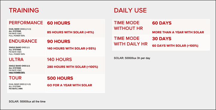
– Increased battery times substantially (see chart below)
– Added dual-frequency/multiband GNSS/GPS chipset & corresponding antenna
– Added new GPS recording rate mode: Low (in addition to Best, Good, OK)
– Added truly continuous 24×7 heart rate monitoring (previous was every 10 minutes)
– Added new on-device weather pages, including forecast, air quality, observations
– Added Strava Live Segments on-device (for Strava paid users)
– Added screen-based flashlight option
– Added new charging screen when charging, or map downloading screen when on charger
– Increased to two sport apps concurrently (3rd party/etc apps, note that guides are different than apps and cannot be concurrently combined)
– Military spec durability tests by 3rd party lab
– Watch is made in Finland with 100% renewable energy
– Watch is fully carbon-compensated for the entire life cycle of watch & future usage/charging, by planting trees on behalf of each watch
– Existing Suunto 9 Peak 22mm series straps/bands compatible with new Suunto Vertical
Pricing is as follows:
– Suunto Vertical base/Stainless steel: $629USD/599EUR/£560/$849CAD
– Suunto Vertical Solar/Titanium: $839USD/799EUR/£735/$1,099CAD
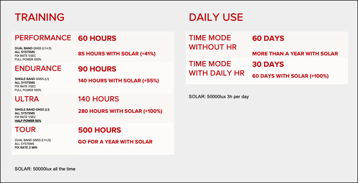
Then we’ve got the battery chart, showing massive battery gains:
And a few general spec things:
– Watch diameter: 49mm (Suunto 9 Peak Pro was 43mm, and Suunto 9 Baro was 50mm)
– Watch thickness: 13.6mm (Suunto 9 Peak Pro was 10.8mm, and Suunto 9 Baro was 15.5mm)
– Glass material: Sapphire crystal
– Case material: Glass fiber reinforced polyamide (aka: plastic)
– Strap material: Silicone
– Weight: Titanium is 74g (56g for case), and stainless steel is 86g (69g for case)
– Water resistance: 100m
Finally, the Suunto Vertical goes on sale from today, and will start shipping next Tuesday, May 16th, 2023.
In The Box:
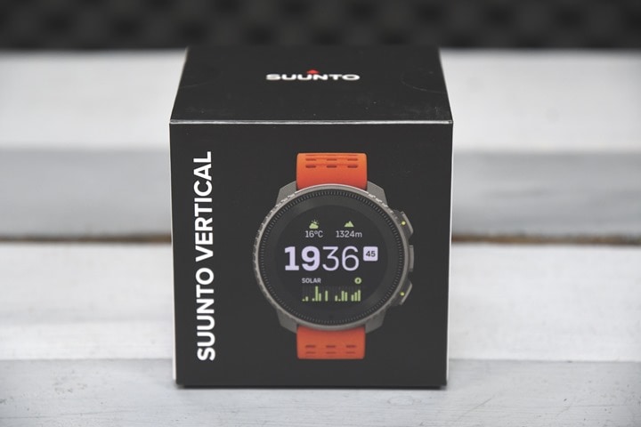
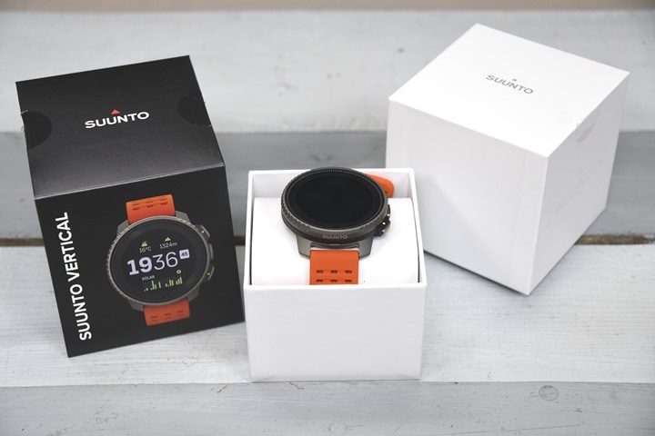
First up, cracking open the box. In this case, this is the solar edition:
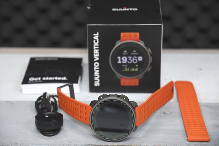
Inside you’ll find the watch, and extra/longer strap, the USB-C charging dock, and a large pile of paper stuff you’ll likely never read:
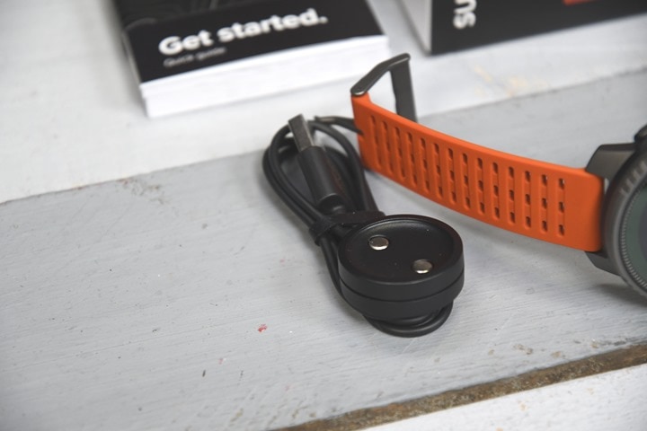
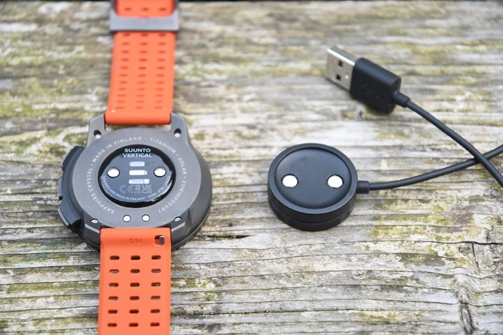
Here’s a closer look at the magnetic USB charging cable, the same one used on other recent Suunto 9 Peak series units:
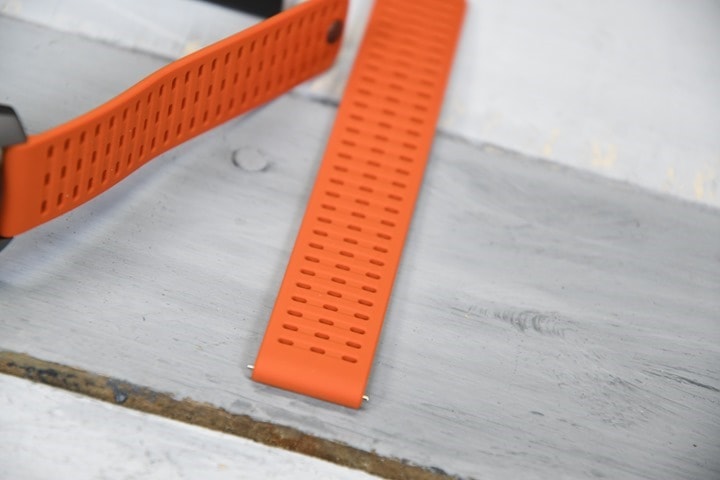
And the extra strap. It’s the same as the primary strap, except longer. Specifically, when I measured the two straps (an imperfect science since it’s including the body of watch and not perfectly flat) – the length of the S/M strapped with watch is approx 230mm, and with the M/L strap, it’s approx 265mm (both of these are measured orange end to orange end, without including the buckle). My wrist is 195mm (ish), and on the small strap I have gazillions of length left.
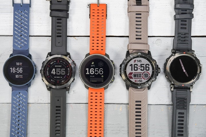
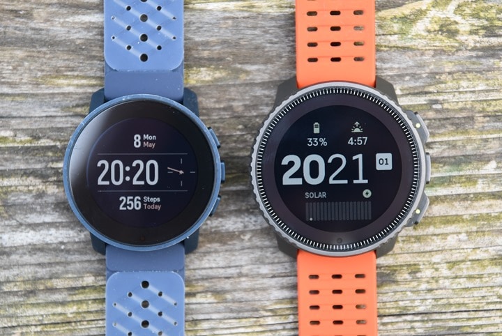
Looking at size comparisons, here’s that too – left to right: Suunto 9 Peak Pro, Fenix 7 Solar, Suunto Vertical Solar, COROS Vertix 2, Amazfit T-Rex Ultra:
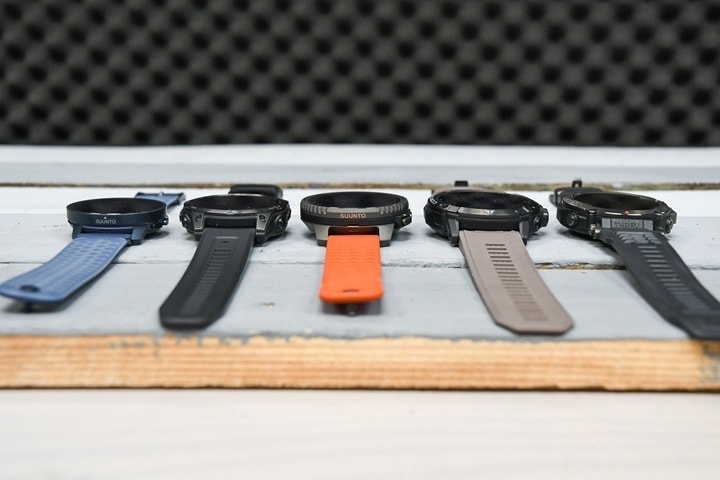
And the same set of watches from a side profile:
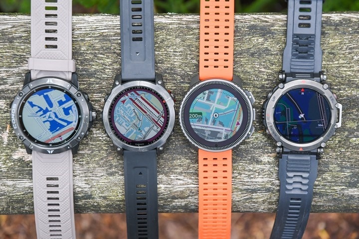
Finally, for lack of anywhere else to stick it, here’s a quick comparison of four watches on the map pages, in terms of screen visibility and functionality (note the street/etc names on the Fenix 7 map). Left to right: COROS Vertix 2, Fenix 7, Suunto Vertical, Amazfit T-Rex Ultra
With that, let’s get into usage details!
The Basics:

This first section of the review is all about the basic day-to-day usage of the watch. For the most part, if you’re an existing Suunto user, you’ll find this all pretty much the same as the Suunto 9 series. However, there has been some re-arranging of a few areas and slight updating of the user interface in a handful of spots – but ultimately, it’ll be very familiar to existing Suunto users. But again, this section covers things like activity tracking, sleep tracking, the new flashlight feature, and more.
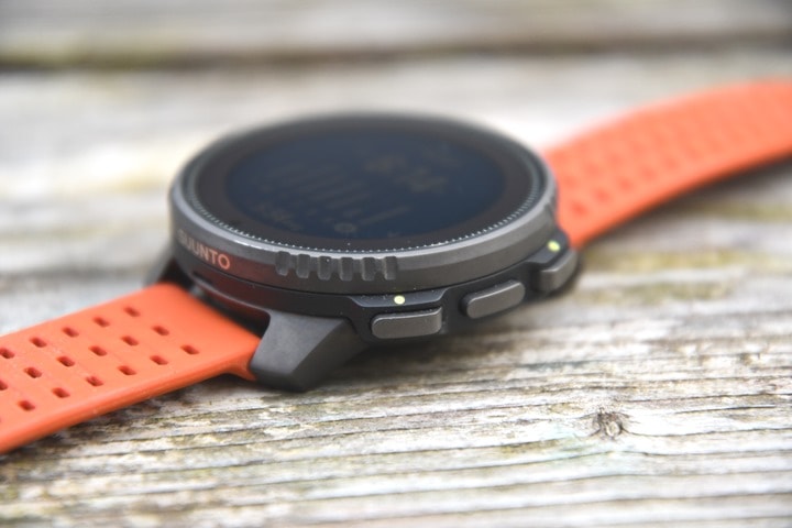
To begin, the watch has three buttons on the right side, along with the touchscreen for interaction. You can use either buttons or touch in most cases, though I tended to use buttons for most things (it’s usually just quicker for me). From a button layout perspective, the upper button generally moves the menu up, the lower button down, and the middle button selects. You can also long-hold the middle button to get back to the watch face in almost all areas (except the Map app).
As I said in my Suunto 9 Peak Pro review, while I know Suunto has long had the three-button design on their touchscreen watches, I actually prefer the 5-button layout on the Suunto 5 Peak (non-touch), primarily for the back/escape feature. It’s just a lot faster than a side swipe or long-holding. I do think the trend here is going to having usability parity between touch and buttons for sports-focused watches. So maybe down the road…but hey, that’s a minor request.
On the touchscreen usability, it’s been fine. I’ve had the ‘pleasure’ of rainy workouts, even a bit of snow, and it wasn’t an issue using it or the maps with it. Nor any problems with tons of sweat. My singular complaint in this usage area is that the user interface still feels laggy and slow, as with past Suunto watches. You can see this in my videos up above, and it is really only noticeable when trying to move quickly through menus.
In any case, the buttons on the Suunto Vertical feel just fine, but don’t have the audible ‘click’ of the Suunto 9 Peak Pro. I actually liked the click, but certainly understand not all people do. To each their own.
I do really like the case design of the Suunto Vertical though. They nailed it – especially the etching around the top. For those that like a bigger watch, this feels big, without feeling ‘chunky’ (such as some of the older Suunto units did). It strikes a good balance between the ‘thinner’ Suunto 9 Peak/Peak Pro units, and the original Suunto 9 units.
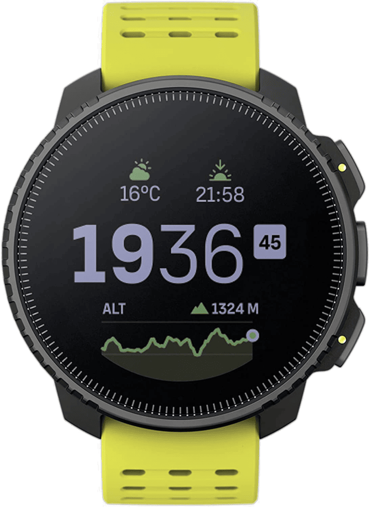
You can see the solar panel around the new larger display, but we’ll talk about that later on. The new larger display is definitely more readable than those in the past. The new display is perfectly readable in both bright sunny and indoor dark conditions. Suunto says this is actually due to a number of changes:
1) They swapped out the display itself to a much newer and “next gen” MIP display from the same provider/supplier
2) They added an additional LED to light up the display better in dark environments
3) This also helps to saturate the colors better, getting rid of that half-dim look of the previous Suunto units
4) They also adjusted the default backlight brightness, changed the fonts, and colors to improve readability
Suunto says the software-focused changes (fonts/colors), they’re also aiming to backport to earlier Suunto devices, hopefully improving the readability of those units too.
Further helping matters based on my testing, is the wrist-detection for backlight illumination in the dark is virtually instant, even with trivial moves like twisting my wrist while typing this on my keyboard. Here’s the Suunto 9 Peak Pro (left) compared to Suunto Vertical (right):
It seems like Suunto has listened to the feedback here on how dim and unreadable their display was on the previous units (such as the Suunto 9 Peak Pro). At no point during my testing of the Suunto Vertical did I have any display visibility complaints. Thus, woot!
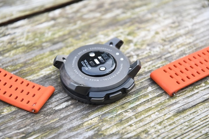
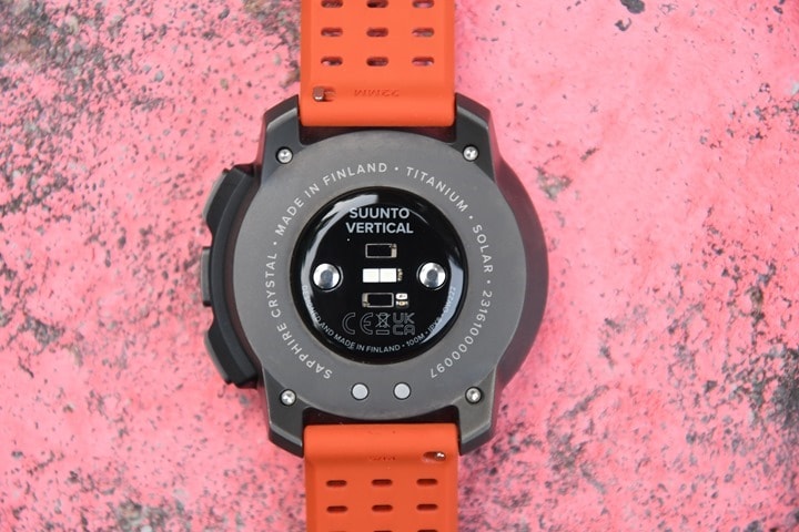
On the backside of the unit you’ll find the optical heart rate sensor and charging port, which magnetically aligns to the charging cable.
You’ve also got the removable straps, which are standard 22mm strap sizes. So you can continue to use 3rd party straps (standard 22mm ones), or previous Suunto 22mm straps as well.
The optical heart rate sensor is still the same as the Suunto 9 Peak Pro, which was a new sensor last fall from LifeQ. However, with the Suunto Vertical, that sensor is now used for truly 24×7 optical heart rate readings, every second. Versus previously it was roughly once every 10 minutes. At present however, the data in the Suunto App itself is still showing in 10-minute blocks, but under the covers it’s averaging that entire timespan of data now. Suunto says they’re working to update the app graphs to show the higher data rates.
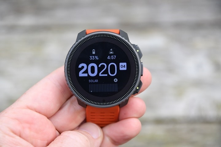
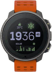
However, we’ve gotten ahead of ourselves. First up is the watch face. This features a new watch face (one unique for the Solar edition, and one for the base steel edition):
You can iterate between a few different watch faces. Additionally, you can tap to change the metrics displayed on the upper two data components, if you want to see something else – for example showing battery time instead of temperature, etc…
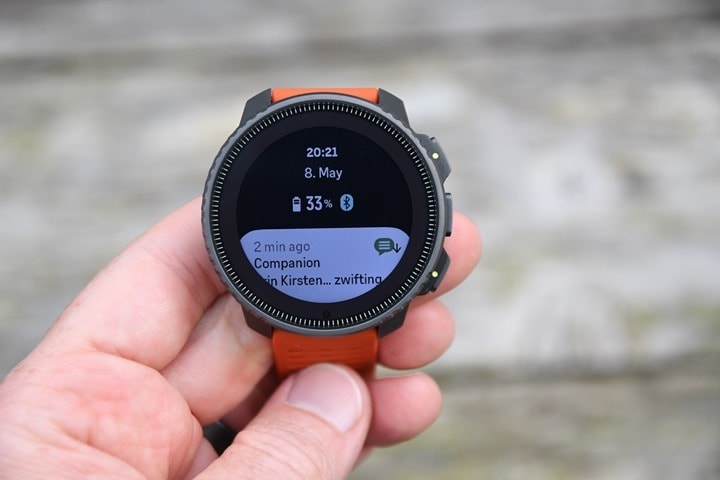
Next, if you swipe to the right (or press the middle button), you’ll iterate through a series of widgets. The first is missed smartphone notifications, along with the date/time/battery/Bluetooth status:
You can then continue to swipe through additional ones, including heart rate, Blood Oxygen, Sleep, Training, Steps, and so forth. However, what’s unique here is that these can now be customized to turn on/off, if you don’t want some of them shown. For example, if you never use the SpO2 (Blood Oxygen) one, you can just turn it off, so you don’t have to waste time swiping through it.
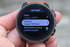
For example, here’s the steps (activity) one. At the high level, we see the steps and calories for today, but then I can swipe/press down to see the last 7 days of steps, the average calories for the last 7 days, along with the ability to customize settings for that widget:
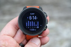
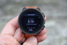
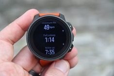
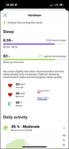
The same general concept applies to sleep as well. First, last night’s sleep hours, along with the 7-day chart. However, down below you’ll find the exact details of last night’s sleep.
I’ve had pretty good luck with it correctly hitting the sleep start/end times, even when going back to sleep close to waking up for the morning (e.g., hitting the snooze button a bunch).
All of this information is also synced to the Suunto App for access later on:
In addition to the widget for sleep, you’ll also get a ‘Good Morning’ type message each morning when you wake up. This will show your sleep stats for last night. I appreciate that Suunto made some tweaks here for this Good Morning page to stay up longer. With some previous units/firmware versions it’d go away the first time you even thought about opening your eyes, and you’d never actually get to see it before it disappeared. However, now it seems to hang around for a while until you touch/interact/dismiss it.
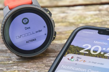
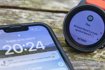
In addition to the widgets, as noted above, you’ll get smartphone notifications when connected to your smartphone. As with before, these work fine, and you can open them or dismiss them, but there isn’t great emoji support (or, seemingly any) – with it missing emojis that enumerate correctly on both Garmin and Apple Watch units. On the Suunto they are just empty squares. Here’s two text examples (with the actual message shown too):
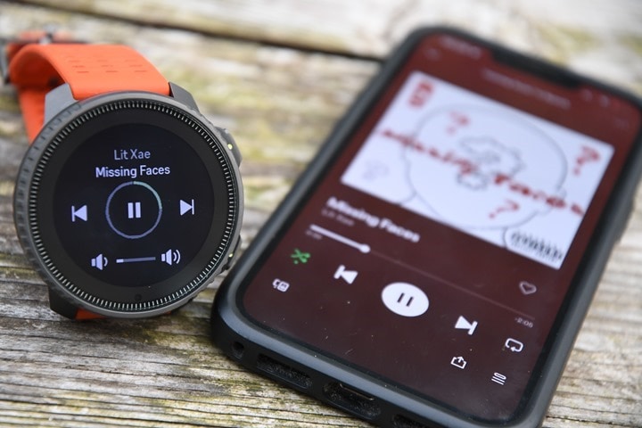
Further, while there is music control, there’s no music storage/playback on the watch. Instead, it’s purely for controlling music sources on the phone.
I asked Suunto whether or not that 32GB could eventually be used for basic MP3 playback via Bluetooth, and they simply confirmed that the Bluetooth chipset inside is capable music playback. Of course, whether or not they go that direction is anyone’s guess. And to be honest, I’d guess that 90-95% of buyers in 2023 don’t really want MP3 playback. They want streaming services like Spotify/etc (something that business-wise, there’s no chance Suunto would be able to achieve/unlock), so time/effort spent on MP3 playback would likely be far better spent on other sports-focused features.
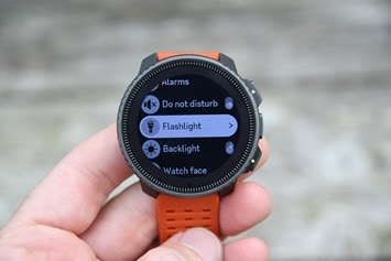
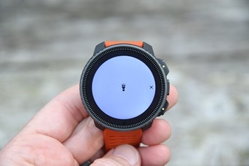
So – what about that flashlight? Well, there’s no physical LED flashlight in the Suunto Vertical. However, there is now a dedicated flashlight feature in the menu, which turns the screen to bright white. To access it, you’ll press down 8 times, then press again the center button, to confirm. A second or so later, it’ll illuminate:
Once turned on, it’ll easily illuminate a dark room, or stairwell. There’s no problem at all with that – even though this photo doesn’t do it justice, cause taking photos at night is mostly a fruitless endeavor.
My only problem is pressing a button 9 times and the annoyance associated with that. With other watches, activating the flashlight is either a simple double-tap, or a long-hold for 1-second. At present, while well-meaning, I’d say the feature is unusable with all the buttons required. Not to mention that it automatically turns off after 30 seconds. Why?!? Huh?
This would all be easily resolved with a long-hold of perhaps the lower right button, and then just stay-on. Nobody is not-noticing the bright white blowtorch of illumination coming from their wrist and forgetting to turn it off.
Still, it sounds like Suunto is very open to that feedback, and this would be a relatively trivial change. Thus if so, it makes the flashlight function super useful.
Sports Usage:
If you’re buying a Suunto Vertical, it’s almost certainly to use for sports recording. The Suunto Vertical supports a flotilla of sport modes, which you can also customize to varying degrees.
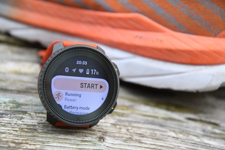
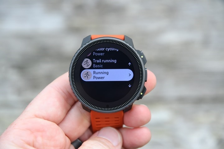
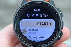
To begin a sport recording, you’ll tap the upper right button. This will bring you to the sport listing, and notably, the most recent sport profile you used. You can iterate up/down in this list to find the exact sport you want:
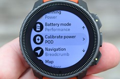
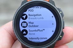
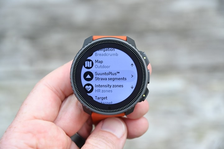
Once you select that sport mode (running in this case), you’ll see further options. These include the battery settings/mode, whether you want to add navigation (such as a route), or which map type you want (more on that in the mapping section). Additionally, you can also add in SuuntoPlus apps or guides, as well as select an intensity zone or target for the activity. All of this is essentially the same as in the past.
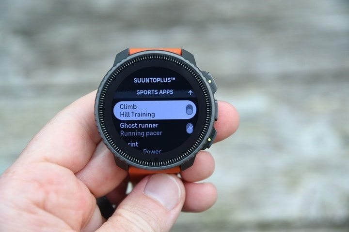
SuuntoPlus Apps/Guides are small 3rd party apps that can add data fields/pages to your workout.
The one minor notable difference here is that you can now select either two ‘Suunto Apps’ concurrently, or a guide. But not one of each. Also notable is that Strava Segments has finally launched, albeit as a Suunto Guide, which makes it a bit less ideal since it takes up one of those slots and isn’t just always-on like other units.
If you want to do a structured workout, you can create a Suunto Guide for that from within the Suunto app. This is where you arrive at the blend of ‘cool’ and ‘annoying’. It’s cool that Suunto has this relatively standard feature, but because it’s in the form of a Suunto Guide (versus native, like every other watch), it takes up the ‘slot’ and is more cumbersome to use. Meaning you can’t do a structured workout plus another Suunto Guide. As I’ve said the last few Suunto reviews, Suunto really needs to bake-in the structured workout feature (and frankly, almost all the other Suunto Guides/apps they’ve created, as just normal data pages/fields to add – like their competitors).
In terms of the new audio alerts, those come from your phone – either the speaker or Bluetooth-connected headphones. The alerts trigger upon each lap, and will first announce the lap #, followed by lap time, followed by lap average HR, and then finally the total duration. I used it with my phone (I don’t tend to wear headphones on the regular during workouts), and could hear the announcements as long as my phone volume was up.
Anyways, once you’ve selected all your settings, off you go on your workout. You’ll see your data pages automatically, and can tap to iterate through them:
You can see the one Suunto App I’ve got in here, the Hill Climb one, plus some pages using/showing route data (like the elevation profile and map):
Handily, running power is built-in to the Suunto Vertical (like other Suunto watches in the past year). Having tested Suunto running power side-by-side with other watches, it’s all in the same ballpark. Remember that there is no standard for running power, and different companies do different things on how they calculate it (none of which are right, and none of which are wrong – as scientists themselves can’t agree on how to define running power). This chart from last fall I did with the Suunto 9 Peak Pro shows that it basically aligns to the COROS running power most closely:
Some companies simply choose to align to what Stryd has done (COROS/Apple/Suunto), while others select different algorithms (Polar/Garmin). Suunto aimed for the Stryd camp, and thus says their data should align there (and it does).
Finally, once your workout is done, you’ll see the stats for that particular workout. And then that same information is available via the Suunto App afterwards as well, except now with more details than could fit on the tiny screen:
As always, if you’ve got 3rd party apps like Strava or TrainingPeaks connected up, it’ll sync immediately over to that as well. That also includes any of the some 200 different Suunto Partner apps that get data directly (assuming you’ve connected said app).
Note, in terms of native sensor support, the Suunto Vertical supports most of the common Bluetooth sport sensor types – such as heart rate, cycling power meter, cycling speed/cadence, and footpod. However, the sensor area isn’t great overall. You can only pair one of a single type, you can’t even see what it is that you paired (notable if you have multiple bikes, or people around you), and you can’t name the sensors. It doesn’t support ANT+ sensors, but that’s less of an issue these days, as virtually all sensors are dual ANT+/Bluetooth Smart. It doesn’t support smart trainers either (FTMS), though most smart trainers broadcast as a Bluetooth power meter concurrently.
While Suunto does support other non-standard 3rd party sensors like a heads-up display, that’s only via the Suunto Apps/Guides, which can be rather limiting as Suunto has pushed many what-should-be-native features into Suunto apps/guides. And you have to remember to toggle/enable them every single workout – versus something that just automatically connects like a native sensor.
Now – just to briefly cover one quick semi-unique feature, which is Suunto’s snorkel and mermaid modes, which track shallow diving using a depth gauge – up to a depth of 10 meters. That won’t be deep enough for tracking scuba, or most serious freediving, but is enough for most people with just a snorkel. The tracking will loosely show a GPS plot, but more interestingly, a ‘dive’ plot of each dive down. Additionally, you’ll see the dive stats on the watch itself too.
In my case, I had the ‘pleasure’ of testing this last week when my drone ended up wanting to join me in the ocean:
I executed two snorkel dive missions trying to find it (some 100m offshore). The first much longer one I didn’t think to record. But the second one I did, and you can see it below, afterwards on the app:
It’ll show the depth and length of each ‘dive’ down. And the totals from that. I wished I had recorded my first rescue mission, because I spent 45 minutes out there endlessly diving trying to find it. On my second rescue mission it was much shorter, only about 15 dive attempts. You’ll notice though that the GPS track is pretty rough. The GPS doesn’t work underwater, so in a typical snorkeling type scenario where your wrists are submerged, you won’t get a GPS point recorded till your wrists are above water for at least a few seconds.
In any case, as with the Suunto 9 Peak Pro that introduced it, it’s a cool little feature for casual vacation-type use. Or, in my case, emergency rescue of a drone. Which, yes, I did find. And yes, it even worked again a day later after rinsing with fresh water and letting dry out. Once. But hey – I got the SD card back at least!
Mapping & Navigation:
Finally, an endurance-focused Suunto device has mapping. Sure, the WearOS enabled Suunto 7 watch had maps – but hardly had the battery life to pull off much more than a pre-lunch day hike. Whereas the Suunto Vertical has both the maps, and battery life to last a staggeringly long time – a claim I even put to the test using navigation to trail run and hike to the top of an 8,000ft mountain – all the way from sea level.
To begin, let’s talk about maps. The Suunto Vertical has 32GB of map storage, which allows you to download (free of charge) the map regions you want, using WiFi. When you download maps, you actually get three map flavors packaged together: Regular Outdoor, High Contrast, and Dark theme maps. All of which are topographic enabled, as well as show trails. For context, that amount of space will roughly hold all of Europe’s maps on it. Though, you typically download much smaller regions.
Downloading maps is easy. You’ll grab the Suunto smartphone app, and simply choose the regions you want. It’s divided up by country first, and then named regions below that. I’d argue this is the *best* implementation of a region picker I’ve seen on any watch or cycling device, specifically because it previews exactly what sub-region you’re downloading. Many other platforms just list names, which is fine if you live in that country – but mostly useless if you don’t. I went to Turkey the last few weeks, and these names were mostly meaningless to me. However, the instantly rendered preview maps made it super easy to ensure I had coverage for the areas I wanted.
Here’s an example for downloading the Alps region of France:
Downloading the maps then takes place via WiFi directly from the watch, once the watch is on a charger. It has to be on a charger, or it won’t download. Additionally, it has to be a ‘regular’ WiFi access point (not a hotel one with a login screen). So do ensure you download maps before you leave for your trip, if your phone’s cell phone plan doesn’t have the WiFi hotspot capability.
That’d be my only complaint here. I wish they had a simple desktop app for also downloading these maps via USB cable, when travelling. For comparison, Garmin allows both USB & WiFi downloading. Though their problem is the map regions are massive (4-10GB), because it’s basically the whole continent. Whereas Suunto allows you to download very small/specific regions, but is limited to just WiFi from the watch.
In any case, downloading maps should be efficient since they’re small here. For again, random context, to download the Alps region of France, it’s about 1GB, and took about 50 minutes via WiFi (I have incredibly fast WiFi, and the watch was only 2 meters from the nearest Google Nest access point). So I was a bit surprised it took so long.
Note that when plugged in and downloading maps, you’ll see this new (above) concurrent map download + charging screen. You can’t see the current download % on the watch itself, but you can see it in real-time on the companion phone app (though, kinda buried a bit down in the exact map section). I’d love to see the progress bar show up on the watch itself.
Once maps are loaded, they’ll be on your device till you delete them. Now, quickly let me just give an overview of the basic ‘levels’ of mapping/routing in devices today:
Breadcrumb trail only: This is when you don’t have a background map, but just follow a little trail on a blank screen – this is what the Suunto devices had previously (exempting Suunto 7). It’s also on the Polar devices.
Non-routable Maps: This is when you have a map displayed behind your route, which shows terrain/trails/lakes/water/mountains/etc… However, this isn’t routable, so it doesn’t actually *know* if you’re on the ‘Deer Lake Trail’ – it just knows your on the breadcrumb track. If you stray too far from the trail, it’ll give you an off-course warning, but it cannot smartly re-route you back. It just tells you via compass how to find the trail again. This is what the Suunto Vertical is, as well as all COROS devices.
Routable Maps: This is the ‘highest’ level, and is when the watch can actually route on the trails by itself, if needed. It knows you’re on Deer Lake Trail, and the next trail coming up is Big Bear Trail. And it knows if you miss that turn, whether or not you need to turn-around, or can catch-up later on. This is what most of the higher-end Garmin devices are (any devices with mapping, like the Fenix/Epix series, or higher-end Forerunners).
Now, practically speaking – I’ve routed with all three types for years, and generally speaking, you’ll get to your destination just fine. However, having maps (either routable or non-routable) is a massive boost in confidence, mostly when you need to make a decision at a fork in the trail. With breadcrumb routing and slight trail junctions, it’s often just a bit of a guess or trial/error. But with maps, you can usually see terrain features (like a stream or hill) that make it easy to confirm.
And that’s true with the Suunto Vertical. While it lacks routable maps, I haven’t really found that to be an issue in real-world usage. I can only think of one time in the last few years where I’ve used on-demand trail routing while hiking (cycling is different) – where I needed an on-demand alternative route out of there. That was when the weather turned quickly, and we wanted to slice off a few hours of hiking and get back down to the valley from the top of a mountain. Point being, sure, it lacks the routing, but real-world, that’s not a huge issue in 95% of scenarios.
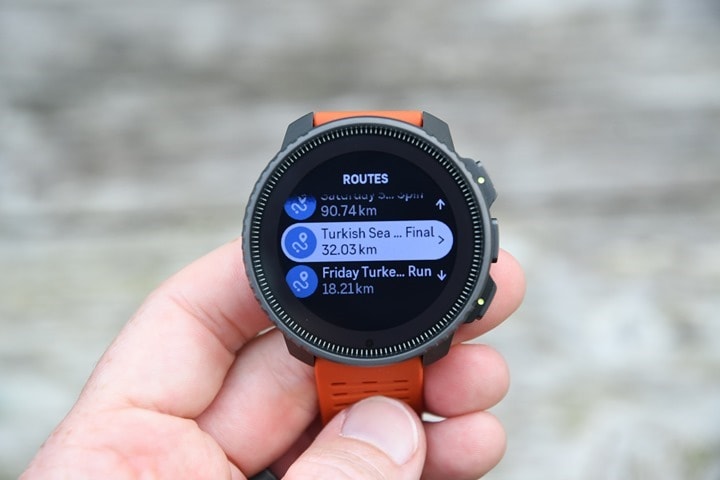
So, let’s look at navigating a route. In this case, I created the route on Strava, and then it auto-synced to my Suunto App account. From there, I toggled the ‘Use in Watch’ option. The Suunto Vertical only holds a certain number of routes in the watch, and while I’m pretty sure I was far below that, it required me to toggle some routes that weren’t actually in my watch off, first, before I could add a new one. I suspect there’s a minor bug somewhere – but it wasn’t a big deal.
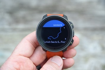
This route would be from the sea all the way to the top of the mountain, initially on local roads before going full trail the rest of the way. When I loaded it up on the watch, you can see the route details of the trail, including a breadcrumb look at things, though, no leveraging of the map here.
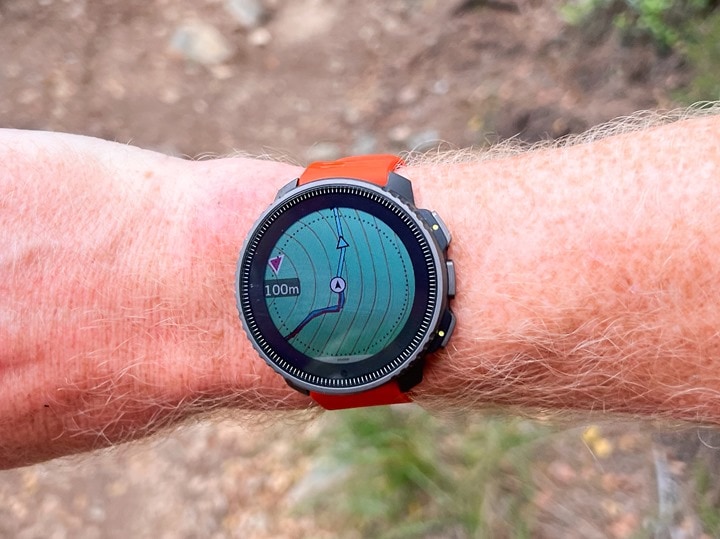
Now, out on the trail after a number of hours, you can see some of the stats. First, we’ve got the map page. Here you can see the map, my zoom level (100m), and the route (in blue). The red portion is where I’ve gone. You can clearly see the blue arrows indicating the direction I should be going in.
The map rotates based on orientation using the compass, and is instant (some watches have weird lag here, but this was frankly the most responsive UI thing the Suunto Vertical does).
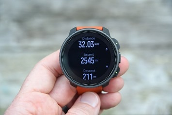
Meanwhile, you can see on this elevation page where I am on the entire course/route, elevation-wise. So, in this case, you can see I’ve climbed 1,325m thus far, but still have 1,158m remaining of climbing. This page is actually the singular page I’d say is hard to see – both in real-life and in photos. The dark blue is just…not good. Pick any other color.
The core/key feature that Suunto is missing is anything like Garmin’s ClimbPro, which automatically splits out the climbs remaining (useful when you have multiple climbs during a route), as well as descents, and where you stand on each one. While Suunto does have a small Suunto Climb App that can be used to provide some climb stats, it’s just more general info than anything (showing normalized graded pass, current grade, ascent rate, and climb timer). As seen below on a different day:
I’ve got distance shown here too on another page – 24.21KM with my heart rate at 69bpm, and the timer down below. Next to that is the kilometer lap page. All of which is next to my stupid required hotel wrist-band.
If you go far enough off-course, you’ll get an off-course warning, but as noted before, it just shows you using the heading bug which direction is back to the route.
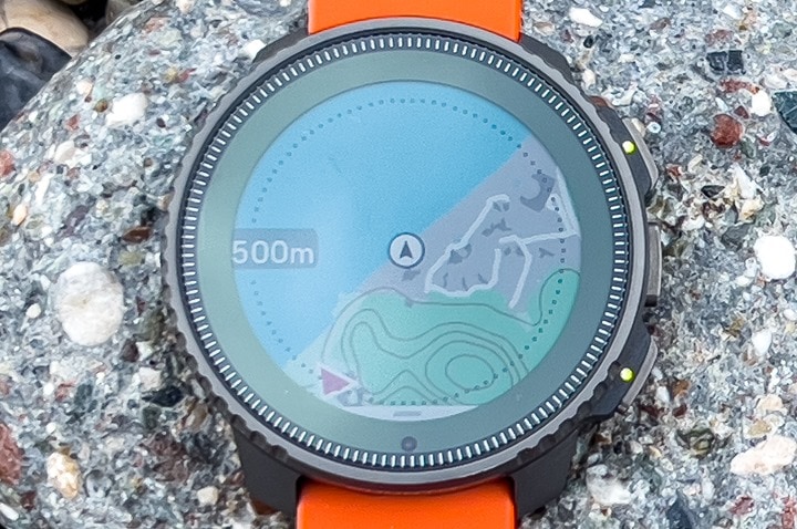
From a map perspective, you’ve got some usage options. First, you can use touch when you want to move around the map, as well as buttons. This is handy when the touch screen isn’t super ideal (such as with gloves). For zooming, you can short-press the upper right button to zoom in, or long-press it to zoom out. Though somewhat oddly you can only zoom out to a max of 500m (whereas you can zoom down to a seemingly silly 25m). Here’s some shots I took on a different day:
Additionally, you can use the controls to switch to both panning side to side, and moving the map up/down (also using buttons). All this works well, and enumerates fast enough.
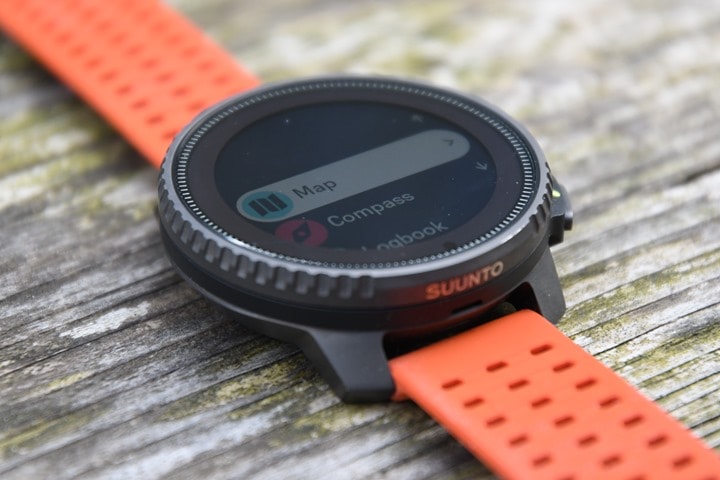
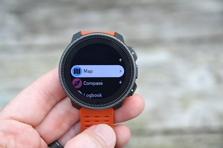
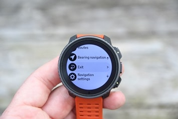
It’s worthwhile noting that you don’t need to start an activity to use the map. There’s also the general ‘Map’ option, just like you’d use the Compass on the watch. Simply press down once from the watch face, and you’ll see the Map option:
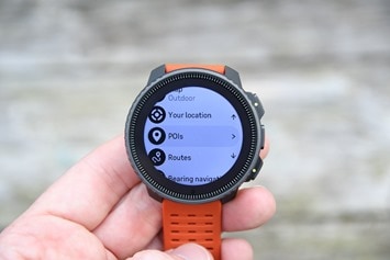
Within that, you can also change the map type (Outdoor/Default, High Contrast, and Dark Mode):
And you can then from there route to a POI, see your current location, load a route, do bearing navigation, or tweak navigation settings.
As for overall navigating with the Suunto Vertical, I’ve had no issues with it in that regard. I’ve used it now for a number of trail runs and hikes, virtually all of which were in trails/terrain I’d never been before – and some pretty off-the-beaten-path stuff at times. For my hike to the top of the mountain, I had one 6-hour stretch where I didn’t see a single human. At times the trail entirely disappeared under rock slides, spring meadows, or snow, and I had no problems following the map as needed on the Suunto Vertical.
I also had with me on that hike a COROS Vertix 2, Garmin Epix, and Amazfit T-Rex Ultra. Compared to the COROS Vertix 2, the Suunto Vertical was mostly a wash in that regard, though I find the map zooming a bit easier on the COROS unit – but mostly negligibly so. The Amazfit T-Rex is fine, but the maps aren’t anywhere near as good as Suunto or COROS. Garmin’s maps are more detailed with trail names and such than any of them, but the main advantage for these hikes was Garmin’s ClimbPro, showing distances/climb stats to the top. That was incredibly useful for big climbing hikes. But from a pure routing standpoint, it was negligible in differences since I had courses pre-loaded.
Point being, the addition of these maps here on the Suunto lineup is huge, and the breakout and clarity of regions when downloading is very much appreciated and very well done. In my mind it’s pretty obvious that the next big feature Suunto needs to work on is a ClimbPro-like competitor (just as Wahoo and Hammerhead have done for their cycling computers to compete with Garmin there). To me, that’d be far more important than Suunto adding in on-demand routing via maps (and honesty, far easier for them to do).
But again, the fact that Suunto has these maps now is a big ‘finally’ moment.
Solar Features:
Perhaps the biggest new hardware change to the Suunto Vertical is the addition of solar power. Or rather, the gains from solar. This is only offered in the higher-end Titanium edition, called ‘Solar’. The lower-end steel variant does not have solar panels on it.
Suunto is not the first, and probably not the last, company to add solar to their watches. We’ve seen the likes of Casio do it for years (and many other non-GPS watches), and then more recently, in the last few years, Garmin. The main appeal for adding solar is increased battery life. However, only certain players have really made use of that – namely Garmin and now Suunto. When Casio added solar to their GPS watch, the battery performance on GPS was so bad it just didn’t matter. But with Garmin and Suunto, it’s actually quite meaningful in some models.
First, let’s look at the technology, then we’ll look at whether or not it matters.
On the tech side, you can see the solar panel encircling the display. It’s effectively taking up almost the entire bezel area. This measures about 3mm wide around the display. Depending on the light conditions, it’ll have a black or reddish hue. Below, with bright direct sunlight and the right angle, it looks reddish. Indoors, or any other non-direct line, and it turns/appears black (like above).
There is a bit of a difference here between Garmin and Suunto. In Suunto’s case, they’ve gone with a wider solar panel section around the display, whereas Garmin has gone with a thinner one. However, Garmin also has a secondary panel above the display itself with a reduced photovoltaic level (thus while bigger, it also generates less because it has to remain invisible to you). There are pros and cons to both approaches.
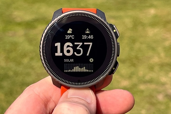
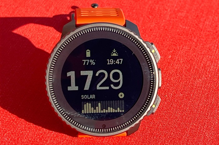
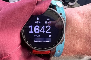
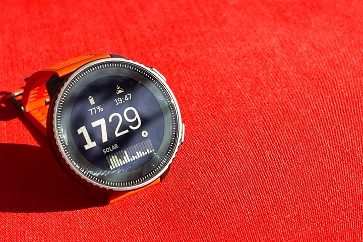
With the Suunto Vertical, you’ll see the solar harvesting gains on the watch face as well as a widget. On the watch face itself, there’s those lines, each indicating a 10-minute time slice for the last few hours. Specifically, it’s giving the average of that 10-minutes on a 0-100% chart. Where 100% level is defined as 50,000 lux (a way of measuring brightness). While the watch will accept more than 50k lux, it won’t show it on the chart. This is the same as what Garmin does (and the same 50K lux benchmark).
Additionally, at the top, you’ll see a small sun icon (depending on if you’ve tapped that area or not to toggle it). This is showing you live/real-time the sun conditions. Here it is on a not-so-sunny day in Amsterdam today:
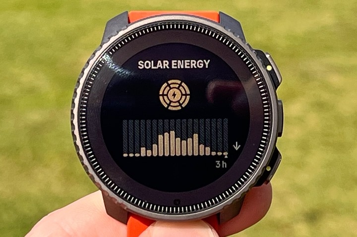
In addition, you can swipe or tap over a few times to go to a dedicated solar widget/page. That page shows things first in a bigger view:
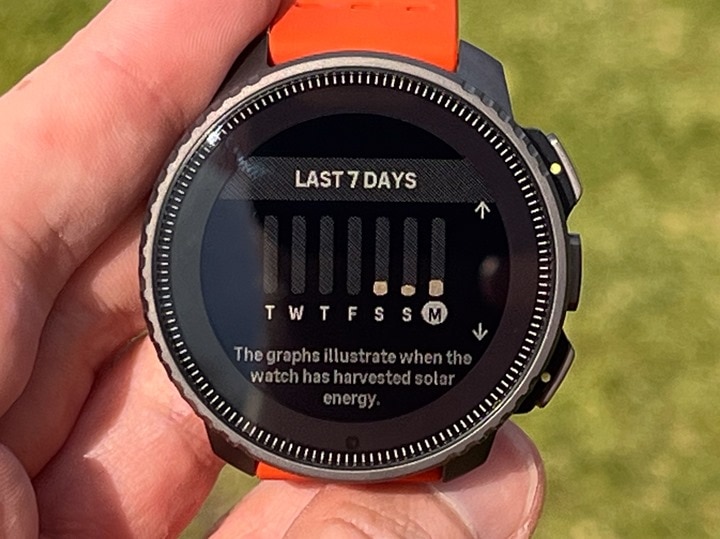
And then, if you press down, you can see the relative solar gains for the last 7 days. Unfortunately, each time I updated the firmware, it loses the historical knowledge, so you’re only gonna see a few days here as the firmware has been updating pretty frequently lately.
There isn’t any way to see the Suunto Vertical solar gains in the app, or specifics in terms of exact battery life gains here. This is kinda like how it works on some of Garmin’s watches (whereas others do show specific numbers). Garmin does save the relative values to their app though, although they didn’t upon launch a few years ago. Hopefully Suunto can get that added here too, down the road.
Now, what about battery life gains? Well, here’s the official Suunto chart showing the differences in battery gains:
Again, keep in mind that all of this is based on 50K lux conditions. For context, even a sunny day in February in the Netherlands will usually float upwards of 70K lux. So that number isn’t all that high by itself. However, that’s assuming you’ve got at least 3 hours of 50K conditions (and your watch is facing the sun). The moment your wrist turns away from the sun, it goes down (likely to zero).
In terms of tracking battery stats, that’s a bit tricky. In the case of other companies, they actually write the exact battery percentages to the .FIT file, but Suunto doesn’t do that – so I can’t plot and do math to figure out burn rates. Instead, I have to do it the old-fashioned (but imprecise) way of just looking at the battery % before and after a workout. In general, the longer the workout the better.
So, here’s the before/after on that 8-hr hike to the top of the mountain, with navigation enabled (and on and off map usage), Bluetooth enabled to my phone, optical HR enabled, dual-frequency GNSS, one-second recording – the works.
Start at 8:36AM: 99%
Finish at 4:42PM: 89%
Thus, 10% over 8 hours with mixed clouds and sun, puts me on target for 80 hours of battery life – basically in the ballpark of the spec listed above!
Beyond that activity, I’m impressed with the battery life. I’m almost at 11 days of usage since I last charged, including 24×7 daily smartwatch usage, activity tracking, sleep tracking, and approximately 20-25 hours of outdoor GPS usage, then another pile of indoor non-GPS workouts. During that timeframe, the watch has gone from 98% down to 37%. Heck, and that even includes like 5 firmware updates in there too – which takes a bunch of power. Plus all my stupid photo/video taking of the screen and map (seriously, I took like 220 photos and videos during my workouts over the last few weeks).
During this period, I was in a sunny location, but not quite as much sun as you’d expect, due to being partly to mostly cloudy most days, and spending a fair bit of time in the water.
Finally, for geekery fun, Suunto says the unit will charge via solar, even if there is no battery left. Inversely, it will not charge indoors using just normal lights – it has to be from the real-life sun, none of this LED fakery.
GPS Accuracy (Dual-Frequency):
The Suunto Vertical contains dual-frequency (aka multiband) GNSS support. This means it’s theoretically the ‘holy grail’ of GPS accuracy. The funny thing though is that the previous Suunto 9 Peak Pro actually has the exact same GNSS chipset. The only difference is that it lacked an antenna internally to utilize the dual-frequency components. Whereas the Suunto Vertical has that.
Of course, as I’ve demonstrated numerous times over the last nearly two years of new watches with dual-frequency GPS: Just because you have dual-frequency doesn’t mean you’ll make amazing GPS tracks. We’ve seen examples from COROS, Polar, Wahoo, and others that have been actually worse in some cases than older non-dual frequency units.
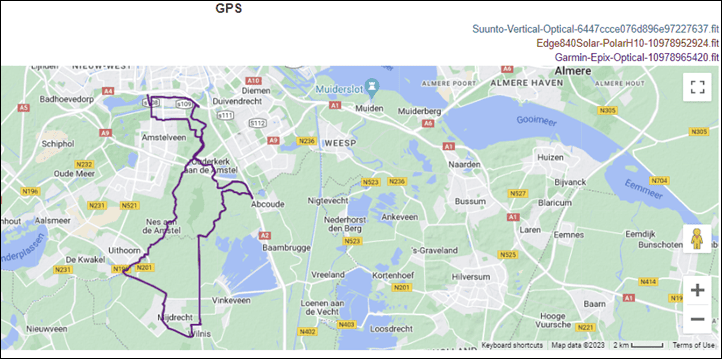
Finally – note that you should *never* compare files from different days – at least from a valid review comparison perspective. Not only are weather conditions usually different – as well as the precise path you took, but so is far more critically, the exact number of satellites available over you at that point and time. These differ actually quite substantially – especially when looking at harder conditions in cities or mountains, so comparing one result from today with another file from four weeks ago can yield vastly different results. Further, using a file from a unit one year ago is even more weird, since it would skip all of the updates/upgrades to have a true/fair comparison. All of my GPS tests, ever, compare files taken concurrently on that exact activity date/time – with the most recent firmware available on that date/time.
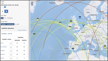
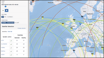
You can see a fun comparison over the Western Europe region of just a two-hour time shift of these sets of satellites which would impact visibility around buildings at different angles (sometimes slightly, sometimes massively, depending on the exact scenario):
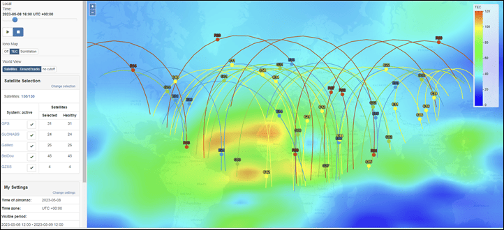
Even more so, compare this looking at a timeframe of total available satellites at a given position, from 3PM to 2AM, a huge swing from 41 satellites down to 29 satellites. Of course, since the orbits are on a cycle, sometimes it’s 10AM that’s best, another day 6PM, another day 3AM, and so on. This is just for today.
All of which ignores atmospheric conditions that makes comparing files from different dates/times…well…non-comparable. Even in a mere 1 hour timespan, that block of red virtually disappears from being over that region. It’s fundamentally why all of my comparisons are always head-to-head on a given date/time/route. Yes, it means more work for me, but it means usable comparative reference data for you.
The point isn’t that you should ‘accept’ bad performance, but rather, that you can’t compare files from different days/times – other than just for fun/curiosity. The conditions and available satellites (for better or worse) are different. That said, you should expect good performance across the board from any device in 2023.
In any case, I’ve been testing the Suunto Vertical on rides, runs, hikes, openwater swims, and more. This has been compared against a wide assortment of units from Garmin, COROS, Apple, Wahoo, Hammerhead, and Amazfit. This includes everything from more casual neighborhood type runs, to deep mountain territory with huge cliff overhangs.
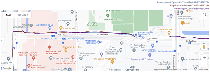
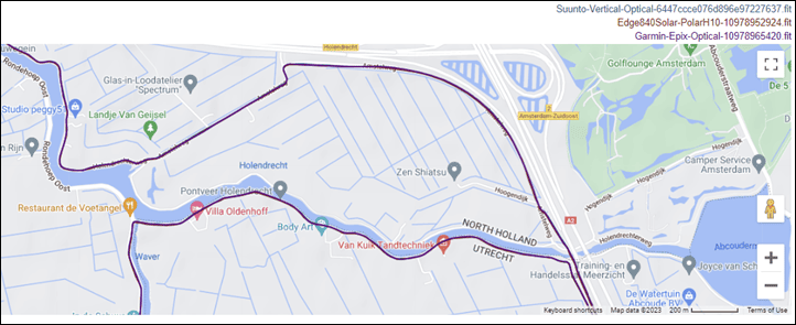
So, let’s get right into it – first though, a straightforward outdoor road ride:
Frankly, this ride is boring. It’s perfect. I mean, the ride itself is nice – one I’ve done countless times. It starts off going under some big buildings, then alongside them, before a blend of tunnels, bridges, and finally open country roads.
All of which were perfect from all units.
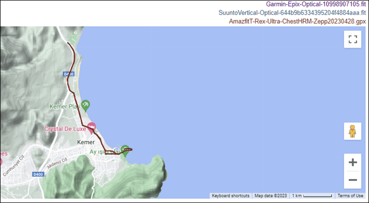
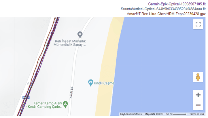
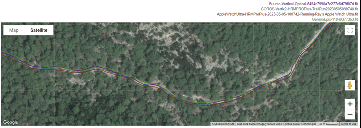
So let’s modestly increase difficulty, this time onto a mostly road run, but with a bit more tree and building cover. At a high level, the units appear to be aligned well:
However, once we zoom in we see the Amazfit T-Rex Ultra has me playing in traffic. Fast, highway traffic. While I was running along the highway, I was not out in the middle of it. Both the Suunto and Garmin nailed this.
From there, in town, we see a few quirks on the T-Rex, and one minor wrong-side-of-street quirk from the Suunto.
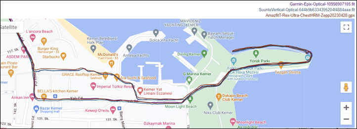
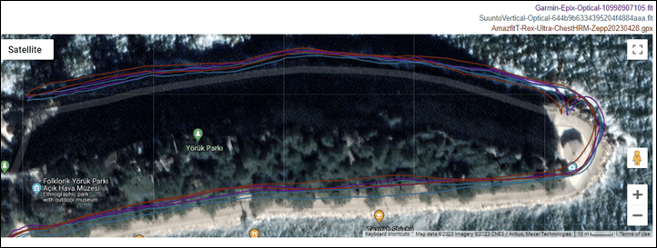
Doing an out and back on the peninsula results in good Suunto/Garmin tracks, and some slightly offset (inwards) Amazfit tracks. You get what you pay for.
Now let’s escalate to a trail run loop. First, on some roads to get to the mountain, and then up into the relatively dense woods.
As we start the initial (painful) climb, all the units seem pretty closely aligned:
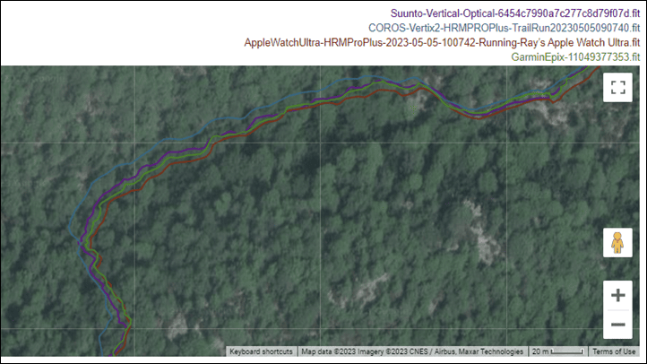
However, as I round the backside of the mountain, we see some initial separation from the units, but in particular, the COROS Vertix 2:
This is confirmed a few minutes later as the Vertix 2 splices off more. This is consistent with my data from the last nearly 2 years – it’s never quite as crispy as Garmin is. Suunto, meanwhile, is right alongside Garmin here.
After reaching the summit, I head back down, and all the units snap back together for this very fast-paced trail run descending back to town:
Looking at the elevation plots, here’s how those handled:
In all my elevation tests, I let GPS handle auto-calibration, and a unit has to get it right by itself. In this case, I had calibrated the Suunto a day prior near the beach. Albeit, it still drifted downwards slightly, and was below actual starting elevation slightly. You can see the COROS was substantially below sea-level despite starting a few meters above sea level. The Garmin and Apple Watch Ultra were in the rough ballpark of about 5-8m starting elevation.
And then, here’s the distance totals at the end. I don’t usually show distance totals, as you can be wrong 100% of the time and still get the right end distance (especially in trails), but hey, I’m feeling generous at the moment – so here’s that table:
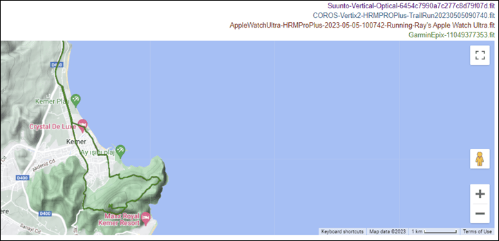
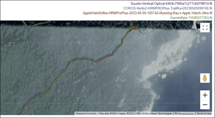
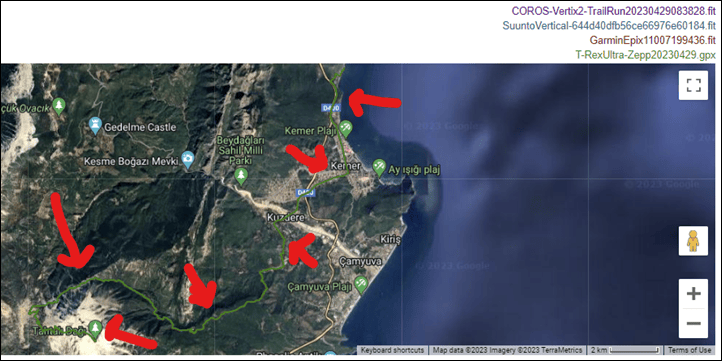
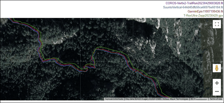
So let’s take a look at that long deep-mountain 8-hour trail run and hike. I agree, the line is hard to see, it’s most easily seen by looking for the green line where I made the red arrows.
I’m going to skip the lower portions, and instead just dig into the upper portions. I’ll note that the Amazfit T-Rex and COROS were looped onto the backpack, rather than wrists/hands. In general, it probably helped them, because they’d been on the back facing the sky the entire time. But hey, I just want to be clear one way or another. Of course, as seen below (and as usual) – sometimes you just can’t give enough assistance to the T-Rex Ultra.
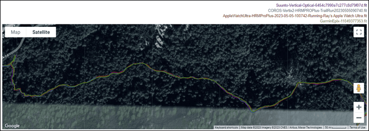
However, as I ascended, all the units did very well:
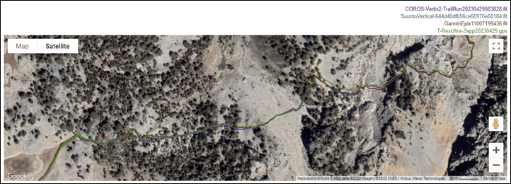
This section here might look flat per the map, but in reality, those are huge rock slides against massive cliffs. So GPS signal was rough here:
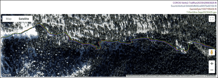
Meanwhile, as I approached the summit, all continued well:
Looking at the elevation plots, they look super similar at a high level:
So, the question is – how close to the final elevation did the four units get? Here’s what it says the elevation is at the top:
And then here’s the elevation listed when I hit stop at the top, according to the files:
COROS Vertix 2: 2,353m
Suunto Vertical: 2,355.9m
Garmin Epix: 2356.2m
Amazfit T-Rex Ultra: 2354.15m
Holy frozen snowballs (mostly my balls at that point) – I’ve never seen elevation values that close before. Ever. Period.
Now, we move on to openwater swimming. I’ve done a lot of openwater swimming with the Suunto Vertical – and frankly, none of it is good. In fact, it’s all horrifically bad. On present firmware, the unit has yet to complete a single one of nearly half a dozen openwater swims without failing halfway through. Essentially, if I tread water for even a very short timeframe (such as waiting for my swim buddy), then it’ll lose GPS permanently for the rest of the swim. You can see the giant straight-line it draws here:
And again:
And again, and again.
This is a long-standing problem on Suunto watches that I’ve seen (easily) for years in openwater swims. However, this time Suunto seems to be taking my frustrations seriously. After the first three or so failed openwater swims, they sent me daily pre-beta test GPS chipset firmware versions to see if it’d resolve the issue. On the 3rd test firmware, I finally got to the end of the swim successfully. However, the GPS track was still very very bad.
But, at least it got to the finish line. Suunto believes they now know what was causing the premature GPS terminations, and have fixed that. However, the ‘cost’ of fixing that was now having to re-do the filtering and other algorithms for openwater swimming. Historically speaking, it takes companies a long time to nail that bit. But Suunto also has more experience than new entrants here. It sounds like the earliest likelihood for a fix for openwater swimming is summer sometime. I’ll update if/when this gets addressed.
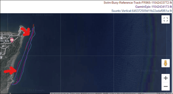
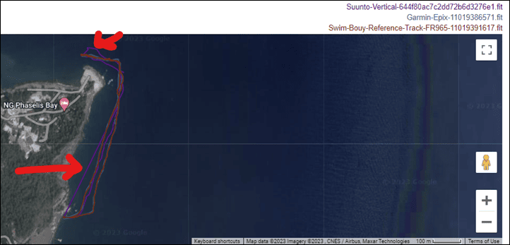
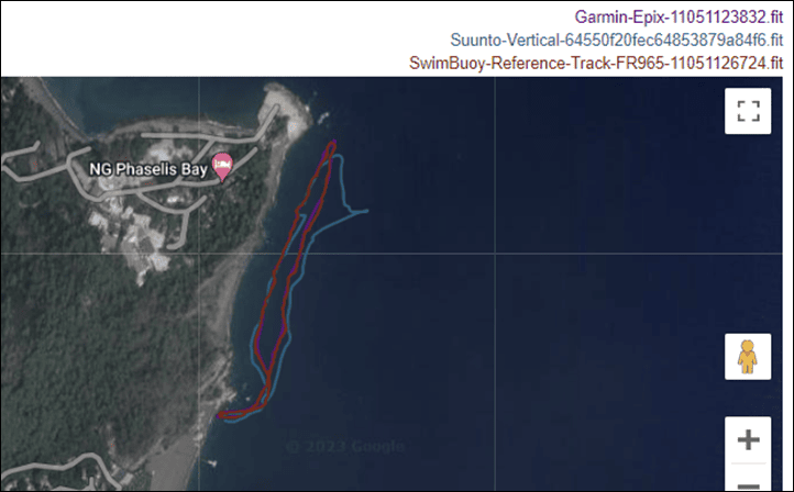
Update – September 2023: Here’s a recent track from an openwater swim comparing the Suunto Vertical to the Garmin Epix during a swim, with a GPS reference track on the swim buoy. As we can see, things are definitely significantly improved here, with only two relatively minor blips compared to the reference track (that the Epix didn’t exhibit). So that’s good to see for sure. Here’s that data:
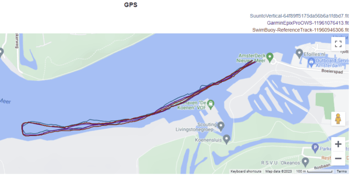
I don’t normally do out-and-back swims for accuracy testing (because it’s easier to see errors on a loop), but alas, boating traffic on this summer-like day meant it was safer to stay to the side. The total distance between these three were all very close, which is also good.
In any case, excluding the openwater swims – the GPS tracks being laid down by the Suunto Vertical in the default settings are virtually indistinguishable from Garmin’s dual-frequency capable watches (all the Garmin units in this review were in Auto-Select/SatIQ mode). Most reviewers have agreed that Garmin is basically putting out the best GPS tracks out there today on their dual-frequency units, followed by the Apple Watch Ultra, and then a bit of a ways down the line is the COROS units. But it’s awesome to see Suunto matching Garmin on dry land. Hopefully they can do the same in the openwater swim realm. And of course, I realize that for those that don’t swim – that particular element won’t matter at all.
(Note: All of the charts in these accuracy sections were created using the DCR Analyzer tool. It allows you to compare power meters/trainers, heart rate, cadence, speed/pace, GPS tracks, and plenty more. You can use it as well, more details here.)
Heart Rate Accuracy:
Before we move on to the test results, note that optical HR sensor accuracy is rather varied from individual to individual. Aspects such as skin color, hair density, and position can impact accuracy. Position and how the band is worn, are *the most important* pieces. A unit with an optical HR sensor should be snug. It doesn’t need to leave marks, but you shouldn’t be able to slide a finger under the band (at least during workouts). You can wear it a tiny bit looser the rest of the day.
Meanwhile, for HR accuracy testing, I’m typically wearing a chest strap (either the Polar H10 or the Garmin HRM-PRO Plus), as well as another optical HR sensor watch on the bicep (often the Whoop 4.0 band). Note that the numbers you see in the upper right corner of the charts below are *not* the averages, but rather just the exact point my mouse is sitting over. Note all this data is analyzed using the DCR Analyzer, details here.
First up, we’ll look at a 2-hour ride outdoors. As we can see, when compared to a Polar H10 chest strap, and a Garmin Epix optical HR sensor, things were…umm…not off to a good start with the Suunto Vertical. To say it failed here would be the mild understatement of the day.
So, let’s give it another day (or, lots of days).
Here’s a more steady-state run – nothing crazy this time. Here we can see it nails it nicely, no problems:
Thus, let’s increase pain again. This time with some tough climbs and downhill running. Overall – very good. A few minor bobbles at one point on a very intense section, but very good overall – and especially notable even during the downhill running sections (around the 1:10 marker):
So again, another painful run. This time though, it seemed to trip itself up at the very beginning and very end – for no clear obvious reason. The only similarities those sections shared was the actual terrain (the highway) – and perhaps a stable but pushed pace. But I have no idea why it lost the plot there, but then nailed the much harder climbing sections in the middle:
So, let’s try again back indoors. This time on an indoor trainer ride with VO2Max intervals mixed in. This is compared to a Polar H10 chest strap and Garmin Epix optical HR sensor.
As you can see, it’s clearly having a rough go of life in the first 10 minutes of warm-up, though it does manage to stick the landing for the 5xintervals section (minus perhaps a bit of wobble).
Finally, note that I don’t evaluate any optical HR sensors during openwater swimming. It’s just far too random and nebulous from a technology perspective these days, with the companies themselves outright admitting it’s a lottery if the optical HR sensor will work underwater during workouts.
Wrap-Up:
The Suunto Vertical watch is finally the Suunto watch that should stop the bleeding, not just to Garmin, but also COROS. In particular, it’ll likely give any existing Suunto user pause to see where the hardware goes. Suunto has put forth a very accurate GPS watch on land, with good and clear mapping. Add to that the good usability of the Suunto app – especially for planning and managing routes. Plus all the 3rd party integrations with the Suunto API & apps.
I love the way Suunto did the map downloads. While the downloads aren’t exactly fast, the ease of use in getting the regions you want using the app is something other companies should look at. Likewise, Suunto should also look at how other companies are using WiFi – especially for things like firmware updates, or even general data sync. The Suunto Vertical’s 32GB of storage will give Suunto room and flexibility to do lots of interesting things on-watch with that storage. For example, we could see them add heat maps, just like they did on the Suunto 7 watch faces, or with the Hammerhead Karoo 2 partnership.
Of course, Suunto still has a very real-world challenge with features when compared to Garmin, and in particular European pricing. For a hiking/outdoors/ultra type focused watch that the Suunto Vertical is (especially with the namesake), it lacks a meaningful competitor to Garmin’s ClimbPro, one of the best mountain/vertical type features out there. We’ve seen other competitors, including Wahoo & Hammerhead, add their own variants of that in the cycling realm, and if I was Suunto, I’d be making that the highest priority of features to implement. And most notably, as I’ve said elsewhere, it needs to be a native feature – not another Suunto App/Guide.
Still, I’m excited to see where this all might go. Suunto has spent a lot of time on the Suunto app/platform side in the last few years, and that’s certainly much appreciated. But with finally having a good hardware base to work from, it’s time to pivot to focusing on watch features to take advantage of that hardware and bring back that previous Suunto mojo. Making the hardware as good as they did was the hard part, now comes the (relatively) easy part: Adding in new software features to match.
With that – thanks for reading!
Found This Post Useful? Support The Site!
Hopefully you found this review/post useful. At the end of the day, I’m an athlete just like you looking for the most detail possible on a new purchase – so my review is written from the standpoint of how I used the device. The reviews generally take a lot of hours to put together, so it’s a fair bit of work (and labor of love). As you probably noticed by looking below, I also take time to answer all the questions posted in the comments – and there’s quite a bit of detail in there as well.
If you're shopping for the Suunto Vertical or any other accessory items, please consider using the affiliate links below! As an Amazon Associate I earn from qualifying purchases. It doesn’t cost you anything extra, but your purchases help support this website a lot.
Here's a few other variants or sibling products that are worth considering:
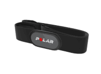
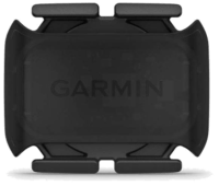
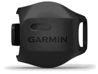
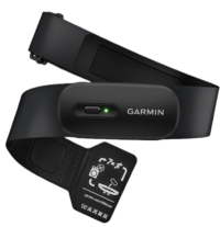
And finally, here’s a handy list of accessories that work well with the Suunto watches. Given the unit pairs with standard Bluetooth Smart sensors, you can use just about anything though. I'd recommend the Garmin bike sensors over the Wahoo ones, merely because the Garmin have two concurrent Bluetooth channels versus one for the Wahoo RPM/SPEED sensors.
And of course – you can always sign-up to be a DCR Supporter! That gets you an ad-free DCR, access to the DCR Shed Talkin' video series packed with behind the scenes tidbits...and it also makes you awesome. And being awesome is what it’s all about!
Thanks for reading! And as always, feel free to post comments or questions in the comments section below, I’ll be happy to try and answer them as quickly as possible. And lastly, if you felt this review was useful – I always appreciate feedback in the comments below. Thanks!


![clip_image001[8] clip_image001[8]](https://media.dcrainmaker.com/images/2023/05/clip_image0018_thumb.png)
![clip_image001[10] clip_image001[10]](https://media.dcrainmaker.com/images/2023/05/clip_image00110_thumb.png)
![clip_image001[4] clip_image001[4]](https://media.dcrainmaker.com/images/2023/05/clip_image0014_thumb.jpg)
![clip_image001[6] clip_image001[6]](https://media.dcrainmaker.com/images/2023/05/clip_image0016_thumb.jpg)
![clip_image001[8] clip_image001[8]](https://media.dcrainmaker.com/images/2023/05/clip_image0018_thumb.jpg)
![clip_image001[34] clip_image001[34]](https://media.dcrainmaker.com/images/2023/05/clip_image00134_thumb.png)
![clip_image001[12] clip_image001[12]](https://media.dcrainmaker.com/images/2023/05/clip_image00112_thumb.jpg)
![clip_image001[17] clip_image001[17]](https://media.dcrainmaker.com/images/2023/05/clip_image00117_thumb.jpg)
![clip_image001[10] clip_image001[10]](https://media.dcrainmaker.com/images/2023/05/clip_image00110_thumb.jpg)
![clip_image001[19] clip_image001[19]](https://media.dcrainmaker.com/images/2023/05/clip_image00119_thumb.jpg)
![clip_image001[21] clip_image001[21]](https://media.dcrainmaker.com/images/2023/05/clip_image00121_thumb.jpg)

![clip_image001[12] clip_image001[12]](https://media.dcrainmaker.com/images/2023/05/clip_image00112_thumb.png)
![clip_image001[14] clip_image001[14]](https://media.dcrainmaker.com/images/2023/05/clip_image00114_thumb.png)
![clip_image001[16] clip_image001[16]](https://media.dcrainmaker.com/images/2023/05/clip_image00116_thumb.png)
![clip_image001[23] clip_image001[23]](https://media.dcrainmaker.com/images/2023/05/clip_image00123_thumb.jpg)
![clip_image001[18] clip_image001[18]](https://media.dcrainmaker.com/images/2023/05/clip_image00118_thumb.png)
![clip_image001[20] clip_image001[20]](https://media.dcrainmaker.com/images/2023/05/clip_image00120_thumb.png)
![clip_image001[22] clip_image001[22]](https://media.dcrainmaker.com/images/2023/05/clip_image00122_thumb.png)
![clip_image001[28] clip_image001[28]](https://media.dcrainmaker.com/images/2023/05/clip_image00128_thumb.png)
![clip_image001[26] clip_image001[26]](https://media.dcrainmaker.com/images/2023/05/clip_image00126_thumb.png)
![clip_image001[24] clip_image001[24]](https://media.dcrainmaker.com/images/2023/05/clip_image00124_thumb.png)
![clip_image001[25] clip_image001[25]](https://media.dcrainmaker.com/images/2023/05/clip_image00125_thumb.jpg)
![clip_image001[30] clip_image001[30]](https://media.dcrainmaker.com/images/2023/05/clip_image00130_thumb.png)
![clip_image001[32] clip_image001[32]](https://media.dcrainmaker.com/images/2023/05/clip_image00132_thumb.png)
![clip_image001[37] clip_image001[37]](https://media.dcrainmaker.com/images/2023/05/clip_image00137_thumb.jpg)
![clip_image001[31] clip_image001[31]](https://media.dcrainmaker.com/images/2023/05/clip_image00131_thumb.jpg)
![clip_image001[33] clip_image001[33]](https://media.dcrainmaker.com/images/2023/05/clip_image00133_thumb.jpg)
![clip_image001[35] clip_image001[35]](https://media.dcrainmaker.com/images/2023/05/clip_image00135_thumb.jpg)
![clip_image001[39] clip_image001[39]](https://media.dcrainmaker.com/images/2023/05/clip_image00139_thumb.jpg)
![clip_image001[41] clip_image001[41]](https://media.dcrainmaker.com/images/2023/05/clip_image00141_thumb.jpg)
![clip_image001[43] clip_image001[43]](https://media.dcrainmaker.com/images/2023/05/clip_image00143_thumb.jpg)
![clip_image001[45] clip_image001[45]](https://media.dcrainmaker.com/images/2023/05/clip_image00145_thumb.jpg)
![clip_image001[27] clip_image001[27]](https://media.dcrainmaker.com/images/2023/05/clip_image00127_thumb.jpg)
![clip_image001[29] clip_image001[29]](https://media.dcrainmaker.com/images/2023/05/clip_image00129_thumb.jpg)











I know this is a Suunto post, but… kudos on finding the drone and making it work again! I guess you had to use a new, non-submerged battery?
Thanks! I was impressed, I’ve never had a reason to use the ‘Navigate to’ GPS coordinates on a watch before, but this was an astoundingly perfect scenario.
The DJI app records the last known GPS point, and astoundingly it was actually accurate this time (sometimes it’s not accurate if it flies beyond range, but this was well within range and just sunk slowly into the ocean like the titanic). I had initially done a lot of recovery attempts in an area that was far closer than the drone actually was.
Once I went back out with the coordinates loaded, I juad hovered over that spot and repeatedly dove till I found it. It was a bit tricky because I had to get down about 3-4 meters before I could see enough of the bottom to find it, and then that didn’t leave a lot of time for the actual searching.
But yeah, that battery toast, and now the unit is a bit unhappy in general with some weird warnings. I’ll get it swapped out under the warranty – but it was nice to get the SD card back – as I hadn’t offloaded all of the footage from the hike/day prior (some of it, but not all).
I just wish I had enabled the snorkel mode on the first round of dive attempts, as I’d love to have known exactly how many I did (my guess is 30ish). I was exhausted.
Hi DC, quick question. How does this watch keep up with the current Polar Grit X2 Pro? I own the latter one but want to buy my dad a new watch for hiking, trekking and marathon runs. Thanks in advance!
And what about some recovery / regeneration features? like HRV vs. training load etc.
It seems nothing new here right now – still same functions.
It’s the same new features as outlined about two weeks ago: link to dcrainmaker.com
I’ve gotta add in some screenshots of that here into this review, should be up shortly.
Should the second to last sentance finish “NOW comes the” instead of
“not XXX comes the (relatively) easy part.”
Doh thanks – fixed!
Why do you need to spend extra on solar if the GPS goes 60+ hours at best mode?
The flashlight was on the original Suunto Ambit Peak – for sure it works well if needed.
Its a real shame that these watches are released but still laggy when navigating menus. And I wouldn’t bet on Suunto “fixing” this as they never bothered to with past models. Pehaps that’s the trade off with having battery longevity?
Also think you should call out firms regarding ongoing costs – new straps etc – for example, Suunto charge obscene sums for a fabric replacement strap.
With regards to design I’m not sure its anything different to what we’ve seen from other manufacturers. I mean it looks ok but its not exactly a bold statement that we’ve seen fom Suunto in the past. From a distance its looks like any other watch.
That open water swimming bug is disappointing, but I guess that’s why they market it as an “adventure watch”. From Suunto you should really expect a watch that works when swimming,…
All that said, this is a massive improvement and at a decent price.
I’ll certainly consider one pending other reviews.
Does Suunto sync devices/activity ands sleep stats from multiple watches? For example, I’d wear a peak with my suits at work. Then use this vertical when swim bike run etc… but I’d like to see everything (stats wise) synced across devices. Is this possible?
Can we load music directly onto the watch?
Lastly, Suunto really has to make efforts to improve the software and capabilites of this watch via software debugging and feature updates/upgrades. Its not the finished product by any means.
*Did you get the diameter mixed up with the peak?*
I generally agree that I don’t think crazy GPS battery times are needed – even for people doing Ultras, we’ve largely passed the point where it matters anymore, save for the last 1% of the 1%.
That said, the counter-arguement to that is that you have to charge it less. If it wasn’t for having to download maps (which requires putting it on a charger), I’d easily be over two weeks with a ton of outdoor GPS time, all with navigation. Plus all the usual 24×7 type stuff.
As for strap costs, the nice part here is that it’s all just 22mm standard bands. So you aren’t stuck in whatever Suunto offers. That said, if you haven’t seen strap costs lately, go walk past the Garmin strap store to see how insane they are. You’d be thinking hard about just buying a new watch…
The best argument for crazy long battery life is headroom for inevitable li-ion/li-po battery degradation.
I don’t think those crazy GPS battery time plus built-in maps are (mainly) designed for ultra sports. It will be very useful for mountaineers, sometimes they’ll go on a trip or expedition for more than a week. With gpx routes loaded and detailed terrain maps, this watch will probably reduce 90% needs to use a cell phone to ckeck routes, which means they can carry a smaller power bank or leave their solar panel behind and save lots of weight in their bag.
I’m going to respectfully disagree on the runtimes, at least for the subset of the longer ultras. I JUST upgraded from a Suunto 9 Baro to a Garmin Enduro 2, because I have one 314 mile race (Vol State, no support, no aid stations, no crew, no drop bags…) and then Moab 240 this year.
The Enduro solves my charging problem at both these, with Vol State looking like 5+ days, and Moab probably around 90 hours, but with possibly significant cold which always drops the runtimes quite a bit. You biker folks usually aren’t out there for 12 hours in sub-zero temps, but believe me it’ll do some harm to a runtime that you don’t see skiing because in that case it’s usually inside your coat sleeve.
Yeah, I get this is a subset of a subset group, but it was important enough for me to drop $1k to “upgrade” from a watch I was otherwise totally happy with. The extra features of the Enduro 2… meh. Whatever. I run. I go up. I go down. Sometimes I want to know if I’m on course. That’s pretty much it. If I had known THIS watch was coming out three weeks ago, I probably would have waited and gotten this (Suunto has always been super reliable; Garmin in my experience… not so much).
Nice review of a nice watch!
One thing I didn’t quite understand: Is 50 minutes for downloading 1GB of maps fast? To me it seems kinda slow. But then again, I have no idea how fast or slow the competitors are.
No, it seems slow to me. I’m gonna do some more timed tests. I was pretty sure the ones I did for Holland were substantially faster. When I did the Turkey ones, I had left to go get breakfast, so I’m not exactly sure how long it took on those ones, plus, I had forgot to grab those before I left and had to use my cell hotspot.
Hi Ray, Really nice review, thks for that. I am suunto fan (polar my second choice) and first impression of that watch is that is gorgeous!
However always missing 1 feature from suunto-watrches: HRV measurements! So i would like to ask what about that new vertical watch? Does it make hrv-measurements?
thks,
Christos
No HRV measurements. Or at least non-exposed in any default features.
“SuuntoPlus Apps/Guides are small 3rd party apps that can add data fields/pages to your workout. They work well, but you have to remember to add them before your workout, as once the workout starts it’s too late.”
Hey Ray, now it’s possible to add/remove/change SuuntoPlus in he middle of the workout from the workout options. Maybe it was added in one of the latter betas 😉
Ahh, nice, that’s a great change then! Will update.
Albeit, still feel that many (if not all) of these Suunto-made ‘Apps’/Guides really need to be native implementations as just simply data fields that you can use as-is in any sport profile in combination with others.
Yep, I completely agree. Apps should be for specific features, but some fields should be just standard in the sport profiles. Not only so you don’t waste SuuntoApp “slots”, but just to mix and match with whatever.
I’m looking forward to having both SuuntoGuides and the PlusApps at the same time.
Can you do a sport activity with map navigation in endurance and ultra tour?
Or only in performance mode?
Thanks for the great review Ray!
So when you choose the ‘Ultra’ profile, it does the following:
A) Disables Map
B) Turns off touch
C) Disables Wrist HR
D) Brightness to low
E) Vibration off
F) Display time-out off.
Whereas for Endurance, it does the following:
A) Disables Map
B) Turns off touch
C) Brightness to low
D) Display time-out off.
(So in Endurance you keep wrist HR & vibration).
So none of those include the map, but, you will still get breadcrumb trail navigation (just tried it).
If it’s like the 9 Baro, you could always do a custom battery mode and tweak some of those things, while potentially keeping the Map on.
I’ve had over 30 hours on the 9 Baro in a custom mode, best GPS, HR sensors off, Low color and Display timeout on
“Watch diameter: 49mm (Suunto 9 Peak Pro was 53mm, and Suunto 9 Baro was 50mm)”
Hi DCR, small mistake here, 9 Peak Pro is obviously a 43mm :-)
Good catch!
Nice review, thank you for the hard work and great imagery.
“Finally – note that you should *never* compare files from different days – at least from a valid review comparison perspective”
you missed off the end of the sentence “unless you are comparing to a precisely followed route”. In which case the files are comparable and the satellites’ dispositions become another variable. ;-)
This is quite a complex area and I’ve looked at it on and off over many years. Here are some points
1. The number of satellites can be important for accurate positioning but accuracy also depends on their angle in the sky. There are various measures like VDOP, HDOP, TDOP etc which measure the resolved precision (dilution of precision)
2. I’ve found that, actually, the number and position of satellites (unintuitively) don’t make that much difference to accuracy UNLESS there are an unusually low number, which rarely happens. for example, Your charts above show 100% healthy satellites and lots of them
3. With dual band, the number of available/connected satellites, I would imagine, does not necessarily correspond with the number that are used at any given time
4. The number of satellites simultaneously available to watches worn on different wrists would not necessarily be the same. Though normally would.
kind regards
tfk
While in general comparing across two dates/times won’t impact easier routes, it will likely impact tougher routes – namely ones with buildings. So in that case, whether or not the same route is followed doesn’t matter – the satellites that are available to those watches can be vastly different. And not just the binary ‘is it there’, but rather, the ‘where is it’ from a sky perspective.
If we take the 44 down to 29 difference example, and then go alongside a building, or in between two buildings in a downtown core, that reduces the number of viable satellites – which, when you get into those tough situations (e.g. NYC, etc…) – that can be the make or break moment.
Plus, comparing from different months/years means different firmware versions from companies, where changes would have been made (especially since most of these watches are actually sharing the same chipset).
It’s actually kinda nice that COROS shows the exact number of satellites it sees at any point in time. I did some fun testing yesterday with this alongside buildings, it’s a separate post that I almost posted yesterday but will dive into tomorrow.
If you look at all the DOP’s, those too can vary, within a given day, upwards of a 200% swing. In most cases, the values are still all very good, but they do shift from what would be considered excellent to ‘mostly good’.
The point is, I think it’s fair to compare multiple watches on the same day/time on different wrists, but I think comparing across different years isn’t really representative of current performance.
Thanks for the review. A good move for Suunto. I hope Garmin will finally add the possibility to download only countries/areas of the Garmin TA maps the users want…
Indeed, it just makes it so easy for trips to quickly grab what you need – especially if you aren’t going to many places.
This was really interesting; for my own part, some of the best open water swim tracks I’ve ever achieved were with the Spartan Ultra during a SwimRun race here in NZ. It’ll be cool to see how they develop this platform.
Looks incredible that battery life is insane, looks like a bullet proof no bs tool I will be pre ordering one for sure.
Thanks Ray,
I may be old but I do miss the rolling pin comparison pics against other similar watches :-)
2nd this. Hard to visualise the size compared to Peak, 7 etc
Thanks for the review, Ray!
Is it ANT+-compatible, or Is it still Bluetooth only?
If you compare Vertical versus Vertix2, which do you prefere when it comes to out door navigation?
Only Bluetooth.
It’ll be interesting to do a proper comparison between the two on navigation. They are exceptionally similar at a high level, but have a lot of nuanced details when it comes to routing/navigation and specifically planning on the app side.
I started to write up some comparison stuff last night, but had to defer it to get this finished first. Notably, COROS did just revamp the app side of their navigation a few weeks ago, as well as their map downloader (now WiFi). I think Suunto’s map downloader is still a bit better, though each has their own pros and cons.
I’d love to see a really detailed comparison of navigation features between the high-end watches of Coros, Garmin and Suunto.
Like how fast the compass is rotating, contrast, zoom and so on
Yes, a detailed comparison between those two watches should be very interesting, since they seems to have the same target group.
Indeed, I would love that too. Using maps will be an important functionality when choosing a new watch for me, and these companies have certainly improved on that field the last year I’d say, not only on precision but also on functionality.
Nice job Suunto!
Sorry if I missed it but do they support Broadcast HR?
No broadcasting of HR. :(
Definitely one of those features they really need to add in.
Yes, a detailed comparison between those two watches should be very interesting, since they seems to have the same target group.
Great review – I like where Suunto is going.
Do you know if there is functionality to set an alarm/timer to remind you to eat/drink. I know Garmin and coros have tbis
Thank you for another great review! Does it have sport modes for e-biking? It’s missing from my Suunto 9 baro and I would like to keep track of my rides and separate them from normal bike rides.
Great review. I really like the watch, but the sensor thing.. You can have only one sensor of each type? I own three bikes, each with a PM. So, if I understand correclty, I would have to remove and add a PM each time I swap to a different bike?
On a positive note: Suunto seems to integrate Stryd natively (I also hope for the vertical). That is one thing I really hate about my Epix 2 at the moment.
Dear Ray, nice report. How many data fields per page are possible?
Great step in the right direction. I can’t see it swaying many Garmin users at that price, but any competition is good competition.
Maybe not Garmin but what about Apple Watch?
The aesthetics are much more inline for someone who appreciates a clean look (both HW and SW) but find AW data lacking. Not to mention the battery life. Suunto + Wahoo (or Karoo) vs all Garmin, it’s compelling now.
Yeah, I think the key likely customer segment for this watch would be:
A) Existing Suunto customers
B) Existing Polar customers
C) Some that may have jumped ship to COROS
D) Some with really old Garmin Fenix devices that are put off by the rising prices of a Fenix.
I suspect it’d be hard to convince most current Garmin Fenix 5 Plus or 6 customers to shift to this, since aside from multiband GNSS, they’ve already got all that and plenty more.
Still, it’s a critical first step. As noted above, Suunto needs to fill in the gaps a bit on software for critical features (e.g. ClimbPro something). If they can do that, they can begin to compete to a greater degree on brand/aesthetics (which they do well). That’s an area that’s tougher for COROS to compete on, so COROS makes up for that by doing more features faster.
Speaking as a Fenix 5+ owner who’s been toying with the idea of upgrading (in particular, I’d like to play with x-c ski power, so I’d be buying Garmin anyway), the two reasons I wouldn’t get the Vertical are 1) no ANT+. Yes, recent sensors have both ANT+ and Bluetooth, but I have a lot of older sensors (Tempe, 1 gen Garmin magnetless speed and cadence) with ANT+ only. 2) No maps. I’m not in particular talking about routable, although that is a requirement for me. All I see above is art. No place names, no trail names, no numbers on the contours. Context is a requirement for me on a map, and Garmin (and Apple, for that matter) provides context. Maybe that’s because Ray took those photos at just the wrong moments, but I think it’d be unlikely that I could take a photo of my 5+ with absolutely no text on the map screen.
The Suunto design is nice, but why those two white dots on the side over the buttons? They irritate me and somehow disrupt the look. And also these markings for seconds (?) around the display. Without them, the design would be cleaner.
Is Polar as a company bigger than Suunto? I’m curious what polar will develop for new watches.
They need something with maps and also Amoled.
I’m surprised that Suunto and polar offer nothing with Amoled.
Had Suunto Spartan Trainer, upgraded to Garmin Fenix 5, must have been 3-4 years ago (not the same tier watches, the Fenix being Sapphire, baro etc.). At the time, Suunto didn’t have proper product compared to the Fenix, and I had zero trust the company would even exist for long. Was easy choice.
I will likely buy a new watch in the next year or so. The battery life is slowly diminishing and not getting any updates on the old Fenix. The latest Fenix is possible, but I hate the price, and the Garmin UX is not impressive. The sport data screens are quite retro (the font they chose is one factor), even if technically the screen was better, in practise it looks to my eye worse than Suunto. Old Suunto had a few features Garmin took a really long time to catch up (sleep tracking visible on the watch, HR graphs on the watch during activity). The Connect App is horrible and needs a redo. Still in 2023 you have to frequently restart the app for the watch to start synching. Notifications (messages, apps) on the Fenix have NEVER worked properly. Even having all things Apple, the watch is not an option for the bad battery.
I do multi-sports, not super competitive and no ultras. Long batter life and usefulness in daily life are the most important features. And the looks, since I wear the watch every day, office and sports.
Probably not going to switch Fenix 5 to this Suunto, but definitely got my attention. Fix the laggy menus is a must.
Hi Ray! Great review as usual!
I wonder how well Suunto Vertical implements Strava Live Segments and how reliably it follows segments, especially when running on trails with sharp turns or switchbacks?
The reason I am asking is that Garmin’s implementation of live segments is fairly flawed – it is rather eager to drop off a segment when approaching a sharp turn. It always drops off segment when approaching a sharp turn, which to me points to an algorithmic issue (I have a theory explaining that behavior). It is quite frustrating when I go for a long FKT style segment, and then after 30-60 minutes of a hard work it declares that I am off segment and stops tracking even though I am right on it. Overall, Garmin’s failure to track long mountainous live segments approaches 100%.
Also, it would be great if you could include a screenshot of a segment screen on Suunto Vertical. When you add the segment guide, can it match and follow multiple segments – not concurrently but at different parts of a run?
i would like to know this also, can HR yet be displayed when doing live segments ? I remember that was a major issue with garmin is it was locked into the displays and you couldnt have HR showing which is critical for a lot of people who are going for a FKT etc
Are any updates (software) possible for 9PP?
Cant get the Vertical because of wrist size, I can live eithout maps..
It’s been mentioned on the Suunto Forums that an update for the S9PP is expected after the Vertical’s launch.
This looks amazing tbqh, but outside my price bracket , as all the best things are :(
Is there a watch suitable for hiking (I don’t run, ever) which would last 10hrs GPS mode (walking, so don’t need every second recording) and, crucially, have path navigation (IE basic show me my pre planned route and where I am on it offline, even if it’s not on a detailed map) and be about £200? I tried the watch recommendation post and flipping through old reviews but just got dizzy with the the sheer number of models, variants of models and versions…
Hope someone can give me good news, haven’t been able to find something.
Maybe an Instinct 2/2s could fit your bill? But you have to like that particular aesthetic.
A 2nd hand Garmin Fenix 6 Pro / 6X Pro maybe? With a new (3rd party) strap it won’t differ much from new.
Bought mine two years ago used, no regrets! Amazing value with life-changing metrics.
Coros pace 2
Coros pace 2 definitely, no competition in its price range.
Thanks for suggestion – I had ended up down a Forerunner series rabbit hole & getting side tracked with the likes of apple watch, galaxy watch etc and thought maybe my requirements couldn’t be met
Watching Ray’s review on the instinct 2 now, and Suunto 5 (mentioned in his Instinct 2)… and the Coros pace 2 others (thanks all!) have suggested too. Lots of nerdy video viewing, but looks like any one of them is better than the options i’d found beforehand so much appreciated!
Have opted for the Pace 2 – thanks for recommendations guys, knew I could get good stuff out of DCR readers :)
You could easily pick up a 2nd hand Suunto Peak or Peak Pro for £200.
I’ve had my Peak from Launch and its worn very well, almost as new and I’ve had it since launch.
if you join a Suunto Facebook Group you’ll find people selling Peaks to buy the Vertical.
Great to see more competition in the field!
Regarding maps:
On my Fenix 6X Pro I prefer using more detailed non-Garmin maps, which are easily downloaded and transfered to the watch through USB. Is it possible to use non-Suunto maps on the Vertical?
Im assuming so. I have a Suunto 9 Peak Pro, and am upgrading to the new Vertical which has identical UI and improved internals. I download gpx files from a lot of different mapping sites (Alltrails, Strava, Komoot) and they all work perfectly.
I really appreciate that Suunto did not choose to cover up a large chunk of their photovoltaic strip with their logo (😒Garmin). Seriously the industrial design looks really good and the feature set is solid.
The carbon offsets with planing trees is both good and a great brand identity thing.
It seems like they have a way to go on dubious training metrics and quantified self / health tracking features derived from HRV.
Overall I’m glad to see this.
If there is no error in the table with the altitude, I think you might have mixed up the numbers. It is not 0,1m lower but nearly 10m. The photo shoes 2.365.m and the watch only 2.355,9 m. Interestingly all watches are fairly similar.
What would be great in your review is to compare the watch with the last available model (Peak Pro) not only from design / size difference but also how both perform.
Maybe the sign is showing you its altitude, which looks like it could be 8 m off the ground. Or maybe the sign is just wrong. The fact that 4 different watches are within 2 meters of their average after 2300+ m of climbing is impressive.
…teaches me to try and read tiny numbers at 4AM.
That said – it’s long been a fascinating question of mine when we see those markers on trails (or the top of a lift/etc…) with the elevation. Where exactly is that measured? Is it measured on the ground at that point (the base of a trail marker pole), or at the pole height?
And then, for summits like some where a big elevation is a tourist attraction unto itself, but yet the peak goes very slightly higher (maybe 10-30m sheltering a building) – where exactly is that measured.
Either way though, yeah, the fact that they were within 2 meters of each other is absolutely bonkers.
On the question of Suunto 9 Peak Pro vs Suunto 9 Vertical data…yeah, that was my hope, but I sorta ran out of wrists.
Thx Ray for the great review again. The question is wether certain e. g. Running stats such as pace and distance can be shown on the map screen during an activity? This is in my eyes an important when running somewhere you never been to and have to keep an eye on the map frequently during a run. Thx a lot for your feedback. Keep up the good work.
Great review Ray. Used your link to order it and try it out.
Thanks!
Sean
Hi, thanks for the helpful review. Maybe I missed it, but is it possible to download a GPX file on the watch and navigate with it; for example the Southern Upland Way in Scotland (215 miles)? And will the watch than last for at least 100 hours if in use all the time?
It is shockimg that this watch is not accurate when it comes to open water swimming. This is the first Suunto watch which looks like a possible successor of my Ambit3Peak for me, the smart watch functions like 24/7 HR measurement take it into a new league for sure. However, I can not understand that they solved accurate OWS measurement 10 years ago on Ambits (with different chipset and hardware but come on), how can they suck with it now. Waiting for the update…
Yes, you can download GPX files to the watch, via the Suunto App.
For a 100hr timeframe, you wouldn’t be able to use the map option, but could still use the breadcrumb trail (just no map under it).
Есть ли карта России, в частности Дальнего Востока?
The country is divided into 83 different maps totaling 15.93GB, along what I assume are the various republics/regions.
Meh. I started with Polar, went to Garmin and took a detour to Suunto. 25+ years – I’ve seen it all! I know that many like anything but Garmin and/or the Suunto design. Fine. But in an objective way, how can this compete with FR955? Suunto have upped their game substantially, but they still seem well behind Garmin on the price/performance measure. Sure, performance depends on what you intend to do, but for common sports metrics, the FR955 seems way superior for less $$$. What am I missing here?
What you get compared to the forerunner in my view is a much better made better looking watch made out of quality materials (sapphire glass) etc that you wont find in your well “featured” FR955. Im guessing those who buy suunto do for these reasons over the many “features” of garmin most that are useless.
My theory is that people are begging for a reason to ditch Garmin in favor of Suunto (or Coros, Polar, etc). But despite Garmin’s forgettable aesthetics, Garmin is hard to beat. I want to love a Suunto watch – and this one checks lots of boxes – but no onboard music or routable maps are no gos. And please spare me the “we don’t want music on a watch” BS. That’s fine you don’t, but I and many others do – and you don’t have to use it. Seems like some of the GB dedicated to maps could be used for music. For now I’m sticking with Epix 2 for training, although I’ll need more battery life for racing.
Actually i think its great they don’t have music and other nonsense like pay that garmin offers that YOU have to pay for with the high price. I hope they dont try to copy garmin/apple and become both smart watch and sports watch and increase price accordingly trying to incorporate so many features to please the entire population.
Ray, sorry to be off topic, but would it be possible for you to test if sunblock on a watch face stops Garmin solar panels from working? or at least pull less power?
If I get a sunny day again in Amsterdam, I’ll give it a whirl. Yesterday dumped. Today is just…well…typical grey. :)
I felt like DC Rainmaker answered a lot of great and relevant questions as to whether or not this watch is worth your time, but he never answered if it’s worth $800+. Yes, it appears to be better than the Suunto 9 series, but it still appears to be more of the same (user interface, display quality, etc.) and appears to be suffering from the same problems of their previous watches. Like why are we still talking about lag? It’s almost like the lag should be listed as an unique feature of all Suunto products. So again, all of the updates are good and great. But is it worth $800+ when you compare it to the Garmin Fenix 6/6X or the Fenix 7/7X. You could even find a Garmin Epix Gen 2 or a FR955/965 at a better price if you’re patient. I would be willing to try this device for fun if it were significantly cheaper, but being that that’s not the case, I’m thinking it’s a hard pass…unless I find one used at some point. And that’s if it’s still relevant.
I think it’s more challenging at the $800+ solar price point than the base price.
Somewhere up above I talked a bit about brand, and how that relates to features.
For example, the APEX 2 series, when it came out this past fall, got effectively slaughtered by reviewers for being overpriced (cause it was, and probably still is), relative to the also-plastic Forerunner 955 for the same price ($499). Sure, the APEX 2 Pro had a tiny edge metal bezel, but otherwise was plastic. More importantly though, the FR955 had a million more features, better accuracy (HR & GPS), and far better navigation. And beyond that, Garmin is simply a bigger and more well known name/brand.
As we saw recently, COROS had to reduce prices there. And also, as noted, it’s a horrible spot to be in price-bucket wise. That $350-$500 price range is steep in competition from major players, and incredible value.
Suunto faces somewhat the same challenge with a $600-$800 unit, except they’re really only being compared to the Garmin Fenix & COROS Vertix. I think materials wise, I prefer the Suunto look/design – but that’s just a personal thing. Features-wise, obviously Garmin wins (in every category, including accuracy). Currently, Suunto has an edge on battery life though at high accuracy rates, so that may be important for some. But Suunto’s challenge (same with COROS here), is that a Fenix 6 is still more competitive features-wise, and can be had for silly prices these days. Someone e-mailed me two days ago about one he was buying in the UK for a mere 130GBP, unopened, 2nd hand. We’ve seen them into the $299ish range on flash sales. It’s bonkers.
So in this case, Suunto has to lean hard into brand. And the Suunto brand is good (at least in Europe, it’s lesser well known in the US). But in my mind they have until Jan 2024 to show how quickly they can iterate on new software features. They need to basically emulate COROS for the next 7 months, with moderate feature drops every few months – even if that means it’s at the expense of older watches receiving those features (which I know might not be popular, but sometimes there are tough choices in business).
Hello DCrainmaker,
Thanks for this review.
Do you have any insights about suunto’s future, now that they were bought by liesheng?
Vertical was the first launch, if I am not wrong, and it was an “innovation” on their side, but it seems it has not only new bugs due to new features but also old bugs remain (step count, resources dropping fast after a soft activity) and it really seems that old watches will be left behind.
Before there was a lot of talking on old watch support on the forum, but since the launch of the vertical they are sillent.
Can we hope for a “new” suunto with more energy, or more of the same, were they go at their own pace, still communicating and if they were still be the best (it reminds me a lot of “saab users” on this old top gear episode link to youtube.com).
Although they may need to give less support to older watches, in order to make the new ones “shine”, I guess it is already too much for most suunto fans..it was with the ambit 3s, spartans, maybe s9p?
Keen on knowing more if you can share =)
After I was done with the fenix 3 and 5 , which I often had system problems with, switched to the polar grit, unfortunately no maps. I love the Suunto 7, despite the shitty battery, no training goals and no trackback. does the vertical make up for all that?
It depends. If your main attraction to the Suunto 7 was because of Wear OS, this doesn’t have that (nor all the Wear OS features). However, if your main attraction to the Suunto 7 was juts a better Suunto, then this has all those endurance features you’d have been missing there, but with maps and training related goals (including trackback).
great thanks for your response. I don’t use wear os now either, so I won’t miss it. But the maps of the 7 are fantastic, as is the screen and easy to use. I just missed all those things that are essential for a training program
I think I understand the non-routable maps now, thanks for your explanation.
But you state: “Point being, sure, it lacks the routing, but real-world, that’s not a huge issue in 95% of scenarios.”
That might be well true, but these 5% where it is needed might be very important I’d say. Namely when I am running in a place I don’t know well, and need to go back to the start, like my car. Or your example that the weather changed quickly and you needed to get back down to the valley from the top of a mountain.
What I think is that non-routable maps can’t give you the shortest way (only a bird’s flight line at best), and that routable maps can give you the shortes way back, turn by turn. Is that correct?
How quickly do you think routable maps will be on Suunto (and Cronos)?
I mean, what is blocking them? New hardware, or is it just a software upgrade? Is it a pricing issue, like does it need expensive R&D, or can they buy it somewhere?
It would be great if you can shed your light on that!
The Suunto App works very well for easily making a turn by turn route with watch notifications. In this situation I would plot and save the route in the phone app, and sync to the watch, and navigate. You can do this while in an activity. I always take my phone on a run, especially in a place I don’t know well. So, I don’t see this as a limitation.
Alex,
So the watch notifies you of an upcoming turn? It’s not clear from Ray’s review that the Suunto Vertical does this.
Hi Bob,
Yes the watch can notify you of upcoming turns, if you have plotted the route in the phone app and enabled ‘Turn-by-turn guidance’ for that particular route. When navigating the loaded route within the watch, the watch will beep 100m before a turn “100 m turn left” then at the turn point it will beep “turn left”. No road names are displayed, just the instruction. It loads the instructions as waypoints on the route.
This is how it works for my Suunto 9 Baro, and I assume it works the same for the vertical, just with a map layer shown on the screen.
Note: If you go off route, the watch will not adapt the guidance to get you back on route, it will only know the pre-loaded instructions for that particular loaded route.
Is it possible to set up a new route on your watch, without smartphone?
Thus if I have to return halfway, can I create that new return route from my watch or do I need my phone?
Eugene, short answer no: you cannot create a route from within the watch itself. Long answer: You can easily follow your existing route backwards. The watch automatically picks up which direction you are headed on the loaded route, forward or backwards. You can create any number of back up routes and load them to the watch, and toggle between different routes mid-activity. I always hike and trail run with a phone (why wouldn’t you?) so you can create routes on the phone, and sync them to the watch mid-activity. Activities and routes can by synched to the phone without any need of signal. The Suunto app can suggest popular routes based on heat maps, or within Strava you can create/suggest routes, and any ‘starred’ (favorited) routes within Strava will automatically appear within the Suunto app. Looking at the Suunto user forum, I understand street names etc will be coming to the watch maps.
Thanks Alex – this covers my use case. I’ve never been too impressed with on-watch routing. So for me, TBT on a preloaded course is best. Sounds like I could also simplify my workflow (currently strava – plotaroute) with Suunto. Will have to take a look at the watch when it comes out. Thanks for taking the time to answer my question.
“How quickly do you think routable maps will be on Suunto (and Cronos)? I mean, what is blocking them? New hardware, or is it just a software upgrade? Is it a pricing issue, like does it need expensive R&D, or can they buy it somewhere? It would be great if you can shed your light on that!”
It’s very very very hard to make the jump from breadcrumb to actual full-routing. With ‘routable’ meaning that if you go off-course it can use known trails/roads to get you back on course smartly. Additionally, that you can just pick some random point off in the distance, and it’ll use known trails/roads to get you there.
Generally speaking, if I look at companies in the cycling segment that have made the jump to full routable bike computers, it takes about 18-24 months *after* they release the routable navigation for it to be consistently usable. We can look at examples of Hammerhead, Wahoo, and Sigma in that realm. As well as other past companies now gone.
The problem is – it’s even fuglier on the watch side. Not only do you have to deal with all the roads/streets, but you now have to deal with all the trails.
It’s one thing to solve it for one country (still a huge thing, but perspective-wise), but in this case, Suunto/Polar/COROS/etc have to solve it for at a minimum all of Europe and North America. It’s the nuances of the differences in how roads/trails/etc enumerate in different countries that’s part of the challenge, but also, knowing how to generate useful routes across that.
I’d say Suunto is in a much better position than COROS, because they have all that heatmap data – and are familiar with using it already to generate routes (within their app). But again, it’s a gigantic leap.
My guess is that COROS would be more willing to say ‘eff it’ and release a routing version that’s most nicely described as “rough”, since that’s historically how they approached some areas (like their EvoLab suite). Whereas Suunto, tends to be more conservative in that realm in terms of having a higher minimum quality threshold.
The good news is for components like ClimbPro equivs, they don’t need to do any of that. They just need to parse the elevation profile. Heck, even showing upcoming gradient (color-coded) would be a huge step up.
Eugene – I had this exact case when I was running a trail in Austin, Texas a few years ago (I am from Michigan). I was just running along following a local trail and exploring on my way out, but with no route loaded on my Sunnto. On my way back to my rental car where I started, I missed a turn at a “Y” in the trail.
I did not realize that I had missed the turn immediately, but when I looked down at my Suunto (much older model), I could see that I had veered off the “breadcrumb path” that the watch created on my outward bound run. I was easily able to backtrack, following the breadcrumb, and find my car.
This looks great – I have an old Vertical but want an update – I’d nearly bought the Fenix 7x last week.
Will primarily use for trail running, hiking and climbing.
Does this have facility for showing you your grid reference whilst hiking for when using traditional map – which is how we operate in UK mountains really? This looked easy to configure with a hot key in Fenix 7x…. Can the grid ref (OS GB) be pre-set into one of the screens showing your other metrics whilst climbing?
Best wishes – great review!
I’m not sure for the Vertical but if it’s the same as the 9 Peak Pro – the UI looks identical in the photos – you can’t have your location / grid ref as a data field. But all you need to do to see it is go to the map/navigation screen, press the down button to access the navigation menu and select your location. It’ll then display the 10-figure OS grid ref (as long as you’ve set the watch to British grid). A few button presses and takes 5 seconds or less, so never been a problem for me.
Correct, it’s the same in Vertical.
Interesting that this is now being presented as a Suunto 9 Peak successor. The information I got was that the Peak will remain in production and this is the successor to the Ambit3 Vertical hence the name Vertical and also is considered the next generation Suunto Core adventure watch, it is the “spiritual” successor to that line of watches which is why the introduced that recreational snorkel mode which the Core also had.
I think the price level on this is a little bit high given Suuntos position in the current market compared to the competition. It is not like in the past when Suunto’s was considered King of the hill in this segment that spot is safely taken over by Garmin ever since Garmin fenix 5 and to some extend already in fenix 3 days. Suunto failed badly in the market with the Spartan about a decade ago and never recovered after that. They need to compete on price and be a good premium budget option. The steel version should be at $450 and the Titanium at $600 and not more. Now it is $200 overpriced like it was a Garmin fenix watch! I really like the way this is designed although I would have preferred a 24-26 mm strap given the watch size.
Given that this can now display colored maps I am surprised Suunto are not providing a way to change watch faces. One of the thing people like with smart watches is the ability to change watch face to change the look of the watch. It adds a bit of fun but with this it appears there is only the one watch face? That is a bit boring!
Ray I hard from a tester of this watch he had accuracy problems with the thermometer even when off wrist. Can you test it to see if it is now accurate?
Yeah, I noticed some temp accuracy issues off-wrist today while filming my user guide video. It was showing 29*C (about 82*F), despite being in a normal room-temp room of perhaps 19*C or so.
Thank you for this review! My v800 GPS has started acting up a bit and resetting the watch hasn’t worked, and since Polar ended the support for v800 a while ago, I’m thinking about upgrading. Also having a comfortable watch for 24/7 activity&sleep tracking could be nice. This release has a perfect timing and definitely piqued my interest!
I haven’t used Suunto devices before, so I’ll ask a few basic questions.
– How much can you customize the views during different activities? For example, in orienteering races it’s forbidden to use the watch for any kind of navigation, so I’d love to disable the map and any kind of “return to start” arrows while orienteering, but still have them during other sports. Suunto being a Finnish company, I guess they have thought of this but I just want to be sure. (At my level, nobody actually checks what features my watch has or if I can reactivate them during the race, but I’d like to avoid the temptation.)
– I specifically don’t want any kind of notifications from my phone on my watch during the day, and I don’t know if the other smart features (weather forecast etc.) are that useful. So it might be better to keep it disconnected from my phone. However, of course I want to sync my data sometimes. Is it convenient to use the watch in that way, or do you need to pair/unpair it constantly? Or is there an easy way to disable notifications etc but still keep it connected to the phone? Also, I haven’t had a smart watch in ages, is there a significant battery drain on the phone if I keep it connected?
– Stryd website says that other recent Suunto devices fully support the Stryd footpod, i.e. they can get distance and current pace form the Stryd. Have you tried it with Vertical, does it work without problems?
– And a weird corner case: A friend had an incident with his Polar Vantage V2, where while he was waiting for a while in the rain before starting an activity, and during that time the rain pressed the touchscreen buttons and changed some GPS recording settings, without him noticing. I see you can have the touchscreen disabled during an activity, but can you also disable it outside an activity?
Point 1: you can disable maps but cannot get rid of the breadcrumb display.
2: Notifications can be turned off easily and remain connected to the phone.
3. Yes, power, distance and pace can come directly from Stryd and power is native on the watch
4. Touchscreen is automatically disabled during an activity but cannot be disabled in watch mode. I have never had a problem with this.
Actually you can disable the breadcrumb (and navigation) display. You can’t do it in Suunto App when setting up a sports profile but you can disable it on the watch. When you select an exercise and before you start it, scroll down in the menu to “Navigation”, select it, scroll down and select “Off”. You can also do it during an exercise in the menu shown when you pause it.
I guess paring as a food pod and not power pod right? I got the Stryd connected but how am I sure it’s recording power from Stryd? As in “Paired devices” under “services” I only see: Running speed and cadence. Auto calibration off.
Any compatible temperature sensor?
I do a bit of Swimrun and I have a Garmin Tempe attached to my shoe lace. It provides an accurate measure of the air and most importantly water temperature during my workouts, while the watch can stay on my wrist. I never found a device that would be compatible with Suunto to do the same (Core body sensor are limited in the temperature range and Stryd is not waterproof). Any chance anybody would know a similar external sensor that would be compatible with Suunto Vertical?
Ray, any chance you know the answer to this? I would imagine that the Core temperature sensor will eventually be compatible with the Vertical, but at the moment the SuuntoPlus app for the sensor displays as not compatible.
Fun fact: Garmin silently reduced the official price of Instinct Crossover from 550 euro to 400. Found out by accident while browsing their website.
Nice catch! Yeah, the higher price didn’t really align well with reality.
Where is your Huawei Ultimate review? Expedition mode, diving to 140m, amorphous Zirconium case, not plastic, double thickness back and front sapphire crystal, scuba diving mode and water extraction pump. Makes the Suunto vertical look like a toy.
To be honest, I’ve had zero demand/requests for it. You’re the first.
I guess it is because American retailers are not allowed to sell it. I gambled and bought one last week when it was released because I didn’t see the Peak Pro as much of an update to my old Suunto 9 Titanium Baro from 2018. And the gamble paid off. The ulimate is full high resolution diving and expedition watch in a class of it’s own. Complete with ECG, skin and body temperature, no lag whatsoever, compatible with Apple and Android and the health app is awesome. Saphire glass front and back and it costs around the price as the Vertical with a titanium strap as well.
Looks interesting but it’s not cheap. What version did you get? I’m worried about the metal band, I usually get rashes with some metals (eg. Cobalt).
Can you export workouts with working HR data on that watch/in Huawei Health? If so, I would also be interested in a review :)
Hey
I see you have a connection to the Sunto and Gopro companies
I have products of both
And I really enjoy seeing your analysis of these excellent products
But I have a lot of suggestions to streamline some small ideas that can certainly be added in a software update
And some big ones that probably require more thought
Anyway, I think my ideas can help users significantly
I would be very happy if you would contact me by email so that we can see if you can connect me to someone in these companies or if you yourself can talk to them
Or you can make videos and explanations on your website and YouTube about all the things they can improve so that it pushes them to improve them
And again, thank you very much for the videos, I really enjoyed them
I would very much appreciate a response
Thanks
Suunto is over
Black with rubber strap.
Rubber band, cool. Should give me no problems.
Second.
Rainmaker do we know how suunto is working out V02max for those who mainly do trail running and vertical kilometre type stuff? I understand they use firstbeat from Garmin based on flat runs and pace or cycling with power meter, but what about for trail running? Garmin has there trail run V02 max to try to correct for terrain what does suunto do?
I’d assume Suunto is still using all the older variants, rather than the newer ones. I can check on next volley though. I’d say that based on my oddly low VOMax numbers coming from the Suunto, and given I’ve done more trail runs than usual lately, I’d say it’s not handling it correctly.
Thanks mate damn you that’s a real shame
‘Added truly continuous 24×7 heart rate monitoring (previous was every 10 minutes)’
Is there a choice between 10 min and continuous? Thx for a short reply and another helpful review!!!
No, just on/off.
Hey folks-
Just a quick update for those following along in comments:
1) I’ve uploaded and published a real-world full user guide video, here: link to youtube.com
2) I’ve added an unboxing section above in the post link to dcrainmaker.com
3) Within the unboxing section are some side by side comparison photos to the COROS Vertix 2, Garmin Fenix 7, and Amazfit T-Rex Ultra
Cheers!
Is it possible to get a photo with it on your wifes wrist (and measurment) to compare with your wrist? TIA.
As always, great review. Thanks!
Regarding the sports modes, does the Vertical feature rowing? Does it detect stroke rate?
Thanks a bunch!
It’s crazy, I think it was 3 years ago, I switched from my Suunto Ambit 3 (because of the barometer going full crazy mode about the altitude, and the Suunto support didn’t gave me any satisfaction) to the Garmin Fenix 6X Pro. And 3 years later comes this Suunto that don’t have any crazy feature my watch doesn’t have… despite being 3 years old !
The thing the Fenix 6 lack the most compared to the recent watches is the tactile screen, it’s so less efficient to use the map with the buttons. But beside that, there is no major feature it doesn’t have (I don’t find solar as useful on a watch as it can be on a cycling computer).
But it’s a good thing for us consumer, if the brands can’t make newer models groundbreaking it means older models are still plenty good for most usage for a price way more reasonable.
How does the screen compare to the FR255 or 955? Does the auto-brightness make a difference? One of the things that annoys me about my 255 is that you have to choose one brightness level for daytime use even though ambient light changes.
Sizing – Specs say it fits to 215mm with the accessory strap.
I’m running a 219mm wrist. Is the 215 realistic or can that be stretched??
So with the main S/M strap attached, the entire length of the watch is approx 230mm (kinda messy to measure), and with the M/L strap, it’s approx 265mm (both of these are measured orange end to orange end, without including the buckle).
I’d think 219mm would be totally realistic. My wrist is 195mm (ish), and on the small strap I have gazillions of length.
Honestly, that 215mm spec seems weirdly short.
Wow, really did not see that one coming, solar on a non-Garmin smartwatch. I’ve always considered those Garmins as basically damage mitigation, attempts to recover at least some of the money they sank in the Sunpartner acquisition that they wouldn’t do starting from a blank slate. Perhaps this means that the chances to eventually see solar-under-OLED (where the existing Sunpartner technology would not contribute anything useful) aren’t quite as low?
It’s not a hard-no, but my understanding is that due to some technology elements in terms of MIPS vs AMOLED thickness and connectivity, adding the solar layer atop AMOLED is better served by just adding more battery with that same space. But as always, technology can change over time.
Hi
Again a great review!!
Maybe you can answer two of my questions:
– If paired with like assioma duo pedals, does the suunto vertical show the left right balance too?
– On my different bikes I use different power meters, so when I change bike I always have to pair, the suunto sports watch I am using, again. It does memorize only one device so each bike chance requires a pairing process. Does the vertical memorize all of my power meters and pics automatically the one which is available/sending signal
Thanks
Kurt
1) There’s no left/right balance on Suunto unfortunately.
2) Still the same there, it only remembers one. Pretty frustrating. In my user guide video I go on a small rant about that. At this point, if Suunto wants to be at all appealing to triathletes/cyclists, they need to pair to more than one power sensor (mainly so people can also pair to trainers). And you should be able to name sensors, and finally, it should be able to deal with at least left/right power.
They might seem like small things, but these are the things that stop people from buying a watch.
Thanks for your reply! I personally could live with the missing option of the left/right balance. But in my case you are absolutely right!!! Those small things stop ME buying this watch! Pairing the power meters again and again and again is just a pain in the…. and a device for this price should remember/save more than just one power meter, HR-belt or whatever it is! At the end this is just question of the firmware there is no additional hardware needed.
Hi Ray – has Suunto ever given you an ‘official response’ as to why they choose to only support 1 power meter source? People have been commenting on this gap for several years now and Suunto seems to be deaf/indifferent to this for some reason.
I’m about to upgrade my Garmin forerunner but I’m hesitating about switching to Suunto. Would this model be finally a good competitor to Garmin? Is it worth losing the Garmin data for?
Thx
It’d probably depend on what exact Forerunner model you’re coming from.
If you’re coming from an older model like a Forerunner 35 or Forerunner 245, then it’d likely be seen as an upgrade.
However, if you’re coming from a Forerunner 945/955/965, or even a Forerunner 255/265 – it’d probably be seen as a physical design upgrade, but a feature downgrade. The FR255/265 in particular is messy because while those units don’t have mapping, they do have far deeper training load/etc support, as well as better multisport/sensor/everything else support.
Said differently – it just depends what you want out of it.
Hi
Is a screenprotector available en does it match with the solar option?
Thanks
Kristof
Has Suunto improved the ability to store multiple sensors like Garmin does? I have having to re-pair my sensors on my Baro 9 every time I use a different bike or heart rate monitor.
No change there unfortunately, still just a single sensor of a given type pairing at a time.
I would love to love this watch. Unfortunately, like Ray says, there are a few small things that will stop me buying this watch. A big thing for me is to have different morning alarms on different days. It’s a small thing, but an important part of sticking with my Garmin. I could change the alarm every day, but I know that at some point, I would forget, and that means the difference between a 5am start and a 6am start!
Thanks again for another great review Ray.
I just received my Vertical, and it’s just as impressive as your review suggested. I have yet to put it to the test, but it’s the watch I was not expecting anymore from Suunto. There’s one small thing that’s worth mentioning (maybe you covered that and I missed it): the vertical and Suunto 9 baro do not share the same wrist straps size. I’ve tried to put my baro 9 straps on, to no avail, and the Vertical’s straps are too narrow by about 2 millimeters to fit the baro 9.
… to complement my previous post, I also had only one length of straps; wrote to Suunto to enquire.
Same here, only two bracelets instead of three came with the watch. Ironically, if you need the longer bracelet, you have to buy a complete set – of which only one part is then needed…
Same here. No extra band lengths included – but luckily for me the supplied size was correct. The on on the watch is labeled “S/M”
I have small wrists so the size “S/M” are okay… for summer. I don’t think I could wear the watch over gloves/jacket/etc with the provided length. Unfortunately Suunto is out of stock for the strap kit I was considering (black). I will proudly wear the orange straps but find it strange Suunto did not foresee a rush to buy straps when it looks like that was the point from the start. Bought a third party strap kit on Amazon but I’m not impressed with the quality.
I did get a 10% rebate from a Suunto employee when I enquired about the straps.
How is size and feeling on the wrist compared to Garmin forerunner 965?
Now that I own both of these watches I can say both watches feel really good on the wrist. Vertical obviously has more weight (but not too noticeable) and does sit higher on the wrist. The 965 disappears on the wrist as it is extremely light weight. Build quality without question goes to Suunto. Really enjoy both of these watches for different reasons.
Very nice watch watch from Suunto. I rallye like the Design and the Features are good enogh for me too. But i am thinking about returning mine and go for Coros or Garmin again. First of all i don’t need sleeptracking, so i turn the device offiver night to save battery. Neuer do this! Step and calories ounter are not resetted and you have to snchronize the watch to get correct Time again. It should note that Hard to fix this,because every other watch manufacturerer can do this. On the other hand i still don’t understand this Suunto Plus thing. Most if These feateures are naurally integrated in waches of other Brands. Ad i can online choose to of them? So if i want some Training Peaks metrics, Strava relative effort and quick access to my GPS coordinates, i can nly choose two of them? And Wien i use a sekf Designer Workout (=Suunto guide) i can not use any of the suunto plus Apps? Seems a litle bit outdated for me these das. But this is a suunto problem, the vertical is still a good watch.
Thanks, Craig!
Great analysis and description!
Hey Ray,
Are you considering evaluating and testing the new Ticwatch. Not solar, but pretty impressive specs. Would go up against a Venu. OLED, 80hrs, etc. $350.
link to amazon.com
Hello! Thanks for your review, Ordered one and receveid it today, Suunto Vertical Titanium. Well… it’s a complete waste of money. Sorry, for the remark, but the Technology of the Suunto Vertical it’s like going back 25 years in time when I graduated from a bachelor in computer engineering …. DOS and x286 era. Yeurk. Interface is crapy and slow, recharge cable with no magnet for proper insertion (you never know if is positionned correctly), interface logic again a 7 years old has designed it…
Very disapointed. Lastest Watch from Suunto. The will go banckrup soon.
Ordered a Garmin Epix Gen 2 in replacement. Hope to see if the Garmin is better, I havent chose the Fenix 7 because it is close to Suunto Vertical. Let’s hope for a better 2023 design with long battery Life, I don’t wanna go for the Iwatch Ultra ´cause of the battery Life. But, may need to if the Epix Gen. 2 is not in par technologicaly speaking.
How is the Vertical close to the Fenix 7? After all, there is still the Coros Apex Pro 2. Fast, a fresh design (Garmins interface, really isn’t that changed over the years) and good battery life.
If you cannot operate the magnetic charger my fear is you should not own a watch.
“How is the Vertical close to the Fenix 7?”
Realistically, not close.
It’s still a legit challenge that Suunto has at these price points. Suunto’s main flag right now is the longer battery life. And – while a very legit flag, it’s also a torch that at the battery life levels the Fenix 7 has already, isn’t really a deciding factor for 98-99% of the market. Certainly, it may be for a few percent, but not many.
I think we talk too little about the eco friendly production, solid material choose, EU assembly and environmental with the tree planting thing. That, for me is one of the reasons to jump for the Vertical, putting a real comparison with another brand aside. Good maps, distance, altimeter and time. More I don’t need. But that’s me, no need for a smart watch. Than I look elswhere
I just got the Vertical and have two questions. 1) Is there a way to have workouts sync the other direction? More specifically, when I cycle, I use a cycling computer versus my watch. Can I get that workout over to Suunto’s ecosystem to make the metrics more accurate? From either Strava, Training Peaks, or Apple Health? 2) Is there a way to turn off the beep for notifications and have it be vibrate only?
You can have vibration only. On the watch go to Settings – Tones and choose “all off”
I’m quite certain that you can push a workout from Trainingpeaks to Suunto.
Correct for TP. But he want to do reserve I believe. Recording on Strava (app) or any other device and import that into Suunto. That doesn’t work I believe.
Yes that’s right. I was wondering if I could import workouts done using other devices. Thanks for the advice on the tones – I was able to get it fixed.
Happy with the Vertical? I’m still on the fence with the Coros Apex Pro 2. But I am in a environmental mood and really like what Suunto does. I’m not married with an eco system as I only use TrainingPeaks for over 10 years+. I guess you could say that the Suunto Vertical and Coros Apex Pro 2 are 2 more …. simple watches compared to Garmin and this is what I want.
I’m only about 24 hours in, but like it so far. I’ve had a Fenix 6 in the past and an AW Ultra. For my needs, I like it better than the Ultra. I especially like the looks of the Vertical – for me it’s the best looking watch in the category.
Ok, looks…that’s a legit reason 😀
I was certain I did it, checked just now, I used health sync to import from Strava to Suunto (Rungap would be the iOS alternative).
About 10 days in and I am happy with the purchase. My main use is road running and it gives me everything I want…accurate gps, syncs great with training peaks structured workouts, and the app gives me all the details I want. I do prefer the look of this watch to garmin, coros, and apple. I was fearful about leaving garmin ecosystem but the things it has over Suunto turn by turn directions, pay, and music are things I never used. Good luck with your next watch decision.
Craig,
Suunto does have turn by turn directions. When you create a route in the Suunto app, there is an option at the top of the screen that looks like an eyeball that says “turn by turn”. In the iOS version of Suunto app, it is the 4th “option icon” from the left when you create a new route.
For existing routes, there is an option switch that says “turn by turn guidance” which can be turned on and off for each individual route. You can see this option when you click on an existing route in your library to view it.
Enjoy your new Vertical, and feel free to post any questions (I am a Suunto tester so I am familiar with the watch and the ecosystem)
Thank you Brad and very much appreciated.
Is there any way to install a custom map layer based on openstreet maps?
We have colored tourist routes in the Czech Republic and it would help a lot in map orientation. (Garmin offers similar topo maps for the Czech Republic)
No custom maps at this time.
Hi Ray,
Thanks for another great review! Personally I like the direction of design for this Suunto and the fact that it has a metal body. If planning on wearing it daily you kinda want a watch to look good/solid/substancial as well and I think Suunto nailed that part. You could argue that having a good looking watch is worth more then some addtional “nice to have” features that you end up not really using anyway?
Thanks for the great review.
Looking to upgrade my Suunto 9 Baro. I recently ran a multi day race (108hrs continuous) and was able to use performance mode the entire time by charging my watch with auxiliary batteries every 20hrs or so during the race. Unfortunately my run did not upload to the Suunto App but remains on the watch. I’ve contacted Suunto and they are unable to rectify the issue. There is no other way to upload from the watch other than using the Suunto App unlike other brands which treat a watch like a “hard drive” when connected to a computer and allow gpx files to be directly upload from their watches to a computer and saved.
A couple questions for you:
Can the Suunto Vertical be charged with an auxiliary battery / battery pack during activity like the Suunto 9 Bar can?
Can the various activity data saved on the watch be accessed / uploaded and saved via computer connection or can this only be done using the Suunto App?
I’m debating between the Coros Vertix 2 and the Suunto Vertical but may also consider the Garmin Fenix 7 but my last experience with Garmin was with a Fenix 2 that was seriously unreliable. I use the watch primarily for running (work outs and long distance ultramarathons) so gps accuracy, battery life, navigation, ease of use and reliability are my main priorities.
Thanks again for doing what you do!
Marty
If I can jump in:
I received my Vertical on May 16th and ordered a Vertix 2 at the same moment.
– Yes the Vertical can be charged while on the run. Keep in mind that the charging port is a bit wonky. Good enough for charging on your desk but you can’t really move with it while charging. And even on the desk, the magnetical contacts need to be in the correct place.
– I don’t know how you can make the Suunto act like a hard drive like Garmin. Did you tried something like Android File Transfer?
– Vertical/Vertix. Well for my use I really like the navigation on the fly while I am running or hiking. Let’s say I come to a crossing in a remote spot than I can very easily put a waypoint in the Vertix. (link to youtube.com). It’s really like the Hansel and Gretel story, laying cookies on your route. The screen of the Vertix is a bit dull but the same can be said from the Fenix 7. The map experience on the Suunto is best. Big screen and good maps. I don’t mis street names really, and maybe they fix that some point in time.
Thing is with Garmin, they load them up with tons of features but that’s not always the best. If you all want that you need to go Garmin. If you want “a tool” (versus a toy maybe) I find brands like Coros and Suunto a better choice. Those big batteries come mainly from compromises in HR tracking every 10 min instead of 1 min. Less GPS accuracy but all in all I think Coros takes the win here. They are sturdy build and the UI, I do find very intuitive with no learning curve whatsoever. The Vertical is indeed laggy but not disturbing. It looks nice and is well build. The eco-story behind it is nice. But my pick is the Coros mainly for integration with Stryd. Coros takes in full Stryd metrics and Suunto does only power. My distances always comes from the Stryd so I don’t really care about the GPS. Also, in the Suunto, the setting are a bit all over the place. Same like with Garmin. If you take a 5 year old Garmin (and Suunto) those UI aren’t really new. That add and the add, year after year until it becomes a mess. You really feel that with Coros they started from a blanc sheet with the question: “What do we want in a watch?”
I ended up with the Coros Apex Pro 2 because the screen is a bit more bright and for some reason I couldn’t get the compass working on the Vertix. Several resets and the compass was always 30-40° off but also the 180° error was there most of the time. I didn’t bother contacting Coros about it.
If you think the Vertix is bulky, I have small wrists and I didn’t found that to be the case.
In the end, what do “you” need. Having the 100+hr in battery life is nice but I am not there yet to run a 100+ hour event. And if I do, there will always be a moment for charging.
Thank you very much for the reply and information Steven, much appreciated.
Marty
Thanks for the review. I’m following very closely from here in Japan. The Vertical goes on sale this coming Friday, June 9th and I have one on order but still on the fence and waiting to see what Apple does with WatchOS 10 & Apple Watch Ultra (owned since launch day last year).
Hi! I was about to move from my old Garmin Fenix 5 to the new Suunto Vertical. Three reasons:
1) I’m very disappointed with my Garmin battery life drop: since very early, no more than 4-5 days of regular use.
2) Optical heart rate inconsistency (some moments very goods, but some others at 170 bpm when I know I was no more than 130).
3) Garmin Connect closed platform (very dificult to massive export all my data… and it is my data ;-)
BUT, after reading your very detailed review.. I’m afraid that:
1) Optical heart rate maybe not the best in market? Do you think it will improve?
2) How the continuous solar battery charging will affect the battery life?
Thank you!!!
3) Garmin Connect closed platform (very dificult to massive export all my data… and it is my data 😉
You can submit an Data-Export-Request on the Garmin Website and then you can download all your data and upload it anywhere. I did this and uploaded every workout to coros. You can also transfer your data via different apps to Suunto/Sports Tracker,
Good evening,
I am looking for a first sportwatch to use mainly for outdoor (hiking, trekking) and I am undecided between several devices (Garmin, Suunto, Coros).
I have a chance to get the Suunto Vertical with 20% discount (we talk about 450 EUR the non-solar version.) is it worth it at this price? What are the differences between the solar and non-solar version? Is it worth spending more for the solar version?
Or am I better off spending more for a Garmin (Fenix 7 Solar with 25% discount from the official Garmin store)?
Suunto has released a new firmware a few days ago that includes „New GPS firmware improving tracking accuracy“.
Does anyone know whether this solves the issues with open water swimming?
2.25.66
Staged release starting from June 28th, 2023.
This update brings an improvement to openwater swim accuracy.
Hi Rob,
Have you tested this firmware improvement vs the prior version in open water? Since I am trying to make a purchase decision I‘d very much appreciate your experience.
Thanks
Thomas
If anyone has one and wants to trade for a garmin 265 plus some cash let me know lol.
Hi there,
Thanks for this excellent review.
Do you know if Suunto has fixed the open water swimming GPS bug yet?
Cheers
Thomas
Just reading the end of June comments about improved firmware Release with respect to GPS open water. Can anyone confirm it is working?
So I bought the Vertical.
Kinda satisfied with it.
Firmware Update openwater works, GPS stays on while swimming. It is accurate, too.
I used the 5 before, it took 20 secs max to find back the GPS signal when I lifted watch out of the water.
Annoyingly it takes 40 secs on average for the Vertical to pick up the GPS signal again.
Anyone knows why? And how can I summit this observation to Suunto?
Thanks
Thomas
Just as an update to this, I added a recent openwater swim to the accuracy section. Overall, much much much better than before. Not quite perfect, but within the ballpark of acceptability, so good to see.
Thank you.
Hi Thomas,
I have seen other reviews with very good openwater tracks with the latest firmware updates. It would be very interesting (and upright) to know if the issues have been finally been addressed.
Thank you so much for the very nice review.
I was replying to Ray, not Thomas. Sorry for the mess
I did a swim with it recently. It was fine. Acceptable. Not industry-leading, but not as bad as the Suunto Race was.
Thanks Ray
Sorry for asking again Ray. I have read that the Suunto Race GNSS accuracy was also improved with the latest firmware updates. Both watches seem to share the same chipset. I’m not sure if you have tried again the Race in that new swim.
Thanks
The most recent firmware update I swam on was .14. The more recent .16 from 3-4 weeks ago doesn’t list any GNSS improvements though: link to suunto.com
I’ll see if I stashed it in my bag for this trip, and try to include it on a swim. I think I have it somewhere in the watch pile.
Thank you so much Ray.
I’m posting this: link to suunto.com ,
because I don’t remember needing that 3 minute wait on Garmin for a solid GNSS lock. I remember also reading that it’s best to not stop while swimming because Suunto’s watches won’t recover GNSS accuracy when the watch is more time than the expected underwater.
Yeah, at the end of the day, any openwater-capable swim watch should be fully capable of a swimmer stopping for 10-15 seconds (or even 30-60 seconds), and the resuming swimming. That’s 100% a normal thing for openwater swimmers to do, especially when swimming in/with others where you might need to wait a few seconds for them to catch-up, or have a quick discussion to decide to go longer, etc…
If others can mantain the accuracy, they should too. With prices between 450 and 550 eur, those watches are not cheap at all (cheaper than others but it’s supposed we are buying solid watches)
I just received my Vertical and I’m trying to set it up. However, I can’t connect it to the wifi (I get an error message “The password is incorrect” even though the password is correct). Suunto help has been, well, a little short of helpful.
Anybody has had luck solving this issue?
Hi. You might find an answer on Suunto’s Community Forum: link to forum.suunto.com
There was a bug around launch where the Vertical had issues with SSIDs that have special characters. You could post your question there and you’ll get a quick answer, typically.
Thanks, Cornelius! I have posted there but haven’t found any solution yet.
Will Sunnto bring out a footpod. I’d love to do a session on a treadmill and my watch give me some data that is any use apart from HR.
I can’t imgaine they would at this point. THe market for footpods is so incredibly small right now (and getting smaller).
Makes me think about a Corps Apex pro 2 rather than changing my Suunto 9 baro for the vertical. What do you think? I am an ultra runner and so mapping and training metrics are what I want I guess, battery life is great for all the top watches now
And the one place that isn’t available for offline maps is where I live on Prince Edward Island which is a little annoying. Been trying to get get an answer from Suunto for days now to see if and when it will be added, kinda makes the watch no better than the 9 bar I had before.
Thanks for the (as always) in-depth review!
Daily I use an Apple Watch Ultra but now I’m getting back into ultra distance running, I’m looking for a watch which can last for 50-100 mile and possibly multi-day events. I’m not looking for the “smartwatch” features like sleep tracking etc and any sort of mapping will be fine, so its between a Vertical and one of the Garmin’s – Fenix or Enduro I guess.
Are there any other obvious recommendations people would have for a watch which is really focused on these things? I know all watches are adding more and more features, but I just want a good solid GPS watch with very long battery life for tracking my running!
Hello Ray and thanks for the review
My last UTMB 42h58 activity is remaining on my Vertical! (Impossible to synchronize with my phone).
I had no synchronization issue before and new activities after that event can also be synchronized without problem!
I did a soft reset and start a new connection with my phone, but no effect.
What is the problem with Vertical? not compatible with too many hours, 3 different calendar dates (1st Sept – 2nd Sept and 3rd Sept), 3 maps (France, Italy, Switzerland), others ?
If I remember correctly, S9B had also the same synchronization pb at the beginning…
Thanks in advance
Best regards
Laurent
Eeks…well, first, a not eeks: Huge congrats on the event!
I was around, but not for all the races. An awesome venue and of course a huge accomplishment.
As for the watch, that’s definitely not awesome. I’d reach out to Suunto before doing anything else reset-wise. You definitely wouldn’t want to lose it. Certainly they had a presence (actually, a big one) at UTMB, so if it’s something bigger/more common, they’ll likely have some fixes for it that you can try. I assume you’ve updated your smartphone app, but just in case, definitely do that.
Sorry, wish I had better ideas!
I had a similar issue with my data from Cocodona 250 last May (multi day, 108hrs plus). The data would not upload to the app, Suunto customer service (mostly likely a bot, no option to speak to a human) was unable to help. Data could not be recovered but remained on the watch until a software update completely reset the watch. Not impressed. Have since upgraded by Baro 9 to a vertical, hoping to never have this issue again but from your post, it sounds like Suunto has yet to resolve this. Very frustrating and disappointing to hear.
Hi!
I guess this should be some mistake here (shown in picture). I’d rather not believe to have dual-band GPS accuracy on ‘Tour’ mode as given in this chart.
If you have to decide between Suunto Vertical and Garmin Epix 2 (leaving aside garmin pay and streaming playback feature) only in regards to sports and Overall health functionalities which one would you choose? Thanks for a short info
Kind regards chris
on LOOP mode doesnt show anything on screen for a few seconds like before when i pass the loop (like on a track)..its all just gray numbers, no green or red numbers like before telling if it was fastest or slowest..i did a soft reset and a factory reset and nothing changed..anyone knows why?theres no place to ask!
Hi everyone, hi DCR,
So I planned to go to the Bahamas. Wanted to download the map. Usually I am fine with the maps, it is a bit slow, but it is working well.
I discovered there is no map of the Bahamas in the Suunto library. So I tried Cuba, Bermudas, Jamaica. None of them in the library. A few one are, like Aruba and Guadeloupe. But most of the Caribbean Island are not.
So, I contacted Suunto customer service.
1) via German customer email. Done twice, no response at all.
2) via Chat. Done three time. These guys do not even understand the problem. When I told them: “there are maps missing” I got advice HOW to download maps. There is no understanding at all of the problem of missing maps.
@all: can you check please if you fine Bahamas and Cuba and Jamaica? So I have proof I am not stupid like Suunto customer service suggests?
@DCR: you have a direct line to Suunto: maybe you can point out the problem to them. They won’t listen to an ordinary customer who paid 799 EUR. :-(
Thanks.
Thomas
My personal impression in previously dealing with Suunto customer service was that I was dealing with a bot or artificial intelligence. Communications weren’t clear and I had to re explain myself numerous times. Even though I would attach the entire email chain / thread, there was no continuity and no way to speak to an actual person when dealing with an issue I encountered. Even though I really like Suunto watches, my personal opinion is that their customer service processes are lacking and this may be a deciding factor in me choosing my next watch.
I’ve sent over a quick message, as I can confirm I can’t find those countries either. Will let ya know when I hear back.
Thanks. Much appreciated
Hi Thomas-
Heard back from Suunto. Those missing countries should show up in the next day or two.
They’re also going to put in place both:
A) A process for ensuring future mapset updates don’t miss tile sets (which sounds like what happened here, causing the countries to disappear)
B) That customer service has a clear path to escalate to the engineering team responsible for maps, in the event something is missing (so customer service doesn’t just say ‘shrug’).
Cheers!
Thanks for your help in this case. This is great and appreciated.
But it is disappointing when the ordinary customer does not have a chance to be listened to.
Thank again!
Thomas
I bought a Lime no-solar version for 300E on Amazon. It was a flash sale. I guess for this money it’s a no brainer, right?
Hi everyone, hi DCR,
With the new software 2.33.12( 25 March 2024) it is nearly impossible to synchronize data on Suunto Apps.
In the description of this version, it is said “Improvement of the synchronization screw of the Suunto application”
I tried with different Android phones without success. (Removed everthing and re -installed Suunto Apps) .
Any ideas ?
Thanks in advance
BR
Laurent
Suunto Apps mid May 2024 release solved this pb.
Hi everyone,
I need some help. I really like my Suunto Vertical Solar (Titanium).
I purchased it earlier this year and have had no issues with it until now: I can’t upload a multi day run I just completed (Destination Trails Tahoe 200). The run and data is on the watch but will not upload to the Suunto app. I had a similar issue last year with my previous watch (Suunto Baro 9) and was never able to resolve it or get the data. I was never able to get in touch with a live customer service person or technical support. I received a series of contradictory emails from what seemed to be a chat bot when attempting to resolve the issue with Suunto.
I am dreading going through this again but I really want to recover this data and wish Suunto would resolve this issue once and for all.
I had incorrectly assumed this would have been rectified by now or was just a one time glitch when I purchased the new Vertical. Again I really like the watch and platform but it is useless to me if I can’t uploade a multiway activity. I’m very disappointed and annoyed and should have kept that in mind before choosing to go with Suunto again.
Would appreciate any help or info in regards as to how to rectify the issue and successfully upload my data. Also any insight as to how to get in touch with a live person at Suunto would be greatly appreciated.
Thank you,
Marty
Hi Martín,
I have a Vertical but I don’t know how to help you here. I suggest you to open a thread at Suunto’s forum. There’s many people with the same watch and Suunto staff will also know about this issue. Perhaps there’s a bug there that should be fixed.
If you go into the logbook on the watch and open the activity, can you see the graphs/charts for pace, hr, intensity zones, altitude etc? If so, the full file is saved in the watch and you should be able to sync it. As suggested, ask on Suunto forum because I believe there was a bug that affected syncing of long activities, though I thought that had been fixed with the most recent firmware update (I have a 9 Peak Pro, so I’m not sure).
If the graphs aren’t showing in the logbook entry and you can only see the numerical summary data, the full activity data isn’t on your watch (either didn’t save or has been overwritten). In this case nothing you do will make it sync because that data/file isn’t there.
I had the same problem with the 9 Baro, trying to save and sync a 100hr race recorded in “performance” mode (1s data points). This was because the 9 only has enough memory to store an activity of about 50-60hrs, so it was never saved. That’s how I know about the logbook graphs and implications. I’d be surprised if memory is the issue with the Vertical though, given all the space it has my maps, compared to which fit files are tiny.
Hope you get it sorted, I remember how frustrating it was when I lost my race data.
Thank you, I’ll try the Suunto forum.
Hi Mark,
I can see the graphs/charts and all associated data in the logbook. I’ll try the Suunto forum, thank you.
Martin
I’ve been using the Suunto Vertical GPS watch for three months now, and while I absolutely love it, I’ve noticed that recent firmware updates seem to introduce bug fixes that aren’t resolved quickly enough. As an elopement videographer and planner in the Mediterranean, I rely on the watch for hiking and exploring stunning locations, from mountains to secluded beaches. The ability to save POIs directly on the watch and access them through the Suunto app is a game-changer, especially compared to Garmin’s less streamlined approach with their Explore and Connect apps. The solar panel feature also significantly boosts the watch’s battery life, making it even more reliable for long days out in the field. Overall, despite the occasional software hiccup, the Suunto Vertical remains an essential tool in my gear.
Was looking at the Suunto website and saw that they now have the Steel Solar version of the Vertical, any idea how it compares to the titanium solar other than the weight difference?
I recently discovered your site, and these reviews are so helpful. Can you please add the Suunto Vertical to your product comparison tool?