The Garmin Edge 810 is a cycling GPS with built in mapping navigation that aims to build upon the previous edition of the unit, the Edge 800. I’ve been testing the unit for a while now, and have a pretty good grasp on how well it works and how the new features and functionality pan out.
Is this $499 unit worth the cash though? And are the new features enough to make you want to upgrade? The answer might surprise you.
Because I want to be transparent about my reviews – Garmin sent me a final production Edge 810 unit to test out, though, it’s been running beta and release candidate firmware. In the new few weeks I send them back to Garmin and then go out and get my own (to be able to support y’all in the comments section down the road). Simple as that. Sorta like hiking in wilderness trails – leave only footprints. If you find my review useful, you can use any of the Amazon or Clever Training links from this page to help support future reviews.
Lastly, at the end of the day keep in mind I’m just like any other regular athlete out there. I write these reviews because I’m inherently a curious person with a technology background, and thus I try and be as complete as I can. But, if I’ve missed something or if you spot something that doesn’t quite jive – just let me know and I’ll be happy to get it all sorted out. Also, because the technology world constantly changes, I try and go back and update these reviews as new features and functionality are added – or if bugs are fixed.
So – with that intro, let’s get into things.
Unboxing/Components:
While I received a final production unit, the unit sent to me for testing did not have the final box with it. So I’ll circle back for a proper unboxing once I’ve got a full retail kit.
Of course, I still have all the components and what’s included – so let’s dive into that.
The Edge 810 looks identical to that of its older sibling, the Edge 800.
In fact, the only visual difference between the two units is the outer case styling has “Edge 810” on it.
Like the 800, this unit features three buttons. On the left side, you’ve got the power button, which also controls the light/display options, as well as allows you to access sensor state information such as ANT+ connectivity and smartphone connectivity (as well as weather).
On the front of the unit, there are two additional buttons. The bottom-left button is for setting a lap, while the bottom-right button is for starting and stopping an activity (as well as pausing/resuming).
If you turn it over, you’ll find the USB port (mini-USB), as well as the MicroSD card for loading maps (or to use as additional storage):
The touch screen itself hasn’t changed any from the Edge 800. It’s still a full color, resistive touch screen, which means that it works just fine with gloves and the like (unlike your smart phone).
Looking at the backside, you’ll find the familiar Garmin Edge quarter-turn mount that’s on all Garmin Edge units these days.
This mount is secured via industrial strength rubber bands. These mounts and bands have proven themselves as being the industry standard over the last two years, primarily due to how easy they are to move between bikes – and because they just don’t break.
Within the box you’ll find a small flotilla of quarter-turn mounts and bands. Enough to start a small rubber band fight.
In addition, there are third party mounts available for the Garmin Edge series, which I’ll dive into at the end of the review.
Also in the box will be a USB charging cable. The Edge 810 uses a standard mini-USB cable. This isn’t micro-USB like your cell phone, but instead more commonly seen a few years ago in devices:
You’ll use the USB cable to both charge the unit, as well as download workouts (if you don’t wirelessly upload via cell phone). You can plug the USB cable into a computer, or the included USB charging block:
Also, depending on which bundle you buy, you’ll also get a soft-strap HR strap with the unit.
With the introduction out of the way, let’s dive into the size of these units.
Size Comparisons:
Garmin will often re-use their device casings for multiple iterations or variants of a device. For example, the Edge 200 is in the same case as the Edge 500. The Forerunner 110 and 210, and golfing devices share the same unit. The FR405, FR405CX, FR410 , again, all share the same case.
And the same is true here of the Edge 810. The 810 shares the same exact case as its older sibling, the Edge 800. In fact, from more than about two feet away, you probably can’t tell the difference:
The only visible difference is the 810 includes the text ‘810’ along the edges, whereas the 800 does not.
Looking at a comparison of GPS cycling units on the market today, you can see the 810 is at the bigger range of things – though not quite the biggest:
Here’s an above shot showing the depth (excluding the Mio unit, since it was being temperamental standing up):
If we narrow it down to the most popular GPS units around these parts, you can get a better understanding of where it stands:
From the side, the 810 is of course identical to the 800, and nearly identical in height to the new Edge 510. Though, it’s still a fair bit higher than the original 500. If we put the four Garmin units side by side, the differences are more easily spotted (left to right: Edge 800, 810, 510, 500):
The Quarter Turn Quick Mount System:
The quick mount system found on the Edge 810 is identical to that found on the earlier Edge 800. This mount system was introduced with the Edge 500, and has been kept the same since then – for all Garmin Edge units (as well as being utilized in the triathlon line-up too).
The Edge comes with a bag of two mounts and a bunch of rubber bands of varied sizes. You can also buy a box of mounts and bands for $9, which is pretty cheap compared to most cycling accessories.
You’ll go ahead and grab two rubber ands and a mount, and then snap them to your handlebars:
Once that’s done, you’ll take your Edge unit and put it into the mount at a 90* angle. After which, simply turn either left or right to lock it in place.
Quick and easy!
Here’s a quick video I put together showing how it works:
A few years ago when this system was first introduced folks (including myself) wondered how it’d stand up to long term use. Now, three years later it’s clear this system works exceptionally well. I’ve taken these mounts on and off bikes and other objects more times than I could ever count, and never in that time have I had a mount snap. Nor have I ever heard of anyone’s mount breaking. Not too shabby.
Touch screen:
The Edge 810 includes touch screen technology, which is used within the unit anytime you plan to change display information. The unit does still include tactile buttons though for Lap, Start/Stop, and Power. The touch screen is resistive, which means that even with wet fingers, or with gloves, it’ll still respond (cell phones are typically capacitive).
The screen found on the Edge 810 is indistinguishable from that found on the older Edge 800. Same size, same resolution, same colors, same screen.
While the touchscreen response isn’t quite as fast or precise as that found on smartphones, it does generally do the trick. When navigating through menus, you can swipe up/down, though I generally find it quicker to just use the arrows at the bottom of the screen:
Additionally, while in regular cycling data display mode, you can always hold down on a given data field to go straight into the menu to change that data field:
Because the easiest way to demonstrate how the touch screen works is via video, here’s a short clip I put together walking you through some of the basic functions using the touchscreen:
Next up, let’s look at how glove use works out. I’ve grabbed a stash of gloves from the winter glove box and will walk through a few seconds with all of them. These range from common cycling gloves I have around, to big fluffy mittens.
Last but not least, use in the rain. For better or worse, it seems to always be raining where I am here. So this has been easy to test. I’ve had no issues, just like the Edge 800 before it. I’ll look to get a nice rain video uploaded in the near future.
Note that you can lock the touch screen by tapping the power button (left side), and then pressing the lock icon. To unlock the screen from touch, you’ll just do the reverse. This does not lock the two top physical buttons however.
While I’m generally mixed on touch-screen devices in sport use as many often perform poorly, the Edge 810 generally responds well enough that it doesn’t annoy me. The fact that they kept the start/stop & lap buttons as physical buttons is key in my mind, since those are the most commonly used buttons – and ones where you don’t want to be fiddling around with a touch screen.
Cell-Phone Integration:
Without question the biggest new feature in the Edge 810 is the cell phone connectivity and integration. While Garmin first introduced cell phone connectivity to the fitness lineup in the Garmin Fenix, this is the first cycling unit (along with the Edge 510) to support it.
The Fenix though focused primarily on getting courses and activities to/from the phone. Whereas the Edge 810 does all that, but then adds in new features like weather and live tracking with sensor information. I can only hope we see those back-ported to the Fenix (no reason why it can’t be done).
I’ve split up this section into a bunch of smaller chunks, focusing on the different app components. Note that this is current as of January 7th, 2013. I’d expect (well, I’d hope anyway) that we’ll see further features and enhancements to the app over time. So I’ll come back and update this section with those new features as they’re added. With that, let’s get cookin’.
The Garmin Connect App and Basic Pairing:
In order to connect to the Edge 810 you’ll need to download a new Garmin app called ‘Garmin Connect’. This is different from their previous apps including Basecamp and the Garmin Fit app. Though, you will see some similarities.
Note that in my opinion Garmin made a critical revelation in calling it ‘Garmin Connect’ instead of ‘Garmin Edge Connect’. I think this is just the start of similar connectivity for other devices down the line – such as the running watches. Though I don’t foresee that happening anytime before summer.
The app is free, and can be grabbed from the iTunes store (it should be available in a couple days, a week or so at most). There’s also an Android version, but I just had access to the iPhone version for my testing.
Once you get the app installed you’ll need to either create a Garmin Connect account, or use one that you already have. This allows the unit to then upload workouts, pull course/workout/activity information, and publish Live Tracking results. No Garmin Connect account, no go. Fear not, it’s free.
After you’ve got yourself logged in, you’ll need to pair your Edge 810 to your phone. Just like a Bluetooth headset, you’ll do this via the Settings control panel and then into the Bluetooth portion.
While on the Edge 810, you’ll navigate to Settings > Bluetooth and enable pairing from the device. Note that you can pair the device to only one phone. However, you can pair multiple devices to a single phone.
The approval passkey process only takes a second, and you’ll just confirm that everything is good.
Following which, you’ll get a notification that the Edge unit can connect to the phone. It’ll prompt this notification each time you start the Edge 810 up in the vicinity of your phone.
With that set, we’re ready to use it.
LiveTracking:
Live tracking is probably the new feature with the biggest draw. It enables you to transmit your location and sensor data to others out on the web. It’ll show your current location, your past track (where you’ve been), and your past and current ANT+ data (Cadence/Power/Heart Rate/Speed). Additionally, it’ll show activity time and average speed (as well as average pace for runners…woot!).
To enable LiveTrack, you’ll select the ‘LiveTrack’ option from within the app.
Once you do that, you’ll go to the LiveTrack configuration options. From here you can edit the name of the activity broadcasted, as well as the recipient information:
Within recipients you can add in either direct e-mail addresses, or pull people from your contacts. It’ll keep this list saved, so it’ll send to the same group each time unless you edit it. This is nice because I’ve just been sending them to the same people each time (my wife, my coach, and myself).
Unlike the Garmin GTU tracking, people do NOT need a Garmin Connect account. They just click a link and see your live stats.
You can also post a notification with tracking information to Twitter and Facebook. By default it’ll leverage your default account configured on the phone. If you have multiple Twitter accounts, it’ll prompt you.
Once you’ve selected those options – you’re ready to start!
What’s cool here is that you can send out invites ahead of time. I’ve been doing it about 10-15 minutes prior to actually starting my ride. Usually when I’m getting ready. This allows me to validate they sent out. The activity tracking won’t start recording until you press the start button on your Edge unit to start recording the ride. The two of them are tied together.
Of course, you’ll need to ensure you press the ‘Start LiveTrack’ button. A second or two later, the Livetrack icon will illuminate (photo taken a second before it illuminated, see the icon next to the Bluetooth one on the Edge 810):
This will also post a notification to the Edge 810 too.
Now, once you begin your ride, simply start as normal by pressing the start button. The data will automatically stream to the site. In my testing it seems the first minute or two may be delayed, but then it catches up. The refresh interval is hard-set for every 30 seconds. But it backfills in data from that 30-seconds, so it looks ‘correct’. i.e. there’s no missing corners or anything between data points.
Here’s what it looks like from a normal web browser:
You can zoom in on the map as you’d expect, as well as swap back and forth between the satellite view and plain map view:
Every five miles you’ll get a 5-mile marker, which you can click on to get information about the previous 5-miles. Mostly summary information.
Personally, I’d like to see this be a bit more customizable. For example, I’d prefer the option to show every mile (or kilometer), as well as to show the laps as defined by me (the athlete) on the unit itself. Often times those laps are more useful in that they define the chunks of my workout.
If you’re from the metric persuasion, you can easily change the units at the bottom of the site as well, along with the language:
As we look at the bottom you’ll find the lower half includes an expandable graph section – which shows your current ANT+ sensor data. It records the full ride in real-time and the whole thing is displayed throughout the ride (meaning, it doesn’t slowly slide out of view):
You can click at any point on the graph to get more information about that point:
I’m super-appreciative of the fact that they allow you to switch between speed (MPH/KPH) and pace (minutes/mile – minutes/kilometer), which makes it function for running:
Lastly, at the top you’ll find total ride time and some high level average stats. What’s cool here is that these stats do NOT include stoppage time, in either the ride time or average. Meaning that if I stop along the side of the road to eat a Cinnabon, as long as I press pause, it won’t count against me. Essentially, my coach wouldn’t know. That’s key. The way I like it.
From my testing, the battery life impact here is quite minimal. I found repeatedly that it only impacted my iPhone 4s about 7-9% per 1 hour.
Automatic Workout Uploading:
Automatic uploading of workouts allows you to have the unit automatically upload your completed workouts to Garmin Connect, as soon as you press the ‘Save’ button on the screen.
This is configured within the app on your phone, and then it will save the setting for all future rides.
It will be using your phones data connection for transmission of the files – but the activity files are very small (typically about 100KB in size), so not much more than loading a web page or two. So I wouldn’t worry about it putting a dent in your cell phone data plan.
When the unit starts the upload, it’ll display a notification on the Edge 810 (it’ll also display a completion message):
Additionally, you can also see the status of the upload within the Garmin Connect app:
While this is definitely a cool feature, I really wish that Garmin had a connector to other services (such as Training Peaks/Strava/etc…) – allowing the data to be pushed to them as well. Ideally you’d configure this on Garmin Connect, and just select which data providers to push to.
Weather Information:
The display of any weather information is new to the Edge units. It too depends on cell connectivity. To enable weather transmission, you’ll go on the phone app and simply toggle the ‘Weather’ icon to the ‘On’ position. You can also get basic weather information via the Garmin Connect app:
After enabling weather (default is on), you’ll in turn see the weather icon illuminated on the Edge 810 (you can access this icon by pressing the power button). It’s the middle one along the bottom.
If you then tap the weather icon, it’ll show you the weather page with the current weather up top:
You can then scroll down to see upcoming weather over the next few hours. Unfortunately though, only three hours worth. It tells you the temperature, wind speed and direction, and the precipitation state:
Additionally, if you click the little information icon (looks like an ‘I’), you’ll get any weather alert information:
In my time using the 810, I’ve yet to find a case where a weather alert has been generated, though, it’s possible that’s a beta bug. In talking with the engineering team, there’s some 84 different cases where a weather alert might be generated and displayed to the end user. These are typically weather events that would impact a cyclist.
With that introduction, I’ll note that weather information can be pretty handy for a cyclist. However in my opinion the current way it’s displayed isn’t terribly useful. Let me explain.
Currently, this weather information is pulled from a nearby weather station. In many cases, these weather stations may be upwards of 30 miles or more away. In that case, it means that you as a cyclist have probably already accounted for the weather (i.e it’s really hot, or might rain). It also means that the weather event might not impact me at all being so far away.
For most cyclist doing long rides (i.e. 50 to 120+ miles), the weather can and often does change significantly over the course of a ride. When I lived in DC I’d often ride the full length of Skyline Drive along the top of the Appalachian mountains. This could take 6-7 hours to complete the 110 miles of mountain fun.
In that time the weather would often change quite dramatically. I’d usually see dark storm clouds off to my side or ahead of me. But the key was knowing when – if ever – they might actually impact me. I could well stay in the sun the entire time.
In my mind it would have been FAR more useful if the device had displayed some form of weather radar/image overlaid onto my route. Given the unit knows my route, it knows where I’m going and thus it would be easy to then visually see if the weather was going to impact me.
To illustrate my point, I’ve mocked this up (the green is a rain cloud layer from radar imagery, the red line shows my course/route):
That would have been cool. Otherwise, I just feel like the information is ‘blah’ useful at best.
The biggest drive of that blah-usefulness is that I have to have my cell phone anyway for this to work. As such, this feature should show me something truly useful since it ‘requires’ the use of my phone. Showing me something that may or may not be valid for me isn’t super useful, especially given the lack of detail.
Search and download courses/routes:
Behind LiveTrack, this is probably the second coolest phone integration feature – at least, in potential. This enables you to grab saved courses and routes from your Garmin Connect account and push them to your Edge 810.
Courses are essentially routes that you’ll follow. They can be roads, trails, or anything else you want.
I say ‘in potential’, because it does require you to have pre-created the courses online. But it does at least mean you can create the course quickly online without connecting your unit physically to your computer, and then just push it wirelessly to your edge.
So after you’ve created the course in Garmin Connect, then open the Garmin Connect app and select ‘Courses’ from the left side. It’ll then enumerate a list of all Garmin Connect courses you’ve ever created:
You can also toggle into map view to view them. Though, this isn’t terribly useful since it doesn’t show you the course/route. Just a starting point.
Once you’ve selected a course you can browse it and explore it on the phone.
Then, simply select to ‘Send to device’.
Typically it only takes about 5-10 seconds to send the course over to the unit, it’s pretty quick.
Once the course is there, it can then be found along with your other courses in the ‘Courses’ section under the folder icon on the main screen:
You can then select to ride a course, which I’ll get into later. Note that the course is NOT displayed during LiveTracking, which seems like a strange omission to me.
Search and download workouts:
The ability to download workouts works pretty much the same way as courses. Workouts are preconfigured training sessions with identified steps in them (such as zones, power, cadence, etc…) – just like that you’d get from a coach. You can set these up in advance on Garmin Connect. For example, here’s an indoor trainer ride workout:
Once I’ve created the workout I’ll go into the Garmin Connect app and then enumerate the workouts in my collection:
Just like with a course, I can then send it to my device:
It only takes a few seconds and it’s successfully transferred, ready on my 810.
One interesting note is that you can only send cycling workouts to either the Edge 510 or 810. Logical, but worth pointing out. If you try and send a running workout, it’ll give you an error.
From there, you’ll be able to find all workouts (regardless of whether they were downloaded or created manually on the device) within the folder icon, and then under workouts.
While I appreciate the ability to download pre-created workouts, I wish there was a workout creator as part of the app. Creating workouts on the device is hellish, and the same goes for trying to create workouts from my phone using the Garmin site.
Creating them via a normal desktop web browser is easy however.
Ability to search activity history:
Lastly, there’s one final item available today within the app – the ability to view your past Garmin Connect activities. This pulls from Garmin Connect and includes all workouts, including other sports such as swimming and cycling.
From within the app you can then look at the details of the activity, including maps and graphs, and lap and summary information.
And if you’re feeling social, you can go ahead and Tweet/Facebook/Text/E-Mail it out from there to anyone of your liking.
With that, I’ve covered all the cell phone functionality available today. As you can kinda guess, I think it’s a good start, but I feel like it’s 80% there on each of the features. Like they aren’t really fully baked yet. Perhaps in time that’ll rectify itself.
Activity and Bike Profiles:
In the past, the Edge units have always supported multiple bikes. But the Edge 810 also introduces the ability to create multiple activity profiles (in addition to the separate bike profiles).
Activity profiles are different in that they control your display field settings. For example, when I’m on the trainer, I don’t much care about elevation or grade. But when I’m out training, I do care about elevation and grade. Similarly, if I’m on my commuter bike, I don’t at all care about power meter display fields. Activity profiles also control settings such as which map layer to display as well as whether or not auto lap is enabled.
So activity profiles allow you to quickly swipe left or right and change all the display fields to a given preset configuration.
You can create up to five activity profiles, each having a separate colored background. This allows you to match the colors to the activity – a critical aspect of any cyclist:
Next up is bike profiles. They’ve expanded the number of bikes up to 10 bikes, with each one having not only their own ANT+ sensor sets, but also their own bike details:
Bike details include wheel circumference as well as bike weight:
And a new feature allowing you to specify a small icon as well. There’s about 20 to choose from.
For me, I’ve setup a couple different bike profiles. Some are for different physical bikes (triathlon vs commuter), and some are actually for different sensor sets that I use during testing. For example, one bike profile links up to the PowerTap power meter, while another to the Power2Max power meter. For most people though, you’ll just use them for separate physical bikes:
Interestingly, bike profiles also contain crank length – a required component for the upcoming Garmin Vector:
And for the activity profiles, I’ve personally set one up for trainer, and one for training (outdoors), and then one for race. The race one is a bit more focused on the core data fields I’d want to see.
Mapping and Routing Functionality:
There’s only one major reason to buy the Edge 810 over the Edge 510 or Edge 500, and that’s maps. Or more specifically, routable maps. Almost every other athletic GPS unit on the market contains some form of GPS track/course functionality, but those utilize breadcrumb trails, and aren’t routable. Breadcrumb means that it’s simply following hundreds or thousands of little markers, without any real understanding that you’re on ‘Main Street’ and turning right on ‘Maple street’. It’s just following little dots.
Whereas the Edge 810 supports routable maps, which means it knows that if you missed that turn on Maple street you can instead turn right on Nutcracker street and loop back.
With that overview, let’s talk about the five types of maps that the Edge 810 supports.
Base Maps
By default when you purchase the Edge 810 it’ll come with a ‘base map’, which is a default map set that Garmin loads on all mapping units. The challenge here is that the base map is about as useful for mapping as a airline napkin.
The basemap unfortunately provides absolutely no value, because there’s virtually nothing on it. Only a couple of streets in major cities. For example, in Paris proper, it only identifies a handful of roads – usually roads that you wouldn’t want to take your bike on no less.
Here’s what the basemap looks like when I stopped during a recent ride. Despite being on a road, with four other fairly major roads all intersecting right behind me – there was nothing shown (the blue circle you see isn’t the road, rather, my route):
The problem here (and this hasn’t changed since the first Edge cycling units), is that in order to make the Edge useful as a mapping device, you’re going to need to grab some maps.
The good news is there’s lots of options – including some free options. So let’s walk through them.
Garmin City Navigator Maps
Garmin City Navigator maps are Garmin’s paid mapping options. Typically these run about $100 for a region. What defines a region varies quite a bit. For example, some cover the entire US, yet other only cover chunks of Canada. There’s also non-City Navigator maps that cover other purposes, such as Topos and the like. Those are more useful for hiking and longer mountain biking trips.
Now to put things into context as to how big a difference these maps make over the basemaps, let’s look at Paris. Below, is the default (included) Global Basemap for the city of Paris and surrounding areas.
And here’s the exact same view with the City Navigator map set:
To zoom in a bit more, two more examples. First, the default map:
Now, the City Navigator set:
As you can see, exact same view – pretty massive difference.
If you zoom in further, you can get various shops and points of interest:
So, how does all this look on the Edge 810?
Well, here’s an example with the City Navigator maps turned on during the ride I was talking about in the section before:
Now the key benefit you get with any of the City Navigator benefits is what’s known as ‘routable mapping’. Routable means that it’s not just an image, but rather, has underlying road information that the Garmin can take advantage of to route you to your destination – just like a car GPS.
I’ll talk more about routable maps in the courses and navigation section – but it’s an important distinction, especially as we look at Birdseye maps, which are not routable. Think of them just as a photo on the wall, rather than than something with logic in them.
Birdseye Maps:
In addition to traditional maps, the Edge 810 also supports Birdseye Imagery, which is essentially just satellite maps. Now, in most cases I don’t actually find the satellite maps terribly useful – the reason being that for road cycling you’re generally more interested in knowing about the roads than a specific visual on a satellite. However, for some offroad cycling, or just other non-cycling uses, the Birdseye imagery can be useful.
The imagery costs $30 a year from Garmin to use, so it’s not free. You’ll use a piece of software called Garmin Basecamp to get the imagery onto the Edge 810. This is a desktop app that you’ll install. Though first you’ll have to authorize your Garmin Connect. Once that’s complete, back to Basecamp you go.
Within Basecamp, you’ll be starting with the Basemap, which as we established is useless. That’s what you see above. It has major highways in some countries, but not much more detail than that. I think in New York city it shows a total of about 6 roads.
To start the Birdseye process, we’ll need to zoom in on the area we want to pull the satellite imagery for. To do so, just use the zoom button. I’ve gone ahead and zoomed in to Paris below:
As you can see, not many roads are shown.
Next, in the upper left where it says ‘My Collection’, you’ll go ahead and right click to create a new Birdseye collection, which will then open up a starting wizard, as well as highlight a chunk of your map. You can resize the chunk as you see fit:
After selecting the required area, we’ll then be able to name it:
It’ll ask you for your credentials as well:
Following which, the download will begin. Depending on how much you requested, this might take a short bit of time:
Garmin does limit you a bit in terms of how much imagery you’re allowed to download in one shot (about 100MB). It’s kinda silly, as the limit hasn’t changed in years. Especially for cyclists or hikers going a long way. And even more silly when you figure that a simple 16GB MicroSD card costs all of $12.
Now, once you have it transferred to your unit (you can just check the box to transfer automatically when it finishes downloading), it’s added as a map layer.
Your Edge unit supports map layers. Think of them as pages in a book. If you have page three opened up, you can’t see what’s on the next page (another map layer). So you’ll need to toggle map layers on/off so that you can see which information you want. For the City Navigator maps, you’ll pretty much just leave it on all the time. But for the Birdseye maps, you’ll likely want to disable it unless you’re really using it – as it’ll otherwise obscure the stuff you want.
Note that the menu for toggling the map layers is in a new place compared to previous units. It’s under the Activity Profiles, and then under Navigation and Maps.
At first I was annoyed by this, but the more I use it, it actually makes sense. This way I can create a ‘Hiking’ activity profile with a different map layer (such as Topos), and then still have my default road riding one be City Navigator. Nice touch.
Finally, here’s what the Birdseye imagery looks like on the Edge 810:
Now, one interesting thing that I actually learned as part of this is that when you purchase a Birdseye Subscription, there’s a few options. For most people you’ll want to select the $30 (per year) standard subscription – which covers everything I did above. But in addition, there’s a few other options. Some of them are Topo based, and others have names like ‘France Select’. The other night while downloading them to the unit, I didn’t think and selected ‘France Select’. Figured that’s what I wanted.
Turns out, that was a bad 1AM assumption.
See, France Select is actually this wonky tourist map looking thing. As you can see below:
If you zoom in more, you can see what I mean. All the major tourist/point of interests on there, but not satellite imagery.
In case you’re curious, here’s what it looks like on the Edge 810:
The moral of this story being just download the regular Birdseye Imagery one, not one of the other funky ones – no matter where you are.
Openstreet Maps (Free Maps):
In addition to the paid Garmin options, there also exists the ability to use free maps that are readily accessible online. In past years, loading these maps have been somewhat difficult. But now, they’re pretty straightforward. To start, you’re going to head over to this site, which is where you can choose which regions you’d like to download:
You’ll then choose the map type you’d like (I choose Routable Bicycle), and then the predefined country. You can override that and deselect certain maps, or if perhaps you’re crossing over areas, you can do that too. This works for just about anywhere on the planet.
Next, you’ll click on “Download map now”, which will take you to the download page. You’ll want to download the Basecamp Map installer. Be sure that you’ve first installed Garmin Basecamp. Note that if you’re on a Mac, you’ll want to use the installer two items below the one I’ve highlighted.
With that done, it’s time to run the installer. It only takes a couple minutes to finish. Essentially during this time it’s unpacking all of the map tiles (the .img files you see below). Each tile represents a given area.
Once the install is complete, go ahead and open up Garmin Basecamp. Within Basecamp, you’ll now notice there’s a new map listed within the maps dropdown – that’s the Openstreet map:
In doing so, you’ll now notice you’ve got yourself a crazy amount of detail – all for free.
Now, go ahead and right click on your Edge 810 and the memory card within it, then select ‘Install Maps on Memory Card’. Note that you will need a memory card, as there’s just not much storage space otherwise. Fear not, memory cards literally only cost $10-20. Like I said above, here’s a quick and easy 16GB one I use($12) – TONS of space for a gazillion maps. These are MicroSD cards you’re looking for, not standard SD cards like for your camera.
Next you’ll get the screen to choose which maps to configure for the Edge 810, you can see I’ve selected the ‘Openfiestmap Lite’. Then click Continue.
It’ll ask you to confirm it. No problem, click okey-doke (Install):
And then wait a short bit:
Ok, make that a long bit:
As I said, might take some time. Note though that you can select just individual chunks – and it goes MUCH faster.
Once it’s on your unit, you can go into the maps menu to enable/disable the layer, my default though it’s enabled so you don’t have to do anything.
Using the free maps, the detail is just as high:
Note though that in some ways, the detail is a bit too high, as it makes it really difficult to see the route outline in this picture (it’s the dark blue one):
But hey, I can’t complain about free!
Custom Maps:
Finally, there are custom maps. Custom maps allow you to overlay a custom-made map on top of one of the other map sets. An example of this could be a unique map for say a large amusement or national park, where the default city map information isn’t really as relevant as that by the given entity. In most sport applications, these will likely be rarely used. Perhaps on occasions like 24 hour mountain bike races with a repeatable and set course. But in most cases, it’s just not as useful.
I don’t really have any good examples at the moment to show you. But this page explains it a bit more.
Courses, Navigation, Virtual Partner and Virtual Racer:
The Edge 810 has the ability to follow a set course. Courses allow you to create a predefined route. You’ll create courses online with Garmin Connect, and then push them to your Edge 810 either via phone or USB cable.
Once you’ve created a course, you can load it via the Edge by going into the folder icon. Alternatively, you can also access courses at any time via the little map icon while mid-ride.
Courses will give you navigational direction based on the predefined route. For example, below, it’ll tell me which streets to turn on:
As I approach each street it’ll count-down the distance and/or time until I make the turn:
If the course is off-road, then it acts more as a breadcrumb trail to follow.
But you don’t need courses to navigate. The Edge 810 supports freeform navigation – unlike the Edge 510 (which requires a known waypoint). The Edge 810 is also unique in that unlike the 510 it supports on-road navigation, so it knows that there’s a river between me and the point I want to go to, and routes appropriately based on roads/trails.
Within the Edge 810 I can go into the navigation menu to bring up a host of things I can navigate to:
For example, eateries or points of interest:
Once I’ve selected them, it’ll then pull up directions on how to get there. If I get off course, it’ll simply recalculate my route.
The database is pretty extensive – but does require that you have the City Navigator maps installed (or, have the Openstreet maps installed).
You can navigate to set addresses as well as known (predefined) waypoints. For example, I added in my house as a waypoint, so I could quickly navigate back.
And, you can trigger the navigation on the fly as your riding. Just this morning I pulled up a new point of interest across town as I was riding home, and navigated towards that – all at a stoplight.
In addition to courses and normal navigation, you can also race against a Virtual Partner. The Virtual Partner is simply a set-speed computerized person. As you ride it’ll tell you how far ahead or behind you are of him, based on your known speed and position.
In addition to Virtual Partner, there’s also Virtual Racer. This is similar, except it has knowledge of the course, and you race against a known past effort on the course. For example, you can race against a friends activity (or even a Pro’s file from Garmin Connect). Or just against yourself. Virtual Racer is different in that it’s aware of the speeds at different points on the route, so it knows that you aren’t going to go up a hill at 30MPH.
Creating and riding workouts:
Workouts allow you to create predefined parameters to follow while outside (or inside). Typically these are scripted against values like heart rate, power, speed, cadence and others. Think of it as guidance from coach.
It’s easiest to create the workouts online through Garmin Connect. To do so, you’ll just drag and drop the different segments of the workout, specifying which goals you’d like for each segment:
Then, you’ll take these and sync them to the Edge 810. You can do this via the phone app, or via the USB cable.
Once they’re on the Edge 810, the unit will alert you if you go over/under your set goal for that particular segment of the workout.
I often use these during races as a reminder to keep within given zones, which works fairly well. I usually take my race plan and then translate it into the workout. This helps to ensure that I don’t forget the different components of it.
Training Indoors:
The Edge 810 can work inside just as well as outside. Given that’s where I do much of my training, it’s also an area I’ve spent a lot of time with the 810 on lately.
In order for you to get usable data indoors you’re going to need some sort of ANT+ sensor. Otherwise it’s just going to be a really expensive stopwatch.
The good news is that ANT+ sensors work outside too, so it’s not wasted money. Typically most folks use an ANT+ speed/cadence sensor to get speed and cadence information. You can usually find these sensors for about $30-$40.
Do note however that speed indoors on a trainer is somewhat of a useless metric. The reason being it doesn’t prove anything. I can easily go 30MPH on a trainer with the same effort as going 9MPH, just by adjusting gearing on my bike. So keep that in mind when comparing trainer rides.
The cadence sensor will give you that same cadence information both inside and out, so that’s of more value. Plus, the sensor comes with most speed sensors.
Of course, you could always go the route of a power meter, which will give you wattage information, and that’s a much better indicator of progress when used correctly. The 810 supports all ANT+ power meters on the market today. But I’ll talk more about that in the power meter section.
The trainer is an ideal place to use the new ‘Activity Profile’ feature, as you can create a separate activity profile for the trainer that excludes data fields such as elevation or grade, as well as remove the maps.
Note that if riding indoors you’ll want to manually turn the GPS off. Some legacy software applications don’t correct interpret the ANT+ speed channel, which means even if your speed sensor is showing 20MPH, it’ll see the GPS showing 0MPH and use that instead.
It only takes a second to turn off via the Settings menu, and next time it’ll automatically turn back on so you don’t have to worry about forgetting it.
Finally, you’ll notice that you’ll still get elevation data indoors. This comes from the barometric altimeter. The data while indoors might look funky, since it’s slowly adjusting based on changes in pressure. Just something to be aware of.
Otherwise, all other non-GPS functions will work as normal.
On-Device History and Personal Records Feature:
There are two history options within the Edge 810. The first is your general activity history, which includes details about every ride you’ve done on the unit. This shows data such as the route, your heart rate, and power/cadence data. By default the Edge 810 has about 75 MB of free space on it for workouts. With a typical 1hr workout taking up about 100KB space (with GPS and all ANT+ sensors enabled), this means you’re looking at close to 750 hours of workouts before you need to upload. Of course, you could just stick that $12 16GB MicroSD card in there and have…well…a lot of hours.
The history menu is located within the little folder icon on the home page. Note that this icon is NOT accessible anymore once you’ve started a ride. Only before/after. I’ve not got a clear answer on why this change was made, but it’s kinda lame.
Once you’re in there, you can look at your past rides, by click ‘Rides’.
You can select either the Last Ride, or All Rides. All rides will give you a date-organized list of rides, and you can choose a given ride to dive into it a bit more.
Within that you’ll get summary information, as well as a map, elevation graphs, lap splits and more.
You can also create a course based on that activities route, which you can then follow for next time. Note that this doesn’t get uploaded to Garmin Connect, so it’s just for this device.
It’s sorta better to instead wait for the activity to upload to Garmin Connect, then create the route based on it there, so it’s in both places.
In addition to ride history, there’s a new area – Personal Records (PR’s aka Personal Bests). These PR’s are as recorded by the device through, and not the data stored in Garmin Connect. Which kinda sucks.
PR’s include ‘Longest Ride’, ‘Highest Power’, ‘Most Ascending’, and more. At the completion of a ride, a PR notification is displayed immediately upon saving the ride.
You can also access history of the PR’s you’ve set this far. Again, remember these are just on the device (hence why mine are kinda wimpy).
It’s too bad that this feature doesn’t pull from the Garmin Connect PR’s feature, which is slightly more accurate in that it contains years worth of data from me. Hopefully that’s something they can remedy, especially given the Garmin Connect tie-in via the phone app.
Uploading data to Garmin Connect via PC:
Most folks will likely just upload via their phone. But if you’re phone isn’t handy (or compatible), you can upload via USB cable. To start that process, grab the included mini-USB cable (or any one of the probably 30 of them you have around your house), and plug it into the computer and your Edge 810:
Then, navigate to Garmin Connect. If you haven’t created an account, you’ll need to do so. Otherwise, just go ahead and login. Then click the ‘Upload’ button in the upper right corner:
Once that’s done it may ask you to install the Garmin Communicator plug-in. This plug-in isn’t required, but it makes uploading new activities quicker and cleaner.
After that, you’ll go ahead and ensure that the screen says ‘Edge 810’ as the selected device. Normally this happens by default. You’re able to select whether to upload all new activities, or just selected activities. You can also upload just health data (from a weight scale). Personally, I just select ‘All New Activities’, and let it do its thing. It’ll automatically select only ones not already uploaded (including from the phone):
After pressing the button, give it a few seconds to figure itself out:
Once that’s done, it’ll show you a list of new activities (if there are any). You’ll simply click “View Details” to then view details about the activity.
From there it’ll take you to this page – the activity details page:
The map at the top can be switched between Bing and Google, as well as between map and satellite view:
The left side of the page shows you primarily summary information about the ride, while the bottom shows you graphs and sensor information from the ride. This includes heart rate, speed, cadence, and power.
Additionally, along the left side you’ll find your TrainingPeaks TSS/NP/IF metrics, if you set your FTP ahead of time and had a power meter attached.
Within the graphs you can select any given point to see more information about that data point:
Additionally, you can then expand the graph and zoom into specific sections or chunks of the workout:
Lastly, up at the top you’ll find the ‘Splits’ tab, which allows you to see details about each of your splits. Splits are the ones that you created by pressing the lap button, or, were created for you if you had auto-lap enabled.
There’s a fair bit more to Garmin Connect than just the activity information. For example, you’ve got access to both a reports summary and list view of past activities:
And, if you track weight/health information, that’s automatically in there as well (see the weight scale section).
For me, the most useful aspect of Garmin Connect though is planning rides. It’s like a massive MapMyRide.com – but with every activity ever uploaded from other Garmin users. Literally millions of activities (I heard once it was 50,000 per day uploaded).
You can then find an activity in an unknown land and save it as a course, and then send it to your Edge 810 via the phone. Pretty cool.
Finally, if you use 3rd party applications you can always export out the activity files as both GPX and TCX formats, which are widely supported by just about every training log site out there.
In general, Garmin Connect is a good basic platform for simple analytics and creating courses/routes. But for more comprehensive analytics I’d recommend other sites or applications. Personally I use Training Peaks while online, and use a combination of Sport Tracks and Golden Cheetah for desktop usage.
Power Meter Support and Details:
Power meters are used to measure a cyclist’s power output, usually displayed in wattages (watts). This value helps to remove environmental variables such as hills or wind, which speed would otherwise be impacted from. While cyclists will often proclaim how many watts they put out (i.e. 300w!), in reality, numbers are best compared based on watts/kilogram – which simply takes the wattage obtained and divides it by your weight in kilograms. This helps to even out the playing field between a heavier cyclist and a lighter one.
The Edge 810 supports ANT+ enabled power meters, which is essentially every power meter on the market today except the Polar power meters. ANT+ power meters follow the Power Meter Device Profile, which dictates how information is communicated to the Edge 810. The Edge 810 does not support Bluetooth Smart power meters, as the Edge 810 doesn’t contain a Bluetooth Smart capable chip (4.0 is required, and the Edge 810 only has 2.1)
There are a few types of power meters on the market today, based primarily on where the measurement data is taken. They range from the rear wheel hub (PowerTap), to the crank spider (Quarq, Power2Max, SRM) to the crank arm itself (StageOne power meter). Additionally, there are those coming down the line that are pedal or cleat based, such as the Garmin Vector or Brim Brothers Zone.
With that background out of the way, let’s get your power meter paired.
To do so, you’ll navigate into your bike profile settings, where you’ll see your ANT+ sensors displayed:
At that point, click the dumbbell icon, which is for power meters. That’ll take you to a screen allowing you to enable the power meter search:
When pairing your power meter for the first time, it’s best to be nowhere near other cyclists (I’d suggest your living room/garage). Once you’ve paired, you can be friends with others again, but otherwise it’ll find other people’s power meters. Note that if you know your ANT+ ID (of the power meter), you can manually enter it in. The latest Quarq power meter for example actually have it written on the outside of the device (four digit number).
With that paired, then go ahead and check out the calibration menu. You’ll want to calibrate at least before you’re ride, as well as about 10-15 minutes into it. In general, temperature affects most power meters (drift), so calibration never hurts. Some power meters have introduced methods to minimize drift through auto-zeroing, but others haven’t.
With everything paired, you’ve got a few options for display of power data. Here’s a snippet of some of what you’ve got. I’ve pulled out the full table of options later on in the ‘data fields’ section down below.
Now personally, I prefer using a 3s and 30s smoothed power arrangement. That’s because I use 3s (3-second) power instead of instant-power, as it’s a bit more stable. And then I use 30s power to give me an idea of what I’m trending at.
Below is a bit of a massive look at the mother of all power meter screens (not what I use though day to day).
While we’re talking about display, you should ensure that you’ve included zeros within your power data. By default, it’s enabled – which is what you want (yes, that penalizes you while you’re coasting). Additionally, I also prefer to set zero-recording enabled on cadence as well.
Additionally, one super-critical item to validate configuration of is 1-second recording, you definitely want that, not smart recording.
Lastly, if you have a power meter that displays left-right power (either calculated or measured), the Edge 810 does support that. You’ll see a few extra power fields above with the word ‘balance’ in them, these are for left-right power.
On the unit itself, when displaying left/right power it’ll show it as a percentage value (i.e. 52%-48%) with the left number showing left, and the right number showing right:
Later on, while online, you’ll also see the left/right power displayed a special graph on Garmin Connect:
Speaking of graphs, normal power is also displayed right above that as well (for those with or without left/right power capable PM’s):
And your Training Peaks TSS/NP/IF information is displayed along the left side, as well as your summary and average information:
Of course, remember that while power meters can make for an incredible training tool – they are just that – a tool. Ultimately, you have to put in the work and follow a plan of some sort to make them truly valuable.
Display and Device Customization (i.e. Metric/Statue/etc…):
The display of the Edge 810 is pretty customizable. Starting with the brightness and backlight, you can configure the backlight to turn off after a set time period (such as 15 seconds), or leave it on unless turned off.
At the same time, you can adjust the brightness via tapping the power button:
You can display GPS coordinates in more ways that I’d prefer to type. I wrote up all of the different display options in the Garmin Fenix review here. Literally about a hundred ways.
One pretty cool option in the Edge 810 is that you can configure different metrics with different display preferences. For example, you can configure distance to display in metric (kilometers), while temperature remains in fahrenheit.
In addition to configuring the display preferences as you see fit, you’ll also want to configure your heart rate and power zones. These zones can be set both on the device itself, as well as online at Garmin Connect.
Personally, I prefer doing it online as it’s way quicker to type it in there than on the device itself using the touch screen.
To access this, you’ll go into your settings on Garmin Connect and then choose Training Zones. From there, you can set the zones as you see fit. Once you’re done, you’ll click ‘Send to Device’ on the left side, which will then prompt you for the device to send to – in this case, the Edge 810. After that click Continue, and you’re good to go.
For power meter users, and in particular, TrainingPeaks users, it’s important that your FTP be set exactly the same on both the device and TrainingPeaks. Otherwise, your TSS/IF numbers won’t align when you go to upload your workout afterwards (or on the device itself).
Data Fields and Data Page Options:
I’ve already outlined how to customize your data fields, within the ‘Activity Profiles’ section. This section instead serves as a table of all of the data fields available on the Edge 810.
Note that you can have 5 data pages, with up to 10 fields per page (or as few as one field). Additionally, there are semi-configurable pages such as the map and lap summary page. In general, it’s almost identical to the Edge 800. Just slightly re-arranged from a category view.
Here’s the full listing of data fields you can configure as of January 7th, 2013:
Updating Firmware:
The Edge 810 is firmware updatable, which means that as new firmware releases occur from Garmin, you can easily update your unit. Garmin has often in the past added new features and fixed bugs for past Edge units, and that’ll likely be the same for this Edge unit.
During the beta cycle I’ve updated my firmware a few times, and each time it did save almost all of my settings (all the ones that matter). Of course, there’s no guarantee that it’ll do that in the future.
To update the firmware you’ll use the Garmin WebUpdater client, which is an application you download. You then connect your device via USB and the utility will copy over a roughly 10MB firmware file. After that you’ll turn back on the unit and wait about 3-5 minutes for it to finish installing.
Once that’s done, you’re good to go.
Running with the Edge 810:
While the Edge 810 is a bit clunkier than the Edge 510, you can still actually run with it. Sorta.
The Edge 810 includes the same quarter-turn mount as the Forerunner 310XT does, and the FR310XT has available for it a quick release kit ($18) that includes the below wrist strap:
With that strap, you can then connect the Edge 810 into it:
It’s not pretty, but it works just fine.
Now, the biggest challenge here is that there’s no ‘Pace’ option on the Edge 810. Instead, you’ll have to display everything in ‘Speed’ instead (i.e. MPH/KPH). But, it does work from a recording your information standpoint. Note, it will connect to your ANT+ heart rate strap just fine, but not to an ANT+ foot pod.
Lately I’ve been running with it to track my runs (via the LiveTrack option with my cell phone). While you can wear the unit on your wrist, you can also just stuff it into a pocket. I’ve been using the Spibelt to hold either the unit, or the unit and my phone.
Sometimes the phone ends up on an armband itself.
Just remember to lock the screen if you stuff it into the Spibelt or a pocket, otherwise you’ll find that it’s on some weird menu half-way through.
Here’s some tracking information from a few runs done this way:
The cool part here is that on the tracking site your followers can change it from ‘Speed’ to ‘Pace’ so they will see it more like a run than a ride.
Of course, taking both your phone and the Edge might be a bit silly, since there are free apps out there that do this just fine with just the phone. But, it is an option for those that want it.
Weight Scale Integration Functionality:
Like the Edge 800, the Edge 810 supports ANT+ weight scale integration. This means that if you have an ANT+ enabled weight scale, you can transmit that information wirelessly from the scale to the Edge 810.
To start, you’ll go ahead and navigate to the Weight Scale function within the menus:
Then, just tap it – and it’ll start searching for a scale:
Depending on how your ANT+ scale works, you’ll either need to step on it/kick it/or wait. If you need to step/kick, then go ahead and do that to get it turned on. Then weigh yourself as normal. If you’ve got to wait for the Edge 810 to initiate the connection, then do that and wait for the blinking light:
Once you’ve weighed yourself, the Edge 810 will update with the results (depending on the scale model, you’ll get both weight, or weight & body fat, or other metrics):
Those results are then stored on the device and will automatically upload to Garmin Connect the next time you sync the device (however, only via USB – and you’ll need to remember to use the ‘Upload Health Data’ button if you don’t have any new activities that aren’t already there).
They are then displayed on Garmin Connect within the Health section:
Now there’s a few different scales on the market that are ANT+ compatible, from about $80 to many times that. Check out the accessories section below for details on some models.
Accessories (Garmin Branded & 3rd Party):
I’ve talked about most of these accessories already throughout the review, but here’s the roundup of what’s compatible with the Edge 810:
Garmin Branded Accessories:
1) Box of Edge quarter-turn mounts:
In the event you need more mounts for your Edge, you can pickup a box for $9 of them. It comes with two full mounts and enough rubber bands for 10 mounts:
Really, I don’t know what people do with the extra 16 rubber bands.
2) Garmin Forward Mount
The Garmin forward cycling mount supports both the Edge and Forerunner units. Note that in order to switch between the two you’ll need to use the little included hex wrench.
The mount is nice and sturdy, but it’s hardly my favorite. Check out the 3rd party ones below for what I’ve been using. I prefer the 3rd party options because they don’t require a tool to change orientation for those that have both Garmin Edge and Garmin Forerunner units (triathletes).
3) Garmin ANT+ heart rate strap
The ANT+ heart rate strap will measure your heart rate during activities and report it back to the Edge 810. The Edge will display that information both in beats per minute (BPM) as well as a myriad of other metrics (see the data fields section).
The Garmin GSC-10 is probably the most popular speed/cadence sensor in the world. It measures your speed while indoors (or outside, such as in a tunnel), as well as measures your cycling cadence. It does this via magnets that attach to your crank and wheel, the sensor then sits in the middle. Cadence is the number of times your foot rotates around the crank, measured/displayed in revolutions per minute (one-side).
This information is then displayed both on the unit, and recorded for later analysis:
In the event you feel like your Edge 810 could be put in harms way (throwing it at passing motorists), you may want to grab the soft shell case, which might protect it.
I’ll have some hands-on time with them tomorrow and will be taking them home, so I’ll update this section with my awesome pics then, replacing the stock stuff:
3rd Party:
In addition to Garmin branded accessories, the vast majority of the ANT+ accessory ecosystem is not Garmin branded, but rather, made by other companies. Lots of other companies.
1) Power meters
ANT+ power meters are probably the most expensive ANT+ accessory you can buy. Some units stretch into the thousands of dollars. Power meters measure your power output, typically displayed in wattage (watts).
There are tons of players out there on the market today, the cheapest being the Stages Cycling power meter (coming up later this month) at $700, and the most expensive being the SRM starting at about $2,100. The most popular these days is the CycleOps PowerTap (about $1K depending on model).
Note that there are also power meters that aren’t direct force (DFPM). This means that they don’t directly measure your power output, but rather guesstimate it. These tend to be cheaper but more inaccurate.
Over the past year the 3rd party market for Edge compatible mounts has exploded. There are now tons of options, from super-cheap to super-expensive. For example, in parts of Asia you can find cheap $5 Edge mounts.
Lately I’ve been using the Barfly mount, as it’s compatible with both the Edge and Forerunner series – ideal for triathletes.
But there’s tons of options out there for them. Check out this monster Slowtwitch thread for all the options, both those on the market, and custom-made.
3) Weight Scales
I detailed these out above, but the Edge 810 is compatible with ANT+ enabled weight scales. This includes both those that transmit just weight, as well as weight and body fat.
The Tanita BC-1000 transmits body fat and weight, but lately I prefer the $80 Lifesource scale, which only does weight (but at 1/3rd the price).
4) Speed/Cadence sensors
The world is full of cool and innovative ANT+ speed and cadence sensors. Personally, I use Bontrager Quick Release ANT+ speed/cadence combo sensor, since it allows me to move it anywhere I’d like – no zipties required!
The Girl on the other hand uses the Bontrager Duotrap, which is built into a hole in the side of the bike:
There’s a LOT of other ANT+ heart rate straps out there. And that’s good for you. If you already have an ANT+ heart rate strap from another product, it’ll work just fine with the Edge 810. Simply ensure it has an ANT+ logo on it somewhere.
Note, the Polar straps are not compatible with ANT+ devices, and thus not compatible with the Edge 810. Same goes for Suunto heart rate straps, which are private-ANT, and not ANT+.
USAT (USA Triathlon) Official Ruling on using LiveTracking during events:
I reached out to USAT Commissioner of Officials Charlie Crawford late last night to get some clarification on the allowances of a device such as the Edge 510/810 with LiveTracking enabled with a cell phone. I outlined four scenarios. Some of them cover the Edge 510/810, and others cover future scenarios that the Garmin team could enable down the road.
Here’s what I asked:
“1) Using a cell phone to provide one-way live tracking of a rider (i.e. location/speed/distance/HR/cadence/etc…). Scenario: Cell phone sits in jersey or saddle bag and passively provides location info to family and friends.
2) Using a cell phone to provide two-way communications between an athlete and someone outside the race (i.e. text messaging/phone calls). Scenario: Rider pulls out cell phone and texts/calls others.
3) Using a cell phone in conjunction with a bike computer on handlebar (i.e. a Garmin unit) to provide one-way live tracking of a rider. Scenario: Rider has cell phone in jersey or saddle bag, which communicates wirelessly to their bike computer on handlebar. Communication is one way, transmitting position/athlete data from bike computer to phone to friends/family. No inbound communications.
4) Using a cell phone in conjunction with a bike computer on handlebar to provide two-way communications (i.e. Coach could send message to rider to ‘rider harder’, without athlete having to touch cell phone, via bike computer on handlebar). Scenario: Rider has cell phone in jersey or saddle bag, which communicates wirelessly to their bike computer on handlebar. Rider is streaming ride data in real-time, and friends/family/coaches can communicate back to rider, which appear on screen in front of them (not on cell phone in saddle bag).”
Here was his response:
“The answer to questions 1-4 are all “Not Legal.” We have made exceptions to the “carry” rule only to allow someone to make an emergency call while off the bike or not making forward progress on the run. Modern smart-phones are also personal audio devices and are forbidden by Articles 3.4i, 5.8, and 6.3.” – Charlie Crawford, January 6th, 2013.
A bit of a bummer for those hoping to use this in long-distance events. Though, technically, the Ironman branded (WTC) events don’t necessarily follow the full set USAT rules.
My thoughts on the Edge 810:
In general, my thoughts on the Edge 810 are pretty much in line with the Edge 510. So parts of the below are the only section I’ve duplicated from both reviews. I will say that my disappointment is just a tinge less with the Edge 810 than the 510. The reason being it doesn’t cost more than the Edge 800 did, and because it’s not awkwardly larger than the previous unit without notable benefits.
Bluetooth: Garmin made the virtually unforgivable selection of going with Bluetooth 2.1. In doing so, the unit will never be compatible with the host of new Bluetooth Smart sensors flooding onto the market – all of which require Bluetooth 4.0 (it’s a chipset thing, not a software thing). This means that there can’t be connectivity to any new Bluetooth Smart heart rate straps, speed/cadence sensors, power meters, or other items. Further, they couldn’t expand into areas such as connectivity to Bluetooth Smart trainers – like the Wahoo KICKR. How cool would it have been if you could control resistance on your trainer from the Edge? Simply can’t happen now. They could and should have placed a full Bluetooth 4.0 chip in there (not just Bluetooth Smart like in the Garmin Fenix watch), which would have still been compatible with legacy smart phones as well as new Bluetooth Smart sensors.
(Small Technology Sidebar: Bluetooth 4.0 allows one to connect to both legacy Bluetooth devices as well as newer Bluetooth 4.0 only devices, like Bluetooth Smart. Cell phones released in the last year or so have a full Bluetooth 4.0 chip that’s backwards compatible with any older devices. These chips are usually more battery dependent, but share the same battery drain as Bluetooth 2.1. Meanwhile, Bluetooth Smart is a subset of Bluetooth 4.0. It requires a Bluetooth 4.0 capable phone. The Garmin Fenix uses a Bluetooth Smart component, which means it must have a phone that supports Bluetooth 4.0. Whereas the Edge 510/810 use a standard non-smart Bluetooth 2.1 chip. This neither saves battery, nor provides access to Bluetooth Smart accessories.)
Some will speculate that perhaps Garmin went with a non-Bluetooth Smart compatible chip in order to slow adoption of Bluetooth Smart devices, in favor of ANT+ (which they own). The problem is, I think it’ll actually only serve to reduce their market share (Garmin’s) in this market. Garmin is facing a huge battle against cell phones as head units (including cycling), and by limiting itself, it only serves to isolate it further from the reality that consumers want both. It had a golden opportunity to bridge the gap and be the only device on the market that could do both…instead fell off the bridge.
Weather: Yes, the unit displays weather. But the detail of the weather data is pretty much useless in my mind. It pulls from weather stations that can be upwards of dozens of miles away. Why couldn’t the unit have shown weather radar information overlaid onto my route? Or the weather map on my screen? I can’t tell you the number of times I’ve been out for 100 mile rides and seen dark clouds in the distance. The opportunity to have my known course with the precipitation information overlaid onto it would have been awesome. Instead, it just shows me the super basic temp/cloudy/sunny/rainy information in hour chunks for three hours. My phone already does that (and it has to be in my pocket anyway). I just don’t see the value add here. I see potential, but failed execution.
Live Tracking: Live tracking on the Edge 810 is a cool feature, no doubt. But ultimately, it’s hamstrung by the fact that it has to have a cell phone connected to it. They really should have leveraged the GTU10 technology to include that within the Edge 810 – allowing upload of data in real-time, without a cell phone. In talking with Garmin, the concern was that products like the GTU10 are just now getting into some countries (for example, Brazil) due to regulatory slowness. While I understand that concern, ultimately I feel that Garmin selected to stay behind the technology curve for the benefit of a few countries – instead of leaping ahead. This problem is faced by every technology company on earth, and while I understand it’s tough to leave some markets untapped – it’s even worse to lose the war. There are other companies that are coming out in the spring with this functionality (such as Bia). Garmin has two years of GTU10 experience to rock this functionality. And yet still completely missed the boat. If you’re catering to “high performance racers” – how many of those are going to take their cell phone with them during a race?
Cell Phone Integration: There’s just so many things in my mind that could have been done here. Why doesn’t it allow pushing to Strava, Training Peaks, etc…? Why not allow 3rd party connectivity via Bluetooth to the Edge – imagine the Strava app talking directly to the Edge unit? Why can’t two Garmin Connect mobile phones talk to each other, à la race radios? Why can’t I search other people’s Garmin Connect routes, only my own? Why can’t I create workouts on the app? Why don’t you show my incoming text messages from people allowed by the Do Not Disturb feature? I don’t want to answer them – I just want to see when my wife is urgently trying to get ahold of me. Again, so many possibilities.
Many of you with the Edge 800 may ask whether or not you should upgrade to the Edge 810. Here’s the advice I would give to my Dad, who has the Edge 800 today. Likely, he’ll call me later today and we’ll chat about it. I’ll explain to him that due to the limitation of the older Bluetooth version, I think it’s a poor choice to upgrade to the 810 today because it would limit him in his accessory purchases for the next 2-3 years. I’d continue that I think he would be much better off waiting and seeing if Garmin removes their head from their back tire and updates that chip to Bluetooth 4.0. If they did that, then I’d recommend it.
Until then, I’d tell him to keep on using his phone for doing all the things that the Edge 810 has added – be it tracking or weather. For downloaded courses on the fly, I’d explain that while that’s definitely cool – as long as you know your end point, you can do that on the Edge 800 today. Thus the only thing lost is downloading courses you’ve already created (you can’t search others) to the unit. And since you’ve already created them, you’ve probably already downloaded them to the unit anyway.
Again, just my two cents. Make sense?
Overall, I feel like the phone integration is highly limited. It feels rushed, last second, and half-baked. The best analogy in my mind is of a college student who the night before a big project realized it was due, started working on it. He ended up copying someone else’s work (in this case, previous units), and only changed a few things. There wasn’t any original thought. At the end of the day, we’re talking three years for someone to think up kickass ideas. And virtually none of the things that people have been asking for were truly executed upon.
Summary:
Comparison Chart:
Below is a comparison chart comparing the units in this category. I’ve selected the units that are most comparable, and most likely to be compared. However, if you want to compare other units, simply go to the full product comparison page here, and you can mix and match units till your hearts content!
At this point, you probably have a pretty clear idea of what I like and don’t like. But just in case it needs to be highly distilled from 12,000+ words to a couple lines, here we go:
Pros:
– Cell phone integration for quick access to online workouts/courses
– Living Tracking works well
– Clean and clear mapping
– Routable navigation
– Supports major ANT+ cycling accessories
– New cleaner interface
– Easy uploading of rides via cell or PC
Cons:
– Bluetooth 2.1, not Bluetooth 4.0 (no Bluetooth Smart support)
– Cell phone integration seems half-baked, rushed
– Default map set (basemap) completely useless
– [Update] At this point, if you’re a power meter user, I would further not recommend this unit. The Edge 510/810 currently have issues where they have power drops within the data set, making power meter collection useless on the device. With the current firmware (Aug 2013), I’m seeing this as fixed best I can tell in my testing, and watching forums.
General Beta FWIW FYI: While the unit I used for this review was a final production unit, it was running beta software. As such, it’s plausible (though highly unlikely in the case of the Edge 810) that there could be slight changes to features and functionality between now and when the unit lands in your hands. Again, pretty unlikely given it’s supposed to land in your hands in a week or two. Additionally, because the software was beta software, it’s possible that functionality that worked above, may not work in future builds. That’s the reality of beta software. The inverse is true as well. Certainly, with beta software, I saw some minor bugs (though, fewer than the Edge 510, which is a bit further away). As always, if those bugs are still present in the final release of the software and I find them, I’ll note them accordingly.
As always – thanks for reading. Feel free to drop comments or questions into the comments section below and I’ll try and run down the answers!
Found this review useful? Or just want a sweet deal?
Hopefully you found this review useful. At the end of the day, I’m an athlete just like you looking for the most detail possible on a new purchase – so my review is written from the standpoint of how I used the device. The reviews generally take a lot of hours to put together, so it’s a fair bit of work (and labor of love). As you probably noticed by looking below, I also take time to answer all the questions posted in the comments – and there’s quite a bit of detail in there as well.
I’ve partnered with Clever Training to offer all DC Rainmaker readers exclusive benefits on all products purchased. You can read more about the benefits of this partnership here. You can pickup the Edge 810 through Clever Training using the link below. By doing so, you not only support the site (and all the work I do here) – but you also get to enjoy the significant partnership benefits that are just for DC Rainmaker readers. And, since this item is more than $75, you get free US shipping as well.
Additionally, you can also use Amazon to purchase accessories (though, no discount on either from Amazon). Or, anything else you pickup on Amazon helps support the site as well (socks, laundry detergent, cowbells). If you’re outside the US, I’ve got links to all of the major individual country Amazon stores on the sidebar towards the top.
As you’ve seen throughout the review there are numerous compatible accessories for the unit. I’ve consolidated them all into the below chart, with additional information (full posts) available on some of the accessories to the far right. Also, everything here is verified by me – so if it’s on the list, you’ll know it’ll work. And as you can see, I mix and match accessories based on compatibility – so if a compatible accessory is available at a lower price below, you can grab that instead.
And as always, feel free to post comments or questions in the comments section below, I’ll be happy to try and answer them as quickly as possible. And lastly, if you felt this review was useful – I always appreciate feedback in the comments below. Thanks! Finally, I’ve written up a ton of helpful guides around using most of the major fitness devices, which you may find useful in getting started with the devices. These guides are all listed on this page here.
Ray…my first post on your site, but I’ve been “lurking” and reading your reviews for a few weeks now (Garmin Edge models as I was looking to upgrade this year from my 500; MSband 2 which I bought in advance of your detailed review, most of which was spot on about it’s functionality/limitations, etc. and Garmin Virb Elite to name a few…) and just wanted to start by thanking you for the amazing work you do with regard to all of the fitness gadgetry you review…truly and amazing, amazing resource and I”m stunned at how thorough each is…do you ever sleep my man? ;)
At any rate, on to my specific question and man, do I ever feel like a total newb asking it, but needless to say, Garmin 810 is light years different than the 810 i just bought (thanks to your review), so forgive me if I ask the most idiotic question ever posted on your board here in a second…
You mentioned in the “Uploading data to your Garmin” section above:
“For me, the most useful aspect of Garmin Connect though is planning rides. It’s like a massive MapMyRide.com – but with every activity ever uploaded from other Garmin users. Literally millions of activities (I heard once it was 50,000 per day uploaded).
You can then find an activity in an unknown land and save it as a course, and then send it to your Edge 810 via the phone. Pretty cool.”
Well, that’s one thing that would be amazingly useful to me, especially when I travel up to Austin, TX (from San Antonio) to visit my sister in law and want to try and sneak in a ride in unfamiliar territory….thing is, I can’t flipping figure out how to find in Garmin Connect these millions of activities/courses that you and another poster in comments above allude to. Do I need to be connected to them first to see their activities, or am I just not looking in the right place/flipping the right switch in Garmin connect to bring them up because the only activities I see in Garmin connect are my own. Feeling really really clueless especially with you both making it sound so easy. Any help or steerage in the right direction is more than appreciated.
Try switching to “Classic View”; available under profile tab on lefthand side of screen. Once there you should have an “explore” tab available at the top to search other users courses and activities.
Ok..I figured it out…..another way to get there is to go to your dashboard and on the activities tile, where there is a little search magnifying glass, click on that….it’ll open to the Explore window you mentioned Nickles and there you can filter for the type of activity and by not having the “My Activities Only” selection toggled on, you will see all activities uploaded to Garmin within your map range and other parameter limitations. So weird that when you surf over to activities through the sliding frame you don’t get this same interface, but now that I found what I was looking for, will be a tremendous help in “poaching” courses here in San Antonio and Austin that others have vetted as safe, solid ride options.
I’ve also been having a number of problems with the device shutting down when I’m riding a course – incredibly frustrating but reading the comments below it seems I probably need to do a hard reset. If all my courses / activities are on Garmin Connect – is that enough to not lose them when I do a hard reset?
Another issue and one that affects me more regularly is that the bluetooth on the device doesn’t seem to work and I can never get the device to connect to Garmin Connect without actually plugging it in. My phone shows that the Edge is giving off a bluetooth signal, but when I click on it to connect, it doesn’t work. The phone works fine with lots of other bluetooth devices including Fenix 3 so I think it must be a problem with the Edge. This has been the case for months now…. Any ideas?!!!
Love the site and your podcast and find it so helpful, thank you very much.
Great review. I am trying to figure out the best unit for navigation for gravel/ B roads, bike packing, and forest roads. I have a 510, and it’s really just a line to follow. sounds like the 810 is the choice is its not getting replaced anytime soon? Thanks so much for the help.
I’m having real issues trying to get an opensource map onto my 810 (or Micros SD card to be precise)
I’m getting the email link and downloading the mac version of Basecamp installer.
Basecamp finds the map (which has the same name as the original map i downloaded but now covers too small an area) and i can switch between the maps in Basecamp.
I can’t however work out how to put it onto the SD card. I’ve tried dragging and dropping to no avail. I have opened Map Manager, and gone to “install map@ but that doesn’t seem to do anything it. I select the map (which is on my desktop for now) and then click install. It says it’s done, but doesn’t appear in the list.
I then tried MapInstaller but that doesn’t seem to work either?
At a bit of a loss as to what to do (and quite why Garmin have made it so complicated?)
First, I assume you saw Ray’s other post that is strictly about the map loading process at this link and followed all of those instructions: link to dcrainmaker.com
If so and you are still having issues, then maybe my comments below might help.
I was having some trouble initially too and I did a few things to rectify my situation..I’m not even sure which of the following things I’m going to describe was the key to it all or if it was a combination of them or the planets being aligned or what, but I got it to work and so hopefully one or more of these things will help you as well.
First thing…I had mistakenly bought a 64 gig micro sdcard thinking hey…they are so frickin cheap on amazon, why not get 64..bigger is better, right? And it wasn’t a crap card either..at least, I don’t think it is, but there might be some memory snobs out there that would question that (link to amazon.com)….85mbs speed, Class 10, etc….well, i was able to follow the instructions and get the map onto the SDcard but when I inserted back into my 810, the 810 wasn’t recognizing it for the life of me. I deleted, re-tried..nothing. Finally, reformatted and still nothing. So then I started doing some research and I can’t remember now where I found this..might have been DC’s sight, or GPScity or even Garmin but I read that the 810 only plays nicely with 32 gig or less….sooo, I ordered one. Same model and everything.
Got that one in….still had the zip file and the map of course from my original request and download, so didn’t mess with re-requesting. Stuck the image file on that microsd, inserted it into my 810…nothing. Only map that garmin was recognizing on “boot up” was the base map…GRRR. So, I went ahead and reformatted the microSD (make sure you are formatting as FAT32 if you do this step and not NTFS..that was another tip I found somewhere during my trouble shooting research) and then went to put the image back on the microSD and at first, I was just copying it from my desktop over to the blank card and that’s when I realized…duh…don’t forget to create the Garmin directory on the sdcard first and put the image file in there. So I did that, and boom…it worked like a champ. On boot up, it recognized the base maps and then recognized the Openstreetmap no problem and all I had to do was going into my training profile settings and choose that map instead of the base map.
So I’m really not sure what it was that was causing my issues initially..the fact I had too big a microsd card…the fact that i needed to format the card before I did anything else, or the fact that I might have kept forgetting to create that dang Garmin folder and stick the map in there, but whatever the case, doing those three things seemed to make it work for me. Hopefully if you are missing one of those and correct them, the same happens for you because trust me brother, I was right there with you with my frustration level. Ray’s instructions made it look so damn easy and when it wasn’t working for me, I was like..what the hell?
Oh, one other thing..I think someone else said to get on Garmin Connect and make sure your firmrware is all up to date because I think someone found issues with one of the older firmware versions that got corrected later on, so that’s a 4th thing to check I suppose.
I know this isn’t exactly a new product and I don’t know if you still take questions for it, but do you know if the screen on this is acrylic or glass? Can’t find this anywhere on the internet (saw you saying the vivosmart HR is acrylic, that’s how much i searched!). I scratched mine to submission after it falling of the bike on a DH trail and being ran over X many times, and am now trying to sort out it with watch scratch removers/etc. Thanks!
I love my Edge 810 because of the ability to see a map on the display and search for the way home when I’m lost in nowhere, but one thing is very annoying since the last few months: Bluetooth-Connection to my Iphone 6
My girl wants to stay informed how I am doing and espacially if I’m still moving or lying in the ditch. I don’t know exactly since when it stopped working good for me (could be an IOS 9.x update) but everytime I do a ride the edge shows me “phone disconnected” – “phone connected” at intervalls of five minutes.
If I check my livetrack on the mobile browser outside the garmin website tells me: “livetrack stopped”. Well – is it my fault forgotten to check any settings in the phone/edge, is it a firmwareproblem of the edge talking to my iphone 6 or is the bluetoothmodule a brick?
PLEASE READ! I’ve done everything! HELP WITH HRM/CALORIE TRACKING/ZONES??? WHAT can I do to make this work?
Here’s my story about my Garmin Edge 810 – which I love with a passion but the calorie counting. I am on the fence about getting the new Garmin Vivoactive HR watch because I am afraid I will get the same calorie readings. It would be nice to have all fields working correctly. I continually get calorie counts at only about 1/3 of actual rate after each ride/spin class.
I have had it for awhile and set up my heart rate zones as I have had set on every other HRM I have used and it always work well. I keep thinking I am missing some type of user entry or algorithm, as I believe that bad data beget bad results and normally it is always a user error.
It is important to me to have this information, as I am both a personal trainer and instructor.
I have been in touch with Garmin many times and have done the following to try and get it to work properly.
1. Done rides with other HRM: Wahoo and their APP, HRM watch with strap and all are much higher.
2.Reset the entire device
3.Tried numerous HRM straps (Garmin/Wahoo and one other strap.) All work well with other ANT devices and Apps – so no problem there. The average HR for the activity even matches and the ongoing HR displayed is either the same or very close. (yes I have used two devices at the same time)
4. Changed my activity class to 5 (even tried a 3 for awhile). This is interesting as I ride three times a week (40/40/60-80), teach both Spinning and full body conditioning classes minimum of 2x per week
5. Garmin even just replaced it for me with a refurbished 810 – no luck.
Here are my settings and any changes I have made trying to make this work
Gender – Female
Resting HR 42 Changed to HR 62 to see if that might amp things up
Weight – 123
Height – 5’7”
Age – 66
Activity Class 5 Changed from 8 to 5 on advice of Garmin
Interesting. I’ve generally dismissed the calorie numbers, for the opposite reason – that they seem too high.
But, looking back over the last half dozen workouts, they do seem in the ballpark – a little bit more than 100 calories per mile running, and around 500 per hour for cycling (except for one where I did put in quite a bit more effort, and it reported 750 / hour.). I haven’t done anything with HR Zones, or activity class (I’ll have to look that up….).
Dear All, I was a proud owner a fortnite ago. I got an 810 for my birthday. 2 weeks everything was fine. But since the last two weeks my edge gets hung up or goes putt and it’s about the third time I had to go through hard setup. Does anyone have an idea if it’s me or the device? Garmin is not answering my complaint. Any solution, hint would be highly appreciated. Or shall I throw it into the bin? Thanks in advance
Re-routing: I’m skeptical and unsure how the re-routing capability works on the Edge 810 and not having much luck thus far in learning much at all about it via Google searches.
Why I’m interested in re-routing: This is of some interest to me due potential reasons like (a) geography/ draw bridges, (b) wind speed and direction and (c) traffic.
Examples:
Circumvent an area: I may deviate off course to say circumvent one draw bridge and take a brief detour instead of waiting 10-30 minutes.
Headwind and/or traffic: Or due to a head wind and/or heavier traffic on a more main road or street, travel on a less busy street like a residential street for two to three miles that is both parallel and about 300-500 feet east or west of the main road I had put into the GPS bike computer.
I don’t own a GPS and I don’t have to go off-route of a memorized, pre-determined and desired route too often when I ride but what I’m ultimately trying to avoid is a situation such as:
a.) taking a detour for 2-3 miles when riding with my GPS on a pre-planned, longer (30-50 miles) route and the route subsequently being re-calculated and 5-10 miles of the re-calculated route considerably deviating from where I wanted to go. Or some other similar issue when going off of a pre-planned route.
Question: Is there option to see what is your pace while riding and also how to put user info to display when you turn your edge 810 on??? Thank you :)
Ok, I’m not going to win any prizes for technology, but the people that write the official manuals for this kind of stuff need taking somewhere quiet and shooting.
I’ve had an Edge 810 for a few days and, frankly, have been sorely tempted to shove it on E bay; nothing about this is ‘simple.’
The I found this website and explains accurately, without condescension, and succinctly exactly what this thing is all about.
I’ve only got thru Bluetooth download and found out why the map is rubbish and feel energised already
For your opinion, is it better to but the 820 or the 810 or the 520, since the 810 is cheaper because of the newer versions, but it seems to me as a better product, what do you think?
The Ebay price for the 810 today is around 250$ VS 400$ for the 820.
As a previous user of an 800 and a recent user of the 820, I would stay (far) away from the 820, at least for now. I had numerous issues that were echoed in the 820 review section which led me to return it. Now I’m looking at the 810 or 1000.
I’ve been having issues with my few years old Edge 810 and i’m beginning to get to the end of my tether with it.
The issues are;
1) freezes / turns itself off whilst navigating a course
2) constantly forgets my powermeter. I have to repair it, if i go into the sensor menu, it shows the Ant+ ID as “0” rather than the powermeter’s Ant+ number. I try and re-add it, but a lot of the time it won’t find it. This has become a constant issue. It just loses the power meter mid ride. A real pain in the a– when i’m training with power.
3) It freezes. I have to hold down the power button and then it doesn’t remember the ride, so i lose the data from the session.
Now, these issues only seem to happen with one of the 4 bikes i use. (2 being Stationary trainers);
Wattbike – no issues to date
Giant Right Ride Power – no issues to date
Bianchi commuter – old style garmin magnet cadence & speed sensor on chain stay – no issues to date
Cervelo – new style Garmin speed sensor (on rear hub), Stages Power meter – frequent issues
This leads me to think there’s something with the Cervelo. I’ll often have my phone connected when using this bike for Livetrack or i’ll be using it whilst on the turbo, so the bluetooth will be connected.
Thoughts? I’m getting really fed up with it. I’m loathe to go through a full reset and have to go and pair everything again, but will give it a go if people think it would help.
I’ve been having issues – with and without phone connected; with and without new Garmin Cadence Sensor connected; in Dublin and in Amsterdam (openfietsmap.nl); following a course, navigating, and just riding; own bike and rental; before full hard reset and after (including issues doing the actual reset due to the device not staying ‘off’ at one point, kept starting itself up within a second of me shutting down, after I tried to reboot after it died). Supposedly it’s a firmware issue with the latest 5.10 version (according to various posters on the Garmin forum). I’ve just downgraded to 5.00 (brand new device, I bought it a week ago, issues since ride #1), let’s hope it does the trick!!
As usual DC a good review. I know its old and now superseded by the Edge 820 but I managed to pick up an 810 cheaply and have been using in conjunction with my faithful IpBike which I love. The cellphone gives a better screen which is much easier to read. Together with Life 360 the cell phone also provides live tracking capability.
My main complaint with the 810 is that although the HR zones are stored in the system I cannot find any reporting function.
Has anyone ever replaced the battery on the 810? I see there are some do it yourself kits online to do so, just wanted to know if anyone has ever used them.
I recently moved to the UK from South Africa. My Garmin Edge 810 maps are of course for South Africa and I am unable to use the unit in the UK. I am trying to weigh up the pros and cons of using either:
1. Open Street Maps
or
2. Garmin UK and Europe Official maps
and
3. Will the generic maps still allow me to record my hill profiles on a ride?
I know absolutely NOTHING about the technical aspects of GPS bike computers and mapping. The dilemma I have is that I am worried that using Open Street Maps could somehow damage my 810. Is that a possibility? Is it safe to use Open Street Maps? Can the process be reversed if something goes wrong?
I loaded a couple of new routes on which i used over the weekend. I completed the routes got the little fanfare, and then the unit switched itself off. Turning it back on, there is no history of the ride.
This happened on two separate, new routes and then on one older route i’ve used before.
Going in to “last ride” after its done this, crashes the unit and it won’t load.
This morning i did another new route and it worked fine, but there is still no history of the other rides.
The routes were created on RIde with Gps, downloaded to the computer as .tcx tracks and then uploaded to “Garmin \ new files”
Any help appreciated. I’m going to send this to Garmin as well
Hi – I had a similar issue this weekend.
At the end of a two our ride, when about to ‘save’, I found that the screen on my 810 had gone entirely blank. Very disappointing. I turned the unit back on but the ride had evaporated.
I am training for London to Paris on behalf of Bloodwise and have elected to try the Chiltern 100 this weekend. I am praying I don’t lose that data too as I’m not expecting 109 km / 1,400m climbed to be easy.
Any advice on how to avoid this happening will be invaluable.
A shop is offering me a deal for the 810 … is it worth it? Or just make the push and get the 820? I’m mainly using it for the basics (cadence, power, speeed, distance) + maps (just moved to a new city and need to have maps so I know where I’m going). Still undecided …
I’m probably not the best person to ask TBH – I use mine for basic stuff too and it is mostly very reliable. I just used in with a route I imported from ‘Ride with GPS’ which I found worked well on open roads but less well in urban areas on roads close to cycle routes but that may not be an issue where you live. I am in the UK.
Had an interesting one this weekend, with power and cadence dropping in and out during a turbo session (making the unit unusable) Any ideas?
Set up;
Bike on Turbo Trainer (Bkool Pro).
Power Tap P1 pedals feeding power and cadence data (as per normal).
Riding on Zwift, with pedals sending cadence data, trainer sending power data (via Saris?!), Garmin HRM sending HR data
Data being collected by Edge 810 and by Forerunner 920XT
Also, Iphone nearby playing tunes wirelessly (via BT) to some Sony headphones.
Checked battery cover connections on the pedals, both Garmin units were dropping in and out. Tried turning Edge 810 off to restart it and the 920 starting behaving.
Tried a few times to get both working, but eventually just turned the Edge 810 off. Cadence and Power just wouldn’t read and when they did would just read the same number on repeat, then go off again.
Didn’t try an exhaustive elimination process, but have used everything other than Zwift together before with no issues.
Seems to be that neither Garmin Unit (Forerunner 920XT or Edge 810) likes it when both are switched on.
They both give weird readings for power and cadence (from the Powertap P1 pedals). Making them unusable.
Turning one off means the other then works. I’m thinking it could be an issue with the Pedals given that it’s affecting both units. I don’t recall ever having this problem before when racing.
Ray
I heard you just visited Garmin and said ‘make cool shit’ or something.. Please ghouls you amend to ‘make cool shout that works’? My edge 810 is a disaster – losing ride data and sensors, screen blanking out, powering off by itself. Garmin japan sent it to be refurbished – it took 3 months – 3 weeks later, it’s doing the and thing. I really hate this. Please recommend people to stay away until they improve their quality control. Really wish I’d got an elemnt bolt ?
my Edge 810 has black and red two-tone off/on in settings. Slide to right it is red, slide to left it is black. this is for turn guidance and off course warnings. I assume slide right red means off and slide left black means on? Does green not register in Garmin’s mind? thanks
Adding to the list of issues above… I’ve had the 810 for over two years, and I’ve had a host of freezes, crashes, and other problems that I’ve just learned to live with. Oddly, the Vivoactive HR watch doesn’t seem to have any of these issues. Anyway, the latest problem is that every time I switch bikes on the 810, I have to re-pair the ANT devices all over again. This is particularly annoying for the power meter, which then has to be recalibrated. And spending 5 minutes searching for each device is a pain in the butt when you have to do it before virtually every ride. I’m very close to switching to the Wahoo soon… my friends have it and they have no issues.
My 810 just went back to the factory for its second official refurb. The first one took three months, and a week after receiving it, it reverted to turning itself off, losing ride data, saving data corrupt, not finding the cadence sensor, losing the maps and having unreliable gps location. In all, it’s the most useless pos I’ve ever owned. Switching to wahoo elemnt asap
As an aside, they have lent me an 810j (japanese version) for the refurb period, and it is much more reliable and has pictures in the map… Seems the japanese get better equipment (and probably have to pay for it too!)
Thank you DCR for all the helpful reviews.
I love my Edge 810. Still can’t see any reason to upgrade to a newer model.
There’s one thing I’ve always been curious about though. Is ‘Time to Destination’ based on the course defined average speed or on the average speed ridden on the ride so far?
Thank you
“Note that the menu for toggling the map layers is in a new place compared to previous units. It’s under the Activity Profiles, and then under Navigation and Maps.
At first I was annoyed by this, but the more I use it, it actually makes sense. This way I can create a ‘Hiking’ activity profile with a different map layer (such as Topos), and then still have my default road riding one be City Navigator. Nice touch.”
When I change maps, the effect is global. In other words, I am able to have different maps associated with different Activity Profiles. I have an Edge 810, firmware 6.30. Did this change? Is there a firmware version where this actually works as described above?
First of all, I would like to congratulate you on the excellent article, by far the best I’ve seen about the Edge 810.
Secondly, I would like to ask for your help (or anyone else who might be reading). I have this device, and every time I click to start the workout, the following message automatically appears: “ELEVATION CALIBRATED TO POSITION.” Consequently, my accumulated altitude rises to my current altitude, even though I haven’t even walked half a block.
I have restarted and reset the device several times, but the problem persists, affecting the real altitude that I will be cycling.
Do you know how to help me resolve this headache?
Important information:
I’m using version 6.30;
I have an Open Street Map, but I’m not sure if it interferes.
Thank you in advance for your attention.
I swim, bike and run. Then, I come here and write about my adventures. It’s as simple as that. Most of the time. If you’re new around these parts, here’s the long version of my story.
You'll support the site, and get ad-free DCR! Plus, you'll be more awesome. Click above for all the details. Oh, and you can sign-up for the newsletter here!
Here’s how to save!
Wanna save some cash and support the site? These companies help support the site! With Backcountry.com or Competitive Cyclist with either the coupon code DCRAINMAKER for first time users saving 15% on applicable products.
You can also pick-up tons of gear at REI via these links, which is a long-time supporter as well:
Alternatively, for everything else on the planet, simply buy your goods from Amazon via the link below and I get a tiny bit back as an Amazon Associate. No cost to you, easy as pie!
You can use the above link for any Amazon country and it (should) automatically redirect to your local Amazon site.
While I don't partner with many companies, there's a few that I love, and support the site. Full details!
Want to compare the features of each product, down to the nitty-gritty? No problem, the product comparison data is constantly updated with new products and new features added to old products!
Wanna create comparison chart graphs just like I do for GPS, heart rate, power meters and more? No problem, here's the platform I use - you can too!
Think my written reviews are deep? You should check out my videos. I take things to a whole new level of interactive depth!
Smart Trainers Buyers Guide: Looking at a smart trainer this winter? I cover all the units to buy (and avoid) for indoor training. The good, the bad, and the ugly.
Check out
my weekly podcast - with DesFit, which is packed with both gadget and non-gadget goodness!
Get all your awesome DC Rainmaker gear here!
FAQ’s
I have built an extensive list of my most frequently asked questions. Below are the most popular.
You probably stumbled upon here looking for a review of a sports gadget. If you’re trying to decide which unit to buy – check out my in-depth reviews section. Some reviews are over 60 pages long when printed out, with hundreds of photos! I aim to leave no stone unturned.
I travel a fair bit, both for work and for fun. Here’s a bunch of random trip reports and daily trip-logs that I’ve put together and posted. I’ve sorted it all by world geography, in an attempt to make it easy to figure out where I’ve been.
The most common question I receive outside of the “what’s the best GPS watch for me” variant, are photography-esq based. So in efforts to combat the amount of emails I need to sort through on a daily basis, I’ve complied this “My Photography Gear” post for your curious minds (including drones & action cams!)! It’s a nice break from the day-to-day sports-tech talk, and I hope you get something out of it!
Many readers stumble into my website in search of information on the latest and greatest sports tech products. But at the end of the day, you might just be wondering “What does Ray use when not testing new products?”. So here is the most up to date list of products I like and fit the bill for me and my training needs best! DC Rainmaker 2024 swim, bike, run, and general gear list. But wait, are you a female and feel like these things might not apply to you? If that’s the case (but certainly not saying my choices aren’t good for women), and you just want to see a different gear junkies “picks”, check out The Girl’s Gear Guide too.


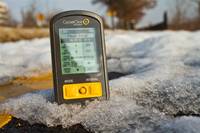
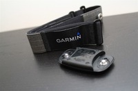
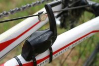


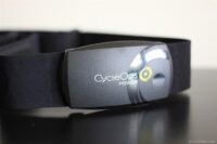
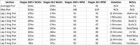
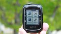

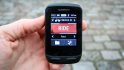
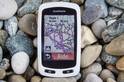


Ray…my first post on your site, but I’ve been “lurking” and reading your reviews for a few weeks now (Garmin Edge models as I was looking to upgrade this year from my 500; MSband 2 which I bought in advance of your detailed review, most of which was spot on about it’s functionality/limitations, etc. and Garmin Virb Elite to name a few…) and just wanted to start by thanking you for the amazing work you do with regard to all of the fitness gadgetry you review…truly and amazing, amazing resource and I”m stunned at how thorough each is…do you ever sleep my man? ;)
At any rate, on to my specific question and man, do I ever feel like a total newb asking it, but needless to say, Garmin 810 is light years different than the 810 i just bought (thanks to your review), so forgive me if I ask the most idiotic question ever posted on your board here in a second…
You mentioned in the “Uploading data to your Garmin” section above:
“For me, the most useful aspect of Garmin Connect though is planning rides. It’s like a massive MapMyRide.com – but with every activity ever uploaded from other Garmin users. Literally millions of activities (I heard once it was 50,000 per day uploaded).
You can then find an activity in an unknown land and save it as a course, and then send it to your Edge 810 via the phone. Pretty cool.”
Well, that’s one thing that would be amazingly useful to me, especially when I travel up to Austin, TX (from San Antonio) to visit my sister in law and want to try and sneak in a ride in unfamiliar territory….thing is, I can’t flipping figure out how to find in Garmin Connect these millions of activities/courses that you and another poster in comments above allude to. Do I need to be connected to them first to see their activities, or am I just not looking in the right place/flipping the right switch in Garmin connect to bring them up because the only activities I see in Garmin connect are my own. Feeling really really clueless especially with you both making it sound so easy. Any help or steerage in the right direction is more than appreciated.
Try switching to “Classic View”; available under profile tab on lefthand side of screen. Once there you should have an “explore” tab available at the top to search other users courses and activities.
Ok..I figured it out…..another way to get there is to go to your dashboard and on the activities tile, where there is a little search magnifying glass, click on that….it’ll open to the Explore window you mentioned Nickles and there you can filter for the type of activity and by not having the “My Activities Only” selection toggled on, you will see all activities uploaded to Garmin within your map range and other parameter limitations. So weird that when you surf over to activities through the sliding frame you don’t get this same interface, but now that I found what I was looking for, will be a tremendous help in “poaching” courses here in San Antonio and Austin that others have vetted as safe, solid ride options.
I’ve also been having a number of problems with the device shutting down when I’m riding a course – incredibly frustrating but reading the comments below it seems I probably need to do a hard reset. If all my courses / activities are on Garmin Connect – is that enough to not lose them when I do a hard reset?
Another issue and one that affects me more regularly is that the bluetooth on the device doesn’t seem to work and I can never get the device to connect to Garmin Connect without actually plugging it in. My phone shows that the Edge is giving off a bluetooth signal, but when I click on it to connect, it doesn’t work. The phone works fine with lots of other bluetooth devices including Fenix 3 so I think it must be a problem with the Edge. This has been the case for months now…. Any ideas?!!!
Love the site and your podcast and find it so helpful, thank you very much.
Great review. I am trying to figure out the best unit for navigation for gravel/ B roads, bike packing, and forest roads. I have a 510, and it’s really just a line to follow. sounds like the 810 is the choice is its not getting replaced anytime soon? Thanks so much for the help.
I’m having real issues trying to get an opensource map onto my 810 (or Micros SD card to be precise)
I’m getting the email link and downloading the mac version of Basecamp installer.
Basecamp finds the map (which has the same name as the original map i downloaded but now covers too small an area) and i can switch between the maps in Basecamp.
I can’t however work out how to put it onto the SD card. I’ve tried dragging and dropping to no avail. I have opened Map Manager, and gone to “install map@ but that doesn’t seem to do anything it. I select the map (which is on my desktop for now) and then click install. It says it’s done, but doesn’t appear in the list.
I then tried MapInstaller but that doesn’t seem to work either?
At a bit of a loss as to what to do (and quite why Garmin have made it so complicated?)
Any advice appreciated.
JohnnyB….
First, I assume you saw Ray’s other post that is strictly about the map loading process at this link and followed all of those instructions: link to dcrainmaker.com
If so and you are still having issues, then maybe my comments below might help.
I was having some trouble initially too and I did a few things to rectify my situation..I’m not even sure which of the following things I’m going to describe was the key to it all or if it was a combination of them or the planets being aligned or what, but I got it to work and so hopefully one or more of these things will help you as well.
First thing…I had mistakenly bought a 64 gig micro sdcard thinking hey…they are so frickin cheap on amazon, why not get 64..bigger is better, right? And it wasn’t a crap card either..at least, I don’t think it is, but there might be some memory snobs out there that would question that (link to amazon.com)….85mbs speed, Class 10, etc….well, i was able to follow the instructions and get the map onto the SDcard but when I inserted back into my 810, the 810 wasn’t recognizing it for the life of me. I deleted, re-tried..nothing. Finally, reformatted and still nothing. So then I started doing some research and I can’t remember now where I found this..might have been DC’s sight, or GPScity or even Garmin but I read that the 810 only plays nicely with 32 gig or less….sooo, I ordered one. Same model and everything.
Got that one in….still had the zip file and the map of course from my original request and download, so didn’t mess with re-requesting. Stuck the image file on that microsd, inserted it into my 810…nothing. Only map that garmin was recognizing on “boot up” was the base map…GRRR. So, I went ahead and reformatted the microSD (make sure you are formatting as FAT32 if you do this step and not NTFS..that was another tip I found somewhere during my trouble shooting research) and then went to put the image back on the microSD and at first, I was just copying it from my desktop over to the blank card and that’s when I realized…duh…don’t forget to create the Garmin directory on the sdcard first and put the image file in there. So I did that, and boom…it worked like a champ. On boot up, it recognized the base maps and then recognized the Openstreetmap no problem and all I had to do was going into my training profile settings and choose that map instead of the base map.
So I’m really not sure what it was that was causing my issues initially..the fact I had too big a microsd card…the fact that i needed to format the card before I did anything else, or the fact that I might have kept forgetting to create that dang Garmin folder and stick the map in there, but whatever the case, doing those three things seemed to make it work for me. Hopefully if you are missing one of those and correct them, the same happens for you because trust me brother, I was right there with you with my frustration level. Ray’s instructions made it look so damn easy and when it wasn’t working for me, I was like..what the hell?
Oh, one other thing..I think someone else said to get on Garmin Connect and make sure your firmrware is all up to date because I think someone found issues with one of the older firmware versions that got corrected later on, so that’s a 4th thing to check I suppose.
I know this isn’t exactly a new product and I don’t know if you still take questions for it, but do you know if the screen on this is acrylic or glass? Can’t find this anywhere on the internet (saw you saying the vivosmart HR is acrylic, that’s how much i searched!). I scratched mine to submission after it falling of the bike on a DH trail and being ran over X many times, and am now trying to sort out it with watch scratch removers/etc. Thanks!
Thanks guys.
I managed to get the map onto my Edge using my work PC. I think the issue lies somewhere in the Mac interface.
I assume i can rename the maps when i download them from the OpenSource site to keep both rather than rewriting due to the same file name?
Thanks for the help
Johnny
Hi Ray,
I love my Edge 810 because of the ability to see a map on the display and search for the way home when I’m lost in nowhere, but one thing is very annoying since the last few months: Bluetooth-Connection to my Iphone 6
My girl wants to stay informed how I am doing and espacially if I’m still moving or lying in the ditch. I don’t know exactly since when it stopped working good for me (could be an IOS 9.x update) but everytime I do a ride the edge shows me “phone disconnected” – “phone connected” at intervalls of five minutes.
If I check my livetrack on the mobile browser outside the garmin website tells me: “livetrack stopped”. Well – is it my fault forgotten to check any settings in the phone/edge, is it a firmwareproblem of the edge talking to my iphone 6 or is the bluetoothmodule a brick?
cheers
Daniel
Hi Ray!
PLEASE READ! I’ve done everything! HELP WITH HRM/CALORIE TRACKING/ZONES??? WHAT can I do to make this work?
Here’s my story about my Garmin Edge 810 – which I love with a passion but the calorie counting. I am on the fence about getting the new Garmin Vivoactive HR watch because I am afraid I will get the same calorie readings. It would be nice to have all fields working correctly. I continually get calorie counts at only about 1/3 of actual rate after each ride/spin class.
I have had it for awhile and set up my heart rate zones as I have had set on every other HRM I have used and it always work well. I keep thinking I am missing some type of user entry or algorithm, as I believe that bad data beget bad results and normally it is always a user error.
It is important to me to have this information, as I am both a personal trainer and instructor.
I have been in touch with Garmin many times and have done the following to try and get it to work properly.
1. Done rides with other HRM: Wahoo and their APP, HRM watch with strap and all are much higher.
2.Reset the entire device
3.Tried numerous HRM straps (Garmin/Wahoo and one other strap.) All work well with other ANT devices and Apps – so no problem there. The average HR for the activity even matches and the ongoing HR displayed is either the same or very close. (yes I have used two devices at the same time)
4. Changed my activity class to 5 (even tried a 3 for awhile). This is interesting as I ride three times a week (40/40/60-80), teach both Spinning and full body conditioning classes minimum of 2x per week
5. Garmin even just replaced it for me with a refurbished 810 – no luck.
Here are my settings and any changes I have made trying to make this work
Gender – Female
Resting HR 42 Changed to HR 62 to see if that might amp things up
Weight – 123
Height – 5’7”
Age – 66
Activity Class 5 Changed from 8 to 5 on advice of Garmin
Zones
Bpm
84 51%
101 61%
118 72%
134 81%
151 92%
165 100%
Interesting. I’ve generally dismissed the calorie numbers, for the opposite reason – that they seem too high.
But, looking back over the last half dozen workouts, they do seem in the ballpark – a little bit more than 100 calories per mile running, and around 500 per hour for cycling (except for one where I did put in quite a bit more effort, and it reported 750 / hour.). I haven’t done anything with HR Zones, or activity class (I’ll have to look that up….).
Dear All, I was a proud owner a fortnite ago. I got an 810 for my birthday. 2 weeks everything was fine. But since the last two weeks my edge gets hung up or goes putt and it’s about the third time I had to go through hard setup. Does anyone have an idea if it’s me or the device? Garmin is not answering my complaint. Any solution, hint would be highly appreciated. Or shall I throw it into the bin? Thanks in advance
Re-routing: I’m skeptical and unsure how the re-routing capability works on the Edge 810 and not having much luck thus far in learning much at all about it via Google searches.
Why I’m interested in re-routing: This is of some interest to me due potential reasons like (a) geography/ draw bridges, (b) wind speed and direction and (c) traffic.
Examples:
Circumvent an area: I may deviate off course to say circumvent one draw bridge and take a brief detour instead of waiting 10-30 minutes.
Headwind and/or traffic: Or due to a head wind and/or heavier traffic on a more main road or street, travel on a less busy street like a residential street for two to three miles that is both parallel and about 300-500 feet east or west of the main road I had put into the GPS bike computer.
I don’t own a GPS and I don’t have to go off-route of a memorized, pre-determined and desired route too often when I ride but what I’m ultimately trying to avoid is a situation such as:
a.) taking a detour for 2-3 miles when riding with my GPS on a pre-planned, longer (30-50 miles) route and the route subsequently being re-calculated and 5-10 miles of the re-calculated route considerably deviating from where I wanted to go. Or some other similar issue when going off of a pre-planned route.
Question: Is there option to see what is your pace while riding and also how to put user info to display when you turn your edge 810 on??? Thank you :)
Pace avg is always an option. And the info on your screen was part of this review if I’m not mistaken.
Ray – How is the 820? Interesting it shares the same form factor as the 520 except a change in color.
link to youtube.com link to the5krunner.com
woop – video taken down! so it was real.
Ok, I’m not going to win any prizes for technology, but the people that write the official manuals for this kind of stuff need taking somewhere quiet and shooting.
I’ve had an Edge 810 for a few days and, frankly, have been sorely tempted to shove it on E bay; nothing about this is ‘simple.’
The I found this website and explains accurately, without condescension, and succinctly exactly what this thing is all about.
I’ve only got thru Bluetooth download and found out why the map is rubbish and feel energised already
Great stuff
Cheers,
Jerry
For the love of God, do not, repeat DO NOT, turn right on Nutcracker street.
Hi ,
Thanks a lot for this review.
For your opinion, is it better to but the 820 or the 810 or the 520, since the 810 is cheaper because of the newer versions, but it seems to me as a better product, what do you think?
The Ebay price for the 810 today is around 250$ VS 400$ for the 820.
Thanks,
Gabi
As a previous user of an 800 and a recent user of the 820, I would stay (far) away from the 820, at least for now. I had numerous issues that were echoed in the 820 review section which led me to return it. Now I’m looking at the 810 or 1000.
Hi all,
I’ve been having issues with my few years old Edge 810 and i’m beginning to get to the end of my tether with it.
The issues are;
1) freezes / turns itself off whilst navigating a course
2) constantly forgets my powermeter. I have to repair it, if i go into the sensor menu, it shows the Ant+ ID as “0” rather than the powermeter’s Ant+ number. I try and re-add it, but a lot of the time it won’t find it. This has become a constant issue. It just loses the power meter mid ride. A real pain in the a– when i’m training with power.
3) It freezes. I have to hold down the power button and then it doesn’t remember the ride, so i lose the data from the session.
Now, these issues only seem to happen with one of the 4 bikes i use. (2 being Stationary trainers);
Wattbike – no issues to date
Giant Right Ride Power – no issues to date
Bianchi commuter – old style garmin magnet cadence & speed sensor on chain stay – no issues to date
Cervelo – new style Garmin speed sensor (on rear hub), Stages Power meter – frequent issues
This leads me to think there’s something with the Cervelo. I’ll often have my phone connected when using this bike for Livetrack or i’ll be using it whilst on the turbo, so the bluetooth will be connected.
Thoughts? I’m getting really fed up with it. I’m loathe to go through a full reset and have to go and pair everything again, but will give it a go if people think it would help.
Thanks
JB
Backup your files and do a full reset. That has always fixed any issues I’ve had.
I’ve been having issues – with and without phone connected; with and without new Garmin Cadence Sensor connected; in Dublin and in Amsterdam (openfietsmap.nl); following a course, navigating, and just riding; own bike and rental; before full hard reset and after (including issues doing the actual reset due to the device not staying ‘off’ at one point, kept starting itself up within a second of me shutting down, after I tried to reboot after it died). Supposedly it’s a firmware issue with the latest 5.10 version (according to various posters on the Garmin forum). I’ve just downgraded to 5.00 (brand new device, I bought it a week ago, issues since ride #1), let’s hope it does the trick!!
As usual DC a good review. I know its old and now superseded by the Edge 820 but I managed to pick up an 810 cheaply and have been using in conjunction with my faithful IpBike which I love. The cellphone gives a better screen which is much easier to read. Together with Life 360 the cell phone also provides live tracking capability.
My main complaint with the 810 is that although the HR zones are stored in the system I cannot find any reporting function.
Has anyone ever replaced the battery on the 810? I see there are some do it yourself kits online to do so, just wanted to know if anyone has ever used them.
I recently moved to the UK from South Africa. My Garmin Edge 810 maps are of course for South Africa and I am unable to use the unit in the UK. I am trying to weigh up the pros and cons of using either:
1. Open Street Maps
or
2. Garmin UK and Europe Official maps
and
3. Will the generic maps still allow me to record my hill profiles on a ride?
I know absolutely NOTHING about the technical aspects of GPS bike computers and mapping. The dilemma I have is that I am worried that using Open Street Maps could somehow damage my 810. Is that a possibility? Is it safe to use Open Street Maps? Can the process be reversed if something goes wrong?
Open street maps are just a file copied onto a SD Card on your 810 and will not damage it in any way at all.
Recording of elevation has nothing to do with the maps, that will work fine.
Follow Rays guide here link to dcrainmaker.com
I’m having some odd issues with my Garmin 810.
I loaded a couple of new routes on which i used over the weekend. I completed the routes got the little fanfare, and then the unit switched itself off. Turning it back on, there is no history of the ride.
This happened on two separate, new routes and then on one older route i’ve used before.
Going in to “last ride” after its done this, crashes the unit and it won’t load.
This morning i did another new route and it worked fine, but there is still no history of the other rides.
The routes were created on RIde with Gps, downloaded to the computer as .tcx tracks and then uploaded to “Garmin \ new files”
Any help appreciated. I’m going to send this to Garmin as well
Johnny
Hi – I had a similar issue this weekend.
At the end of a two our ride, when about to ‘save’, I found that the screen on my 810 had gone entirely blank. Very disappointing. I turned the unit back on but the ride had evaporated.
I am training for London to Paris on behalf of Bloodwise and have elected to try the Chiltern 100 this weekend. I am praying I don’t lose that data too as I’m not expecting 109 km / 1,400m climbed to be easy.
Any advice on how to avoid this happening will be invaluable.
A shop is offering me a deal for the 810 … is it worth it? Or just make the push and get the 820? I’m mainly using it for the basics (cadence, power, speeed, distance) + maps (just moved to a new city and need to have maps so I know where I’m going). Still undecided …
I’m probably not the best person to ask TBH – I use mine for basic stuff too and it is mostly very reliable. I just used in with a route I imported from ‘Ride with GPS’ which I found worked well on open roads but less well in urban areas on roads close to cycle routes but that may not be an issue where you live. I am in the UK.
Had an interesting one this weekend, with power and cadence dropping in and out during a turbo session (making the unit unusable) Any ideas?
Set up;
Bike on Turbo Trainer (Bkool Pro).
Power Tap P1 pedals feeding power and cadence data (as per normal).
Riding on Zwift, with pedals sending cadence data, trainer sending power data (via Saris?!), Garmin HRM sending HR data
Data being collected by Edge 810 and by Forerunner 920XT
Also, Iphone nearby playing tunes wirelessly (via BT) to some Sony headphones.
Checked battery cover connections on the pedals, both Garmin units were dropping in and out. Tried turning Edge 810 off to restart it and the 920 starting behaving.
Tried a few times to get both working, but eventually just turned the Edge 810 off. Cadence and Power just wouldn’t read and when they did would just read the same number on repeat, then go off again.
Didn’t try an exhaustive elimination process, but have used everything other than Zwift together before with no issues.
Anyone got any thoughts?!
Drop the log file into this website and see if you are getting excessive ANT+ or other errors??
link to zwiftalizer.com
Thanks, didn’t bother even saving the data. Will do this next time.
Seems to be that neither Garmin Unit (Forerunner 920XT or Edge 810) likes it when both are switched on.
They both give weird readings for power and cadence (from the Powertap P1 pedals). Making them unusable.
Turning one off means the other then works. I’m thinking it could be an issue with the Pedals given that it’s affecting both units. I don’t recall ever having this problem before when racing.
Ray
I heard you just visited Garmin and said ‘make cool shit’ or something.. Please ghouls you amend to ‘make cool shout that works’? My edge 810 is a disaster – losing ride data and sensors, screen blanking out, powering off by itself. Garmin japan sent it to be refurbished – it took 3 months – 3 weeks later, it’s doing the and thing. I really hate this. Please recommend people to stay away until they improve their quality control. Really wish I’d got an elemnt bolt ?
Sorry about the typos
my Edge 810 has black and red two-tone off/on in settings. Slide to right it is red, slide to left it is black. this is for turn guidance and off course warnings. I assume slide right red means off and slide left black means on? Does green not register in Garmin’s mind? thanks
Adding to the list of issues above… I’ve had the 810 for over two years, and I’ve had a host of freezes, crashes, and other problems that I’ve just learned to live with. Oddly, the Vivoactive HR watch doesn’t seem to have any of these issues. Anyway, the latest problem is that every time I switch bikes on the 810, I have to re-pair the ANT devices all over again. This is particularly annoying for the power meter, which then has to be recalibrated. And spending 5 minutes searching for each device is a pain in the butt when you have to do it before virtually every ride. I’m very close to switching to the Wahoo soon… my friends have it and they have no issues.
My 810 just went back to the factory for its second official refurb. The first one took three months, and a week after receiving it, it reverted to turning itself off, losing ride data, saving data corrupt, not finding the cadence sensor, losing the maps and having unreliable gps location. In all, it’s the most useless pos I’ve ever owned. Switching to wahoo elemnt asap
As an aside, they have lent me an 810j (japanese version) for the refurb period, and it is much more reliable and has pictures in the map… Seems the japanese get better equipment (and probably have to pay for it too!)
Thank you DCR for all the helpful reviews.
I love my Edge 810. Still can’t see any reason to upgrade to a newer model.
There’s one thing I’ve always been curious about though. Is ‘Time to Destination’ based on the course defined average speed or on the average speed ridden on the ride so far?
Thank you
“Note that the menu for toggling the map layers is in a new place compared to previous units. It’s under the Activity Profiles, and then under Navigation and Maps.
At first I was annoyed by this, but the more I use it, it actually makes sense. This way I can create a ‘Hiking’ activity profile with a different map layer (such as Topos), and then still have my default road riding one be City Navigator. Nice touch.”
When I change maps, the effect is global. In other words, I am able to have different maps associated with different Activity Profiles. I have an Edge 810, firmware 6.30. Did this change? Is there a firmware version where this actually works as described above?
Hello.
First of all, I would like to congratulate you on the excellent article, by far the best I’ve seen about the Edge 810.
Secondly, I would like to ask for your help (or anyone else who might be reading). I have this device, and every time I click to start the workout, the following message automatically appears: “ELEVATION CALIBRATED TO POSITION.” Consequently, my accumulated altitude rises to my current altitude, even though I haven’t even walked half a block.
I have restarted and reset the device several times, but the problem persists, affecting the real altitude that I will be cycling.
Do you know how to help me resolve this headache?
Important information:
I’m using version 6.30;
I have an Open Street Map, but I’m not sure if it interferes.
Thank you in advance for your attention.