I arrived into Long Beach (greater LA area) around 7:50AM on Friday, from a week in Las Vegas. First on the agenda was finding Starbucks. With a 5AM departure to the airport, I needed it. Badly. I actually don’t like straight coffee though, but I do like the Mocha Lite Frappuccino thingy.
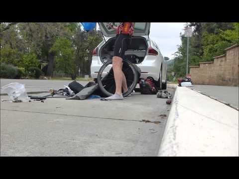
Once that was taken care of, I went over and met up with the Profile Design folks. These are the people behind various aerobars and things of that nature (aerobottles, etc…). They have a new aerobottle + bike computer holder product that’s just hitting stores here in the next few weeks, and they wanted me to try it out.
Above, the Profile Design Aero HC system. It won’t take long to put together my review. It took all of two rides to decide what I think about the bottle. Actually, about one ride. And unlike a gadget, it’s kinda straight forward.
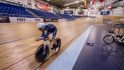
It was pretty much perfect timing though, because a few short hours later I’d find myself at the velodrome, ready to do aerodynamics testing. I’ve got a full post (perhaps two) on this for later this week, but essentially through the use of a sensor network they’re able to do real-time aerodynamic testing while you’re actually riding. This is a bit different from a wind tunnel, which isn’t able to simulate normal rider movement. The technology behind it is from a company called Alphamantis was largely locked down to the Canadian and British cycling teams until the completion of the 2012 Olympics in London. Now, it’s available for anyone willing to pay. ERO Sports runs the testing out of this former Olympic site.
We spent 5+ hours doing all sorts of tests. While some were tests around me and my position, most were tests focused on either products (like the aerobottle above) or other gadgets.
There was a lot of laps involved. I alone did about 25 miles worth on a 250 meter track. But, it was a blast. And I’d love to spend days there tinkering with the guys. It was like a giant cycling geekfest. Standing around pondering “What if we changed this? What would happen? Or this? Or that?” Of course, each test required 10 laps of the track to get good stable data (you have a pretty clear idea after a lap or two though).
With the loops complete, I headed to my hotel and indulged in all that American TV had to offer. Mostly Discovery channel-esque type shows (Deadly Catch, etc…). Many hours passed. I was lazy, and it was great.
And for the most part, Saturday was the same. It was my one opportunity over the next…lot…of weeks to relax a bit for a day. And so me and my little hotel room TV did just that.
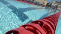
Later in the day I did become un-lazy though and hit up the local YMCA. I picked the absolute closest one that was outdoors (only a mile away), and then wandered over just ahead of closing time. Thankfully, with the crappy weather in full force in the LA area, there was only one other person in the lap lanes.
You know what the good part about not swimming a whole lot lately is? My swim times will improve rapidly. :)
All in it was just about 3,000 yards. Not a huge workout, but just a bit of a ‘get back in the pool’ sorta thing in between two days of riding.
On a side note, I tried (for a second time) the concept of using the Mio Alpha optical heart rate watch to transmit over ANT+ to the Garmin. While it transmits just fine at that close of a distance (any more and you lose signal). The actual data from the Alpha while underwater is largely useless and laggy (the fault of the Mio, not the Garmin in this case). I’ll add my full results into the existing Alpha review in the next day or two. In short, doesn’t really work as a solution (at all). And, for those asking about the Swimovate Pool Mate watch that does HR using a strap, I ordered one and it arrived into my US forwarding address on Friday. I’ll have it sent over in the coming weeks.
Sunday morning I planned to get up at dawn and head up to the mountains. But somehow I talked myself into a few extra hours of sleep before heading to bed. That was probably a poor choice. A really poor choice.
Around 7:15AM I woke up naturally, just a few minutes ahead of my alarm clock. So I got everything all packed into the car and headed out. I decided that I’d bring everything with me in case I was running a bit late. I figured I’d be able to find somewhere to shower along the way.
I worked through the comments from Friday’s post, looking at all the awesome options that everyone provided. In the end, I went with one heading into the mountains for a 44 mile loop from just outside of Pasadena. Here’s the route.
It had some nice climbing in it, and looked like it would largely be away from people. I like nice quiet people-less rides. So I downloaded it to the Edge 800 and the O-Synce Navi2Coach units and headed out.
It took about 40 minutes to the starting point. I just picked a school nearby where the route started. I figured it’d probably be awkward to park in the reader’s driveway.
I spent about 30 minutes getting everything all ready, including photos of the aero bottle. While I had prepared everything the night before – there’s still an element related to validation of all the devices I’m testing. Both power meters as well as head units. And of course the bottle.
(I was proud of my little bit of innovation. Re-purposed a running armband to hold the WASP bridge. I had seen some droppage issues a few rides ago on one of the PM’s due to likely range issues. So this brought it nice and close.)
Once everything was good to go I headed out. The route itself was fairly simple. There was one road into the mountains, simply climb up it. When I got to the turn, follow it all the way around until it came back. Like a big lollipop. So, up I climbed:
And climbed:
I even saw three other folks riding:
These would be the only people I’d see riding for the rest of the ride. And in general, there were very few cars. Just a handful of motorcycles out at the higher elevations.
A short bit after passing them I heard a rumbling. But it didn’t match any sound I’ve ever heard before. Sorta like a broken jet engine meets a really rough sounding washer and dryer. Given I was in the fog with only about 20-30m visibility, I couldn’t visually see what was causing it.
And then I saw it. Immediately to my left and coming down quickly was a rock slide. It was about 15-20 feet in front of me on the opposite side of the road, cascading off of the cliffs high above somewhere and down into the roadway. Given my lack of visibility, I didn’t know if this was just a trickle, or if there was much more coming out of the thick fog from above.
I quickly accelerated just in case, and put some distance between me and it. As I looked back, one of the cyclists that I had just passed had been a few dozen meters behind me, and stopped just in front of it. Thankfully, none of the debris crossed into our lane during this slide. But about 30-40 seconds later as I was continuing up I heard a much louder slide. Not sure where exactly it came from or went to. Never saw it.
On my way back down a few hours later, here’s the slide remnants. I assume someone moved much of the bigger pieces off. Mind you that as a cyclist it would really only take a baseball sized rock to auger me in.
About 20 minutes after the slide I reached the turn-off on the loop. It took me a minute or two to validate it, because no matter which way I went the Edge said I was going the wrong way. I double-checked with the O-Synce Navi2Coach (also had the route) as best as possible and then just decided to go for it. A short bit later both were happy again, so I figured I must have gone the right way.
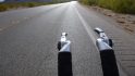
While I had cleared much of the rain, wind and fog, I traded that for some really rough (and kinda wet) road.
Thankfully it only lasted a few miles. But it was definitely not time-trial bike friendly given the conditions. Everything on my bike was shaking and wobbling around to undesirable places. With my hands mostly frozen, I was really hoping it’d get warmer soon. I took the below photo in the most photo-friendly spot along the stretch (read: Few cracks so I wouldn’t crash).
Once I cleared the cracked up road, the clouds ever so slowly started to let up. A hundred or so yards at a time my visibility slowly improved:
And before you know it, I was up and blue sky was visible!
At this point I just rolled (well, mostly climbed) my way up and up, one mountain after another:
The area was really rather pretty. Especially since the only signs of life I’d see were the occasional motorcycle out roaming around:
Yes, I really don’t think they wanted you to stop. Don’t worry, I wasn’t planning on it.
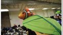
I did see one non-confrontational little creature though:
Nearly ran him over he blended in so well! Looped back to take a closer look at him. Beyond him and the dog, they were the only animals I saw.
Shortly after him while looking up at the road ahead, I realized I was probably in fairly big trouble when it came to making my flight. For some reason I had budgeted just over about 2hrs for the 44 miles. I miscalculated how much climbing there would be. I thought it would be some initial climbing, and then mostly level out for a while on the loop portion before coming back down. This particular climb that I saw ahead definitely put a nail in my timelines coffin. You can see the road far up the hillside snaking along.
What, you can’t see the road? Exactly my point. It’s so far away, and so far up it doesn’t even come out in the above picture without really squinting. A while later, once up top, looking back down you can barely see the road:
Eventually, I reached what I think was my highest point, just under 5,000ft. Though, I had started around 1,500ft, and climbed more than 5,000ft in total:
From there, it was soon back into the fog and rain for the descent.
I really disliked the descending aspect. With the rock slide remnants always present (I probably avoided 20-30 in total over the course of the descent sections), and the slick roadways, there wasn’t much enjoyable about the 48*F and rain ride back down.
The visibility at times was so bad that you couldn’t even see an entire school bus (one was going uphill) in one shot. I think I actually ascended faster than I descended some sections. At the time I took this photo it seemed bad, but then I turned that corner right behind that SUV and it was like a complete whiteout – as the hill had been blocking some of the fog from pouring onto the roadway.
About 11 painstakingly slow miles later I broke out of the mountain roads and rain and found myself down in the neighborhoods near where I parked. Mostly happy to be able to take my hands off the brakes. I’ve got two fingers still sore from holding onto the thin metal slicing brake handle.
While I’ve been using the O-Synce unit a lot lately, it was nice to test it out in the mountains from an elevation standpoint. I was pleased with how well it tracked altitude, primarily to the altitude markers I saw many places along the route. Additionally, it was pretty darn close distance-wise to the Edge computer (no idea which one is truly right).
For those keeping track at home on the airplane front, it was at this point 12:13PM. My flight was at 1:58PM…out of LAX – some 30 minutes away. Plus packing my bike. Plus returning the rental car at LAX (which I know from many historical visits is probably the single airport in the US that takes the longest to return a rental car). Plus checking luggage.
Fear not, I packed up my bike pretty quickly. Here’s the whole process (including a brief water bottle leftover shower) in 60 seconds:
Probably not the pinnacle of my bike packing jobs however – but it’ll have to do given the circumstances. A number of you have asked about the bike case recently. I wrote up about it here.
I made really good time back down to LAX. But ultimately the rental car return did me in. It took about 25 minutes all-in from the moment I removed the key from the car. By time I arrived at the ticket counter it was about 22 minutes until the flight. And while I would have made the plane itself just fine (had already checked in), the bike/luggage was a bit more challenging. I wasn’t terribly worried through, I had looked earlier and there ample flights later on. So the agent easily changed me to one a few hours later.
Ironically, a bit later I flew right back over the exact same spot I rode on. And the same places where it was clear for me during the ride, it was still clear. And same goes for the clouds.
With that, I’ve got one more flight and I’ll land in Kansas City. Where in nearby Olathe, Kansas plays home to the headquarters of Garmin. I’ll be spending the day there talking with various product teams, giving your feedback, and other things related to the company. As I said a few weeks ago, I’ve got a few different trips planned over the next few weeks with some of the biggest players out there. Part to give your feedback, and part to give you a peek behind the curtain. And yes, for those wondering – I’m paying for everything.
So hang tight, it’s gonna be a crazy week bookended with interesting visits.
Thanks for reading!
FOUND THIS POST USEFUL? SUPPORT THE SITE!
Hopefully, you found this post useful. The website is really a labor of love, so please consider becoming a DC RAINMAKER Supporter. This gets you an ad-free experience, and access to our (mostly) bi-monthly behind-the-scenes video series of “Shed Talkin’”.
Otherwise, perhaps consider using the below link if shopping on Amazon. As an Amazon Associate, I earn from qualifying purchases. It doesn’t cost you anything extra, but your purchases help support this website a lot. It could simply be buying toilet paper, or this pizza oven we use and love.
I swim, bike and run. Then, I come here and write about my adventures. It’s as simple as that. Most of the time. If you’re new around these parts, here’s the long version of my story.
You'll support the site, and get ad-free DCR! Plus, you'll be more awesome. Click above for all the details. Oh, and you can sign-up for the newsletter here!
Here’s how to save!
Wanna save some cash and support the site? These companies help support the site! With Backcountry.com or Competitive Cyclist with either the coupon code DCRAINMAKER for first time users saving 15% on applicable products.
You can also pick-up tons of gear at REI via these links, which is a long-time supporter as well:
Alternatively, for everything else on the planet, simply buy your goods from Amazon via the link below and I get a tiny bit back as an Amazon Associate. No cost to you, easy as pie!
You can use the above link for any Amazon country and it (should) automatically redirect to your local Amazon site.
While I don't partner with many companies, there's a few that I love, and support the site. Full details!
Want to compare the features of each product, down to the nitty-gritty? No problem, the product comparison data is constantly updated with new products and new features added to old products!
Wanna create comparison chart graphs just like I do for GPS, heart rate, power meters and more? No problem, here's the platform I use - you can too!
Think my written reviews are deep? You should check out my videos. I take things to a whole new level of interactive depth!
Smart Trainers Buyers Guide: Looking at a smart trainer this winter? I cover all the units to buy (and avoid) for indoor training. The good, the bad, and the ugly.
Check out
my weekly podcast - with DesFit, which is packed with both gadget and non-gadget goodness!
Get all your awesome DC Rainmaker gear here!
FAQ’s
I have built an extensive list of my most frequently asked questions. Below are the most popular.
You probably stumbled upon here looking for a review of a sports gadget. If you’re trying to decide which unit to buy – check out my in-depth reviews section. Some reviews are over 60 pages long when printed out, with hundreds of photos! I aim to leave no stone unturned.
I travel a fair bit, both for work and for fun. Here’s a bunch of random trip reports and daily trip-logs that I’ve put together and posted. I’ve sorted it all by world geography, in an attempt to make it easy to figure out where I’ve been.
The most common question I receive outside of the “what’s the best GPS watch for me” variant, are photography-esq based. So in efforts to combat the amount of emails I need to sort through on a daily basis, I’ve complied this “My Photography Gear” post for your curious minds (including drones & action cams!)! It’s a nice break from the day-to-day sports-tech talk, and I hope you get something out of it!
Many readers stumble into my website in search of information on the latest and greatest sports tech products. But at the end of the day, you might just be wondering “What does Ray use when not testing new products?”. So here is the most up to date list of products I like and fit the bill for me and my training needs best! DC Rainmaker 2024 swim, bike, run, and general gear list. But wait, are you a female and feel like these things might not apply to you? If that’s the case (but certainly not saying my choices aren’t good for women), and you just want to see a different gear junkies “picks”, check out The Girl’s Gear Guide too.