Remember the first time you used Google Earth some 19 years ago? Yup, that’s kinda like this. Except, now with all your personal Strava heatmap overlaid atop it. And yes, Google earth is really 19 years old. It was first released in June 2001 – some 8 years before Strava themselves came along. History lesson aside, this is not Google Earth, but rather, powered by Mapbox. In fact, I’m sure someone at Mapbox or Strava is face-palming that I’d even mention Google Earth. But hey, Friday.
To use it’s super easy – assuming you’re a Strava Subscriber. Though, it works best on a laptop/desktop – less so on a mobile device since it’s not Strava’s app, but rather their desktop site. Still, if you’re determined enough – then go forth and hit up this link. Here’s mine, starting with Amsterdam. This isn’t new, but it’s still fun to see every road or path I’ve ever ridden or run on, and then more lava when I ride that route more often.

Though, it’s not limited to just running and riding. In fact, if I toggle satellite mode you can see my swims in the ‘lake’, and my ice skating in the rowing basin. You can use the various checkboxes and toggles at left (on above screenshot) to filter activities and such. The cool thing though is *ALL OF THESE ARE LINES MINE*, and mine alone. But again, we’re not here for that.

Instead, we’re here for this checkbox:

Click it! Click it real good!

And just like that, you learn the Netherlands is a pancake. A perfectly flat crepe. Not even the summit I repeated some 27 times shows up to become the Strava Local Legend. You can change from satellite view to not-satellite view, but it won’t make the Netherlands any less pancakey.
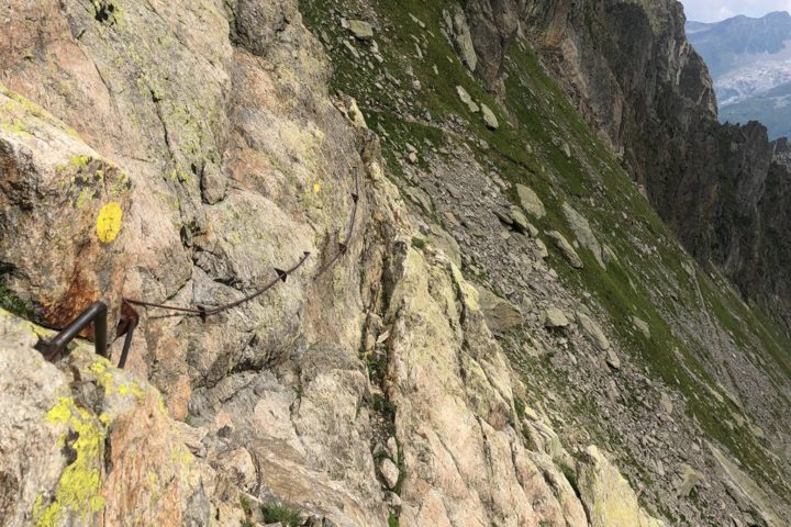
So instead, let’s go down to Chamonix, where I’ve got plenty of lines to make this feature halfway viable. And there we go, we can see all my red lines. Most are hikes and trail runs. Though some are skiing, and a few mountain and road rides. I go less now that we’ve moved from Paris, but there’s still many years of data there.

You can hold down the CTRL button on your keyboard to move the map’s orientation around, while concurrently using the mouse to tilt it. For example, I can see this skiing down the glacier:

Or the numerous hikes and trail runs I’ve tested many a watch before major reviews. The Fenix 5 Plus and Fenix 6 series watches, as well as Suunto 9 reviews were all put together here. Along with GoPro and drone reviews, and honestly countless other products over the last near-decade.

Of course, the 3D modeling isn’t Hollywood level here. But it’s kinda neat, and helps put into perspective some of your larger elevation events. Kinda like Relive. Oh wait, was I not supposed to mention that either? Crap…Friday again.

Anyway, it’s cool stuff. Like most 3D mapping things, it’s probably more interesting to yourself, than to others. For me, I look at these lines and have distinct memories of each line. Above, that purple line through the snowfield? Yup, that’s actually a sketchy AF section hiking/trail running. In fact, the least lovable part of my 7-hour meander that day. To you, it’s just a purple line on a white field. To me, it’s this:
Meanwhile, below at Le Tour is the edge of France and Switzerland, along the black line on the right side. It’s sorta the forgotten child of the main Chamonix area, but is honestly my favorite. It’s always quiet – tourists don’t tend to go there, and I can shoot and test all sorts of products there without anyone poking at me. Those lines below are from GoPro Hero 8 testing and AirDog ADII testing. The Fenix 6 Review Video (with 1.3mil views) was shot with me standing where the ‘F’ in red is, with the mountains in the background. The Suunto 9 Hands-on video with 334,000 views is where the S is.

But again, to you they’re just lines on the grass. French grass, Swiss grass…but still just grass.
Still, it’s fun to play around. Go forth and have fun, here’s that link again (for Strava Subscribers anyway).
With that – thanks for reading!
FOUND THIS POST USEFUL? SUPPORT THE SITE!
Hopefully, you found this post useful. The website is really a labor of love, so please consider becoming a DC RAINMAKER Supporter. This gets you an ad-free experience, and access to our (mostly) bi-monthly behind-the-scenes video series of “Shed Talkin’”.
Support DCRainMaker - Shop on Amazon
Otherwise, perhaps consider using the below link if shopping on Amazon. As an Amazon Associate, I earn from qualifying purchases. It doesn’t cost you anything extra, but your purchases help support this website a lot. It could simply be buying toilet paper, or this pizza oven we use and love.


I think the first occurrence of the link is wrong; it links back to one of your own posts ;).
Thanks, fixed!
Cool feature, but also not life saving.
I just get triggered each time when someone on the internet says ‘The Netherlands is flat’. I so wish they would say: ‘most part of the Netherlands is flat’. If you think why that matters: come ride a bike between Heerlen and Maastricht and we can discuss flatness in the Netherlands. (gues in what part of NL i live in *grin*)
To be fair, I didn’t call it flat. I called it a perfectly flat crepe.
Sometimes, rarely, crepes get little deformed parts that stick up. :)
Sorry Pal, living in Switzerland, the route from Heerlen to Maastrich for me is still “flat” ;-)
Ray did mention a particularly lumpy bridge once…
This reminds me of a conversation I had with an Austrian in a bar years back.
Where are you from?
Poland.
Holland? Holland is flat.
So there’s that 😉
In my part of the the world we do our climbing on overpasses 😜
That’s so cool… more encouragement to go up those hills!! :)
All this work from strava this year and yet when my distance reads 7.00 miles on my watch it still shows 6.99 miles on strava.
I thought I was the only one that gets annoyed by that.
I don’t recall seeing inline ads before.
Or is this something different?
Hi JD-
They’ve actually been in place for a few months now. Though not typically on posts this short. I think the logic is on posts with at least 3 sections (so on a review, that’s a lot of words). I’ll have to check with the ad company on this one.
Cheers!
first time i’m seeing ads today as well. the kind that follow me and play videos and i keep having to ‘x’ out of constantly.
thankful that reader view is there to the rescue, otherwise it’s not even worth visiting pages that have them all over the place like this :/
You can consider becoming a DCR Supporter and not have any ads at all: link to dcrainmaker.com
Cheers!
It looks great. Now if only they could add a useful feature like comparing all the segments you have in common with one of your followers for a bit of friendly rivalry. (Which 3rd party sites used to do before Strava changed it’s API)
I have played around with it a bit and it really only looks good in non-urban environments; the buildings aren’t rendering as 3D so it looks extra fake. It looks really nice for some Patagonian hikes I went on before the pandemic but for my DC based runs it is just kind of fine. The rendering speed and activity grouping on zoom-outs is a huge improvement from the previous heat map; however, this is still isn’t a feature I would try to sell my friends on why they should pay for Strava. In my opinion, this is where a lot of the premium features fall – they are fun to have but not hugely beneficial to training. I enjoy what used to be called the suffer-score and the safety beacon, everything else just extra benefits.
As a subscriber I find this feature completely useless. One thing that has stopped working is the ride match, that was extremely useful. Most of my rides now look like I was alone when in fact I rode to a group ride. This was primarily how I found new people to ride with. A social networking site enabling real world social interaction, how novel, but alas they changed it last year and it no longer works and my interactions with strava tech support have confirmed this is on purpose. I wish strava would focus on its core features instead of these gimmicks.
This is likely because the people on your ride haven’t re-enabled the correct privacy settings: link to dcrainmaker.com
I think they have as they show up in the fly-by portion of the site. Strava told me that if I don’t ride more than 50% of my ride with them then they won’t show up, even though we’ve done a 25 mile loop exactly together.
When they finally add the OSM CYCLE map layer. 3Dterrian Function not needed.
Just a quick tip:
In that other tool, Google Earth you can in fact scale the landscape, so even in flatter regions (Belgium/Netherlands) you can see those hills you’ve been running/riding on to be just as daunting as in real life.
Nice! I have to admit this feature was the last nudge to push me to take some months of subscription this summer (together with the Assiomas I recently took).
The added value of Strava is really exploiting your own ride history over the years – I am OK to pay two or three months each other year for that (I am absolutely against full year commitments).
PS: guess where my parents live (and I grew up) and spend a week each year doing some rides?
That’s cool, where is that?
At first I was thinking it’s kinda like the elevation from Bourg-Saint-Maurice up to Les Arc, but the town/river profile doesn’t fit.
The front is Austria, town of Hallein. My parents are very close to the local saltmine. The interesting part is in the very back background, across the border to Germany (Berchtesgaden) – the track is the hidden secondary road up to Eagle’s nest (Kehlsteinhaus, they built two roads up for Hitler, for security, he only went up once but too afraid of heights).
Nice climb: link to strava.com
That looks awesome!