
With Garmin’s introduction of the Edge 1040 Series they’ve become the first GPS bike computer to not only add solar panels to it, but also add multiband GNSS, dramatically increasing the accuracy of the GPS tracks – especially in tougher conditions. Beyond that the company has added a slate of long-asked for upgrades, including things like USB-C support, metal mounting back/tabs, and dramatically faster route calculation and destination searching.
However, beyond that are the slate of new features we see anytime Garmin adds a new device. These include their new Power Guide function that creates race/training day plans/targets specific to a given course, while also adding in features that help identify your cycling ability and how that matches up to a given course’s demands. All while also laying the groundwork for more cycling-specific dynamic training plans that we saw introduced and hinted at on the Forerunner 255/955 last week.
I’ve been using the Edge 1040 Solar for a while now, putting it through its paces on everything from everyday rides to epic rides, indoor training to commutes. All of which ultimately culminates in this review based on real-world usage and not just reading a specs sheet).
As usual, this unit is a media loaner, and it’ll go back to Garmin shortly. This review is not sponsored (nor does any company get to preview my review), furthermore I don’t take any advertiser money from any companies I review. And as regular readers know, if something is crap, I’m gonna tell it brutally like it is – no matter the brand (as Garmin saw just a few weeks ago). Once this unit goes back, I’ll go out and get my own for any future testing needs. If you found this review useful, you can use the links at the bottom, or consider becoming a DCR Supporter which makes the site ad-free, while also getting access to a mostly weekly video series behind the scenes of the DCR Cave. And of course, it makes you awesome.
What’s New:
The Edge 1040 is largely an evolutionary upgrade rather than a revolutionary one. Still, because of a complete re-design of the user interface, it effectively represents a break from the past. A dividing line if you will, and as such we see a slate of new features taking advantage of that UI redesign, as well as a handful of features being killed off.
I’ve gone through side by side of both units (1040 vs 1030 Plus), and tried to find every nuanced feature that’s different. Some of them are substantial (Power Guide or Multiband GNSS), and some of them less substantial (adding WiFi sync-all button). In any case, go forth:
– Added Solar ($749) and non-Solar model ($599)
– Added Power Glass specifically for Solar model only
– Increased storage from 32GB to 64GB for Solar model only
– Added pre-loaded North America & EMEA for base version
– Added pre-loaded North America, EMEA, AU/NZ Maps for Solar model only
– Added Multi-band/Dual Frequency GNSS/GPS
– Added USB-C connection
– Changed the back mount to be metal
– Completely revamped the user interface everywhere
– Changed lanyard attachment to not thread through the charging door
– Added Connect IQ Widget Glances to Homepage/Dashboard
– Added Power Guide for per-course training/racing guidance
– Added Up Ahead for distance to waypoints
– Added Cycling Ability to classify cyclist strengths/weaknesses
– Added Course Demands to compare course features to ride needs
– Added Real-Time Stamina to show energy/distance/duration left during workout
– Added Location Search Widget
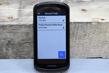
– Added ‘Recent Finds’ from navigation panel (so things you recently searched for).
– Added new ‘Bike Shops’ & “Water Stops” categories for navigation search (and completely re-did other categories to mostly get rid of auto stuff)
– Added Post-Ride ClimbPro Splits on device
– Added re-scheduling of primary workouts
– Added support race/event driven Daily Suggested Workouts (subset of what was launched on FR255/955 last week)
– Added paired sensor information to summary page (even for non-Garmin sensors)
– Added support for Shimano STEPS sensor type (eBike component)
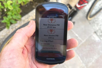
– Added new consolidated post-ride Highlights screen with PR’s
– Added estimated battery remaining when toggling Battery Saver mode
– Added manual WiFi sync all button (a ‘do it now’ option, but removed single-ride upload option)
– Added phone-based config of data fields/data pages
– Added Garmin Connect IQ App Store on-device marketplace
– Changed nearby POI/Things search to be fast AF now. Holy crap.
– Far faster route calculation times
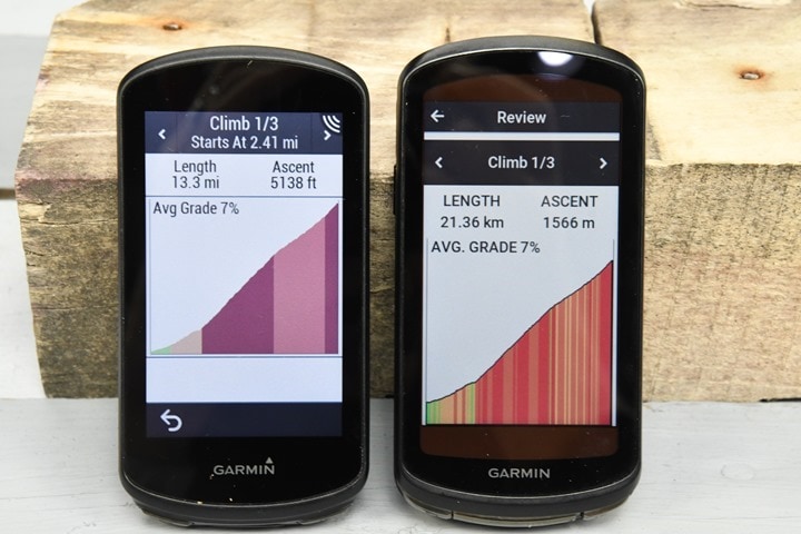
– Increased ClimbPro coloring to show more gradient definition
– Now automatically changes map popularity type to match activity (I.e. Road vs MTB)
– Removed horrifically unreliable duplicate Bluetooth pairing process for phones
– Removed Varia Vision sensor support
– Removed device transfer (sharing between units)
– Removed 3D Map Orientation option (kinda looks like car GPS map)
– Same screen resolution as before
– Same touchscreen as before
– Increased weight slight from 126g to 133g
– Nearly Doubled battery life from 24 hours up to 45 hours (in Multi-Band GPS mode with Solar)
As usual, it’s common to ask whether any of these features will be added to any existing Edge units, and unfortunately this time the answer is no. While Garmin has added an insane number of features to the Edge 1030 since its release (including virtually all of the Edge 1030 Plus features), as well as a sizable number of features to the Edge 530/830/1030 Plus since their releases, this time around the new features aren’t being added downstream.
Garmin didn’t clarify why, though, I suspect it’s largely tied to the new user interface on the Edge 1040. Bringing those features down to older units would have required either updating the UI on those older units, or, changing the code on the newer features to work in the older UI (which in turn has more developer time associated with it). Of course, that doesn’t change the reality that the Edge 1030 Plus especially, as well as older units, are largely fully capable technically-speaking of receiving future firmware updates, they just won’t from a business standpoint.
Meanwhile, we’ve seen both Wahoo & Hammerhead continue to add features updates to older units. Albeit even in those cases, that continuation for the oldest devices has somewhat faded. For Hammerhead, the majority but not all of the new features are both Karoo versions (of course, Hammerhead is releasing so many new features every two weeks it’s insane), whereas in Wahoo’s cases, their new feature train has mostly died.
Size Comparisons:
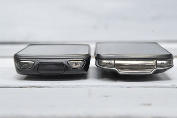
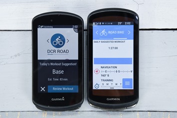
To begin, here’s a look at how the new Edge 1030 Plus (left) compares to the Edge 1040 (right):
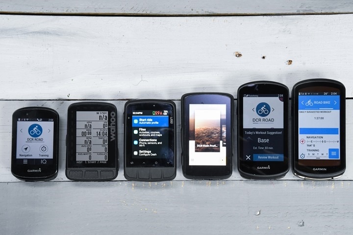
Then, here’s a lineup against some popular units these days (Edge 830, Wahoo ROAM, Stages L200, Hammerhead Karoo 2, Garmin Edge 1030 Plus, Garmin Edge 1040 Solar):
And finally, here’s a weigh-in of all of them:
Got all that? Good, let’s start using it.
The Basics:
This section will start off with some basic aspects of using a Garmin Edge series device, but will cover newness in the Edge 1040 as I go along, getting deeper and deeper. Note that I’ve separated out the Solar, Mapping/Navigation, and new Training Load type features into separate sections after this. Everything in every section except the Solar unit, applies to both models.
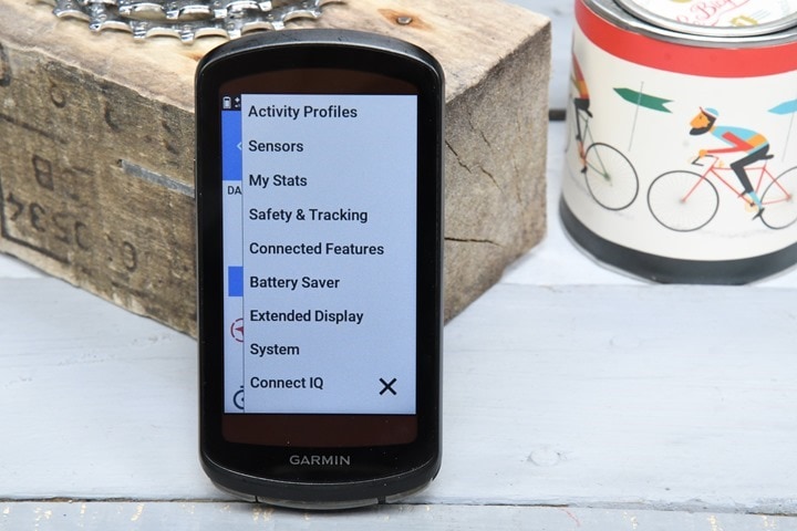
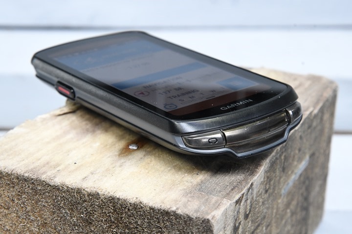
Starting with the user interface, the Edge 1040 is a touchscreen interface, but also has three physical buttons for certain features. The buttons are used for starting/stopping an activity, as well as creating a lap. And powering on/off the unit. In other words, things that you generally do rarely or very purposefully. Meaning that while the touchscreen is pretty good, like any touchscreen, accidents can happen.
The touchscreen seems to work quite well in either sunny or rainy conditions, and with or without gloves. Even all-out dumping rain with standing water on the screen, and it still works just fine. The display resolution and touchscreen are the same as before, though the clarity will look better because of the new fonts (and inversely, also like the slightest bit darker on the Solar edition).

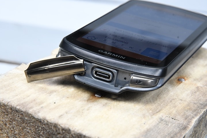
Next, and perhaps most importantly, Garmin switched to USB-C for the Edge 1040. Given they’ve been working their way through adding USB-C to other devices this year, this likely comes as no surprise. And is solidly on the “Flippin’ finally!” realm.
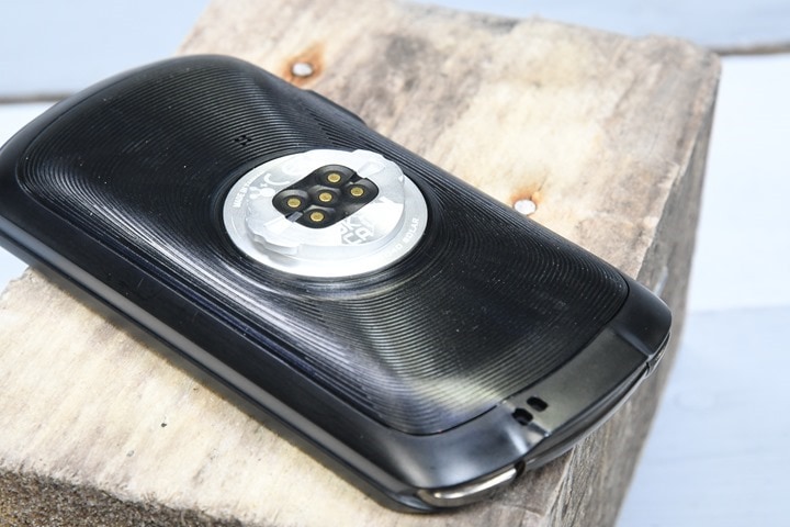
They also changed the mount on the back to be aluminum, as well as changed the location of the lanyard string to not be through the charging port door (much cleaner). The mount still supports Garmin’s Extended Battery Pack, in the event 100 hours of battery life by itself still isn’t enough for you.
When you first unbox the Edge 1040 you’ll likely pair it up with Garmin Connect Mobile on your smartphone. If you do so, and if you have an existing Garmin Edge device, it’ll transfer over your sport profiles/data pages/settings, as well as all your paired sensors. In my case, due to a now-fixed bug, it did not transfer my sport profiles over, but did transfer over all my sensor profiles.
Most notably as part of that pairing process is they’ve done away with the frustrating dual-Bluetooth pairing they used to do, which paired both a legacy Bluetooth connection and a newer Bluetooth Smart connection, which was prone to connection issues. That’s gone now.
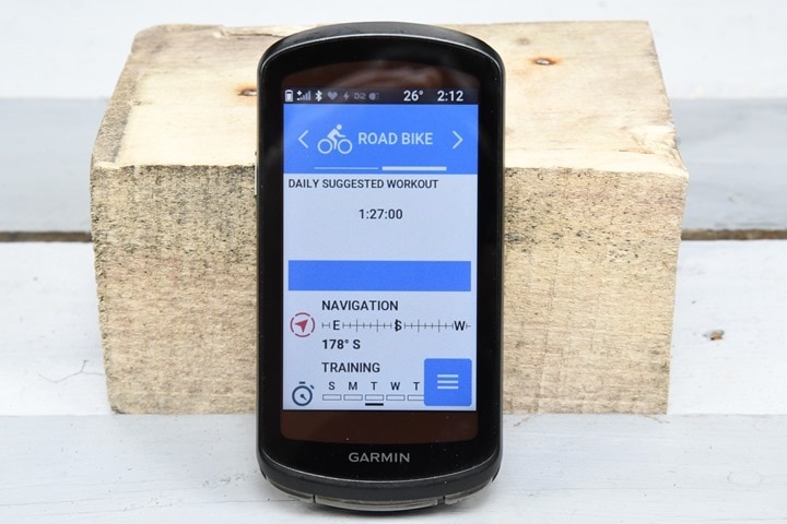
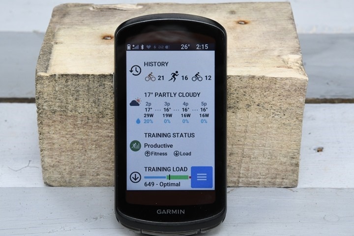
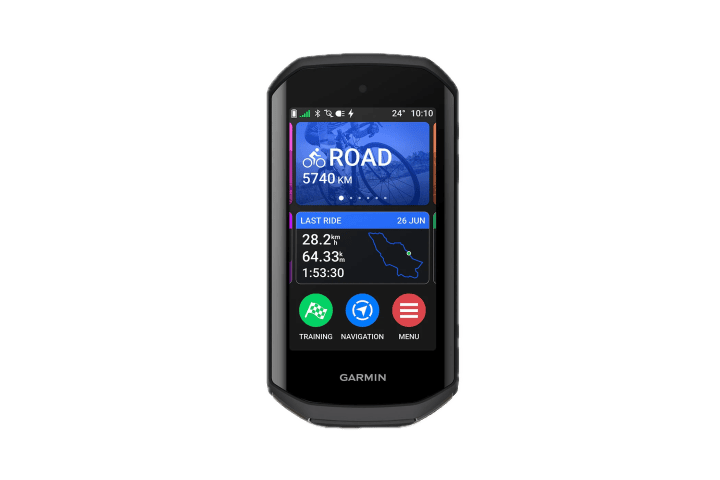
Once turned on, you’ll find the newly revamped interface on the Edge 1040. The main shift here is towards a homepage/dashboard that roughly matches the Widget Glances functionality that’s been on their wearables a few years. The idea being you can customize this, download widgets to it for various things, and tweak it to however you like it.
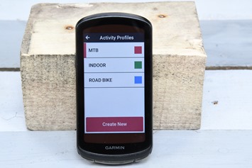
Up at the top you’ve got your activity/ride profiles. You might create one for road biking, one for mountain, one for commuting, and so on. Each of these can have vastly different settings, from map/navigation settings, to data pages and data fields, ClimbPro settings, timers/alerts, GPS configurations, etc…
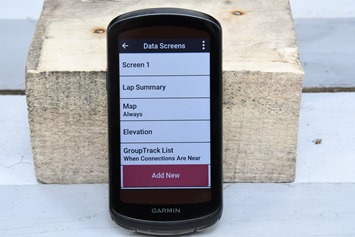
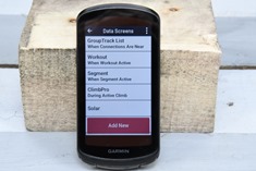
Looking at data pages for example, you’ve got a slate of predefined pages (including things like Strava Live Segments), and then you can create pretty much as many custom pages as you want. Custom pages can have up to 10 data fields per page, and there’s likely hundreds of different data fields you can choose from. And that ignores all the Garmin Connect IQ data fields from 3rd parties you can add (for free).
Notably, you can now manage and edit all data fields/pages/settings from your phone – just like recently seen on the Fenix 7, Forerunner 255/955, and Instinct 2 series.
Going back to the widget glances for a second, you’ll find them customizable and covering everything from quick access to navigation, to your ride history, as well as your training plan (if one is created). If connected to your phone via Bluetooth, you’ll get weather data and any smartphone notifications.
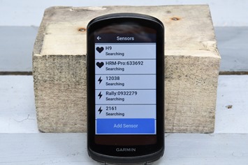
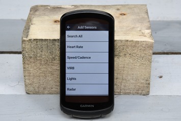
Next, there’s sensor pairing. That’s located within the sensors menu, and lets you pair up any ANT+ or Bluetooth Smart sensor:
The Edge 1040 Series supports the following sensor types:
Heart Rate (ANT+ & Bluetooth Smart), Speed/Cadence (ANT+ & Bluetooth Smart), Garmin VIRB (ANT+), Cycling Lights (ANT+), Cycling Radar (ANT+), Cycling Power (ANT+ & Bluetooth Smart), Garmin inReach (ANT+), Garmin Edge Remote (ANT+), Shimano STEPS (Proprietary Shimano ANT), eBike (ANT+), Gear Shifting (ANT+), Shimano Di2 (Proprietary Shimano ANT), Smart Trainer (ANT+)
Notably, this adds Shimano STEPS sensors, which are eBike sensors, while concurrently removing Garmin Varia Vision sensor support. Speaking of removals, they also removed device transfers between units, which was previously used for sharing courses and such. While it sucks that they removed it, the feature hardly worked well to begin with. So I’m not sure it’s a huge loss.
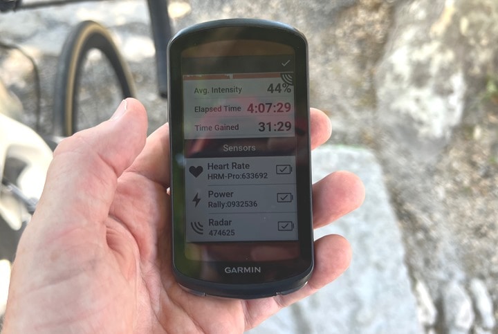
One cool thing that they added in the sensor realm is that at the end of the ride, it’ll actually show you not only which sensors were paired in the summary screen, but the battery status for those sensors (including non-Garmin sensors when broadcast):
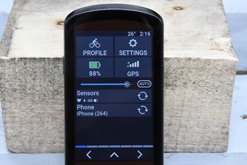
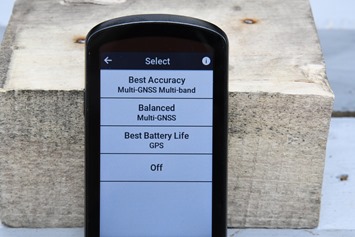
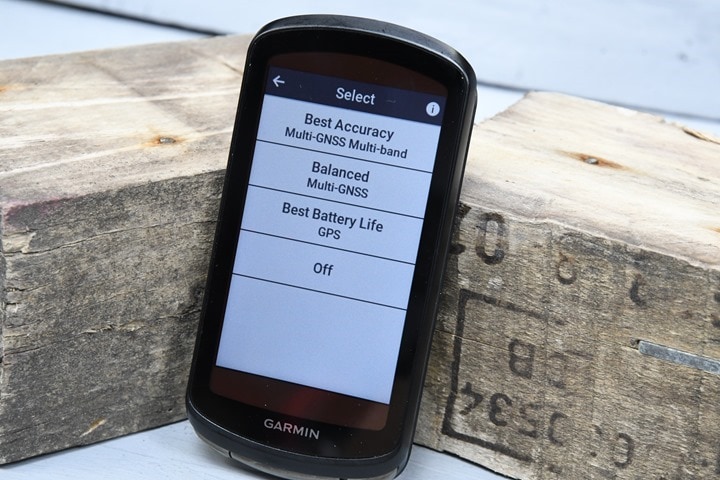
Next, there’s the new multiband/dual-frequency GNSS/GPS. This is considered the holy-grail of GPS accuracy. You can quickly glance at the top settings to see which GPS mode it’s in, as it’ll show a small “+” when in multiband. You can change this on a per-activity profile basis:
Multiband GPS can produce astonishing results in harder conditions like trees, mountains, buildings – as I’ve shown in my Fenix 7/Epix/Forerunner 955/Forerunner 255 reviews. At the same time, there’s also a significant battery hit (roughly halves your battery). And for most on-road rides, you simply don’t need multiband GPS. So you can go back to ‘All Systems’ or even ‘Base’ GPS, and still get results equal to or better anything you had on your existing Garmin Edge 1030/1030 Plus (and thus, double your battery). More on that in the accuracy section. Here’s Garmin’s official battery specs:
Demanding use (Multi-Band GPS)
– 35 hours / up to 45 hours with solar charging
– Solar charging adds up to 20 minutes per hour during daytime riding
– Demanding specifically means: Multiband GPS, 4 sensors connected, Live Track enabled, an on the map page with a course loadedBattery Saver mode:
– 70 hours / up to 100 hours with solar charging
– Solar charging adds up to 42 minutes per hour during daytime riding
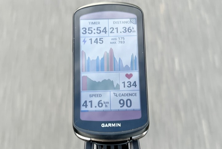
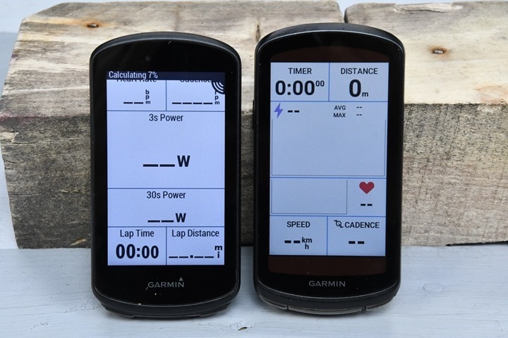
So at this point, with everything set, we’ll just start a simple ride. It’ll usually find GPS within a couple seconds, and find sensors once activated within a few seconds as well. You’ll chose your activity profile and then press start. At which point you’ll see real-time data on the screens, and it’ll be recording in the background:
As you can see, all of this is pretty much like any other bike computer. The fonts are a bit different of course than before with the new user interface, but by and large, it’s pretty much same-same. And, like before, it all works well.
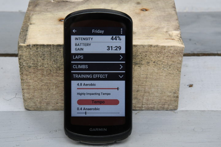
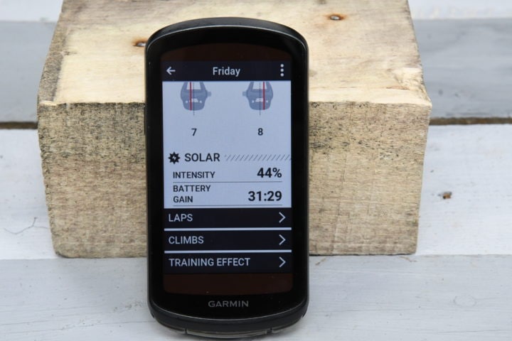
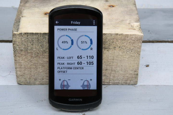
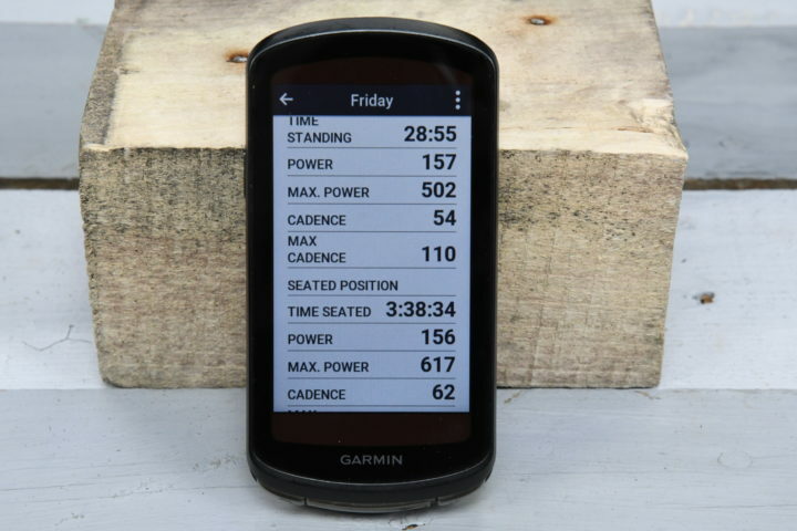
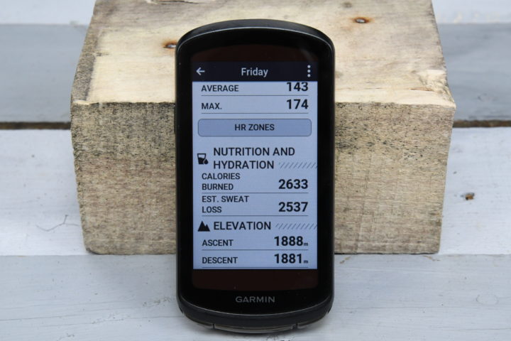
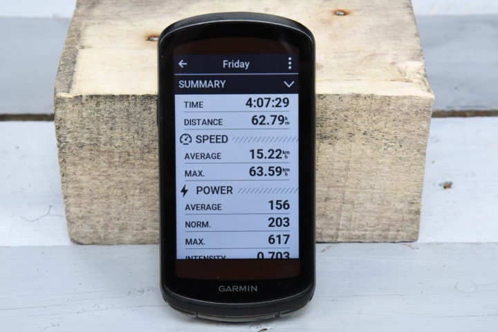
Post-ride, there’s a slew of changes however, starting with a new achievements summary page that outlines any PR’s for the ride, as well as the training impact/load/recovery time, and then if on the solar model – the solar related bits.
After that you’ve got a second more detailed post-ride page that gets into crazy-town on the detailed stats, broken out into different sections that are easier to digest. Here’s a galley of all that:
As usual, all this gets sent up to Garmin Connect via Bluetooth/WiFi (or even USB), and then is visible on Garmin Connect Mobile or the desktop site. And of course, if you’ve got any linked accounts like Strava, TrainingPeaks, Today’s Plan, Final Surge, etc… it’ll instantly send the data to them as well.
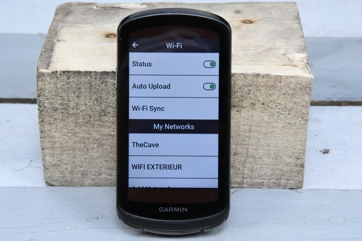
Finally, for lack of anywhere else to put it, the Edge 1040 does have WiFi connectivity. That’s for syncing rides, courses, firmware, and everything except maps. Maps via WiFi would be logical, but I’ll rant about that later in this post. However, what is cool is that Garmin added a new Sync Now button. I know this sounds trivial, but previously this didn’t exist. You could sorta fake it by going deep into a single historical workout and triggering it there for a given ride, but this new button makes WiFi sync easy:
I find that generally speaking, WiFi sync just works more reliably than phone sync, especially for courses or such – or, if I’ve got other Garmin devices already doing syncs (like a watch or such). But perhaps that’s just me.
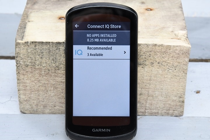
Garmin has also added in a new Connect IQ app store for the Edge 1040, that’s on-deice itself. This is prominently displayed in the lower right corner of the unit, and takes you to a list of recommended apps. Of which, there are basically just a couple (literally, three).
As I criticized last week in my Forerunner 255 & Forerunner 955 review, having just 2-6 specific Recommended Apps here (that don’t change) is entirely useless and defeats the point of this concept. I should see weekly recommendations of cool new apps, ideally from a blend of big and smaller developers. There’s countless new CIQ apps available, and showing me the same tired big-name apps that all of us have ignored for years isn’t likely to get me to increase my usage of those apps. Either I already have them, or I didn’t want them years ago. Showing me the same apps forever isn’t going to change that.
With that, let’s dive into Solar features next before circling back on navigation/routing and other training load features.
Solar Features:
This section is focused entirely on the solar edition of the Edge 1040, which includes the solar panel technology. This solar panel (obviously) provides solar power for the unit, which increases the battery life both while you’re riding, and also (in theory) while just chillin’ on a table in the sun non-riding.
Starting with the Solar panel itself, it’s divided into basically two types. The first is the most obvious portion of the panel at the top/bottom of the screen (the reddish portions above). This is the visible portion, and has a photovoltaic level of 100%. In the most simplified explanation, 100% of the sun’s goodness that hits this portion of the panel gets converted to extra juice (there’s a lot of technical nuances to that, but again, simplicity here).
However, over the entire display is another solar panel that has a 15% photovoltaic level (a notable increase over the Fenix 7 & Forerunner 955 panels which are 7% photovoltaic levels). This main panel is obviously far larger than the upper/lower panels, but harvests less energy since it’s just 15% versus 100%. But, you can see though it, so it’s essentially invisible to you. That’s what Garmin calls ‘Solar Glass’, because it’s actually glass.
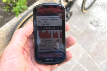
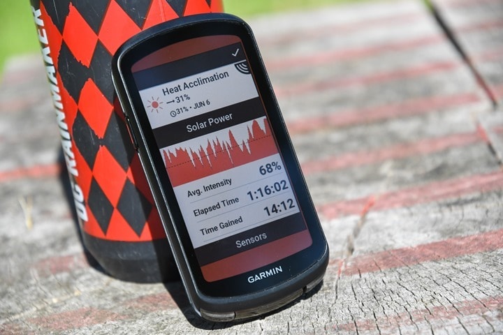
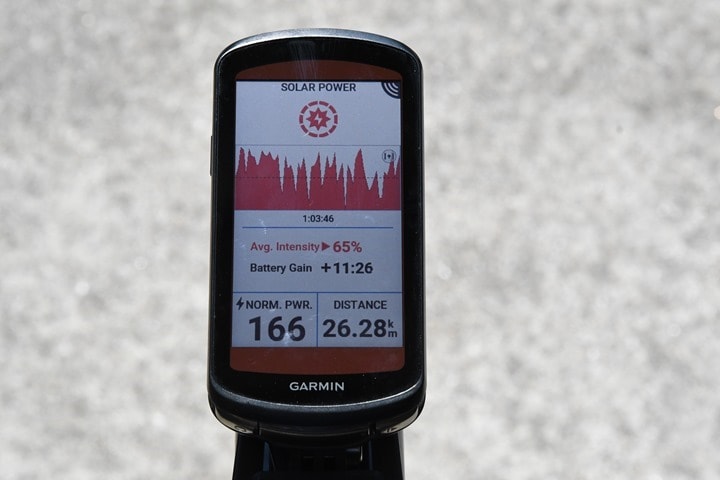
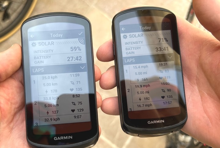
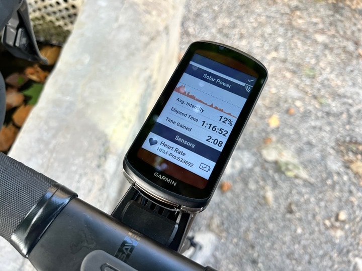
Out in the sun while riding you’ve got a new Solar data page that shows you the exact solar power you’ve gained (in minutes:seconds), the average solar intensity for the ride, as well as a little graph showing the solar intensity throughout the ride:
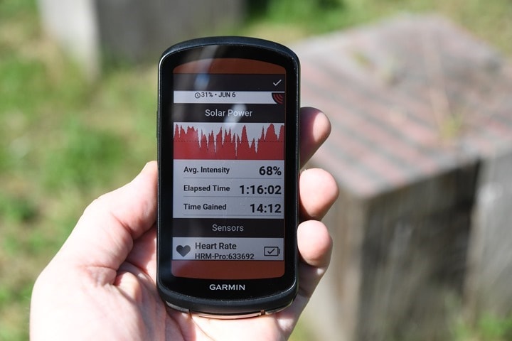
Then post-ride you’ll see the same in a few different places, showing your ride totals:
This is also shown in Garmin Connect where you’ll see your summary for the ride there displayed:
Garmin’s solar battery claims are based on 75,000 lux conditions (a measure of brightness), which is another increase over their previous baseline claims of 50,000 lux conditions for their Fenix/Instinct/Forerunner units. This is actually a more useful change, because 50,000 lux conditions really aren’t that high. Even in the winter, on a sunny day in the Netherlands I can hit 70,000 lux. Whereas in the summer in a warmer locale, I can hit 125-150,000 lux. Garmin will harvest any extra lux it gets, so it’s not limited to 75,000 lux.
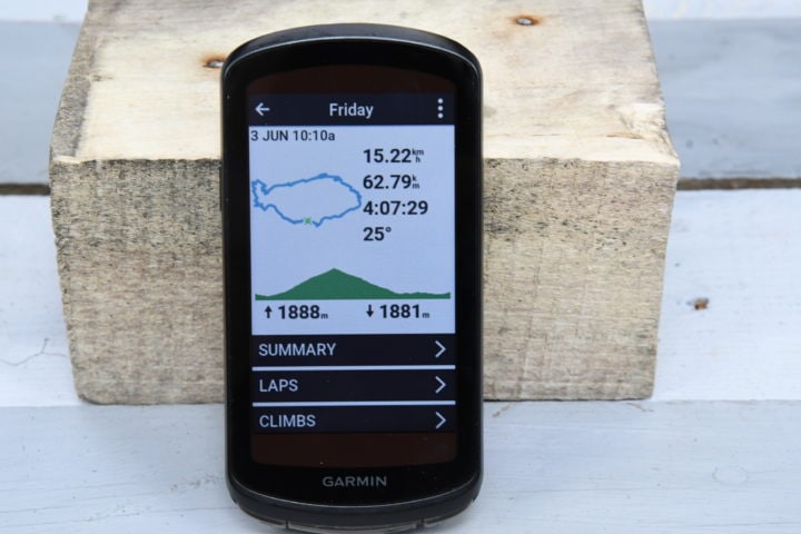
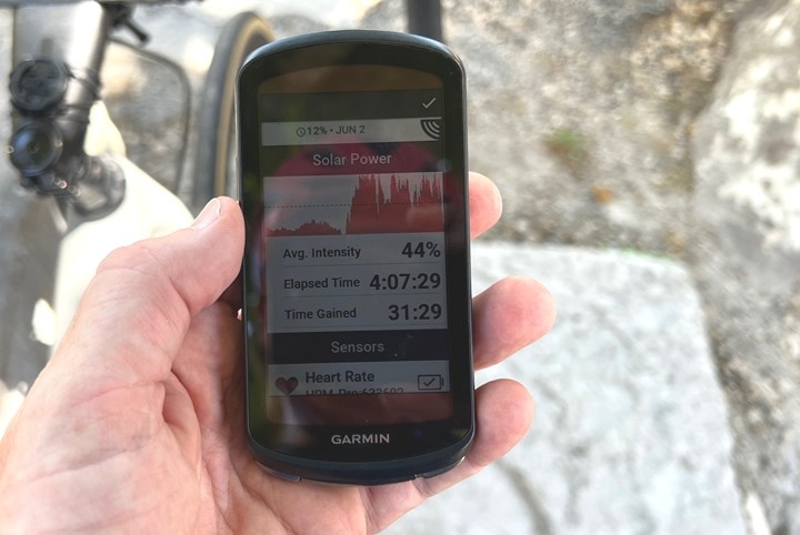
To put in context what this all means, check out this 4hr Mont Ventoux ride from a few days ago. This was a looped ride, and the bulk of the main climb was actually under cloudy/light rain conditions. However, as we neared the summit it got sunny and the solar harvesting estimates were jumping crazy high, I presume due to a combination of summer-sun and high altitude means even higher lux conditions.
Ultimately, I ended the ride with 31 minutes gained. This means that my battery run rates put me at an estimated 46 hours of battery life (with Multi-Band GPS, course/navigation enabled, ClimbPro enabled, Power Guide enabled, ANT+ Power, Di2, Heart Rate, and Bluetooth LiveTrack to my phone.) And again, the first half of the ride it was raining/overcast.
Another shorter 2hr 21 minute ride the next day in very hot & sunny (but a bit hazy) conditions in the south of France gained me 27 minutes and DesFit 33 minutes. Interestingly, we decided to test whether the Edge 1040 would produce different battery estimates in different GPS modes. So he left his in multi-band configuration, and I put mine in ‘All Systems’ GPS configuration (the middle option), which is equivalent to an Edge 1030 Plus accuracy-wise. This would in theory improve my battery life compared to his, and thus, I’d get a higher Solar gain time. In reality, it doesn’t appear that the time-gained Solar widget accounts for your GPS settings.
And it doesn’t seem like this had any meaningful impact on battery life either, since both of our units had near-identical battery burn rates, with battery life projections of nearly 60 hours (and again, all the same things enabled).
Meanwhile, when the sun goes away, so does the extra juice. Here’s an evening pre-sunset ride, where we only gained two minutes after 76 minutes of riding:
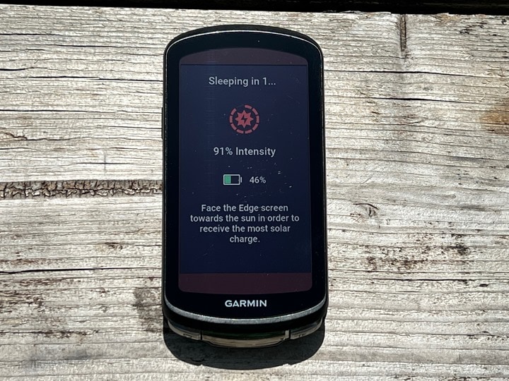
When you power off the Edge 1040 Plus, it actually gives you this screen which shows/explains to you the current solar intensity level, and how to place your unit on a surface for continued solar capture in the sun:
Those results can honestly be more impressive. Yesterday I just placed mine in the sun for about 2 hours, with 70,000 lux occasionally cloudy conditions, and it gained 49 minutes of battery life. Depending on your windows and sun, you could literally just leave your Edge 1040 Solar in the windows and have it charge itself back up most days.
Of course, you’d also gain that battery life in just a couple minutes plugged in. And while harvesting the sun is better for the environment, it’s not entirely a zero sum game. Especially when that privilege costs you an extra $150.
Mapping & Navigation:
While one may buy the Edge 1040 due to its large screen, the most likely reason you’d buy such an expensive beast is for its navigation features. There’s no bike computer on the market that comes close in terms of navigation related features, and the Edge 1040 extends that slightly in a couple of updated/new areas:
– Addition of “Up Ahead” Waypoint planning/display
– Dramatically faster calculation times
– Revamped categorization of POI groups (including adding bike shops & water stops)
– New location search & search history
– Power Guide on courses (more in next section)
– Included maps for more regions in Solar bundle
Of course, this is in addition to all the existing core mapping & navigation functions:
– Course routing (from files, Garmin Connect, or 3rd party sites)
– ClimbPro climb navigation/details
– Searching for points of interest nearby to navigate to
– Searching for specific addressees to navigate to
– Creating round-trip course on the fly based on desired distance
– Built-in heatmap/popularity map data
– MTB-specific trail data
– Routing to saved locations
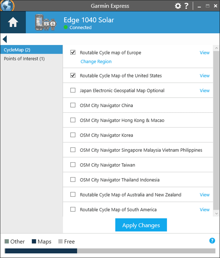
Which isn’t to say it’s all perfect, or necessarily the leader in every part of every category. In fact, the first area that probably shows some of those cracks is the map loading. On the Edge 1040 it’ll come with the maps for your region you bought it in, whereas the Edge 1040 Solar comes with maps for North America, EMEA (Europe/Middle East/Africa), and Australia/New Zealand. This is because the Edge 1040 base edition has 32GB of storage, whereas the Edge 1040 Solar has 64GB of storage. Fear not though, if you have an Edge 1040 base, you can still load fully detailed Garmin maps (for free), using Garmin Express on our computer via USB cable:
However, this falls short of what all their competitors have in terms of WiFi map downloads (Hammerhead/Wahoo/Stages/Sigma), and even their own wearables groups, which supports map downloads via WiFi on the Fenix 7/Epix/Tactix 7/Forerunner 955. I just don’t understand how/why this isn’t supported here. And this is just one of many clear disconnects between two groups within the same overall division (Fitness, covering Forerunner & Edge devices). More on those later.
No matter, the maps you’ll get on the Garmin Edge series are very good, and include all of the so-called ‘popularity’ data, which is basically heatmap data on them. However, they won’t show actual heatmaps like the Hammerhead Karoo does, which is tremendously useful when ad-hoc riding or changing a route, and want to just glanceable look at the roads around you to see where people actually ride.
Still, if you do specifically route somewhere, then the underlying data is there, and arguably, Garmin’s underlying data is far more complete and detailed than Hammerhead’s (which is based on Suunto’s smaller data set).
In any case, for today’s ride we’re gonna load a course. In my case, I created the course in Strava, and it synced over automatically. However, you can also create the course on numerous platforms that support automatic sync, or simply manually create courses in Garmin Connect.
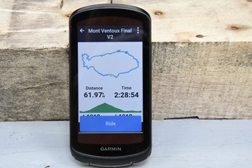
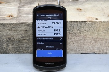
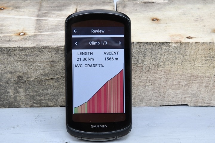
This course has a substantial climb in it, being Mont Ventoux, and as such, you’ll see the climbs listed within ClimbPro.
ClimbPro is by far my favorite Garmin feature, and lets you see the exact details of the climb as you ride it, including details on distance/ascent/grade remaining till the top, as well as your position on the climb. The Edge 1040 significantly increases the ClimbPro coloring to show more detail now, with different gradients more clearly shown on the climbs.
Now in the Garmin world, this still requires a course be loaded, whereas Hammerhead doesn’t require any course loading. That’s a huge point for Hammerhead, but inversely, Garmin’s data is consistently more accurate. On Hammerhead I constantly get incorrect upcoming grade information (hugely incorrect), versus Garmin tends to smooth it a bit more and is ultimately actually accurate. Still, I don’t see why Garmin can’t add in ClimbPro on-demand like Hammerhead (or inversely, why Hammerhead can’t do a better job at smoothing out inaccuracies).
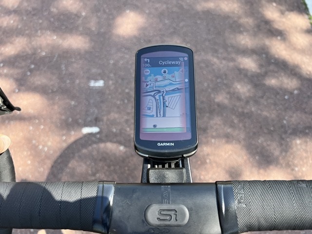
While riding a route you’ll get turn by turn notifications each time a turn is required. It’ll display a little mini-amp that includes turn information as you approach each turn:
If you go off-course, it’ll give you options for getting back on course (and if you ignore it, it’ll just take care of it for you). This happened 3-4 weeks ago when I ran into some road closures that dramatically changed my route, and it sorted things out as I just rode along. If you’re riding to a destination you’ve set on the Edge itself (as opposed to a course), it won’t even bother you with re-route notifications, it just does it instantly and silently – making up for your mistakes.
The re-calculation times are virtually instant here. Whether or not that’s because they’ve changed how they display recalculations is probably the better question. Previously, Garmin would show you the slow recalculation progress at the top, but in reality, you could always ride immediately. It was calculating the full route – miles before you ever got there. Realistically, you didn’t need to know that. So whether it’s actually faster, or they just hid the part you don’t need to know – I don’t know. But either way, it’s instant gratification. For funsies: On the Edge 1030 Plus, the calculating route took 1 minute 58 seconds to complete a 55KM course, on the Edge 1040 it was instant.
Speaking of instant gratification, there’s the new search function, which allows you to search for pretty much anything. It’s like Google on an Edge. Towns, cafe’s, mountains, etc… Just search and it finds it – usually in under 5 seconds, sometimes instantly. And, it saves your search history too, making it easy to find perhaps foreign words that you painstakingly typed it slowly, only to previously have to type again.
You can also search within point of interest (POI) categories. This includes a totally revamped category set, largely getting rid of automotive categories. Those things are still there, but they just aren’t top of the list and prominent anymore. Instead, first on the list is bike shops, which even pulled open bike pumps and compressor locations.
All of these things are routable on-demand. So you can just tap them and route to it. And again, all of them are virtually instant to search for and route to. Riding along this past weekend I was searching for all sorts of things easily (on a closed bike path with zero people around because it was too stupid hot to be outside), without any delay. It was amazing.
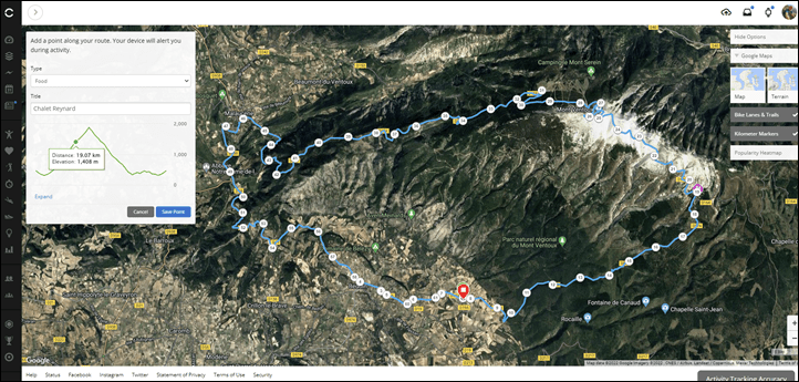
A new feature on the Edge 1040 is the addition of Up Ahead waypoints. This allows you to add waypoints in Garmin Connect for items, along with custom icons. The idea being you can add potential café stops, sprint lines, race-specific climbs, or whatever the heck you want:
Then, out on the road there’s a new Up Ahead page, that works in real-time to tell you how far (via route) that next point is.
This is super helpful when you just want a glanceable look at how far that blueberry pie slice from Chalet Reynard might be.
The only downside though, is that this feature doesn’t appear to utilize either the known course grade or even Power Guide to figure out the estimated times. In the example above, it shows the top at only 22 minutes away, despite being 9% and 9KM away. Obviously, that ain’t gonna happen. In talking with Garmin, the feature currently uses your average speed to date (on that activity). Obviously, if your route includes flats/descents beforehand, that’ll adversely impact it (as it did for us).
Ultimately, the main changes on the Edge 1040 when it comes to mapping and navigation are around dramatic speed improvements, and cleanliness of the user interface, as well as increasing details on things like Climbs. The ancillary major new feature I cover in the next section (Power Guide) depends on courses, but isn’t really navigation per se. Thus, thing of most of the 1040 changes as incremental in terms of new features, but massively faster in terms of ability to use them
Power Guide & New Training Load Pieces:
This section is a bit of a combo-dish of new features that have arrived on the Edge 1040 that are largely focused on training load, racing, structured workouts, or categorization of you or your courses. In other words, this section is all about the new Edge 1040 features that are trying to make you faster.
At the core of things are the following main new features:
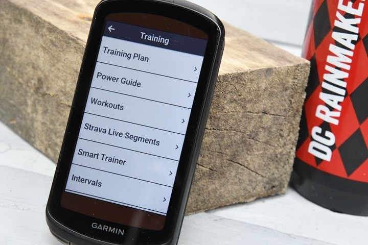
– Power Guide: This creates a complete race or training plan for a given course
– Cycling Ability: This identifies your cycling strength areas
– Real-Time Stamina: This tells you how far you can ride at a given intensity level, and if that’s sustainable
– Course Demands: This shows whether your cycling ability to handle this course well (or not)
There are more training load and recovery features of course from before, but the above are the main new ones. I’ll cover those mixed in here though as we plod along.
Let’s start with what is the most interesting of the group, which is Power Guide. Power Guide is akin to a race-plan for the power targets you need to hit, to achieve a certain time. This requires a power meter. In effect, it’s like a highly detailed race plan (perhaps a bit too highly detailed). For those familiar with Best Bike Split, or Garmin’s own running Pace Pro, it’s sorta a blend between those two.
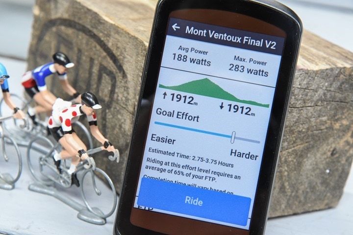
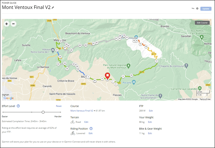
To begin, Power Guide requires you have a course/route planned. Once that’s done, you’ll create your Power Guide program on either Garmin Connect Mobile (smartphone app), or Garmin Connect web (online). You’ll choose the course, and then from there you’ll specify the terrain type (if not already listed), as well as your weight, bike, and gear weight (and can change your FTP):
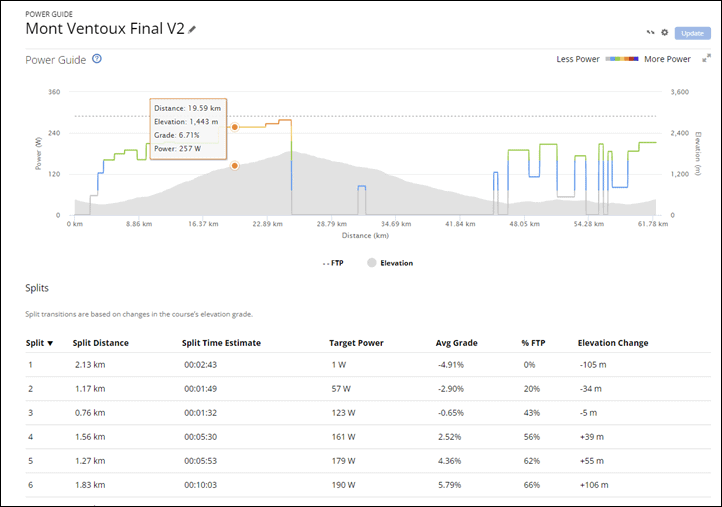
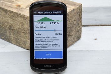
After that you’ve got a simple slider that goes from ‘Easier’ to ‘Harder’, which is divided up into 10 levels. As you change that slider, it increases your power levels (and decreases your estimated completed time).
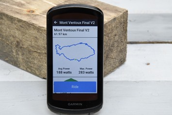
Down below, it’s subdivided the course into a million chunks. Each chunk is based on the specific terrain, so for example 4% vs 2% grade. The longer and more varying in terrain the course, the more chunks you’ve got. For example, compare this ~60KM route up Mont Ventoux and back down a different side with more rolling terrain. Garmin says the minimum segment (chunk) length is 200m. For Mont Ventoux and this ride I ended up with 40 segments.
From there, you’ll send this to the Edge 1040, where you can choose to enable it on the course you ride. Once a plan is created, you can also tweak this on the Edge 1040 too:
Once done, you’ll see this new Power Guide screen, which handily also includes a built-in ClimbPro mini-screen if you have climbs within it.
At the top of the screen you’ve got the current section, which you can kinda think of as a lap. Again, depending on the terrain this could be very short or very long. Then below that you’ve got your 3-second power, guide planned power for this section, and your power for this section.
Below that is a terrain map with little blue dots indicating ups and downs in the power. And then below that is either a mini ClimbPro chart, or, on flatter sections, this is replaced with a mini-map and a some summary stats on the right side. Below you see 21w for the Guide Average. That was a bug that was fixed since my ride on Friday.
What’s cool about this feature is that it’s not as naggy as having a ‘proper’ structured workout loaded in the unit. Unlike a structured workout, this doesn’t chirp/beep the entire time at each target change, or, if you’re out of zone. Plus, unlike a structured workout, you can change your target easy/hardness level (1-10) mid-ride. That as useful for me on Mont Ventoux when I may have set it a wee bit high, and then reigned it in slightly as I got settled in on the climb.
Now while this feature works great for solo rides/races/training, it won’t work so well in group rides or races with any sort of group/peloton. That’s because your power levels will drop in the draft, which will confuse this. Further, the ranges it gives are pretty big – upwards of an hour.
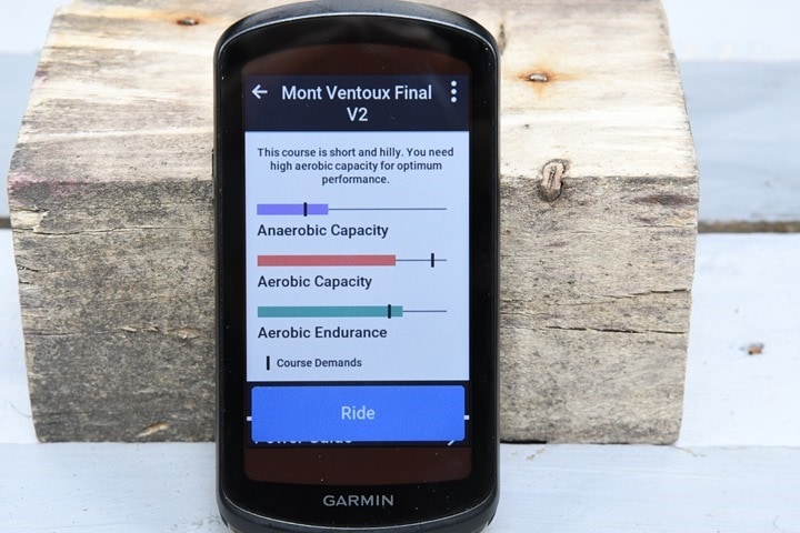
Next, there’s the new Course Demands feature. This allows you to load up any course and see what type of aerobic and anaerobic capacity you need to excel on this course, with the little marks noting the course demands relative to your capacity in colored sections:
Practically speaking, I’m not sure this feature really adds much in its current iteration. I can’t imagine anyone looking at this and going “Oh, this course needs more aerobic capacity, I’ll skip it”. I get what Garmin is going for here, in demonstrating your potential shortcomings, but this kinda comes across as noise.
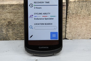
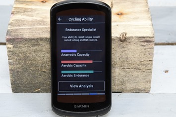
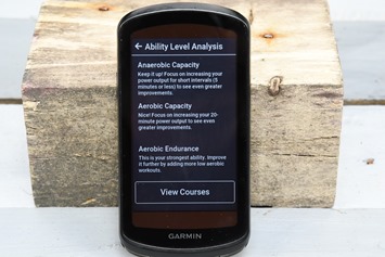
Slightly more interesting is the new Cycling Ability widget, which shows you what type of cyclist you are. For me, it initially identified me as a Flat Specialist, though later changed that to Endurance Specialist. You can tap to see an analysis of that with a smidge more detail.
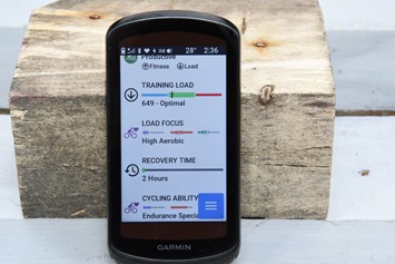
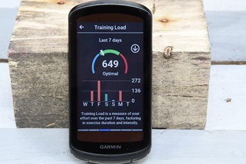
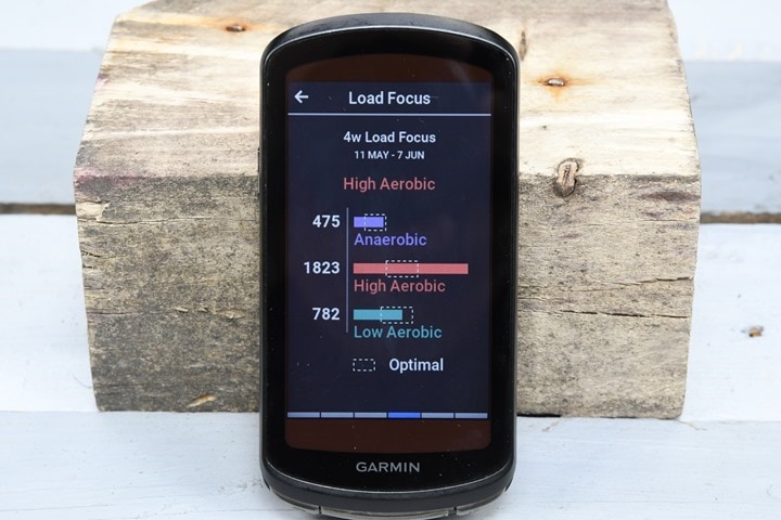
Much of this of course ties in with the training load and load focus components, which have been around the Garmin ecosystem previously. The Training Load piece shows your load over the last 7 days, and shows you whether that load is appropriate to what your recent history (last four weeks). It’s a little wonky that Garmin doesn’t match this with the revamped Acute Load launched last week on the Forerunner 255/955 and coming to the Fenix 7/Epix/FR945 LTE. It’s very similar, but Acute load is better weighted, better named, and has better ‘tunnel’ guidance to help you more.
Meanwhile, your four week load shows up under Load Focus, which categorizes that training:
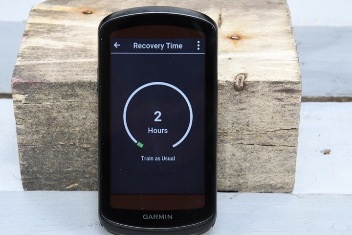
Now it’s worthwhile nothing that post-ride you’ll get an estimated recovery time until your next hard ride. If you have another Garmin device (mainly, wearables), this will contribute via Physio True-Up into that, to allow for recovery planning. However, by itself without other Garmin wearables, the recovery time metric probably isn’t super useful, since it’s not going to account for things like sleep or other sports.
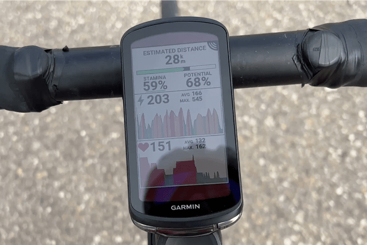
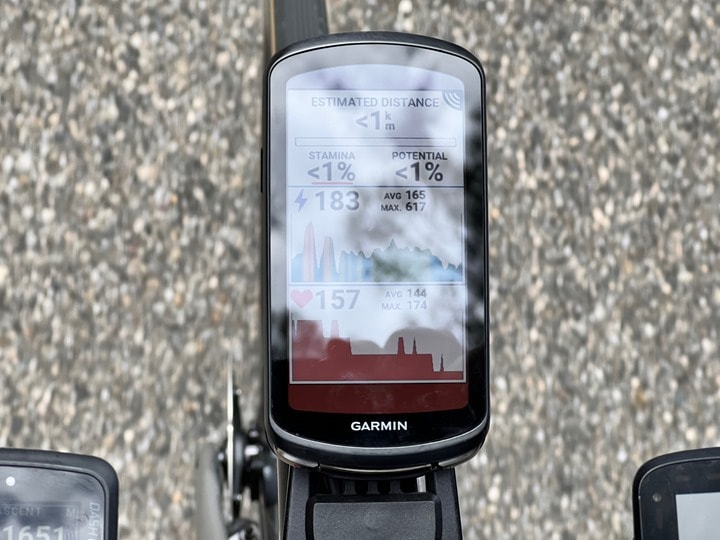
Now, we do need to circle back to Stamina. This feature gives you real-time pacing into how much time/distance you have left till you die. Or, at least until you collapse. The theory behind this is that it looks at your current recovery time (from previous workout), as well as your heart rate to power ratios, and figures out how long you can sustain a given effort for. This was introduced on the Fenix & Epix watches, and then carried through to the Garmin Forerunner 955 as well. This is a real-time metric that doesn’t require having anything loaded. Here’s an example of it on a ride as I just cruised along:
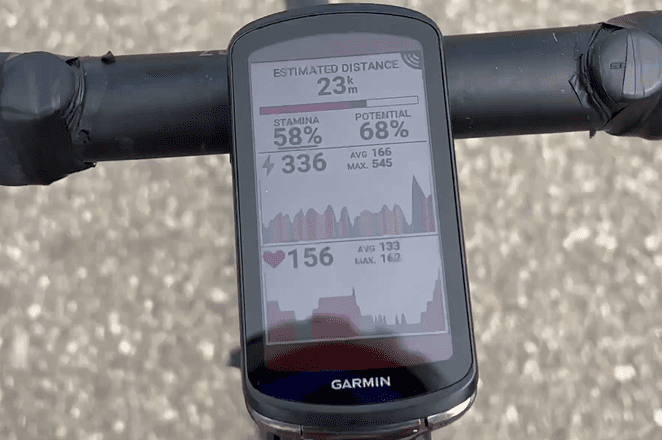
Now, as I kick up the power levels and heart rate, it instantly starts to reduce my viable distance/time. Basically, it’s telling me how long/far I can go at that given intensity. Certainly, you can’t sustain a sprint forever, and this illustrates that:
When the little bar is green, that means you’re recovering or otherwise good. If it’s red, that means you’re burning the candle faster than you can likely recover.
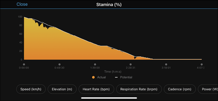
Up until this past Friday, I’ve found Stamina incredibly accurate and on-point. Months of using it on the Fenix 7/Epix, and then Forerunner 955, it’s surprisingly good at nailing rides and how I feel, and how much energy I have left. But this past Mont Ventoux ride I finally managed to kill Stamina on both the Edge 1040 and Forerunner 955. Or, it killed me.
Going into it, my Recovery Time was high from not just a ride the night prior, but also previous workouts. Add to that, it was being impacted by poor/no sleep, travel, and everything else. Here we are, about 3hrs or so into the ride, you can see, I’m dead. Yet, I still then pedaled on another 15-20KM including climbs.
Now what’s interesting, is looking at the data. One might argue I managed to pace this climb as perfectly as my ability allows, because I basically flat-lined just after the peak. Of course, the question then becomes – what is the definition of 0% Stamina? Is it “You cannot pedal anymore” or is it “You can uselessly continue pedaling, but you’re shot”?
So in this case, I went back to Garmin (without any context on my question) and asked for the definition of Stamina and what happens when you reach 0%. Herman Bonner, one of Garmin’s FirstBeat leads explained:
“When your Stamina and Potential Stamina are both zeroing out together, expect your ability to race in a meaningful way to be severely compromised. It doesn’t mean that you are unable to put one foot in front of the other, falling off your bike, or passed out on the ground.
And similarly: If your Stamina is zeroing and you have Potential Stamina remaining, expect your ability to sprint/climb hard to be severely compromised, but you can probably drop your intensity safely below your anaerobic threshold and keep going.”
In this case, that’s pretty much exactly what happened. I dropped below my threshold, and kept on chugging along slowly to get to the hotel where fresh French baguettes, fresh French cheeses, and cookies awaited. But, at the same time, I was shot. There was nothing left in the tank on the descent, and it shows in my power numbers.
And this ultimately matches the same experience in other times where I’ve managed to basically zero it out, including one 7-hour ride earlier this year on the Fenix 7, arriving back at the hotel with 1% remaining (and I was shot then too). So to that end, this feature seems to be working pretty well for me
GPS Accuracy:
There’s likely no topic that stirs as much discussion and passion as GPS or heart rate accuracy. A watch could fall apart and give you dire electrical shocks while doing so, but if it shows you on the wrong side of the road? Oh hell no, bring on the fury of the internet!
GPS accuracy can be looked at in a number of different ways, but I prefer to look at it using a number of devices in real-world scenarios across a vast number of activities. I use 2-6 other devices at once, trying to get a clear picture of how a given set of devices handles conditions on a certain day. Conditions include everything from tree/building cover to weather.
In almost all these tests, the Edge 1040 Solar was in the default multiband configuration, the highest GPS accuracy. Though, I also did some in regular GPS mode too, just out of curiosity to see how it’d do.
To spoil you bothering to read this section, I’ll simply say upfront that there’s no bike computer anywhere near the accuracy of the Edge 1040. Just like what we’re seeing with Garmin’s other new multiband GPS-enabled units, the accuracy continues to get better and better. And that’s especially the case in more challenging terrain/conditions, where it really shows how impressive it is (see my recent Forerunner 955 review for that).
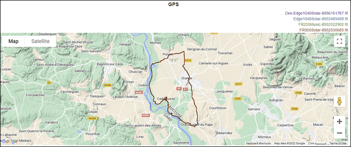
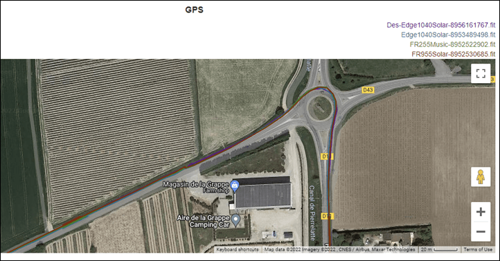
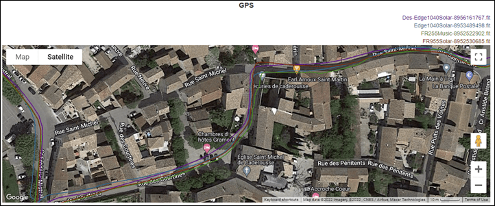
Nonetheless, here’s a few samples, starting off with a 50KM ride through the French countryside, including some forested sections, but also some tiny villages where we purposefully ‘explored’ the tight buildings. And in this case, I had my unit on regular GPS, while Des had his 1040 on multi-band GPS. We rode side by side. Starting off the high level, things look pretty normal.
As we go around round-abouts, it’s absolutely perfect tracks:
But check out this section here, inside this tiny town with some ‘roads’ barely 2 meters wide. You can see just how tight the two Edge 1040 tracks are, despite being blocked by 2-3 story buildings.
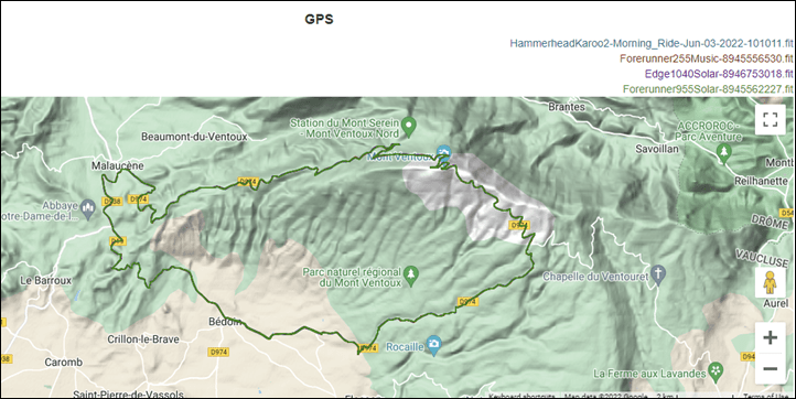
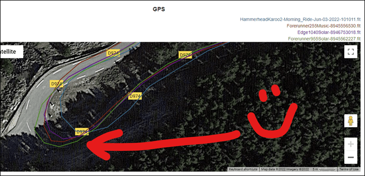
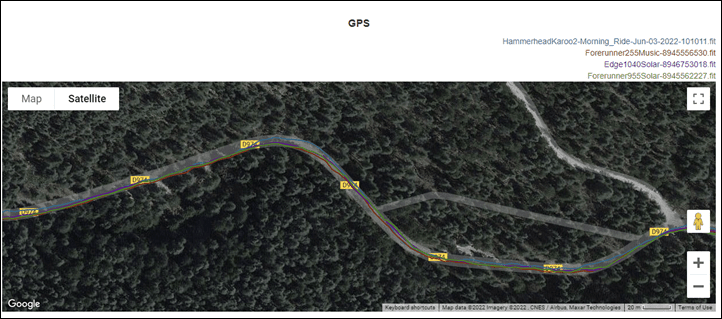
So let’s step it up. Here we’ve got a ride up Mont Ventoux, then back down a different size with more twisty roads and sharper cliffs. Again, at a high level, things look totally fine (this is compared to a Hammerhead Karoo 2, Forerunner 955, and Forerunner 255):
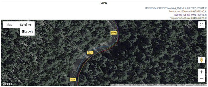
But the separation is in the detail. Check out this deep forested section and look at how perfect the Edge 1040 is – on the correct side of this tiny mountain road, where the Karoo 2 is on the other side.
Or here during fast descents, where the Edge 1040 Solar correctly hugs the inside line of the road. The Karoo pulls a Lance Armstrong and cuts the corner, while the two watches are out in the middle of the road. I know this is trivial stuff, but it’s fascinating to see.
When you’re looking at more generic sections of roadway on the mountain, they look closer, but you can still see the differences in track stability compared to the Karoo 2 and how that wobbles a bit.
As far as elevation on this one, the Garmin 1040 and Forerunner 955 slowly drifted together, whereas the Karoo 2 and Forerunner 255 slowly drifted together. Which one was right? Well, the top elevation of Mont Ventoux is listed as 1,909m, and the Edge 1040/955 combo was 1,892 (vs 1,843 for the Karoo 2/FR255 combo). So the 1040 was the closest here.
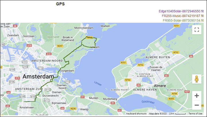
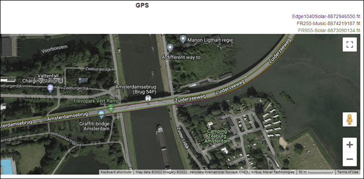
Last up for now, we’ve got a ride including some tunnels/bridges and other goodness out into the countryside:
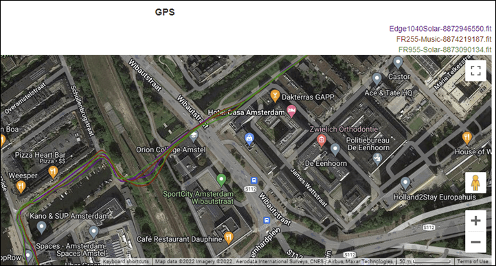
Check out this section over this bridge, where it puts me exactly on the edge of the bridge, within bike path. Not off the bridge in the water, not in traffic, but exactly on the bike path:
About the only tiny blip I could find was here, when I pass under a set of railroad tracks in a tunnel, and in one direction it’s flawless, but in the other direction where I make a 90* turn right before the tunnel, once it loses GPS it seems to try and continue the turn angle for a few meters. But c’mon, this is really nitpicking.
Additionally, while I wasn’t able to get any mountain biking in this go around, my friend DesFit did include a bunch in his video review, which you can review here.
Ultimately, all of the data DesFit, GPLAMA, and Myself see across these units is astonishingly good, and inline with other multiband GPS efforts we’ve seen from Garmin, which lay down very impressive tracks – especially in harder situations.
(Note: All of the charts in these accuracy portions were created using the DCR Analyzer tool. It allows you to compare power meters/trainers, heart rate, cadence, speed/pace, running power, GPS tracks and plenty more. You can use it as well for your own gadget comparisons, more details here.)
Wrap-Up:
It’s pretty easy to say the Edge 1040 Solar is the most advanced and accurate bike GPS we’ve seen to date, from any company. And I’m pretty sure it’s also the longest-lasting bike GPS too battery-wise, with the potential to go well beyond its published battery specs. As I’ve seen and shown with stats above, it easily almost doubles their published official specs under the most ‘demanding’ power-draw scenarios, despite just half-hearted sun conditions. And if we look at the new multi-band GPS and accuracy, it continues to lead the way, even slightly edging out the newest Forerunner 955.
The new software features like Power Guide can potentially be super useful to the right groups of people (namely those that train or race individually). Personally, I find the Up Ahead feature more useful on longer rides to be able to figure out how far I have untill certain waypoints/locations at a quick glance. The same goes for Stamina, I find that’s a good proxy for when I’ll bonk, and perhaps change my pacing strategy to compensate for it.
Still, there are some quirks that show the lack of lockstep within the Garmin realm – especially when compared with the higher-end Forerunner 955 that was launched just last week. That includes WiFi map downloads (the Edge 1040 doesn’t), and also has the newer training load/recovery terminology that the Edge 1040 lacks. Garmin says that the Edge 1040 will start to incorporate these newer metrics in Q3 later this year, but I just feel like this kind of stuff should be baseline matching for a company like Garmin on flagship releases.
As I noted in my video, I ran into a substantial number of mostly minor bugs during my testing period. However, the latest firmware update yesterday seems to have checked off and fixed each issue I’ve had, which included numerous sync issues, cases of the unit having amnesia, and forgetting what I did the day before (rides/PR’s/etc…), as well as incorrect power guide data. At this point, only time will tell though, none of the issues I could easily repeat on-demand last week are happening now with this latest firmware. One issue I do want to revisit is slow gradient changes, for which I did see issues last week, but need to double-check it on a hill later today (I don’t have many/any suitable hills near me, so that requires a bit of travel). I’ll report back on that one. There’s often a balance there between accuracy and responsiveness. [Update: My bugs are back. Both the amnesia one and Power Guide. Garmin says they now know what’s causing both, and it’ll be fixed in the first update release. I don’t have an exact date, but sounds like a days thing rather than a weeks thing. Also, others are reporting issues when you install a CIQ data field, it’ll cause sensor dropouts.]
Ultimately though, if you’re on an older Edge unit, or, looking for arguably the best bike computer in the market, the Edge 1040 or Edge 1040 Solar won’t disappoint. I’m not sure it’s worthwhile upgrading from an Edge 1030 Plus, but I think if you’ve got just about anything else, it’ll feel like an entirely new device – both in capabilities, but also accuracy, and battery life.
With that, thanks for reading!
Found This Post Useful? Support The Site!
Hopefully you found this review/post useful. At the end of the day, I’m an athlete just like you looking for the most detail possible on a new purchase – so my review is written from the standpoint of how I used the device. The reviews generally take a lot of hours to put together, so it’s a fair bit of work (and labor of love). As you probably noticed by looking below, I also take time to answer all the questions posted in the comments – and there’s quite a bit of detail in there as well.
If you're shopping for the Garmin Edge 1050 or any other accessory items, please consider using the affiliate links below! As an Amazon Associate I earn from qualifying purchases. It doesn’t cost you anything extra, but your purchases help support this website a lot.
Here's a few other variants or sibling products that are worth considering:
And finally, here’s a handy list of accessories that work well with this unit (and some that I showed in the review). Given the unit pairs with ANT+ & Bluetooth Smart sensors, you can use just about anything though.
And of course – you can always sign-up to be a DCR Supporter! That gets you an ad-free DCR, access to the DCR Shed Talkin' video series packed with behind the scenes tidbits...and it also makes you awesome. And being awesome is what it’s all about!
Thanks for reading! And as always, feel free to post comments or questions in the comments section below, I’ll be happy to try and answer them as quickly as possible. And lastly, if you felt this review was useful – I always appreciate feedback in the comments below. Thanks!




![clip_image001[7] clip_image001[7]](https://media.dcrainmaker.com/images/2022/06/clip_image0017_thumb-1.png)
![clip_image001[9] clip_image001[9]](https://media.dcrainmaker.com/images/2022/06/clip_image0019_thumb-1.png)
![clip_image001[5] clip_image001[5]](https://media.dcrainmaker.com/images/2022/06/clip_image0015_thumb-2.png)


![clip_image001[6] clip_image001[6]](https://media.dcrainmaker.com/images/2022/06/clip_image0016_thumb-1.jpg)
![clip_image001[4] clip_image001[4]](https://media.dcrainmaker.com/images/2022/06/clip_image0014_thumb.jpg)
![clip_image001[8] clip_image001[8]](https://media.dcrainmaker.com/images/2022/06/clip_image0018_thumb-1.jpg)
![clip_image001[10] clip_image001[10]](https://media.dcrainmaker.com/images/2022/06/clip_image00110_thumb.jpg)



Thinking of upgrading my Edge 820 to the Edge 1040 Solar as a result of the multi day cycle touring that I do and the solar feature. I do have a bicycle dynamo for charging devices, but it does seem appealing.
One question I have is whether you can still manually copy downloaded OS Street Maps maps to the device like you can with older devices. Just want to make sure Garmin haven’t closed that and make you purchase maps from Garmin?
This still works.
Done that today as well…
Thanks Ronald.
Slowly finding my way in this device.
Another question which I couldn’t get answered on the Garmin Forum (for now):
How to load my own POI file or moreover where to store my own POI files?
Have several (category-) files (in .gpi format) which on the 1030 could be stored easily:
* Garmin
* map name POI
* submap name POI
* file names H2O and Handy
worked like navigate/search/other/ H2o (resp Handy)
Here on the 1040 this trick doesn’t work and I cannot see where standard POI files are stored.
So, as always with new devices, one gets a bit lost and a I have no idea whether POI loader would work (which thus I don’t do)
Has somebody tried this already, loading/storing own .gpi (POI) files?
I have an Edge 830 that is a huge headache. BT rarely connects, dropped sensors, Varia radar disconnecting, changing light modes on its own, rebooting itself at random times and no help from Garmin. There hard reboot did not work and the file share instructions don’t work and they never respond back. So before spending more money on Garmin products, does the 1040 have these problems. Is it easy to navigate and set up profiles. Are there good tutorials on how to use it to it’s full potential.
Thanks for the awesome in depth review.
If you want to be a beta tester for the 1040 – not as a volunteer – but as a paying (full price) customer, then yes, go ahead and change your broken 830 for a « not yet ready for prime-time » 1040.
Another option would be to send in your 830 for repair – to a Garmin authorized dealer. They’ll either repair it or replace with a refurbished unit.
Hi Dale, I’ve been using the 1040 for a few rides and I’m quite happy with it.
Hi Giuseppe – Do you actually have the Edge 1040?
Thanks Camillo, would like to hear more after you have more time with it.
@DCR,
No, I don’t have the 1040.
I bought a brand new 1030 Plus, about 6 weeks before the 1040 came out.
Had the 1000 before, but the USB connection, started going wonky, as did the on off switch, and the automatic uploads to my wifi or bluetooth network.
However, the 1000 was sooo much faster with gradient display and elevation accuracy – two important features for me.
Obviously wasn’t happy at first – when the 1040 came out, only a few weeks after I bought the 1030 Plus …. Until I read it had similar issues (which were/are important for me).
Honestly – I don’t use most of the “features” of the 1030 Plus. I like it because of the big screen – which is great with my 50 year old eyes.
Fyi, I then sent my 1000 to a Garmin authorized Center for repair. They simply exchanged it for a refurbished regular 1030 Edge – for a fee of course.
Lo and behold – same fast gradient display on the 1030, ghat my trustworthy 1000 had!
Thank you so much ++ for your unbiased, trustworthy reviews and free-speech comment sections. I have bought stuff from your affiliate links in the past.
All the best.
Thanks for the in depth review
It’s been a while since I looked at a Garmin because…
What happens if you just turn on the unit and do NOT press “start”, but just start riding?
Can you view ride length / time / altitude? Does the odometer recognize / record the riding you do even if you don’t press “START”?
Typical ride (for most people, I’d think) would be getting out to the edge of town through traffic, then the “real” ride begins, followed by the poking your way back through town, etc. Just hated that I either had to see a recorded avg speed that was maybe ⅔ of my actual “ride” speed, or the first/last 5km of my ride didn’t add to the odometer.
No, if you don’t press start, it doesn’t record anything (if you have a Garmin speed sensor, then that speed sensor will record the data and sync it afterwards, but that’s kinda a mess in terms of dual recordings).
While I understand that specific thinking (having lived in plenty of cities that you suffer a file in slow traffic/etc first), I think most riders just don’t worry about it.
Why not just start the computer, finish it up, and call it «getting to edge of town”, then do the actual ride, then the same on the way back?
Or keep separate screens for lap times/ distance/ elevation, and just lap the computer when you start and finish the actual ride?
Second what Ketil writes, I just can’t see why it should be a problem. Record your first ride out of town, save it and then record a new one.
Sure the varia radar does not work with the 1040 solar? The specs on garmin say it Will work….
I can’t read comments 201 to 530?!?
Older comments = 1-200
Newer comments = 531 – x
Hmm, mobile or desktop?
Desktop, Win 10
I tried with Opera, Firefox and Chrome…
Now I tried it again and it works OK
I have the 1040 solar and have to say this is by far the best computer they have come out with and bug free too. I’ve had 500, 510, 810, and 1030 computers over the past 10 years and this one is definitely a home run, super job Garmin.
I always use a glass screen protector. Would this impact on the solar units ability to ‘recharge’ during a ride? And are protectors even available for these units,
Hi Ray,
just bought a 1040 and see it has imported last 30 days of activities from Connect (via Android phone).
So, it is showing me different figures for Training Load and other metrics, compared to old 530.
I have read that those metrics are based on last 90 days of data, is that correct?
In case, how do i force a sync to 1040 that can include previous months?
Thanks
Hi Ray! Great in-depth review, as always. 😀
Does Power Guide also works with routes loaded to device from RideWithGPS, or route must be created though Garmin Connect?
It works for routes from ridewith GPS – I have several races on mine that were loaded that way and the power guide works fine. not sure if it’s because they were synced with GC first, but they work either way which is what’s important.
Would you know is there a routing option that lets the Garmin 1040 route road and gravel roads and make the best route of that combination?
Ray,
I finally received my 1040 Solar in Canada and just discovered that they removed 3D Map mode (which was in your notes). I thought this was the best way to navigate with a GPS. Any idea why it was removed and can I assume that it will not come back ?
TIA
Pierre
Any idea when or if the AMOLED screen will make it to Garmin’s next bike computer?
I upgraded to the Edge 1040 from a 1030 and immediately ran into a problem with my 4iiii precision 3 power meters not working. Contacting Garmin support, they claim it’s 4iiii not using the right ANT+ frequencies.
Quote from Garmin chat support:
Kurt:
Garmin uses ANT frequencies to pair to sensors. The ANT spectrum for Garmin devices used to be a wide spectrum of frequencies. Example of what it used to be: 100 to 150. As time has gone on – we’ve narrowed this to spectrum to what we have found to be the best: 120 to 140.
The ironic point is, the original creator for ANT was 4iiii. And eventually Garmin purchased this technology.
Unfortunately, 4iiii stops at 119. Which is outside of the 120 to 140 range that Garmin uses now moving forward.
And from what I understand up to this point in time – it’s up to the 4iiii team to adjust their protocols.
Have you heard anything about this Ray?
Is this a similar issue to the Varia Vision no longer being supported?
Hi Ray, were you able to investigate Brian’s question on the 4iii connectivity? I have a couple of bikes with 4iii PM’s as well, and this would be a deal breaker.
TIA
Chris
@Ray
Hi, my self and many other people in the Garmin forum, complaint about the rerouting calculation and settings for routing pop-up in the Edge 1040, because they are at the best confusing, please can you publish something like ‘routing and re-routing in Edge from garmin perspective’? :-)
I mean, for example in Italian language but a German people complaint the same, are at the best wrong, or without sense.
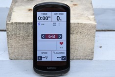
I love this one screen you showed right after the following verbiage: “So at this point, with everything set, we’ll just start a simple ride. It’ll usually find GPS within a couple seconds, and find sensors once activated within a few seconds as well. You’ll chose your activity profile and then press start. At which point you’ll see real-time data on the screens, and it’ll be recording in the background:” Would you mind sharing how you compiled that beauty?
No problem, here ya go:
Up top: Timer, Distance
Mid-Upper: Power Graph
Mid-Lower: Heart Rate graph
Down below: Speed, Cadence
Cheers!
Ray,
I have the 1030 plus and I was looking at the difference on Garmin site between 1030 plus and 1040. It says there is a gyroscope in the 1040. I have noticed with the 1030 plus that the incline change is sometimes slow to change. With the addition of the gyroscope does the rate of change improve with the 1040? Have you compared the the rate of change in incline/decline with 1040 and 1030? Or did I miss it somewhere.
Thanks for your reviews.
@Joseph,
Not really. Same lag of 10 – 15 seconds or more, still exists unfortunately.
Although this does not seem to bother certain fanboys, many other users beg to differ and have expressed themselves under various Garmin sub-forums.
Eg.
link to forums.garmin.com
Hi Ray,
maybe this could be slightly off-topic but the question raises from the subject: is there any very likely (or almost explicit) plan to come out with new 840/540 units in the near future, as the issueance of this new 1040 could possibly suggest?
Hello! I’ve just received my Edge 1040 and connects to everything great (speed sensor, Assiomo pedals, HRM, Varia). However, trying to get it to connect to my Wahoo Kickr Snap just results in a spinning wheel on the Edge 1040 and no connection. My Edge 530 connects immediately. Have you had any feedback on smart trainer issues with the 1040?
Hi Ray
Just set up the 1040 solar and took it for a spin–I had a 830 and had set up sensors and shifting etc — on one of the screens where is show s the gears (front and back, both graphical and gear number ie 1/2 and 6/12). I have sram red axs 12 speed. selected the correct gear ratios etc front and back and on the scree (see pic) instead of showing the rear gear there is a black box. Has anyone has had the same issue? I updated software to 12.16, fully charged the rear derailleur battery and reinstalled the shifting sensor and problem persists.
The black box is a known issue and has been reported by a number of people in the Garmin forums.
Hi Ray, do you have any insight on whether some of the new features, specifically Real Time Stamina, will be added to the next generation lower end units, such as the next 840?
Quote: “As usual, it’s common to ask whether any of these features will be added to any existing Edge units, and unfortunately this time the answer is no […] this time around the new features aren’t being added downstream.”
Have had an order in for a 1040 solar from Amazon since the release in early June. Amazon listed the delivery date as unknown. Was curious if anyone knows when they will be available for the general public?
They are readily available in Europe. Bike24, decatlon etc. has them in stock.
As always great review. I decided to buy the Edge 1040 after your review/video.
Two issues though with my new 1040, one is clearly a Edge 1040 bug, the other may be a Fenix 7 Sapphire Solar issue or Edge 1040, I’m unsure…
1)The graphical display of the Di2 Gear’s has a problem displaying the cassette gear selection, it shows as a solid block, rather than say 4/11 or 2/11 (see attachment)
2)I use my Fenix 7 Sapphire Solar to broadcast my heart-rate as a ride activity to my Edge 1040. Works great, except after a rest stop. If the connection gets interrupted (like I was to go into a coffee shop), then the heart-rate will not reconnect to the Edge 1040 – no matter what I try…. enabling/disabling the sensor, searching for a new sensor etc. My assumption is this is a BLE issue, is there a way to change the Fenix to broadcast Ant+ vs BLE?
For the gear graph, it looks like your Di2 sensor isn’t connected, and you haven’t set what you have for front and rear gears.
Alain, I was sitting in the family room when I took that pic, however I assure you when it’s connected to the Di2, the black block on the top right corner remains. The coloured bars indicating what gear your in work as does the left hand side front chainring indicator. I’ve reported the issue to Garmin, they said they are aware and are working on fixing if next update.
I haven’t tried that set up, I just use the numbers for the gears not the graphics and it works fine.
Looking to compare this to the Karoo2 but the 1040 isn’t in the product comparison table here, will it be added soon?
Does anyone know what color the side panel is for the 1040/1040 solar? I’ve seen photos of 1040’s with a shiny silver side panel, and on the Garmin website, they show a version of the 1040 Solar with a charcoal gray side panel. I’m not sure if it makes a difference but I’m in the US?
Thanks!
I think the silver side panels are on the 1040, and the 1040 Solar (which I have) has dark gray sides. The Solar also comes with black silicone case which covers the sides anyway, so it doesn’t matter unless you don’t want to use the case. The Solar also includes an MTB mount, so you are getting more than solar for the extra $150.
Thanks Tom J!
I’ve got a Fenix 6 now, thoughts on whether a Fenix 7 and an edge 530 just to view stats/varia easily or going for a 1040 and keeping the Fenix 6 is better??
I’ve been thinking of getting the 1030 plus, for one reason that your review on this included the fact that beep was noticeably louder for the Varia Radar, which is a safety feature for me (I have an 830, and really can’t hear it). Then they came out with this. Is the beep still loud? Crazy thing is…it’s the same price.
If you have the RTL515 varia radar, there’s an app for iPhones and Androids. I can’t speak for the Android app, but the iPhone app is very loud.
Thank you. Garmin let me know about it as well. With my Shokz open ear headphones, it’s a great solution. I would still be interested in the device volume itself, as the other day I was on a ride and my headphones had not been charged. :)
It’s about the same volume as my 1030, plenty loud enought to hear easily by me and people riding with me if they are within a few bike lengths of me.
I have seen the altimeter on Edge 1040 is working very bad. In an undulating road the response time on altitude change is vey slow, hence it records 20% less ascent versus 1030. Anybody else experiences this issue?
I don’t watch the altitude on a screen but my feet of climbing / ascent looks the same as my 1030 on the same routes and the % grades look right to me on my 1040.
@ Matej,
Correct, the 1040 has altimeter (gradient) lag issues. Just like its predecessor, the 1030 Plus.
You are certainly not alone to observe this problem:
link to forums.garmin.com
link to forums.garmin.com
@Steve R,
Perhaps it’s because you are on a long, long, NON UNDULATING slope climb. Otherwise on constantly changinging terrain snd dlopes, the 1040 is way to slow regarding its gradient lag issues.
*too slow
@Giuseppe, Thx for your feedback. At least I know I am not alone and there is nothing wrong “my device only related” but a general problem. What concerns me is the speed Garmin addresses such issues since they did not fix a problem on 1030 plus after 1+year :-(
Probably is because I’m not paying attention to grade on any places I’m undulating. I really only look at grade when I am using climb pro on longer climbs as a distraction from suffering and out of curiosity. If I’m riding rolling hills I’m pretty much looking at the road/trail or wheel in front of me if in a paceline.
I have noticed the grade doesn’t match up exactly to where I am on a course, its off a bit too but personally I’m normally just not that interested in that information, Watts / HR/ Cadence / what gear I’m in / next turn / how much longer till the top of a long climb are the things I see as much more valuable information that the exact grade at the moment I’m there. I mean, what am I going to do with that information anyway? Curious what you folks are using that information for if you wouldn’t mind explaining.
Hi,
any ideas how to use stamina on a circuit?
I went thru the setup using my iphone GC app and said yes to transfer profiles however only an indoor profile appeared on my 1040. Is there another way to transfer the profiles?
Happened to me exactly the same, only indoor transferred (road and MTB not). I have decided to manually enter data for missing profiles. You can try copy/paste settings.fit data using PC (see folder Garmin/Settings and copy paste settings.fit file). I am not sure it will work since they have changed the SW on 1040 vs previous models but it worked e.g. from 1030 to 1030 plus.
Hmm, if it failed, there isn’t a manual way. The only viable way is to basically just reset it and try again. :(
Same with mine. Only INDOOR came across. I attached my 1030 to my PC, copied the PROFILES folder across to the 1040 and that fixed it
At least I think that’s what I did 😉
Hi Ray:
The 1040 Series supports primary and secondary targets on the workout screen. However, there seems to be an issue when workouts are pulled from Training Peaks where the secondary target is not being displayed.
I have opened an issue with Garmin Support, as well as Training Peak support.
At first I thought the issue was Garmin’s. However after spending some time reading the FIT SDK docs, and looking at the FIT files exported from TP. I think the issue might actually be how TP is writing the workout step messages to the file.
When I created a workout in Connect Web that had primary and secondary targets, the workout screen showed both as expected.
When I dumped the workout’s FIT file, I noticed that Garmin populated a set of secondary target fields (secondary_target_type, secondary_custom_target_low, …)that contained the cadence info.
-marc
-marc
Hi Guys,
over a year has passed and this secondary workout target still hasn’t been sorted out by trainingpeaks. I found the ticket on trainingpeaks that Marc raised to get the issue fixed but it has not got much attention so posting the link here. If any other trainingpeaks users here want this fixed too, comments/votes would be welcome to give it priority. see link .
link to peaksware.uservoice.com
I guess Ray mustn’t use trainingpeaks with secondary targets as he is detail oriented and this would bug him too!
Jonathan
Thanks for the great details and technology goodness! I’m looking to make the upgrade to the Edge 1040 Solar (replacing 4 year old 1030). The features on the 1040 looks perfect for my long adventure rides. But I’m shocked Garmin launched this product without availability (also I’m not shocked with chip supply issues hitting every market), I’m in the US and I can’t find the 1040 available anywhere. Can you share info on their supply and delivery issues?
Chris:
At the time of this reply both Competitive Cyclist (link to competitivecyclist.com) and BikeTiresDirect (link to biketiresdirect.com) seem to have the units in stock.
-marc
Can it re-route back to course/route – like the wahoo roam does so greatly – on any deviation?
Doing a recalc to the finish point normally is not what want ;)
Thanks Ray for an excellent evaluation of the 1040. I have been using one (non-solar) version for about three weeks, but have run into the following problems using Strava segments:
(1) When I check my (enabled) Strava Live Segments, I can only see KOMs not PRs or any other option (even though I have put PR at top of the Default Leader Priority screen – and KOM at the bottom).
(2) On the few segments where I can see a PR, it is from the first (oldest) time that I recorded a PR for that segment..
I have contacted Garmin who believe it is a problem pulling data from Strava (looks like only KOMs and few old PR segments have been transferred). Maybe this can be solved if you could choose what data you want from transferred from Strava (in my case just PRs)..
I note from some Garmin Forums that these problems were seen in the 520+ and 820+ series a few years ago (but did not see a solution) and seem to have resurfaced for the Edge 1040 now.
(3) What may be related to the above problems is when syncing rides via Garmin Express, I get multiple reminders to sync what appears to be already synced data..
Ray, are you still updating the product comparison calculator?
My biggest issue with Garmin Edge devices (and i didn’t see you discuss this) is the re-routing feature. If I go off course it just keeps telling me to U-turn back to the point I went off, so I wouldn’t really consider that re-routing. Even more frustrating is when I get back on course further down the road it still tells me to u-turn back to the point I missed (so if i know I have to make a right turn to continue it tells me to go left instead). This is really an issue when for example the road is closed so I have to go off course and I don’t know where I am the Edge just keeps telling me to go back to where the road is closed. Has this been updated with the 1040? I don’t get how this is just accepted in a premium GPS computer.
This is definitely an annoyance for training rides. What I sometimes have to do is cancel navigation and then re-start the course once I’m back on course and don’t navigate to the beginning, on my 830.
For races, where race rules require that you re-enter the course from the location that you left the course in order to avoid being disqualified (in the event of a wrong turn), routing that makes you u-turn and enter the course where you exited is exactly what you want!
Yeah, the problem is that until Garmin perfects the telepathy module, your Edge can’t know why you left the course. Were you daydreaming and simply missed a turn? Is something going on on the road ahead (a crash, a fire, construction, etc.) where you simply can’t go that way? The Edge can’t know. Maybe a U-turn is the right thing to tell you. Maybe showing you a way around is the right thing. My preference would be for some kind of UI to tell it “I can’t go that way”, but that doesn’t exist right now. If you simply proceed, eventually it (at least an 830) will stop telling you to U-turn and start showing you a forward way back to the course, but that doesn’t happen immediately.
Hi. I’ve not sure if this was covered, but will the Solar also charge the Extended Battery Pack?
Great review. good writing
I know where the field is.
And I know how little I need this thing.
Really even if it worked , almost nobody needs it.
Nothing I need that my phone cant do. Better
I think I’ll go for a ride.
O bought 1040 based on this review. You always put a super detailer review, so I thought “ok, that’s it”. But I must admit: I got disappointed with this review.
Edge 1040 seems not to be a finished product.
1) ANT keeps disconnecting, even with this most recent firmware updates
2) Climb pro, one of the best features of my 830, was ruined. It shows completely out of synch. One of my climbs was so absurd, that it said “Climb finished” on my Garmin and yet was still like 30 seconds of climbing. The same climb was perfectly synched on 830.
3) Depending on firmware update, Strava Segments work OR NOT.
I started today to use my 830 again since on my last ride or disconnected all my devices and I ended up the last 30 minutes of my ride completely bling: no power, no radar, no HR, no candende.
I am really not sure why none of this HUGE bugs were not reported on this review. On Garmin forums, it became clear that I am far to be the only one having this issues. And again: with basic funcionality…Shame for Garmin. I am still your fan DV, but I got disappointed indeed with this review…
While I can’t speak to the other issues you were seeing (though to be fair it does reference some people reporting sensor drop out issues and some other quirks based on firmware versions),
I am starting to wonder if the Climb Pro sync issue goes beyond the 1040. My wife and I were on a ride the other day, where she was on a 830 and I was on 1040 Solar…. we were riding right next to each other and both of our devices had Climb Pro out of sync with the actual ride – starting the climb late, but virtually in sync with each other. So, something is certainly going on with Climb Pro.
I saw that yesterday on my 830. On the ClimbPro final climb, it was just off. “Go” started well after I started the climb, while when “Climb Complete” showed up I had been descending for a while. The other weird thing that happened is that the track is way off on Garmin Connect (but no where else I looked) at about the same place that ClimbPro acted up. The track is well away from the road on the map. Of course, the map on GC might just be wrong. The usual amount of notifying that it found my VIRB which was on and recording the whole time, and I think one or two bogus notifications of sensor drops. Something is off about the current firmware. I had lots of things connected to the 830 (eMTB ride, so e-bike, speed/cadence, power, HRM, and VIRB) and I was navigating, so having all that to do might be a contributing factor.
I’m curious about your comment that there was 30 seconds left in your climb when climb pro said you were done. I’m sure you could see looking at the road, that the climb had a bit more work to do to finish and 30 seconds isn’t much – Can you explain how this 30 second difference impacted your ride and performance in this situation? Personally, I find climb pro very useful when it’s a long climb and I can’t see the end but when I can look at the road and see the finish I’m not sitting there looking at my bike computer to tell me I’m at the end, its really obvious with out climb pro at that point. It’s a bike computer, not a video game.
@SteveR
Just curious – would you be similarly forgiving and use same video game anslogy if Garmin’s speed or HR or wattage or navigation displays were similarly “off”?
@Giuseppe,
No I wouldn’t be as forgiving but they are not off so….. HR and wattage are peformance / fitness metrics – climb pro is just something to facilitate pacing oneself on a long climb, at least that’s what it is for me.
Unlike a climb, I can’t see my HR or wattage without looking at my bike computer, but I can sure see if there’s more climb left or if I am done – apples and oranges comparison that makes no sense to me anyway. I don’t stare at my bike computer for 30 seconds at a time or at the end of a climb to see my HR or wattage either really. Seems nit picking to me but everyone has their own things that are important to them while riding I guess….
Interesting. We were riding a bike-packing race/ride in Minnesota’s Northwoods and my Climb Pro was trash. It totally missed one climb, was super late starting a climb, and was generally worthless on both days of the ride. We’re on a tandem and getting climb information is super helpful. I kept thinking that being on remote gravel roads was causing the issues.
Here’s the link to my activity yesterday on Garmin Connect. On the easternmost side of the track, where I turned from Greens Valley “Road” onto Blue Ball Road heading south, the track simply leaves the road entirely. I don’t know what it’s showing (maybe the track it thought it was navigating?) because everywhere else I look (Strava), including the GC iPhone app, the track follows the road as I actually did. Very strange. If it is showing the track it thinks it was navigating as opposed to the actual track, that would explain the weird ClimbPro notifications, but why would they do that (and who knew that’s kept in the FIT file)? ClimbPro has always worked well in the past, and I’ve never seen this before. Anyone else seeing anything weird on the GC website for their tracks?
Oh, and I forgot that I also had radar, a light (the Varia), and iPhone connected to the 830. So lots of things connected and navigating.
My experience with Climb Pro on the 1040 Solar has generally been very good.
A lot of the time Climb Pro is uncannily accurate and I what I feel as the gradient changes seems to match what is displayed (even for relatively short sections). In these cases Climb Pro actually seems better than on the 1030 Plus. I have Multiband GPS enabled for the highest position accuracy and I wonder if that has something to do with it. That said, Saturday I was on a climb and Climb Pro was definitely off by about 20 – 30 seconds.
I don’t know how Climb Pro works internally, but if it relies on an accurate GPS position then using Multiband might help. Of course, that leaves the experience I had on Saturday unexplained.
I use Climb Pro since version 1, on multiples Garmin Edges. On my Garmin Edge 830 it was spot on!
No, not sure why you are tying to defend Garmin company (ok, maybe you are one of the firmware developers), but there is no excuse on this one. It is used to worked perfectly and now it almost useless.
It is supposed to be a very accurate “map” of your climb, so you know if you can start, for example, give your best since after that climb is a long descent.
Excuse me, but the ones that are not using this way are the ones using this feature in a wrong way.
And as I said first – I am using this feature since day one when it was launhed. There is zero percent chance I was looking other ways or any other excuse. The climb was completely out-of-synch.
@Giorgi, I’m not defending or advocating for Garmin’s execution of the 1040, just trying to understand how people are trying to use it and the benefit they are getting. When I can see the start of a climb or the finish, I really don’t need a bike computer to tell me that I’ve started or finished, sounds like others do. I do like to know what’s ahead on a climb that lasts a mile or so when I can’t see the whole thing though and it does that well for me so far with adequate accuracy. I wouldn’t choose to do anything differently on a climb if it was off by + or – seconds, seems like many do though for some reason, yet to be explained very well.
@Steve R I live in a flat place, I need to ride a 20 miles to find a Cat 4 climb, so I don’t use Climb Pro on most local training rides. But when I’m out on a long ride/race on roads I don’t know, Climb Pro is very helpful. Most roads I ride are twisty, and there’s no sight line to the top of the climb or when a climb is coming. My example earlier, we’re on a tandem and knowing when the climb is going to kick up to 15% is critical to shift in advance of the ramp (we can’t get out of the saddle to mash up a steep ramp). Also keep my stocker informed since they can not see the hill at all. Yesterday, we’re on a climb, and the Climb Pro started late not warning me of a steep ramp … but making it look like the ramp was still coming up. It’s not a deal breaker, but is sure makes Climb Pro pointless if it’s going to be that far off.
Obviously nobody needs to have Climb Pro to see when a climb begins. But when you have it very accurate and you want to do a 8km climb on your FTP, Climb Pro (when accurate) is the best tool I had so far.
Also, I use to go Neuro (Z7) at the next 30 seconds of my climb. My whole teammates use CLimb Pro in a very similar way, so I am sure not an exception here…
Just a quick comment because I’m out on the trail with no/limited cell for a week or so.
However, it sounds like something has obviously changed, that impacted people this weekend. Nobody has reported any ClimbPro issues till now (and I never saw any, it was just as it’s been for years). The unit has been out almost two months now, without ClimbPro issues.
I’d say if you started seeing them this weekend, to raise a support issue with Garmin Support.
As for the sensor dropout issues, those were reported by folks that had CIQ items installed, but that was fixed within a week of release, so I’m surprised your seeing it now.
Cheers.
Yes, and I was using indeed 14.12 lastest firmware (Beta) version, since 12.16 I was still seeing those ANT drops. For some reason, 14.12 it seems to make it worse – at least on my case: I had never seen a behavior like that: after 3:30h of ride, all sensors were disconnect and never conected again.
Interestingly when planning the routes with KOMOOT I tend to get useless results. when exporting the gpx from Komoot and IMPORTING the very same gpx to Garmin Connect, ClimbPro is abolutely fine.
Hi
are the training/stamina features work while using an E-MTB with Shimano Steps and a heart rate belt?
Thank you for any answers.
I am not sure between the standard 1040 and the new explore 2….
I’m not an expert in Shimano Steps (and don’t have regular access to a bike with it). However, I did briefly try out integration at Eurobike with one, and recorded a sample file here: link to connect.garmin.com
On that bike, using Shimano Steps, it did not broadcast power data within the data stream. Maybe others do, I don’t know. But you do need power data for cycling Stamina (plus HR).
Used the 1040 Solar for the first time today, excellent unit. On the screen why is there a red piece at the top and bottom of the screen–seems like that reduces the size of the scree
Those are solar panels for charging the device. The actual screen size is the same as the previous versions.
Amazing in depth review. Thank you. Did you notice like I and many others have the 15 or more second delay in the gradient % changing to reflect the grade you’re on? The 1030 had minimal. In another article you mentioned how you like this data field to handle false flats. What are your thoughts on 15 to 20 sec delay when you look at it? Sad to see garmin go backwards and to this climber may be a deal breaker.
There are lots of discussions up above on it. It’s on my slate to re-test this week on Weds/Thurs, now that I’ve finally got a second breather to go the hour+ out to the singular meaningful hill in this region of the Netherlands, and do some ups/downs with comparative units to show how it actually looks.
If one goes back to my big climbing comparison video I posted earlier this year (Garmin/Wahoo/Hammerhead), there were a bunch of cases where I showed it’s not quite as black and white as people think it is. Garmin definitely isn’t always the slowest. There were many times were Wahoo or Hammerhead was slower. Of course, most people just aren’t stupid enough to have three bike computers and a GoPro on their bikes recording this for hours on end. :)
Thsnks.
I did a mini rainmaker last night..
Had my 1030 attached next to 1040 solar and rode around to compsre. Staggering. Wish i could have recorded but climbing with 1 hand wasn’t gonna happen. Easily 15-20 sec behind always was the 1040. Thanks
I am really disappointed with this too. Was one the best features Garmin had. What was the firmware version you were on?
Please take a Garmin 830 (or similar) vs 1040. The difference is huge. I can’t talk compared with other brands, but Garmin was spot on with Climb Pro – at least until 1040. And it is not data issue, like Garmin wants me to think on the firmware discussion. I know that because I was using the same route I used to use with my Garmin 830: so same dataset, same climb, same cyclist – only difference was the unit. Not sure why / how they ruined that.
Just to be clear, we’re talking two separate things here:
A) Gradient lag
B) Whatever the heck seems to have broke ClimbPro alignment for some people in the last 10-14 days
Nobody was reporting ClimbPro issues prior to the last 10-14 days (on any units). Whereas people have been reporting gradient lag for some time.
No issues for me yesterday or today using ClimbPro on the Edge 1040 Solar. I don’t really pay much attention to the gradient, so I can’t comment about that feature.
Did a 100 mile ride today with the 1040 solar that I got yesterday.
I already tested the first night with the 1040 vs 1030 as I watched the gradient have a diff of 15-20 sec as you know. Some people said try a Garmin widget that does gradient to the decimal place and they said it shows it quicker as you ride. I used a page with the garmin % gradient and the widget and I am not sure there was any difference (other than the decimals).
I used climb pro today and that seemed normal. In short, the 1040 is just so much better than the 1030 in every way except in 1 (the gradient) it is just so much worse.
not much more to say on this as it just seems to be what it is.
DC, if you get in Garmin’s ear and make any change that would help a lot of cyclists!
Hey DCR,
It’s been a couple if weekd now. Have been impatiently waiting for your re-test of multiple devices simultaneously, to confirm the unbearable gradient lag issue with the Garmin 1040, 1030+, 830, 530 etc…
I / we all respect your expertise and meticulous testing methodology.
Respectfully – Giuseppe
Hej Ray, with sw 14.12 beta update Garmin added a Music Control widget (via connected phone). As far as I remember, Garmin always told us, there will be no music/no music widget on the Edges due to safety reasons/concerns. So it seems they have changes their opinion?
Do you think we will get IQ music apps like Deezer, Spotify etc and a bt headphone connection on the new Edges, too? That would be the next logical step.
Indeed, it actually launched on the Edge Explore 2, and then now was added to the 1040 in beta. Garmin says there’s no plans for the Edge 530/830.
I don’t know if they’ve changed their opinion, I can poke. Obviously, those units have the storage for it. But I don’t know if the BT chipset has the right configuration for direct audio pairing. My guess is their opinion as shifted as more and more riders are going to gravel (at least in the States), where the safety risk is less than out on roads. I guess a question is, would that many people actually use direct on-device Spotify, versus just having the phone in the back pocket.
I feel like with running/gym/etc, people want to run phone-less. But with cycling, I can’t remember the last time I didn’t take my phone.
I am using Deezer on my Epix 2 with Aftershockz OpenMove headphones, so I can still listen/hear the environment “noise” and I also get the sound of my paired varia radar via headphones. Because bt headphones/music is available on the wearables (which one also can use on the handlebars or on the wrist) during a bike ride…Because of the bigger display, I prefer my 1040er on the handlebars (and btw: the Epix 2 in bright sunlight on the handlebars is a disaster (at the moment), because of the automatic dimming).
I’ve had two rides this past week where in the middle of the ride, the 1040 just hangs. Drops all sensors, doesn’t respond to the screen type hang.
I’ve discovered that if I touch anything on the screen while it’s hung, I inadvertently cause something else to happen. For example, when it hung today, I tried to get to the home screen. Nothing happened, however when the device finally came back to life, it has started a structured workout.
Ray, any ideas what is going on?
Thanks
-marc
As part of the navigation search categories revamp – have train (railway) stations been axed? Can’t seem to find them on a UK model using latest available European maps (2021.20) neither on the obvious “Transportation” section nor anywhere else..??
FYI: Dramatically faster router calculation.. actually, it’s pretty similar to previous units (1030 etc), the smoke and mirrors being the 1040 software revamp automatically computes and caches route calculations for all new courses *when they arrive on the device*, instead of the first time they are ‘navigated’. So long as you’ve given the 1040 time to do this = seems lightning fast when you go to use that course for the first time. A simple, obvious-in-hindsight yet very effective improvement.
4iii precision 3 power meters are not detected by the Edge 1040. The problem is now widely known. And certainly Garmin knew of the problem before they started selling the 1040.
The compatibility issue between the 1040 and 4iii should have been disclosed by Garmin.
I contacted Garmin this morning (8/11/22), and they have no idea on when the fix might happen.
Back the device goes to Amazon.
I actually can get it to detect just fine. Though, some people are having issues with maintaining connectivity.
I’ll be honest, I struggle to see how this is Garmin’s problem here. 4iiii has basically been playing games with the Gen 3 units to try and eek out (unnecessary) battery life claims, and this appears to be one of the ramifications of it. In general, when every other power meter on the planet works, except one new one, most signs point to that one being the issue.
Weird, I’ve had no issues connecting, nor maintaining a connection.
HI GUYS, I am having problems with strava live segments using the edge 1040 solar, anybody else??
@DC Rainmaker
Ray, this week I did a three day trip using my Edge 530 for nav. My 530 is running the current public firmware (9.40?).
To my surprise (given the ‘no backporting features’ bit), I had an Up Ahead screen. I was really pleased about this, as it is REALLY useful.
Haven’t seen this mentioned elsewhere, so thought I’d let you know. Apologies if you have already covered it!
I’m thinking of buying a new navigation device for my mountain bike. I’m now using an etrex30. My experience is that the accuracy of this device is better than older Edge models.
I only use the device for navigation, other differences are not interesting for me.
Question now is, with current multiband technology, is this still the case. Is a GPSMAP66SR more accurate as the new Edge1040, both have multiband technology. The GPSMAP66SR does have a special helix antenna but does this improves the accuracy that much that it compensates its larger size and weight compared to the 1040 ?
GPSMAPxxx and Edge xxx units are VERY different beasts – despite both being Garmin, they are best thought of as no real relation.
The GPSMAP units are meant to be robust and easy to operate in a variety of harsh conditions. If coming from an Edge they seem quite old school and basic at first, but then you start to realise this is actually their positive – Garmin have deliberately kept the basic interface the same so you can operate it with thick gloves on while hiking up in the clouds, paddling in rough sea, many more use cases. Oh and cycling.
Whereas the Edge units are cycle computers. Yes they do navigation, and in more fancy ways too (routing, courses, MTB trails etc), but that’s just the start – there’s the whole fitness/training side of things too.
In terms of navigation alone: I think you’d be hard pressed to fault either (or indeed most modern GPS units). In terms of which to buy: depends on your use case- if you are a cyclist of whatever type then get an Edge, if you like to do a whole load of other outward bound activities and that includes a bit of mountain biking then a GPSMAP would be good.
Personally I think the GPSMAP is just too big to fit on my bikes so would always use an Edge.
One quite specific question about navigation:
During the recording of a ride, can I push a newly planned course to the 1040 and then select it to guide me for the rest of the ride? On longer gravel days this need has come by.
Yes you can, at least at the moment it works.
I say this because within the Edge 1040 UI you cannot trigger a manual sync while recording an activity (says something like “activity in progress”) BUT you can trigger it phone-side and it does work – positively tested multiple times.
Quite disappointed in the lack of discussion in this article of the gradient lag being reported all over Garmin’s forums for all of the x30 devices as well as this new one. People are reporting 25-30s delays in gradient changes and Garmin themselves are saying that 15s lag is acceptable. This is insane to me for a cycling product. What other metrics are people okay waiting 15s for an update?
I almost bought one of these devices after your review but am really glad I did additional research. Not saying you are being paid for this but really seems like you have some sort of secret obsession with Garmin or something.
Truly weird. Gradient, and gradient alone (?), is so important to you that you ignore anything else this device can do? What the device tells you the gradient is doesn’t change what it actually is. You can see gradient changes with your eyes. Yes, my Edge 830 lags, but it doesn’t take long to get it about right (certainly not 20 s), and it does other things as well that are much more important to me. This fixation with gradient is mystifying. Yes, it’d be nice if were exactly correct at all times in everything, but that isn’t going to happen. Yes, the Edge 1000 (I have one) updated the slope field much quicker, and even claimed bogus precision, but it’s not obvious it was any more accurate in slope than my 830.
And yet gradient (!) causes you to passive-aggressive insult someone (and others to threaten bogus legal action against Garmin)? Hint: Garmin is by far the biggest player in this space right now. Maybe Apple will make some kind of move next month on the watch end, but they’re never going to produce a bike computer.
totally agree with you Paul S. I think it’s a carry over of computer gaming fixation into cycling, just my opinion.
Gradient alone is enough for me to decide not to spend $750 to “upgrade” yes. Sure I can see gradient approximation with my eyes. Can you tell how fast you’re going with your eyes? Can you feel how much power you’re putting out? Why even use a bike computer at all then?
Different people use these stats for different things and have certain stats that are more or less important to them. Not sure why that’s so hard for you to understand.
My only point here was that I was surprised and disappointed that in a review as thorough as this which seems to be a huge glowing review for Garmin a negative factor which is important to a lot of people – yes enough to have a lawsuit filed in the UK apparently – was completely omitted. I trust this site for its reviews. I am a supporter. This review was the first one that felt biased and misleading to me after all the time I spent on Garmin forums discussing this problem to have it not be mentioned whatsoever. Just my opinion. If that pisses you off then 🤷🏼
Hi Tim-
A couple of quick thoughts. First, thanks for being a DCR Supporter.
In terms of gradient lag, I do actually mention it in my summary section of the review.
Most recently, I also noted in the comments I was going out to do some side-by-side testing with other units, notably the Hammerhead Karoo 2 and Wahoo BOLT V2 on hills, where I record those side by side. This is because when I did this same exercise this past winter on the 1030 Plus + Hammerhead/Wahoo I found the gradient lag isn’t quite what people make it out to be. TLDR: Sometimes Garmin is slower, and sometimes Wahoo is slower. And occasionally (but more rarely), Hammerhead is slower. Though, Hammerhead is almost always incorrect on their Climber data, so, pick your poison.
As far as my recent 1040 test, I went out about 10 days ago and found it wasn’t much different than my 1030 Plus test. I did longer rolling hills, short hills, hills with cobbles. Everything I could find (which, is very limited where I live).
While I’ve been too slammed to get that fully edited, the short result is that it was basically like before. Sometimes Garmin is slower (10-15 seconds), and sometimes Wahoo is slower (same timeframe). Rarely, but occasionally, Hammerhead is slower. Usually, it’s the fastest. But like before, Hammerhead also often shows incorrect CLIMBER gradient. Personally, I’d rather know the upcoming gradient is spot-on, than have incorrect up-ahead data but faster current data.
I agree it’d be nice to see Garmin be faster here, albeit, not at the expense of incorrect data. If they can find middle-ground between themselves and Hammerhead, that’d be ideal. Ultimately though, it’s no different than it’s been for years. And honestly, outside of a handful of the same people that keep replying to the same threads, I’m just not seeing huge backlash over it (nor, has there been huge backlash for years with the x30 devices). Said differently: People largely seem fine with whatever that trade-off must be.
Perhaps it’s true some people here are hashing or rehashing their frustrations w Garmin gradient lag. If so I’ll admit I’m one of them.
Re. your test comparison – with 1040 gradient lag reporting, and saying it was similar to the 1030+…
Of course! They have similar or the same barometric pressure hardware apparently.
Would’ve been more valid to compare the 1040 or 1030+ to the 1000 or 820 etc.
As for claiming the 1040 / 1030+ are slower at reporting gradient lag, but otoh, are gold-standard precise, this is not really accurate. How do we know for sure thd lagged gradient reported bb 1040 of 1030+ is indeed valid / gold-standard true?
The 1000 and 820 were “pretty close enough” to actual measured vs. device-reported grade.
Finally, not sure about the particular Wahoo V2 unit you had, but on our group rides in rolling hills or constant-grade climbs the Wahoo guys all shout out their gradients. All are MUCH faster than my Garmin 1030+.
Nonetheless, thanks for all your work. I try to support you by clicking on your product links whenever possible.
Giuseppe
Tim – for me, gradient is important and I enjoy seeing it.
You also make a great point saying we know we are going fast, when flying along in a Cat B group ride, so why bother having a speedometer
Ignore Paul S. He argues only his metrics are useful. No one else’s (unless of course they agree with his p.o.v.)
And yes, there are still many old-school, strong riders around here who can’g be bothered with power meter bc they feel they “know” from all their years of competing and cycling without PMs.
To each their own
Thanks for replying back Ray. And for pointing out that you at least did give a brief mention to the slow gradients in the wrap up. I guess the mention didn’t stick out enough for me when I first read your review to register.
In any case, your results are interesting to hear. I currently use a Wahoo ROAM and my experience is that the gradient change is never more than 5 seconds behind and is usually more like 1-2s at most.
My biggest disappointment in Garmin is reading them state that lag of up to 15s is considered within spec. 15s is a LONG time to wait for any cycling metric to update. And in the forums users are saying sometimes 25-30s which is totally unacceptable.
The best guessed explanation I’ve seen so far is that the software is calculating gradient using a 15s rolling average and this is what is causing all of the issues.
In any case, I’ve just epoxied the mounting bracket that broke off on my mountain bike ride this past weekend back to my ROAM and am just going to keep on using it for now. Until Garmin sorts this gradient thing out or Wahoo introduces a newer shiny unit with more bells and whistles. Karoo isn’t an option for me because of Shimano’s dumb fight with them and the lack of integration there. I like seeing gears and I like using hood buttons for page changes.
The Garmin 1040 is supposed to have all this advanced technology. Thus the expectation is that it would provide proper GRADIENT results on a timely basis. I have had an annoying Gradient issue with my 820, and I was ready to upgrade based on your glowing review. Only to get to the comment section, to see the small mention of a gradient issue. I’m now holding back until you do a fair assessment of what is going on and what Garmin going to do about it.
All I can say is that when the reviewer of a product omits reviewing a major product deficiency (and only makes a small mention of the deficiency in the comments section), one wonders why that feature review was omitted. But if the reviewer then becomes an apologist for the company’s product deficiencies, then one wonders if we have something else going on. Please don’t forget your mission mantra: “…..And as regular readers know, if something is crap, I’m gonna tell it brutally like it is – no matter the brand….”
I find it somewhat interesting for such a supposed “major deficiency” that this product has been out some 4 months now, yet, aside from a handful of people complaining about it (which they also complained about previously and it hasn’t changed), I just haven’t seen much comment about it (again, because it hasn’t changed since previous versions).
As I noted above, the TLDR version of the video I’ve yet to get around to editing is that “Sometimes Garmin is slower (10-15 seconds), and sometimes Wahoo is slower (same timeframe). Rarely, but occasionally, Hammerhead is slower. Usually, it’s the fastest. But like before, Hammerhead also often shows incorrect CLIMBER gradient. Personally, I’d rather know the upcoming gradient is spot-on, than have incorrect up-ahead data but faster current data.
I agree it’d be nice to see Garmin be faster here, albeit, not at the expense of incorrect data. If they can find middle-ground between themselves and Hammerhead, that’d be ideal. Ultimately though, it’s no different than it’s been for years.”
I know it’s tough to let reality get in the way of posting comments about something you haven’t tried, but that’s…well…the reality of climb grade accuracy. Not sure why you had to get into name calling, given my post that you undoubteldy read in this same comment thread covered it.
Any rider that lives and rides in areas with elevation changes and hill climbs is interested in GRADIENT and changes. Most of us have lived with the deficient GRADIENT display in the Garmin devices for a while, but that does not mean we are happy with it. Many people also do not take the time to complain. The GRADIENT feature is almost worthless unless there is a hill with a constant grade which is rarely the case.
With the new advanced technologies in the 1040, we did expect improvements. As you mentioned in your review, there is a gyroscope in the 1040. Thus elevation changes should be immediately picked up by the device. Garmin has elected to continue to provide deficient GRADIENT and changes because it is not using all the capabilities in the device to do calculations. And you decided to gloss over their deficiency which assists them in not making improvements. Your review should have included an in-depth review of their GRADIENT feature with actual results for rolling hills, short climbs, and long climbs with constant elevation changes. And the review should have had comparison to other top devices.
I’m sorry I hit a nerve with my reply, but I did not name call. I just found it odd that you did not cover this feature given that YOU noticed weird delays as you mentioned at the end of the review in the comments. And you decided not to zero-in to determine what was going on like you do in so many other things about the devices. This is almost the review that a “Marketing Manager” at Garmin would have written glossing over deficiencies. You should go to the Garmin website to read the threads about the GRADIENT issues.
I have relied on your reviews for many years, and I have made many purchase decisions based on your reviews. I appreciate that greatly, but I found this review to be an oddity. Again please don’t forget your mission mantra: “…..And as regular readers know, if something is crap, I’m gonna tell it brutally like it is – no matter the brand….” Thank you.
Not any rider. I’m not interested. I live in the middle of the Appalachians in Pennsylvania, so I climb (2200 ft total today in 20 miles, max grade was around 10%). The gradient is the gradient no matter what a device says it is. (And I believe there are websites where you can find the grade on a map after the fact. It doesn’t change.) I don’t ride by instrument staring at my 830, I use my eyes to see what’s coming ahead.
Ray drew attention to the fancy accelerometer/gyroscope the 1040 has. Did you ever wonder why Garmin doesn’t use it for grade? I do, but I don’t assume that they didn’t try. In the end, the old tried and true (elevation gain/distance) might be more accurate when vibration from surface irregularities is taken into account. Garmin certainly won’t tell us.
I don’t know about the “anyone who lives and rides where there are elevation changes” comment. Sure, the grade is interesting to me after the ride is over in some situations but I can’t say I can remember the last time I looked at grade while I was riding – even on climb pro it’s just not something I look at, I look at the color coding on the screen occasionally and the road ahead. On a steep long climb I’m more interested in watts and cadence and what gear I am in. I have done plenty of very climby rides too, our local gravel rides average 100ft / mile.
102 mile ride in Connecticut this Sunday. 8800 feet of climbing and when we began the route listed 23 major climbs.
Every single climb that appeared in climb pro on my 1040 solar looked beautiful when it showed on screen with its new red orange green colors and every single of the 23 climbs was off from where I was riding on the climb. It was depressing and I never experienced this with the 1030 (non plus) and it doesn’t do this lag with strava live segments on the 1040. When I ride the strava live segments and watch my progress up these climbs it is accurate- (i.e. when I hit the red on screen it is the hardest part of the climb, when I finish the climb, the little dot is at the end of the segment). this 102 mile ride was off the entire time.
so sad and do not know what to do anymore.
“I just found it odd that you did not cover this feature given that YOU noticed weird delays as you mentioned at the end of the review in the comments. And you decided not to zero-in to determine what was going on like you do in so many other things about the devices.”
As noted, I live in a very flat place. I noticed that quirk on a single very short/steep (100m long) climb on a trip far away, that’s it. It wasn’t an issue the entire previous two days on rolling terrain, or on Mt. Ventoux. That little quirk was also the last short/steep on the trip.
So, the next time I could find I hill, I did (as noted in the comments), and I outlined the results of that in the comments, which are basically “Yeah, it’s like before, which is sometimes better and sometimes worse than the competitors”.
As always, if you live in the Garmin Forums (or any other manufacturer technical forum), you’ll come away thinking the world is ending and that everyone is experiencing this. Sorta like a hospital, for the most part, only people with issues go to technical forums. 99.9% of happy users simply don’t spend time in support users. Sure, I look at the forums, but I use my actual real-world experience instead.
Likewise, you’ll also find in the forums (especially in this particular instance) that a given very long thread is often just a handful of people re-iterating the same thing over and over and over and over again. The actual unique user count is very low.
And I know, that’s not a popular opinion – but that’s also the simple reality. Just like it’s the simple reality if you go out and compare side by side all these units on the same climbs, you’ll find cases where one does it better than the other and vice versa. Just like I did last winter, and just like I did this summer.
@Paul S
“… Not any rider. I’m not interested. I live in the middle of the Appalachians in Pennsylvania, so I climb (2200 ft total today in 20 miles, max grade was around 10%). The gradient is the gradient no matter what a device says it is. (And I believe there are websites where you can find the grade on a map after the fact. It doesn’t change.)…
As I said before – I don’t care whether or not you’re interested in fast, reliable gradient change displays – on the fly.
I am, and that’s what counts for me.
ps. Using your same analogy, some don’t care about their current speed or watts or respective averages, on the fly, bc there exist websites that show it all – after the fact:
Strava for example…
@Steve r:
Similarly, those of us who want to see fast and reliable gradient changes DURING our ride, (*like on the legacy Edge 1000 and 1030 (non +) units*; don’t care that you, otoh, ONLY look at gradient AFTER your ride (and only in some situations).
“…Sure, the grade is interesting to me after the ride is over in some situations but I can’t say I can remember the last time I looked at grade while I was riding…”
In an attempt to remain constructive on this topic: the question isn’t whether one is/isn’t or should/shouldn’t be interested in the accuracy of instant gradient – the only real possible story is whether Garmin have taken a backward step in such instant gradient accuracy when compared to their previous generations of their Edge unit.
A handful of users coming from older Edge units are of the opinion the new 1040 is significantly less accurate in this regard. Yet others (including myself) don’t notice any real difference – neither an improvement nor regression.. though noting it’s not something I’m obsessive about so haven’t paid too much attention, still my observation remains the same.
In parallel, several tests have compared the latest-and-greatest from the main manufactures and results seem pretty much a wash – some better in one respect, others another, often with inconsistencies – the headline being nothing seems to ace it, and this is generally agreed (phew).
If indeed there has been a regression within the Garmin Edge line that would be interesting, both as to why more users aren’t jumping up and down about it (maybe there’s a lag? ;)) and indeed whether it was a deliberate trade to improve something else? Only Garmin themselves can answer this; also, again if this is the case and bearing in mind the relatively few users complaining, it would seem this trade has been largely well-received as remembering no matter what you do you can’t please everyone.
ps. difficult to give Ray a hard time on this topic when a) he hasn’t explicitly seen this regression himself, b) lives in a geography renowned for being flat!
I’d also like to add, I was Zwifting last night- 39 miles, 1500 ft climbing and I see they have the % grade on screen as I ride.
I bet every single Zwift rider peaks or uses that at some point to help their riding improve.
Could you imagine that the % was delayed by 25-30 seconds as you rode on Zwift?
When we ride virtually we use the % grade for many reasons as well as some of us use the mini map to see elevation which would be like Garmin’s Climb Pro which seems delayed as well.
I am just using Zwift as a comparison for the features both Garmin and Zwift have and how they are used by some athletes in a strong way.
No, @Giuseppe, speed is not the same as gradient. I can do something about speed, power, cadence, etc. That’s all directly under my control during the ride. The gradient (or altitude) isn’t under my control at all, so it doesn’t really matter what a device says it is. I see a climb coming up, and make the necessary changes (downshift) to be able to go up the climb. If the device says that I’m at 3000 ft while I know I’m at 1200 ft, so what? (The Edge 830 never does that, but my VIRB Elite did once.) And for the most part, I’m riding routes that I’ve ridden many times before so I already know the climbs. I’ve gotten a few hits on wandrer.earth this year, but it’s a tiny fraction of the total. So, no, I really don’t care what my 830 says the gradient (or the altitude for that matter, or temperature) is. On a long climb grade seems fairly accurate, but it doesn’t do transitions quickly.
And on the 1000: fast sure, faster than the 830, but is it accurate? Unfortunately, gradient isn’t recorded in fit files, so there’s no way to compare to each other or to an accurate map.
@Barry Hoffman
Great point… great analogy.
For those of you concerned about gradient on the 1040 (and since I now have a 1040, I agree that it lags), there may be a solution. A few weeks ago GPLama did a video review of the Windfield ConnectIQ data field, which puts weather info into a data field on an Edge. One of the many quantities it can display is a calculation of the grade independent of what the Edge does. It seems to update faster than the Garmin number. The author has a free data field on the ConnectIQ store (not sure if this link will work but I’ll paste it anyway: link to apps.garmin.com) that does just the grade, and according to the description is touch enabled to flip to ascent or elevation. I haven’t used it (I’m using the main Windfield app) but it may be the solution you’re looking for.
Thanks Ray for all your incredible information. I now have a very connected bike with an Edge 1040, Varia UT800 smart headlight, and Varia RTL515 taillight and radar that I’m super happy with (and a Forerunner 955 broadcasting HR to the Edge when I don’t want to wear my strap). I love that when I put the Edge to sleep, both the lights turn off too, and wake it up, they turn back on when the ride starts! BUT is that something I can rely on day-to-day, or should I power all three devices after each ride (and conversely back on before the next ride), that is, how much battery drain do people see on these devices in “sleep” mode vs off?
On previous Garmin units the recalculation when you go of the planned route is useless. It always wants you to make a u-turn and return to the point of deviation. Not very useful when a road is closed, or you miss a turn and there’s a parallel street that’ll get you there too. Has this been improved in the 1040?
Also, my 830 does not follow planned routes and does writers stuff like turn left for one block, turn right for one block, turn left and get back on the planned route. Does the 1040 follow planned routes or does it reinterpret them?
how many languages are supporting?
I remember is not like iphone can support worlwide languages, it is rigth??
where can upload the language pack??
Most of the non-Asian languages are built-in on the device itself. I count 22 that don’t require downloading, just a tap of the button in the settings.
Is there a specific language you’re looking for?
Thanks for the in-depth review. Will the 1040/1040 Solar be added to the Product Comparison Database?
Garmin have just release a beta (14.50) that fixes the connection issues that some have being having with 4iiii Precision 3 power meters. Connection and stability has been great for me. Hopefully it will hit the stable release channel soon.
I’m surprised that you did not review the GRADIENT feature. You only made a small remark about “slow gradient changes” and that you would check on that later. It appears that he GRADIENT calculation in the 1040 is horribly slow and inaccurate based on Garmin discussion threads. Have you circled back to this GRADIENT issue? It would be useful if you would completely review this feature and compare it against other devices. In this way, customers would be aware of this major deficiency and know if Garmin is planning to fix it.
@ giusepee, the point you seem to be missing – it’s not “Any rider” – it’s you and some others but not the majority, probably a few. Regardless, for me and most others it’s an awesome bike computer that checks all the boxes, best on the market today. My 1030 sits on my desk drawing dust, will probably give it to one of my sons. I’m confident you are one of a very small group focusing on the gradient accuracy as a must have and a huge problem.
Not sure where you ride or who you ride with. But in challenging rides with serious hill climbs, there are only two things that all normal people talk about after the ride: (1) Total elevation climb, and (2) Max gradients and range of gradients encountered. Thus, more than “probably a few” are annoyed that Gradient is off continuously.
But it’s not off continuously. If it’s anything like the 830, it’s only off at transitions. If the climb is long and steady enough, the gradient is accurate. But it takes my 830 roughly 10-15 s to respond to changes, even big ones. Elevation gain is usually accurate, it’s only grade that lags, and that’s because of how they calculate it.
Just for fun, yesterday, there’s a very short 12-15% climb shortcut up to a highway overpass. It’s maybe 50m long, but you’re going slow because it’s only a meter wide with some 90* turns.
Garmin: 0% till the top
Hammerhead: 0% til the top
Wahoo: 0% till the top
At the top I stopped on the flats (because of cross traffic):
Garmin: Showed 8-9% for a few seconds and then zero’d out again
Hammerhead: Showed 16%, and then stayed stuck on that despite being stopped
Wahoo: Showed 4% and then zero’d out.
Speaking of elevation gain, is the barometric altimeter in the device generally considered to be more accurate than whatever calculations Garmin uses when it estimates elevation gain for a course?
Whenever I create a course Garmin’s elevation gain estimate is significantly higher than what the device records. For example, yesterday I rode a course that the Garmin Connect app said included 860m of elevation gain. When loaded onto the device the 1040 said the course had 1,100m but at the end of the ride the device had recorded about 700m.
What Garmin and others use when constructing a course is a digital elevation map (DEM) which purports to give the elevation for every point (and I believe DEM’s are global). In reality, they can’t do that, so the maps probably contain tie points with exact altitudes for a given position and an interpolation algorithm to find the elevation in between tie points. There are errors in DEM’s; I run into them in Strava’s DEM when I create routes there. The first time I ride a Strava course ClimbPro will sometimes show climbs that aren’t there and ridiculous gradients on the ones that are. The actual elevation gain found from the barometric altimeter when actually riding the ride is the one I’d believe, because DEM’s are unlikely have the resolution to perceive the little climbs and descents during the ride. Garmin devices seem to remember what they found the first time you rode the course, though, because it seems to use that rather than the DEM during subsequent rides of the course. How that happens (whether it’s passed back to Garmin Connect or stays on the device) I don’t know exactly.
It’s pretty easy to see if a barometric altimeter is working well. Almost all of my rides are loops (home to home), and I’ll do a lot of my routes many times during the year. If the altimeter was working perfectly, the beginning and end point would be at the same altitude, gain and loss would be the same, and every time I rode the loop it’d give the same gain. That almost never happens. The ride I did Friday the course on GC says 2181 ft (whether that’s DEM or from a past ride on the course I don’t know) and the actual ride this time was 2254 ft. Looking at the last twenty times I rode it, gain ranges from 2320 ft to 2070 feet on my Edge 830. (This is about a 20 mile course.) The maximum difference between gain and loss is about 100 ft, but most of the time it’s much closer. That seems to be typical behavior for the devices I’ve had over the years with a barometric altimeter.
Thanks for the detailed explanation.
It is curious though why the Garmin Connect app and the device have different ideas of what the total elevation gain for a course will be (you’d think they use the same algorithm, but apparently not).
It would be interesting if elevation gain for courses could be estimated by averaging the data collected from all users who use a device that has a barometric altimeter. I guess this would require quite a bit of work to identify segments along the course that people have ridden and then filling in any course gaps where there is no historical barometric altimeter data using DEM data. Garmin already has algorithms to identify “segments” so presumably they could repurpose that code to break a course into segments and create a database of elevation gain for those segments.
That’s very odd to see the device and GC have different altitude gains – I don’t think I’ve ever seen that, unless you manually toggle to enable/disable elevation corrections.
On GC, if viewing on the web, on the right side of the activity, does it shows if corrections are applied or now?
I should have made it clearer, I was talking about the course I made when the Edge 830 first came out and I wanted to try out ClimbPro. This is a ride I never navigate since I’ve done it so often, but when I got my 830 I was curious about ClimbPro, so I constructed routes/courses for most of my regular rides and used them for a few rides each. The course on GC shows gain 2181 ft and loss 2180. The same course on Strava (which is probably where I originally constructed it) shows a gain of 2246. The ride I did last Friday on GC shows a gain of 2253 and loss of 2211 (same gain on Strava for this ride, and Strava doesn’t show loss). Elevation corrections, as usual, are not on for that ride. Sorry for the confusion.
On the Garmin Connect web site the elevation correction is toggled off for the Edge 1040 when looking at the activity (that’s the default and I never change it).
The elevation discrepancy is between what is shown for the course in the Android Connect app and what is shown on the Edge 1040 device after the course is transferred. The actual elevation gain is closer to the estimate on the Connect app than what is estimated on the 1040. I’ve attached screen shots to illustrate.
Hi DC Rainmaker, Thanks for your all great content!
I for one would like to see Grade % in real time and your findings above are discouraging.
I just sold my 1030 Plus because i was tired of the 15 second moving average grade calculation. I was hoping the 1040 was better but based on your report about i am guessing not.
I found my old 820 in the drawer and echoing another user here i find the Grade % better. Something more like a 5 second moving average.
To be clear: I don’t see there being any reason for not being able to report instant Grade % and i expect that from an expensive computer. My phone can do it.
On another but related note: Comparing elevation gain between on the one hand a Garmin Edge (both 1030 Plus and 820) versus Garmin FR 965 i find 1 15% difference. And that is just rolling 60km West of the Twin Cities and getting 579m total ascent with the FR 965. That is definitely an issue I wouldn’t mind you taking a look at. Could very well relate to a moving average type algorithm but things are likely more complicated.
Thanks again for all the great content!
I just got my new 1040 (non-solar). It’s a significant upgrade from my 830, but it keeps crashing when I’m in locations. It would be nice if there were an easy way to send saved locations to the unit through the connect app or from the desktop. Also, the backlight stays on while charging which seems to slow down the charging time. It’s not a deal-breaker but just kind of annoying lol.
Hello Ray
Would you comment on the gradient lag of the 1040?
Also, how about the temperature being way off, does it affect the recomended training, training results, hydration, etc.
Inever had this problems 1030 and before, all started with the 1030+ and the 1040 seems to carry on.
Thanks!
Based on prior responses regarding Gradient, if a 1040 feature is not working right, but the feature is as bad as it was before (e.g. 1030+); then DC Rainmaker thinks it is OK, and it is not worth doing any testing or comparisons to other devices. Thus, he did not include any Gradient testing in the review. Interestingly there is no temperature testing for the 1040 in the review either.
I’ve discussed the gradient bits above in this (and many other) comment streams: link to dcrainmaker.com
As for temperature, it’s one of countless data fields that many modern bike computers show. It’s not something that’s super important to me on a bike computer or watch. On a watch it’s generally influenced by your wrist. And on a bike computer, there’s also heat from the internals of the case itself. It has actually no impact on any training scores or metrics, as Garmin doesn’t use the internal temp sensor data for their temperature acclimation readings, nor hydration changes, or anything else. That comes from nearby weather station data.
And while I’m sure it’ll disappoint someone in the comments section (as apparently everything does), the simple reality is that these units have hundreds if not close to thousands of features and combinations of features. Given that over the last decade virtually nobody ever asks about the temperature reading (for the aforementioned readings), nor seems to care about it, it’s just not something I spend much time on.
Agree that temp is not that critical to me and on the bike computer it also varies on whether i am moving or stopped to rest
Hi,
Does all power related features such as Power Guide, Cycling Ability, Real-Time Stamina, need to use along with power meter?
I was curious about the battery claims. The Garmin support site list battery life from up to 35-90 hours under various scenarios. However, if I do not have “battery saver” on, a 81% charged battery is equivalent to ~ 8 hours of use left. What am I missing?
Owning an Edge 530 (about which I am happy) I bought the 1040 Solar a few weeks ago (I got an offer I could not refuse…). What I most like about the 1040 is the size of the screen, and the navigation; that is unprecedented in giving clear and timely directions and in accuracy (especially visible during gravel rides in the woods). The additional functionality is nice but for me not worth the money as compared to the 530 (which I still use for mountain bike racing due to its smaller size).
I expect some software updates of the 1040 soon because I experienced some flaws (such as touch screen buttons not working well during navigation). Yesterday, the 1040 crashed after 4 hrs of a 5,5 hr ride. It restarted neatly (all data preserved) but back home I found out that my Garmin Exercise load was way too low (~1/3 of that it should be) and that my Stamina restarted at 100 right after the crash. I expect both to be related..
And that’s exactly why I left Garmin. Too many unexplainable crashes/corrupted ride data. I was really intrigued by the 1040 Solar, but for such a premium price, I really expect it to work consistently.
I have the 1040 Solar and to date have had zero issues with it and love it. Works well for me
Hi Ray,
does the DEM altimeter calibration work for you Edge 1040/S devices?
Purchased a 1040 (non-solar) to replace my 520 Plus and returned it without ever taking a ride. After the very positive experience with my 955 watch the 1040 is a total disappointment. My experience with Garmins is if you get “that feeling” when setting it up and trying to sync it, return it. Nothing went smoothly. I couldn’t even adjust the time via Garmin Connect (it refused to work), I had to stand outside in the cold to sync with satellites like it’s 2012 again. The battery life seems greatly overestimated. Just setting up data screens and fiddling around with settings the battery went from 100% to 95%. I also think the screen is crap. For the size and price of the device, it’s a joke. I may as well use my phone. The problem is I don’t want to switch to a Wahoo. I’m deep in the Garmin ecosystem and enjoy a lot of the features of Garmin Connect. I am probably going to wait for the 540 or whatever it’s called to see if that works for me. I realize to that touchscreens are a no go. Just such a bad idea for cycling if there aren’t also physical buttons besides start or lap.
Mike sorry to hear about your experience with the 1040. I have the solar version and love it and have no problems. It automatically synced with my previous Garmin so set up was easy. I love the touchscreen option but I can also control the screen manually via my Di2 electronic gears
PROBLEM: When navigating, Map screen rotates (around 180 degrees) whenever I stop, making navigation in unknown places a complete PITA.
I also compared the compass of the EDGE 1040 with my FENIX 7, and it does not align.
I have seen this problem discussed in FB and Garmin Forums, but without mentioning the compass discrepancy.
Does anyone have this issue, and can check the accuracy of the compass? Maybe this probably manifest due to a compass failure.
You’ll probably be happier if you set your map to “north up”. Then it won’t rotate. My guess is that when you stop you pull your bike back to park it, so it thinks you’re traveling in the opposite direction.
As for the compasses, have either been calibrated? I don’t know about the 1040, but the 830 has a calibration procedure. Also check to see if they’re using the same north reference.
On the 1040, there is not option for calibration.
This issue happens when I stop in a traffic light, or in a trail, if I pause to assess my location…
Navigating with the map set to “North up” is not an option for me..I have always used the “riding orientation”…
Then maybe something is wrong with the compass in your 1040. If the Fenix 7 is calibrated, I’d believe what it says about north (whatever north it’s using). But I can’t find anything that says that the 1040 even has a magnetic compass, so maybe the problem isn’t related to an internal compass. No magnetic compass means it’s probably using GPS and motion to find north. (The 830 has an “electronic compass”, whatever that means.)
If it does have a magnetic compass, another possibility is you have magnets/generators of some kind on your bike near the 1040. The Earth’s magnetic field is pretty weak, and it’s easy to find local fields that are stronger.
Yeah, I haven’t seen this rotation. It definitely has a magnetic compass. And I just toyed around with rotation stuff and nothing rotated randomly when I stopped (I use direction of travel as my preference).
Thanks for your reply DC,
I have open a case with GARMIN, as I also received other people feedback stating that their equipments works OK.
Hi there, after checking out your reviews (of course) I have upgraded from my elderly Edge 1000 to a brand spanking shiny new Edge 1040. However, even my Edge 1000 was not as elderly as me, and it dang sure was not as dim. With that in mind (and I often think this when I read your reviews) it would be really good if there was a downloadable pdf “idiots guide” for simpletons like me. I find the Garmin generated users guides (and website frankly) hard to figure and having bought it, I just basically want to know how to set it up, basic user instructions for rides (indoor and outdoor) and syncing. I know they are all explained above, but for we, the technically challenged very old skoolers, a printable version would be even greater than what you provide here and on YouTube. Snogs. Jim
Jim, I am also an old fart and not really technically astute but i found the 1040 easy to “install” and easy to operate . Read the instruction manual and call the Garmin 800 # you will find their reps to be very helpful
Thanks Jim (great name by the way). I am doing exactly that, which is so much better than it was when I got my Edge 1000, but I’d still like a basic guide I could have in my hand while I’m playing with the functions in front of the tv whilst pretending to watch whatever She Who Must Be Obeyed wants to watch on the telebox! 😂
With the 1040 you can automatically sync your other unit and all the data is transferred
Thanks Jim. That is the plan. It is currently updating itself via G Express, which may have been my first mistake.
With the 1040 you can automatically sync your other unit and all the data is transferred
Hi, I am owning the 830 and thinking about an upgrade.
Most important feature for me would be to have the navigation map of my planne route AND the structured workout on one screen.
I did not find any information on that, yet. Is it possible to have a screen like that on the 1040? It seems to be impossible on the 830. Thanks a lot for your support (and a potential picture if you realized that).
Hi and thanks so much for your work ! Perfect review ! Just one question: in the page of the training, i watch the two bottom fields empty. So, i go for modifiy but is impossible to change anything ! Is impossible modify it. The good news is the two target is visible: primary and secondary, (in my case: watt and RPM), is a good improve imho.
Thanks so much.
All the best, Corrado, Italy.
Not sure where else to turn. I have had the Edge 1040 Solar for about 9 months and LOVED it until now. All of a sudden it stopped navigating and continually says route calculation error. I restored to factory settings and re-synched with Garmin Connect and still have the same issue. I also looked on the Garming Forums and no luck – did what they said and still have the issue.
Help?
When I have issues that t cannot “fix” on my own I call the Garmin 800 number and they are always extremely helpful
There appears to be a significant bug in the 1040 with respect to ebikes. Auto synching doesn’t work, either through bluetooth or wireless. Garmin has been aware for quite awhile, but apparently no fix yet. See here link to forums.garmin.com
Data (.fit file) can still be uploaded manually.
This problem now seems to be solved in latest beta version of 1040 software. Not clear yet when public version will be released.
I just got a 1040 today (hast an 530 before). I know on Garmin watches you can change the weekday for the long runs at the daily suggested workouts. Is that possible on the Edge 1040 for the suggested long rides?
Also the targets for my suggested workouts seem way too low. It wants me to do a base ride with a target labeled as „custom 109 – 157 watts“ while my ftp is 273. Also I don‘t know why it says „Custom“, I didn‘t change anything.
Can I use modern fast charger (i.e. Samsung Cel phone charger) to charge the 1040 (they advice not to use those on older units…)
I don’t know…calling a professional reviewer an apologist is name calling I would think?
Another issue with the sensors where the device is paused/sleeping and they are not detected afterwards. A reboot of the device is required for them to be detected again. Garmin have displayed no urgency in resolving the issue, despite the length of time the issue is open and the number of people who have complained of same issue.
link to forums.garmin.com
I think Garmin is making progress on these issues as well in the latest beta version. Mine seems to be connecting better after a sleep, but still not consistent. If you want to get the latest beta version, you can sign up on the Garmin website.
I am already subscribed to the beta versions and install all the latest versions. There is no progress on this issue since it was first raised months ago. I have provided garmin with 500mb of ANT debug logging files and other data as mentioned in the issue thread on the forum. I have gone through the log files and pointed out to garmin exactly when the issue occurs and the errors in the logs at that time.
Not sure what to say other than “thank you” for the time and effort. Connectivity after Sleep and/or short shutdown has clearly improved for me in latest beta versions. But still not ideal, to say the least. Sometimes takes longer than optimum for the connections to be restored, and sometimes one or more (usually either one of my Bontrager daytime running lights or my Garmin RTL [light] or my Di2 status) won’t come back at all. Turning the lights on manually usually remedies the light network issue, and the Di2 connection will often come back on after awhile by itself.
hi
cycling in Japan, I have downloaded the Japan Electronic Geospatial Map, but the names of roads and locations only display as interrogation marks. Garmin Express does not show any additional language pack to install. Any suggestion, apart from using OpenStreetMap?
hi Ray. Did you ever notice an inconsistency in the calculation of calories in the Garmin Connect app? Yesterday I had a totally lazy day (so almost no active calories from steps or other activities), with the exception of an easy ride. The activity summary indicated 875 total calories, out of which 150 “rest” and 725 “active”. Looking in the daily summary, the “active” reported calories are 587, which does not match in any way with 725. Curiously enough, the 587 is very close to subtracting the “rest” calories from the “active” ones, instead of from the total. I’m not tracking calories, so it is not a serious problem for me, but others may think differently.
I cannot find information what is the optimal charger for the device how much watts can it take to charge the fastest
So guys, what’s the verdict: Buy or not to buy? Asking for a friend.
Buy. Eventually decided because of the larger memory w.r.t. the 840, and happy so far. Not as discreet as the 840, but not by much. Although not my primary goal, I discovered that with a normal set of sensors and average sun/cloud conditions the solar panel keeps the battery almost constant. It works so well that I even tried to see if it can do reverse charging, e.g. a Varia radar during a stop for lunch … well … no, its USB-C seems not to have this function. Maybe it was asking for too much.
Can you comment on the sound volume of alerts on the unit? I have an Edge 830. It’s great, but I can’t hear the alerts for things like hydration reminders and sharp turns. I’d love to know if the alerts are louder on the 1040.
Yes they’re louder. I went from an 830 to a 1040 when the start/stop button on my 830 started failing. I’m 69, have tinnitus, and I can actually almost always hear the radar, navigation, and ClimbPro beeps. I almost never did on the 830.
but … what about lowering the volume? I could not find how to do it, or if it is possible at all (apart from setting OFF the alerts)
stopping to examine the map can be a little awkward with auto-pause. Does anyone know how to avoid having a dim screen with a bit “pause” icon in the middle?
Hi
Has anyone else had issue with sensors disappearing mid ride? They are there then drop sometimes they reconnect. Very recent phenomenon. Help.
Is it only possible to have the screen with 2 datafields below, climbpro in the middle and a map on top while using climbpro in freeride or is it also possible to have this view while riding a predetermined course?
Has someone experienced this? USB cable and connector is burned snd cant be separated. Garmin says it ist my fault because I did not use the Garmin cable. Edge is only 4 month old.
Hi Ray I bought a 1040 recently and I wanted to use it in ‘passive mode’ to record my Zwift ride similar to my wahoo. But it’s driving me crazy but I I cant figure out how to do this, without it trying to control my trainer instead of Zwift. If you have any advice or a cheat guide I would appreciate the assistance.
When comparing models I found the following post about 1030 vs 1040:
link to averagejoecyclist.com
It state:
Hardware change: USB-C
With this model, Garmin has FINALLY switched from a mini to a USB-C connection. However, note that while you can use a generic USB-C to USB-A cord for charging, you will need the Garmin-specific cord that ships with the unit to connect to Garmin online.
Can you confirm that it needs this special USB-C cable, which would be a absolute NoGo (like let’s go back to custom connectors) or can you confirm that any decent USB-C cable (also USB-C to USB-C) works?
I typically use a GoPro cable, and it works fine. I’ve also used other non-Garmin cables. (I’m not even sure I know where the cable that came with the 1040 is; it might still be in the box.) You need a cable that supports data to connect online, but they aren’t hard to find.
Thanks Paul, that’s what I would expect.. but nowadays you never know. There are vario devices (for paragliding) out there with a regular USB-C connector …. but the manufacturer states in the manual: DON’T charge it with anything else than a good old style 5V/2A charger, otherwise you’ll break the device and we will not repair it … because we told you so.
Probably someone tried a power only cable and you need one with all the data lines too.
Honestly you don’t really need to connect the 1040 to a PC anyway. Don’t think I ever have. Wifi and bluetooth cover everything I’ve needed.
That electricity warning is nonsense. USB C Power Delivery sources have to support 5V (even if they CAN go up to 20) and the device will negotiate that. I’ve charged my 1040 from a MacBook Pro power supply.
I noticed something recently on the 1040 – when approaching a roundabout, there’s a little icon in the top “distance to” banner which shows a circle with an arrow pointing at the exit to take
The problem is, it assumes you’re in a “drive on the right” country. e.g. if you are supposed to leave at the first exit? It shows an arrow pointing right. Here where we drive on the left, as nature intended, the 1st exit you want actually goes left.
Does anyone know if it’s possible to get it to switch the icons it uses? The routing info is fine, so it’s just a minor thing but it did cause me to go the wrong way once, before I twigged what it was doing.
A couple of things that seem to have changed since the review (I haven’t checked Garmin’s firmware release notes but assume they have been added over the last year)
The popularity map can now be shown live. Not tested this, just saw it in the Profile options.
ClimbPro works without a route loaded.
Any thoughts about the differences between the standard 1040 and the solar version, when looking at the price difference between the two. Apart from the solar function the main difference is the 32 vs 64 MB memory which means you cannot load a smaller number op maps, which can be overcome by just loading the maps you need, as you stated in your review. And when no enormous multi-day trips are planned the advantages of the solar function are limited. On the internet I ran into some remarks about the better screen clarity of the standard model. Is this noticed by you or other people?
Thanks in advance for your comments and keep up the good work.
Regards,
Albert Willem
I have a Fenix 6X pro that I use it to record my cycling workouts. I like the Garmin connect with all of its features.
I want to amp up my cycling training and get the 1040 Solar. How would the 1040 solar integrate with the Fenix? A lot of people must have both.
1. Would it double count my HR activity level, on rides, even if I just used the 1040 to record the ride.
2. Is there a way to use the wrist HR monitor from the Fenix with the 1040, instead of always using the strap.
I have a Fenix 6X also and a 1040 solar. They work well together, no double counting of stress or activities or HR, Garmin connect sorts that out automatically for you when uploads happen. You can use your Fenix as the HR monitor input on your 1040 if you would like. In your Fenix menu set it to broadcast HR and then search for HR under sensors on the 1040 and you are set.
Fantastic post as all of your product reviews. I’m a great fan from Spain! I’m deciding between the 840 Solar and the 1040 Solar. If you could buy the 1040 Solar for 600€, or the 840 Solar for 490€, which one would you go for? It would be to replace my old, but still working, Edge 1000. I only do road biking. Thanks a lot in advance for your feedback!!
Fantastic post as all of your product reviews. I’m a great fan from Spain!! I’m deciding between the Garmin 840 Solar and the 1040 Solar. If you could buy the 1040 Solar for 600€ or the 840 Solar for 490€, which one would you go for? I’m coming from an Edge 1000. I only do road biking. Thanks a lot in advance for your feedback!! Keep up the great work!!
If you like to use navigation a lot I would definitely go for the 1040 – especially if you are only using it on the road. I was worried about the size because I also use to for my MTB but even on the MTB it has helped me navigate and the size is not a problem with the special MTB mount.
I’ve had my Edge 1040 about three months now and bar confusion about getting Strava segments when following a course (only works if the course is created in Strava apparently), it’s been great.
After a week in the Alps climbing lots, I’m puzzled about what the bracket section on ClimbPro is showing me when on a CP climb though.
Garmin’s own notes say “The bracketed section below the chart represents the image of the climb being shown.”
I just don’t get what the bracket is showing me. Is the main colour chart showing me a subsection of the climb (if so, what distance does it represent?)?
Thanks!
I’m not sure which chart you mean, but the one that’s prominent for either free ride or navigated only shows a portion of the climb. It’s about 2 miles/3 km in my experience. One climb I regularly do, about 3 1/2 miles in total, has a long shallow climb that suddenly kicks up to 13% near the end. I always hate having that part of the climb appear. The ClimbPro page that shows all past and upcoming climbs (or in the new beta, shows the free ride climbs you have done and occasionally one ahead that’s in range) shows the entire climb.
Thanks Paul.
It’s the ClimbPro page (when on a course) for a single climb (not the overview page showing all the climbs found on your course).
Not sure if a link will post but it’s this text:
link to support.garmin.com.
Stupid of them to use an example that’s less than 2 miles to go. But yeah, in my experience (with an Edge 1040 currently and an Edge 830 in the past), that field shows only a 2 mile portion of the climb if the total climb is longer than 2 miles.
So after using the Garmin Edge 1040 solar since July 2022 I have a few comments and questions. initially i would press the power button to shut down the unit and then when given the option of sleep or shut down, i would select sleep. This lead to issues with syncing at the end of rides and making the light network for my garmin radar and front light finicky. At a friends suggestion i started shuting the unit off instead of using sleep. The unit seemed to work much better, more consistent syncing much better stability with the light network. Then all of a sudden in early August 2023 the battery life cut in half from about 40 hours to about 20 hours, and syncing at the end of rides became more inconsistent again. I ended up performing a hard reset by holding the power button for about 10 seconds. The hard reset did help with the syning issue, but the battery life is still notably short. I did check my back light settings and they were exactly the same as before the reduction in battery life. I do plan to call Garmin support to discuss, but was wondering if others have had similar issues….and also wondering why Garmin can’t make the unit less finicky? I do really like the bigger screen and did like the long battery life, but the PIA factor is making me think to go back to a wahoo and maybe get a Roam V2.
No problems with battery life here or stability. The battery lasts long enough I only charge it once a week at most and can’t say I have ever seen it lower than 50%. I ride 10 to 15 hours a week or more. I use a Varia tail light, power meter, HR monitor, Di2 gear tracking, cadence, speed sensor, auto brightness and all the GPS accuracy satellites. Talking with fellow riders who use other brands, Garmin certainly isn’t less stable or dependable than the alternatives, it’s better. Small sample but that’s my experience. I would guess your call to Garmin will help you get things sorted out.
Thanks for your reply Steve. I’ll post back after I get in touch with Garmin.
So i called Garmin and after 1hr and 9 minutes they said my unit is working fine with respect to battery life. they said that a ride in May used 5% battery life and a ride in August of slightly longer ride time used 9% battery life and that is only 4% difference, so all good. I said that’s almost a 50% difference. Well they sent me the battery life expectation chart that says the battery life should be about 35 hours for my configuration and i said yeah that’s pretty close to the ballpark 40 hrs i said at the beginning of the conversation, now based on rate of battery use it appears i’m getting about 20 hrs. So they don’t agree with me and i guess that having to charge the unit 1 once per week instead of every other week is the same to Garmin. So we don’t agree. I’m not sure if any more will come of this, they are supposed to be opening a case number for me so maybe they’ll dig deeper.
So I have followed up with Garmin in early September and they said they were busy and gave me no ETA as when they would get back to me regarding the loss of battery life in the edge 1040. I had not heard anything from Garmin all of September so early this week (week of oct 9) I emailed again. They started asking questions as if I had never called and previously provided details and ride files. Asking if I still had the issue, could I send them ride examples….so they are obviously stalling hoping I will go away. This is pretty disappointing as I had helped Garmin by providing ride files to help them slowly fix the radar disconnection issue….which of course Garmin never admitted was an issue….So at this point I’m kind of done with Garmin.
In November, after reminding Garmin monthly since August 2023 that my 1040s had lost half of its battery life, Garmin offered to send me a refurb unit in replacement. After several long rides i can confirm that the replacement unit has resolved the issue and i once again have about 40 hours of battery life on one charge. It’s really disappointing that i had to go back to Garmin so many times. I spent several hours on the phone with a customer service type person who kept telling me 20 hours of battery life was normal….i really lost all hope that Garmin would do anything, but i kept emailing them monthly and they finally offered up the refurb unit which fixed the problem. Of course i had to pay them for the refurb unit, and mail my old device back to get reimbursed. The whole denial of an issue really left me with a bad taste and i’m pretty darn disappointed in Garmin.
How closely is the 1040 aligned with the 840/540 from a hardware perspective? I’m tempted to update a 530 to 840 just for touchscreen and some shiny new features, but the larger screen for adventuring on a 1040 is appealing, and the price difference on 840 and 1040 is negligible right now. The concern is that with the x30 series, the 1030 came out earlier, and then quickly lagged behind the 530/830 to the point that Garmin released a 1030 Plus.
Good question. I have not had need to research since i purchased the 1040 before the 840 was released. I purchased the 1040 for the bigger screen and longer battery life. Hopefully, Garmin will figure out why my battery life dropped off by about half in early August about 3 weeks after the 1 year warranty was up.
Garmin 1040 £419.99 on Garmin’s web site Birthday Sale! link to garmin.com
Garmin new GroupRide feature in Edge 1040 firmware 18.23.
I am wondering why nobody reports on that. This sounds like a great new feature for anybody doing group rides. This is different from the group chat feature that they had but dropped.
Any comments?
Read the firmware log here:
link to forums.garmin.com
And more on Garmin news.
link to garmin.com
Yeah, it sounds super cool. It’s been on my to-do list for a while, but just haven’t had enough people in one spot out riding with all new x40 units to make it work.
I see. Would ride with you but am a little too far from you. Our group rides have unfortunately ended for the season. No way for me to get a group together anytime soon.
Looking forward to what you have to say when you get to it.
One thing that always annoyed me on Garmin Edge units was sorting courses you would load a new course and it would place it alphabetically so you ended up scrolling through a ton of previous courses to find it. Have they finally added a sort-by-date option to the course menu?
They’ve had it for a while. You can sort by:
A) Name
B) Distance (to you)
C) Date added
I’ve been using a Karoo2 since launch so a little out of touch with Garmin Edge units.
Thank you for the update Ray It’s good to know Garmin did improve that.
With some deals about I might consider the 1040 now.
I’m using the edge 1040 now also in conjunction with a wahoo kickr v5 and my road bike equipped with a quarq powermeter.
For now I’m only controlling the power directly from the edge1040.
But what IMHO so far is wrong is the power measurement. I’m not that bad in keeping constant power, but I’m not that constant neither. Meaning: In the recording of the trip I see a super constant power which IMHO is the value “SET” to the kickr and not that one actually measured by the quarq powermeter.
But I don’t find any setting to a) configure which power is displayed when selecting a widget “power” nor a way to say which one is recorded (which for me should be the measured on in both cases).
Anybody having/had the same issue and found a solution?
Problem solved. It seems that by coincidence the battery of the power meter had just did when moving onto the kickr.
It still does not answer the question how to select which power do display or record, or at least name which is displayed/recorded. But now at least I see the one I am expecting; and it looks like it also shows the power set on the kickr.
Excellent, detailed review! This bike computer is very enticing.
However, I will no longer buy wonderful Garmin bike computers or watches unless the battery is easily, user replaceable. It’s time to go back to the future. I remember my old Nokia phone (not a smart phone) which I used for 12 years with simple battery changes.
Please consumers unite, demand designers and manufacturers to stop global waste! Demand replacable batteries. In turn, offer to pay reasonable fees to keep devices operational beyond 3 years to keep companies profitable. Upgrade devices when you want new, better technology; but, let’s not make difficult, convoluted battery replacements – literally destroying proper seals and risking broken components to make unauthorized battery changes, to keep our older devices functional.
Let’s do our part to make the world less polluted and a better place to live.
If you agree or have better proposals, spread the word. If you want the world to notice, ask the same of Apple and Samsung. If they change, the electronic universe will change.
…
Yes,
Not sure if this is asked/discussed elsewhere on the site but any latest ballpark on when the latest iteriation of the 1040 will be released? Said differently – is the 1040 worth investing in today (for context – would be an upgrade from a smaller edge model – 530) or is it worth waiting for a new launch later this year?
Neil Beltchenko (bikepacking.com) just did a review of the Edge 1040 Solar after a year of heavy use. dcrainmaker.com gets a nice shoutout in the video: link to bikepacking.com
Nice, thanks for the heads up!
Any info on how to sync data pages from an 830 to the 1040? What makes it harder is I only have the Garmin files from my 830 to upload, the device is gone.
It seems the UI is a little different between the two and may not be a drop and drop into the 1040 folder structure,
When you first setup the Edge 1040, it’ll ask you if you want to copy your settings over from a previous Edge unit. It’ll ask that on the Garmin Connect Mobile (smartphone) app.
If you accidentally skipped over that, and don’t mind resetting your Edge 1040 (since everything shoudl be synced anyways), you can reset your Edge 1040 back to factory defaults and then re-do the setup process.
(Pro Tip: Remove the Edge 1040 from your phone via Garmin Connect Mobile too, as well as the Bluetooth settings panel. It’ll make things go smoother).
Thanks for the tip.
One last question: Where do you see the storage capacity left on this? I have the non-solar 1040 and want to keep tabs on how much space if left for the future.
The only way I know is to plug it into a computer. It’ll mount as a disk and then you use whatever you normally use to check disk space. I just checked on my 1040 non-solar and couldn’t find a way on the device on in the Connect iPhone app to find out how much is being used or how much is free.
That said, you’re very unlikely to fill it up in normal use. A normal FIT file from an activity is on the order of 100’s of kB and you have 32 Gb to play in.
I have a Garmin 1040 solar and I noticed an overestimation of 100m in the height difference of the exits. I found many other posts on the Garmin 1040 complaining about problems with the difference in altitude…is this a hardware or software problem? I’ll send it in for warranty or wait for a software update
Altitdue issues on any device, including the Edge, can honestly be a few different factors:
Most common: The altimeter port is simply blocked, such as with mud/muck/gel/whatever. Dropping your Edge into a bowl of warm soapy water for 15 minutes or so, then giving it a good shake in there usually helps, along with running water over the port and letting it dry it. If you see actual bits still stuck in there, then a very soft toothbrush, VERY VERY lightly/carefully can do the trick.
Rare: Map issues with the base altitude at a given starting point. This is super rare, and especially a 100m difference.
Or…it could be something else.
Ok thanks but my device is new, comparing myself with other owners of the 1040 solar some of them complain about the same problem with the total height difference
Yeah, it literally only takes a single ride with something stuck in the port (usually on a very muddy day/etc) for that to happen. I’d try the warm soapy water thing first, and then failing that ringing up Garmin support.
Hi Ray! I feel like you must have addressed this topic, but I can not find it: Garmin Edge units dropping sensors connection during activities.
For background, I got the 1040s late in 2022 (my third Edge – 510 & 1030) and used it most every day, and I a few bikes with different sensors on each; but all bikes share my old Varia RTL500 and Tickr HRM. Yesterday I was doing a 20 minute FTP test with my Rally XC100 pedals and I kept seeing my power hit zero while pedaling. Note: I was riding a bike greenway in a dense part of my town (lots of wifi signals), I’ve rea d that turning on the wifi connection on the Edge fixes this issue (I’ll test later today or tomorrow).
I’ve worked with Garmin support and they seem stuck on the fact that the RTL500 is no longer supported and somehow that’s the cause of the sensors dropping/reconnecting, but I’ve heard folks using newer Varia models are having the same issue. Also the Varia is the most annoying one to drop connection because it chimes every time it drops and reconnects.
The Garmin forum is full of posts about sensors dropping with a wide variety of Edge units. Let me know if you’ve looked into this issue and have any work-arounds or tips to stabilize the sensors connect. Thank you!
Saved Course Question. Let’s suppose I ride a round trip route and save it as a course (giving it a unique name). Let’s suppose the next time I ride the course. I depart from the saved route at one or two locations. Looking to lengthen the workout or maybe follow a more scenic path. How do I replace the old course (named) with the new course (to be named)? The owner’s manual is not at all clear on this question.
Have used a Garmin Edge 1030 for the past few years. Never a problem. Beautiful maps. Upgraded to a Garmin 1040 (non-solar) a few weeks ago. After a ride, when I connect to Garmin Connect, I see, as always, a beautiful map. Not so when I am riding. On the road I see an almost completely blank screen. Sometimes with a vague blue arrow that might be an indicator for my position. There might be one labeled road, but the road usually has nothing to do with my route. I am also seeing a useless + and – symbol and sometimes a hand on the screen. I think I am doing something wrong. There are so many map options moving up from the 1030, it must be my fault. Comments? Advice? Suggestions?
Check your map settings. They’re per riding profile, so if you have more than one profile, you’ll need to do it for each. Make sure all the maps are enabled. Under Appearance, you can choose the style of map and how much information you want it to show. Personally I have my Map Theme set to “High Contrast” and Map Detail set to “More”. One possibility, the first thing I thought of, is that you don’t have the maps for your continent installed, but you can check that when you check whether the maps are enabled.
The + and – are zoom in and out, respectively. Touch the hand and you can drag the map around.
Do you think they are releasing a new edge soon since the 1040 just went on sale?
Great review as always. I’m in the UK and have the 1030 with Ordinance Survey mapping on an SD card. Do you know if this can be uploaded to the 1040. I use it for walking and MTB riding.
Thanks
Depends on when and where you got the maps, I’d guess. There was a time when Garmin sold SD cards with the maps somehow locked to the card. You could switch the card between devices but you couldn’t copy a working map off the card.
But I’m surprised that you need to use Ordinance Survey maps even on the 1030. My 830 and then 1040 had all the trails in the area (I live near a big Pennsylvania state forest, so lots of trails, including the Maryland to New York Mid-State trail) and the combination of Trailforks and Garmin’s cycling map is enough. Everything is on there. I wouldn’t put USGS topo maps on it because there is no reason to. I guess things are different there.
Can anyone recommend a travel case that will fit the 1040 and the garmin chest strap?
Picked up the 1040 when discounted. How is it that Wahoo has better Varia Radar integration than Garmin itself? The alert tone is so weak (nb: so are route cue notifications) that they are inaudible on most rides. The only time I can hear the alert tone is at a dead stop in a low traffic environment> Called Garmin Customer Service….that’s the way it is….the tones are not adjustable. Anyone else have the same impression on the alert tones?
Interesting, mine is plenty loud. Enough so that other riders hear it on group rides all the time. Might be a problem with yours.
One of the first things I noticed when I switched from an 830 to my 1040 is that I could actually hear the radar alerts, and I’m 70 with tinnitus. Is your mount interfering with the speaker? (I have no idea where that is on a 1040,)
Ray,
Do you know how to remove “Garmin Coach” from the “Home” screen? I checked all of the settings I could find, and I can’t seem to remove this – very annoying.
My Edge 1040 resets after downloading activity files via USB to Windows 10 PC (the device has been correctly disconnected by Windows before disconnecting the USB cable). Everything is lost, you have to install the 1040 from scratch: personal data, screen fields, sensors, connection to the mobile phone etc.
I have informed Garmin on this problem, but until now no reaction.
Have anyone noticed similar experience?
I haven’t but when I have problems I always call support. They are very good and it’s faster.
I am struggling to chose an upgrade.
My requirements are basically a very big easy to read screen.
Unfortunately this seems to count as “premium” with matching cost.
Today, my thinking is:
1040 solar – the screen is allegedly more difficult to read because of the solar component.
Good for multi day rides with no overnight power.
This isn’t anywhere near the top of my requirements.
1040 – looks to do what I want. Major question is how good is the screen in winter shade (I ride country lanes a lot through tree shadow, occasional bridleways through forest).
1050 – screen allegedly does all that I want. More memory but do I need it?
Pricing: (with the help of PriceRunner)
1050 £601.24 Swinnerton Cycles
[I keep seeing mention of 365Rider which seems to be a Spanish retailer – and feedback on them? Out of stock anyway.]
1040 £399.99 Free delivery Sigma Sports
At the moment the big question is “Is the improved screen visibility on the 1050 worth £200?”
I am replacing an original Edge Explore which (apart from battery issues) is getting hard for me to read in bright sunlight.
I hope that my next purchase will last me 5 years, so additional cost £40 per year) isn’t a deal breaker but I am reluctant to spend that extra money if the improvement from the Edge Explore will be sufficient.
Any advice gratefully received.
I’ve been using a 1040 for about 2 1/2 years now, coming from an 830. I don’t know how big the screen of the Explore is, but if you go to the bigger screen of the 1040/50, you’ll never want to go back. I ride a lot in a nearby big Pennsylvania state forest, and I don’t remember any time where shading was enough to make the screen hard to read, since it has a backlight that will automatically adjust to conditions. Visibility in full sunlight is fine. All in all it’s been very good for road, gravel, and mountain biking.
If I had to make the choice now, I might go for the 1050 for the 2 years newer hardware and the AMOLED screen. But the 1040 is a fine choice. (Since I get about 4 years out of an Edge, my guess is that my next will be a 1060.)
Thanks Paul.
1040 non-solar is looking the option of choice today.
I will decide in the next few days, I hope.
Finally went with the 1040 non-solar because the reviews said that there was poorer screen visibility due to the solar panel overlay on the solar unit.
I have the beast, it is now charged up and paired with my phone.
I foresee a long learning curve.
First puzzling thing is that I don’t always get a response from the touch screen on first touch.
I don’t know if this is to be expected, or if there is something untoward going on.
We shall see.
@Paul S.: The 1050 screen is not AMOLED. As of now _none_ of the major brands (Garmin, Wahoo, SRAM/Hammerhead etc) have bike computers with OLED/AMOLED screens. Even the latest screen generations (1050, Karoo 3, Ace/Roam 3/Bolt 3) are all still transflective/backlight driven.
Hi Ray
love your stuff always.. looking at a new computer. with modern releases, a Garmin 1040 (without solar?) is about the same price as a Karoo 3 and Roam 3. Which would you recommend? anyone?
don’t really like touchscreens on bike coms (edge 540 returned after a week as unresponsive in rain + sweat, but also due to button/ layout clunkiness). Been on a Roam for a while, which I love, but failed buttons and screen.
also had failures with other garmin and Bolts.. but the karoo is an unknown!
Thanks a lot
Hello all!
Not specific to the 1040 but I am on a 1040 : how to remove a segment from the device ? Maybe I should delete the fit file on the storage but, is there any “user friendly” way ?
Thx a lot !
rgds