On a daily basis I see and hear questions on it:
“When is Google Maps coming back to Garmin Connect!”
And Garmin was hearing it as well.
Trust me, oh did they ever. By ‘hearing it’, I mean that every conversation about anything with the word Garmin in it, seemed to include a preface first about the Garmin Connect maps. The good news is, they listened to you!
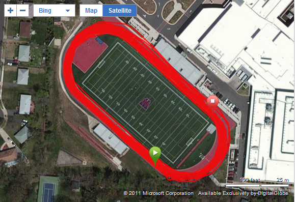
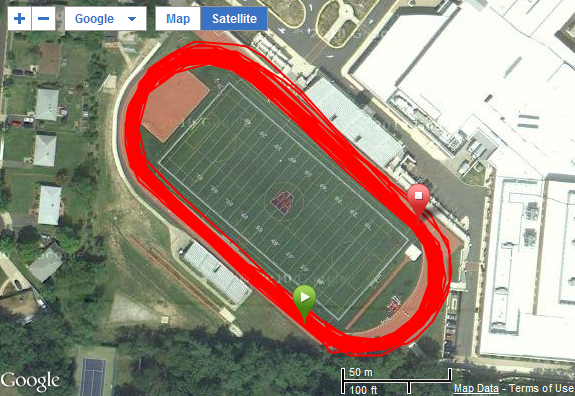
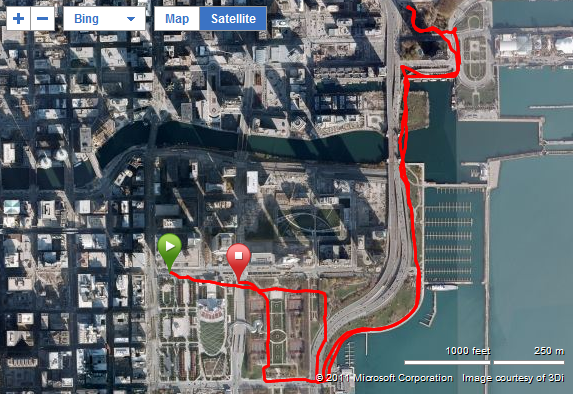
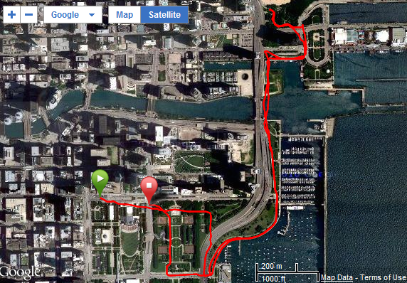
So starting today you can now toggle back and forth between Google Maps and Bing Maps, based on whichever map service displays the best maps for you and your area. For some folks, Bing maps will offer a better experience, and yet for others, Google Maps does.
Check it out:
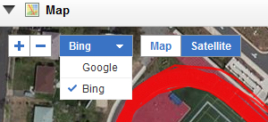
You’ll see now displayed above the map the ability to switch back and forth between Google and Bing.
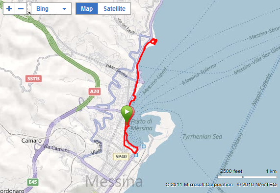
And in fact, with toggling back and forth you can easily see the differences between the two providers:
 |
 |
 |
 |
 |
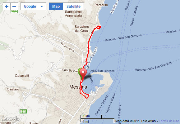 |
See, mapping services like Bing Maps and Google Maps use mapping providers to get maps and satellite data. These are companies like Digital Globe and Navteq. In addition, they also use local partners such as governmental agencies (USGS) and even private sources. Google and Microsoft ultimately pay for the vast majority of this data, based on how old the data is, and the resolution of the data. The newer, higher resolution (defined as how much you can zoom into the image) is more expensive. So these companies balance their market goals against buying imagery and updating it. Popular areas like NYC will see more updates than a small village in Kenya.
That’s why when I travel and post snippets of rides and run routes in unique places, I often mix and match the two companies maps. For some countries or locales – Google has the best data, and then in other places, Bing. And in many places in the US, they’re about the same. Of course, that’s not as true outside the US.
In my mind – giving users the choice to quickly toggle back and forth is the best of all worlds.
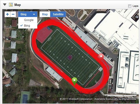
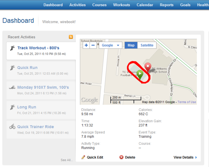
The new toggle switch is available today in the Dashboard activity now, as well as the activity detail page. This is the dashboard view:
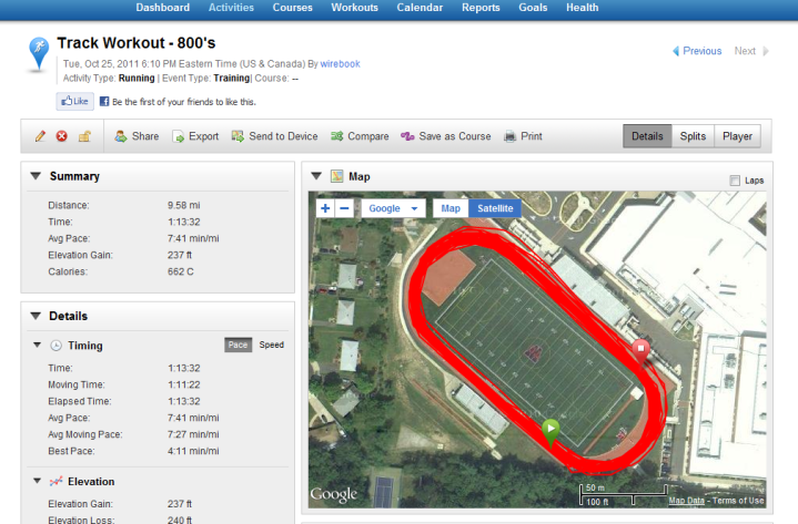
And this is the activity detail page:
Going forward, they’ll be adding the toggle into the new Course Creator as well (see here for details on that) – which will enable you to leverage the recognition that Google has around bike/running paths when making new courses.
Additionally, you’ll also see the adding of the toggle into the Explore tab – which is where you can go out and find new routes.
The Garmin Connect team felt that getting this out first for the activity view and dashboard view was the highest priority, before doing the other two areas.
As always, if you have any questions – feel free to drop them below.
Thanks for reading!
FOUND THIS POST USEFUL? SUPPORT THE SITE!
Hopefully, you found this post useful. The website is really a labor of love, so please consider becoming a DC RAINMAKER Supporter. This gets you an ad-free experience, and access to our (mostly) bi-monthly behind-the-scenes video series of “Shed Talkin’”.
Support DCRainMaker - Shop on Amazon
Otherwise, perhaps consider using the below link if shopping on Amazon. As an Amazon Associate, I earn from qualifying purchases. It doesn’t cost you anything extra, but your purchases help support this website a lot. It could simply be buying toilet paper, or this pizza oven we use and love.








I’ll have to revisit Connect. Last time I checked though, they were way behind Strava. At least in terms of my needs as a road cyclist.
thanks Ray. I probably wouldn’t have noticed.
that’s good. it’s allways good to ha choice.In my country the bing satelite image is better then google’s, but the google road map is far better.
I find that any gps-path displayed in connect is shown with way less points/resolution than if I export/download as a KML-file and view the same data in google earth. What’s up with that??
If I would only use Garmin Connect to view my GPS-data I would conclude that the data is pretty awful! How do your track-laps look in google-earth? Any different?
Ray,
Have you asked them about adding in OpenStreetMap? I think that is a cool project where people can use their runs/rides on trails that are not mapped and then map them. Once that is done they can show up via Garmin Connect.
-Sean
When is Google gonna buy Strava?
I’m so glad Google Maps is back on Garmin!
Google has actually largely moved away from map data providers: link to readwriteweb.com
Just signed on Garmin Connect with my new (used 910XT).
I can see the Map in the Dashboard but when I go to actual activity in Analyze tab, the Map is blank and nothing inside the Map window works….
What’s up?
That’s very odd. I definitely don’t get that. Any chance it’s a connection issue?
I found a workaround the problem.
The problem shows up with FireFox & Chrome.
But it works OK with IE!
I am running 64-bit Windows 7.
Same problem happened when I tried to update my 910XT from 2.20 to 3.00.
The .js that was supposed to run did not!
Had to go to IE to get that to work.
Now playing around to loading courses.
Same problem with BikeRouteToaster!
Had to go IE to successfully transfer to 910XT.
Looks like Garmin Communicator for 64-bit Firefox/Chrome is broken.
Hi dudes. I know this sounds like a real first world problem/request! But… Is it possible to change the default from Bing to Google?
x
Garmin connect shows just a tiny map (either google or bing) and there is no way to resize it. They actually worked hard to program this limitation by placing the map inside a flashy non-resizable pop-up “window”. The only way to see the route properly is to export to a kml file.
Another case of programmers getting too fancy at the expense of the users. Really!
I use a Garmin 520 bike computer & then upload to Garmin Connect all my rides.
I ride zig zag, haphazard, spontaneous, and randomly. When I look at the resulting map
which shows my route in a red line … I can push the arrow button to cause a cursor to run the route and
I can watch how my ride went here and there. The cursor follows my route. It starts at where I started and stops where I stopped riding.
PROBLEM: That cursor moves so fast across the map that I can’t see what its doing as it crosses over and back again along the route where I rode multiple corners and back and then again, etc.
HOW DO I SLOW DOWN THAT CURSOR MOVING ALONG MY MAP ROUTE SO I CAN MAKE SENSE OF WHAT ITS DOING. RIGHT NOW ITS LIKE TRYING TO FOLLOW A BULLET ACROSS THE SCREEN.