Despite having lived in Paris almost a year now, I’ve rarely cycled outside of my little set of known routes and locales. Partly because the weather has been so bad this winter that I spent a lot of it on a trainer. But also partly because of the unknown aspect (and language barrier). But with the weather finally getting nice here, it was time to venture out of the city.
The trick is – how do you create a viable and functional cycling route out of thin air?
While following a ‘known’ route is good, it doesn’t really help when the ‘known route’ starts 15 miles away and goes someplace else. I wanted to effectively build a route into an area that I knew in general was nice, but didn’t know which specific roads were good. So here’s the story of my weekend…
In a completely unrelated find a few weeks ago I stumbled on Race Shape. I don’t even remember how I got there, but I did. At first it didn’t seem too terribly interesting me as someone who lightly uses Strava. It was essentially just exposing Strava segments. Meh. I had almost closed out the browser tab forever when I saw the ‘Global Heatmap’ function up in the right corner and figured I’d give it a quick peek.

Holy cowbells batman!
It’s enumerating 917 million data points (according to the stats at the top), and in doing so is effectively showing me all of the Strava rides ever done.
But wait, could I zoom in and make it more useful?

And further:

Now we’re talking! Now I’m able to start making out areas that are more popular. I can see Paris (upper right-ish) is actually not terribly popular with Strava cyclists. This makes sense. While there’s undoubtedly more cycling going on in Paris proper than outside, it’s more along the lines of bike-sharing (Velib) and commuter bikes. The type of rides that Strava wouldn’t really be tracking.
But off to the West and Southwest of Paris there’s plenty of cycling going down according to Strava. The darker/thicker the colors, the more people are riding it. As I zoom in more, I can get a clearer picture of things.

I can click to actually show me the relevant nearby Strava Segment. For those unfamiliar, a Strava Segment is essentially a small race-like chunk of road. Effectively something that you compete on (even if you don’t know it at the time). They can be just a few hundred yards, or many miles. It’s sorta like a single page of a AAA Triptik. Yes, I just brought you back 15-30 years. Welcome to last century.

As you can see – ridden 2,000 times seems pretty solid to me. Keep in mind, that’s 2,000 uploaded rides to Strava. Based on what I see in the area here as far as devices capable of uploading to Strava, I’d guess we’re only talking low-single-digit usage of Strava amongst cyclists out doing training rides (1-5% at the high end, since I tend to only see about 5-15% of cyclists with GPS-computers on their handlebars). So in a way, you can loosely use this as a proxy. Like ‘4 out of 5 doctors agree’…sorta.
Looking at other popular routes, where I do loops (along with thousands of other Parisian cyclists), has been logged 94,000 times!

And one segment in Central Park in NYC? 140,000 times!

So from this data I can start to understand what’s popular and what’s not.
With that in mind, I cracked open Garmin Connect and their course builder. While Garmin Connect has heat maps for some cities in the US, it doesn’t quantify them with totals like Race Shape. Further, Garmin Connect will be pulling in data across anyone with a Garmin device – which while normally great, for this purpose I actually kinda want more ‘competitive’ cyclists. Which is something that Strava attracts. In effect, I know that the majority of cyclists using Strava are going to likely be doing so on good fast roads, rather than some meandering non-well maintained path that might be better for a beach cruiser or runner.
Anyway, I pull open the Garmin Connect Course builder, and the Race Shape maps side by side and start to go to work. First up, I know how to get past the river on the Western side of the city. I’m good at that. So I just quickly build my route using my own route that I routinely do.


Now is when I start analyzing the different chunks. By looking at the heatmap I’m able to piece together the best overall route to get me out to where I roughly want to be.

And the process continues. It doesn’t take too long. I find that in general I just simply create a few points a few miles apart and let Garmin Connect give its best shot. In most cases, the best guess route Garmin Connect lines right up with that from Race Shape. The white dots are the ones I added, but everything in between is what Garmin Connect decided on. As you can see, I was able to connect large lengths between the map above and below without having to get too detailed.

From here, I just did this repeatedly until my route was mapped out. Analyzing each segment a bit along the way.

Before long, I was done and ready to send my course to my unit. To do so, I just tap the ‘Send course to unit’ button, which works across all the Garmin Edge cycling units, as well as the more advanced Forerunners (multisport/running watches).

For those on non-Garmin platforms, you can follow all the same steps, but instead of using Garmin Connect – you could use something like Bike Route Toaster to create the GPX or TCX file – which many GPS units out there on the market supports for breadcrumb trails.
Now, there are some catches here to this whole process of using the heat maps. And I got bit by one pretty badly on my ride back, costing me quite a bit of time on Sunday. The good news is that because I’m telling you about it, you’ll probably avoid getting bit.
First is to always double-check the route. Just move along over the map and make sure it passes a sanity check. What’s funny is that I did that for the outbound, but then got tired and neglected to do it for the return. Of course where I got bit was on the return.
Here’s what happened. See this little section below:

Well, it’s actually a horse trail. Probably technically a dirt road (questionable though) Despite Garmin Connect being set to ‘Stay on Roads’, it went there. Now, that may not be Garmin Connect’s fault, it may well be Google’s fault (or one of their providers), since the data comes from them. Here’s what it looks like from Google Streetview:

Obviously, that wasn’t going to work in a time-trial/triathlon bike.
In fact, if I tell Garmin Connect to switch over to Openstreet, you can see clearly it’s marked as a trail:

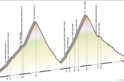
What made matters even worse here was that this little section is sorta a mini-mountain (a hill normally, but Mt. Everest with a triathlon bike). Something you can see above in the Google Streetview photo (look at the background) and below in the terrain map:

So why didn’t I catch it on the heatmap with Race Shape? Well, two reasons.
First is that for some reason unclear to me, Race Shape doesn’t allow you to zoom in any more than this level:

Which means it makes that little segment really hard to see. And because I can’t zoom in, and can’t tell it to re-enumerate segments in that section to get better clarity on it. I’ve yellow highlighted it above (dead-center of image), and then resized a crop of the image (with highlights) below:

You can see there are some tracks there. And that makes sense – likely by mountain bikers. Which does me no good at all. A mountain bike trail a road bike trail does not make.
Outside of this one ‘minor’ error, my route was flippin’ awesome. For a complete guess of a route, it was packed with people. Literally flowing full of cyclists the entire ride, with beautiful countryside like this:

And this:

Oh, and this:

Seriously, finding the above was purely a function of following the heatmaps which happened to lead to this châteaux.
From here on out, this is how I’m going to find long routes in unchartered territory. While I’ll still use Garmin Connect to find ‘complete’ shorter routes (i.e. a 5-mile run in a foreign city), Race Shape is much better for piecing together viable routes out in the middle of nowhere.
Now, the real question is when is a device company going to take advantage of this. For example, Garmin has a much larger dataset than even Strava does. There’s no reason why Garmin couldn’t do the analytics on data and create dynamic heatmaps like this. But even more so, they could actually do route generation based on it. Per a conversation with the GC team, Garmin Connect gets upwards of a few hundred thousand uploads per day. To put that in perspective, the above Race Shape mapset includes ~200,000 activities as the total data set.
You want a 50 mile loop ride that’s moderately hilly? No problem, they could use their own data to generate a route on the fly that’s got the most rides on it (with hills). Which is a bit different than what Mio was doing with their Cyclo units, as they didn’t have the ‘actual rides’ dataset to work with. They just had mapping providers best guess at good routes. Actual rides takes it from ‘complete wild-ass-guess’ to ‘ridden 94,000 times’. Yes, it’s good. Oh – and they could do it all from the head unit using Bluetooth to take advantage of your cell phone connection.
Then again, maybe I’m just dreaming….
Thanks for reading!
FOUND THIS POST USEFUL? SUPPORT THE SITE!
Hopefully, you found this post useful. The website is really a labor of love, so please consider becoming a DC RAINMAKER Supporter. This gets you an ad-free experience, and access to our (mostly) bi-monthly behind-the-scenes video series of “Shed Talkin’”.
Support DCRainMaker - Shop on Amazon
Otherwise, perhaps consider using the below link if shopping on Amazon. As an Amazon Associate, I earn from qualifying purchases. It doesn’t cost you anything extra, but your purchases help support this website a lot. It could simply be buying toilet paper, or this pizza oven we use and love.


Or you could just use ridewithgps.com or download a GPX file directly from Strava. I’ve run into similar issues trying to create my own routes.
Hey Ray, you may also check out http://www.gpsies.com . This is a route creating service I use for all of my routes. You have different map services like google opencyclemap and so on. Theere a plenty of existing routes, but you can create one by your own and directly upload it to your garmin or what ever. There are also options the minimize waypoints, so the garmin can work fine with its 500.
The best thing is, like you wrote, you will find places you would never go to, because most roads end up in the middle of nowhere!
Give it a shot ;-)
If you are ever planning on coming to the Belgium, here you can find all the routes in the Flemish part: http://www.fietsnet.be and you can also select the type of road: normal road, “semi-hardend road” – sort of macadam I guess – and of course your favorite: cobblestones. And you can export it to your bikecomputer. Very easy to do, you just have to follow the numbers you can find on boards near the road, or like I said, on your Garmin.
Very nice routes, with not too much traffic.
To plan routes in France I would even suggest http://www.openrunner.com as it allows to display IGN maps which are the official topographic maps. Depending on the zoom the shown details change and the more details views include the height information. The site works well for cycling although it had been created for running.
Get a Surly Cross Check, throw some 700x42s on it and don’t let the dirt stop you :-)
I had been kinda using Strava (with its limitations) to find routes in unfamiliar places, but thanks for the find, this is a much better way! Though if you travel to a place where you have a lot of readers, I’m sure we’ll still be glad to post links for suggested rides! :-)
Garmin connect also has heat maps available. When looking at the map, under the layers/maps icon you can select that option and see what is popular. Not as specific, but same basic idea.
Yup, the challenge there is they’re only available for certain cities (US based). :(
Nice post ray
Thanks
Yes!! Good Find! I am been looking for a good alternative to find better routes. Going to start using this when I get back to Cali from DC. I am in your old stomping ground for about 8 weeks. Looking forward to using this!
Nice, thanks for sharing. I’ve been using the Garmin Connect heatmap tool for a few months to plan out new routes, this looks even better.
Hey, raceshape creator here. Thanks for posting about the site. Your use case was exactly how I was intending the map to be used.
The rides on the map are those that have been raceshaped, the sites main feature where you can compare segment efforts to get a second by second time gap to see where you gained and lost time. So it’s a weird, and small, subset of all Strava data. But it still has pretty good global coverage.
The zoom level is limited by memory of the machine the site is running. Which is related to cost. I was actually going to add 2 zoom levels this morning, but because of your post I don’t want to have the downtime, maybe in a few days. Talk about timing :)
Awesome! Looking forward to the change once you’re ready!
Just like in Strava itself, the zoomlevel is restricted when having the terrain check box active in the map. Just uncheck it to see the map without shading and you can zoom in to much greater and sufficient detail.
Ray – thanks for this. Great post as always. Raceshape looks excellent.
One (newbie) question: how do you actually use the route once its uploaded to your Garmin in order to navigate? I’ve just received an Edge 510 for my birthday and I was under the impression it doesn’t really show you where to go.
Sorry if you’ve already answered this a thousand times.
Love your blog and frequently share links to it with my (very modest) blog audience.
Interesting but this web site definitely isn’t pulling all Strava data. I just zoomed into my local area (Virginia Beach) and it’s literally a dead spot despite plenty of Strava uploads from the local cycling community here.
While not useful outside the US this could be useful to find tips left by others for biking:
link to nytimes.com
(Raceshape could allowed commenting of segments to have the same type of info)
Hey Ray, here is maybe a better site than the raceshape heat map
link to jonathanokeeffe.com
Simply put a segment in near to where you are, and it will show all of the rides through that segment. Then you can mouseover the rides on the bottom left and view the actual route each one took
Thanks for the link to my site, Andrew. Like Paul from RaceShape mentioned above, this is pretty much exactly the use case I had in mind when creating my mapping tool. Drop in a Strava segment, and see all the rides that pass through that segment.
In case you hadn’t noticed, it’s also possible to put in multiple segments (just separate the segment IDs with commas). This lets you build up a more complete map of rides in an area. For example, here’s a map showing 400+ rides passing through a dozen or so segments southwest of Paris since June 1 of this year.
Thx Ray!!!!
Great use of the big data that Garmin or Strava collect. I agree with you, i do not understand why there is no more data mining like this example.
Here’s a tip to avoid small, dirt roads when planning a new ride:
In google maps, drag the little yellow street-view-man over the map, but don’t drop him anywhere (i.e. keep your finger on the mouse). All of the roads with street view are highlighted in blue. These roads correspond to “proper” roads, i.e. if the street view car will go there then you should be fine on the road bike too!
Very cool tip! I like that. :)
What is you want to map only Mountain Bike trails? What do you recommend for that?
Are there any iphone apps that help your create and navigate a route seen on strava or raceshape?
I’m not aware of any. And unfortunately given Strava’s whacking of a slew of 3rd party apps last week, we likely won’t see any until next year (they’ve restricted API access now till at least 2014).
Hi Randy/Ray,
Don’t know if this is what you mean by creating a route? Other than using Garmin or other tools to rebuild a route, I found an app (iOS), EasyRoute which lets you create a map pretty easily on your iPhone/iPad and then export it via open in to anything that supports gpx files (including dropbox).
Appstore line
(I have no connection with EasyRoute, just found it a useful app)
Raceshape is great. Created by a UC Davis Cyclist who was pumped on the Strava game. Build your heat map!
For Garmin route planner is there a chance or setting in order to export to the Edge 810 also the vertical profile?
Cool how-to-guide, thanks very much.
Just made my first course using raceshape data. Lets see what happens ;-) Cheers.
Really enjoying your website – your advice came in handy for my first sprint triathlon this summer. I’m preparing to bike tour Europe for 5 months next summer and am excited to read about the resources to find the best rides. I’ll be looking at buying a bike GPS over the next few months and I’ll be sure to read the reviews.
It would be great if you could feature your favourite rides on the blog so we could recreate them.
Since you’re over there in Europe, one question I have is buying used bikes – we will be going to Europe via South America after 4 months traveling there, so bringing bikes on the plane isn’t an option. Have you heard of any good places to buy good bikes used in Paris or in Western Europe?
Enjoy the sweet life in Paris!
Thanks. Yup, I post some of my favorite Paris rides/runs here: link to dcrainmaker.com
As for buying a bike, it’s tough – I included a few links about that above in that post too, but not so much on used stuff.
Enjoy the trip!
This is interesting. I wasn’t able to see any clickable markers to display the Strava segments though.
Just check this: link to strava.com
Here’s an auto magic way of doing this… which shouldn’t take you down gravel paths.
link to mapmyride.com
it’s genius!
Salut Ray
J’habite aussi a Paris, et fais du vélo, je vais régulièrement en rouler en vallée de Chevreuse et connais des parcours très cool qui sont très vallonnés, en ce moment je suis bloqué a la maison à cause d’un accident de moto depuis près de 4 mois, mais quand je serais rétabli, si tu en as envie, je me ferais un plaisir de faire la route avec toi et te montrer tous ces beaux parcours ;-).
Voici un exemple, tu pourras voir que le dénivelé est intéressant:
link to bikemap.net
link to bikemap.net
A bientot
Dom
Hi Rain Maker, I stumbled across your blog yesterday and haven’t been able to close it yet.
Just for info as you stated that you use it, Strava has the heatmap function built into its own map creating tool. You just click on ‘Map View Options’ and activate the ‘Strava Popularity Heatmap’ option.
Im also a fellow français, I live down in the south at Toulouse, ever been or thought about cycling down this way?
Indeed, the new Strava heat map is pretty cool. Used it just last week actually.
I haven’t been down to Toulouse yet…it’s on my list!
Hey Peter and Rainmaker
I also find out today – looking for routeplanner for race bikes – that you can activate the “Popularity” flag in the Strava Route Builder (today still in Beta).
What is the meaning of this flag?
Strava Popularity Toggle
Enabling the Popularity toggle will take the activity data of runs and rides from the Strava community and use that to select paths runners and cyclists prefer.
From my point of view it seems that planning/creating a route, Strava Route builder uses the Heatmap based data to draw the route, and that results in having – most likely – a route that can be ridden with a race bike!
With kind regards
Peter
Thanks so much. Great blog and methods to use for the future.
Yep, I’m finding the new Strava Route Builder is unlocking new and better routes for me by mapping based on popularity in the UK. I’m doing my first (credit card/lightweight) bike tour from Orleans to Albi in June and am relying on the strava tool to take me a decent route. It’s got me going up and down Col de Lestards so clearly has some idea!
Slightly off yet on topic, has anyone tried the new Routes integration with the latest app update for Strava? Does it do turn-by-turn instruction now based off routes?
A less lonely solution: every town around Paris has its own bike club, and they all go out for group rides every Sunday. I joined the Neuilly club last year, and have discovered all the rides going west (chevreuse, thoiry, etc), and have made many friends. Come join us!
Also, look at the schedule of organized rides on the ffct web site. There are links to thewebsites of the clubs that organize the rides, and you can download the maps and gpx files for each one.
Rust.
Thanks for the tip on Strava Heatmap, Rainmaker. I noticed that if you open the Heatmap on an iPhone, you can zoom in closer than you can in the full website on a Mac/PC.
I really enjoy your site, thanks! I’ve been using this tip and passed it along to a friend who’s in Paris for a bit. I also have started using Strava’s Route Builder and I think it “saves” a step in a way because you leave out anything to do with Garmin Connect. The drawback is you’re pulling your phone out of your pocket when out on the bike trying new routes. Is this a mission for the Garmin 1000? What I mean is for anything over a 2 hour ride in unfamiliar areas a moving map on your handlebar, with active routing however you generate the actual course you want is probably the way to go, right?
Yeah, the Edge 1000 does some of this. The challenge is that it doesn’t quite take into account true local cyclist favorites, but rather just bike-friendly routes from a mapping perspective.
As a cycling computer Edge 1000 has a lot of extras that I have no use for, the 500 works perfectly as that. But as a moving map/navigator I just don’t know that iPhone in my jersey pocket is good enough, that’s where I look to the 1000. Generating routes is one question and for me there’s no need for Garmin Connect. But enough pixels and a map that I can interact with easily while still one hand on the bars, there’s where I’m leaning for riding in densly paved areas. For instance I’m just outside of Boston right now and there’s a whole lot of roads i don’t know. So I “build” a route on Strava (or explore a region) using Heat Map and then export in .gpx to a Garmin. That’s the direction I’m leaning. I’m a pilot and have been using moving maps for a long time, I’ve always felt that pixel count is where you start if you want the map to be useable. Of course iPhones have tons but don’t think I want it on my stem.
Strava has absorbed Race Shape. :-(
So I for one can’t find the heat map yet. Any body else have any luck?
Steve, it looks like they’ve incorporated the heat map into their route builder. You go ahead and select My Routes, then Create New Route. When the map loads, there’s a toggle button to view Global Heat Map. I think that’s the same data. However, I assume I can only do this because of premium membership.
link to labs.strava.com
Hi Ray,
Did you had a chance to correct link to connect.garmin.com and would you recommend it for a aero bike ride ?
Thanks !
Fab
Oh and by the way, if you have other routes for cycling from Paris to Vallée de Chevreuse with road bike, would you please share some GC links ? ;-)
Thanks !!!!
Strava doesn’t distinguish between road cycling and MTB so unfortunately you see a composite of the two disciplines. I (and many others) have requested Strava to build this into their solution so I hope they’re going to do something soon. They already distinguish between running and cycling so how hard could it be?
this is pretty cool … afaik this is used as “map genius” at the above mentioned mapmyrun.com
link to routeloops.com
Is there a way to use HeatMaps for running? I’m visiting Louisiana next week and I want to run Bourbon St and some others, how can I see where the most popular nearby running areas are? I don’t need to upload to my device, I just want to see them on a map so I can get to them from my hotel and then just run that area.
Thanks!
What you guys would recommend to build the road: Garmin or Strava?
Apparently RaceShape is now part of strava and it isn’t obvious to me how to get the heatmap like you had up before.
Strava Labs Global HeatMap: link to labs.strava.com
And also this: link to labs.strava.com
You can allso test http://www.openrunner.com , I think it’s the best one to find tracks for booth MTB and roand cycling.
Hi ray,
just reading this post with some delay.
If you go to Strava and do a SEARCH for activities in a particular city or area, you can see number of local rides. Thanks to a filter you can nail down the type of ride you’re looking for.
You don’t need to use the heatmap function at all.
Go under EXPLORE > ACTIVITY SEARCH and put the name of the city or region you want to see rides in.
Then you rebuild it in Route Builder unless you have a pro account, and you can then download GPX file and transfer it to your Garmin.
I’ve been doing it for years and have ridden solo new routes and rarely found issues about the terrain not be suitable for my bike.
The best i’ve ever come accross… It will avoid or find dirt roads immediatly and generate endless random routes…
link to naviki.org
Only just been directed to your site by others as I was looking for reviews on particular things. However, when I saw your article about Race Shape, I thought ‘excellent, I can use that’.
Just tried to log into Raceshape.com and it comes up stating Race Shape is now part of Strava!
Have you tried this since Race Shape was swallowed by Strava?
Thanks
Great post, just what I was looking for and I am looking forward to reading your other posts soon!
Glad to chat your blog, I seem to be forward to more reliable articles and I think we all wish to thank so many good articles, blog to share with us.
Hi Ray,
Although this is an old article, people still like to be taught how to create a route. I believe Raceshape was taken over by Strava. Sadly they stopped supporting the site and now it is offline. On the Strava forum i stumbled upon a reaction from one of the Strava staff:
Elle Anderson
June 23, 2017 02:40
Hi Aidan,
RaceShape is a Strava domain, but the site is not currently under development nor has it been maintained. We have no plans to fix the errors at this time unfortunately.
Elle Anderson
June 23, 2017 20:07
Hi Aidan, working on an update for you.
However, it’s likely that we will decommission this site and it’s features in the future. There are no plans that I’m aware of to save the SNAP tool, especially given that few folks use it unfortunately.
On that topic, however, we are working on an in-house tool to snap activities automatically to our basemap. It’s very experimental right now, but could be on the horizon.
Just get out and ride get lost have an adventure.
Yeah.
Nothing better than being lost in a foreign country where you can’t speak the language when you have been on the bike for 10 hours in 43c heat carrying all your own luggage.
Nowhere to eat because it’s Sunday and everything is shut on a Sunday, can’t find water and your bottles have been empty for more than an hour.
You would have turned off 50km ago if you had known but to turn around now means 1000m of vertical back to the route.
Yeah, get lost and have an adventure.
This is really great info, thanks for sharing.