Long before the Garmin Epix (2nd gen) or Fenix 7 came out, Garmin has been selling maps. In fact, they’ve been selling maps for basically their entire existence. Lately these things are built into devices, but it wasn’t that long ago that if you wanted extra maps on a Garmin device you had to buy them separately.
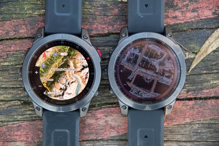
But one of the neat things you can do with this map-buying-prowess is put satellite imagery maps onto the Garmin Epix and Fenix 7 series. In fact, you can also do it on the Fenix 6 Pro watch. Neither are officially supported (listed as a compatible device), but all these units work just fine and people have been using them for years. Some suspect the reason it was removed from official compatibility is that the map experience with the lower resolution Fenix 6/Fenix 7 displays may not always be great. But the Epix has far greater resolution and pixels per inch – at 326ppi versus 200ppi on the Fenix 7 series. So, things simply look better now.
The main reason you’d want to use satellite maps over the included regular maps is for areas where the regular maps aren’t as useful. For example, along coastlines or near water, where important wet/dry details tend to be fuzzy. Same goes if you’re off-trail entirely, and trying to figure out if you can cut across a vast swath of land, or if perhaps just out of sight are impassable rocks/marshes/etc… There’s countless uses for it.
In any case, you can do this on the Fenix 6 Pro, Fenix 7 (all variants), and Epix units (as well as even the Fenix 5 Plus series and original Fenix 5X). And doing so is easy – assuming you’ve got a computer, and your charging cable nearby.
(Note: At present, if on a Mac, there seems to be an issue preventing Basecamp from seeing Fenix 7/Epix devices, though, it does work fine with Fenix 6/Forerunner 945 devices. This issue has nothing to do with BirdsEye directly, but since Basecamp is needed to be able to download maps, it indirectly blocks BirdsEye at the moment.)
Downloading It:
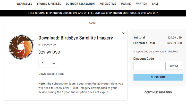
First up, you need to go and buy a Garmin BirdsEye Imagery Subscription. It costs $29/year, and gets you unlimited maps during that period, for anywhere in the world. It links to a single device. Also, any maps you download during that subscription year remain valid on your device even if you unsubscribe.
So starting there, simply follow the purchase steps from this page:
Once you’re done paying, you’ll get a few different e-mails over the course of a few minutes. It’s not instant, it takes like 5-15 minutes. Next, if you haven’t registered your device yet (e.g. paired it up to a phone or computer), you need to do so. It’s pretty likely you have already done so – but if not, do that first.
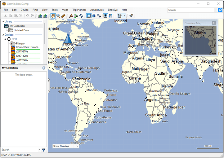
Then, you need to download Garmin BaseCamp. This is part of their “Basecamp is Old and Stinky Software” series of desktop products (aka BOSS). It’s been around for longer than the Fenix series has existed, and allows transfer of routes, waypoints, and maps to devices (originally for handheld devices). Normally for most newer maps you’d use Garmin Express or on the Fenix 7/Epix series even the watch itself. But BaseCamp was designed for the handheld era, and apparently nobody remembered this software is still there.
Once downloaded and installed, you’ll be staring straight into the face of 2008 user interface design and culture (another 2008 offering):
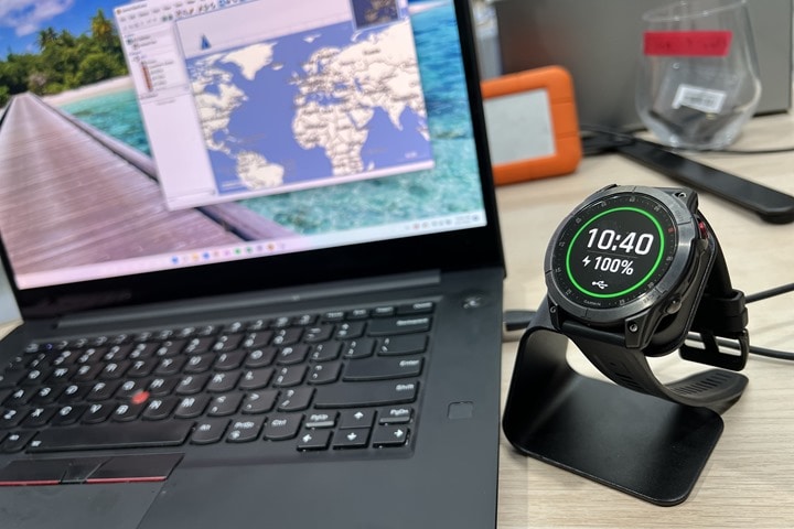
If you haven’t yet, go ahead and plug your watch in (yes, using this stand makes this seem even more BOSS-like):
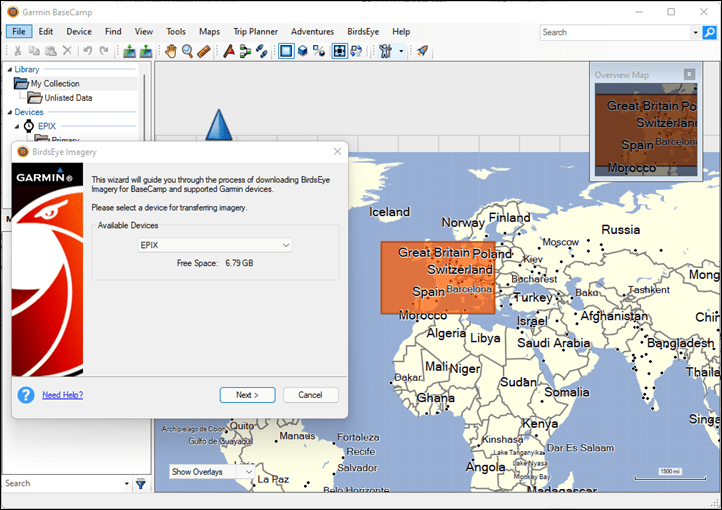
Then, at the top menu, select ‘BirdsEye’, then ‘Download BirdsEye Imagery’. That’ll bring you here, which shows your Garmin Epix (or Fenix 6/7):
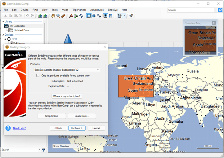
Click next again, and you’ll see the BirdsEye product automatically populated, but then click on ‘Where is my Subscription’ to sign-in and get your account validated (so you can see the purchase you did above). The username you’ll enter is your e-mail address. Remember, the BOSS software is so old it’s from an era where Garmin Connect used usernames, not e-mail addresses.
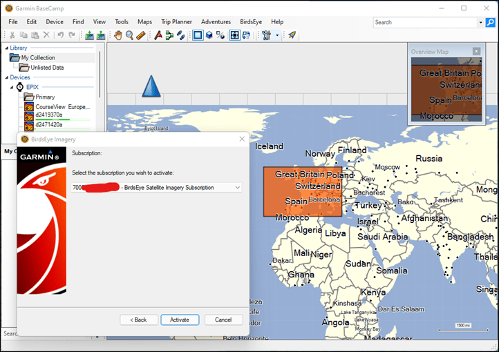
Once you’ve signed in, you’ll see your subscription listed, click the ‘Activate’ button to get it excited:
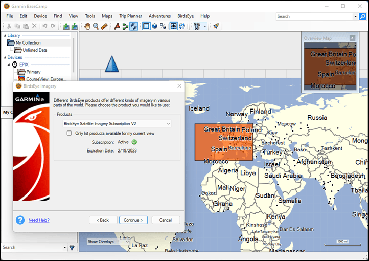
Once you’ve done that, it’ll give you a success message, and then another confirmation dialogue indicating your mission is mostly accomplished:
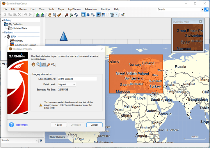
Now, comes the good part! Choosing the area you want to download. You’ll see how you can use the little map zooming tool in orange to highlight a region. But remember, satellite imagery is huge in terms of size. So downloading all of Europe like this would take a whopping 22,465GB, also known as 22 Terabytes, which is approximately…well…way more storage than you have on your little 16-32GB Epix/Fenix units.
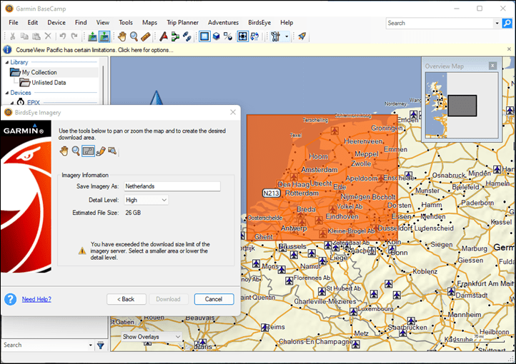
You can use the little icons to zoom in/out (magnifying glass), move around (hand), and either draw a square or free-form. You can see that even if I select the whole Netherlands, that’s still some 26GB at the high level (but 74GB at highest). If I reduce that to the standard, it’s about 1GB.
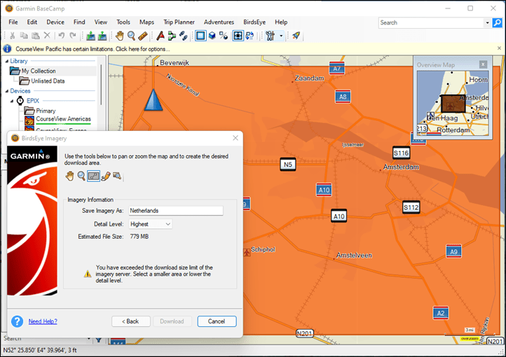
But standard is no fun, so I’m going to zoom into just Amsterdam, and there we go – far better, at the highest it’s about 779MB (just under 1GB) and easily fits. If you were hiking in a region, you could easily make a more finite circle around the area you needed and easily make it fit.
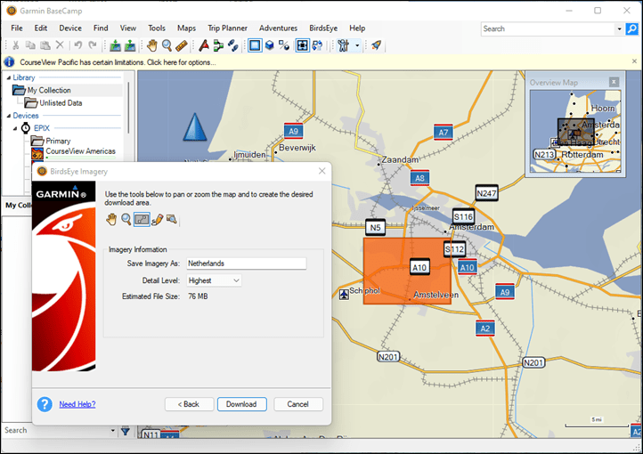
Except, wait – it says I’ve exceeded the download limit of the server. Because again, 1997 BOSS. This was apparently the era of dial-up modems. The exact limit seems to vary based on which setting you choose. So at the ‘Highest’ setting, it appears limited to about 76MB, whereas the ‘High’ setting is 107MB, and in the standard setting you can go super big. Except, not always. It’s also about the underlying tiles, so in some places you’ll get far higher levels. For example later on I download the area around Chamonix (Alps in France), and easily cleared over 200MB on the highest setting.
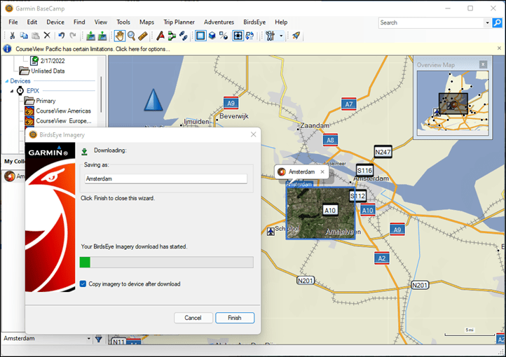
Anyways, now I’m ready to download:
It’ll download everything, and if you didn’t give it a name, you can do so as well. You should hear the dial-up modems starting in your computer. It’ll take about that long to download this 76MB map. Check that ‘Copy maps to device’ box, so once it’s done next week, it’ll at least have copied the maps too. That’ll be the quick part.
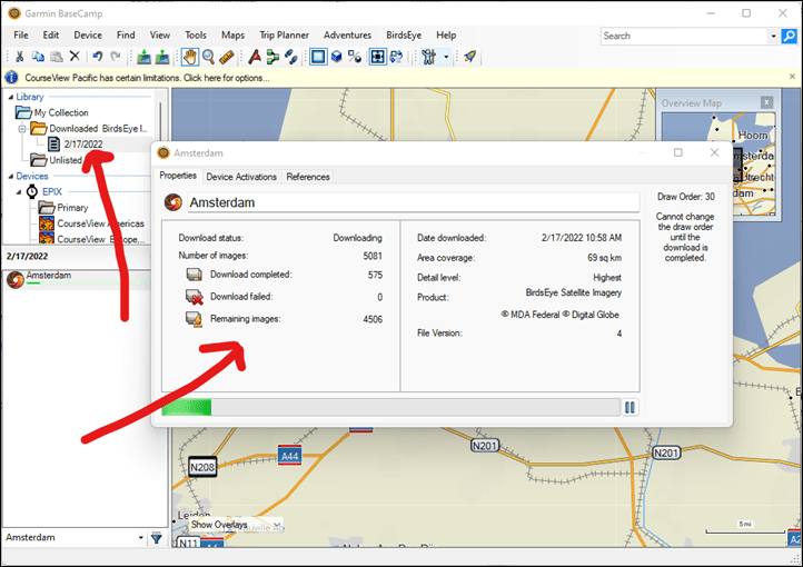
If you tap finish, you can double-click on the map name you created to see this nifty screen showing, where you can watch map tiles download, mentally envisioning Tetris pieces falling:
No really, this entire thing took about 45 minutes to download this 76MB. And no, it’s not my internet – I average speeds of about 500 Mbps here at the DCR Cave, meaning in a best-case scenario it should take approximately 1.216 seconds to download a 76MB file, and a worst-case scenario 2 seconds. Obviously, this is more about the design of how files are downloaded for BirdsEye imagery.
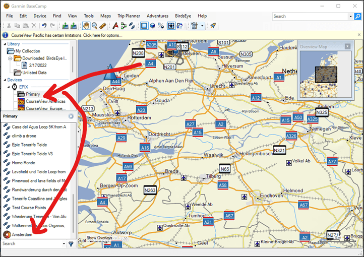
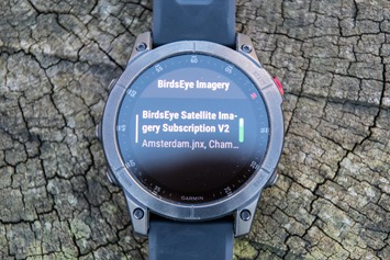
You can double-check everything copied by looking at the ‘Primary’ folder under your device, and then likely scrolling to the bottom:
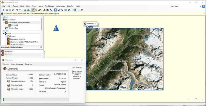
Further, you can repeat this process for as many areas as you’d like. I went along after and added some imagery for Chamonix as well. Though this time it allowed me to download a 220MB section on ‘Highest’, demonstrating it’s all about the underlying tiles. This one took 1hr 31mins to download.
With that, you’re ready to use it – so go ahead and disconnect your watch from the computer.
Using it:
Good news! This section is trivially easy. You just use your watch as normal.
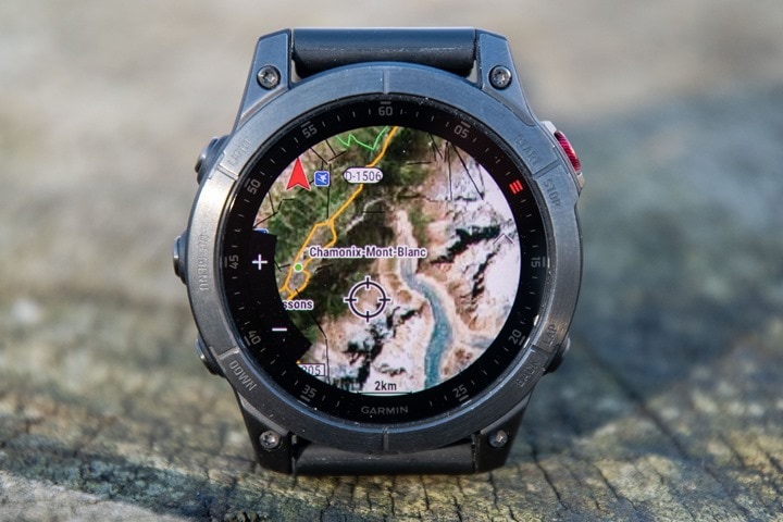
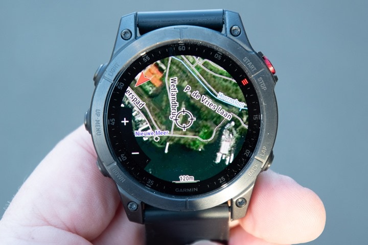
By default, Garmin will load the BirdsEye Imagery for any areas you’ve downloaded. But what’s cool is that they’ll also automatically overlay the trail/road/route imagery over the top of that. You can see this below here:
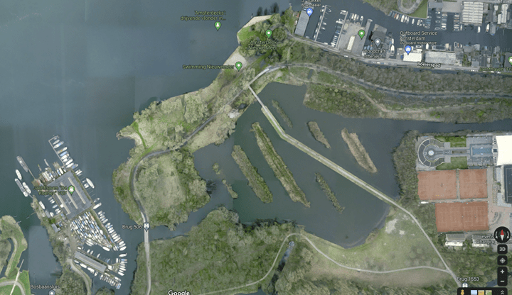
As you can see, the quality here is generally pretty good, but not as detailed as you’d find if looking on a computer or phone. For example, I can roughly guess that there are boat docks above, but you can see it’s not as sharp as the actual imagery if I look on Google Maps or such (below, but upside-down). And while these are certainly different sized images, even when fully zoomed in on the Garmin satellite maps.
Still, depending on what you’re using this for, it’s still more than useful in most cases. I find satellite imagery super helpful in trying to figure out areas of tree cover (or not), or rough ideas on where snow-covered trails might be in summer (since mountain satellite imagery tends to be taken in the summer, so you can usually figure out where glaciers/etc might be). Same goes for many coastal areas where non-satellite maps aren’t super useful for finding the edges of water or small islands. As always, there are plenty more uses here.
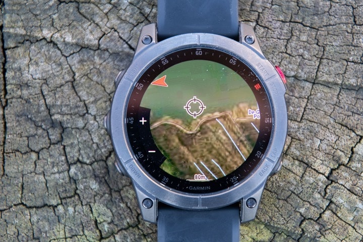
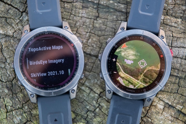
For example, here’s the edge of a marsh area I often run in:
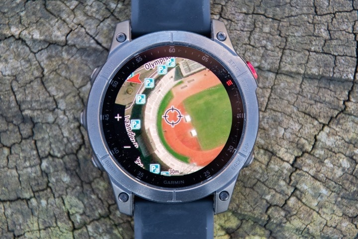
And for fun, here’s Olympic Stadium:
And here’s Epix and the Fenix 7 side by side, obviously, in very different areas (French Alps vs Paris):
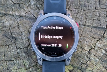
Now, if you want to turn off the BirdsEye layer (or the trails layer), you can do so in the maps options for that particular sport profile. Once in that profile, access the settings by long-holding the middle-left button. Then scroll to ‘Map Settings’ > ‘Map’ > ‘Configure Maps’ > ‘BirdsEye Imagery’ > and then toggle either on or off.
Note that it’s all or nothing here, so either all your regions go on or off. If you backed-up one level, you’ll see the same option for ‘TopoActive Maps’, which do allow toggling it per-region (e.g. North America, Europe, etc…).
All the core features like routing and popularity and such are all the same here, since they’re leveraging that detailed TopoActive map layer. So none of that changes. Undoubtedly there’s a battery hit to using the BirdsEye maps versus TopoActive maps, but I haven’t calculated that at this point.
Wrap-Up:
It’s cool that this is an option, both in terms of being able to download satellite maps for anywhere in the world, as well as being able to toggle these layers on and off, within the device itself. Plus, with the 16-32GB of storage, you can load quite a bit of satellite imagery, depending on the exact detail level you choose, and how particular you get with that download area creation tool.
Of course, I think it’s also clear that Garmin probably needs to look at overhauling some of this stuff. As more and more of their units get AMOLED displays over the coming years, people’s interest will increase here. And this is an easy $30-annual subscription in terms of revenue for them. Plus, it’d benefit all of the existing handheld and Edge cycling devices that already support this today (almost all of them). Moving this type of feature to be smartphone-based using WiFi to download maps, with speeds that represent this decade, is something I hope is on some internal roadmap to get done.
Certainly, we aren’t all going to be using BaseCamp forever. Or at least, this version of it. I suspect this would fit well within the Garmin Explore app, and there seems to be hints about variants of that app allowing BirdsEye imagery download (based on looking at the baked-in version on their new Overlander device). The Explore app has recently seen its duties expanded to accommodate Garmin’s inReach Mini 2 connectivity, so perhaps more is on the way.
Either way, as with many other Garmin things, this feature will likely be used by less than 1% of the Fenix users. But for that sub-1%, it’s incredibly useful. And, as I’ve said before – that’s ultimately what’s made Garmin so successful – finding everyone’s own 1% feature.
With that – thanks for reading!
FOUND THIS POST USEFUL? SUPPORT THE SITE!
Hopefully, you found this post useful. The website is really a labor of love, so please consider becoming a DC RAINMAKER Supporter. This gets you an ad-free experience, and access to our (mostly) bi-monthly behind-the-scenes video series of “Shed Talkin’”.
Support DCRainMaker - Shop on Amazon
Otherwise, perhaps consider using the below link if shopping on Amazon. As an Amazon Associate, I earn from qualifying purchases. It doesn’t cost you anything extra, but your purchases help support this website a lot. It could simply be buying toilet paper, or this pizza oven we use and love.



Thanks Ray. I have downloaded a small test birdseye (possible for free) and the resolution is still not good for my area and pulpy and not really recognizable on my Epix. So I would recommend trying it out for free for a test area first…
Btw: just saw, the birdseye map for my area is ok. Attached a sceenshot from my Edge830. With 50m on Epix, you only see pulp. So no, nou usable for me on my Epix.
Did the test/sample file say which of the three resolution settings it was downloading from?
Yes: „highest“.
Hi Ray, seems more to be a zoom scale bug on the Epix. Attached a pic with 50m scale and 30m scale (same area). Already reported this to Garmin.
Thanks for that update @Volker! Been very intererested in the Epix, specifically to put birdseye on it. Was discouraged by the pics of bad quality (which does not make sense, on my alpha 100 with 155ppi it looks better.. ). Zoomed in seems more like it! Thats how I would use it anyway
Sorry if I missed it somewhere in the article, but do you know whose imagery Garmin licenses? Would be good to get an idea of what quality I could expect in areas I’d be likely to use it (though I’ve seen the comment above about free test areas)
I haven’t seen it shown anywhere, or, at least anywhere obvious. :-/
Map options on Forerunner?
I haven’t tried to see if this works on the FR945. I suspect it probably does, but haven’t tried or researched it yet.
It does work on the Edge series devices.
I tried this last year on my fenix 6X. Where I live it was a bust. The maps come out as kind of undifferentiated green-brown smears.
The Epix 2 seems like a better bet given the much higher color depth and double the pixel density.
Even if I love the idea I would reccomend to be prudent. Indeed several third party app can damage your watch. I had a very unpleasant experience with third party map… They worked ok but reduced dramatically the battery efficiency. I was lucky my garmin was under warranty otherwise 3 hours of battery would have been a disaster. After that I decided to not upload anything that it is not certified. 😬
Your clearly didn’t read the article wich explains how to install Maps you „buy“ from Garmin with ancient Garmin software (ancient but still actual) on Garmin devices that support this kind of maps because Garmin made them to. There is only one third party involved: the payment service you use Tobias the subscription.
For aging (66 yr old) eyes, would you recommend the Epix 2 or the Fenix 7X for this application? TIA.
The Epix has far higher resolution/clarity over the Fenix 7X.
Check out the Epix vs Fenix 7 photo in the ‘Using It’ section, to see just how crazy better the Epix display is. And in that particular photo – I even jacked up the Fenix 7 backlight to 100% (from the default of 20%).
Thanks, Ray.
Hi Gary,
I had the same question (and problem) and eventually went with the Epix 2. I would have liked to be able to compare in real life but I don’t know anyone with a Fenix 7 (I have a Fenix 3) and although the screen is great on the Epix 2 I’m not convinced it has made viewing the screen with aging eyes that much better. It is better but not out of this world better.
After the initial purchase of the Epix 2 I was wishing I’d gone with the Fenix 7 for the better battery etc, but I’ve played with the settings on the Epix 2 and turned off a lot of stuff that I don’t need and I reckon I can easily get over two weeks of use on a single charge and still have an amazing screen.
My two cents.
Is there any indication how frequently the satellite/map data is updated?
I haven’t seen much detail there, or on provider sources. Sorry!
Sounds like a way to get Fenix 6 Pro map and routing capabilities on a Fenix 6.
You do still need a Fenix 6 Pro, as it contains the storage for maps.
After paying for Birdseye and receiving the confirmation e-mail, plugging my Epix 2 sapphire into my MacBook, running Basecamp … all I get is “unable to find Birdseye compatible device”. Any tips or is it possible that they’ve blocked some of the new Garmin’s (Epix and 7) from allowing this?
Click on Primary on the left hand side, wait for it to initialise (can take a while), then once it has retry download birdseye. This worked on my Fenix 6 Pro
Thanks for taking the time to reply! I can’t see anything called “primary” and with multiple plug/unplug cycles, restarts, etc. Basecamp doesn’t acknowledge the Epix as a device…
Sounds like the Mac isn’t quite seeing it correctly, for some odd reason. The way Garmin enumerates their music-enabled devices on a Mac can be funky.
I can write up any additive steps tomorrow on my Mac at the office in case it’s not showing up still by then.
Thanks for the personal reply, Ray! G.Express recognizes just fine and I’m using the latest M1 MacBook Pro with a quality USB-C cable and well-aware of the need to use Android File transfer for certain things (like direct music transfer), but can’t get around this hurdle. Thanks again.
Hi,
Do we have any update on that ?
I wasn’t able to use Basecamp on Mac with Epix :(
Hi Ray, thanks for this article! Trying this on my Mac with an Epix 2 but no luck (it worked on a FR945). No luck either on an Edge 530.
Any updates from Garmin on when this may be fixed, or any hints at a workaround in the meantime?
Thanks!
:🤭🤭🤭
29$ for something that is free on google ??
🤣🤣🤣🤣
I wasn’t aware you can tap to download from Google to your watch?
Don’t want it to turn into another FB or Twitter or whatever, but when are you going to get Likes and Dislikes on posts?
Your reply gets a Like.
Free?
Basically, you sell all your data to Google, in order to be able to use their services without paying.
RE: Likes/Dislikes
Hmm, I actually had that on the list at some point. Not sure where it went to. I suppose, like many things on the list, it just gets moved to another list. :)
As Custom Maps?
No, no such capability exists. That’s my point (and others). He was trying to imply you could just get it for free, which you can on your phone or computer. But you can’t simply get Google Maps for free on your Gamrin. Or, get it at all on your Garmin.
(OK, technically there are some crazy archaic ways you can do it because Garmin supports custom map tiles, but it’d take an immense amount of effort to create/write/script, and also be against their licensing terms. So basically, it’d be for one’s own personal use at best.)
I confirm !! I use the custom maps for specific (small) areas. My raster files are from Google map (satellite View) or IGN (1:25.000 French area). You produce .KMZ file. I have done this for my F5X, and .KMZ files created years ago work fine on my Epix 2 :-)
And it’s free !!
See : link to support.garmin.com
Speaking of Google, Ray – any clues you can offer on whether or not you’ve got a Pixel watch in your hand for testing?
I tried that and it works. The filesize seems limited to 3MB? It took me a while to understand it. First, using Google earth, save an image, then add that same image as an overlay, then save it as KMZ file. It’s nice for a very small area, but cumbersome if needing to do this over and over for a larger one.
Could you foresee a world where there would be a Google Maps app for the Epix (as there is for other smartwatches, for example) which would include their satellite layer?
I would imagine Garmin’s incentive to do so would be limited because of the loss of potential subscription revenue and Google’s would be low so as not to support a competitor’s smartwatch (although there is a Google Maps app for the Apple Watch, for example).
If Google wants it, that’s possible. Even there’re some map apps that can download and display such data.
However, even if Google makes an app for this; it won’t be quick to use as it needs faster Bluetooth versions or LTE to download imagery quickly. Otherwise BLE is slow and will take a lot of time to download…
I actually think it’d make a lot of sense for Garmin to do a Birdseye app, and have that be subscription-based – just like LTE.
Then again, one has to remember that the TopoActive maps we now have on our Fenix 6/7 watches also used to be subscription based from Garmin years ago. Garmin recently said they have no interest in subscription services for “your own data”, but certainly, Garmin has many subscription services for “someone else’s data”.
And then i could see a scenaro where they say “Oh, on Marq, it’s free”, or “Oh, on the Fenix 7 Sapphire editions it’s free”, or whatever. All things to drive people to higher price points.
Either way, it’s worth nothing that Suunto’s Wear OS Watch (Suunto 7) does have free satellite maps downloads, though, it’s highly limited to just a single area, and unlike Garmin’s, you can’t do multiple areas. Though, unlike Garmin’s it doesn’t take 4 years to download. :)
I simply download with cable from Opentopomap or Userbeam. They update weekly and I can correct or add more data. Even, I didn’t install its own map on my F7X. Actually, I tried, but it said not enough space. I deleted everything and it started download. I woke up 4 hours later and it could download only 2.5 GB of 11 GB Europe maps. :D My point was to download and backup the Garmin map, anyway. Maybe I’ll install it via USB someday in the future.
As they said, for those who already had a subscription, BirdsEye would work. But do not connect the new watch.
Pavlinux- I’m not sure why you keep saying that. It’s factually not true.
LOL: I think they are using an acoustic phone coupler too with those speeds. Is it better than uploading stuff to GoPro though?
Typo: “You should hear the dial-up *model* starting in your computer.”
Do not get me started on uploading stuff to GoPro… ughhh
Yeah, the GoPro stuff is wonky. I have no idea what it’s doing half the time. I’d love to understand the technical reason why it’s slow (for them).
But equally, I assume the technical reason it’s so slow on Garmin’s side is just due to crazy-old designs where at one point this was all on DVD’s, and basically the processing speed to find each tile and copy it to your device was slower than the actual copy time. Thus, they never bothered to move away from that architecture.
In all honesty, it’s these sort of silly re-architectures that Garmin has so much potential on (business revenue and consumer happiness). Making it trivially easy to add a satellite map from your phone, or a marine map, or any of the 928 other map types Garmin sells. Have that be totally seamless with Apple Pay or Google Pay (or, tied to your Garmin account payment). And make it quickly download over WiFi, or eventually LTE.
Garmin has removed Birdseye Imagery from their wearables for no reason.
link to reddit.com
Oh no! That must be why it’s not working. I wonder if I can get my $29 back
That’s 9 months old. These instructions were half-written a week or so ago, and then I re-did them all for a video companion yesterday afternoon on another device (of course, my screen recording apparently failed halfway through, so I have to re-do that…sigh).
It still works perfectly fine (setting aside Keith’s computer issue, since Basecamp isn’t even seeing his device, he hasn’t gotten to the point of Birdseye even being engaged yet).
Birdseye satellite imagery is discontinued .
I just downloaded and installed a “sample” map on my 5X (non-plus) and it worked. It was the free trail and I selected the highest resolution but I am sure it reduced the resolution since it it not very good to look at. But it DID WORK so there is that. Maybe I will try it with the subscription.
“It takes like 5-15 minutes” is that english?
It’s English when a beer or two deep.
What happens when you stop you subscription. Would you still be able to use the maps that were already downloaded?
My understanding is existing imagery remains on the device just fine, but downloading any new imagery would fail.
is it only for windows user.
BaseCamp for Mac cant find the Epix2 or the Fenix 7
Yeah, I’m doing some troubleshooting for a while this morning.
It appears there’s some issue with enumeration of a Fenix 7/Epix unit on the Mac Basecamp versions. Which in turn, blocks Birdseye. This doesn’t seem to impact the Fenix 6/FR945 units though. Will probably hit up Garmin to see what’s up.
I can somewhat get a Fenix 7/Epix to show up in ‘Garmin’ mode (USB settings on the watch), but then I can’t get Basecamp to enumerate all of the files on it (which means, it’s not properly requesting access like it should here: link to support.garmin.com)
Make sure Connect is completely killed (its background agent too) and also AFT as well. Basecamp doesn’t like either of them loaded
Thanks for confirming that, you’re right. Sadly the “Mac bug” still exists even with those programs and their background processes killed.
One thing I have found is that if before you do the download, you highlight a GPX route in Basecamp and then do the imagery download it will automagically just select the right area to cover your route.
Very nice – that’s a great tip! Indeed, the entire pan/zoom/find process is super slow/cumbersome, so that saves a lot of time!
I connected my fenix 7x device to my windows 10 computer and got the error in the image I guess wearable devices are not supported subscription money wasted :(
I wrote the entire guide on Windows, and re-did it again today. So it definitely works on Windows.
Looking at your screenshot, your Fenix 7X isn’t enumerating correctly or being blocked by some other app. You can tell because your ‘Primary’ folder should be populated with stuff, and it’s not showing. There’s a slew of causes for this, but quick things to check:
A) Ensure your firmware is up to date
B) Ensure your Garmin is connected using MTP mode (it’s in the Fenix 7 system settings, and more than likely you haven’t changed it, but in case you did, change it back)
C) Ensure you’re using the Garmin cable (I’ve seen weird quirks with other cables)
D) Ensure you’re not using any USB hub along the way (your specific message is most closely aligned with a USB hub)
E) Ensure Garmin Express is closed (on a PC, this shouldn’t actually matter any, but worth a shot).
Cheers.
Thank you for your answer, my device cable, the cable that came in its original box, I tried all the items, both windows 10 and windows 11, but it didn’t work :)
Have you activated the subscription in basecamp?
no i can’t get to that screen
Same here, Fenix 6x PRO. I think the basecamp does not support Fenix series anymore, it used to work, may be it is discontinued with updates?
Ok, now you may be young, but actually garmin pre dates sat Mac’s with maps. Their early GPS receivers just gave gos coordinates on a screen and had an interface that allowed you to connect them if you wanted to a computer that could then read the position and use with mapping software. I actually had one of these which at times I connected to a psion 3 or computer.
These new watches are just getting better and better.
I wanted to buy a fenix 7 or epix 2 (sapphire edition), but Garmin doesn’t have enough stock. Only the white version.
Bonjour je veux essayer ça pour mieux comprendre
So depending on how desperate a Mac owner you are, it is possible to install Parallels on your Mac (even the latest M1’s) or use BaseCamp to install Widows on your Mac and this allows the Mac to recognize the Fenix 7/Epix 2! The Birdseye Imagery installs perfectly.
I bought BirdsEye the day I got my F7. Sure, it doesn’t look as great as it would on an Epix, but you can still see the required detail and the performance (i.e. time to update renders) is decent. However the quality of available imagery can be disappointing (e.g. shadows of mountains cast on trails, blurred sections, etc.)
Wery much appreciated! Thanks for testing and confirming @DC rainmaker
I tried following the link provided to purchase the Birdseye download and the page states the product is “Discontinued”. I don’t see any option to purchase the license. Any suggestions?
went to purchase the subscription and it says discontinued. Waiting on a callback from Garmin support to see if there is a replacement. Does anyone know?
Just spoke with Garmin support and Birdseye downloads are dead as of this week with no replacement according to the rep I spoke with.
Can also confirm that birdseye is no longer an option for epix (other than maybe if you patch the firmware). Bought it before it became discontinued but dit not try to register it until after. No longer possible to register it to a device that is not “compatible”. Still worked on another device. Went with the custom maps option using MOBAC . Tiresome process but the result is better. Google and bing satellite images. The size limitations can be cirmumvented if you keep each layer below 100 tiles (one map became almost 200 layers). Recommend not using zoom level over 17 or perhaps 18 for faster panning.
Do you know if the Fenix 7 firmware can be patched so we can load our own raster JNX maps? Brinxter used to be the site, but now it’s down, and his last version worked on 5X+.
July 2022- this shows as discontinued on Garmin website.
Hi, do you know if this still works? On the Garmin homepage it says the service has been discontinued and I can’t find an option to buy the 1 year subscription? If it still works, do.you think it’s possible to get it to work with the new FR955? THANK YOU!
Can you overlay lat and long to the live sat view and how rapidly would those numbers update I was thinking of using this to navigate while snorkeling
Hi, great guide !
Seems like the service is discontinued. Can you please elaborate on that ?
Birdseye image no more available with Garmin..Any other format, way to upload raster in a Garmin watch ?
Much Thanks
Denis
Thank you for the procedures. Unfortunately BirdEye’s no longer exists. Are there other options now?
My desired use is for coastal small boating: SUP, Rowing, Dingy Sailing mainly in New Jersey (US) on my Epix 2 (not pro).
The main issue is that uninhabited land shows on the marine map that comes with Epix but only at 0.5mi scales or higher. Given the low speed of travel this isn’t great.
Are there other maps or is there an option to show those land masses at lower scales. The information is in my device but I cannot figure out how to display at all scales.