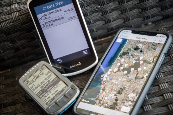
Longtime readers know that one of the biggest annoyances I have with Garmin’s entire mobile platform is that for a company whose sole existence was for location purposes, you actually can’t create a darn course/route in Garmin Connect Mobile. Nor can you in Wahoo’s app for their navigation devices either.
The closest you can get in Garmin’s case is that you can now create automatic routes, which are routes based on you providing how many miles you want to ride or run, and it’ll spit back a nifty course using heat maps and such. And in the case of Wahoo, you could route to a specific point, but it’s just whatever the most efficient route is to that singular point. Not for a looped course.
Again, I’ve long been annoyed about both of these.
However, as of today, we now have a solution on the Garmin front, which also has actually worked for a while on the Wahoo front. Consider this post a Tuesday Twofer.
The Details:
(I’m going to outline the iOS app here, cause that’s what I use. But the concept is exactly the same in Android in theory with this app, however, it doesn’t seem that the Android GCM version is accepting the .GPX file from it (meaning, it doesn’t show as a valid end point). Also, be sure you have the *latest version* of Garmin Connect Mobile on your phone if using it on the Garmin side.)
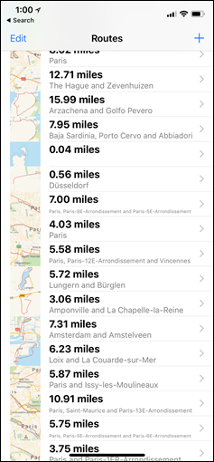
In order to create your route, you need some sort of route creation app (because neither Garmin nor Wahoo do it yet). The app I’ve used for years (many years) is called “Easy Route”. It’s 100% free (as of December), and doesn’t require any account creation or logins. You can just tap your way through a map for your route and you’re done. I use it both at home and travelling, when I just want to quickly figure out how long (distance-wise) a route might be. Tap…tap…tap…done.
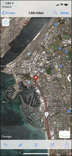
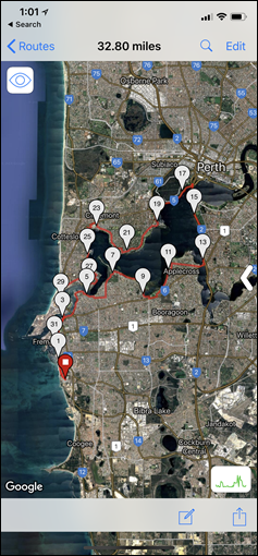
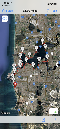
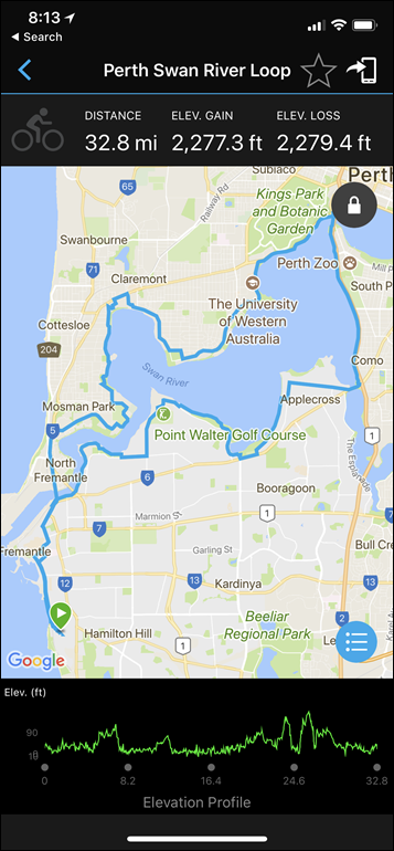
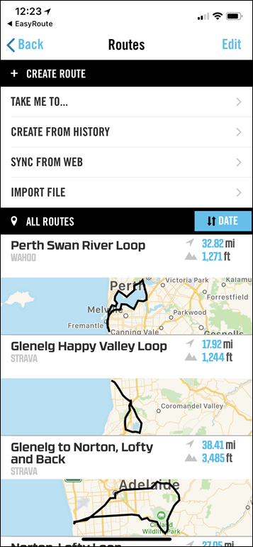
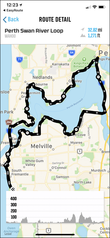
So, I did that for my ride this weekend. I actually created it fully within Easy Route. You can see that above:
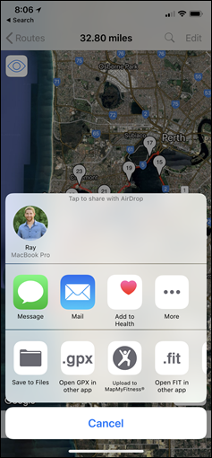
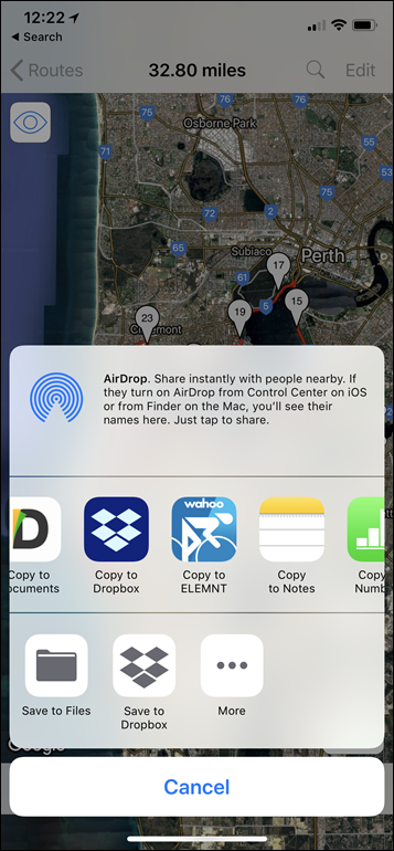
Then, I saved it. You can give it a name if you’d like within Easy Route, though it won’t really transfer that name to Garmin Connect. Next, you’ll see two options at the bottom: “Open GPX in other app”, and “Open FIT in other app”.
For Garmin, go with .GPX (since it doesn’t support .FIT in the mobile app yet). Whereas for Wahoo go with .FIT since it’ll transfer turn by turn directions to the ELEMNT/BOLT. No worries though on turn by turn for Garmin , I actually used the .GPX version this weekend on the Edge 1030 without issue.
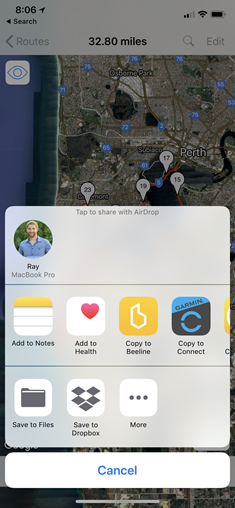
After you click that option, it’ll then ask you which app. Simple choose either Garmin Connect, or Wahoo ELEMNT, depending on what you want.
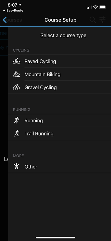
In the case of Garmin Connect (and this is the part that’s new this past week), it’ll open up the Course Setup window. Simply start by selecting what type of course it is.
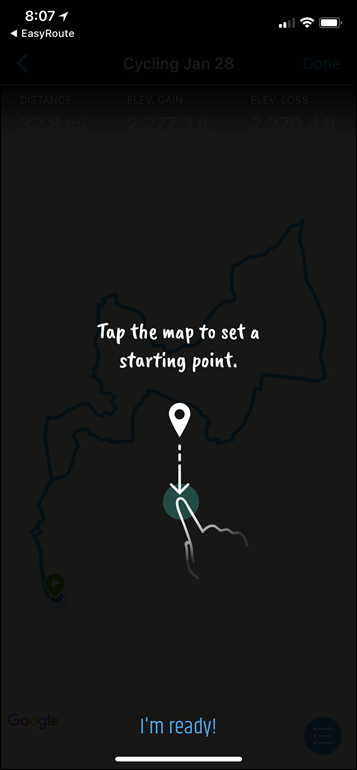
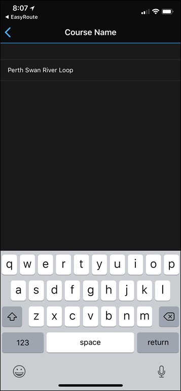
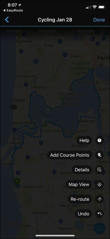
Then you’ll see your course all laid out, magic complete. You can add course points and tweak things if you need to. Then you’ll just give it a name:
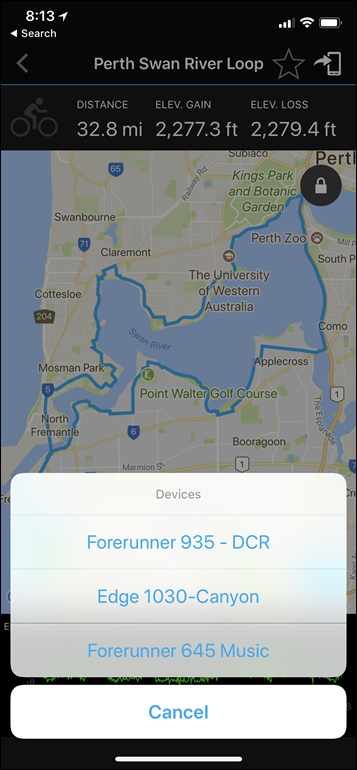
And now you’re done. As normal, you’ll need to send it to your device. So just tap on the little icon in the upper right corner to do that. As long as your watch/bike computer/whatever is nearby, it’ll shoot it over via Bluetooth Smart in a few seconds or so.
That’s it!
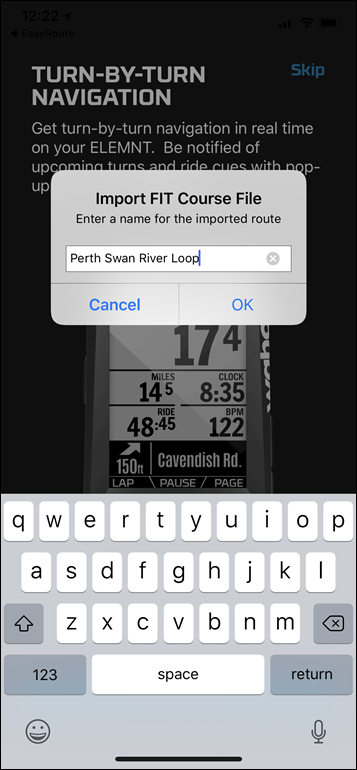
For Wahoo, it’s basically all the same, except they do carry over the name of the course from Easy Route:
You’ll then see it listed within the app a few seconds later, which is then also synced to your device. In the case of Wahoo, you can’t change it within the Wahoo app though. So some minor differences here.
At this point, you just ride or run your route like normal, by selecting it on the device itself within the courses or routes menu.
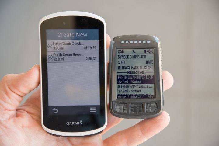
And that’s exactly what I did on Sunday. I did everything exactly as described above on the Edge 1030 and it all worked quite well for me. So happy days.
Oh – and here’s one tiny last tidbit of fun for you. The Easy Route iOS app I mentioned? The developer actually joined Wahoo Fitness a bit over a year ago. And thus completing the circle of life.
FAQ:
Just to quickly cover some questions I suspect will come up, here we go:
1) Why do I have to use a 3rd party app?
Because neither Garmin or Wahoo have put manual route creation in their own apps.
2) Which route creator app for Android?
I’d recommend trying MyRoutesMap, it’s roughly the same. But feel free to contribute other recommendations below in the comments.
3) Wait, you said Garmin Connect Mobile can now create automated routes? Why haven’t you talked about it?
I was busy eating cookies or something. But I actually did post about it within my Edge 1030 review. See, fun times.
4) Does this work with my watch too?
Generally, yes. As long as your watch supports ‘Courses’, it’ll work with it. That’s basically most Garmin watches over $299.
5) What if I have a watch under $299?
Then you’ll want to check out a Connect IQ app instead. The best bet is dwMap+, which many people agree is one of the best all-around solutions here. It’s also free for the basic version, and works on all the less expensive Vivoactive watches.
6) What if I create routes on Strava?
Then you can ignore everything I said here. This is really only for folks like myself that like quick off the cuff solutions to create a route totally from your mobile phone
7) What if I want to create routes on my computer?
Same as previous question – tons of great options there already. Garmin Connect, Strava, RideWithGPS, and so on.
8) Does this work with Suunto or Polar?
No, neither mobile app has been enabled to consume .GPX files and create courses from them.
9) Why not use Komoot?
Certainly, could use that too, they’ve got their own app and everything. Works quite well. But as noted I like the simplicity of the EasyRoute app.
—
With that – thanks for reading!
FOUND THIS POST USEFUL? SUPPORT THE SITE!
Hopefully, you found this post useful. The website is really a labor of love, so please consider becoming a DC RAINMAKER Supporter. This gets you an ad-free experience, and access to our (mostly) bi-monthly behind-the-scenes video series of “Shed Talkin’”.
Support DCRainMaker - Shop on Amazon
Otherwise, perhaps consider using the below link if shopping on Amazon. As an Amazon Associate, I earn from qualifying purchases. It doesn’t cost you anything extra, but your purchases help support this website a lot. It could simply be buying toilet paper, or this pizza oven we use and love.



Doesn’t work on my Android with MyRoutes, no option to share direct to Garmin Connect.
I use Routecourse for easy route creation and import to my Garmin Fenix 5. Routecourse can import Strava routes as well without nneed for computer or cable connection.
link to apps.garmin.com
Thanks Ray, being able to create maps on my phone and then send to my Garmin will be very useful.
Thanks Ray,
This looks much nicer that trying to plot a route on my mobile with RideWithGPS set to desktop version and then importing it into Garmin Connect website!
Regarding MyRoutes, I can’t seem to see an equivalent ‘Open GPX in other app’. I can upload to the cloud or just share it via email, WhatsApp etc.
Thanks
PS Using Garmin Connect app v4.2.2
i’ve got the same issue, garmin connect doesnt show up in the ‘share route’ option
Sorry, should be ‘MyRouteMap’, my bad: link to play.google.com
That said, on Android for me it’s not showing Garmin Connect as a viable option. I’ll circle back with them.
Connect shows as “Open with” option when I download a .gpx file with Chrome on Android (tested with link to m.gpsies.com), but not when sharing the route from MyRouteMap.
I was able to work around this by saving the GPX to e.g. Downloads, and then opening it from there with OI File Manager, which did show Connect on the target list. File Kommander didn’t, so there’s probably something wrong with how Connect has registered itself with Android.
I’ve been using Komoot for this for quite a while already.. also nice way to create routes, lots of info available. After saving in komoot, you can sync through WiFi…
Now if only wahoo would turn on route syncing through Bluetooth data connection with my iPhone, it would be perfect.
Does this work on the 520?
In the Garmin connect app I am getting an error of “your device does not support courses” but that is not the case (as it shows in the menu)
Any update on this. I am seeing the same, Does not support courses message on the Edge 520
That’s odd, because the Edge 520 does support courses. I’ll try and replicate it sometime this weekend and see what’s up.
blue tooth needs to be on and connected to your phone – 520 then send it to the 520. I had the same issue until I realized my 520 was off
rob
Thanks. Didn’t realise it had lost connection as was still uploading activities.
FYI, I just discovered that it was possible from the Strava website on Safari to export the .GPX file of a route to Garmin Connect to create a route in the same way as with EasyRoute.
Thanks for that extra tidbit – That’s a deceptively simple work around. Good thinking.
It also means that it’s far easier to get *any* route onto the device, irrespective of how or where it was created. Create the route in any app or on any website you fancy, save as a .GPX, drop it into an iCloud Drive folder, and then open it from Files on the iPhone and send it to Connect.
(I suspect that Google Drive would work just as well, as would sending it attached to an email)
I used komoot.de several times.
it does create routes on openstreetmap data and heatmap.
With the Connect IQ app you can sned the troute to your device.
For locations I use “sendpoints connect IQ app.
“I was busy eating cookies or something”.
Hope the were Phil Gaimon cookies…..
Thanks Ray for this great tip! It works like a charm. I shared your pain in creating routes on mobile – no more. Also thanks to John Famiglietti (EasyRoute developer) for such useful app that I use all the time.
Great Quick Tip, Thanks Ray! Was already a long time disappointed that Garmin didn’t have this feature and now there is a simple solution for it.. :) Can’t wait to use it during holidays etc. Question, do you know why Garmin doesn’t implement this in their Connect app??
You mean on the Connect web site? The feature exists actually. You can import a gpx as a new route.
For my Wahoo ELEMNT I use online free version of RideWithGPS, since the ELEMNT directly syncs with RideWithGPS. Added benefit: the local biking club (Potomac Pedalers) has a club account, so many club routes are easily downloaded, too.
What you don’t get in the free version is route editing or the ability to upload a ride and trace to become a route with turn by turn etc – you have to upgrade to the Basic $50/year membership. I don’t do that often enough to need it, but I feel like it is a good thing to support the good aps – when I signed up I made a contribution and got a few months access to those features and they work very well.
so, you say Garmin Connect Mobile can now create automated routes, right?!
Because it’s not working with android I tested once more a USB-OTG cable and it worked, but only with a tablet, not with my smartphone.
After connecting the onpowered 1030 the device changed normal to loading display and after that the device memory and SD-memory appeared in the file manager of android.
So u can copy files between these two devices in all directions.
A tablet with the apps LOCUS with offline maps and BROUTER for automatic routing makes you complete independent from PC and/or Internet.
I tried MyRoutes on my PC, but it seems to be quite unstable. Strava seems to be still in beta and had some minos issues, but still very much usable.
Wow. A step I was waiting for a long time! It would be perfect if you could save the track in GCM without the need to be online.
Wahoo have a limited form of route creation on their app.
On the app, if you go to Rides > Route > Take Me To… then you can create a route from your current location to a location you select on the map, and it will create a route with TBT that you can sync with the ELEMNT.
AFAIK it doesn’t allow you to select the start point and you can’t create a route stage by stage, just to an end point. I’ve used it a couple of times when I needed to detour from a pre-planned route and it worked pretty well.
He mentioned this in the review
Thanks for a nice tip.
My Fenix 5X has navigation with maps, and as you mentioned in the intro, it can create loop routes based on the entered distance I want to run or ride. Nice feature, I’ve used it a couple of times when I am away from my usual terrain.
But in my life, I way more often know for how long I have time to run, before it’s dinner or something else on the schedule. Garmin knows how my heart rate zones, my power zones, knows the terrain. A great feature would be to enter for how many hours I can ride. If I enter ie. two hours, Garmin could, based on my previous rides/heart rate/power/speed create a route that would take approximately the two hours I have. And if my Garmin, say after 30mins knows that I am behind schedule, it could either tell me to speed up, or make suggestions to shortening the route, to make sure I am back at my starting point at planned/agreed time.
If I also could enter a different end point than starting point, but let Garmin plan for detours to make the most of the available riding time, it would be fantastic.
What do you think? Too many unknowns?
For Android there is a much more comfortable option to transfer data from smartphone to the Edge!
In the app store you find the app “Gexporter” link to play.google.com which has to be installed on android.
In the garmin IQ you can find the counterpart “Gimporter” link to apps.garmin.com for installing on the Edge
Here you may decide to install wether the widget or the app. Functionality is identical, but the widget allows downloads without stopping a running record.
After you have installed the apps on both devices and they are running you can import all files from the Android folder “download” by choosing the file in the Edge App menu.
This is the only important thing: The files to import have to be located in the folder “download”
There is no need for Garmin Connect or internet connection!
But that way you can´t insert coursepoints or modify VP…
Frankly I find the new option a lot more “comfortable”, nothing to install, all standard.
Maybe their servers are being slammed … but the app doesn’t appear to work at all for even the shortest routes.
Just displays “Working” with an animated activity spinner.
Same for me.. maybe being mentioned by DCR has that sort of affect on downloads and server load!
To clarify, which specific piece is hung?
Broke for me too. I tapped on the screen to select a start location and it has just hung up with “Working..” and a spinny thing.
It worked for me before.
It seems to be working now.
I contacted the author and confirmed his server was getting slammed (Thanks Ray).
It’s been working intermittently for me since.
having similar issues. First it was choosing a start point, now it’s selecting subsequent points. Ray broker the internet!
how does it compare with routeCourse by the same creators of dwMap?
Damn, EasyRoute s free now – I should have waited a couple of months ;-)
Main issue I had with it is that it did not seem to know many of the small paths I routinely use in the country side near my place.
I usually use gpsies.com/GraphHopper.com on the desktop. They have more options (and know more paths) but the desktop sites are not really usable on the iPhone unfortunately.
Hi!
the app is tilt on “working” as I tap to begin the route.
anybody with same issue?
Martin
Ray, thanks much for the update! Been using EasyRoute because it’s simple, and just plain works (and free!). I don’t have to be tied to my home desktop anymore.
Oh oh
When I made EasyRoute completely free last month, it blew past all the quotas I have for my back-end services. (those being Google and MapQuest)
It settled down after a few days and has been fine since, especially after I fixed a few bugs that got exposed as a result.
It looks like traffic from this article has it past its quotas again. Sorry if it isn’t working right now. I’ll see what I can do to fix it.
Awesome App! I love it! Works great!
Good luck! Thanks for making this. I will stop clicking. Probably isn’t helping. :-)
??Simplement WOW !
Merci pour votre App. Facile d’utilisation, rapide et en plus le système d’images satellites est à jour.
Très utile lors de périple dans des endroits que l’on connais peu.
?? Fantastic,
Simply brilliant and easy to use App.
Very useful while in a area where not familiar with.
SIMPLE and Effective.
Thx to you John Famiglietti
– Eric B. Casual Rider – Commuter to work.
I have the same problem. In “New Routes” when I tap to select starting point, I just get a spinner with “Working…” displayed. I’ve deleted the software and reloaded and turned my phone off and back on. No joy.
Using an iPhone 5SE with current Apple software. I’ll keep on my phone for a day or two to see if it’s just their servers.
Enjoy your blogs and recommend you to others. Keep up the great work and enjoy your time in Australia!
Update. Just waited for the server problem to get fixed and it works GREAT! Thanks for pointing out this app.
The Komoot mobile app is pretty easy to use and syncs easily with the Elemnt.
This is welcome news. Although, I’ve had good luck while traveling making routes on my iPad using Garmin Connect, I’ve found recently that Garmin Connect on the iPad asked sucked for route creation. VERY buggy.
As I’m due for a cycling trip in two weeks this will be good try out. Thanks!
You can create GPX files for this from https://routespinner.com
Thanks, for this tip. I will try this one, but you still need a internet connection and that’s not always availible. My solution for offline route creation and sharing is osmand+ and gexporter on a android device, and gimporter on my garmin device. The only thing is that this solution doesn’t bring turn by turn navigation. The forerunner 935 only can handle 50 waypoints, so turn by turn isn’t that great on my device.
Does anyone know of a solid list of sport watches that offer the ability to create and load a route like this? It’s my favorite feature on my current TomTom Spark but would love to know what other options are out there. Sounds like Garmin has some options and I’m pretty sure Polar doesn’t.
I tried this wonderful tip and it worked perfectly. If Garmin doesn’t buy or hire this guy in a week to improve what they do then they are idiots. The app was simple, efficient and got the job done so easily!
If you want to stay within the Garmin world wouldn’t you be able to create the route in gpx from Basecamp or the old Mapsource ?
I have not gotten round to replacing my old GPSmap60csx’s with “real” bike computers – so still use them on both my MTB and road bike (and a more modern multi-sport garmin watch for data collection over ant+)
Yes mapsource has been end-of-life for a while, but i still find it the easiest way to create a route on a pc and the color screen of the old gpsmap’s are not that bad – especially in strong sunlight.
Sure, but those are all PC options. This was all about mobile phone.
Thanks for that hint, I’ve also been long frustrated with this lack of functionality. In my case, I usually want to transfer an existing GPX (downloaded from the internet) to the Garmin device while on the road and not having access to a laptop/computer. This can be done by saving the GPX to Dropbox (for example), choose export (in the case of Dropbox), then “Open in..” finally “Copy to Connect”. Nice!
The only slight hitch with the iphone was that whilst Garmin connect opened it didn’t go into “create a course” so a workaround was opening up create a course in conect, flipping back to easy route and then exporting and selecting connect which did the trick. Easy route worked a treat for me.
1) Android App “MyRoutesMap” does not support fit export? I can’t find it, only GPX.
2) I’ve created a FIT course with GPSies. Android Wahoo app does not support this. :/
found the same, Android version of MyRouteMap does not support the upload of. FIT files used for Wahoo, anyone found an Android app that does upload as .FIT?
Have you tried another FIT from Garmin Connect or so? For me it was not possible to open a fit file with Android Wahoo Elemnt App.
Will Easy route give you off road options or even man trails?
MTB*
MK – try the Viewranger app & website. You can create routes manually on-road or off-road using either their website or app.
Various different base map options available. I have used OpenStreetMap successfully to create off-road running routes in several different countries.
It’s a bit fiddly to create routes on your phone, so I would recommend doing the route planning from your PC/Mac, and then synchronising to your phone.
ViewRanger will cache to your phone so you can still navigate when you have no WiFi / phone signal. Good for use when travelling so you don’t get a big bill for roaming when you’re out running: just cache the map from the hotel WiFi and set off on your route.
Hope this helps.
PS. I have no commercial connection with Viewranger. I just like using it.
It’s a bit fiddly to create routes on your phone, so I would recommend doing the route planning from your PC/Mac, and then synchronising to your phone.
Bit of a negative, at least for me, when the goal is to create routes without a desktop; if I’ve got access to a computer, I’ve usually got a sync cable with me. Supporting OpenStreetMap is a big enough positive that a fiddly interface might be a price worth paying.
Great tip.
I just tried this on my Android phone (Galaxy s7) using the Viewranger app. It worked perfectly (having saved the route as a .gpx file).
The only snag is that I have a Forerunner 220, which doesn’t do navigation and isn’t Connect IQ compatible.
Drat.
A solution is at hand. If I win the DC Rainmaker $500 Friday giveaway I’ll have a new watch to fully test this functionality….hopefully!
PS. I have no commercial connection with Viewranger, other than being a satisfied user of the Android app and website for several years.
Obnoxious, obligatory, Lezyne already does this natively with their app and watches/cycling computers. (and they just recently added offline sync!)
Yup, it’s the singular area they do something better than the Garmin/Wahoo units.
But why don’t they (Garmin and Wahoo, but especially Garmin) add this functionality Ray? Any idea or insight? Could you exert some pressure? Garmin / Wahoo if you’re reading this – take note!
In this day and age do they really expect us to lug a laptop around with us when we’re travelling just to plan a route?
Frankly it’s ridiculous. Especialy when they’re prioritising things like Garmin Pay instead?
I’ve been reduced to finding workarounds for this for literally years when travelling stretching back to when I bought my first Garmin device 10 years ago (now on my 5th device) but still nothing developed to natively deliver this in Garmin Connect Mobile? And clearly, given that demand triggered by this great DCR article subsequently breached all of the developer’s limits, there is significant demand from the Garmin and Wahoo user base for this native capability without having to use a separate app.
/end rant! (Sorry!)
I use RideWithGPS to create routes but they don’t have a very usable implementation for creating routes on mobile devices either.
The RideWithGPS app doesn’t support creation of routes, so you need to access their website with a browser, and that just-about works, however the website doesn’t support touch control well for fine adjustment of routes.
So for holidays, I do end up taking a laptop with me to create and edit routes but a tablet or phone would be preferable.
I’d argue they are better in the area of value/price.
Just my opinion, but lezyne is on par with Garmin/wahoo for 99% of core functionality. There are some fluff that others might not be able to live without, but it stands head and shoulders above in terms of value.
It really falls behind in name though. Lezyne super enhanced gps year 10. Maybe even behind Suunto there!
Nice that Easy Route gets what Garmin doesn’t.
The real travesty is that there is no iPad version of the Garmin Connect Mobile app (just a 2x scaled-up iPhone app display), and the larger screen would be perfect for designing or reconfiguring routes.
Oh, and the same goes double for the Strava app. No reason they couldn’t also make use of the additional real estate of an iPad/tablet screen to make route creation easier.
THIS!!
Ray,
Great stuff.
Do you know of any route creating apps that can use an Open Street Map as a base map (They are especially helpful for MTB ) and will it transfer non-Road routes to Garmin connect?
Thx for this article.
Osmand+? Read my other comment in this comment section when you use a android device.
Pete, you can use the dynamic.watch site payd version to create a route on an osm map. It works excellent on a mobile. Export to gpx and just tap on the file to open it in GC app. Great tip.
Or use the routecourse express widget to import it directly to watch.
Has anybody tried if it works also to transfer files from OneDrive (or other cloud services) with this feature? What file types are supported?
Yes, I use this but a Garmin solution would be nice especially working offline.
Great tip as always from you, Ray! (but unforgivable that Garmin and Wahoo didn’t provide this functionality…)
Pete, you can use the dynamic.watch site payd version to create a route on an osm map. It works excellent on a mobile. Export to gpx and just tap on the file to open it in GC app. Great tip.
Or use the routecourse express widget to import it directly to watch.
for android, there’s a wonderfull app : OruxMaps. (it’s free and there’s a donate version)
link to play.google.com
you can load offline maps and do the calculation offline as well.
Thanks for the great works Ray, and hello from France.
oups…
made a mistake with the previous link :
link to oruxmaps.com
Try Viewranger. Works a treat with open street maps.
how do you transfer the viewranger course to the garmin device? I am playing around with the app but no joy!
Up until now my workaround for mobile, was to open Garmin Connect in a web Browser ( Chrome ) as a desktop site, ( not using the app ) then with an OTG cable and wireless mouse ( and some patience ) create a route and fire it off to the Garmin like usual. works ok but there’s often rendering issues.
Just can really tell Ray is Aus! ADL for TDU and PER for sun and fun!
Hi Ray,
Is there a ios app that offers a similar feature to Garmin Courses, I tell it how far i want to run and it spits out a route?
Thanks Ray for pointing me to this one! Finally, Garmin added this long, long overdue feature…
For Android, the best I was able to get was using RouteMap and garmin connect.
I found out that to get the track imported to garmin connect successfully you need to use GPX EXPORT and select the Generic option.
Then, using your favorite file manager, open the GPX and when asked what app to use, select garmin connect, select the type of sport, and voila…
If you do not select generic GPX type in RouteMap, garmin connect will simplify the track with straight lines.
If I just need to copy GPX tracks to your garmin, my favorite is a OTG cable…stupid simple, as I normally prepare the tracks on a computer and copy it to the phone as a backup.
Have a look at #24, there is no need for OTG!
Do you mean RouteMap – doesn’t seem to work as you describe and wonder if you’ve mistyped the name
answering my own question – think he meant My RouteMap
Henry, no support for fenix 3.
Unfortunately, No support for fenix 3 though
sorry guys, made a mistake, real number is #25
So, will this give you turn-by-turn on the Edge 520?
why wait rely on Garmin to come up with a facility to map your own route on a mobile! I have been doing it for a good couple of years now. You do need to have a phone and Garmin with a microSD so no iPhone in other words. I find Strava route builder to be the best when mapping on a phone, I then save the route put the Garmin SD card in the phone and transfer it that way. Done!
Hi,
Thanks for your post. I tried the app “Easy Route” on my iPhone. I tapped some points on the map to create a route. I’m a road cyclist, is it possible to “say” the app use asphalt streets only?
Thanks,
Carsten
Andy, what does not work?
And yes, I mean my RouteMap.
Not sure about turn-by-turm on 520, I have a 1000 and a Fenix 3. On fenix I receive turn warnings and alerts of out-of-track though.
Nuno, there is an app called RouteMap (rather than My RouteMap) . It does not work! My Routemap is fine :¬)
Thanks for the recommendation! It’d be perfect if only it supported open street map for the footpaths. Do you mind if I ask what file manager you use? I tried two; one I liked but it wasn’t flexible enough to send the file to Connect, the other I disliked but it would do the job.
Dom, I use ES File Explorer File Manager, an old version. The newer versions are full of ads… I have been keeping a backup of an old version that does everything I need.
The option that allows me to export gpx to garmin connect is a little like Windows OS, where you say that a specific file is of type “other” and what app to use to open it.
Good move. The current version is the one I found which worked but I didn’t like – ads everywhere, pile of new icons, constantly monitoring new files which will be hard on battery… I’ll maybe try a couple of others. Thanks again!
Total Commander seems like a better option; no ads (other than link to install plugins from the same company, which Google Play counts as an ad), and you can use Open With to use any app that can handle the file, or add an internal association so it will automatically open the app of your choice.
As always great reviews
Thanks for the tip, Ray. Recently moved to a new area and have found myself running the same routes over and over because they’re known. This should help me bust out of the monotony I’ve been in lately.
Have a 645 on order. Itll be nice to easily upload some breadcrumb routes via my mobile device instead of at my computer.
Unfortunately none of this methods of loading a track in a Garmin device seems to work offline. Garmin connect needs a Internet connection to upload the gpx file.
So even if you have the tracks already on your phone, you will not be able to use this trick, mind the other apps that rely on bluetooth.
Fortunately, in Europe, roaming is getting less of a concern.
Nothing to do with this post: Your newest posts don’t appear on the site (desktop computer)…
Workaround for polar:
Save as gpx in iOS files
Open Flow website in Safari instead of app.
Go to favourites and import route, navigate to file you saved earlier.
Works but harder than it should be, Polar.
Hey Ray,
I’ve just merged my VA3 and EDge 520 into a 935.
I liked the OSM maps that I followed from your old tutorial, and was wondering if you can do the same with the 935?
Do you know what the memory allocation is like on the 935 vs the 520?
Cheers,
Nathan
Edge 520 can handle longer routes. 935 can handle only 50 routepoints, Edge 520 250.
Worth to mention is that Movescount-app is getting this feature (creating route in app on the phone).
OK, nice and quick alternative! Though my argument for komoot would still be that you get detailed information about road properties (single track vs. cycle lane vs. road/ asphalt vs. gravel vs. earth track) while planning, so that you can fine-tune your route according to your preferences.
Thanks so much for the app review. Since you published this, I’ve used it at least 10 times when I’m on the road and want to plot a return route quickly. So far, I’ve had no issues with using the app on my iPhone, and the transfers to my Edge 1000 have always worked perfectly.
Thanks, glad to here ya found it useful!
I have a question as I have a watch costing more than $299. the FR630.
i can create routes in garmin connect and even send them to watch but there is absolutely no use to them in the watch.. you cannot follow them.. it does not give you direction so you basically do not know where you should run. or how to use them?
thanks
Thanks Ray and Easy route,
Now I don’t need to buy a new lezyne super gps for my first gran Fondo, I can use my old fenix 2.
A little help from the crowd please?
I used Easy route to create the route and send it to my Fenix 2. The next time I plug my device in to my computer it sends the route to Garmin Connect as an activity, even though I haven’t actually rode the route yet.
If you use Garmin and Android’s mobile, you can use Navmin. It’s new appliacatin, desinges especially for cooperate with Garmin devices (edges, and watches). You have to use Navmin on mobile and dedicated app/widget on Garmin. After that, it’s allow you easly create route in appliaction, you can also import TCX (GPX in beta, most probably will be soon on production) files, or… convert your routes (also imported from TCX) to segment.
It’s contains one more interesting feature – if you configure in Android application your home address, you can fast generate route to home, directly from Garmin (you need connection between garmin and your mobile + access to internet on mobile).
What is important, all routes generated in Navmin contains turn by turun informations:)
link to play.google.com
Do you need a internet connection for gox/tcx import?
No. Internet connection is required only to generate new route. GPX is now available only in beta – link to play.google.com . Beta is now in progress, and slowly new features are added.
Can you also “share” a gpx to navmin from a file explorer, for example “total commander”?
Not now – but great idea, so maybe in near future:) Now you have in Navmin list of TCX/GPX of files on your mobile, and you have to choose file to import. Imported files you can then import to you Garmin directly from Namin app/widget for Garmin, or (for example in case of older Garmin, without support for ConnectIQ 2+) you can save route as FIT file and put it to a NewFiles folder. Any (imported to Garmin) generated route or imported TCX/GPX file, you can also “convert” to a segment. It can be installed on Garmin via Navmin app/widget for Garmin – very soon will be option to download segment in FIT file. Very soon also will be added option to “inject” segment into created route:-)
I like to test your app again (yes, I allready deleted twice :-)), but only when it handles gpx files. But how do I get the beta? I made myself betatester, but I don’t get the beta update.
Did you join to beta test at link to play.google.com ?
Beta version is 1.3.0. Last “production” release is 1.2.2. So if you have 1.3.0, that’s mean you have beta:) You can check version above left menu in application.
BTW many people ask me why creating new routes version require subscription – it’s because for routing I us GraphHopper commercial API, which allow generate routes for bikes, road bikes, walk etc, with turn by turn information, and much more, but… it costs. I work on this application in my free time, and I do it mostly for fun, but as I have to invest into this every month, I decided to add subscription. For now it cover… ~1% of costs;-) So you can consider this as a donate, and motivation for me to make Navmin better and better with every next release:)
I am stuck at version 1.2.2 and don’t get the 1.3 beta update and I always make a donation when a app is usefull for me.
I am searching for a app who convert a gpx to fit with turnbyturn and send it to my garmin device with bluetooth, without the need of a internet connection.
Gexporter does this, but doesn’t handle rtept tags inside the gpx file generated by osmand very well. Those tags haves a lot of extra navigation info for turnbyturn and even streetnames. At the moment I am trying to make a special my own version of Gexporter who can do/handle this.
When there’s a app who can handle this, I really like to pay :-).
If you are in beta tests, maybe you have to wait for update – I’m not sure how Google handle it.
In case of turn bu turn from GPX – for now it’s not serve it, as it’s not a standard in GPX, but if you have file which contain such information, just send me your GPX as example, and I’ll add support for it:)
you got mail :-)
Yes. Thanks! Today/tomorrow I’ll add support for it to current beta:) And I’ll let you know via e-mail:)
Hi Marcin, the subscription is acceptable if the application is valuable but I would suggest a trial period before the subscription is needed. I am not willing to spend even an 1€ for something that I did not have the possibility to test and understand if it’s worth buying.
Without using the subscription, I could only see a map. I could not find any other “feature” to test. There is an import functionality that created only empty routes, maybe they were empty but it’s hard to tell since no information is given.
I’ll consider to add trial time in 1.3.0.
For free, you can import tcx (and gpx in beta), You will see them on routes list, and you can save them as a FIT, or import them directly to Garmin – just install on your Garmin an Navmin application and/or widget. Also for free, you can convert any imported TCX (gpx) file to segment, and import it to Garmin from this same ConnectIQ application. Subscription is required only to make route from scratch.
And remember that in case of any question/problems/propositions/suggestions, you can always write to me via e-mail:)
Look also here link to forums.garmin.com and link to apps.garmin.com , link to apps.garmin.com
Thanks for your answer Marcin.
My two cents are on this is that the most important feature for your app to be worth a payment is what can not be tested, which is the routing.
As per today, Garmin Connect Mobile can import a tcx file and send it to the Garmin, without the need of any additional software or app installed on the Garmin device.
Where your app could fill a gap is in easily creating routes. Ideally, it should be able to create routes and export them in .gpx so that Garmin Connect Mobile can send them to the device (so, avoiding the use of an app on the device).
If that works really well, it would be worth money. But I would suggest a different pricing scheme, a one time price for example. I personally don’t like too much subscription because they need to be managed and controlled. It’s too easy to have too many subscriptions and all of a sudden disover that a significant chunk of money goes away each month. But a personal preference of course.
Tank for suggestion Camillo.
Like I see, GC allow import GPX, not TCX. GPX have big gaps – not support turn by turn notifications. If you convert TCX which contain TbT to a fit file, you will get all of that notification on your course. Now – thanks for Sander – I’ll add support for TbT also to GPX importer, but TbT in GPX is made as extension, so it’s not a standard.
About export courses to GPX – Navmin export them to a FIT, just because I do not want to lose TbT. In 1.3.0 I also wan to add posibility to “inject” segemtns to course – it’s also impossible in GTX.
Why subscription, why not fixed price? I pay every month for access to GraphHopper API. From subscription price, goverment take 23% of VAT, 18% of income tax, Google take 30% of fee :D So most probably it never earn on itself :D Probably when (if) it starting to earn at level that allows me to pay for the API, I will have to increase the plan in GrapHopper, becouse of increased number of request to API :-D But I have fun from doing it, and from make new features I am being asked for by users.
But in 1.3.0 I’ll add 7 days free trial – 1.3.0 should be ready to end of this month.
Don’t forget you need a internet connection when importing files in garmin connect. It’s something you can’t on relay when you are outside.
Or did this also changed with the lastest update?
Good point on the connection, I never checked if it works without. But I hardly remember not having a good connection.
I see, the API is a big tax. Personally, I’m not interested in TBT and if I need it, the Edge will create TBT on the fly. btw, if you use GrassHopper it means you need to be online to do routing?
Depends on with edge device you own, the 520 can’t calculate routes.
Personally I like to create routes on my phone, because it haves a big screen, is much faster, haves a lot of storage, and the maps are much easier to update then the ones on garmin devices.I use the app osmand for offline generating routes on my mobile. This app cost only 6€, this incombination with a edge 520 200€ and the app from Marcin is a combination who kills all other more expensive edge devices!
The app from Marcin needs internet connection for route calculating, for converting fit/gpx into fit files and transporting them to your device not.
Even in Holland during mountainbiking there are places where there isn’t a good internet connection.(and yes we have no mountains :-))
Hi Sander, it’s not about creating routes, just TBT. The Edge 1000 create TBT information on the file, when starting navigation following a track.
I would also like to have a decent app on the phone for creating routes, I think there is a big gap with garmin devices, but I see your use case is different, you use osmand for creating the routes. BTW have you tried gimporter? It’s a free ConnectIQ/Android (no IOS) that just moves tracks into a garmin device.
Hi Camiilo,
yes I tried gimporter, read the source code of it, found some bugs and was starting to build my own version of it. But my programming skills forces me to stop, haha.
Gimporter haves the problem that it skipps all the TBT info inside the gpx file generated by OSMAND. Marcin is building a better conversion from the gpx to fit.
Why you can’t use the OSMAND app on your mobile for generating routes? It generates gpx files. The only difference in my use case is that osmand generates the TBT info instead of the edge.
A little help from the crowd, please?
I used Easy Route to create the route and send it to my Fenix 2. The next time I plugged my device into my computer it sends the route to Garmin Connect as an activity, even though I haven’t actually ridden the route yet. So I end up having to go through my Strava account and apologize to all the people who gave me a kudos.
I also have a 910xt. Would that be better to follow routes with?
Like I see Easy Route allow export to fit file. You can try use FIT file inkstand of GPX. Fit file can be (and probably is) marked as route, not activity, then it shouldn’t be send to GC as activity. I have Edge 520 and FR920xt and it’s works fine from me with Navmin. With Easy Route also should be fine:)
Can’t save as FIT file to GC from Easyroute. Im using iphone BTW.
The last of the daily RAGBRAI route details were announced yesterday, so I thought 400+ miles across the backroads of Iowa would be as good a test as any for a point-and-click route creation app like EasyRoute on an iPhone. Overall, it went pretty well*, definitely faster than creating routes on Strava.
A few caveats I ran into…
First — before doing anything else — check the app defaults hidden in the Settings app (gear icon), scroll down past the lists of Apple settings and installed / optional apps to EasyRoute:
Units – should have defaulted based on your language/region settings.
Route Optimization – defaults to “Foot”, you may want change to “Bike”. ??
Export GPX as – defaults to “Track”, should definitely be changed to “Route”. If imported Routes have been showing up as Activities in Garmin Connect, it was because Track was set as the GPX export default.
To share routes between, say, an iPhone and an iPad, you can turn on “Use iCloud” (defaults do not sync). Which leads to…
Entering waypoints on an iPhone is definitely doable, but is far easier using a larger iPad screen. In order to upload to Garmin Connect, GCM has to be installed on the same iPad and, unfortunately, Garmin only provides a 2x upsized version of their GCM iPhone app, and scaled up iPhone apps on iPads are terrible because they assume the (tiny) original iPhone resolution. Fortunately, GCM is only needed for the initial route imports, the rest can be done from an iPhone or the Garmin Connect website. Which leads to…
With the GPX export set to Track, the share sheet for “Copy to Connect” sometimes GCM wouldn’t know what to with the tracking .gpx file being sent to it, other than to possibly open at the My Day screen. With the GPX export set to Route — and GCM already opened — it generally opens at the Course Setup screen as shown in Ray’s screengrabs (above). If not, a second export seems to resolve whatever is going on between the two apps. ¯\_(ツ)_/¯
HTH,
John (different John from the one above)
* As expected, the Ignore Roads setting can be very tedious to be precise using a touchscreen interface, which is more of a touch interface issue (and lack of current data in OSM) than any issue with the app.
Hello,
Thank for your work.
in iphone, had to update garmin connect app, and then worked just as described above, despite non having a device that supports courses (forerunner 410 does but hasn’t bluetooth) the courses were created.
I went further and in the Iphone I opened a gpx from my dropbox, then hit share icon, open in…, importe with connect…. and there it is in garming connect another course/route this time imported from my dropbox acount.
If it works with dropbox might work also with other cloud services (haven’t tried).
It can be usefull when on the move one can search for a course/route in gpsies, wikiloc or others and then import to our device.
Best regards.
?? Merci pour l’information. Vraiment facile maintenant d’utiliser les parcours (courses) avec le Edge 520. Je vais essayer avec le Edge 25 cette semaine en allant travailler. Merci aussi pour tout ces essais et avis sur les produits.
?? ?? Thank you for the useful TIP. It is now easier to use the courses with Edge 520 while on the go via the phone. I’ll try it with the Edge 25 this week by commuting to work. Thank you for all these tests and product reviews.
– Eric B.
How well do any of the mapping tools generate true heatmap route suggestions for road and gravel cycling?
As you note the Garmin Edge 1030 includes Round Trip Course suggestions from your location but that falls flat if you want to preview the route, zoom/in out, determine POI, tweak the waypoints, etc. — all impractical to do on the device. Why Garmin does not offer this option on their phone app or online then download the route to your device is perplexing.
MapMyRide and RidewithGPS list popular routes, not true heatmap routes. That results in redundancy with slight variations and sometimes partial routes or my favorite entries titled “failed loop”.
What you want is a heatmap overlay (by type) on a regional map to indicate density (color coded). Then you pick your start/end and waypoints as desired. As you do so stats would appear indicating distance, avg/max incline, and elevation change for your selected start/stop, loop, or out and back course.
Which mapping service comes close to offering this function starting with true heatmap overlays followed by start/stop or waypoint planning then easy route download to your GPS device?
An app like Easy Route cannot offer this without access to heatmap data by type (road, gravel, off-road).
Strava Premium should include this considering their immense data collection. So should Garmin.
OMG! This has frustrated me for so long. It worked great! Thanks. iOS and wahoo ELEMNT. Took minutes to create 5 routes.
Hi, Ray. Chanced across this article last week, as I’ve been waiting to find some way of result plotting a course on my phone and having it transfer wirelessly to my Edge 520. So it was really helpful – thanks!
However, I’ve discovered that I can use the Strava course creator desktop version on my iPhone really easily – and can then download the route on my Edge (via the routeCourse Connect IQ app). Seems to work perfectly – and so much more quickly.
The only tiny issue I had was by-passing the Strava mobile app – but have simply saved the desktop course creator URL (link to strava.com) as a favourite on my phone and everything is seamless now! This despite the warning on Strava that course creator is meant for desktop/laptop only.
Conscious that your article is six months old now, so apologies if I’m teaching grandmothers!
Dave
I read this article when it came out and tried Easy Route on my Iphone. Worked perfectly. I just tried it again and it fails to work. When I select send to Connect. Connect opens but not on the course creation page. The downloaded route is nowhere to be found. I have IOS 12 on a Iphone 6 and I suppose the IOS 12 update broke the transfer.
The recommended (in theory) android app myRouteMap is in my opinion not great and have too many bugs or usability issues, see the reviews and rating in there.
I have some good experience with mapLoc for at least cycling routes :
link to play.google.com
it does export perfectly to garmin connect which you can then send to your Garmin Edge (and in theory would work for wahoo too)
I rather have an app that can just do in point to point instead of a weird drawing finger (i.e: strava new feature) or garmin connect, go to this direction and back random, why need voodoo magic??
Using an iPhone/Android app is sooo 2018, now you can do the same with a web app, works on any phone, as well as on your computer. Simply open the app at link to runnermaps.nl, add it to your home screen if you like, and do Tap…tap…tap…done. Or, if needed, Tap…tap…oops…drag…tap…done. No need to create an account, just log in with Google or Facebook, save, export as GPX and it opens in Garmin Connect (Sorry, no FIT/Wahoo support). Enjoy!
I tried Runnermaps on a Iphone and it did not work very well. I signed in using Facebook but there was no way to save the route or export it to Connect.
Can you get in touch using the Support button on the site, or mail to harry@runnermaps.nl, to give more details? As a small developer, I don’t have a range of devices to test on, so I depend on such feedback to fix the issues. That would be really helpful!
Congrats for the app/website. Please be aware that with a small screen the buttons are on top of each other..
Thanks for the feedback! I thought I had it checked with the most common screen sizes. will check again and adapt in the next release.
Usually I plan my routes for my garmins with basecamp – this works perfect with maps from http://www.openfietsmap.nl
I tried a lot of android apps to plan routes abroad (without a pc/notebook), none of them was convincing.
Now I discovered this web app which is what I needed. Simple and fast as Harry says tap tap…
Why wouldn’t Garmin Zumo 590 be listed as a compatible device? Everything is useless!
It’s a car GPS – so a bit outside of what I cover (fitness devices).
It’s not you, it’s Garmin. I was hoping you had uncovered something new. Garmin technology is horrible.
You have written that Ride with GPS is superior to Strava routes for turn-by-turn directions. Why is that the case, and is it still true as Strava has improved its routes function? (Apologies if you have addressed this somewhere – I couldn’t find it.)
Would Easy Route work to transfer created routes to a Garmin GPSmsp64st?
The unit has BT connectivity, and wifi I think. It does allow one to select courses to follow, which can be created/transferred via Basecamp.
Thanks!!
Ps I love your reviews, Ray.
I appreciate this article so much!!!! Life-changing! I, too have been so angry about not being able to create a route on the mobile app and this worked seamlessly.❤️
Excellent. Thanks for this article. Been massively frustrating when, eg on holidays without desktop or laptop, there has been no way of creating an off-road route using the iOS app. Relying on Garmin’s “random” generator has been, well, rubbish.
such a shame EasyRoute no longer works with IOS – not possible to send the file from iPad to Garmin Connect. An issue with the new IOS update and one which easyroute acknowledges on their site but then tell they do not have a solution for. NIGHTMARE.
From what I read in the forum, EasyRoute is correct that they cannot fix it–it seems to be the problem with any app that exports GPX. Something that Garmin Connect has to fix.
link to reddit.com
You can avoid using Garmin Connect.
Save the file from EasyRoute as a FIT file to a folder on your iPhone.
Use the TinyServer app ($4) to create a website that lists the files in the folder you saved it to (above).
Use my Garmin IQ app (free) to connect to the web site created by TinyServer.
It takes a bit of work to set this up but it might be worth it if you need to do this regularly.
link to sites.google.com
Err. It looks like the Garmins don’t like the FIT file produced by EasyRoute.
Hey Ray,
Is it possible to create a course to a specific address and then upload to Garmin device for routing? I want to ride my bike to a specific place but not seeing an option for this on Garmin connect app custom course planning or other apps. Did not find a good way to export google maps route to .gpx file either.
Thank you
Sendpoints should do the trick, see link to apps.garmin.com