
Back in February of 2016 Garmin purchased U.S. based GPS device and map maker DeLorme. In the press release of that acquisition Garmin specifically called out Delorme’s inReach two-way satellite communication devices. Those devices packed a unique capability that allowed the user of the handheld GPS to send and receive SMS messages as well as trigger an SOS message in the event of an emergency. Said differently: These devices don’t require cellular coverage to send messages, but instead leverage satellite connectivity (something that’s otherwise incredibly expensive).
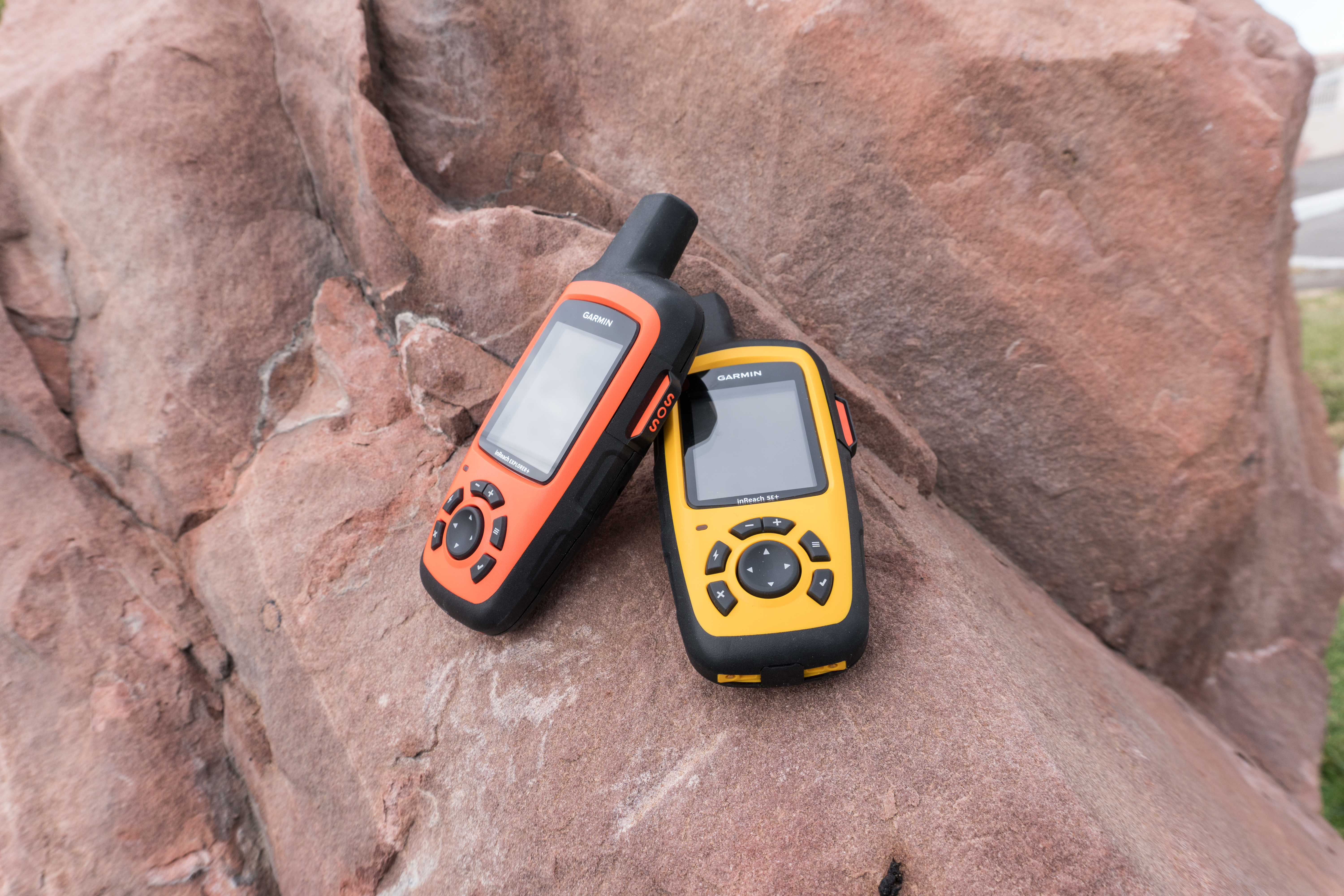
Fast forward to now, nearly a year later, and Garmin has officially unveiled their first branded inReach handhelds at CES: The inReach SE+ and Explorer+. These two models come in identical form factors but pack a slightly different feature set. I had the chance to get an hour or so of hands-on time with them earlier today to check out what they have to offer.
Note that while these might be slightly different than your average wearable reviewed here – there tends to be a fair bit of crossover in the DCR audience to those interested in hiking and trekking in places that have spotty or non-existent service. Thus the slight diversion to check out something related yet interesting. Plus, variety is the spice of life.
So what is it?

Let’s start out with what these are designed to do. While noted above that Ray typically focuses primarily on traditional endurance sports (running, cycling, swimming etc.) and the gadgets that accompany them, the inReach series is a bit of a different animal entirely. First things first, you are unlikely to wear these as a daily watch. These are designed to be used as handheld GPS units and either put in a holster or clipped to a bag or belt.
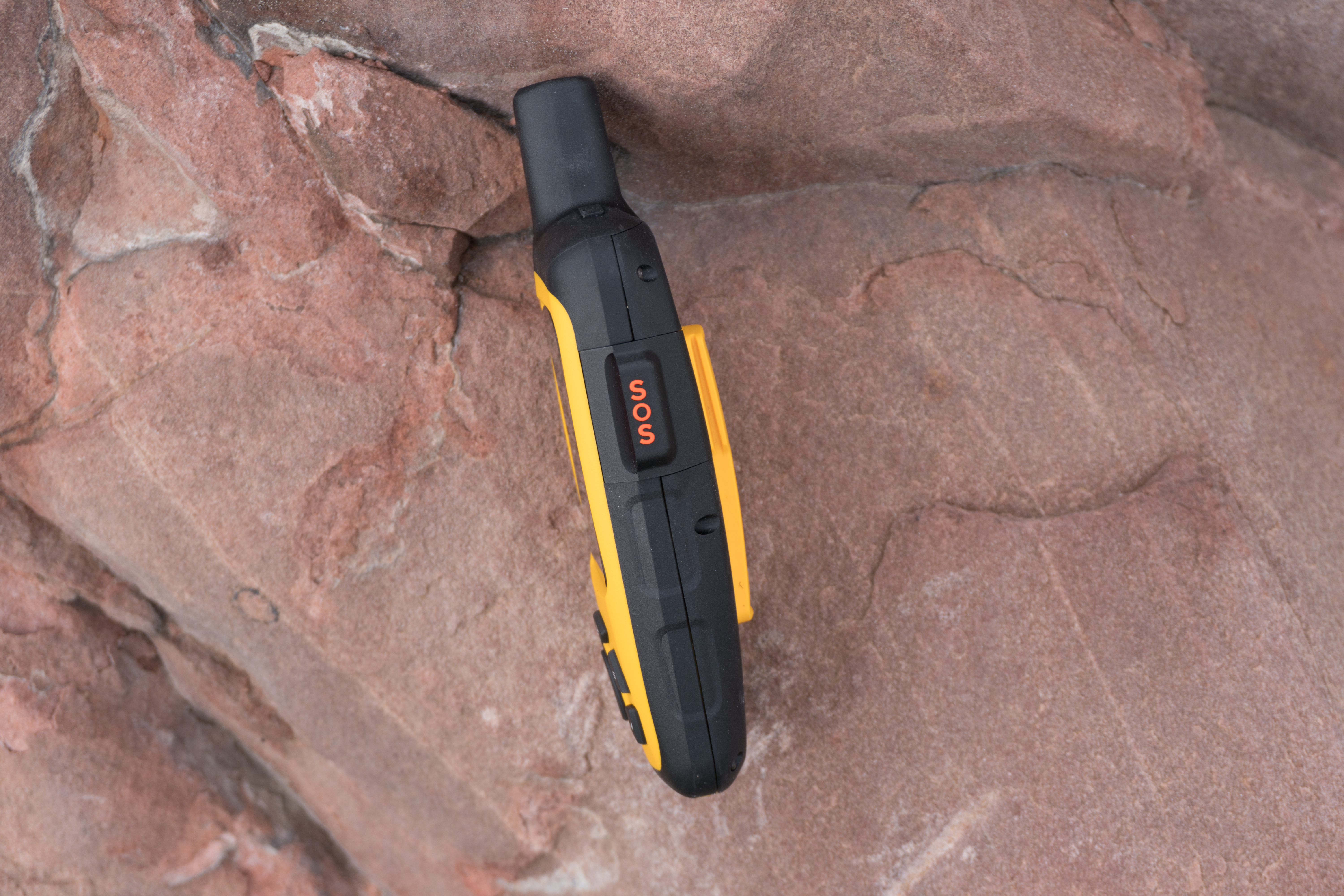
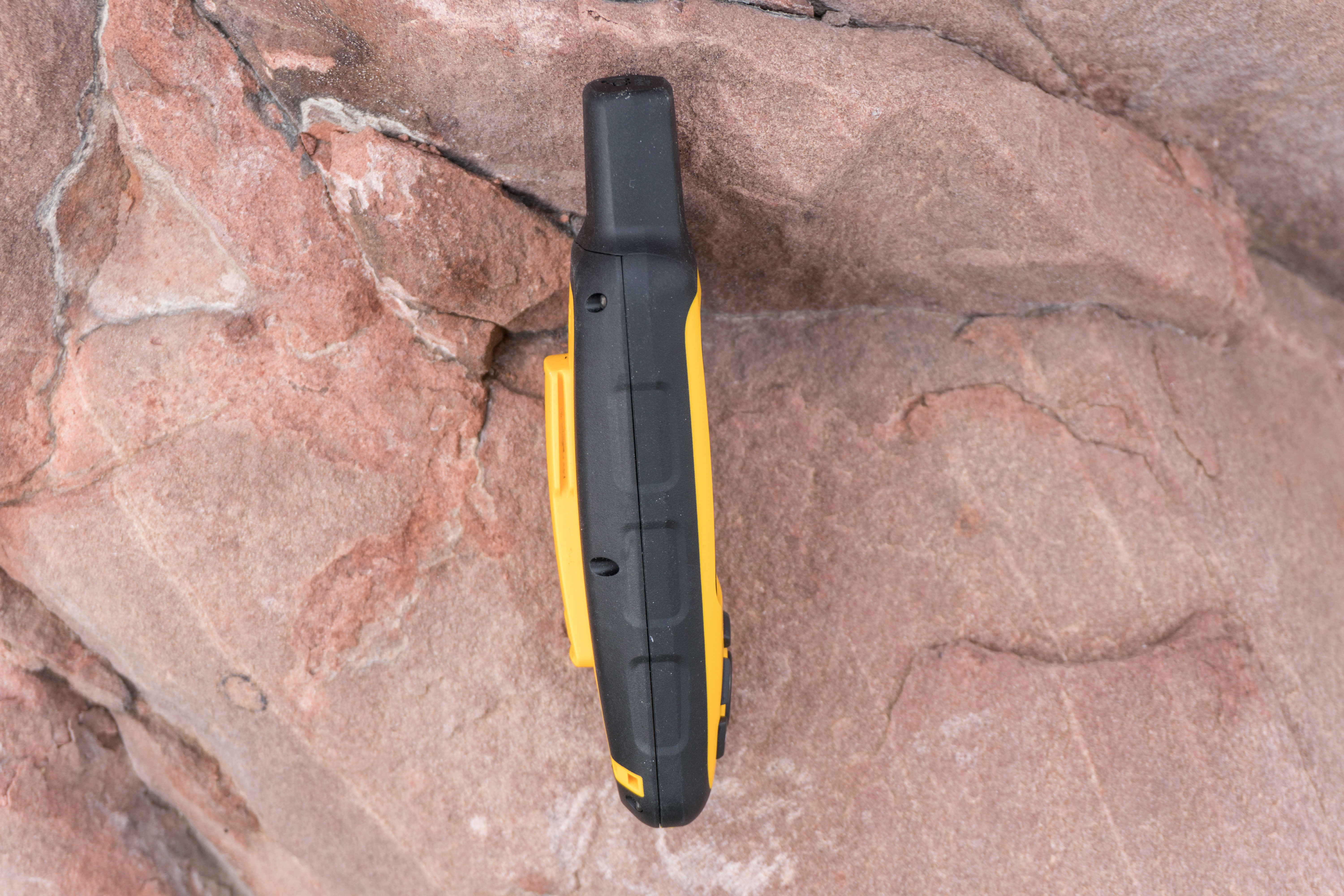
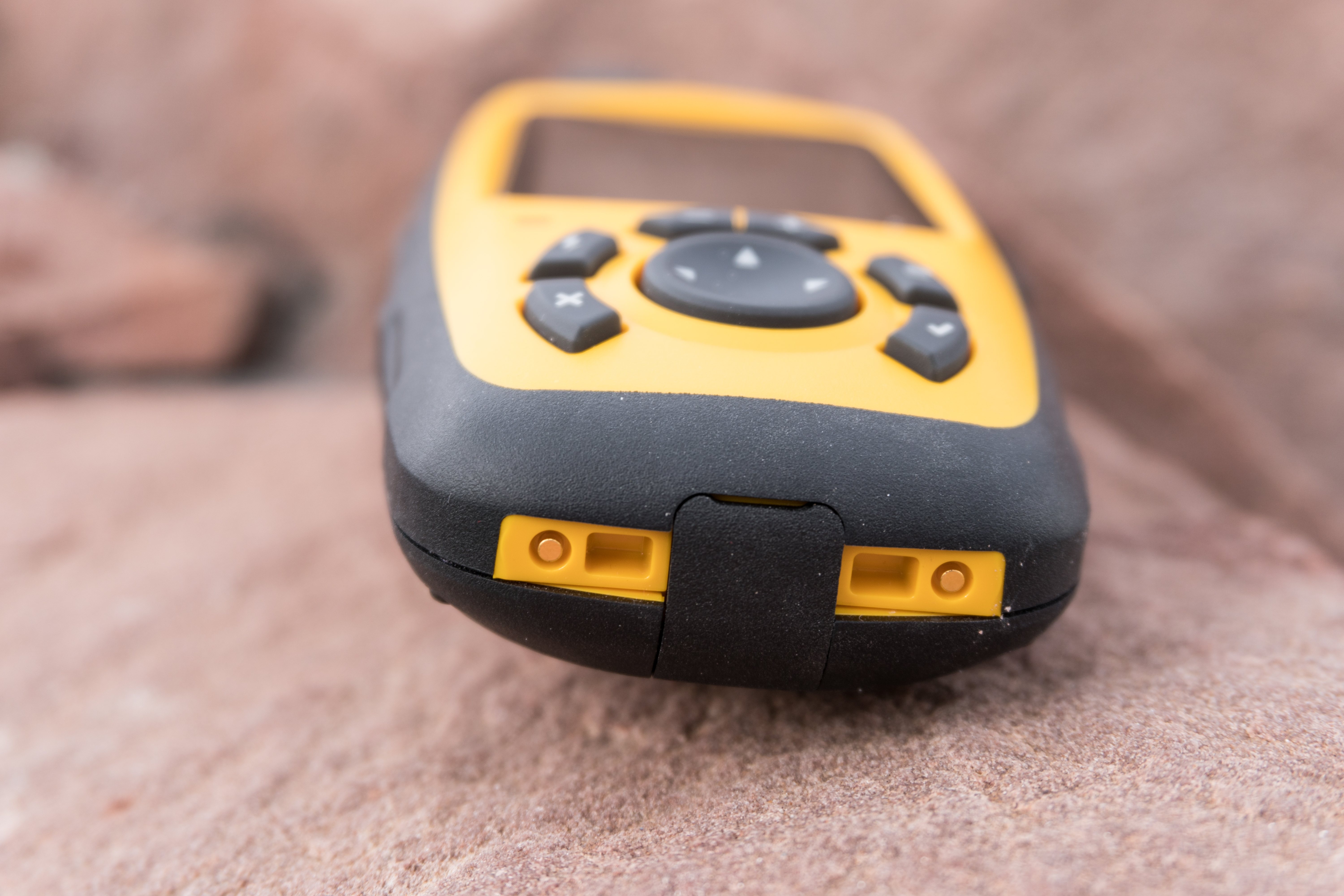
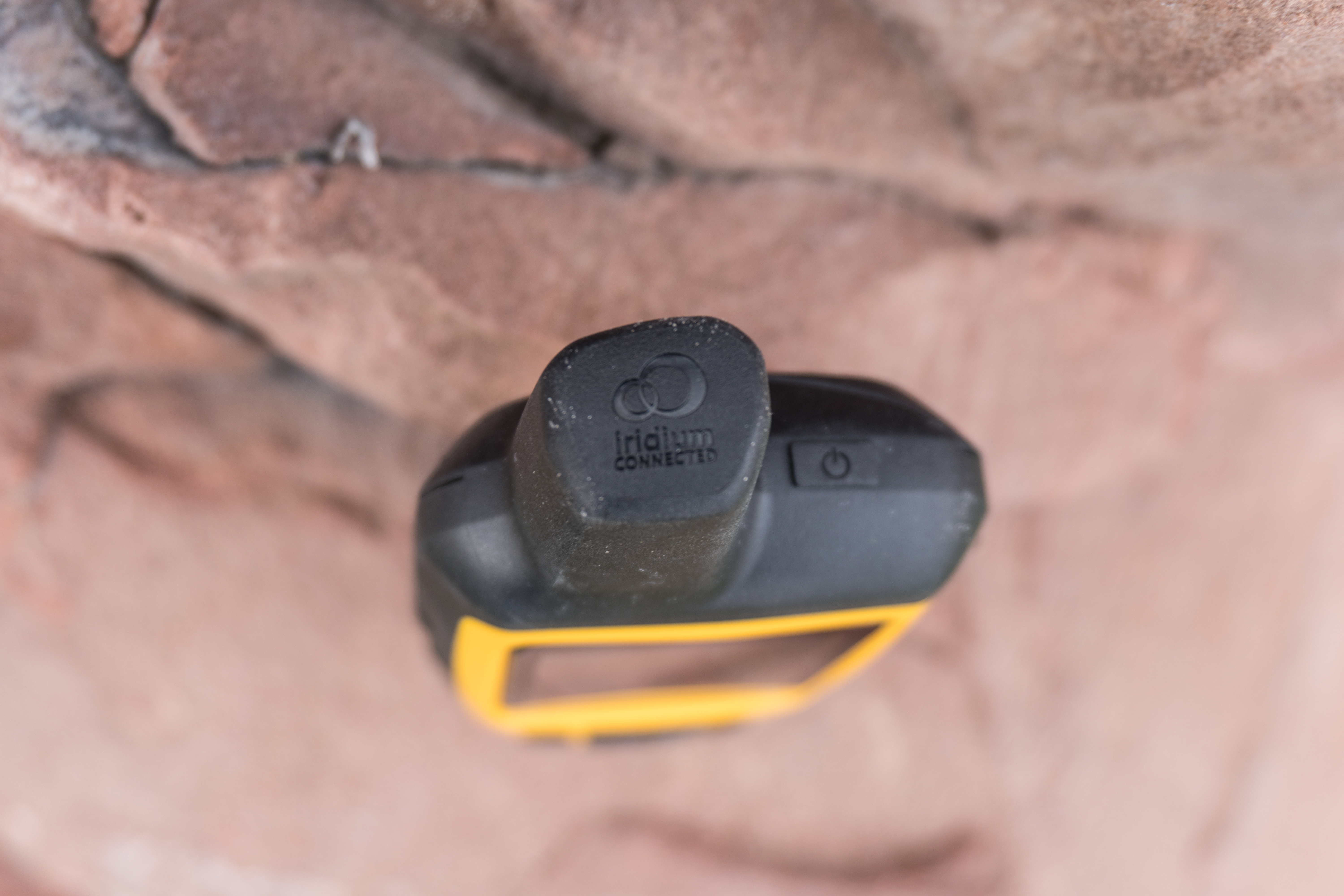
The units themselves come in either yellow for the SE+ or orange for the Explorer+. Both of the devices leverage the Iridium satellite network for ‘pole to pole’ GPS and communication coverage. What this means is the device is able to send an receive communications while outside of traditional cellular coverage. This comes in handy if you are going to be deep into territory with poor to zero coverage and need to maintain communication.
Why does that matter?
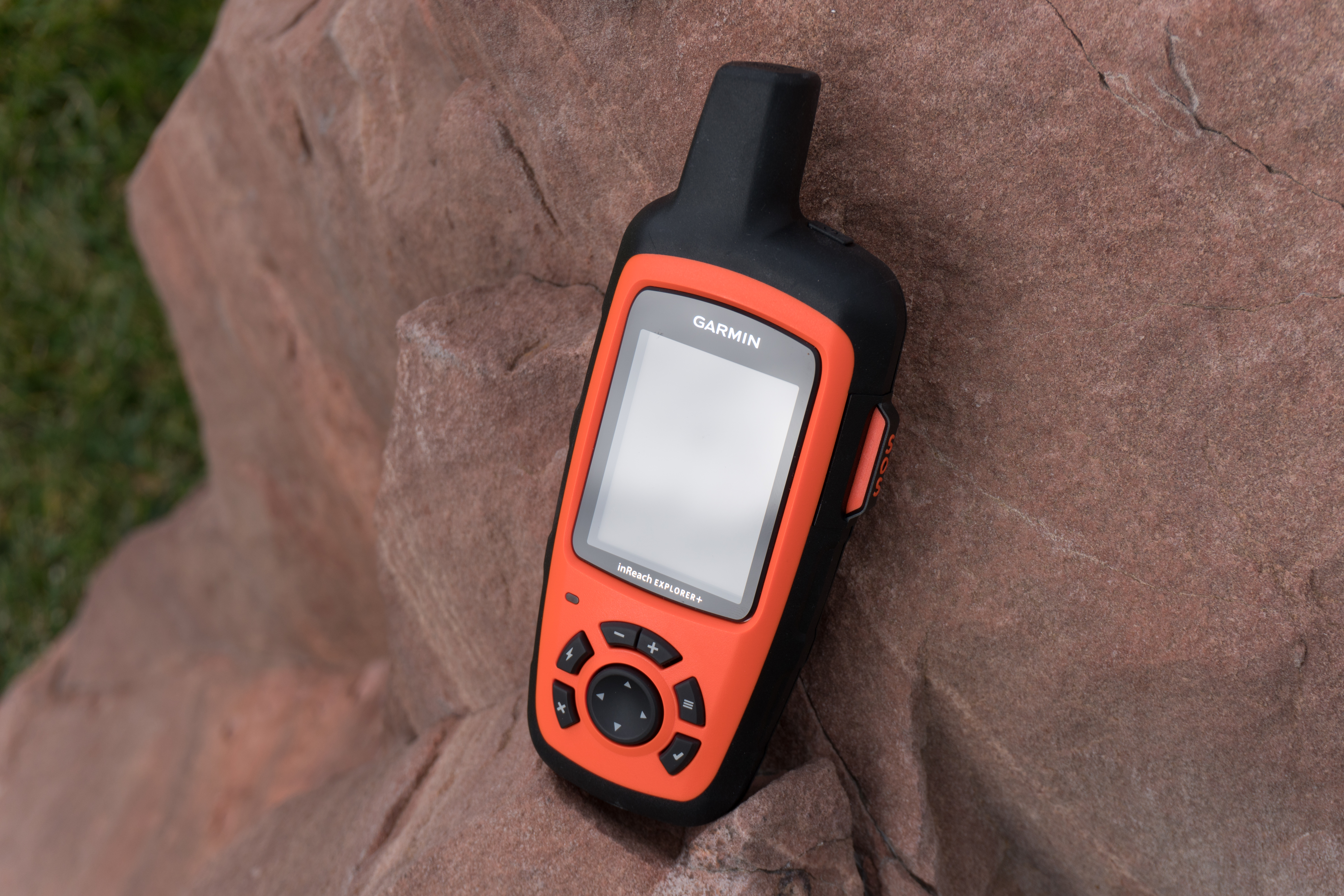
Both devices also have a dedicated SOS button which triggers a response from GEOS, a 24/7 search and rescue center. Once an SOS is initiated you have the ability to communicate with GEOS to describe the actual nature of the SOS call as well as provide any relevant information around injuries and receive confirmation that someone is actually coming to help. They can be programmed to also send an SMS to emergency contacts in the event of an SOS trigger.
Herein lies the real value of these devices, two-way communication. Garmin has made GPS handhelds for the outdoors for years but this is their first device allowing for worldwide two-way communication. The device has an app called Messages (yes, creatively named) which allows you to send and receive SMS messages in the same way you would expect to on a phone. There are plenty of uses for this type of communication, be it coordinating with others while out in the wilderness, sending messages for urgent long-range Pizza Hut delivery on the trail, or I suppose even the odd sext.
The messaging portion worked surprisingly well given the fact that all typing is done with a four-way button and a check mark. The messaging app does include predictive text which comes in handy while typing longer words. I probably wouldn’t use this to send long form poetic text messages, but it is absolutely functional for what it is designed to do.
When you go to send an SMS it starts by asking who you would like to message. You can enter the number directly or search through any contacts you’ve added to the device. When you send the message, you get an audio alert confirming it was sent. Meanwhile the recipient receives your message, as well as a link to the inReach site where they can see the GPS location the message was sent from.


Knowing that the device is sending and receiving data, it makes sense that there is some type of service plan and activation process. In order to use the devices, an active satellite subscription is required. You have several options here ranging from a minimalist plan up through the Cadillac unlimited plan.
The different sizes are going to determine how many messages you can send/receive per month as well as how frequently the service will update your tracking point or ‘breadcrumb’. You have the option of month-to-month or an annual plan with prices ranging from the $12/month range to the $100/month range depending on which level and whether you go with month-to-month or annual.
Rather than try and type out all the plan craziness, below is the relevant snippet from their site:

Setting the devices up for the first time requires you to provide the device IMEI number and an activation code, plus you’ll create your username/password. Note this is a different account than one you would use for Garmin Connect. Because two is always better than one.
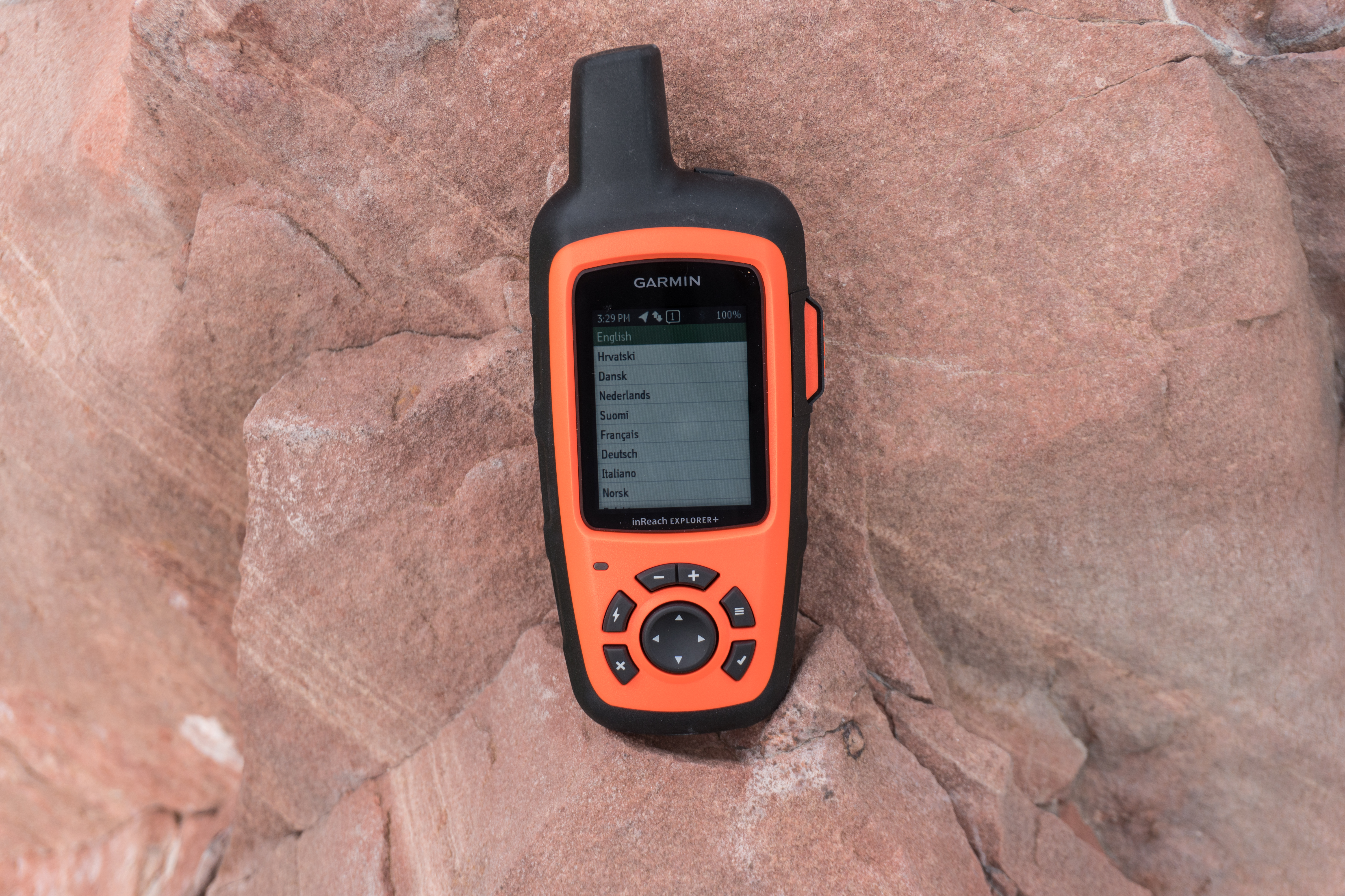
After they know who you are, they will ask for some information about your emergency contacts and then provide you with the service plan options. Once that’s finished, you’ll need to head outdoors and power the device on. It will then establish a GPS connection to begin the activation and registration process. This might take a few minutes (GPS was acquired almost instantly, but the handshake between the inReach system and Garmin took a few minutes longer). Once everyone is on the same page, you are good to go!


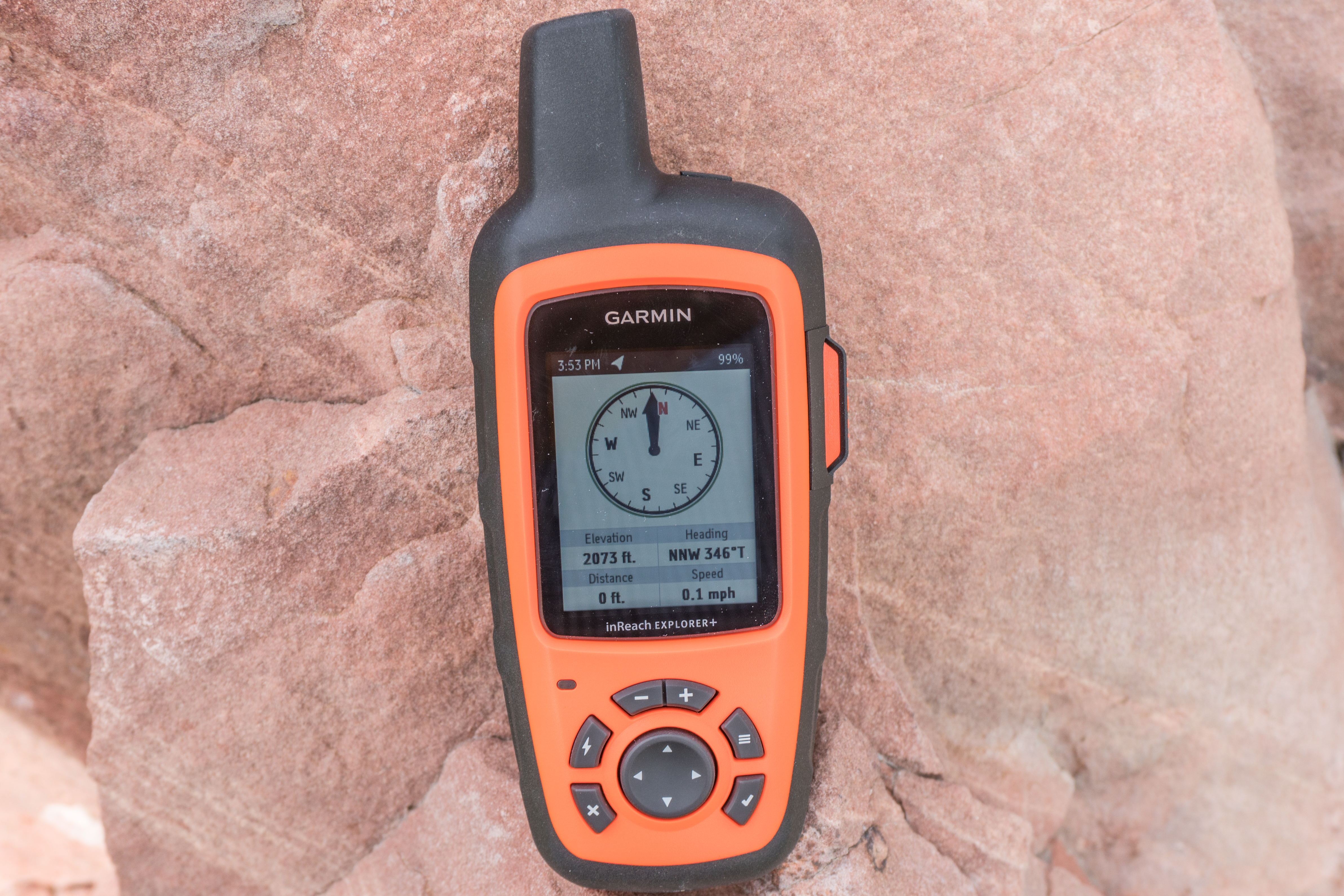
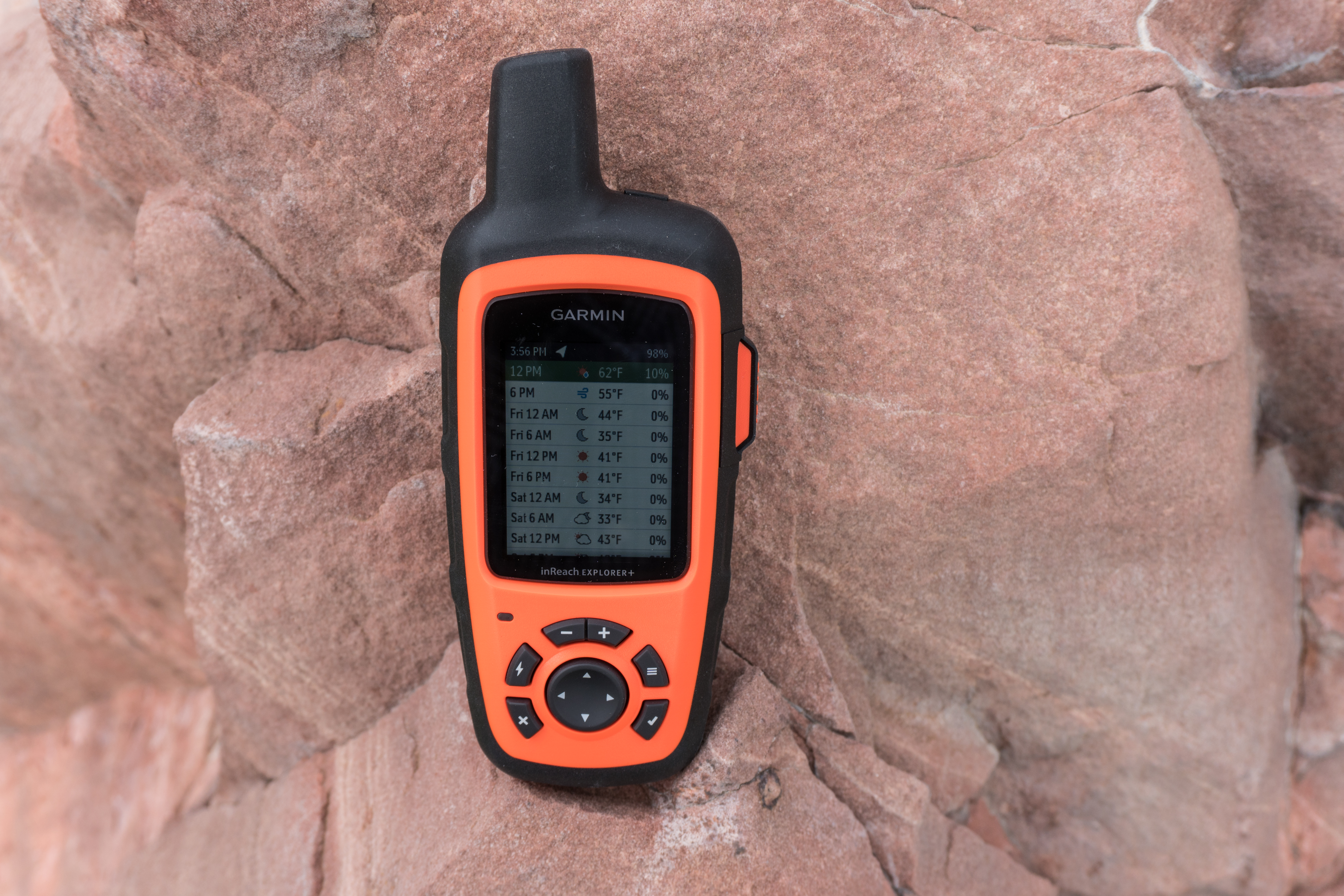
With the communication portion out of the way, the device does function as a handheld GPS including basic navigation, location and tracking data. This allows you to see where you are going and drop little breadcrumbs as you go so you don’t end up lost in the wilderness. Essentially you’re going to get all the major handheld navigation functions you’ve become familiar with on existing Garmin outdoor devices.
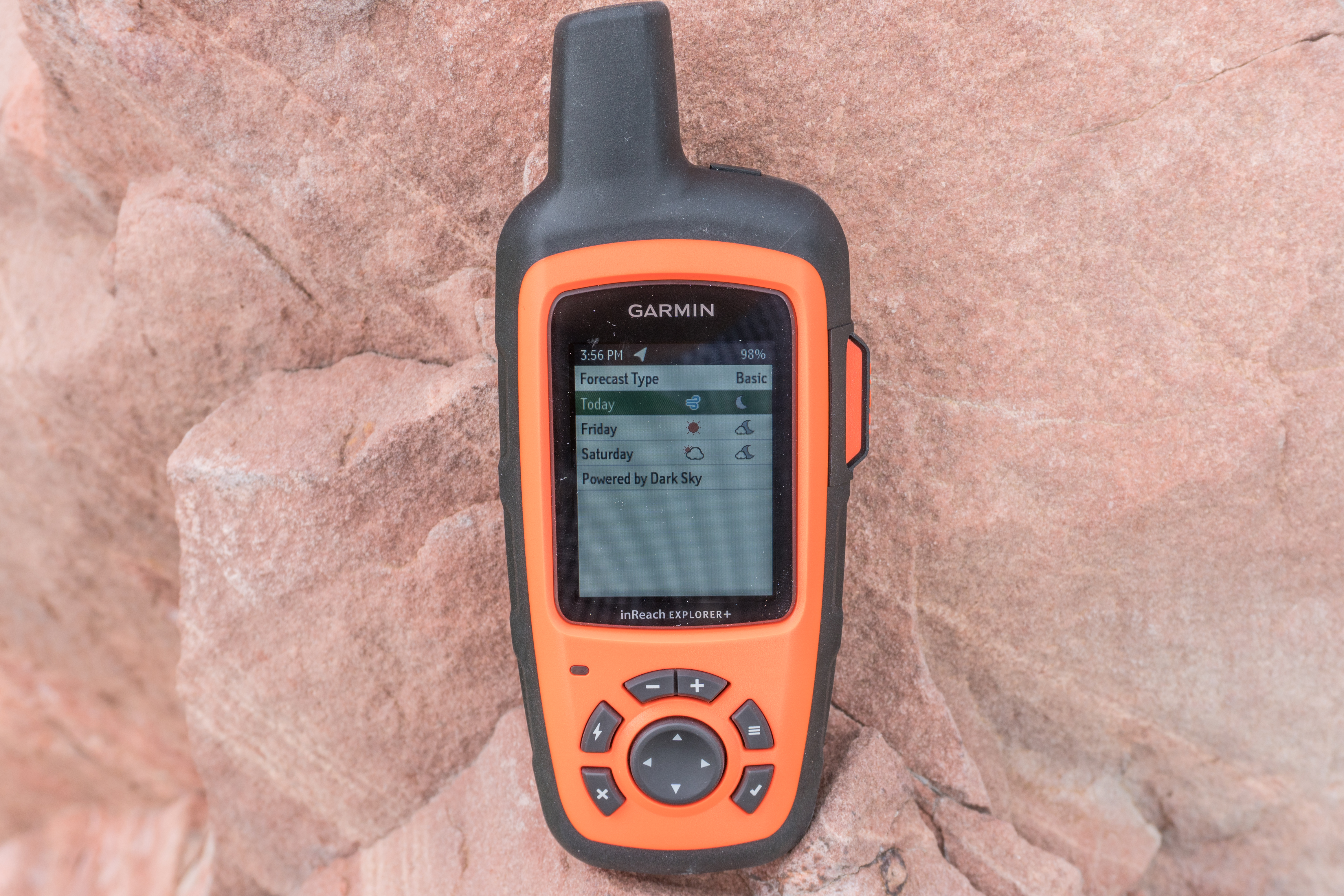
The device will use the waypoints to help guide you back to where you started from. The Explorer+ actually takes this one step further by including preloaded topographical maps, a digital compass, barometric altimeter, and an accelerometer. Both devices allow you to pair with Garmin’s Earthmate app for additional map data and imagery.


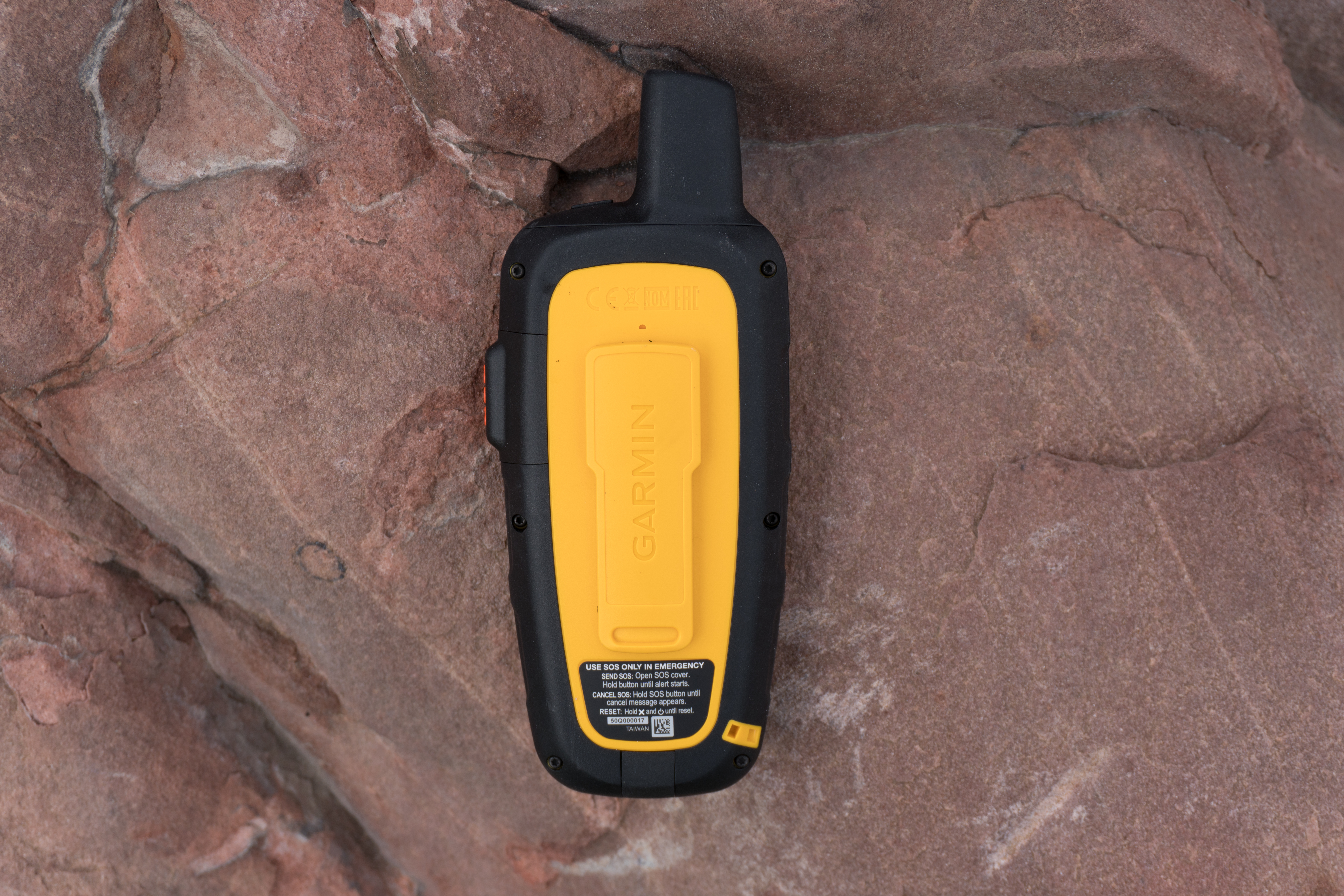
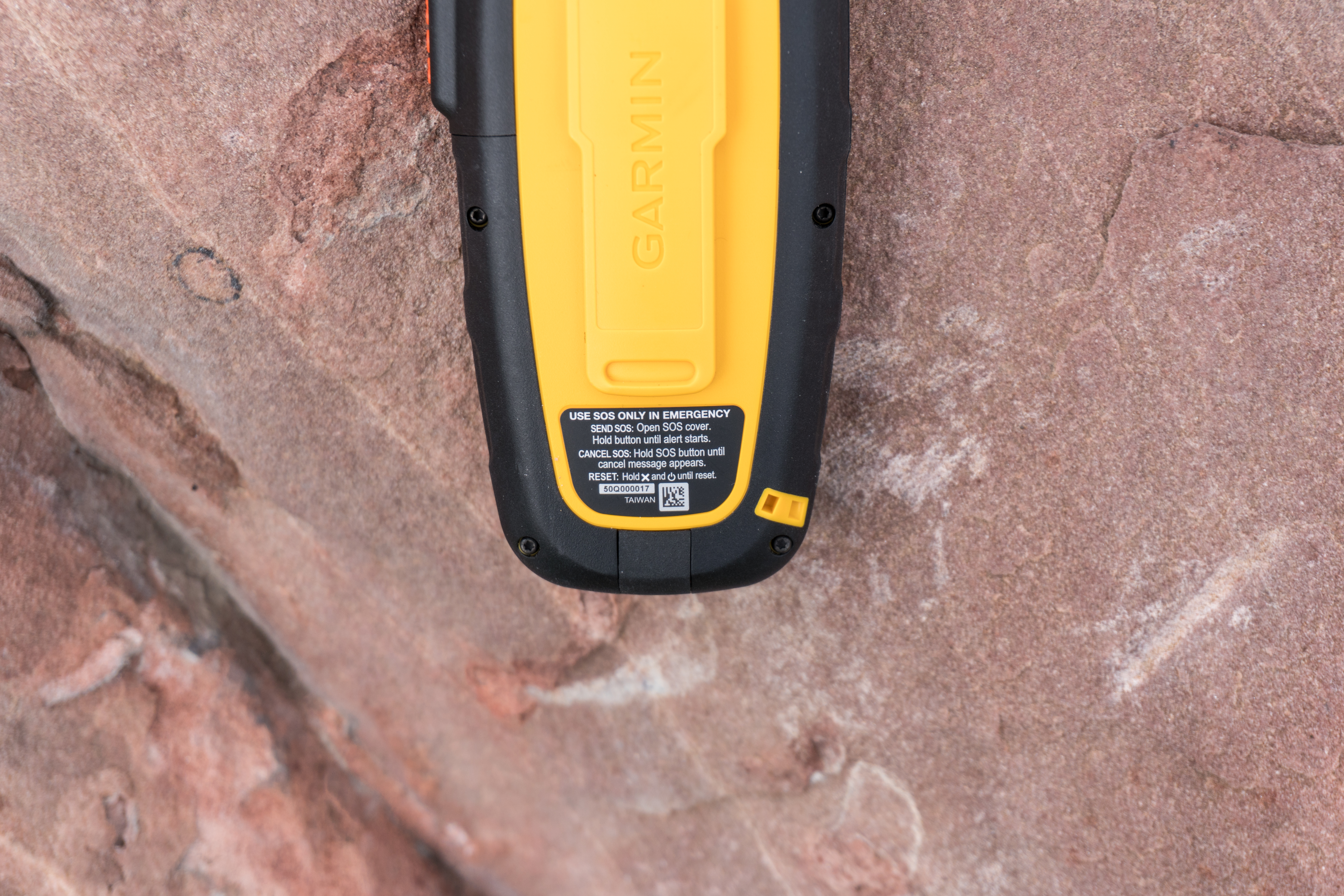
If you are going to be using a handheld GPS on a long or overnight hike, it has to have good battery life. I didn’t get a chance to test battery life but Garmin is claiming 100 hours while in tracking mode and up to 30 days while in power saving mode. The units charge using a micro-USB port located at the bottom under a rubber cover. The unit is IPX7 waterproof, which means it can withstand 30 minutes at 1-meter deep immersion. So snow/rain/etc is just fine.
Wrap Up:

The inReach SE+ will retail for $399.99 with the Explorer+ coming in at $449.99. Again, that $50 difference is due to the inclusion of a magnetic compass, altimeter and an accelerometer. And the color orange, as obviously orange is the new black. They aren’t yet available for preorder but Garmin expects to bring them to market in the first quarter of the year.
Of course – these won’t appeal to everyone. Even those that spend a fair bit of time in the mountains may not find a ton of value in splurging for the connectivity features compared to some of Garmin’s other outdoor devices. Whereas for some users, such as mountain/river/etc tour guides – having an emergency type device like this is relatively low cost for the benefits it brings.
Both Ray and I think what may be the most interesting thing to watch for is how Garmin might adapt this technology into other markets. Obviously Garmin paid a fair sum of cash to acquire the tech, and certainly it’s going to want to leverage it in more than just two handheld mapping devices. One wonders if they’ll eventually expand into a SPOT-like competitive device, which would become more interesting to athletes that wanted coverage in non-cellular areas, but without the bulk of a full mapping device.
One of the advantages that Garmin would have over a company like SPOT is Garmin’s in-house manufacturing capabilities, allowing them to likely get into smaller form factors at a lower cost. Of course, I suspect Garmin will first evaluate how things go with these first generation products before any expansion.
—
With that – thanks for reading!
Don’t forget to check out all the CES 2017 coverage, as well as continual updates throughout the day on Twitter. It’s gonna be a crazy busy week.
FOUND THIS POST USEFUL? SUPPORT THE SITE!
Hopefully, you found this post useful. The website is really a labor of love, so please consider becoming a DC RAINMAKER Supporter. This gets you an ad-free experience, and access to our (mostly) bi-monthly behind-the-scenes video series of “Shed Talkin’”.
Support DCRainMaker - Shop on Amazon
Otherwise, perhaps consider using the below link if shopping on Amazon. As an Amazon Associate, I earn from qualifying purchases. It doesn’t cost you anything extra, but your purchases help support this website a lot. It could simply be buying toilet paper, or this pizza oven we use and love.


Very cool.
I used to rely on the old Iridium phone and their very expensive service when I did a trip in Mexico hiking the Copper Canyon. Wish I had this technology for that trip.
Question. Is there a way to get location/activity updates to Garmin Connect (and thus on to Strava etc.) via satellite uplink? i.e. not having to rely on a computer or cellular device?
I found out after my mildly problematic Copper Canyon trip that my SPOT wasn’t sending my messages :/
Neat device. One question, though: The SOS button seems rather conspicuous sticking out from the side like that, and it seems like something that could easily get pressed by accident. What safeguards are there to prevent that, so that it only gets pressed and sends an SOS when you intend to? Such as, is the button difficult to press? Or can only be pressed while simultaneously pressing something else? Or is there a confirmation like “Are you sure you want to send an SOS?” etc.
There is a lock for the SOS button so that you don’t hit it by accident while locked.
So quick story: When I had the units, Garmin scared me a bit around the SOS button with a big warning on the setup info. (‘These are production device, if you trigger SOS it will trigger an emergency response’) So I honestly didn’t touch the button. Rookie mistake on my part as the ‘button’ is actually a cover for the actual button. It is impossible to ‘bump’ the button. From the previous versions where the button was on the front of the device, this is a targeted improvement to prevent accidental triggering of the SOS. See the attached photo for clarification.
Interesting but these look more like DeLorme rebranded handhelds than real Garmin ones. Same with the Earthmate App which does not look very Garmin-like (updated icon apart).
I’d be interested if they were updated GPSMap handelds (I still use a good old GPSMap 60c but it is getting a little long in the tooth), fully compatible with current Garmin maps (in particular European TOPO ones). It does not look like it is the case… could you clarify?
It is indeed. Garmin Bought Delorme and it comes with Delorme topo maps.
link to newsroom.garmin.com
I think what fiatlux is getting at is they look like products developed by Delorme, with very little benefit from the Garmin acquisition, and he would be interested to see a GPSMap type device with the sat link.
I would absolutely love to see a sailing targeted version of this, especially if it came with some basic ocean charts and EPIRB functionality it would be an absolute no brainer, especially in areas where you are required to carry an EPIRB by law anyway . . .
The companion app (Earthmate) actually allows you to load the U.S. NOAA charts as well as USGS Quad sheets (not necessarily for sailing). There is also a marketplace for additional maps.
You used to be able to compile messages on the iPhone and bluetooth them to the inReach, making messaging very easy.
Also they can be used as trackers using Mapshare see my pic of biking around Cuba, Since it pings every 10mins you can tell how fast I’m travelling by the distance between spots :-)
The SOS button does have a safety lock :-)
Supposing you have a high-end Garmin watch like a Garmin Fenix series, I do not see a reason why you also have to get one of these.
For e.g. the Fenix 5X already costs $699. It has all the required sensors, plus now mapping. It is a great outdoors watch. Users should be able to have a SOS function, and if they pay one of the plans above, they should be able to send/receive messages. It is less confusing, esp. in emergency situations.
Also – I am sorry but if you have an emergency, typing message with a 4-way pad is moronic. What if you are injured, with limited abilities? It makes more sense to choose amongst preset messages (1 – I fell 2 – Need food 3 – here’s my gps location and heart rate, as measured by my Garmin watch etc. + your own preset messages)
Heri,
The hardware set on these are COMPLETELY different than what’s a Fenix__ (pick any Fenix). These require a 2-way Satellite communications platform, something the Fenix does not and could not have (without it being the size of an original Forerunner — even that that would be questionable).
Send with what? Over what?
The trick with these is that they have satellite coverage. I guess you could pair your Fenix with a satellite phone (at least theoretically, don’t know if satellite phones come with bluetooth) but then you would have to take two things along – and power them.
For anyplace with cellular coverage these are overkill, true.
Heri, these use the IRIDIUM satellite network for two-way communications coverage basically *anywhere* in the world. Also, I’m pretty sure there are preset messages, as unlimited preset messages are included in all of the various plans. Maybe Tyler or Ray can clarify?
Obviously the Fenix wouldn’t have the hardware capabilities to communicate with the sattelites. But how about a minimal version of one of these with no GPS or display. Keep it as small and minimal as possible and use your phone, Fenix, FR, Edge as the display & GPS.
Anybody know if this supports CIQ?
Heri,
These are for off-the-beaten-track explorations, not for keeping up with sports-related data. I bought a previous device from DeLorme for a trip from China to Uzbekistan in 2015, and it worked great from everywhere; from cities like Samarkand to the Gobi desert. Also, at least with my model, the navigating was pretty limited but I used the unit for what it was designed for: keep track of my route and occasionally send short messages to my family to let them know where I was. There are preset messages and you can save your own to the unit, with preset recipients to make things easier in case of emergency. All in all it was very reassuring knowing I could contact someone in case things went sour.
I agree the power consumption and antenna size required to send a message TO a satellite aren’t really compatible with a wrist-sized form factor. I don’t know enough about sending radio waves to be sure, but I think you may be up against the hard limits of radio physics, and not something that Moore’s Law, increasing processing power and miniaturization will ever solve in that kind of form factor.
But Bluetooth pairing with a sat phone offers interesting possibilities for those who really want this – although I am not sure of the cost of larger quantities of satellite data.
It’s the exact same hardware as the Delorme inreach devices before Garmin bought them out. I have an inreach and it works great but I was hoping for an Oregon Garmin and Delorme inreach combined. These are just rebranded
Agree with Kyle. I have an Oregon 600 that I use for wilderness backpacking once or twice a year, and a hybrid Oregon + inReach device would be about the perfect combination of technologies for that type of use case. Maybe that’s next year’s device?
Shoutout to Ray and Tyler for reviewing theses here. I saw the inReach press release at the Garmin website yesterday and this “first look” answered many of my questions. Very much appreciated!
Interesting. Had no idea these were out. I forwarded to my company’s president to review for use as safety items for single-man jobs where no cell coverage is available. Amazing how oil is found in areas where no one is around and, hence, no infrastructure.
I appreciate the review of tech items for other activities besides biking. Thanks
Thanks for covering this!
I like the idea but unless it uses the proper cospas sarsat for epirb/plb functionality I’d have to carry my plb anyway so all this gets me is text messages really. GEOS seems to be a private enterprise separate to emergency services so I’d be less confident in a response than with epirb.
Plb and epirb also require the device to have guaranteed power for emergency so safety is really baked in and with no contract to pay for.
I guess this is nice to have for tracking, like the yellow bricks device for sailing but can’t see me hiking with it.
I think Dave nailed the real problem for success for devices like this. And, it’s a problem that has always and continues to exist for the Spots and InReach type devises(sat messengers). I bought a cheap epirb (ACR Electronics ResQLink+ GPS personal locator beacon) years ago for less than $300. It has something like a 10 year battery and only requires free registration with the government which is easily done online in about 3 minutes. It’s still great and throw in the pack or car or canoe and forget it. It ‘s there when you need it if you need it. So, what does the epirb provide over a sat messenger such as these:
1. 10 year battery life no recharging required or to worry about
2. automatic almost anywhere on the planet emergency notification
3. technology proof – it’s just a darn sat radio
4. completely waterproof – it can stay underwater a long time, hey it even floats, ipx7 waterproof of these sat messengers is a joke
5. cheaper- cheaper to begin with and no monthly or annual fees ever
6. transmits for 30 hours straight after activated – try that with a rechargeable sat messenger
7. Last but not least – your iphone has coverage in most all the lower 48 and is a better text messenger and with an app like Gaia gps is a better gps
Other problems with sat messengers:
1. Iridium network is a disaster and has unreliable coverage
2. what if you don’t recharge the damn thing – worthless
3. always outdated technology in a year or so
4. doesn’t notify government search and rescue directly – goes through a service
So, what do these sat messengers actually do for the average hiker. Nothing more than allow you to send a couple few sparse texts messages to friends and family at highly exorbitant rates, think $10 or more a message when you really do the math, and it’s only necessary in the most remote locations in Alaska, Canada, and maybe the East side of Yellowstone Park. The market for these things is extremely small if you have any common sense on what you actually get from it. Generally speaking, the only folks I’ve seen who get good use are extreme explorers who are getting paid to track themselves or who have far more money than sense. Strangely, the folks I see using these extensively always carry a sat phone as well which seems to make no sense. Oh, and by the way, they usually have an epirb in case of emergency also. They don’t rely on these sat messengers for emergencies.
I think they are pretty useful for an adventure cyclist, randonneur, endurance runner, or anyone who really gets out of town. It’s not cheap, but the ability for my loved ones to keep tabs on my insane adventures is great. I’ve had great coverage from an Inreach in Asia, North America, South America, the US and Europe. Now in Europe, it’s not strange to cycle 20 minutes outside of a large city (1 million+ people) and find yourself with no cell signal for good distances at a time. At the same time I understand that it does need a clearish view of the sky, so super dense forest canopies or caves are an issue.
While an EPIRB would work if I got mowed down by a car but were still conscious enough to whip it out, the InReach allows me to do great things like: send a message to the family the I will be home at xxx hour, receive a message asking where I am, or just asking for a new bike part to be located at some town on the route so I can have gears again.
I’ve only had one instance where emergency services were needed, and you can’t underestimate the ability to communicate (if a little slowly) in text. i.e. “Person age xxx fell down hard, pupils unequally dilated, etc..” is almost as helpful as “rescue helicopter 30 minutes out”.
The final bonus is that I can roam freely. It’s sad that a 35/month satellite plan is cheaper than just taking my cell and sending SMS from another country/continent/hemisphere.
The problems with an ePIRB only though are
1) I can’t update my family back home of my status
2) If I get knocked unconscious or have an injury that makes reaching the ePRIB not possible, I can’t activate it. Whereas with the inReach if my wife notices that I haven’t moved or checked in for 6 hours, she knows exactly where I am on the map and can send rescue.
This looks like a nice option for ground communication for high flying aircraft. I fly a Cessna Conquest and have no air to ground communication capabilities flying in the flight levels (above 18,000′) other than VHF with ATC. Other SMS communication devices such as the Garmin GRS56 start at $9,995 plus exspensive installation. At $449 plus $50/month for the iridium subscription this looks attractive.
Does your Cessna have a heated windshield? If so, the Iridium signal is unlikely to get through. Then you need a sat tracker with a remote GPS/Iridium antenna (like the Spider 7 from Spidertracks). To the best of my knowledge there is no way to use an external aerial with the inreach devices.
Spidertracks also offer different plans, depending on planned monthly flying hours. Including on “seasonal” plan that is strictly “pay-as-you-go” (USD 0.07 per tracking point; tracking interval 1 or 2 min).
Do these have a replaceable battery pack? I sure hope so. Would be otherwise very hard to charge while hiking/camping. Could envision solar charging one battery at base camp while out for the day using a second battery. Otherwise I’d want to save battery life for a potential emergency rather than dropping breadcrumbs.
Garmin bought DeLorme a year ago and their first ‘joint’ product is a bigger, heavier, more expensive but identical featured version of the DeLorme Inreach that has been around for several years.
Not very innovative Garmin!!
What am i missing here?
This new version actually has mapping. The Delorme version had a smaller screen, it had gps but the mapping was only a breadcrumb trail. You could put a route on it but it showed only a line to your destination not an actual map, if you wanted detailed maps you had to pair the Delorme to your phone. The Garmin version is more a standalone device now.
My experience is Delorme units with the Iridium network work much more reliably than spot. They also offer the best “live track” platform that I have used — since it lets you leave a route with waypoints on it “like Tuesday night camp”, so even if I forget to send a message saying that I am sleeping there, they know why my track stops there on Tuesday night. It’s a must for longer rides where cell service is not ubiquitous. The only downside for my SE is it doesn’t log a track to the memory, which the Explore did. Now it looks like both do. This was a downside when my Garmin froze and didn’t record a track for about 60k of really cool riding.
SPOT with mapping, basically.
The second-generation Iridium constellation is launching- in fact, in the next few days via SpaceX. I wonder if this is compatible with Iridium NEXT.
Except with a much more robust network, and the ability to easily send messages using your phone. NEXT even if supported won’t bring much to the InReach world (it already works really well with the existing Iridium network) — I would expect that to enable the next generation product that could do higher resolution uploads complete with sensor data — something like a Qollector but satellite based.
The signal strength of the Iridium network leaves much to be desired. NEXT should help with that. Really helpful when in canyons, tree cover, putting a beacon inside bags, etc.
Thanks for covering this kind of stuff. When I was a triathlete I would have had almost zero use for this, but as a gravel rider now, I have one of the pre-buyout DeLorme models and it has worked great. I’ll disagree with the earlier comments that the Sat. functionality would only be useful in Alaska etc. I ride in lots of areas in GA, NC & TN where there is no cell coverage. This gives my wife the peace of mind that she can at least see where I am riding (every 10-20 minutes) and know that if something happens especially since I frequently ride alone), I only need to move one slider and press a button and an SOS is sent. My experience is that the coverage has been very good and I have sent location updates from areas where people with SPOT units have complained about messages not getting through (haven’t needed to send texts from those areas) and have not had any issues with texts going through when I have sent them.
Your write up answered the questions I had about what was in the updates that I couldn’t get from the Garmin website or announcements. Thanks!
Glad everyone enjoyed Tyler’s work here!
When we first looked at whether to cover the product or not, we weren’t quite sure how well it’d be received in the comments. But it’s good to see there’s interest from my audience in this type of product, more than I expected (albeit, it’s been a while since I covered the Spot series years ago). Definitely something I’ll take into account going forward for deciding which products to review or not.
Thanks all!
I would love to see a full DC Rainmaker review on this. I was going to buy the Delorme Explorer this holiday season and I’m glad I waited. My wife and I used to backpack into the back country a lot and last summer we took our daughters ( 6 and 5 ) for a few overnights. We’d like to start more of this but it’s one thing to go with adults it’s a whole other ball game with little kids. I have also started doing longer gravel road rides, living on Vancouver Island we have thousands of kilometers of old logging roads to explore. But I lose cell reception 20 mins away from my house.
Ray,
I think the take-off of roadies doing gravel riding, as well as the adventure/ultra-running crowd means there are increased numbers of data minded athletes now going beyond cellular range, hence the interest in this.
I for one, love seeing outdoor equipment here. I have a GPSMap64st covering my needs really well. The new inReach features do not really appeal to me so much as seeing a bit more modernisation of the GPSMap line in general. It appears that the inReach uses an internal li-ion battery instead of the ubiquitous AA cells of the GPSMap. Running out of power has been pretty much impossible. You can always get a new AA battery (except perhaps in the outermost parts of Antarctica). But all in all these devices fit in here perfectly with all the rest you cover, imho.
I have a 62sc. I would love to see this feature in the next gen 64sc or equivalent
Not sure about just just remote wilderness use, I live 30mins from a major city centre and 5 mins from my house I lose cell coverage (non-existent to extremely spotty if you are lucky) in the local trails, my wife bought me a SPOT device even for short day hikes and trail runs (she’s very safety concious). At a local 5k/10k trail race recently it was amusing watching all the people who coiuldn’t use their phone as there was no signal even in the carpark. Local mountain rescue are forever having to pull people out unfortunately.
The other use is solo overnight camping trips in the mountains where a quick ‘I’m ok’ a couple of times a day message is appreciated. Agree as a per use service it’s not cheap, but then insurance (which this really is a form of) is always expensive until you need it.
Thanks for covering this kind of stuff. I have a number of Garmin GPSmap devices (60csx and 64s) and the “old” Delorme InReach Explorer. These new Garmin handhelds solve the issue of having a GPS and an InReach Explorer. I have not been crazy about the Earthmate app replacing my GPS. Now, if they would only add the Garmin Rino two-way radio capability!
Do you know if there is the ability to add maps via a MicroSD in these new devices?
Will the GPS functionality work without the satellite service?
Want for backcountry hiking but I don’t do that all year, but I could use the GPS functionality nearly all year.
I have the Delorme version of Explorer. I enjoyed being able to send text messages and posts to Facebook from Antarctica. No problem with the satellite coverage down there. It was expensive but at least people knew that I had arrived and when I finished my race and that I was delayed in returning to South America. And they could respond back. That was cool (literally and figuratively).
Ray & Tyler, thanks for covering this. I currently use a spot device when I go out for multiday solo rides. I have found that there are many places without cell coverage. For my wife, the spot tracking gives her piece of mind when my garmin livetrack fails. It looks like there are a number of readers who are also interested in keeping up with this area, so I hope you will keep posting when new products are announced.
definitely good that you cover this stuff. Here in Bend Oregon, cell coverage with AT&T pretty much disappears a mile from the trail head (which is just on the edge of town). I got a SPOT when I moved here just because of that. The piece of mind it gives me and my wife when I go riding solo, is huge.
For my needs, not sure this buys anything over the SPOT and is quite a bit more expensive. It does give more functionality, like the true 2 way communications, but having 3 different pre-programmed messages you can send with the SPOT is fine more most situations. It also looks bigger than I’d usually like take for a trail run or mountain bike, especially if I’m not using a hydration pack.
Another off target Garmin device that could have interest to some here is the Garmin Alpha dog tracker. I’m sure there are many runners here that take their dogs along. And they just added support to transmit dog information over Ant+ from the Alpha so you can now receive this data on your other CIQ 1.3 supporting Garmin device. Which is cool if you want to stick the Alpha in a hydration pack and be able to just glance at your watch to see where your dog is. It’s natively supported as a widget on the Fenix and I just added a CIQ data field to the app store.
Thanks for the write up Tyler.
I recently bought the Spot 3 device and I can see this having the same use. It is a safety net when doing long distance endurance events. I do a couple of bikepacking events (750km+) a year and they generally take you to place with poor or no mobile reception. Having the ability to send messages to family saying that you are good helps a lot. To the extent that my wife is more happy to let me try out longer events knowing she can track me and that emergency services are a button press away.
I cant judge the size of the device or whether it takes AA batteries for instance, but with the Spot 3, there is not screen and takes 4xAA better. It gives me a around 10 days of tracking (10-minute intervals) and due to the small size, goes unnoticed on my bike. Would be good to do a comparison between the devices.
I’ve been making short tutorial video on the inReach functions since the original version almost 4 years ago.
link to avoidingchores.com
Other than getting “garmin-ize” how the units will work looks that will be the same as the current SE / Explorer. I do like the larger screen, especially using Delorme’s topo maps as compared to viewing the maps on my phone. Looking forward on getting my hands on the Explorer+ whenever they ship.
Thanks for the article. Been using Spot devices since the first one came out in, what, 2008? That thing was huge but it was amazing what it did at the time.
Looks kind of interesting.
Seems the unit has a non-removable battery; the user changeable battery of the Montana 610 is essential when on long trips, be it hiking or bike-packing.
For the cost of the service plan an Iridium satellite phone seems better value. I bought an Iridium Extreme phone from eBay and a 200 minute sim card (good for 1000 texts). This allows voice calls from anywhere as well as the breadcrumb tracking.
The Iridium network is very impressive, the phone usually has a reception before the phone has booted. Unlike the other satellite phone networks that employ geostationary satellite an Iridium phone will get a reception in a valley or the “wrong side” of a hill, although the reception might be limited to when the satellite flies overhead. The SOS feature of the Iridium Extreme visually indicates it success in sending an SOS text message
Interesting feedback, how much was that Iridium Extreme phone ?
I also don’t see the point of having to carry an extra and bulky (with each generation the inReach get bigger and heavier!) device when I already have an Oregon and smartphone (with a 10000mah battery pack or two if need be).
The only real advantage of the inReach I can see, assuming Garmin have kept it as it’s not totally clear from the article (but the specs do mention Bluetooth), is that you can type texts on your smartphone and send them over bluetooth to the inReach.
I paid £700 off eBay
They’re about £1100 new
The airtime was £670 (Global, 200min, 1 year valid)
Given the higher in-reach tariffs have unlimited texts
It would be nice if a future Garmin Montana type device (i.e. with a large touch screen) had the ability to text via in-reach.
If it were possible to text easily(!) from a Montana type device I would quite happily then give up the sat phone.
Add the sat receiver to a Garmin Monterra and job done
ok, not cheap but if you need it, it’s priceless of course.
Thanks for posting this. Would love to get a breakdown of differences between the previous generation built by DeLorme and this new version “built” by Garmin.
Ray-
Love to see you covering gadgets like these. Most of my rafting buddies have Delorme devices for checking in with family on river trips. What I’d be curious to know is:
1. what, if any, differences exist between these devices and the ones Delorme put out prior to the Garmin buyout.
2. What new features does Garmin believe it will add to the devices in the future?
3. How well do the devices interact with smart phones on both iOS and Android for sending text messages and other functions (no one I know uses the device itself to write their texts).
Thanks for covering devices like these. Sat phones and solar chargers are the primary tech of concern for me once you get away from home for awhile.
Great call Ray,
Will not go out without one. Absolute must for me, most often solo even local. Safety and risk mitigation.
I keep mine on my pack and my pack in my vehicle or on me. Best feature-letting someone(s) know that you started and stopped. Piece of mind worth the cost to me. Worst- character selection but can use App to compose msg.
Thanks for taking the time to write up a review on these. Def. has helped me in learning a couple more options that are out there for back packing devices.
This is cool. I travel by bike and have been looking into more a safety device like SPOT. Not having to carry 2 devices is nice.
Can you load custom maps like other Garmin devices? link to bkubr.in
I’m new to this area. If you don’t define you acronyms, I can’t read you article.
Just curious, what acronyms need to be defined?
I don’t see a whole lot of them in this article.
GPS CES DCR GEOS SOS SMS IMEI IPX7 USB SPOT
You beat me to this by 30 sec :-) But I left out GEOS, since he says what that is in the article. I don’t know how anyone can be expected to know what GPS, SMS, USB etc are in a article in a series from Consumer Electronics Show (CES) :-)
They are hard to find on the Garmin site so here are the links
Explorer+ manual: link to static.garmin.com
SE+ manual: link to static.garmin.com
I’ve been using the the DeLorme inReach Explorer for backpacking, climbing and mountaineering and have been very happy with its reliability and durability and also the service from DeLorme which I would characterise as outstanding. I typically use it in conjunction with the Garmin Fenix 3 HR. The Fenix is typically set up to give me instant access altitude, temperature (via external Tempe sensor), distance traveled and time. The inReach is often in or attached to my pack and relaying tracks as I move, and used for communications as needed (e.g. at base camp, predefined trip points etc.). I’ve found this combination to be very effective. Iridium communications have been consistently fast and reliable though it is only fair to mention that when using the device I am often above treeline.
I was a little concerned that an inReach device from Garmin might not have the reliability and durability of the DeLorme unit as I’ve had Garmin devices suffer early firmware problems and have never received the kind of phone support I get from DeLorme. However, it looks like the software is from DeLorme so perhaps it will work as reliably as the Delorme at least as far as software is concerned. I do note that the Garmin unit is rated IPX7 vs IP67 for the DeLorme, perhaps because the latter has been tested for dust while the Garmin has not? Possible win for the DeLorme unit there.
My hopes for a Garmin variant were a better and larger screen (somewhat achieved) and lower weight (weight has instead gone up ever so slightly). I’ll wait for reviews but for my use I don’t see any reason to “upgrade”. In fact, if I was in the market today I might look for a discounted DeLorme unit.
Now I just need to talk myself out of the new Fenix 5X! ;-)
I have a Delorme se and live in Australia and ever since Garmin took over my unit wont track,sync, I work and no one can assist me it’s only 6 months old.
Thanks for covering this! Do you know if you can load custom maps (Geospatial PDFs) on the Explorer+? Would really like to be able to load the device with my own maps built in caltopo.
Does the Explorer version have a micro SD slot? I’ve got a bunch of maps I bought on micro SD that I’m using in my other Garmin. Would love to ditch it and my separate inReach I’m using now.
From reading the manual it would appear the explorer nor explorer+ have a memory card slot.
Maybe on a future “high-end” unit???
Found an interesting “catch” with the Explorer+
Somewhat annoying, as means Garmin digital maps cannot be loaded.
“”Preloaded DeLorme TOPO maps are not compatible with other Garmin devices. Other Garmin maps not compatible with this device.””
Bottom of page
link to buy.garmin.com
Can you view the earthmate app info (pace, distance, waypoint navigation etc) during an activity on a Android wear watch?
If I have a friend using one of these can I see their location on my end at home?
yes
if my understanding is correct there are several options.
one is that the device sends out it’s location at regular intervals
another is that the user sends out their location, text, email, facebook, twitter
finally you can “ping” the inreach and it will reply with its location.
I pre-ordered the Explorer+ two days ago & got the Now shipping Email from garmin today. I plan to have it working for the AZTR 4-7-17. Hopefully posting on Trackleaders.com along w/ all the Spots. Not a lot of recharge opportunities, so we’ll see what king of legs on these batts & how much cache battery I’m gonna need. Best case I can recharge it w/ the dyno hub & not have it constantly shutting down as the Garmin do every time you slow down.
Be interested to know how you get on with the unit.
As for power and mounting.
There is a powered Garmin mount that has the AMPS bolt pattern.
Could be a useful.
link to buy.garmin.com
It accepts a max of 500 waypoints according to the specs. Will that be a problem or do you have a workaround i.e. you won’t be downloading a GPX file?
Hi All,
To help me eval whether this device is for me i have three questions:
1. Will the GPS feature work without an ongoing subscription? (What functionality does it have without a subscription?)
2. Does it support MGRS for location/coordinates?
3. Confirm it loses waypoints when it is turned off = cannot plan / track a trip without a computer
That mount looks interesting. I was wondering about the two contacts on the bottom. The ball/tiltable mounts I prefer are nearly overcome by the weight of the device. I test charging & track power by the dyno hub soon. If that work well (doesn,t auto shutdown at low speed) I’ll give this mount a try.
1 Not tested by me but said to be yes
2 Not that I noticed, setting show NAD27 (continental US), NAD83 & WGS84 (defalut). that said someone over at andrewskurka got more info from Garmin & said the SoS datums are ongoing & converted at the receiving end.
3 Doesn’t lose the waypoints, does require a windows/apple computer to load routes/tracks/GPXs
The answer to your question #1 is a big “No/none”.
It is probably worth noting that one can use the inreach with data plans offered by other Iridium value-added service (VAS) providers, besides Garmin’s/Delorme’s data plans. One example is ProteGear from Global SafeTrack Systems (http://www.protegear.de). The data plans of other Iridium VAS may be more flexible than what Garmin offers. However, the answer to your question #1 would still be “No”.
I contacted Global SafeTrack Systems and found them to be very responsive. ProteGear also offers emergency alerts in case of no position updates received, or in case of no movement. They have different “deadman” alerts for different sports/activities. So an alert is sent automatically, even if the device user is incapable of pressing the SOS button.
This used to be the unique value proposition of Emergency Locator Transmitters (406 MHz ELT’s) that get activated by the g-force of the impact (although with a fairly poor record of actually getting the signal through). To my knowledge, out of the Iridium-based satellite trackers, only Spidertracks emulates a similar, automated watch mode, based on no position updates being received for > 10 min.
It is great to hear that – with ProteGear’s SmartSafety feature – inreach can be made to do the same and more, at lower cost. In terms of device and data costs, Spidertracks can easily be twice as expensive as using inreach.
Another option for airtime subscription
link to globaltelesat.co.uk
Was thinking of using this as the main GPS unit when doing the Colorado trail.
Unfortunately the inReach accepts a max of 500 waypoints whereas the the downloadable GPX file has 1300.
Max of 500 waypoints, really? Come on Garmin, your cheapest hand-held device accepts 5000.
I used mine on the AZTR last week by splitting the track with TopoFusion (free/bonus ware), save as, then importing the saved/split track. Works the same as having a track of unlimited waypoints.
PS Topofusion.com is a ‘windows only’ desktop app. Authored by Scott Morris so it’s tailored to bikepacking.
the free pro version is what you want to test it out & fix a CTR track, but It’s more than worth the $75 for premium access.
There likely is other software for splitting gpx tracks, but I only know of the one.
I’m trying to answer a question that I can’t find an answer to after reading several reviews and blogs: I know the messaging and full-fledged GPS functionality of the Explorer are only available when your subscription is active, but what DOES work when the subscription is inactive? (i.e. is it as useful as an orange brick when the subscription is inactive or does some functionality of the unit remain — if so, which specific functions remain?). For me, it’s more helpful to know which functions do work during inactive period than those that don’t. Anyone know?
Based on the reviews on REI, link to rei.com, not much works without a subscription.
GPS, SOS and texting are unavailable so I’d say you’re left with an orange brick.
Since the last firmware update from 28 April 2017 I can use my inReach SE+ in GPS log mode even without an active satellite subscription. Of course it won’t send any satellite messages or position updates, but the GPS log (log interval up to 1 sec) monitored on the Earthmate App, and can be uploaded to the public map site on MapShare once Earthmate has an Internet connection.
That is typically, at the end of the trip when connected again to a WiFi network. However, provided there is data cell coverage, and you have allowed Earthmate to use mobile data, Earthmate would automatically try sync with Garmin MapShare every 10 min.
How would one activate a tow truck with the device? We recently busted a radiator way down a canyon and a guy who gave us a ride out said he usually carries an InReach with him when he’s down there (except not that day!).
Would I SOS to GEOS and give them my roadside assistance phone # and account #? Or text a friend to call a tow?
I always thought the SOS feature was for an injury that might cause a life or death situation.
One would not normally dial 999 for a broken car; well, not here in the UK. One would like get told off for wasting police time.
I suspect the latter, text a friend.
This situation is why I like my Iridium sat phone.
Easy! For this you use the messaging feature. You send SMS (or email) to your mechanic or tow-truck guy and communicate back and forth. In some cases you may need to rely on somebody back at base (who again you contact via messaging about your problem) to identify the right supplier/tow truck company.
If the other party also carries an InReach, then you can communicate directly with them: Your tow truck guy would then see your up-to-date position on his InReach and can home-in on you.
Can I ask a somewhat related though not technical question – especially to the SOS feature?
Who pays for your extraction on a remote trail, e.g. for all the emergency services, helicopter flights etc., for example in California? Was reading of a boy who was bitten by a rattle snake and incurred $700,000 cost for helicopter flights alone. Is this covered by ‘normal’ health insurance or does the general public pay for that?
The answer to these questions would allow me to judge in what kind of situations I would want to press that button: broken arm – probably not, rattlesnake bite – probably yes…
I suppose that would depend upon the country.
Here in the UK SAR is free of charge, so there *should* be zero cost to the end user.
So, I suppose it might depend upon the country in which the SOS was triggered.
To cover this I have the optional GEOS insurance
I just bought the Garmin Explorer+ and have a major concern. I am thinking about trading in at REI, if this is in fact a problem. My older Garmin GPS device would generate a track on the device in real time. That was super important exploring in the field to trace back my breadcrumbs to ensure I was still on track and not lost in the bush.
I can’t seem to find an equivalent function on my device even though the Garmin website boasts “breadcrumb trackback trail”. It does seem to generate a track on the device if you choose “tracking” function but this relies on sending a message to the satellite which costs you $ each time a marker is set down. Not cool Garmin! The alternative “logging” function, which does not rely on transmitting message to satellite (hence no cost) does not create a track in real time, rather you need to resync with inreach website after your trip is done. That will be cold comfort as I navigate myself off the edge of a cliff. “I regret everythiiiiiiiiiiiiiiiiiiiiiiiiiiiiiiiiiiiiiiiiiing!
Am I missing something here or does the explorer + simply not have this real time breadcrumb function common to far cheaper GPS’s?
Hi,
Just had a look at my Explorer+ to try to answer……
Goto Settings>Tracking>Send Interval> set this to “Off”
This is the interval at which the Explorer+ sends a tracking point via Iridium
Then goto Settings>Tracking>Log Interval> set this to whatever you desire, minimum of 1second
This is the interval at which the Explorer+ records an interval internally.
Now, if tracking is enabled a trace will be created and updated at the internal interval set; however, no tracking points sent.
As a work around, I have set my first preset message to “My Location” and send this manually to show my location on mapshare. Being a preset message it is free to send.
If you have a paired mobile phone with EarthMate installed I believe the Explorer+ will upload the internal tracking via cellular; I cannot confirm this as my phone in Windows, and there is no app. :(
On the whole it is a fantastic device, and I do like the knowledge of knowing one is never alone, help is a button press away.
Hope this helps
Thanks for tip David. I’ll test it and get back to you. Do you think there is a risk that it will send tracks recorded all at once if, in the future, I turn send interval back on?
Hi,
To the best of my knowledge, the explorer+ will not queue tracking points if satellite tracking is disabled. No reason it would as tracking is satellite tracking if off.
The unit DOES queue satellite tracking points when satellite tracking is enabled and unable to send; this is a very good feature.
If using 1second tracking watch battery life.
I find battery life very good; however, I tend to use 30second internal logging.
For long trips maybe take an external battery pack.
a friend installed EarthMate on their Samsung Android phone.
last week I had used my Explorer+ in Iceland for the week.
my tracking page was only showing satellite based tracking points
after having connected with the EarthMate app the tracking page now showed the internal logging.
so, if the satellite tracking were off I would indeed expect internal logging to sync with the web portal via EarthMate when the phone has a cellular data reception.
Another useless gadget.
Slow processor, no internal micro sd card, 2gb if memory….Pathetically still in the dark ages.
Travellers buy local sims and research respective countries telephone numbers for rescue svces. Cheap and cheerful. The same services who would be contacted by inreach operators.
Look at the costs of the device then add membership costs then add insurance costs…makes it all a bunch of nonsense.
Then factor in garmins notoriety for endless need for updates to make their devices work & to fix their poor programming.
Once they hailed their new Android powered Monterra….whose android version could never be updated … as ‘the future’… They made one model and…discontinued it!! ROTFLMHO!
Then they hail their resurected 276 CX which many have returned as not fit for purpose as so full of bugs you could start a protein farm!!?
Save yourself a lot of grief and money and forget it.
Perhaps useless to you, but a local phone SIM and/or local rescue service phone is number is of VERY limited use if you are many miles for the nearest phone or cell phone service area. Just because you personally are not the target market does not make it useless, it just contributes to it being useless to you.
Does the GPS device work in areas where there is no cellular coverage?
Yes, it does. This is the whole raison d’etre for this device.