It’s been almost exactly two months since Garmin announced Garmin Connect+, the sparkle-anointed subscription platform that adds a handful of additional features to your Garmin Connect experience (both on desktop and mobile). At launch, as I noted, it didn’t seem to offer a strong enough value proposition, at least to me and my needs.
But Garmin said to give it time, as they would soon expand it, and improve components like the AI insights. Thus, today marks the next new subscription feature: Trails.
In short, Garmin Trails is a mapping and routing feature that finds routes while you scroll about a map (within a new ’Trails’ section on both app and web). You can filter these routes by a number of parameters, and then send them immediately to your device. To be super clear, this does not replace or remove the existing ability to create your own routes, search heat maps, or anything else that exists today on Garmin Connect. That all remains, and is free. There is no loss of features here.
Instead, think of this roughly like what portions of Strava Routes does, or Komoot does, in terms of surfacing up specific trails/routes to you, including ratings, difficulty levels, and even whether or not they have flowers or require a permit. These routes can then be pushed to your device for navigation, or saved to your account for later reference.
Now, eager to try things out, I started off looking for trails around my home in Spain. But sadly, at the nearest default zoom level, nothing was showing up. So, I zoomed out a bit (despite living by a national park packed full of running/hiking/cycling trails). Still, nothing. Then, I zoomed out to the entire island of Mallorca…nothing.
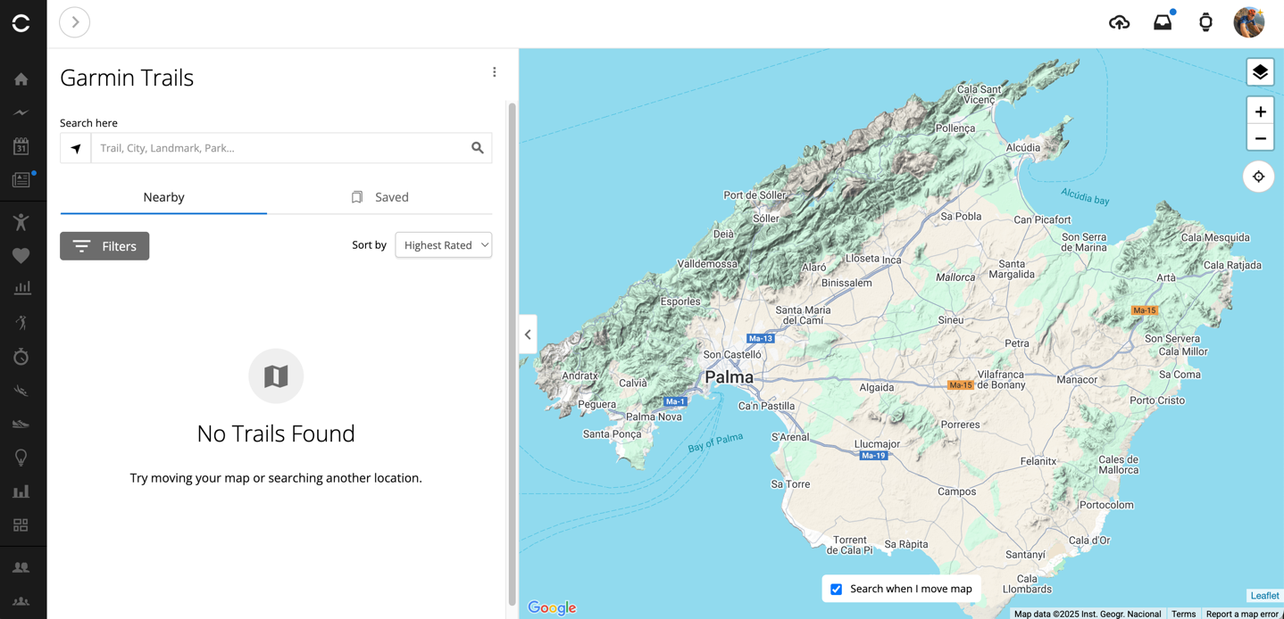
There are apparently no trails in Mallorca. Noted.
Ok, let’s reset. We’ll go to Amsterdam and surrounding areas, where I’ve been most of this week.
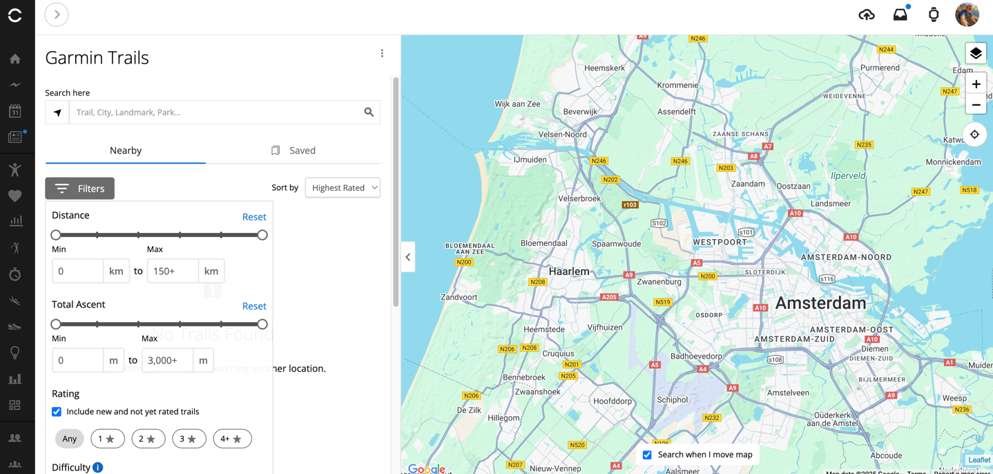
Ok then, maybe not. Perhaps I need to go into the dunes national park area, packed with trails that Dutch people wander in hopes of climbing the next best thing to real mountains: sand mountains.
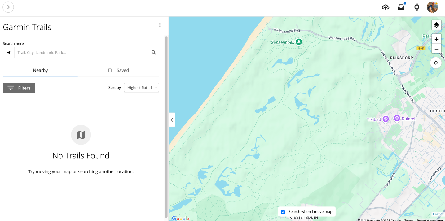
Still nothing (despite literally showing trails within the map). But that’s OK, I’ll go to one of the places I know best: The Alps, specifically around Chamonix Mont Blanc.
Finally, success! We have found routes (indicated by the blue dot, showing the number of routes in that area):
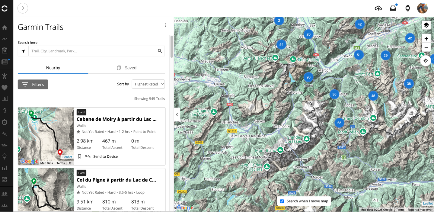
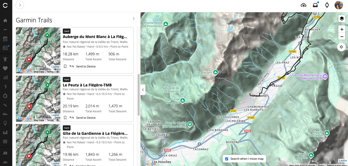
I’ll set aside the fact that the left-hand side of this map is oddly empty of little blue dots, while the right-hand side is populated. And when you zoom in, said left-side shows trails just fine. Here’s the main Chamonix valley, which includes 8 trails (all of which appear to basically be near identical variants of a single section of trail).
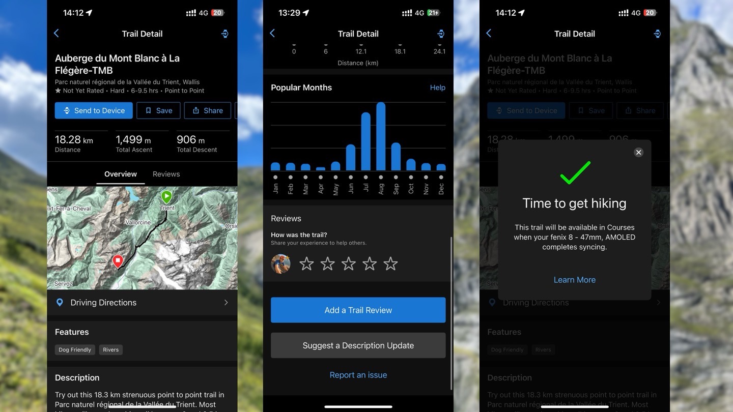
Looking at the first trail in the list, on the upper left side we’ve got some overview stats (seen below, left), and then we have a little snippet of descriptor text. While this seems AI generated, putting it through an AI-text-detector actually says it’s 100% human. Scrolling down, we get more stats about this trail, including seasonality usage, obviously favoring the summer quite heavily.
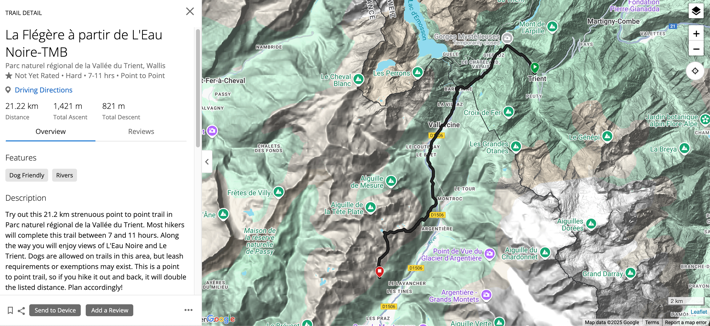
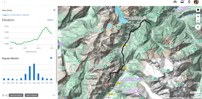
And yes, this is a trail (technically), and yes, the description is fine, and the stats are fine. But, this trail is not something anyone would hike as-is standalone.
I’ve hiked this specific trail section a number of times, forwards and backwards. But, nobody would hike this trail as-is. To begin, this trail starts in Trient, a tiny little cutesy town that most hikers on the Tour de Mont Blanc would hike through. Here are two photos from one of my hikes, from the exact spot this route starts.

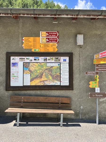
But nobody would actually leave Chamonix village to drive all the way here, and start here (remember, I zoomed into Chamonix for my search). But setting that aside, we’ll start there. Once we begin, Garmin says it’ll take us 7-11 hours, that’s probably a bit high to be honest, given this escapes much of the complexity of going over the ridge behind Le Tour, but fine, we’ll go with it.
The issue is, the trail as Garmin has it, ends on the side of the mountain, nearly 1,000 meters above the valley floor. If you were to hike it, you’d then need to find your way back down to the base (you aren’t allowed to camp in this area, only considerably above it). If you waited till June 7th, you could take a cablecar down from this point (since that’s where the trail stops). But that cablecar ends at 15:45, and with a 7-11 hour hike, that means you need to be starting upwards of before 6AM. Or inversely, if we did this entire route backwards, then we’d have to get to the starting point (the cablecar doesn’t open till 9AM), putting us in a town with almost no transportation options at 7PM (it would take 3 bus connections through two countries, a bit over 3 hours to get back, according to Google Maps).
Look, there are *SO MANY* incredible trails from the base of Chamonix village. Dozens of popular ones, and countless other variations. It couldn’t identify/list a single trail round-trip or otherwise usable trail from the Chamonix village base – arguably the most popular outdoor hiking destination in all of Europe.
[Update: Garmin has since clarified that Garmin Trails is only available in the US, Germany, Austria, and Switzerland. However, it should be noted that no part of Garmin’s press release, Garmin Connect Mobile app, Garmin Connect desktop site, or support articles listed that limitation at time of launch. Even Garmin’s newly launched landing page for Garmin Trails still doesn’t list the regions. C’mon, do better.]
Now, let’s look more at the technical features here. There is the ability to filter trails by a bunch of different parameters:
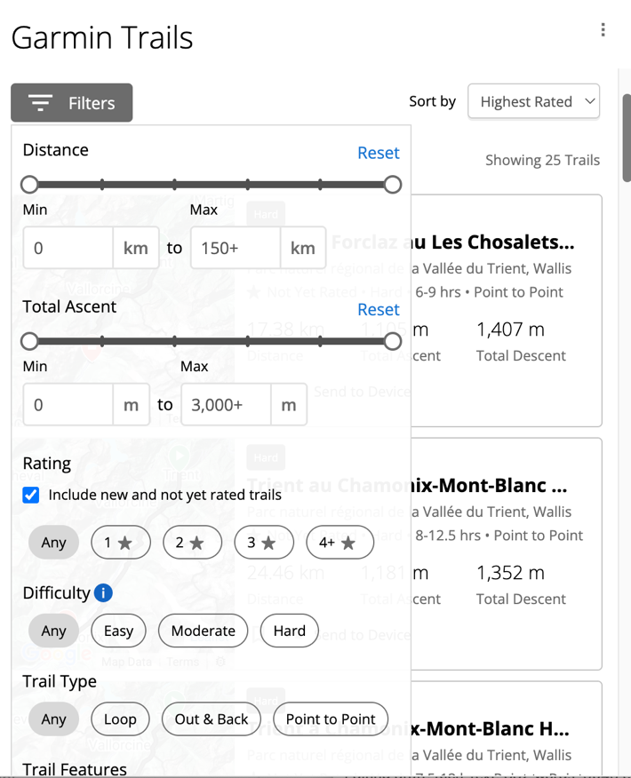
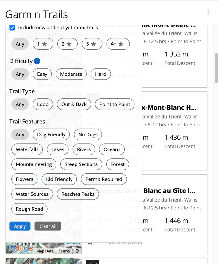
I think these filters do have validity in terms of utility and usefulness, but, it requires more underlying actual trails to become useful. For example, these parameters would be super useful with Strava Routes, where there are gazillions of trail options.
What’s puzzling to me though is that Garmin appears to be relying on some sort of manually curated trails here. Whereas they have this vast trove of automatic route generation pieces that they’ve used on both Garmin Connect and devices for years. And those automated (Round Trip Routes) actually tend to be really good, heavily dependent on Garmin Popularity map (heat map) data. It doesn’t seem like Garmin is leveraging any of that for the instantiation of the trail (perhaps just for the route duration portion).
Look, Garmin appears to be very committed to Garmin Connect+ being a core revenue stream going forward, just as Apple is with various Apple services. But Garmin has to find ways for these features to be fundamentally additive to the premium on-device experience, without feeling like they’re taking features that should be included for the premium Garmin device price. When I pay for Apple’s Fitness+, it’s paying for instructors/coaching. When I pay for Apple iCloud, it’s for the storage of all my silly photos (including the two I pulled from 3 years ago, for the photos above). All of those features have clear value props to me, because they’re executed well, and I can wrap my brain around why I’m paying extra for it (despite paying a premium for the Apple hardware it operates from).
I’m not convinced this new feature is currently providing that value to users, despite having the technical framework (filtering/etc) to do that well. Hopefully that changes.
With that, thanks for reading!
FOUND THIS POST USEFUL? SUPPORT THE SITE!
Hopefully, you found this post useful. The website is really a labor of love, so please consider becoming a DC RAINMAKER Supporter. This gets you an ad-free experience, and access to our (mostly) bi-monthly behind-the-scenes video series of “Shed Talkin’”.
Support DCRainMaker - Shop on Amazon
Otherwise, perhaps consider using the below link if shopping on Amazon. As an Amazon Associate, I earn from qualifying purchases. It doesn’t cost you anything extra, but your purchases help support this website a lot. It could simply be buying toilet paper, or this pizza oven we use and love.


Garmin has lost its way, it’s sad. Charging $1000+ for a device and then having you pay for subscription and so far the best they can do is trails? 99% of people know where they are going beforehand, they don’t need to find trails. It’s not like finding a restaurant.
Once my Amazfit Trex3 gets the new Zepp OS 5 that includes golf courses I can stop using my Fenix 6x Pro all together. They got greedy with pricing and not adding new features to older watches.
What’s even worse is that Garmin Connect has only received a few if any significant updates since like a decade (not including the new layout). This confirms that any new features will be only available for Connect+, even if they’re as bad as Trails.
Don’t buy the subscription if it’s not appealing to you. Hopefully no ones forcing you.
I live near the Alps in Germany and just had a look at the new garmin function. Completely bullshit. Any hike at the mountains is black, means hard, even the easiest ones. And the map behind is also useless, important paths are missing. I would never rely on Garmin, when hiking in the Alps. They already have lots of beta software in their Apps and devices, not really being tested before release. And now they are trying to make even more money with poor navigation software, no thanks!
Hi DC,
If Garmin asked for your input, what would you suggest they add?
Don’t worry—we won’t tell them, so they can’t charge us for it :)
Thanks!
I guess the ongoing analysis of all your health parameters to detect medical conditions, alerts that something is going in wrong direction, active coaching on bilion of stats they are already measuring in activity (like “you should take shorter steps when running because X, Y and Z) would be worth paying for.
And LTE, obviously.
All I want is to turn off the stupid voice yelling in my ear, yet have turn notifications on my 7X, just like I was able to do on my 6X.
But, no… Despite it being a (former) flagship, that’s too much to ask!
“Ongoing analysis and medical advice” would be a hell to deliver from a regulatory standpoint, not to mention the simple fact that the watch can detect all those datapoints, but it has no idea why they happen. Your HRV dipped – is it because you did an activity, you partied too hard after the activity, you’re getting sick or somebody called you and dropped some bad news so you’re stressing out over it?
Well, this depends heavily on how the medical advice would be given. There is a great difference between saying “you have heart condition, take this pill” and “we observed some signs that make us think you can see a doctor. This is the chart that we were basing on, print it and show it to your physician.”.
Regarding “why it happen” part: this is where AI comes in. They can train their models basing on real live and already diagnosed reasons why this happens. Model could be the fine tuned on your own body (like those symptoms occurred last time 5 days before you got sick). Yes, it is a huge thing to do: but they are already into AI, i just tell what would be worth paying for. Because AI that summarizes stats i see (better!) in the chart below isn’t.
Awesome, they started to charging people for already existing functions. The same thing is available in their normal -unpaid version- under Training & Planning -> Courses -> Nearby Courses. And its damn useful as already somebody uploaded a course for something that might be interested in.
The vast majority of the people are right to lost faith in this company. Myself included. Excluding the hard -Garmin boys- who I think they are ready to pay even for the simplest and useless things tons of money without proper justification.
I can’t see a nearby courses option when I look at my one. I can only create new courses myself.
Thanks for the explanation. When I saw the new Garmin Trails badges, I found your article. I’m an avid hiker and this could be a good feature if more trails were included. Not a Garmin + subscriber yet as it’s probably not the most effective with a Vivosmart 5. But I am a Badge Hunter. Thanks for posting
It’s a bit sad that the new norm for features is to launch in beta status and we’re supposed to accept the fact that the features don’t really work as marketed/intended at launch.
While interesting and (eventually) useful, it’s sad that this is a monthly paid feature, and, again, seems to set the baseline that every new feature going forward will (likely) be on the paid bracket.
Only elevation profile and season popularity, that’s all? No breakdown of terrain type, no photos, no % gradient? That’s just sad…
Maps still the worst in the industry? Check ✔️
Which company is offering better maps?
I’ll counter that — Garmin is the only company offering labeled, routable offline maps at this point. They don’t redraw quickly, yes, and I would love to tweak the themes, but if you need the functionality then there’s literally no contest.
OS Maps, Viewranger and Outdooractive to name a few.
Yes, please tell us why Garmin are the worst in the industry. Which maps are better?
Extraordinary claims require extraordinary evidence.
Also MAPY.COM in Czech republic and some other countries.
Exactly. Almost every adventure I plan in Mapy.com, then simply export it to Connect with one or two taps.
I wonder if they’re going to quietly shut down Komoot or AllTrails integration in order to drive traffic to Connect+? I don’t want to give the ideas
Of course they won’t. They want people buying Garmin watches and the one way you do that is by offering as much integration as possible. This isn’t Apple.
So it looks like Trails is available on the free Connect, under “Training and Planning -> Garmin Trails”. Apparently what they’re charging for is the ability to send a trail to a device.
Anyway, I live in an area with a ton of trails both in the nearby Rothrock and Bald Eagle State Forests and on Nittany Mountain. All of the trails seem to be there, and the proposed loops all seem to be reasonable for the most part. Some of them I’ve actually done. There’s a bias towards longer hikes for some reason, but otherwise in central Pennsylvania Garmin Trails seems reasonable. No reason to sign up for Connect+, though, since there are plenty of ways to recreate these loops and navigate them on a Garmin device.
Trails is a big lift. Even if Garmin acquired TrailForks and GaiaGPS from Outside there would be huge gaps.
Perhaps over time the amount of trails in this tier will increase, especially if as you surmise here, the data being brought in seems to be mostly human-curated. We’ll see….
Garmin has certainly been hit or miss with their overall trails-data category, over time. Garmin Explore is a mostly-overlooked mess as far as I see it, and the inherent trails/courses process within Garmin Connect can also be mind-numbingly complex and confusing for most folks.
They have work to do in this area, and it could (SHOULD!) be an area where they lead, given their legacy with maps, GPS, mapping tech, etc.
Again – we shall see….
I like Garmin and I always buy the most expensive devices because I have money but I dont like the Connect+ feature is disrespectful for those who spend much money on it
I love to do sports but I hate that reality when everybody is saying “just give me your money and give me more money and give me all your money” because you love to do sports.
Try something radical like running without a device. I guarantee that it won’t cost you a cent and you’ll still get the same level of workout.
Sir, this is DCRainmaker.com.
So pay for something Alltrails does very well, for free. Noted.
AllTrails have offline maps for free? I didn’t realise this. Thought offline and “send to Garmin” was a paid feature.
You’re right. Garmin already has a free Courses function that you can filter, in addition to the heat map. They are introducing a paid feature that already existed for free. I hope it doesn’t disappear.
I would be sort of ok with the Garmin + subscription for additional features, but so far, the features vs the cost doesn’t quite work, but the way for them to get traction is to gift an annual or maybe 3 month subscription to new devices.
Apple did this with Apple TV+ and it helped get the TV service up and running.
Maybe they think there will be early adopters, then they only have to give away subscriptions later on. But the risk then is people who take the plunge on a device, then find out that had they waited they would have got a free subscription, get shafted!
Not quite right I think. I did the trial period then cancelled. Though that was before “Trails”. Simply not enough features for the price point.
Oh dear oh dear. Still no reason to use the 1 month trial for Connect+.
There needs to be useful tools for paying for something like this that I can’t get from Strava Premium. Lets be honest, Strava is where it’s at as far as community is with Segments, K(Q)OM’s and Local Legends. Then there’s all the routes using heatmaps (I know Garmin provide that for free at the moment) that Strava has taken 10+ years to build to where it is now.
The only thing Connect+ really provides that is of any use, and I think it’s more suited to inexperienced people, is the workout function so you can see your workout on your phone as you’re doing it in the gym.
All of this, and the lack of backwards compatibility on a lot of watch features (hardware permitting) and watch faces (charging £4.99 a watch face) is disappointing from Garmin, and makes me either want to hang on to my current Garmin watch for much longer than I previously have with other Garmin watches, or look elsewhere (Suunto, Coros) when the time does come to upgrade. But, that all depends on whether the competition can step up to the plate in the meantime.
Is this a third party license? That might serve as a valid excuse for putting it behind the subscription.
Apparently Suunto knows Mallorca has trails. And, it’s free
yes, they send your data to China, and it’s your free treat.
This stuff just confirms everyone’s worst fears about this subscription model. There’s nothing wrong with a subscription, in theory, but we’re paying a massive premium for Garmin’s watches. With their newest releases, the cost continues to go up while new features are locked behind paywalls. I could stomach that if their highest end watches were in the $500 – $600 range. Or if they came with a multi-year subscription. But then on top of it all…the features suck.
I’m extremely happy with my Forerunner 955 Solar & Edge 840. They will last me many more years. But at some point, I’ll need a new device and I am not going to be paying into this scheme that Garmin has going now. Hopefully by then, Garmin will have come to its senses (or this terrible program will have done so poorly they’ll have to kill it because its costing them more money than it makes)
Watch’s features are not locked behing paywall, it’s the Connect which is being monetized. These 2 things are totally different.
Yet. Nothing behind the paywall makes me care. But companies don’t tend to keep it that way. Happy to be wrong, but the writing is on the wall.
Fairly limited selection of areas that have trails available, explains why none are showing in Mallorca yet.
Where are Trails Available?
Trails can be found in the following regions:
Austria
Germany
Liechtenstein
Switzerland
United States
Ouch
For my part, I use other tools, the annual price of which does not allow Connect to be considered, without it being more expensive with Garmin.
So apart from being able to manage everything from the same place and remain captive, I personally prefer to use different services and thus easily change when needed.
There are, it appears, no trails on the island of Ireland…….
Interestingly today I got an update of the Garmin Explore App and inside that app you get the trails for free. So if you use an Explore compatible device (Fenix, Epix) there’s no need to pay for Connect+.
It’s listed as being part of Outdoor Maps+ on the Garmin site, so you would need to have an Outdoor Maps+ subscription to be able to use it.
As the5krunner said:
It would be useful if they start and put official trails first into the system.
Then match it with heatmap data to create new ones, but first take the official once.
Those are curated to take care of the environment. Something wich heatmap data alone doesn’t show (but should reflect in some way).
I always hated Garmin Connect for route creation and this doesn’t seem to make it any better.
While it is ok on the desktop, using it on a phone is bad.
So us plebs are never getting new features and as a result are not buying another garmin device
I found one of the Trails listed near me is using one of my hiking activities from 2017. The GPS track is identical and, unfortunately for anyone that decides to follow it, it includes the nearly one mile out-and-back section in the middle of the loop where I missed a turn and had to backtrack .. so anyone hoping it leads out to a view or something interesting is going to be mighty confused and disappointed.
They better not nerf Strava integration to try to push this.
i love garmin devices. i’ve had lot of watches scales and gps devices
software has always been below standars
connect+ is a rip off
trails….wikiloc
Garmin, to the bin.
Now if Suunto could just expand ZoneSense a bit further…
This feature will not be useful ever. It’s fundamental flaw is that there are many many trails and the conditions of these trails are also constantly changing unlike roads ( closed due to erosion, diversions etc).
For this feature to work, you need a large dedicated community to continuously update it for free. Yet, it is behind a paywall. That is it’s fundamental flaw.
What they should have done is make it free for 3-5 years. Build that community, identify the highest contributors and give them life access, then add a fee for new users, whilst existing users get a discount.
It’s stupid to build up the infrastructure of an app and immediately charge people for it… it’s not yet populated with useful data and there’s no community behind it.
What a waste of the developers’ time
I have the Fenix 7 Pro, Edge 1040, Varia rear light, and Garmin Speed and Cadence Sensor.
I wanted to buy the Varia front light and a Garmin chest strap.
I bought the light and the strap from a competitor — cheaper. Great job, Garmin.
Absolute Rubbish – is D C Rainmaker in Garmin’s pocket??
He didn’t used to be
Of course it is. See minor acumen is described every time. Wahoo has made a lot of nice updates and here is further silence. Every now and then some shopping list with G prices. He boasts that he uses a counter and watch – subliminal marketing.
Of course, that’s why he is highly critical of this feature and the Connect+ product so far, it’s definitely reverse psychology or something.
Pretty sure he is NOT!
He just leaves senseless and nonfactual criticism to one-liner guys like you!
Not sure how hard is to see a company needs the customers longer than the executives.
Garmin should buy All trails if they are serious about this. Thats a legit trail database
Feature monetization via subscription is a scourge on consumers. Pay walling features on hardware should be banned by legislation, unless the device itself is free or subscribed to (like a cable box).
Releasing half-baked feaures and having your customers do the testing is what happens when a profession (i.e., computer science) does not have a governing body or professional accreditation. This nonsense doesn’t happen in dentistry, engineering, and law because failures result in disbarrment and the inability to practice.
This should really have been part of Garmin Courses to start with. As it is you already have a hiking filter when looking for courses.
When the time comes to replace my Edge 830 and F7X Pro, I’ll be having a good solid look at what Garmins competition is offering instead. And more likely than not, go with them instead.
Because the “bang for the buck” from Garmin is getting worse and worse. WYSIWYG was barely tolerable at the old price point of the Fenix and Edge Series devices, not when the prices have go thru the roof with features getting locked behind paywalls full of AI slop.
But I already have AllTrails for that. :-/
Unfortunately the experience described/shown here it is pretty clear that this feature is very early stages and perhaps not even half baked yet. I came in thinking/hoping this feature would mean I could ditch the alltrails subscription and have a reason to sign up for Garmin’s subscription service but I don’t think that will be happening for a while yet.
I’ve also found the existing Garmin courses (at least near me) is pretty rough and borderline un-usable due to what are clearly bike rides (sometimes other activities) classified as runs and lots of really bad course names like (1, 1/4/2025, 10k, 2.5 hour loop, and Bike ride just to name a few) also lots of duplicates/minor variations.
To me it looks like Garmin has a LOT of massaging and curating of heatmap and course data to make the trails feature compelling.
Garmin can’t contain themselves from releasing half-baked products. They don’t even fix major bugs reported in the beta program before the full software release.
Time will come, you can only exist per subscription:-)
Instead of introducing half-baked things as “great” features in connect+, Garmin should do it first, once it’s fully available and functional. People are already annoyed enough with connect+, so something like this is completely counterproductive. Just my two cents. Premium has to be premuim and not beta…
This is legit interesting and over time might sway me into paying for Garmin Connect+ and ditching Komoot Premium entirely. I love Komoot track library and there are lots of curated/verified tracks there. If the same tracks would be ported to Garmin (and, IMHO, they are already there, they aren’t surfaced properly) and trail search is made easier (maybe not to the point that I can type ” Komoot” into any search engine and get the trail I’m looking for) plus community photos on Komoot are really great inspiration source and help assessing whether a particular detour is worth it, but for a better integrated experience I would be willing to sacrifice those.
Yes, I’m 100% with you. Using Komoot Premium for many years now and love it. Is this would be available on this level in Connect+ it would be interesting. Right now I don’t see any benefits with Connect+ for me, and the new Trails feature is more a joke…
Just to clarify Rainmakers review. France is NOT covered by Garmin Trails. So if you want to hike the Mont Blanc you have to start in Swiss.
For my region/hiking interests: Germany and Swiss is covered (as well as Austria), France and Spain not…as the rest of the world.
I fully expect Garmin to start removing features from the free version of Connect that I have used for years. They want to extract as much money as possible on the devices, so would match that strategy.
Garmin Connect+ has me shopping around outside of the Garmin ecosystem. I was planning to switch to the new Forerunners from the Vivoactive 4, but the price jumps are hard to swallow even before factoring in a subscription paywall for new features.
I’ll also just keep plugging along with my Edge 1030, too. Subscriptions make the 1050 less appealing if it will also see limited updates without paying extra.
Hi Ray,
I stumbled across some additional info about this. Apparently this new Garmin Trails features works with either a Connect+ subscription OR an Outdoor Maps+ subscription. Either subscription should work, and the OM+ subscription is cheaper (and, for almost everyone, represents a far better value).
BTW trails: with a (paid) om+ subscription it seems that you have there also trails. You can choose a trail map layer in the Explore app, view detailed trail infos and you can download them to your device. I think it is the same (source).
Ok, I haven’t read #66 before I posted #67…
Oh FFS Garmin. I had just finished a trail run in an unknown area while working away from home when I saw that this was released.
I used both Komoot and Garmin Connect to try to make a route and found them both alright but with room for improvement. I got home and saw Chase the Summit had a video about a new Garmin Trails feature.
I got excited at first, my brain perhaps not functioning at 100% after a 20k run, but of course it is for subscribers only.
My frustration was that when planning a route, even when using a satellite map, it was hard to tell what kind of trail to expect. It was in Swinley Forest and there were loads of trails to choose from. Some you could easily drive a normal car on, some would have been easier in a kayak. Some descriptions, or even pictures would help. I know it can’t be perfect as it will change seasonally.
Another frustration was that Garmin Connect would send you an a very circuitous route between two points I selected without explanation when there were many trails on the map offering a more direct route.
When I tried the same thing on Komoot, it would do the same thing but the map clearly showed you that some areas were military grounds. (Sandhurst if you were wondering)
At the end of the day, I had just as much fun and got just as much exercise as I would have if the technology would have been better.
Until Trails is developed further…you can continue to use the “courses” tab and upload to your watch. So until they block that workaround I’ll keep my money.
You don’t need OM+ nor do you need Connect+ to sync trails with your devices using the Explorer app. I’ve neither subscriptions and synced a local route for a trail run I did this afternoon. Now, if Garmin suddenly does a ‘poof’ they’re gone for the trails in the Explorer app, then well ‘poof’ I’m gone. :-)
“While this seems AI generated, putting it through an AI-text-detector actually says it’s 100% human.”
Those detectors don’t really work I’m afraid, at least not if some basic effort has been made to avoid certain giveaways like em-dashes.
While not perfect, they do generally skew in the right direction, especially in this case when it said 100% human. This is likely still algorithmic, but probably not AI.
Garmin has gotten greedy, but then again what else would you expect from a one time buy product and provide free software? Albeit I’ve put in a ton of bug reports and help tickets b/c of updates that break currently working software. When I saw the Connect+ for stupid badges I was like “WTH!” I mean Garmin can’t even get what they have working. I’m not paying for a Virtual Coach or trails. Garmin Explore seems to have much better routes than Garmin Connect. And the predetermined routes they given you are crap. I’m not sure how they are generated but if it’s not a highly trafficked route it won’t even show up. I definitely won’t be subscribing, but if they start doing like Strava did and pulling free functions and stats away and putting behind a subscription I will be ticked. Coros will become my new friend and Garmin can take a hike and watch (pun intended) their users fall off big time.
Just stay with OSM. All these people are only melting down OSM data may be with adding more or less unreliable customer experience.
Simply use OSMand (android and IOS) with the payed features you like, offline etc.
Ya know, the more I think about it, the more I actually think I kind of like this new feature.
For the first few days, I want thinking “Why would I use this when I can just use Alltrails or any number of other trail apps?” But actually, I kind of like that it’s now entirely contained within in the Garmin Connect (and Explore) ecosystem. Makes everything more seamless. I also appreciate that Garmin lets you 1) view the trails without any subscription, just needing a subscription to download it to your device, and 2) it doesn’t actually require the awful Connect+ subscription at all, it also works with the Outdoor Maps+ subscription which is cheaper and a way better value, and something I already had.
It’s got some kinks they need to work out, for sure. Coverage in the US seems good but sucks elsewhere as your post pointed out. And since it’s new, it has basically no user reviews or content at all, just the generic descriptions they scraped from somewhere else. But I think it could get better and has potential. Will it be better than Alltrails and the others? Probably not, but I think it could eventually be good enough that I’ll stop paying for those other ones and just use the Garmin Trails that’s built into Connect.