Strava has added a new feature for Subscribers that lets you see photos while route planning on desktop now, and more specifically, lets you see the exact location of said photos. This is a major upgrade over the Strava route-photo feature introduced earlier this year that showed you photos along a created route, but not their location nor allowed you to plan based on them. Additionally, it brings it closer to Komoot’s photo-based route planning features.

Given I use route planning tools, and in particular photos, very regularly to create my routes, I figured I’d give this a spin. I find photos incredibly useful in figuring out whether or not a route is:
A) Safe (especially for cycling, but sometimes running/etc…)
B) The type of road surface/terrain I want: Namely to ensure a road is a road, and gravel is actually gravel-ish, and MTB is something else entirely different
C) Finding pretty spots to see, life is a journey and all that
It’s largely no accident that most of the epic rides/trail runs/hikes/etc I do look amazing on Strava or Instagram. It’s because I spend time to ensure the views are going to be amazing.
So, with that, let’s take a look look at how this works. First up, some technical details that are worth noting:
A) Only photos on *BOTH* activities marked as ‘Public’ and profiles marked as ‘Public’ will show up (meaning, if you have a ‘Followers-Only’ profile, your photos are not part of this, even if a given activity is set as full public.
B) Photos from you within any of your privacy zones are not included either (obviously, since privacy zones are wide swaths of areas, if other people take photos in your zone, that doesn’t matter).
C) Photos excluded from photo sharing (here) are also excluded here, regardless of whether or not your profile or activity is set to public
D) Photos should not contain human bodies (cows are OK), faces, or bikes. According to Strava, that’s being filtered out algorithmically.
E) Included photos will be updated every 48 hours, and photos older than 12 months are being excluded
F) This update is specifically targeted at desktop (web browser), and specifically for Subscribers
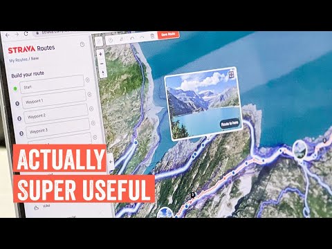
Now, to start, crack open the desktop site, and find a place you want to go. You’ll immediately start to see some bubbles with photos on them. This isn’t all the photos, this is just a few that the Strava gods have deemed noteworthy. Ironically, having been to those locations many times, I’d argue they missed the boat here on places that should actually be highlighted. But hey…algorithms for the win.

No worries, we can set aside Strava’s preference for overly-touristy lake town (Champex), and instead we’ll start from Argentiere, closer in the Chamonix valley. Now, I’ve started the route here and zoomed in, but you’ll notice we only see one new photo spot – this on a trail that should have a ton of spots.

We’ll need to zoom further on Strava, but first, let me show you that same view from Komoot. On their platform, each green dot represents a photo. Thus, it’s easier to see from higher up that there are photos. Hopefully a minor thing Strava can add.

In any case, back on Strava, if you zoom in, then you’ll see all the blue dots – which represent photos. You can hover above one to see animals doing questionable things:

Spots that have a bunch of photos together are what form those photo bubbles we saw earlier. Basically, Strava is looking at places a ton of people take photos and surfacing those up. In the case of that fake tourist town, a lot of people take photos, thus why it bubbled that up.

Now, doing some comparison, you can see at that same section of trail that Strava has FAR more photos than Komoot (and the photo pop-up blocks a pile too). For the very random section of trail that’s in-frame, I count 10 on Komoot and 27 (at this zoom level). But, if I zoom in even more on Strava, then even more dots appear. A rough swag for this section shows 50+ photos on Strava, compared to the 10 on Komoot (zooming further didn’t show any more photos on Komoot).

And this only becomes more apparent as I work my way around this loop. Just so many photos to plan from:

And then as usual, once you’ve completed your route creation, it’ll show all the photos in a collection, sorted largely by the most recent first. I might actually give this route a roll, looks like a fun trail run/hike.

For fun, switching areas entirely, here’s a look at some mostly random farmland on a cycling route I’m gonna do here in a few minutes. Here you can see it’s far more spare (cause, ya know, cows). But, you can see Strava has a bit better coverage (12 on Strava vs 7 on Komoot). Not massively so like up in Chamonix, but notably so. However, that’s only visible when you really zoom down to this level, whereas Komoot makes it far easier to see where the photos are at just about any zoom level.


In any event, we could do this all day, but that’s basically all you need to know. It works, works well, but really needs to be exposed at a far higher zoom level to make the feature pop. Otherwise you won’t even realize they are there, and will mostly only be drawn to the most crazy-popular of spots. And in the case of that initial Chamonix map, I suspect even Strava’s own Chamonix office would agree those three photo bubble spots are hardly the most scenic places in the greater Mont-Blanc area.
Still, love the update. Now, off to plan some more routes and get on with my ride.
Thanks for reading!
FOUND THIS POST USEFUL? SUPPORT THE SITE!
Hopefully, you found this post useful. The website is really a labor of love, so please consider becoming a DC RAINMAKER Supporter. This gets you an ad-free experience, and access to our (mostly) bi-monthly behind-the-scenes video series of “Shed Talkin’”.
Support DCRainMaker - Shop on Amazon
Otherwise, perhaps consider using the below link if shopping on Amazon. As an Amazon Associate, I earn from qualifying purchases. It doesn’t cost you anything extra, but your purchases help support this website a lot. It could simply be buying toilet paper, or this pizza oven we use and love.


This is pretty cool. Do you know if there are any plans to add it to existing saved routes? They have the photos but not the location the photos were taken. It would be nice to have it for all the reasons you mentioned, especially if it is a route you did not create.
Plotaroute.com is my go for route plotting. Lots of features that are really useful. It’s free but I’m happy to pay for Premium.
This is a nice addition to route planning on Strava and definitely a nice incentive for some to justify Premium price.
However, it terms of route planning I think Komoot is still vastly superior (and its subscription has more route-oriented perks compared to Strava).
Fatmap seems the better place to put this. Hopefully they integrate them better
IDK. Checked it out on the routes I ride and doesn’t seem that informative…except maybe for scenic content, but the pix shown on my routes are only OK in that respect. For planning routes, I generally rely on satellite and, where available, street view. I can usually discern surface and road/trail type from the satellite views.
The challenge is there’s no Street View in Strava (that’d be awesome, but alas…not). So you’re left going back and forth between Google Maps and Strava.
damn, i guess i’ll have to komoot route still for street views as i have to see road conditions a lot of time on my ride!
They could pull in pictures from open source streetviews, like Mapillary.
I’ve biked loads of gravel roads or trails where I live with a Gopro MAX on my head, and uploaded to both Mapillary and Google Street View so that others can use it to plan there route more easily. Like, is this route suitable for my bike, or can I walk it with a stroller etc. Would be cool if Strava incorporated these images somehow.
Great new feature set and thanks for the intro into it.
Comparing Strava to Komoot I would like to point out that besides the pictures (green dots) there are the highlights (red dots) that are community based POI‘s that usually also contain a huge amount of pictures and descriptions. So strava might have some more picture points, but one would have to count the highlights also.
That being said I use both – Komoot being my favorite with collections, sharing routes, multiple day trips and so on…
One major difference is that Komoot added pictures on the map specifically with trails in mind (Komoot Trail View), so one can judge the underground (very handy planning gravel rides in area’s which can be more MTB’ish). While scanning now through Strava, it is more related on highlights and pictures from the surroundings from a specific point, while not focussing on the tracks/roads. So, if you want nice views, Strava is better, but if you want to judge track surface, Komoot works better. Probably also one of the reasons Komoot has a lower coverage, since its algorithm focusses on trailsviews only without people/bikes in it.
Unfortunately, I still do not see the benefits to Strava Premium. The best chance they have to pull me in is to fix their route creator which, while the tools are good, dies on its underlying map data, which just isn’t that good for offroad stuff.
If it was to offer an OS Maps underlay, I’d be all over it. Absent that, it’s going to be a no.
No Coros Pace 3 review? Is Ray too busy testing out the new sleep features on the Venu 3?
Nope, would be happy to test out the COROS Pace 3.
Sounds like that’s a question for COROS. Actually, a lot of questions for COROS, but maybe that’s an entirely seperate post. Despite their attempted public smear campaign against me last week from their ‘actual’ CEO in China, I’m still game to test that unit just like any other. Of course, they’ve also banned other reviewers that have been critical of accuracy lately.
I am very disappointed with Coros, they had dug their own grave by eliminating the ant+, now they have jumped into it. RIP.
Such a pity you’re not testing the Pace 3…. I was really looking forward to your review before making up my mind and finally replace my good old M430. On paper, the Pace 3 has everything I need/want (and more), at a very good price point. Of course, provided the new heart rate sensor improved significantly (when compared to the Pace 2).
There are reviews around. I watched DesFit’s review on YouTube, and The Quantified Scientist has one there as well. (Didn’t watch that one, no maps, no ANT+, so not for me, so no point in watching.)
Yes, I’ve watched those reviews, but for the moment they are not “in depth” reviews (not yet at least, maybe they will do more tests). I am getting used to Ray’s very high standards, I have to admit! Really curious to see if the new HR sensor can be on par (or almost on par) with my old 340, which did very well in my case.
Looks like they are using the same HR sensor of the Coros HR arm band, which might be a good sign (the M430 has the same Hr sensor of teh OH1/verity sense…)
Sorry about the smear campaign. Seems like the CEO isn’t too smart. Pretty stupid of him/her to pull these shenanigans around the launch of their best product. Your willingness to still review the product shows your integrity.
This seems to be their ‘PR’ response from dkrey:
“We did not allocate an early media sample for Ray on this launch for the PACE 3. Before each product launches, we are given an allotment of samples that we can allocate to media/reviewers from factory availability (in this case it was ~30 units in our global market).
For the PACE 3 specifically, with the limited samples available, we are always faced with a tough decision of what type of media and which reviewers we think may add the best consumer insights to various different consumer types we thought most valuable for the PACE 3. We very much respect Ray’s platform and are open to working with him again for pre-release product launches in the future, but decided to go with other options for the PACE 3.
We also understand that not including Ray in the pre-release batch of media samples means that we miss out on quite a significant piece of viewership, but made sense to us to give this approach a go this time around. We still look forward to reading a review from him soon!”