Last month Apple announced WatchOS 10, and with it a slate of new features focused on the fitness/sports realm. This included cycling power meter support, a new structured workouts API for all sport types – allowing 3rd party apps like TrainingPeaks to push directly to the watch, and increased mapping support. Which takes us to the topic of today’s post: The new offline topographic maps.
As of today, Apple has now made WatchOS 10 available to anyone in public beta, in conjunction with iOS 17. That said, I’ve been using WatchOS 10 for the past month as part of the developer betas, of which today’s public beta is based upon. As usual with beta software, be warned it’s not finished – and could have adverse effects. You’ll see that especially here in the topo maps portions, as well as even more prominently in the power meter pieces. WatchOS 10 is available for Apple Watch Series 4 and higher, including all Apple Watch SE variants & the Apple Watch Ultra.
The end goal is typically that WatchOS 10 will release to production in the September timeframe, usually aligned to whatever new watches Apple announces on their normal annual release cycle.
With that out of the way, let’s dive into it.
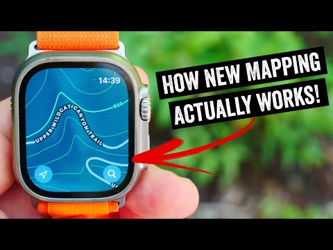
How to Access Topo Maps:
The first thing to know about Fight Topo Club is that it’s actually Apple Maps Club. The topographic maps aren’t in the Workouts app, but rather the on-watch Maps app. That’s the one that looks like the arrow up thingy you see in the center of the screen (the down-arrow one is for diving, and the up-compass arrow is for compass):

This is notable because it’s a clear separation between areas normally used for workouts (the Workouts app), and that used for general-purpose navigation. Most people doing a hiking adventure would be using the Workouts app for recording workout data, so this is another app you’d need to switch back and forth between. Apple makes that easy, but it’s not as easy as a simple swipe of the data page. Everything you’re gonna see in this post is happening within the Apple Maps app – not the Workout app.
In any case, once opening up, you’ll see your current location. If you’re sitting at your home in a flat area, you won’t likely see any topographic lines/details. You’ll just see regular maps, like so:


Instead, you need to go somewhere where mountain lions might exist. I mean, yes, I know they exist in normal neighborhoods almost anywhere in California, but we also need the ‘mountain’ part. So scroll your way to some hills, and then zoom in a bunch. You have to zoom in a surprising amount to get it to show up:


Now when I said we need to go somewhere that mountain lions might exist, I should have been more specific: In the current beta you need to go to a declared parkland in the state of California (see above, right, how the topo lines end when the green ends). Additionally, declared parkland that starts in California and spills over into Nevada also works. But if it spills over to Oregon, that doesn’t work. Somebody in Oregon made someone in Cupertino upset. Look, I don’t make the beta Topo Club rules, I just explain them.
Let me put it differently: Right now, as of July 12th, 2023 at 10AM Cupertino time – if you want to see topographic map data in the current public beta, you need to find a proper park in California. Or, be a mountain lion that’s escaped California and stayed within park boundaries to Nevada. Otherwise, no Topo Club for you. Here, you can see the border between California and Oregon, and the topo lines literally stop on the border:


Whereas the topo lines on parks that run into Nevada continue, just ensure that it’s a park that started somewhere in California:

Now Apple has been clear that by release to production it’ll be for all the US (but not international). However, whether or not it’ll still be restricted to specific parklands remains unclear. Even within the realm of California, vast chunks of very hikeable terrain remains without contour lines. Entire swaths of the coast where the Pacific Coast Trail runs through remain without it.
Given the quirkiness of how mapping data and licensing works, I’m sure this is a complex topic. However, all of Apple’s competitors here simply have “everywhere” topo maps, even internationally. Be it Garmin, Suunto, or COROS, all their endurance sports competition don’t have these sorts of gaps – let alone the US limitation.
Now, the next piece to explain is that the Apple Watch doesn’t actually have offline topographic maps. Instead, your phone has offline topo maps and the Apple Watch can access those maps assuming your phone is within range (and has battery). Or, if you have WiFi/Cellular access. To download offline topo maps, go into Apple Maps on your phone, select your profile picture in the corner, and then choose the areas you want. This download will include the topo maps with it. Interestingly, the Watch Maps app does seem to cache some non-topo portions, though it’s a little fuzzy as to the exact zoom level it cuts out (and in park vs not). You can download multiple areas if you want:
![clip_image001[6]](https://media.dcrainmaker.com/images/2023/06/clip_image0016.png "clip_image001[6]")

Thus, this is again a notable difference between what Apple is doing, and what mapping looks like on Garmin, Suunto, or COROS devices – which have true offline maps on your watch. I don’t really understand why Apple wouldn’t cache those to the watch. The file sizes are trivial here – as seen above, those are very small given how much storage the watch has. And there’s a substantial spec difference between offline mapping on a watch, and not-offline mapping on a watch.
Inversely, while Garmin does have very deep levels of points of interest (POIs) and trail/street names on their maps, neither Suunto nor COROS do. Thus, in this case, Apple does actually show more information than Suunto/COROS do, albeit within the other limitations. Still, at least the info is there.

In any case, the next piece you likely saw or remembered from the WatchOS 10 presentation a month ago was a trailhead and implied routing to it. So, to do that, I’m going to show two different things. First, I’m going to select a trailhead nearby me at the moment. When I do that, it’ll default to vehicular routing. If I tap, I can change that to pedestrian or cyclist routing:


Now, if you look, it’ll give me multiple route options, including the elevation profiles – which is kinda cool:

Once I select one of those, it will give me proper turn-by-turn navigation to that location from the watch:

However, to generate the turn-by-turn instructions, you need to have internet access initially. Once it’s created that route, you don’t need internet anymore (and it seems to save it for past historical routes too).
Setting aside internet access for a second, you don’t have to choose a trailhead (or gas station). For example, here I’m going to Drop a Pin at the top of this park, and then navigate to it. You’ll see that it routes along the trails as I’d expect:


This works well for scenarios that are point to point (going to end somewhere), but of course, doesn’t work for traditional hiking/etc scenarios where you make a loop, or otherwise plan a specific route. Today, Apple doesn’t have any ability to pull in routes/courses natively – those all still require 3rd party apps.
And this is where you see some of the different teams at work here. While all of Apple’s latest marketing pushes (especially around Ultra) are focused on endurance sports, the topographic maps bit actually comes from the Apple Maps team. That team sits outside of the Apple Watch group, and in this case, it’s simply an Apple Watch app (Maps) that’s doing the lifting. And that app is really just the companion to the larger Apple Maps phone app. It’s not about being a watch-first experience, but about being a phone-first experience.
Going Forward:

The thing to understand about Apple is that they work something akin to a tidal wave. From far away it may not look like much coming, but then before you know it, it’s breaking on shore and overwhelming. If we look at Apple Watch over the last few years, especially the last 13 months, we see very clearly Apple’s sports ambitions. The pieces are slowly coming together. Last summer (2022) it was a massive re-write of the Workouts app to support structured workouts, running power, triathlon support, and much more. Then last fall they added a new watch model (Ultra), which extended battery life to cover 95% of endurance sports use cases and offered more buttons. Last winter they added running track mode and expanded it, along with new/longer battery profiles. And this is only talking the big ticket items.
Now this summer (2023) they’ve added cycling power meter/sensor support, FTP power estimates, a new structured workouts API, and the beginnings of offline mapping on-watch. Plus a bunch of smaller things like a companion app mode for your handlebars to show cycling data mid-workout.
In other words, if one were to step back and look at this endurance sports push as if it were a three-part act, the segments (to me) are fairly clear:
Act 1 – 2022: Massive renewed focus on sports data/metrics, initial trackback functionality, expanding battery life, usability of the hardware in sports
Act 2 – 2023: Continued expansion of data/metrics, expanding of tracking to mapping/navigation, initial journey into physiological metrics
Act 3 – 2024: I’d guess it’ll be a heavy focus on mapping/navigation/routing, with a heavy focus on physiological metrics (e.g., training load/recovery)
Of course, Apple won’t comment on what the future holds in detail, however in an interview with Jay Blahnik, Apple’s Vice President of Fitness Technologies, we discussed a number of topics related to the new metrics and WatchOS 10 features. This also included thoughts on how Apple Watch has evolved over the last 13 months in particular. One item that stuck out to me was while discussing the crossover between running power and cycling power, he noted that:
“We’re constantly amazed at how many of our users find their way into things they never thought were interesting to them, because they have metrics available on their watch to them every day.”
I asked whether or not we’d see a shift from the current Apple Watch mapping paradigm, which is point-to-point focused (getting to a destination), versus the sports/recreation realm tends to be focused on following a specific route (the journey). To that, Jay says:
“We are really excited about the journey we’re on, in all the spaces that you see us working on, including the way Maps [app] and Workouts [app] will integrate, now and in the future. The way our users are using maps now and the way they might use them in the future. It’s a really exciting space for us. So we’re just going to continue to keep working on it.”
I’ll dive more into the interview with Jay as part of my cycling power meter (and related features) post.. We get into things like running power versus cycling power, why Apple would even bother with cycling power to begin with, and plenty more.
Still, the standout item from discussions with Apple Watch team members and executives over the last year or so, is that they’re acutely aware of where they stand relative to their competitors in this space. Obviously, Apple sells far more watches than anyone else. But none of my discussions with them has led me to believe they discount their competitors or their current feature set in this space. They know that those companies have far more features than Apple Watch does today in the sports realm, but they also know they don’t need to have every feature. Instead, Apple tends to find the most important features, then simplify them into an easy-to-use, but still usually exceptional experience.
How they take something like the current topographic maps experience and translate it into the ‘exceptional’ category remains to be seen. Part of the challenge with the endurance sports space is that scenarios get more and more complex, the deeper you wade into the forest. Still, if any company can make a go of it, it’s gonna be Apple.
With that – thanks for reading, and don’t forget the Apple Watch power meter post as well.
Found This Post Useful? Support The Site!
Hopefully you found this review/post useful. At the end of the day, I’m an athlete just like you looking for the most detail possible on a new purchase – so my review is written from the standpoint of how I used the device. The reviews generally take a lot of hours to put together, so it’s a fair bit of work (and labor of love). As you probably noticed by looking below, I also take time to answer all the questions posted in the comments – and there’s quite a bit of detail in there as well.
If you're shopping for the Apple Watch SE (2nd Gen), Apple Watch Series 9 or Apple Watch Ultra 2 or any other accessory items, please consider using the affiliate links below! As an Amazon Associate I earn from qualifying purchases. It doesn’t cost you anything extra, but your purchases help support this website a lot.
And of course – you can always sign-up to be a DCR Supporter! That gets you an ad-free DCR, access to the DCR Shed Talkin' video series packed with behind the scenes tidbits...and it also makes you awesome. And being awesome is what it’s all about!
Thanks for reading! And as always, feel free to post comments or questions in the comments section below, I’ll be happy to try and answer them as quickly as possible. And lastly, if you felt this review was useful – I always appreciate feedback in the comments below. Thanks!


Interesting to see the development here. I use a Garmin for the recovery and readiness metrics but much prefer feel and look of Apple Watch both software and hardware. Do you think they will focus on recovery type metrics like Garmin, Whoop etc do as in sure that’s a factor that would turn a few heads!
There’s definitely an opportunity to “Sherlock” several third party apps, though I think most of them deserve it. (TrainingToday and Athlytic put way too much weight into HRV deviations, and are probably more harmful than helpful. HRV4Training is at least appropriately conservative in it’s recommendations. Gentler Streak is the only app I’ve found that has a strong scientfic basis and provides safe and effective advice.)
I just don’t understand why they don’t let us use GPS tracking in more outdoors activities yet.
I ski a lot (nordic) and I’m a bit frustrated to not be able to track it without resorting to the usual “let’s use the running or cycling activity to get my trails”. Same with kayaking.
A toggle, for each activity, that, that would be nice. I could then pick the ones I want or don’t.
10000%. This has to be my biggest gripe with the Apple Watch OS. It’s a huge miss. I will forget and come back from an activity and be so pissed that there is no map or track. WorkOutDoors is fine and all but I want these activities to be supported natively in the Workout app.
Any chance you asked him about swimming? I’m a broken record on this, but Apple pool swimming is really poorly implemented and I’d love to know why and whether they plan on fixing it.
I actually jokingly asked about swimmers and lack of love. They said they love all swimmers. But… I think my point was made. :)
Swimmers and triathletes thank you!
I don’t know why they don’t use the detailed map of OpenStreetMap.org as Garmin do! Why? This maps are spectacular!!!
I agree. Or, use/license something.
This feels a bit like the Track Mode. A strong desire to use Maps data, but, that doesn’t really scale very well. Sure, Apple is up to a dozen or so countries now, but their competitors are up to every country/track in the world.
Now, is Apple’s method better if you’ve never been to that track? Sure, for the first 2 laps. After that, it’s a wash (and even that isn’t always true). In my mind, the best thing they could do is split the difference: Automatic track mode for places that have it, algorithmic for everywhere else. Donezo.
Likewise, for maps, I’d really hope by September launch that at least in the US every bit of dirt is covered. Else, it’s hard to consider it l if I’m going to hike in/out of topo map range multiple times in a single hike. I don’t know if that breakdown is on the Watch team side or the Maps team side, but I hope Apple gets that feedback via the beta process.
I’ll believe it if I see it in September. Apple Maps has always been missing a lot. Trails certainly. (I live two air miles from an extensive trail network, including the Maryland to New York Mid-State Trail. It makes Garmin’s trail widget useless to me, since there are 100 entries within 5 miles. None of them are on Apple Maps.) But there are also “roads” behind gates (to keep the riff raff out) that are just missing, including miles of the route I intend to ride today on my gravel bike. I really doubt that all of those are suddenly going to appear on Map in a few months, and include topo lines as well. We’ll see.
All I want is for my Apple Watch to broadcast heart rate to my Garmin head unit. Heartbeatz works buts so annoying to need another device (and battery) when it’s not needed.
Yup, I discussed that a lot with them, and made that clear that it’s really important. Not even so much for the cycling side, but even just for gyms/apps/etc…. Nothing to share at this time, but I think they understand the weird gap there.
At the rate Apple is evolving their fitness features, I may be retired by the time they are feature competitive with a garmin. I have an Ultra and a F6X Solar. I don’t know why the Ultra that has a CPU probably 20x more capable than the F6X can not compete on features.
Apple really needs to split their apps from the base OS and then allow individual teams to push app updates as often as they need to.
I dealt with this same monolithic release cycle process when I worked at one of the largest networking companies in the world. It sucked.
Still can’t forgive Apple for not having cycling navigation in Apple Maps in the Netherlands. Even Germany has it now, but not the low lands.
Ray, did you post an unfinished version of this weeks ago by accident and then pulled it back?
I am having a massive deja vu here…
I thought it was quite well finished. :)
Now, it has much more info. ;)
You are right, that made it even more surprising to me when I had read it and it disappeared afterwards 😁
Hey there, did you hear about Training Peaks integration with Apple Watch Structured workouts by any chance?
So the bits to support the Workouts API are in there today, but it’s up to TrainingPeaks to release their own beta to go along with it. They haven’t done so to date.
But, once they do, I’ll certainly cover it!
With the cycling support incoming for power/speed/cadence, I’d love to see them allow us to pair the Garmin Varia tail light. That’s one feature that would push me to consider the watch and phone as a solution over my aging garmin head unit.
Garmin makes a phone app for Varia. But that’s all it does, so you’d have to use it and another app to record the activity. There’s really no way an iPhone will ever be able to replace an Edge.
Yeah I know but I can try to be optimistic about it. I know they’ve opened up support to other manufacturers like Wahoo so I can always hope there’s a chance 😉
It’s more like Garmin is supporting standards (ANT+ and Bluetooth) that let others implement Varia radar support. It’s obvious that Apple will never support ANT+ (so much for my Varia RTL 510). Unlikely that they’d implement support for radar using Bluetooth, but you never know.
While you’re there…any plans to go to Reno / TR HQ?
I was there last month, but not anymore. I’ve been to the TR HQ a few times over the years. I’ve always enjoyed September visits there, usually around what was Interbike – but can always be convinced to go for a ride with them…umm…I mean “go professionally visit the TQ HQ office”.
Cool. But at this moment I would love to recover the ability to do configs for the training app from the phone like in iOS 15 times over any other possible feature.
I really hope they look at the new heart rate app on the watch, they are not using the screen space wisely, the older version of Watch OS has a larger view of the data then the current public beta.
rob
Hi DC,
I’m considering switching from Apple Watch to Garmin due to “meh” battery in Apple Watch.
However, I really like WorkOutDoors app on the AW. Any chance you could comment on Garmin TopoActive vs WOD in terms of details (POIs, summit names with elevation, etc.)? Perhaps an idea for video: compare both maps side by side would be great!
Thanks
Interesting, good idea!
Great! I’d be interested especially from the hiking standpoint.
Thanks in advance!
I have both an Ultra with Workoutdoors and a Fenix 5+, so I decided to take a look. Got GPS lock on both, scrolled both a little south to Bald Knob, and took a look. The Ultra was much easier to work with using the touch screen, and of course the screen is better than the 5+. But the maps as maps are much better on the 5+. Both have the many trails in the area, but the 5+ has both topo lines and prominent names for the trails. The trail names and POI’s on the Workoutdoors maps seem to be painted on the map, so that you can easily lose them by scrolling or zooming. The trail names on the 5+ stay on the screen when scrolling or zooming, so that they’re usually there. For hiking I think I’d rather use the 5+, but the Ultra would probably be adequate.
So I would also be interested in a comparison using one of the latest Garmin watches, especially one with a touchscreen.
I can really recommend to give that feedback to the WorkOutDoors developer. He’s (or at least was) quite active on Reddit (u/workoutdoors) and always happy and welcome to any feedback or ideas for improvement.
Do you know when Apple will fix the fact that certain workout activities don’t create a GPS track? I have sadly come back from Kayaking, SUPing and Nordic Skiing to find that no GPS track was created. This is something Apple needs to fix. I hate having to remember to jump over to Strava or WorkOutDoors to record those activity types. Please help Apple to fix this 🙏🙏🙏
Good article! I wish apple would integrate navigation into their workout activities like Garmin does.
Just catching up here…the Ultra has SO MUCH potential as a mapping watch. We need to keep pushing Apple to get Garmin-level detail map downloads for offline use – at least for the Ultra series. It seems so easy and you’re right, storage is trivial. Just imagine a separate page in the Watch app on the phone – pick a region/state, download to the watch maps with known existing trails. Maybe Apple should buy All Trails or Trail Forks and allow those files to be downloaded to the watch for offline use!
Just downloaded watchOS 10 and there are no topo maps in North Carolina that I can find. If I go to Yosemite they show up but nothing in NC for state, local or national parks (Great Smokey Mtn). Am I missing something or did they quietly not release them for the rest of the US? Almost a year after getting and AWU I’m still not convinced I should have left my Garmins. WorkOutDoors works well but is not sleek, and I have to use HealthFit plus Athlytic, plus syncing. Apple should just Sherlock (or outright buy) WODs and make it pretty then they’re really looking like more of a threat to Garmin et al.
Just downloaded watchOS 10 and there are no topo maps in North Carolina that I can find. If I go to Yosemite they show up but nothing in NC for state, local or national parks (Great Smokey Mtn). Am I missing something or did they quietly not release them for the rest of the US? Almost a year after getting and AWU I’m still not convinced I should have left my Garmins. WorkOutDoors works well but is not sleek, and I have to use HealthFit plus Athlytic, plus syncing. Apple should just Sherlock (or outright buy) WODs and make it pretty then they’re really looking like more of a threat to Garmin et al.
Just upgraded to WatchOS 10 on my Ultra and here in central Pennsylvania I see no topo lines, but there is topo shading to bring out the mountains. I live near Rothrock State Forest, a big state forest, and none of the trails are there. (The Garmin trail widget on my Edge 1040 shows 100 trail loops within 5 miles, which gives an idea of how many trails are nearby, and makes the widget completely useless.). So a little progress, but not much. My iPhone now running iOS 17 doesn’t even show shading.
I just shot over a note asking what the current state should be.
I agree, at the moment, I only see California, and a few nearby states with spotty access (some Arizona for example), but nothing anywhere else I’ve randomly checked (focused on big/popular national park areas).
Any word back from Apple?
So, today, January 24, 2024, on a whim I decided to check Maps on my Ultra. I scrolled down to the local Rothrock state forest, and lo and behold, topo lines. A small patch, and there doesn’t seem to be any reason for the boundaries, but finally, in Apple Maps, topo lines. Maybe an area of about 1 sq mile in all. I don’t see them anywhere but this small patch; the other parts of the forest I checked just has relief shading.
I am in Washington state near Seattle.
I have never ever seen this feature work around here.
Did Apple every roll this out fully?
I don’t see any change from what I saw in January. A small patch of the local state forest has topo lines, but nowhere else in the area.