Heads up – Massive Sports Tech Holiday Deals List is Live!!! The Garmin Fenix 8 is $250 off (even the Fenix 8 Pro is $100 off!), the Apple Watch Ultra 3 is on sale, the Garmin inReach Mini 2 is $249, the GoPro Hero 13 Black, DJI NEO, and a ton of other brands/deals, including Wahoo, Oura, Whoop, Polar, Samsung, Google, and more than 100 sports tech deals here!
I’m DC RAINMAKER…

I swim, bike and run. Then, I come here and write about my adventures. It’s as simple as that. Most of the time. If you’re new around these parts, here’s the long version of my story.

You'll support the site, and get ad-free DCR! Plus, you'll be more awesome. Click above for all the details. Oh, and you can sign-up for the newsletter here!
Here’s how to save!
Wanna save some cash and support the site? These companies help support the site! With Backcountry.com or Competitive Cyclist with either the coupon code DCRAINMAKER for first time users saving 15% on applicable products.
You can also pick-up tons of gear at REI via these links, which is a long-time supporter as well:Alternatively, for everything else on the planet, simply buy your goods from Amazon via the link below and I get a tiny bit back as an Amazon Associate. No cost to you, easy as pie!
You can use the above link for any Amazon country and it (should) automatically redirect to your local Amazon site.
While I don't partner with many companies, there's a few that I love, and support the site. Full details!

Want to compare the features of each product, down to the nitty-gritty? No problem, the product comparison data is constantly updated with new products and new features added to old products!

Wanna create comparison chart graphs just like I do for GPS, heart rate, power meters and more? No problem, here's the platform I use - you can too!

Think my written reviews are deep? You should check out my videos. I take things to a whole new level of interactive depth!

Smart Trainers Buyers Guide: Looking at a smart trainer this winter? I cover all the units to buy (and avoid) for indoor training. The good, the bad, and the ugly.
-
Check out my weekly podcast - with DesFit, which is packed with both gadget and non-gadget goodness!

Get all your awesome DC Rainmaker gear here!
FAQ’s
I have built an extensive list of my most frequently asked questions. Below are the most popular.
- Do you have a privacy policy posted?
- Why haven’t you yet released a review for XYZ product you mentioned months ago?
- Will you test our product before release?
- Are you willing to review or test beta products?
- Which trainer should I buy?
- Which GPS watch should I buy?
- I’m headed to Paris – what do you recommend for training or sightseeing?
- I’m headed to Washington DC – what do you recommend for training?
- I’m from out of the country and will be visiting the US, what’s the best triathlon shop in city XYZ?
- What kind of camera do you use?
-
5 Easy Steps To The Site
In Depth Product Reviews
You probably stumbled upon here looking for a review of a sports gadget. If you’re trying to decide which unit to buy – check out my in-depth reviews section. Some reviews are over 60 pages long when printed out, with hundreds of photos! I aim to leave no stone unturned.
Read My Sports Gadget Recommendations.
Here’s my most recent GPS watch guide here, and cycling GPS computers here. Plus there are smart trainers here, all in these guides cover almost every category of sports gadgets out there. Looking for the equipment I use day-to-day? I also just put together my complete ‘Gear I Use’ equipment list, from swim to bike to run and everything in between (plus a few extra things). And to compliment that, here’s The Girl’s (my wife’s) list. Enjoy, and thanks for stopping by!
Have some fun in the travel section.
I travel a fair bit, both for work and for fun. Here’s a bunch of random trip reports and daily trip-logs that I’ve put together and posted. I’ve sorted it all by world geography, in an attempt to make it easy to figure out where I’ve been.
My Photography Gear: The Cameras/Drones/Action Cams I Use Daily
The most common question I receive outside of the “what’s the best GPS watch for me” variant, are photography-esq based. So in efforts to combat the amount of emails I need to sort through on a daily basis, I’ve complied this “My Photography Gear” post for your curious minds (including drones & action cams!)! It’s a nice break from the day-to-day sports-tech talk, and I hope you get something out of it!
The Swim/Bike/Run Gear I Use List
Many readers stumble into my website in search of information on the latest and greatest sports tech products. But at the end of the day, you might just be wondering “What does Ray use when not testing new products?”. So here is the most up to date list of products I like and fit the bill for me and my training needs best! DC Rainmaker 2024 swim, bike, run, and general gear list. But wait, are you a female and feel like these things might not apply to you? If that’s the case (but certainly not saying my choices aren’t good for women), and you just want to see a different gear junkies “picks”, check out The Girl’s Gear Guide too.

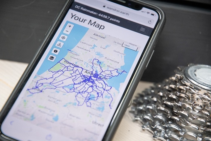


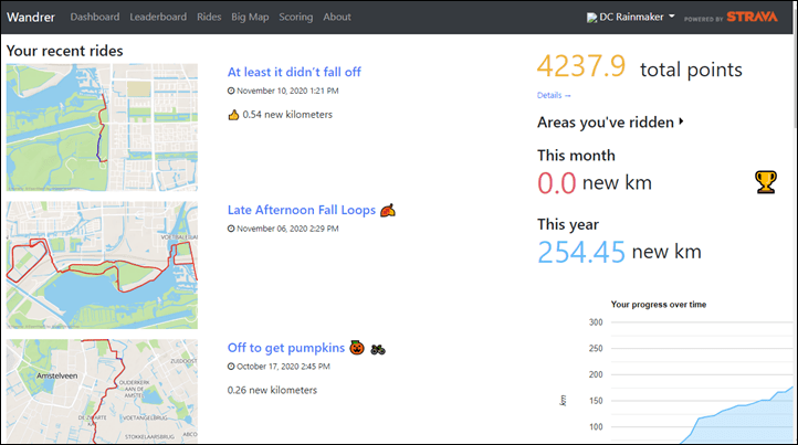
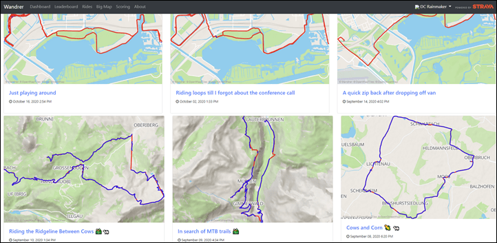
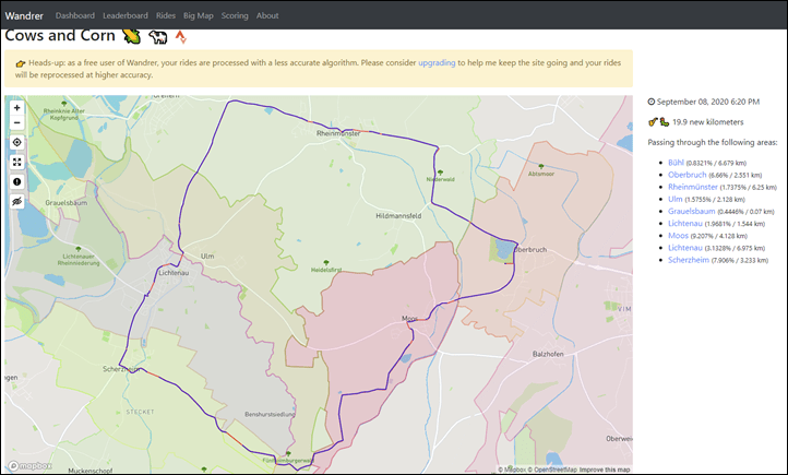
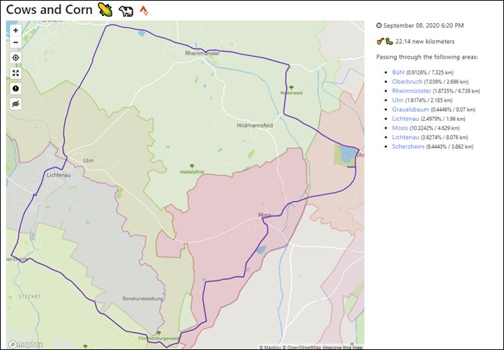
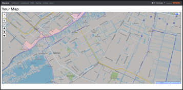
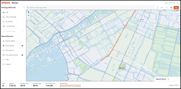
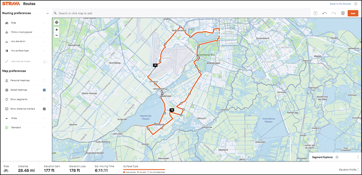
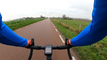
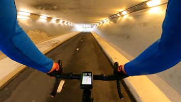
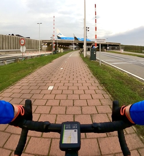
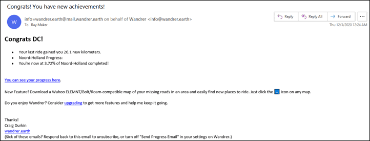
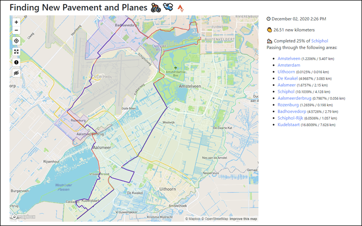
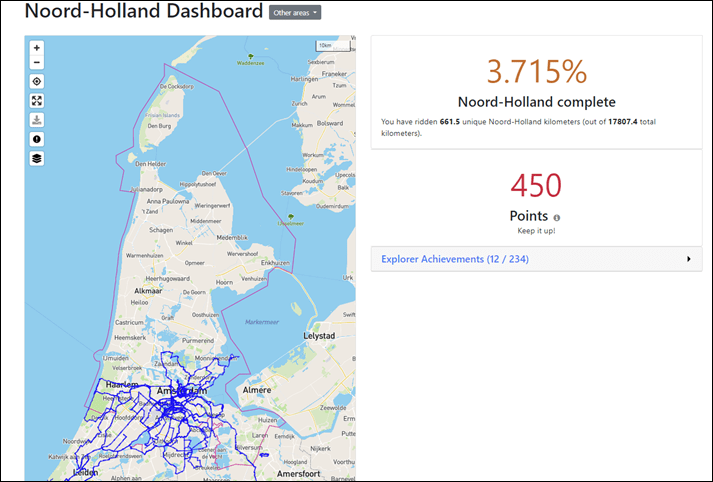
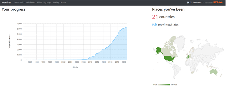
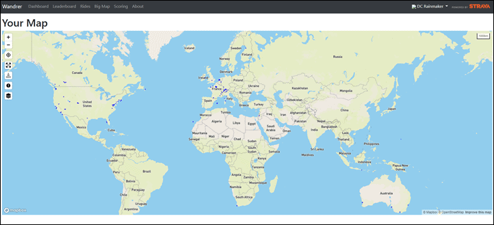
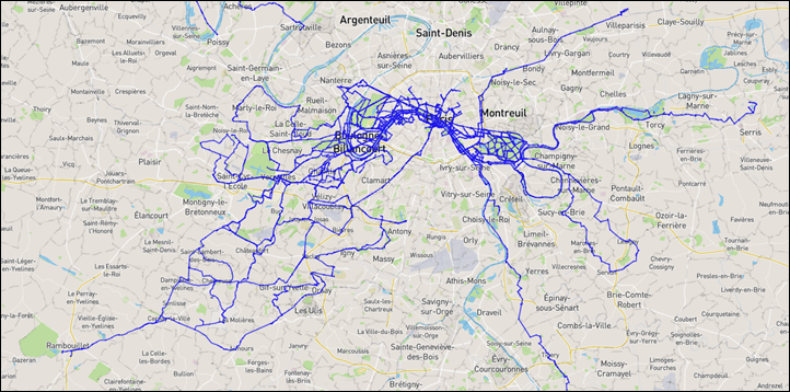
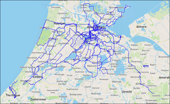
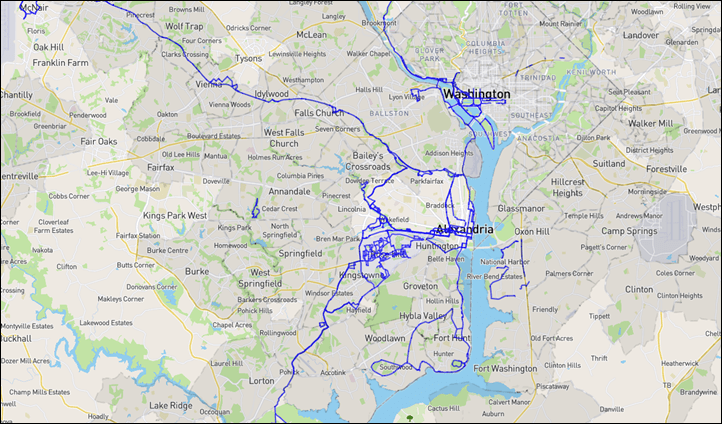
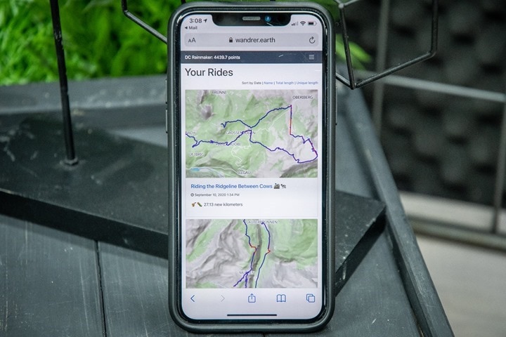


I’ve been using Wandrer for over a year and love it. It gives me incentive to get on new roads and I enjoy riding in new places. I also create a Strava routes with the Strava heatmap and Wandrer map open side by side.
I do the exact same thing when route planning!
I just wish Strava would respect one-way roads…
Statshunters.com does not have the fancy “new roads” per-ride stats, but it does have a lot of other stats, a global map view of past activities (simply overlaid or as a heatmap), and it’s free to use (as I’m writing this, I think it’s time to make a donation!)
Oh, and it has a Chrome extension to overlay the tiles (less precise notion of where you’ve been) on top of Strava’s route builder, though I’m not using the latter so can’t say if that combo is any good.
didn’t know that will have a look at the chrome extension, thing I like with statshunter is that you can import routes and see them with past activities
I also just found out this website : link to heatflask.com
not much to do but beautiful
Interesting to see the Karoo 2 used here. Are you getting ready to do a review/follow up on the unit? Im interested in picking one up and hearing your thoughts.
Yup, coming up this week!
Hi folks! Craig from Wandrer here. Please bear with me for a bit as ride processing is slowed down a bit with all of the new folks. I look forward to sharing a different take on cycling with you, one that often leads to unexpected surprises in the place where you live.
I’ve set up a $5 off coupon code of DCDECEMBER today for anyone interested in upgrading and having all of their previous rides processed. (It will still say $30 on the signup page, but you’ll only be charged $25)
Thanks!
Craig
Hey, Craig. Thanks for the code.
Question – if I were to sign up for the paid tier and get all my historical activities added, what happens to the activities within Wandrer if at a later date I choose to cancel the subscription? I have not found anything on your site which specifies that.
Thanks!
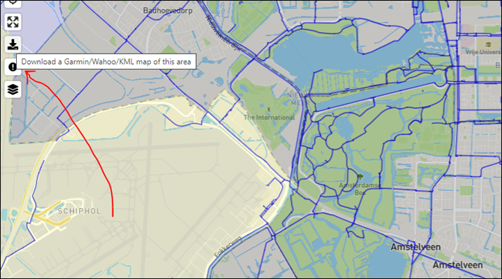
Exporting the map from the Wandrer website and putting it on my Garmin Edge 1030.. works great. It’s just an overlay though.
Hi Ray, just a typo in the 2nd sentence:
“Nothing crazy, just talking about smaller apps that I find interesting and that others might never have hard of.”
Would be neat to see a version of this for the virtual platforms. Perhaps it could use Strava’s platform tagging and look at all rides across all users as the “universe” and then compute how much you have ridden.
I love wandrer! Drives me to explore new roads. I recently passed 90% of Pittsburgh. The remaining will be hard because it is a lot of cobbles and dead-ends and seasonal trails. But it gets me to new places!
Huh. Small world. If that Santa Claus in the woods is from NH I’ve been past that before. :)
Does the app highlight interesting things like that to seek out on rides?
Check out we.citystrides.com for the same functionality but for running/walking/hiking. It’s free with a premium tier, and I’ve enjoyed using to explore new areas on foot
I love Wandrer too, especially this year when rides have been nearer to home, this and Veloviewer tile hunting really mixes my love of maps and bike riding
wandrer is a great app! It’s incredibly addictive and makes you want to go out an explore new areas and places that you wouldn’t normally go. I really dislike cycling the same routes all the time so it’s been really motivating. It even inspired me to cycle all the public transport routes in Berlin, Germany! Managed a cool new 2000 km. And I’m going to plug my blog post series about this :-)
Part one: link to pi-cycles.de
Part two: link to pi-cycles.de
I found Wandrer a month or so ago and joined as a free member. Like you I find the $30/year a bit much. A one time $30 cost to process my old data might be acceptable, but $30/year doesn’t make sense. After the first ingestion of my old data, what do I really get for $30/yr that I don’t get from the free version?
Have you played around much with veloviewer.com?
Great Strava integration and their explorer portion has a lot of similarities.
Yup, longtime member there- and often talk/post about what they do on the pro side of sport.
Probably another post at some point. I guess I feel like they’re (well, him) is so well known that I sometimes forget a lot of people probably don’t know how cool it is.
I think this is awesome!
I been using it for a couple of months and inspires to do even more exploring on my Gravel Tours!
Keep up the good work!
Gerry
I found Wandrer a year or two ago and have been happily using it since (at the paid tier once it came out… I am a data junky, what can I say?). I literally just got back from a 23-mile ride where my goal was to “fill in” some of my local map with Wandrer miles. I download the map and upload it to my Garmin 1030, and I’m ready to go. I often look at my big Wandrer map to get an idea of where I’d like to head towards and fill in and then use the map on my Garmin to home in on stuff I’ve missed or just bypassed in the past. I love it because it breaks up the boredom of riding the same roads, and I’m not training to race, so whether I hit certain power metrics or x number of interval repeats is of little concern. When I found I’d hit 100% of a local jurisdiction (ok, 99.x% because there are still some glitches in what it thinks you can ride but can’t) it put a huge smile on my face. So, cycling + challenge = fun diversion! Plus I’ve seen a lot more of my area (and some incredible homes). Lastly, Craig is a really nice guy, who is happy to help or answer questions. What’s not to like?
I use wandrer often! For me, it helps provide new and interesting goals. Especially in years like 2020!
Suunto App has similar feature out of the box
They have heatmaps, and their heatmaps have always really been some of the best out there in terms of sport delineation and such – they’re great.
But this is a bit different than a heat map, as the Suunto app doesn’t really aim to try and find you roads you haven’t done (in fact, the opposite, they aim for roads with popularity). Also, I’m not sure if it’s just my account, but the Suunto App doesn’t appear to show any of my activities from prior to my Suunto app instantiation (meaning, even though I’ve synced Movescount into it, the cutoff date for my Suunto App heatmap appears to be the same day I created my Suunto App – then SportsTracker – account, some 4 years ago).
> even though I’ve synced Movescount into it, the cutoff date for my Suunto App heatmap appears to be the same day I created my Suunto App – then SportsTracker – account, some 4 years ago
Did you connect Movescount in your Suunto App? It should be done via Suunto App – described here link to suunto.com ?
Interesting, so, I had linked it way back when, when they were first doing syncs of new activities (so I have tons of stuff within that timeframe when I was otherwise largely using Movescount), but it doesn’t show linked from the Suunto app side.
I’ll give that a whirl. Like I said above, I assumed it was probably me as to why that date was specific. Still, this is different functionality than what Wandrer has. The Suunto App is far better for finding places you haven’t been, but this shows how much of a given area you’ve covered in actual numbers.
Hi Ray, I’m not arguing with that, of course Wanderer is dedicated tool and more feature rich, but for me personal heat map in Suunto App is quite enough to see places where I haven’t been yet.
Interesting app but I am not sure it is worth the 30$US per year (even with the increase in the Canadian dollar :) )
I have been a user of City Strides for running. I have it linked to my Garmin connect. Great motivation to run all the streets.
Looks great for “burbing” as it got known Down Under during lockdown. I wonder if that’s what Ben Loke used here…
link to bbc.com
I do a fair bit of mixed terrain riding and I sometimes have to resort to drawing lines when trying to follow a trail in a route on RWGPS (not all paths lead to Strava!). Wander is useful for finding places where bike access in OSM needs to be updated (eg. path rather than foot path) to make building these routes easier. The two ways it helps is if a ride crosses a space which isn’t tagged for bicycle access (eg. foot path rather than path) there will be a break in the blue line. Also, there’s a map layer that shows all the rideable terrain in red. Comparing that to the OSM map (and checking the rules for the area) its pretty easy to figure out what needs updating.
This will fuel my OCD in a not so good way. I already find myself wanting to go on every road, path, trail, etc, in a given certain area. Being a data and map nerd already, this is like crack. Great. Thanks for sharing this.
Ugh.
I like and use Wandrer for a while now. It’s fun and helpful in taking new ways.
What I miss is the following: Same route ridden in opposite directions is often completely different, riding MTB even more so. I’m missing a way to distinguish direction in which route has been ridden.
Try city strides for a running version. Been using it over lockdown to run new roads in my area.
Citystrides.com
Using Wandrer for a few months now. First tried just free to see how it is like, get the flow. But fast got addicted and of course not wanted to “explore” already ridden routes again. So I even paid the hefty 30 Dollar to get all of my data sync’ed in Wandrer.
I enjoy riding my bike even now when it’s cold, last years I was already sitting on the trainer, sweating my ass off, doing training and hard races. But for what? With no goals in mind/sight and now with Covid around even more so pointless to build form.
Back to the roots, bike exploring going there were a car won’t go. My wandrer strong points:
1. Seeing / getting to know area you thought you know well from another perspective (you might know the main road, but from the other side of the field/small road/fieldway area looks completely different)
2. Finding new tarmac’s and shortcut’s even suitable for next road bike trips.
3. Exploring completely not known area’s like getting lost in a quite known forest and suddenly stumbling up a remote pond with a scary little house :)
4. Addictive hunt for coverage and achievements. I think the point system really works nicely. (For your own satisfaction)
5. Leaderboard/Comparing/Competing with other Wandrer’s of your area in hunt for monthly extra points. Quite some additional competitive Addiction you get here. Where not count fastest times or highest speeds. Just your efficiency in planning routes and the time you spent on the hunt ;)
6. Fighting with the elements: like Mud, Flooded area’s, Ice, Vegetation, NOT PROPER paths and Ways on Openstreetmap.
Regards
I’ve been using Wandrer for about a year, and it’s totally changed my riding experience. I used to ride the same familiar roads over and over, but Wandrer incentivizes me to bike in new places, which is great!
I just upgraded to the paid version. To be honest, I didn’t notice a difference, but Wandrer has had such a positive effect on my riding that I wanted to support it.
Wandrer is great, but the free version only logs your latest 50 rides. And to pay €30/year to extend that to unlimited rides is too much for me personally.
An alternative for the Benelux (Belgium, Netherlands, Luxembourg) is Long Term NL Challenge: https://www.longtermnlchallenge.nl (site in Dutch only). Works in another way, but I like it.
And …
Strava adds personal heat maps to their routing function.
link to strava.com
Not the same function, but definitely in the same vein.
If they would let you weight a route to NOT follow your personal heatmap that would be amazing!
That is EXACTLY what Strava should do and I have been looking for sooooo long. It is more than cumbersome – though possible – to work with maps side-by-side or tackle complex overlays in Mapping applications…but that’s such a lot of time and effort I just don’t have during daily routine. A simple algorithm checking all my historic rides, correlating the alternative routes with popularity and spitting out a rout suggestion as Strava already does, would be AWESOME.
I seriously don’t understand why they don’t pick up such data-driven case. It’s no rocket science. The case could even be extended by feeding it a single or bunch of routes from friends or alike to generate an alternative that no-one has ever ridden before. That would be the best surprise for the next group workout, I guess.
You have not yet rode from zandvort to den haag (or maybe even pushed to hoek van holland, you need to fix that, this route is amazing through the dunes :-)
I love exploring on a bicycle, wandrer gives me an extra incentive to do that. I joined when it was free but decided to cough up for the subscription. In the year I have been on there, lots of improvements have been made. I like looking at other peoples maps too.
I just registered on Wandrer after reading your review. I really like the idea and was immediately motivated to go on a bike ride off my regular path. As much as I would love to see all of my strava rides uploaded, I feel that $30 is a price too high for me.
I am a BIG fan of citystrides.com for my running/hiking/walking map. I have been using it for a couple years and love what James has created there.
One big question for me on the Wandrer paid tier is – If I pay the $30 for the first year, and then I cancel that annual subscription, what happens to my >50 rides?
I’d hate to pay the $30, then find out the additional perks aren’t worth an annual subscription and see my data all disappear from my map if I choose to cancel and end up back at only the most recent 50 activities
What I miss is the following: Same route ridden in opposite directions is often completely different, riding MTB even more so. I’m missing a way to distinguish direction in which route has been ridden.
As a rider, I used Maps to Journey Anywhere But I Faced At The Same Problem distinguish direction.
Thank you for sharing this blog. It was so informative and helpful SEO blog.
Thank you for sharing this blog. It was so informative and helpful SEO blog.
link to buysocialpack.net
We would like to introduce our service Buy LinkedIn Accounts. It will help to increase your business in social media marketing. All the accounts we provide are very genuine and secure provided with instant delivery and also with very reasonable price. For more information please visit our website :